Abandoned & Little-Known Airfields:
Southeastern Wisconsin
© 2002, © 2026 by Paul Freeman. Revised 4/20/26.
This site covers airfields in all 50 states: Click here for the site's main menu.
____________________________________________________
Please consider a financial contribution to support the continued growth & operation of this site.
Aero Park (revised 7/5/19) - Air City Airport (revised 4/21/20) - Beaver Dam Airport (1st location) (added 9/30/25) - Beaver Dam Airport (2nd location) (added 9/30/25) - Bong AFB (revised 4/3/20)
Chaplin Airpark (added 4/9/24) - Madison North Street Airport (revised 3/1/25) - (Original) Fond du Lac Airport (revised 2/22/23) - Hales Corners Airport (revised 12/24/25) - Janesville City Airport (revised 4/3/20)
Kohler Airport (revised 4/3/20) - Larson Brothers Airport (revised 12/24/17) - (revised 1/7/19) - Maitland Airport (revised 2/19/21) - Playboy Airport / Americana Airport / Lake Geneva Airport / Grand Geneva Airport (revised 4/20/26)
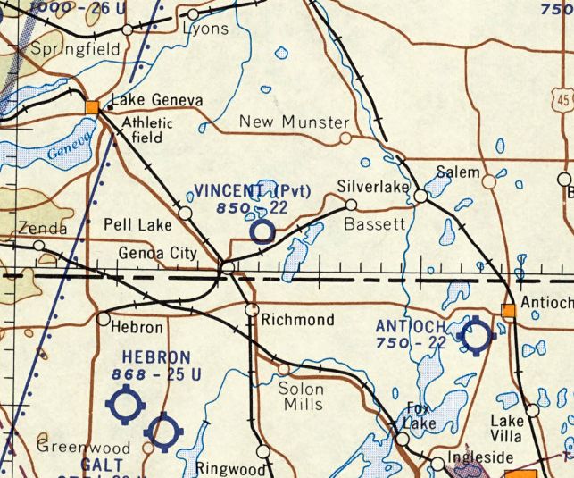
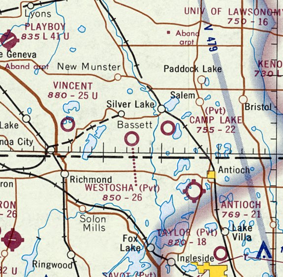
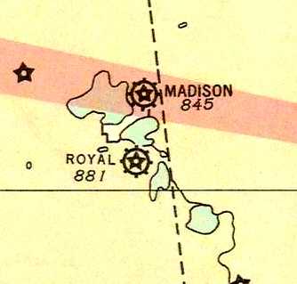
Royal Airport / Pennco Field / Four Lakes Airport (revised 1/7/19) - Vincent Airfield (added 9/9/23) - Westosha Airport (revised 2/22/23)
____________________________________________________
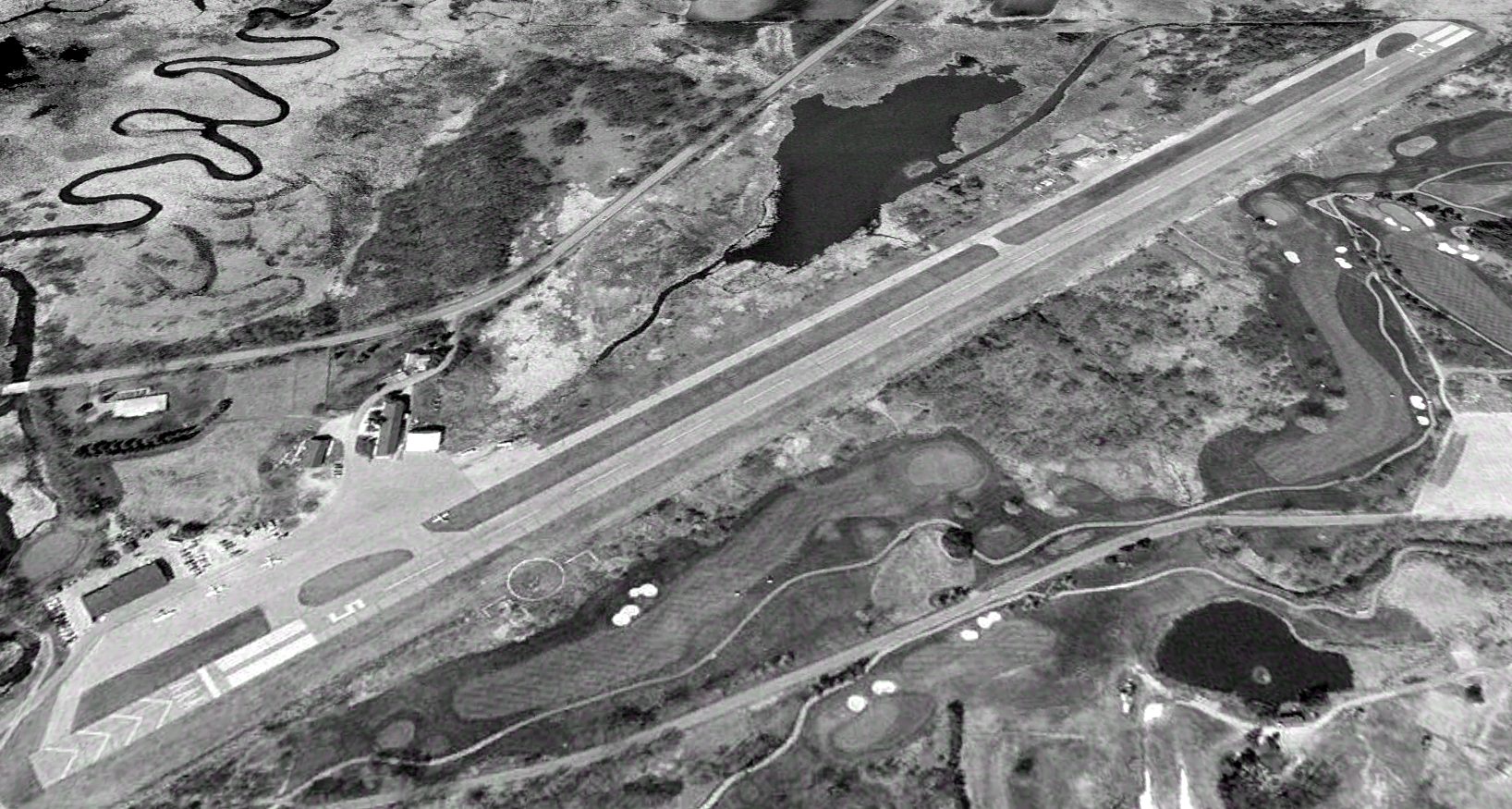
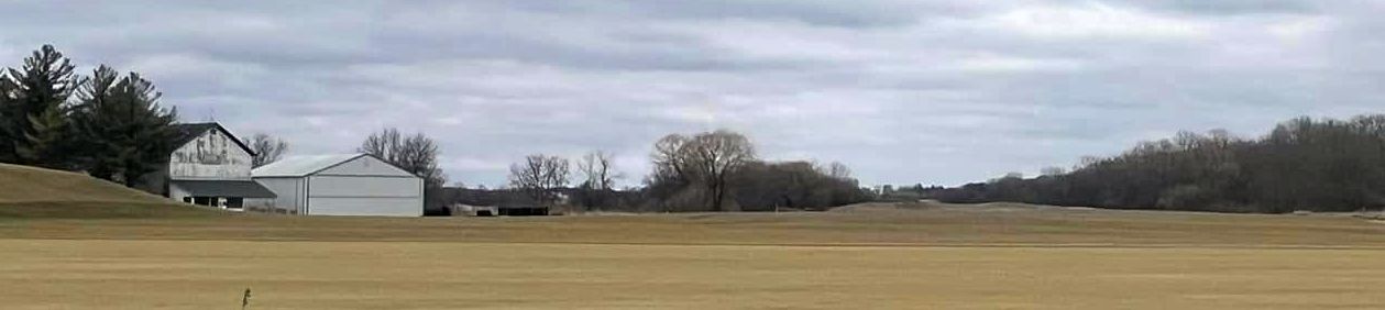
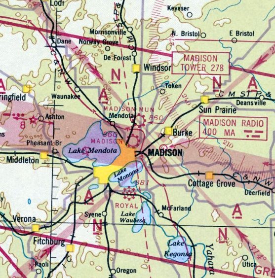
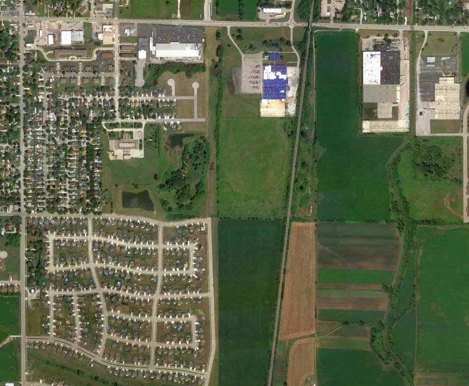
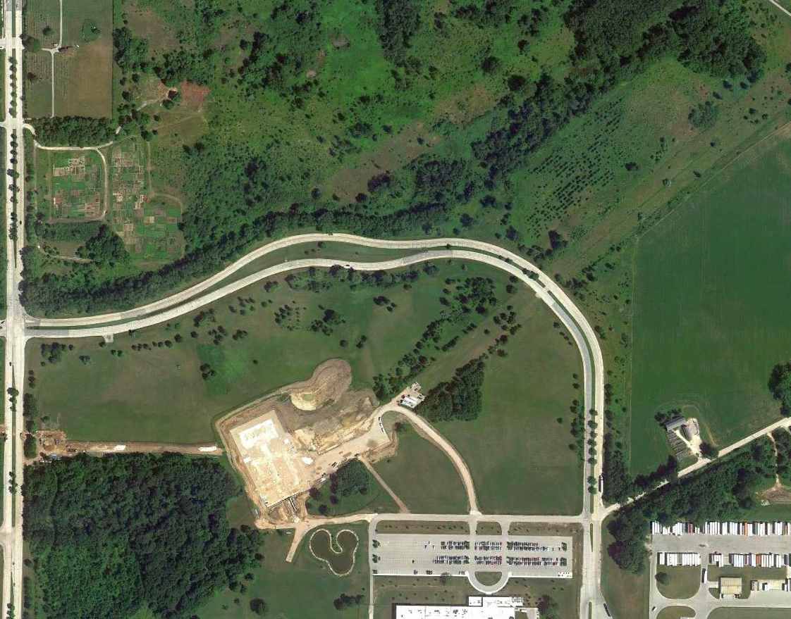
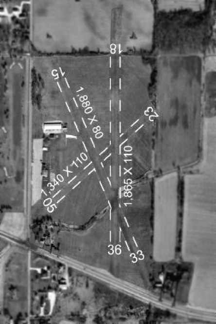
Playboy Airport / Americana Airport / Lake Geneva Airport / Grand Geneva Airport (C02), Lake Geneva, WI
42.613, -88.393 (Southwest of Milwaukee, WI)
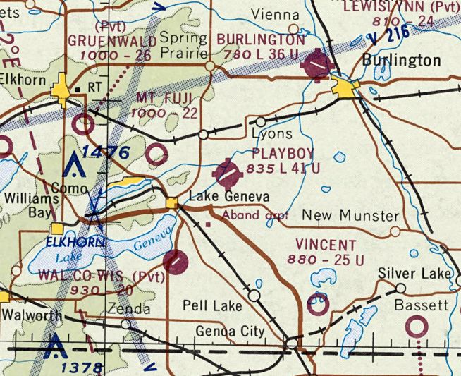
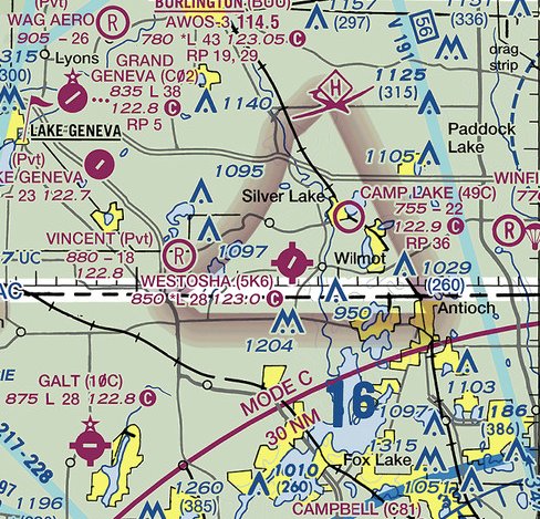
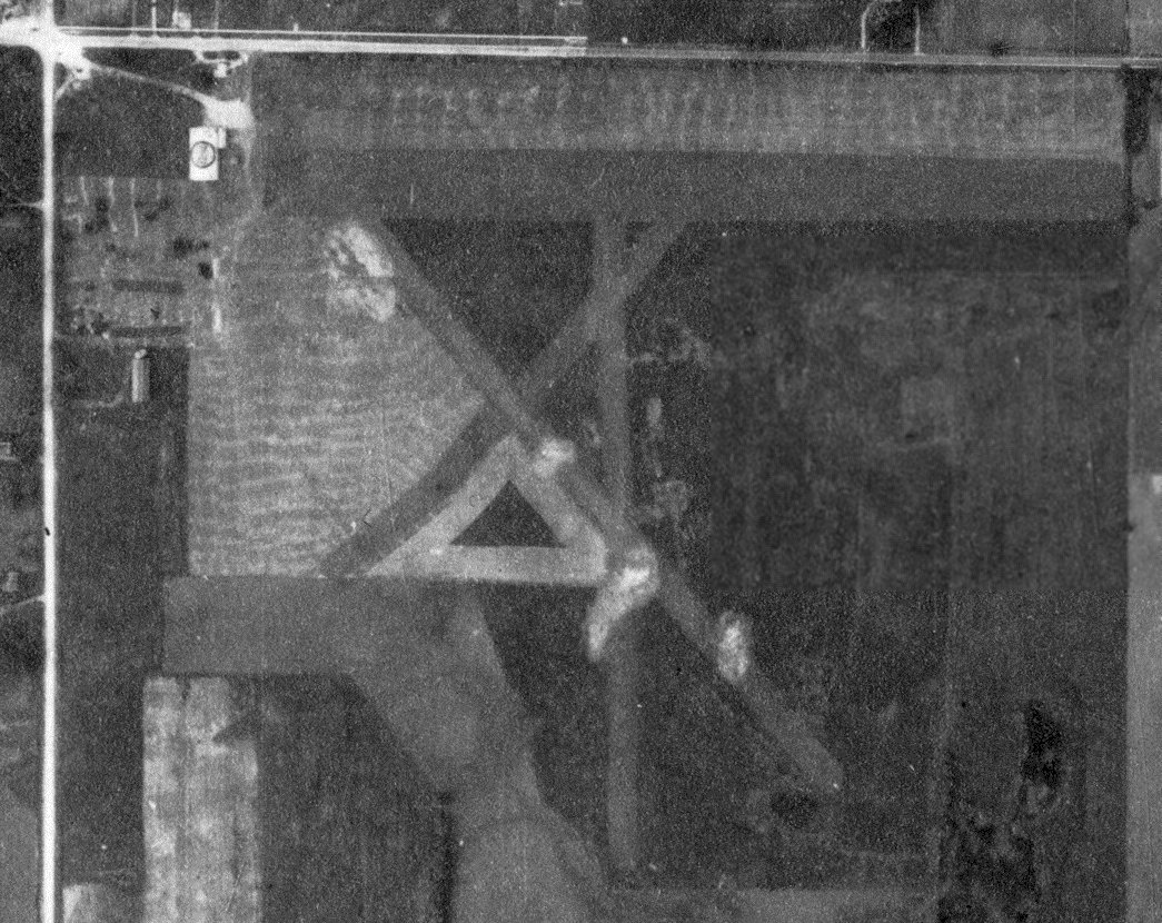
Playboy Airport, as depicted on the May 1970 Milwaukee Sectional Chart.
According to Andy Gelston, the Playboy Airport “was built in mid-1967 / early-1968 & finished in time for the resort's grand opening in early summer of 1968.
The runway was built by local paving contractor, Miller Paving, adjacent to a swamp, on the only level spot within the 1,300 acre plot.
Hugh Hefner flew in for the grand opening in his DC-9, Big Bunny, and broke the runway threshold from the weight of the mains.
Miller was called in to rebuild the threshold... to the specs that should have been called out in the original contract,
while that big black bird with the white bunny head on the vertical tail, languished on sheets of plywood, out on the ramp. She never returned.
The strip was always paved & well-maintained when Playboy owned it.
There was a trap & skeet range off the northwest side of the runway, at the midway point, with a clubhouse & small parking area.
The barn was never affiliated with the airport. It housed the riding stable where visitors could take trail rides on the bridle paths throughout the grounds, and go on Belgian draft horse pulled hayrides.
There was a small, 2-room, airport office where pilots would go to sign in & pay a $3 landing fee. Tie-downs on the ramp were ropes attached to long chains anchored to the macadam.
Fuel available was 100LL from an ancient truck that sometimes dispensed water after a heavy downpour.”
The Playboy Airport was not yet depicted on the 1969 Milwaukee Sectional Chart.
The earliest depiction which has been located of the Playboy Airport was on the May 1970 Milwaukee Sectional Chart.
It depicted Playboy as having a single paved 4,100' northeast/southwest runway.
According to Wikipedia, commuter air service was available directly from Chicago O'Hare Airport to the Playboy Airport.
The airport comprised 20 acres, and had a 4,100' asphalt Runway 5/23.
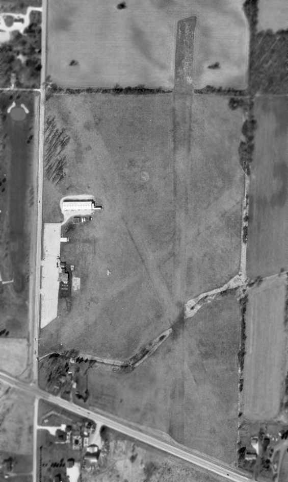
The earliest photo which has been located of the Playboy Airport was a 1971 aerial view.
It depicted Playboy as having a single paved northeast/southwest runway, with over a dozen light aircraft parked on the northwest side.
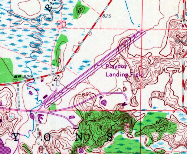
The earliest topo map depiction which has been located of the Playboy Airport was on the 1972 USGS topo map.
It depicted “Playboy Landing Field” as having a single paved northeast/southwest runway & parallel taxiway, and a few small buildings on the northwest side.
Andt Gelston observed, “The 1972 topo shows 2 barns (white) & the Buildings & Grounds Maintenance building (dark rectangle), but not the pilot shack & the shooting range.”
According to Andy Gelston, “Lake Geneva Airways operated a Howard 500 twin (ORD /CO2 commuter) until early 1973, when it started losing money.
There were about a dozen light singles & a flight school based there in the 1970s/1980s.
A local family named Gelderman built the only hangar on the field in the mid-1980s for their Cessna 172. (It now houses buildings & grounds equipment).
Entertainers & celebrities flew in to stay or perform at the resort. The Smothers Brothers flew Dick's Archer in & Dick hung out at the pilot shack.”
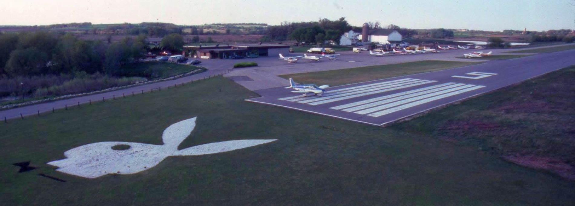
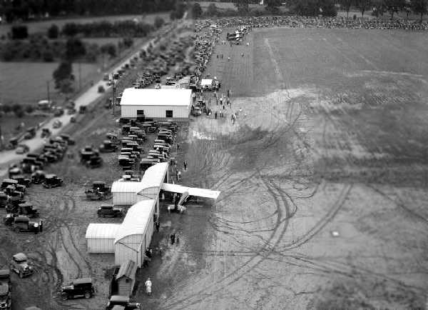
A circa 1970s/80s aerial view looking north at the Playboy Airport Runway 5 threshold, showing the prominent Playboy Bunny logo just before the runway.
Andy Gelston recalled, “The bunny head at the end of [Runway] 5 was made of white gravel, and its bow tie was black gravel; very striking when on final.”
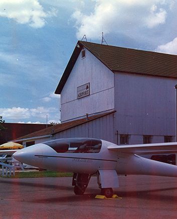
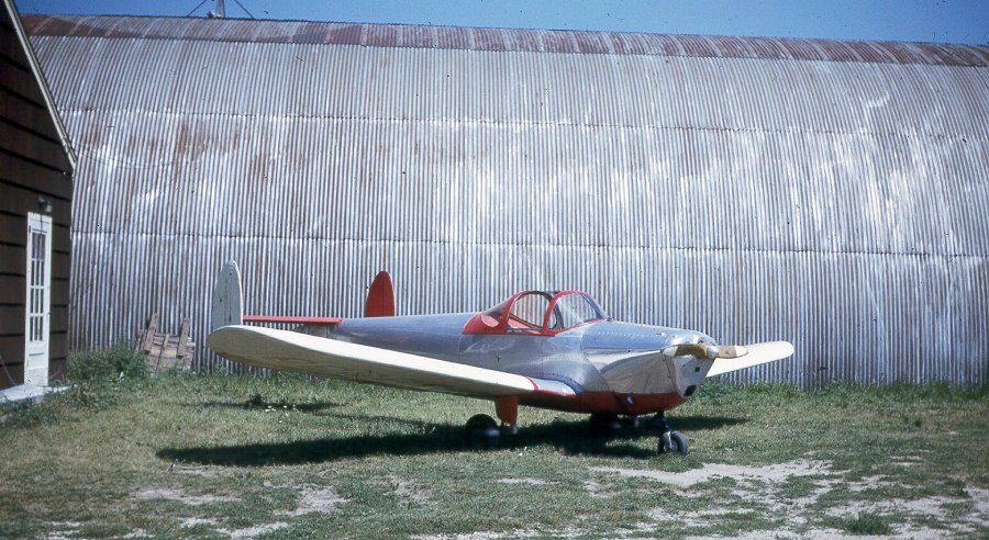
An undated photo of a retractable gear glider in front of the barn at the Playboy Airport.
It was still depicted as Playboy on the 1974 Chicago Sectional Chart.
Andy Gelston recalled, “The last year that Playboy owned the airport (1982), business was slow, so I persuaded resort management to place in the very bottom of their ads, 'Fly into our airport (CO2).' Business boomed.”
The bunny head was sodded over as soon as Ameicana bought the place (the only investment Americana ever put into the airport, other than plowing snow off the runway).
When Americana bought the place in late 1982, they admonished me (as airport manager) that they wouldn't invest one penny into the airport.
It had to be self-sustaining & they would mention the airport in their advertising only if the airport paid 10% of the cost of those ads, in advance. That didn't happen.”
The airport was depicted Americana (after the new hotel owner) on the 1985 Chicago Sectional Chart.
Andy Gelston recalled, “Americana legal didn't like the exposure of the airport being named after the corporation, so changed the name to Lake Geneva.
After sucking the resort dry & going into foreclosure in 1986, Americana eventually sold the place to JMB Realty in 1988, who also ignored the airport, folding 4 years later.
Marcus Hotels acquired the resort in 1993 and the airport name changed for the last time, to Grand Geneva.”
The airport was depicted as Lake Geneva on the 1993 Chicago Sectional Chart.
Andy Gelston recalled, “Other than removing the derelict pilot shack & fuel tank & truck, Marcus ignored the airport like Americana &d JMB, until 1997, when they had the airport improved to meet FAA standards.”
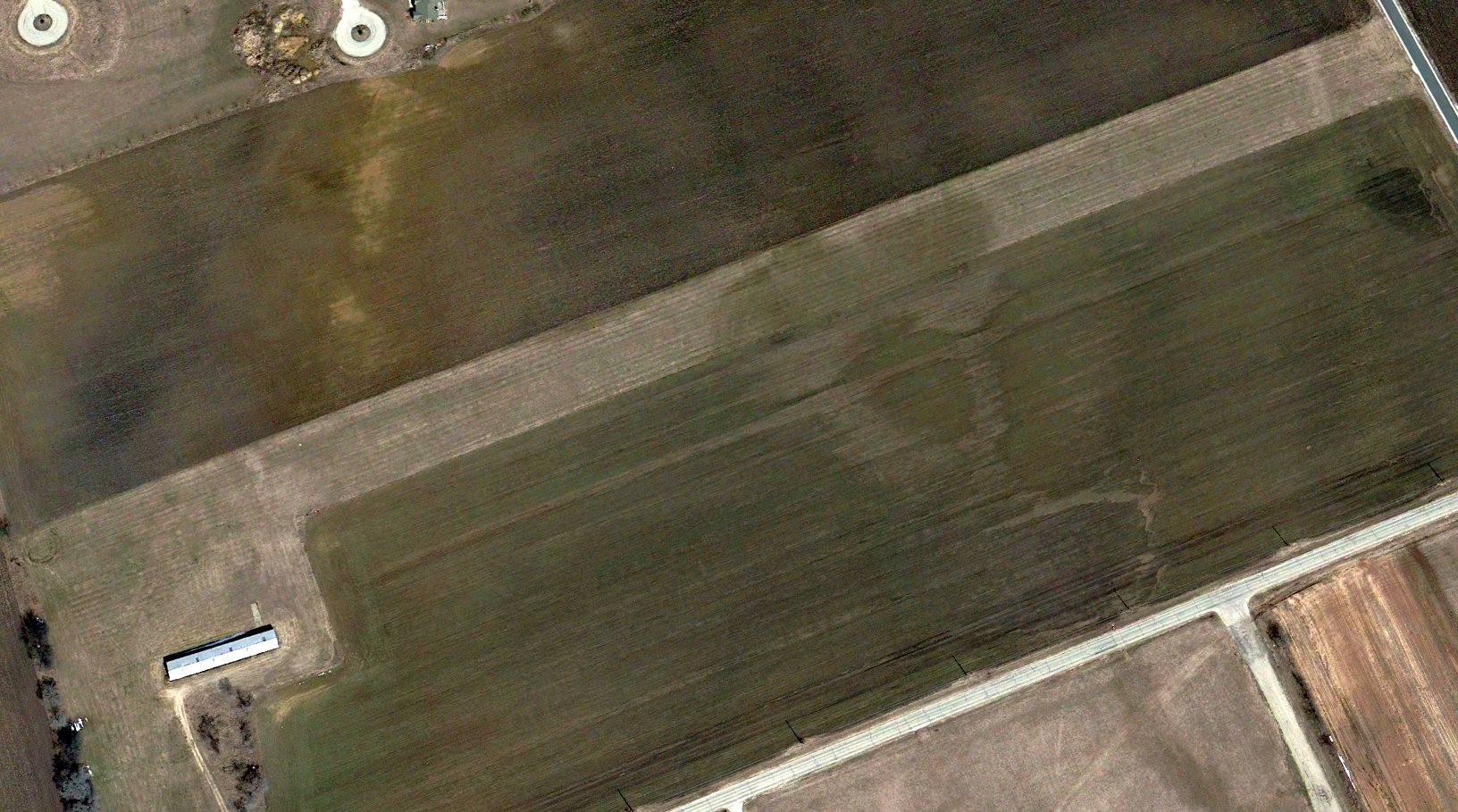
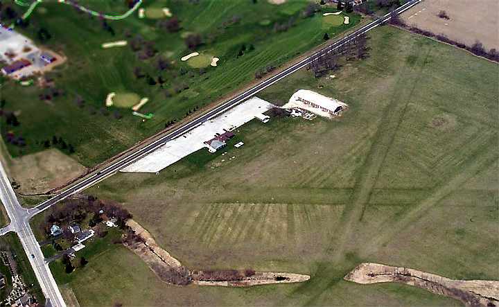
A 2000 aerial view looking north showed Lake Geneva Airport to have an asphalt Runway 5/23, with 4 light aircraft on its ramp.
The airport was depicted as Grand Geneva on the 2001 Chicago Sectional Chart.
Andrew Thome recalled of Grand Geneva Airport, “I was lucky enough to land here once though probably not recommended at the time as it was already in bad shape.”
Andy Gelston recalled, “By the late 2000s, the improvements to the taxiway succumbed to weather & having been accomplished by very low bidders, and was closed off with Jersey barriers.
The last commercial operation at the airport was Ted Davis hopping tourists in his 1929 D-25 Standard biplane in the late 2000s.”
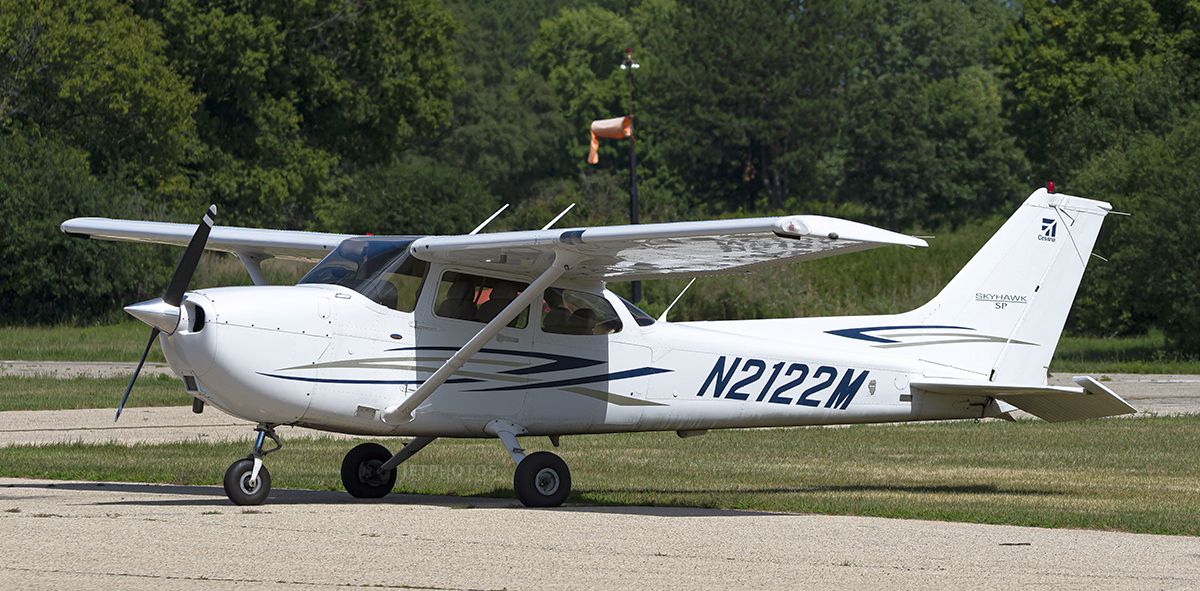
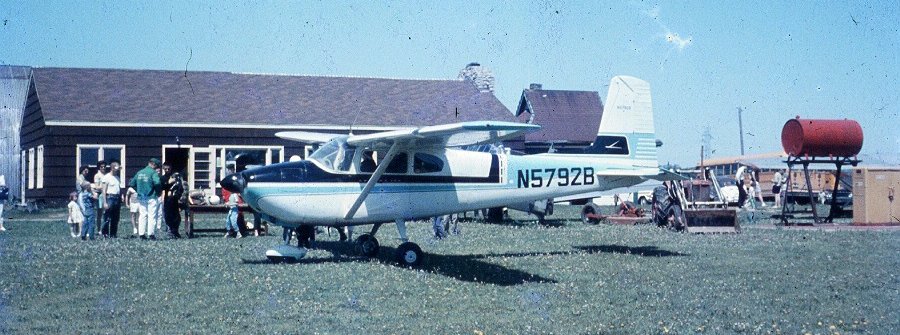
An 8/11/22 photo of a Cessna 172 at Grand Geneva Airport.
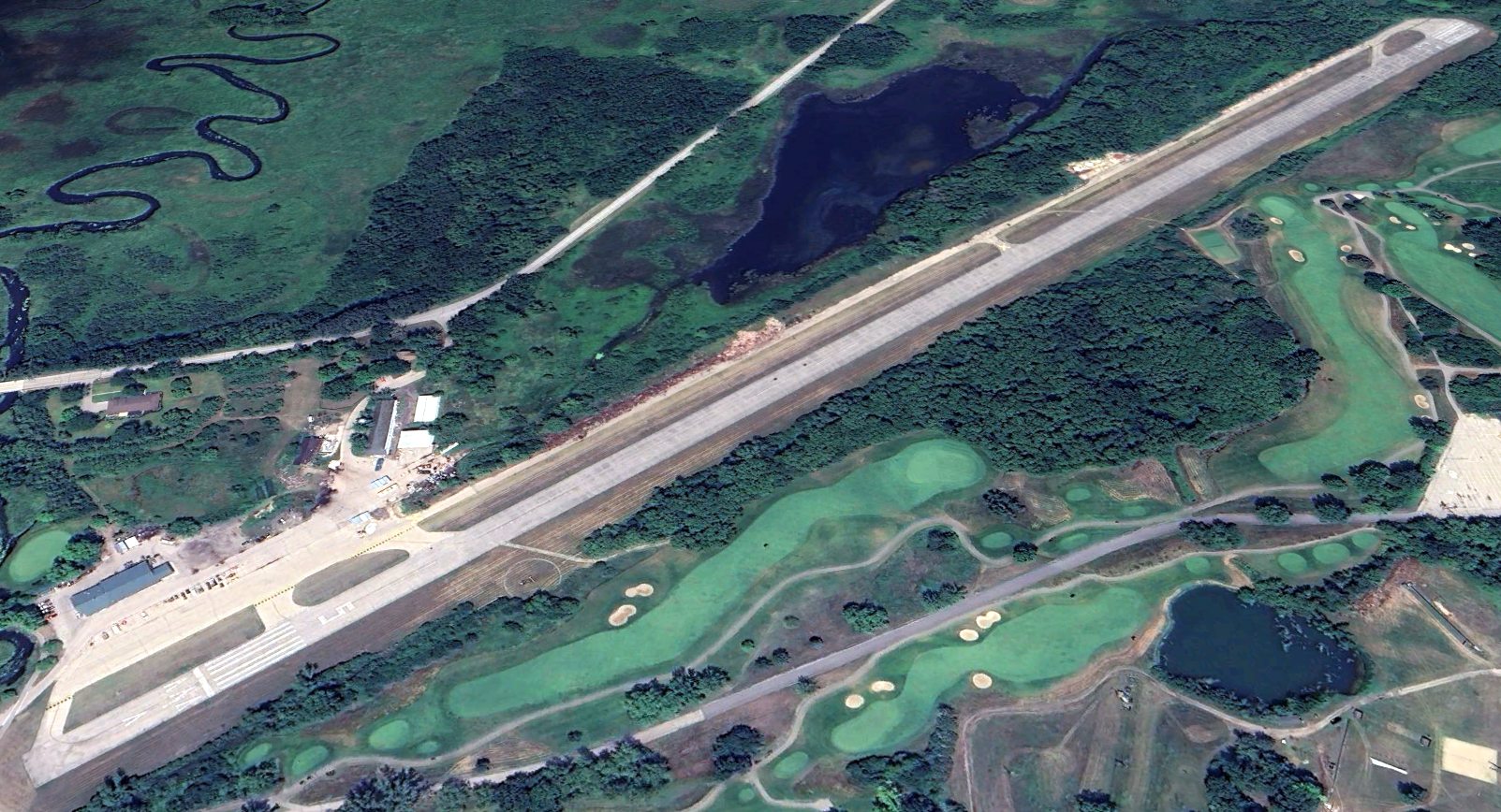
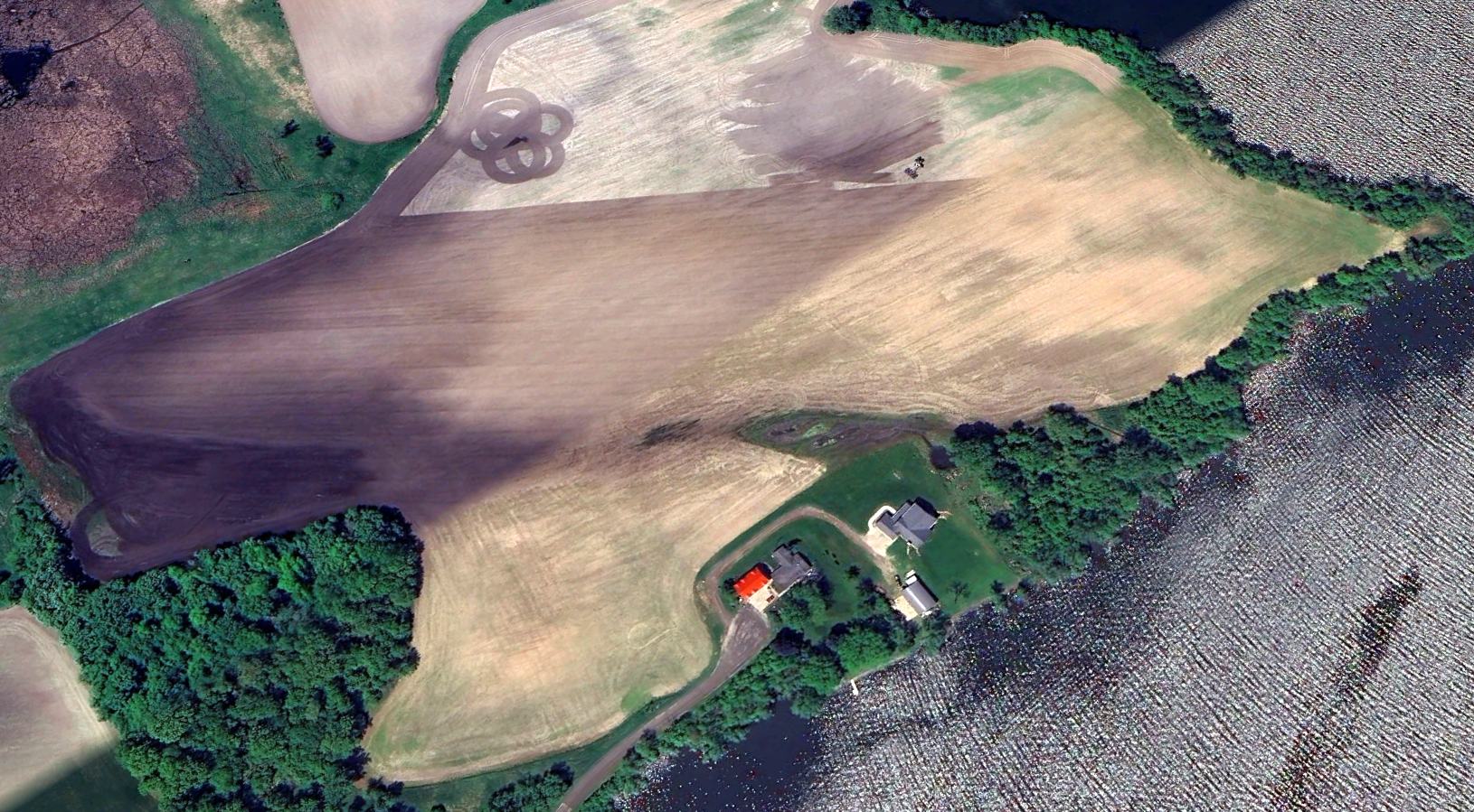
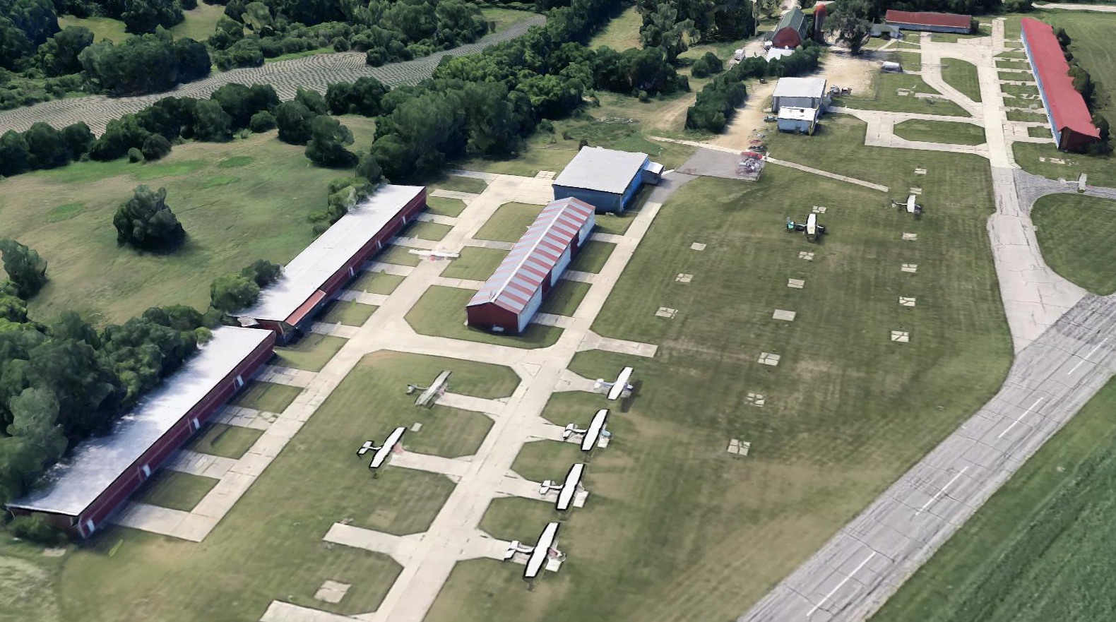
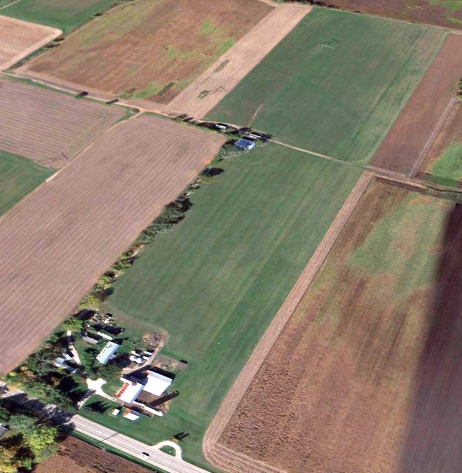
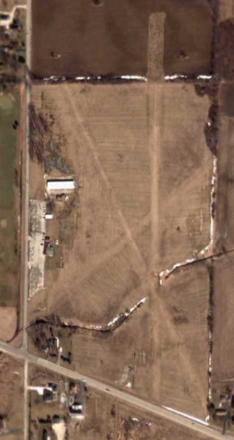
A 2023 aerial view looking north showed Grand Geneva Airport as remaining intact, though devoid of aircraft.
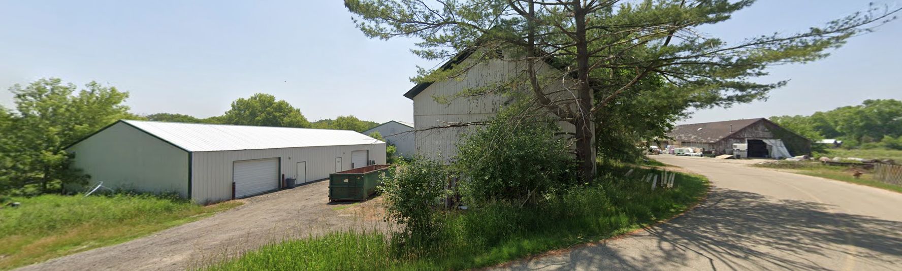
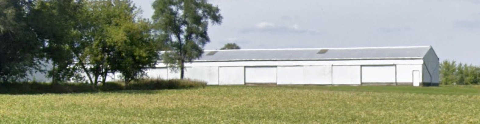
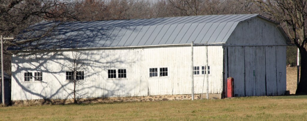
A 2023 photo looking south at the barn & other buildings at Grand Geneva Airport.
For the year ending 5/15/24, Grand Geneva Airport had 150 takeoffs or landings.
As of July 2024, there were no aircraft based at the airport.
According to Wikipedia, a 12/2/24 NOTAM stated that Grand Geneva Airport was permanently closed.
Demolition of the runway was subsequently performed & a new driving range was installed on the former Runway 5 threshold, facing northeast down the length of the former runway.
Andy Gelston recalled, “Eventually, the decades of neglect made rubble of the runway. Not able to contribute enough to the resort to justify resurfacing the runway & taxiway,
it was X-ed over, then removed & sodded over for a golf diving range.
The airport was always a rich man's folly, built with a 4,100' paved runway to attract wealthy jetsetters with Learjets, and womanizing rich men with toys, like WWII aircraft.
It lost its novelty as an exclusive, private club after 7 years and opened its gates to the public, who trashed the place.
The airport proved to be an accurate barometer of how the resort was doing; an asset that resort management seemed oblivious to.”
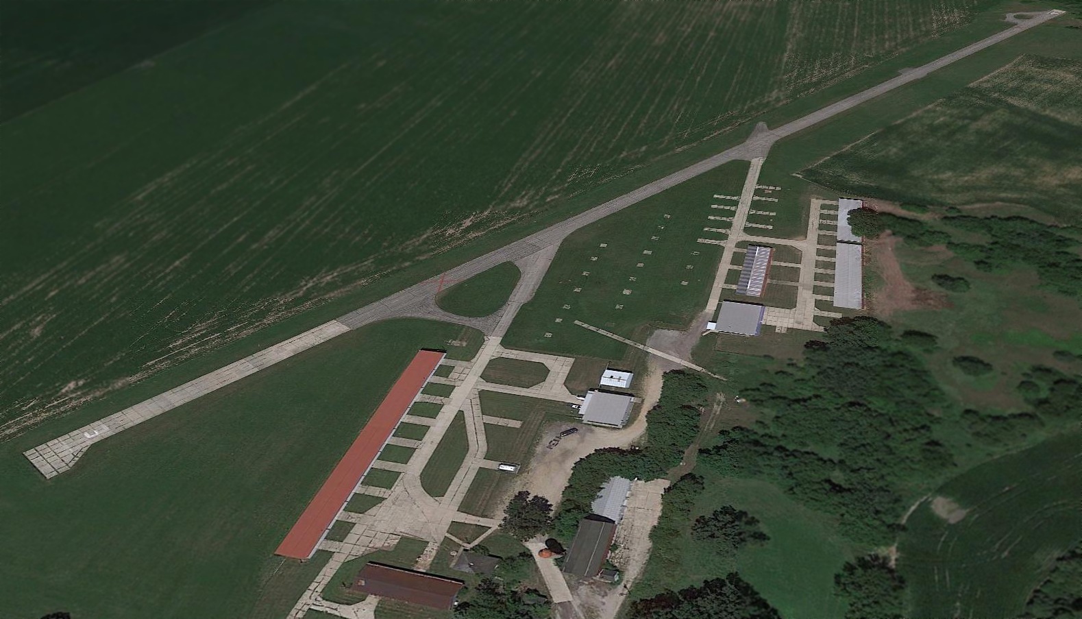
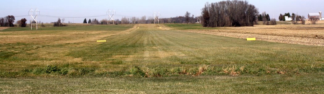
An undated photo looking northeast along the Grand Geneva Airport runway.
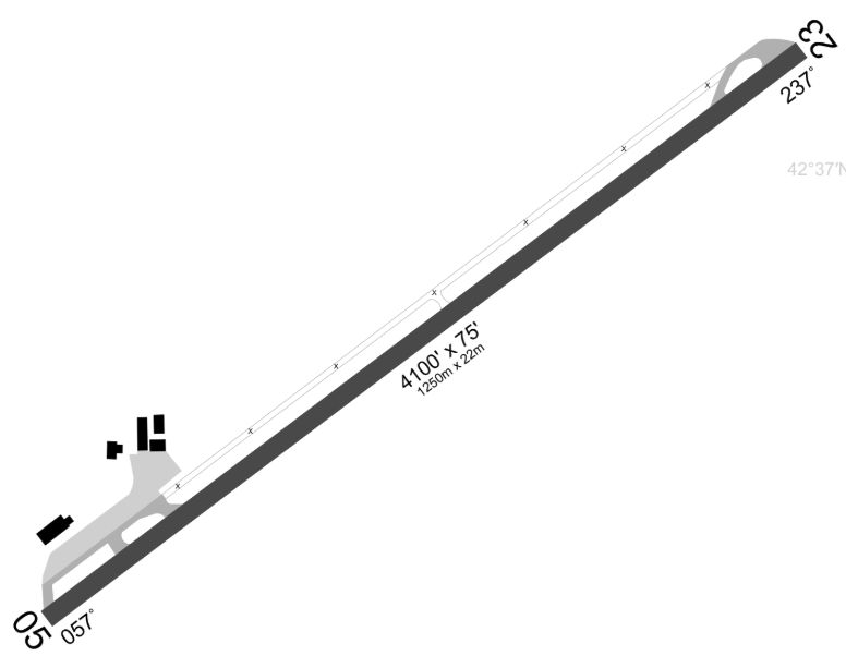
A 2025 airport diagram (courtesy of Andrew Thome) depicted Grand Geneva Airport as having a 4,100' paved Runway 5/23.
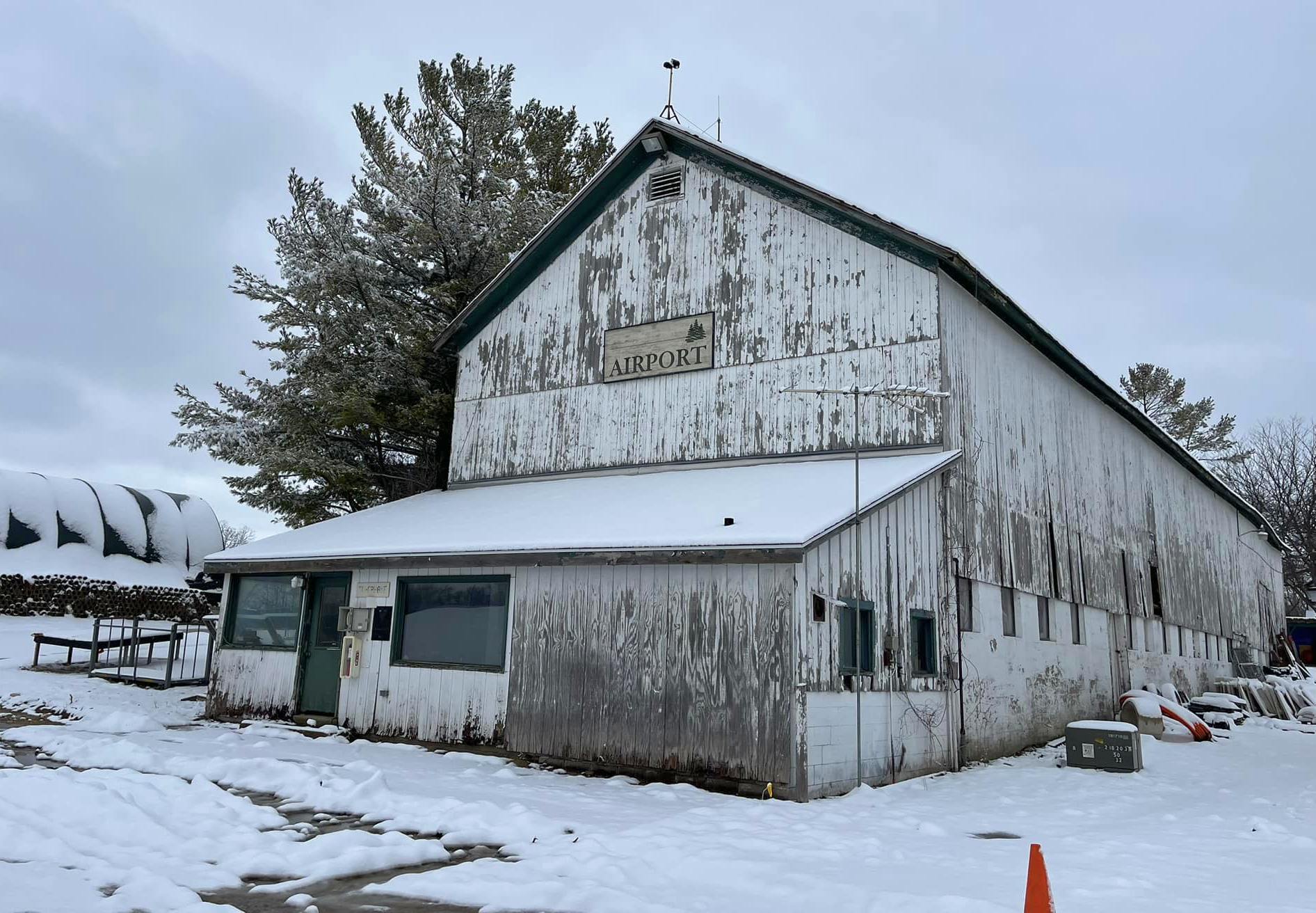
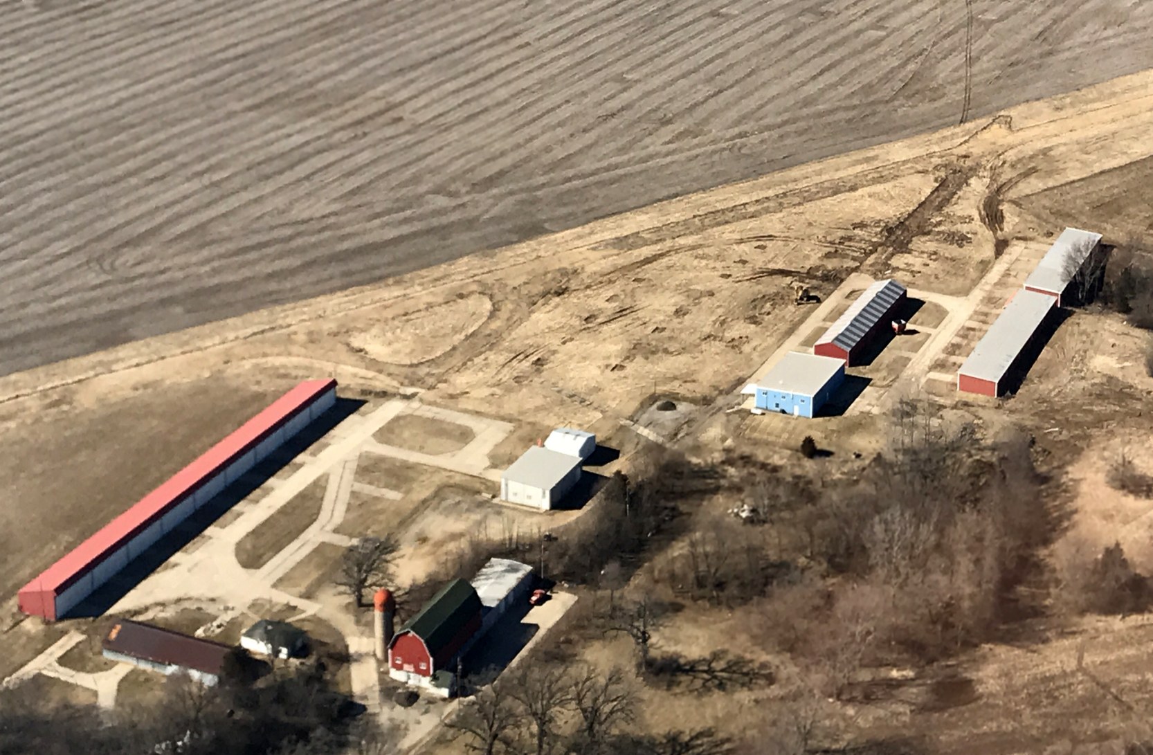
A 2025 photo by Andrew Thome of the Grand Geneva Airport airport office/barn.

The 2025 Sectional Chart (courtesy of Andrew Thome) depicted Grand Geneva Airport as having a 4,100' paved runway.

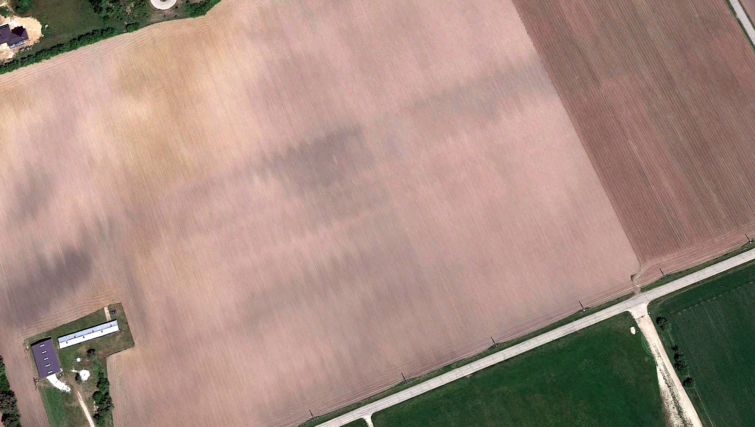
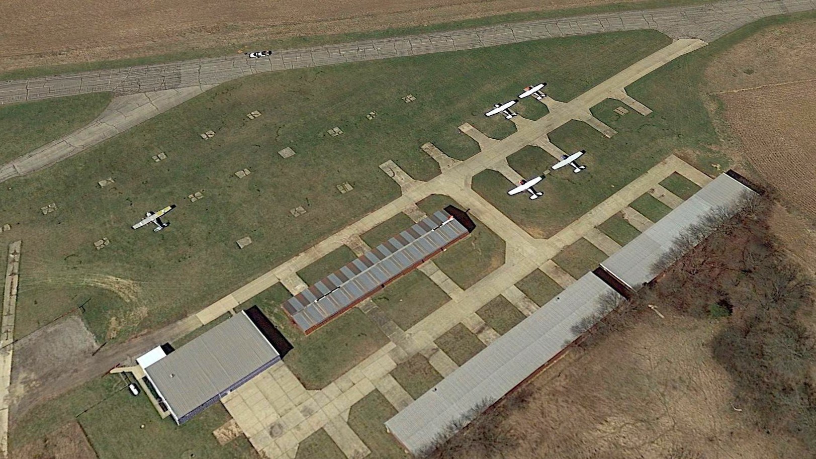
A 2025 aerial view by Andrew Thome looking west at the remains of Grand Geneva Airport.
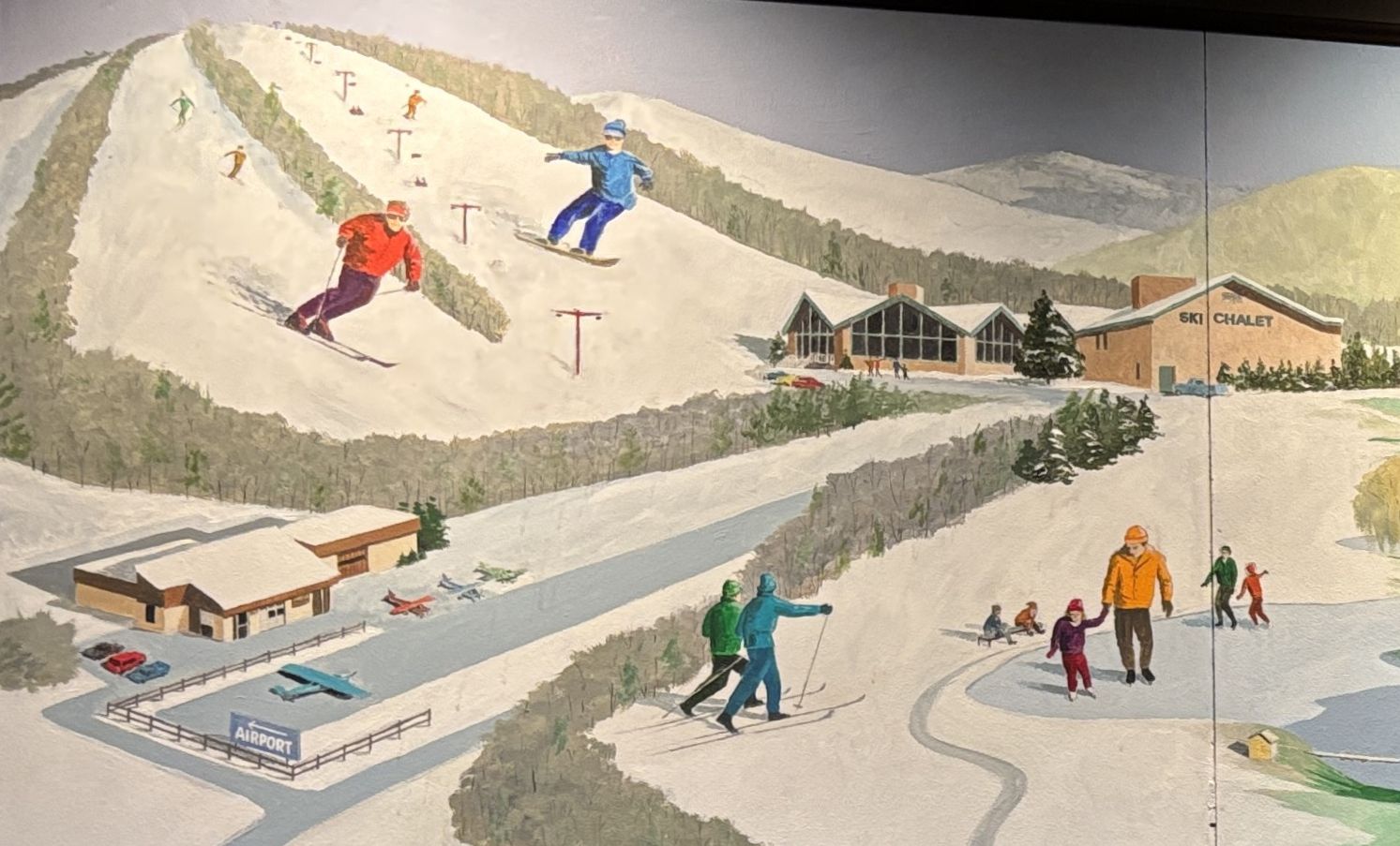
A 4/3/26 photo by Andrew Thome of the mural at the Grand Geneva Airport showing their former airport at the base of their ski resort.
____________________________________________________
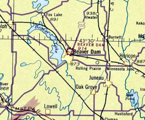
Beaver Dam Airport (1st location), Beaver Dam, WI
43.478, -88.835 (Northwest of Milwaukee, WI)
A 1940 aerial photo of the original Beaver Dam Airport (courtesy of Joe Wrzesinske).
The original airport for the town of Beaver Dam was located on the north side of the town.
The earliest depiction which has been located of Beaver Dam Airport was a 1940 aerial photo (courtesy of Joe Wrzesinske).
It depicted Beaver Dam Airport as having 4 unpaved runways, with some small buildings on the east side.
Beaver Dam Airport was not yet depicted on the 1941 Milwaukee Sectional Chart.
The earliest aeronautical chart depiction which has been located of Beaver Dam Airport was on the June 1942 Milwaukee Sectional Chart.
It depicted Beaver Dam as a commercial/municipal airport.
The last depiction which has been located of the original location of Beaver Dam Airport was on the December 1946 Milwaukee Sectional Chart.
It depicted Beaver Dam Airport as having a mere 1,500' unpaved runway.
The original Beaver Dam Airport was evidently closed (for reasons unknown) at some point between 1946-47,
as it was no longer depicted on the 1947 Milwaukee Sectional Chart.
A 1952 aerial photo did not show any recognizable traces of the original Beaver Dam Airport.
A 2023 aerial photo did not show any recognizable traces of the original Beaver Dam Airport.
____________________________________________________
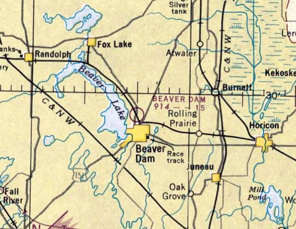
Beaver Dam Airport (2nd location), Beaver Dam, WI
43.457, -88.864 (Northwest of Milwaukee, WI)
Beaver Dam Airport, as depicted on the December 1948 Milwaukee Sectional Chart.
No airfield at this location was yet depicted on a 1940 aerial photo.
The 2nd location of Beaver Dam Airport was evidently established at some point between 1947-48,
as it was not yet depicted on the 1947 Milwaukee Sectional Chart.
The earliest depiction which has been located of the 2nd location of Beaver Dam Airport was on the December 1948 Milwaukee Sectional Chart.
It depicted Beaver Dam as having a 2,900' unpaved runway.
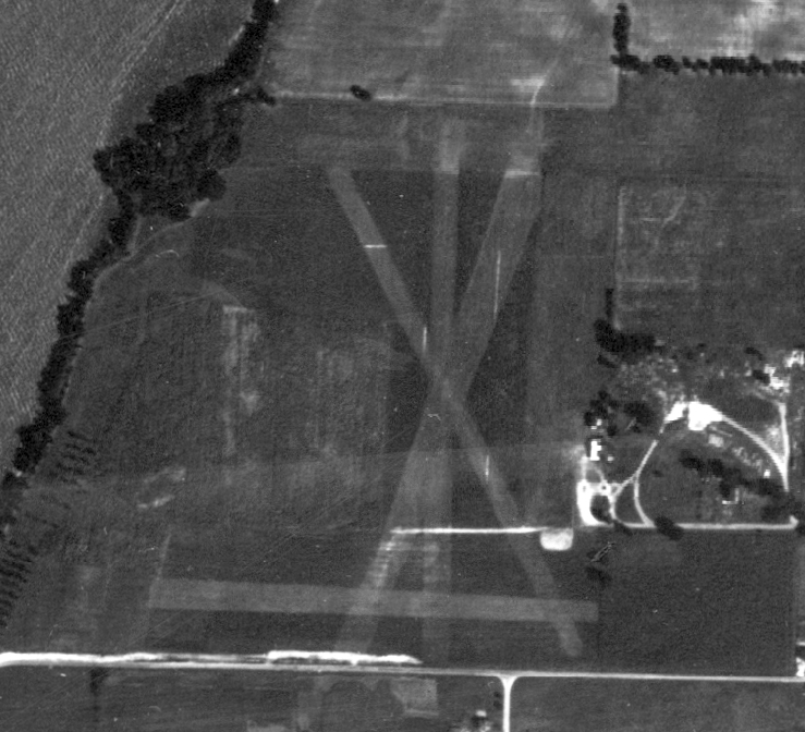
The earliest topo map depiction which has been located of Beaver Dam Airport was on the 1955 USGS topo map.
It depicted Beaver Dam Airport as having 2 unpaved runways in an “X” shape, with a small building on the east side.
It depicted Beaver Dam Airport as having 2 unpaved runways in an “X” shape, with a dozen light aircraft & several T-hangars on the east side.

The last aeronautical chart depiction which has been located of Beaver Dam Airport was on the December 1966 Milwaukee Sectional Chart.
It depicted Beaver Dam as having a 2,400' unpaved runway.
Beaver Dam Airport was evidently closed (for reasons unknown) at some point between 1966-67,
as it was no longer depicted on the 1967 Milwaukee Sectional Chart.
A 1975 aerial photo showed that 3 of the Beaver Dam Airport T-hangars remained, but the runways had been returned to cultivation.
Beaver Dam Airport was still depicted on the 1976 USGS topo map, even though it had evidently ceased to operate nearly a decade before.
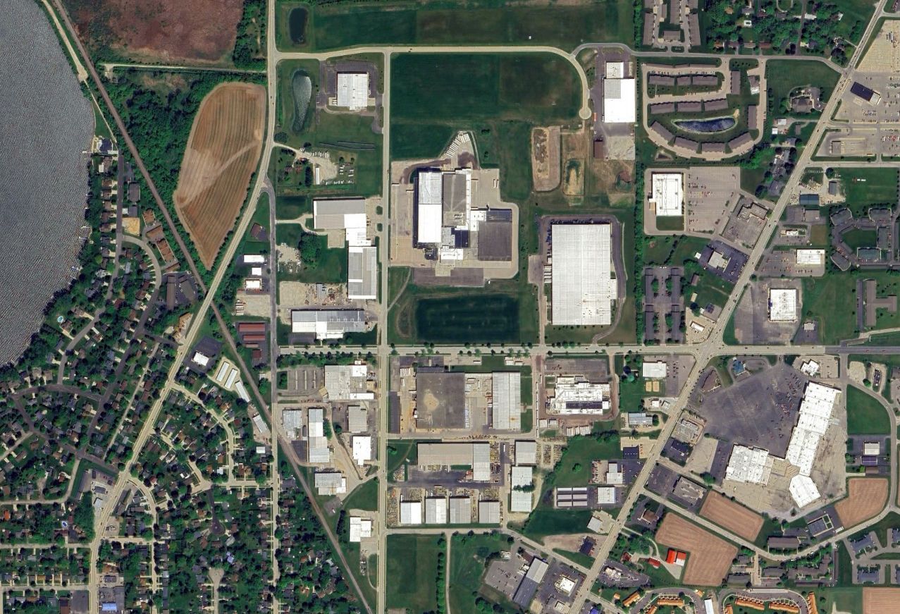
A 2023 aerial view looking northwest showed the site of the 2 location of Beaver Dam Airport remained clear, but with no specific remains of the airport.
Thanks to Joe Wrzesinske for pointing out this airfield.
____________________________________________________
Chaplin Airpark, Plymouth, WI
43.761, -87.986 (North of Milwaukee, WI)

Chaplin Airpark, as depicted on the December 1946 Milwaukee Sectional Chart.
Chaplin Airpark was not yet depicted on the June 1946 Milwaukee Sectional Chart.
According to DiscoverPlymouth, “After Harry Chaplin returned from World War II, his grandmother didn’t want him to leave the area since jobs were scarce.
So, she gave a part of the family farm to Harry to start an airport. It was a place that allowed Harry to continue using the skill he learned while in the Army Air Corps, airplane maintenance.
His father Harvey helped him build the hangars. In 1946, the airport was opened & running as Chaplin Airpark. The name was printed in large letters on the rooftop for pilots to see & know where the airport was.
The first plane the company owned was a Piper Cub. Many interesting people flew through the airport while doing business in the Plymouth area.
To keep the business running in the early years, Harry would take a flatbed truck out & pick up crashed aircraft & rebuild them, since the planes were made of wood & fabric.
There was one runway running east/west that consisted of mowed grass. Keeping the runway open & filling gopher holes were constant chores.
Flight instruction was another part of the business in addition to aircraft maintenance. Harry published the first general aviation statewide publication called The Badger Airway Beacon.
Harry was very active in helping to grow general aviation in Wisconsin & on the national level. He served as the president of the Wisconsin Aviation Trades Association.
He worked arduously to improve aviation business practices & devoted many uncounted hours toward the development of good, sensible, and fair legislation for the industry.”
The earliest depiction which has been located of Chaplin Airpark was on the December 1946 Milwaukee Sectional Chart.
It depicted Chaplin Airpark as having a 2,000' unpaved runway.

The last photo which has been located of Chaplin Airpark was a 1951 aerial view.
It depicted a single east/west grass runway, with 2 small buildings & 1 light single-engine plane on the south side.

The earliest topo map depiction which has been located of Chaplin Airpark was on the 1954 USGS topo map.
It depicted Chaplin Airpark as having a single east/west unpaved runway, with 2 small buildings on the south side.

The last aeronautical chart depiction which has been located of Chaplin Airpark was on the November 1960 Milwaukee Sectional Chart.
It depicted Chaplin as having a 2,200' unpaved runway.
According to DiscoverPlymouth, “The fixed base operation of Chaplin Airpark was moved to the Sheboygan County Memorial Airport when Harry was appointed manager of the new airport in the early 1960s.
The airport was closed in favor of a more centralized airport for Sheboygan County.”
Chaplin Airpark was no longer depicted on the May 1965 Milwaukee Sectional Chart.
A 1971 aerial photo showed houses had been built over the western portion of Chaplin Airpark, along a street named “Airpark Road”,
but the 2 small hangars remained on the south side.
A 1986 aerial photo showed Wisconsin Route 23 had been built over the northern portion of Chaplin Airpark at some point between 1981-86.

A 2022 photo looking east at the former Chaplin Airpark hangars, nicely modernized & reused by the “Other Place” business.

A 2023 aerial view showed houses & roads covering the majority of the Chaplin Airpark site, but the 2 former hangars remained on the south side.

A 2024 photo by Jake Schultz of a mural in Plymouth commemorating Chaplin Airpark.
Thanks to Jake Schultz for pointing out this airfield.
____________________________________________________
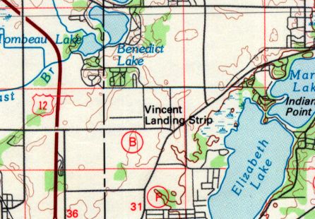
Vincent Airfield (64C), Genoa City, WI
42.519, -88.302 (Southwest of Milwaukee, WI)
Vincent Airfield, as depicted on the May 1960 Milwaukee Sectional Chart.
This small private airfield was evidently established at some point between 1959-60,
as it was not yet depicted on a 1956 aerial photo nor on the 1959 Milwaukee Sectional Chart.
Doug Rogers recalled, “Vincent Airfield... I lived next to it as a child & owe my career to it!”
The earliest depiction which has been located of Vincent Airfield was on the May 1960 Milwaukee Sectional Chart.
It depicted Vincent as a private airfield having a 2,200' unpaved runway.
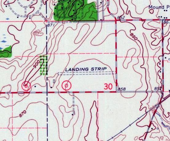
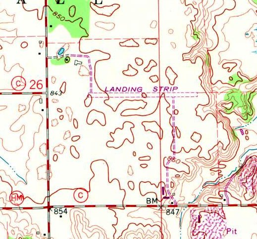
The earliest topo map depiction which has been located of Vincent Airfield was on the 1960 USGS topo map.
It depicted a single east/west unpaved runway, generically labeled as “Landing Strip”.
The May 1970 Milwaukee Sectional Chart depicted Vincent as a private airfield having a 2,500' unpaved runway.
The earliest photo which has been located of Vincent Airfield was a 1971 aerial view.
It depicted Vincent as having an east/west grass runway, and a hangar & 1 light single-engine plane on the southwest side.
A 1976 aerial view did not depicted an aircraft at Vincent Airfield.
A 1980 aerial view depicted Vincent Airfield perhaps at the zenith of its popularity, with 8 aircraft parked on the southwest side.
The 1980 USGS topo map depicted “Vincent Landing Strip” as a single east/west runway.
A 1987 aerial view once again depicted Vincent Airfield devoid of aircraft.
Doug Rogers recalled, “In the late 1990s the hangar contained an Aeronca Champ, a Piper Cub, and a Cessna 195.”
The last photo which has been located showing an aircraft at Vincent Airfield was a 2004 aerial view looking northeast, which showed 1 light single-engine aircraft on the southwest side.
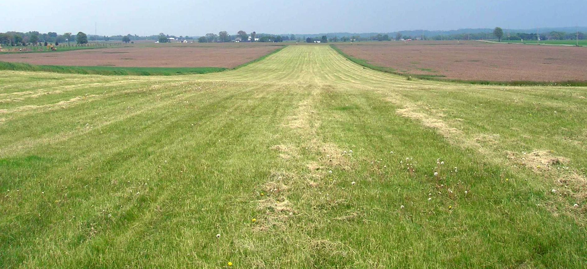
A 2006 photo by Doug Rogers looking showed the Vincent Airfield runway to remain very well-maintained.
A 2007 aerial view looking northwest depicted Vincent Airfield as having an east/west grass runway, with a hangar on the southwest side, but there were no aircraft visible.
Doug Rogers recalled, “The last time I used the field was 2010.”
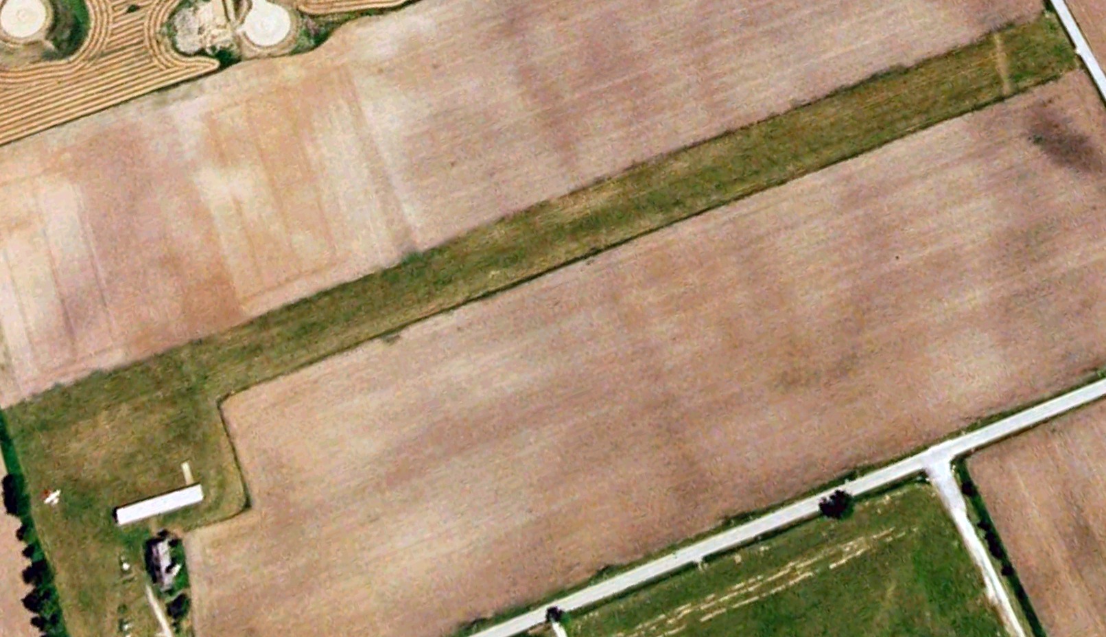
The last photo which has been located showing Vincent Airfield remaining intact was a 2013 aerial view looking northeast.
Doug Rogers recalled, “To my knowledge, the field was closed & turned under some time in 2014 after the death of the manager.”
A 2015 aerial view showed the Vincent Airfield runway had been removed, with a farm field covering the site.
The last aeronautical chart depiction which has been located of Vincent Airfield was on the 2019 Chicago Terminal Chart.
It depicted Vincent as a private airfield having a 1,800' unpaved runway.
This is an obvious safety hazard for the aeronautical charts to continue to show an airfield at least 4 years after it had been physically removed.
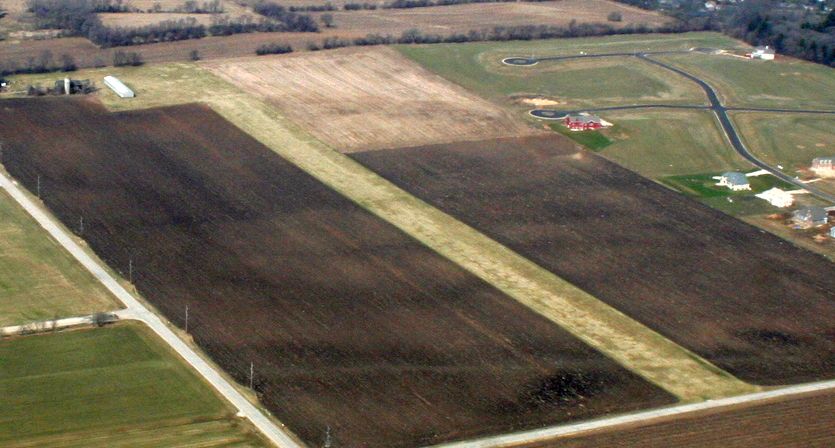
A 2021 aerial view looking northeast showed only the faintest trace remaining of the Vincent Airfield runway, with it having been plowed under. The hangar remained on the southwest side.
A 2022 photo looking north at the Vincent Airfield hangar.
Vincent Airfield was no longer depicted on 2023 aeronautical charts.
Doug Rogers reported in 2023, “The hangar still exists.”
Thanks to Doug Rogers for pointing out this airfield.
____________________________________________________
Westosha Airport (5K6), Wilmot, WI
42.514, -88.205 (Southwest of Milwaukee, WI)
Westosha Airport, as depicted on the May 1970 Green Bay Sectional Chart.
According to its FAA Airport/Facility Directory data, Westosha Airport was activated in September 1969.
The earliest depiction which has been located of Westosha Airport was on the May 1970 Green Bay Sectional Chart.
It depicted Westosha as a private airfield having a 2,600' unpaved runway.
The 1971 USGS topo map depicted Westosha Airport as a single unpaved east/west runway, labeled generically as “Landing Strip”,
with an unpaved taxiway leading to 3 small buildings on the southeast side.
The earliest photo which has been located of Westosha Airport was a 1971 aerial view.
It depicted Westosha as having a single unpaved east/west runway, with an unpaved taxiway leading to 3 small buildings on the southeast side,
around which were parked 7 light single-engine aircraft.
A 1980 aerial view showed Westosha Airport had gone thru a dramatic upgrade in 9 years.
The was no sign of the former unpaved east/west runway, with it having been replaced by a paved Runway 3/21 & an unpaved northwest/southeast runway.
The number of hangars on the south side had grown, and there were several dozen light aircraft parked outside.
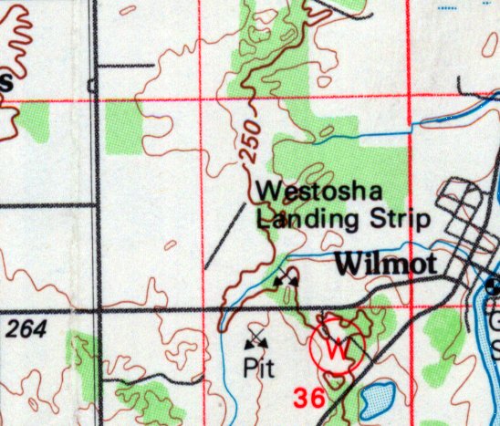
The 1980 USGS topo map depicted “Westosha Landing Strip” in its new configuration, with a paved northeast/southwest runway.
A 1995 aerial view showed Westosha Airport had gained several more hangars, but the number of aircraft parked outside had decreased.
A 2000 aerial view showed Westosha Airport had declined once again in popularity,
with the number of aircraft visible outside having decreased to less than 10.
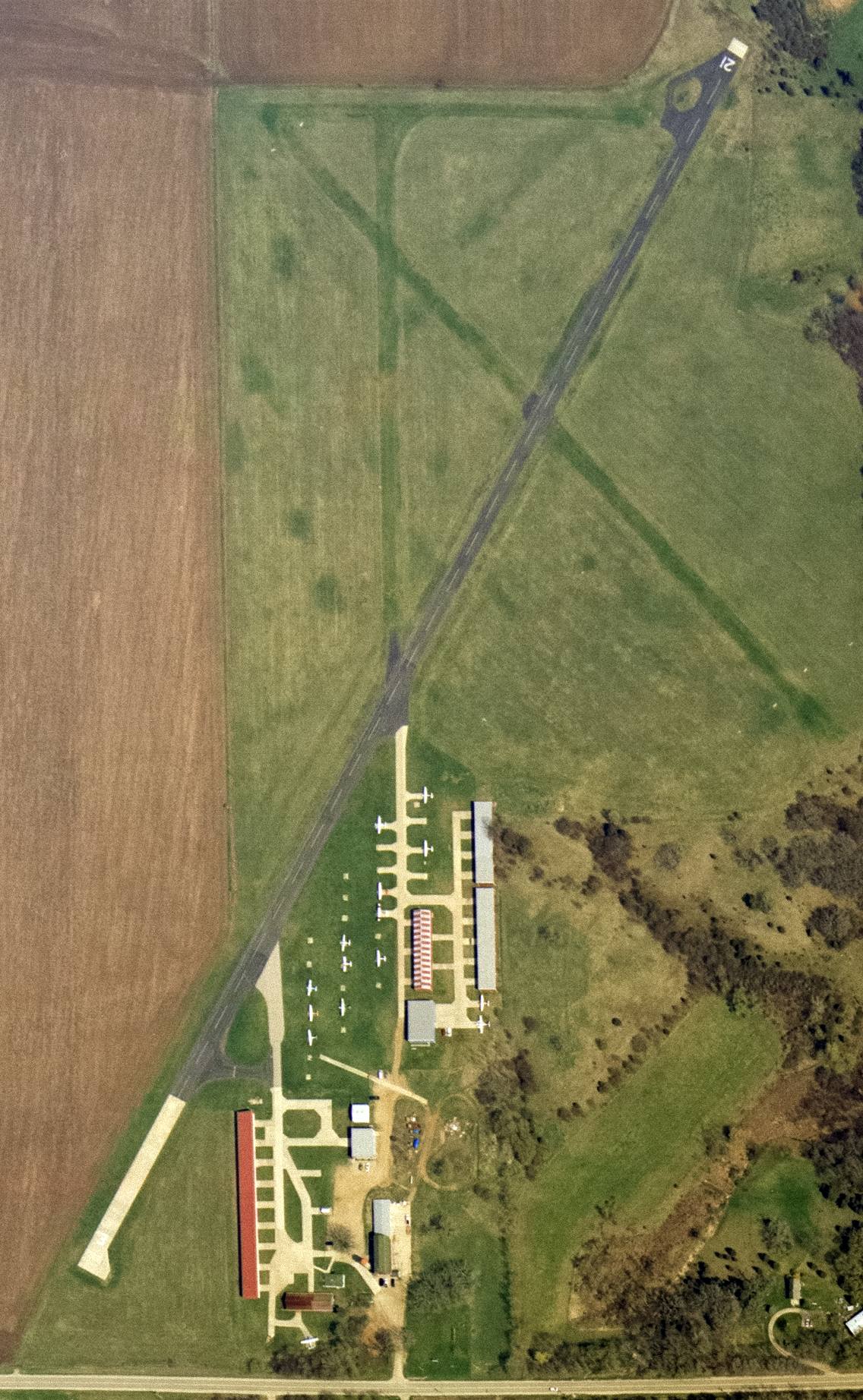
A 4/2302 USGS aerial view showed Westosha Airport as having a paved Runway 3/21 & an unpaved northwest/southeast runway.
A total of 15 light aircraft were visible on the field.
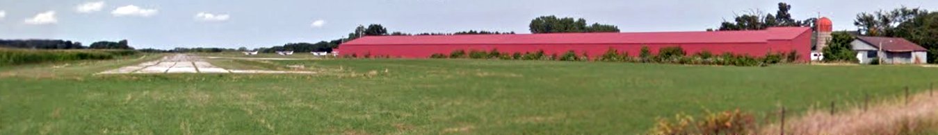
An August 2015 photo looking northeast along Westosha Airport's Runway 3, showing 3 single-engine Cessnas parked north of the hangar.
For a 1-year period ending 6/3/16, the FAA Airport/Facility Directory data described Westosha Airport as having conducted an average of 25 takeoffs or landings per day.
A circa 2016 3D aerial photo looking south at Westosha Airport, showing 9 single-engine Cessnas parked near the hangars.
The last photo which has been located showing planes at Westosha Airport was a 2017 aerial view looking north,
which showed 4 single-engine Cessnas parked near the hangars.
The end for Westosha Airport evidently came in 2018,
when its sole runway (3/21) was listed by NOTAM 06/375 as permanently closed effective 7/1/18.
A 2018 aerial view looking north showed Westosha Airport remaining intact, and with its runway still marked as active, but devoid of any planes.
Westosha Airport continued to be listed with the FAA as an active airport, even after its sole runway was permanently closed.
As of 2019, the FAA Airport/Facility Directory data described Westosha Airport as having 20 based aircraft.
It was said to have a 2,849' asphalt/concrete Runway 3/21, “in fair condition”.
Westosha Airport was listed as being owned by the Thelen Sand & Gravel Company, with the manager being Westosha Aviation Management.
Andrew Thome reported in 2019, “I was really looking forward to flying to it once I had received my Private Pilots License but have lost my chance.
A gravel company is going to mine the area. Sad.”
Westosha Airport continued to be depicted as an active airport on the 2019 Chicago Terminal Chart, shown to have a 2,800' paved northeast/southwest runway.
Since its sole runway has been permanently closed, continuing to depict Westosha as an active airport is contradictory, and a safety hazard

A 2019 aerial view looking southwest at Westosha Airport by Andrew Thome, who observed, “It looks like they ripped up most of the runway except the concrete at one end.”
A 2019 aerial view looking north at the Westosha Airport hangars by Andrew Thome.
What a shame to see this nice grassroots aviation infrastructure going to waste.
Thanks to Andrew Thome for pointing out this airfield.
____________________________________________________
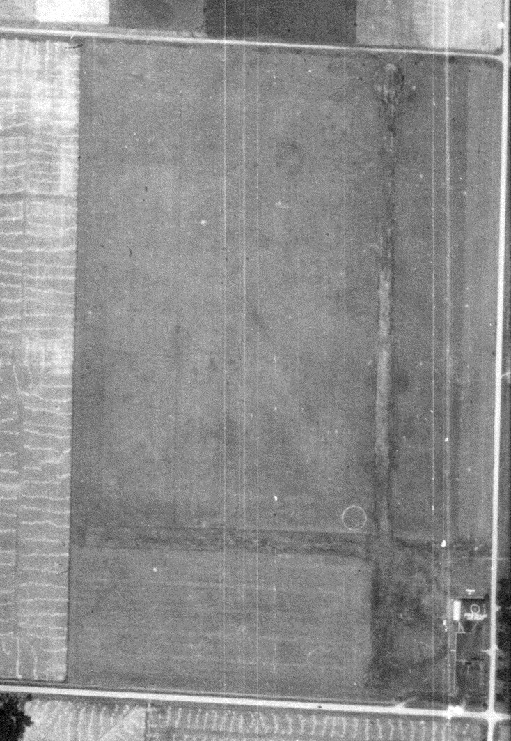
Madison North Street Airport, Madison, WI
43.11, -89.351 (Northeast of Downtown Madison, WI)
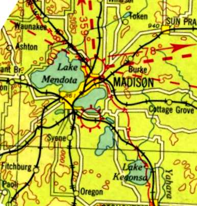
Madison North Street Airport, as depicted on a 1930 Airway Chart.
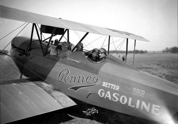
An 8/22/27 photo of Charles Lindbergh landing the Spirit of St. Louis, his Ryan NYP at Royal Airport.
According to Micheal Goc's book “Forward in Flight – The History of Aviation in Wisconsin”, Madison North Street Airport was established in 1927
and located northeast of the intersection of North Street & Coolidge Street.
According to Al Hatz, “This is the airport Orland Corben ran & sold kits for the Corben Baby Ace, Super Ace and Junior Ace.”
The earliest depiction which has been located of Madison North Street Airport was on a 1930 Airway Chart.
Madison North Street Airport, as depicted on the June 1931 Milwaukee Sectional Chart.
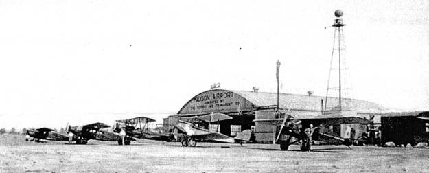
A circa 1930s photo of a row of biplanes in front of a Madison Airport hangar & beacon tower (courtesy of Al Hatz).
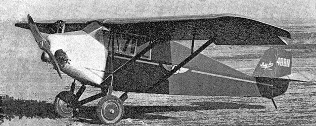
A circa 1930s photo of a Corben Baby Ace at Madison North Street Airport (courtesy of Al Hatz).
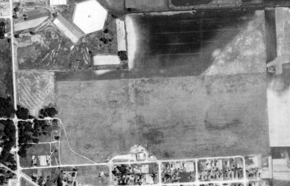
A 7/6/37 aerial view (courtesy of Al Hatz) depicted Madison North Street Airport as having a rectangular grass airfield,
with a hangar & 3 light planes on the south side.
The much larger Madison Municipal Airport / Truax Field was opened a few miles to the northeast in 1937,
which would eventually replace North Street Airport.
The last aeronautical chart depiction which has been located of Madison North Street Airport was on a September 1941 Milwaukee Sectional Chart.
Madison North Street Airport was evidently closed at some point between 1941-42,
as it was no longer depicted on the June 1942 Milwaukee Sectional Chart.
A 2014 aerial view showed no trace remaining of North Street Airport.
Thanks to Al Hatz for pointing out this airfield.
____________________________________________________
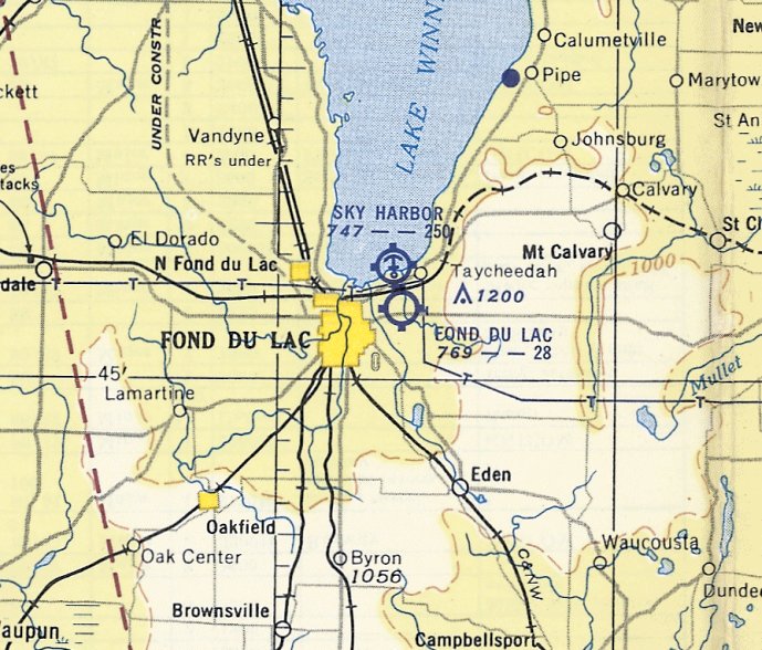
(Original) Fond du Lac Airport, Fond du Lac, WI
43.788, -88.414 (Northwest of Milwaukee, WI)
A 1937 aerial view of Fond du Lac Airport Airport (from the WI Historic Aerial Imagery Finder, courtesy of Al Hatz).
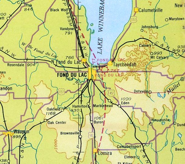
The original airport for the town of Fond du Lac was located on the east side of the town.
The date of establishment of Fond du Lac Airport has not been determined.
The earliest photo which has been located of Fond du Lac Airport was a 1937 aerial view (from the WI Historic Aerial Imagery Finder, courtesy of Al Hatz).
It depicted Fond du Lac as having 2 perpendicular grass runways, with a hangar & 1 light single-engine aircraft on the southeast side.
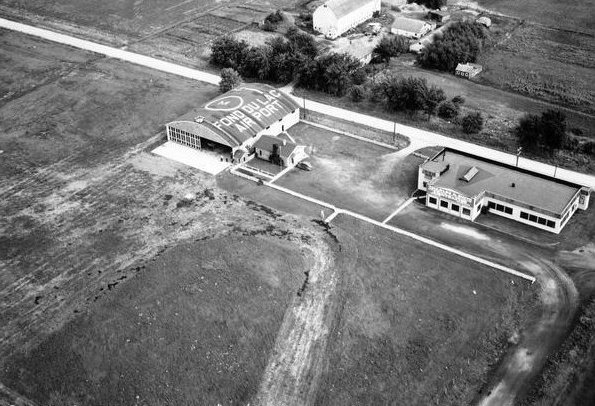
A 9/19/40 aerial view (courtesy of Lee Corbin) looking northeast at the Fond du Lac Airport
depicted an arch-roofed hangar (with “Fond du Lac Airport” painted on the roof) & a terminal building alongside a grass airfield.
The earliest aeronautical chart depiction which has been located of Fond du Lac Airport was on the June 1942 Milwaukee Sectional Chart.
It depicted Fond du Lac as a commercial/municipal airport.
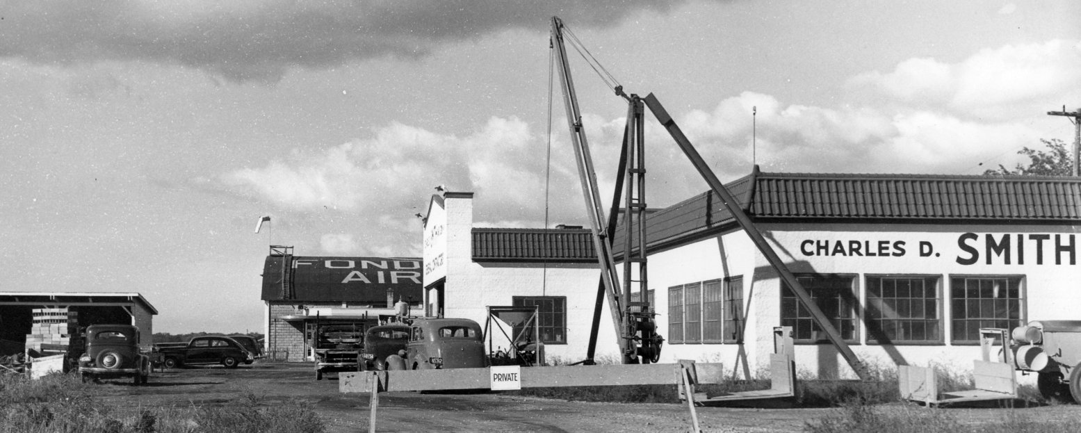
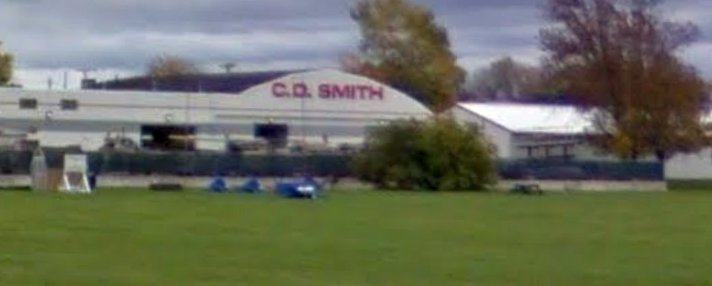
A circa 1940s photo looking north at the Fond du Lac Airport hangar (with windsock on top) (courtesy of Nicole Blatz of the C. D. Smith Company),
along with the Charles D. Smith Company building in the foreground .
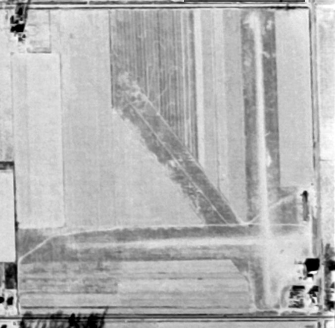
A 12/4/51 aerial view (courtesy of Lee Corbin) depicted Fond du Lac Airport as having 3 unpaved runways,
with a few small buildings on the southeast side.
The last aeronautical chart depiction which has been located of Fond du Lac Airport was on the May 1953 Milwaukee Sectional Chart (courtesy of Ron Plante).
It depicted Fond du Lac Airport as having a 2,80' unpaved runway.
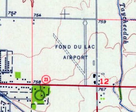
The 1955 USGS topo map depicted Fond du Lac Airport as having a paved north/south runway,
an unpaved northwest/southeast runway, and 3 small buildings on the southeast side.
The larger Fond du Lac County Airport was opened to the west of the town in October 1958,
at which point the original Fond du Lac Airport was evidently closed.
John Potter recalled, “I was born in Fondy in 1959 & my parents had built a home on a dead-end street at the West end of the old airport.
Dad worked for Hopmans at A.F. Klinzing Company (farm equipment) who had moved into the old airport building & shared the north side with a concrete drain line supplier.
Dad use to drive on the weed-covered runway to shortcut to work. Dad's office was the 3rd window from the right of the office entrance.”
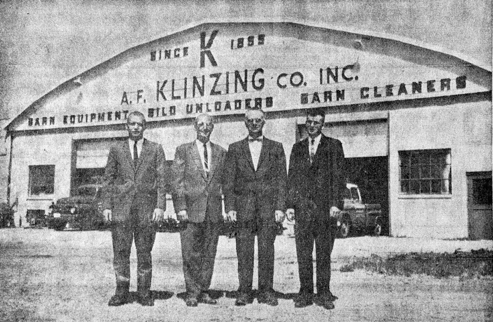
A circa 1963 photo of the staff of the A.F. Klinzing Company (including C.E. Potter on the right)
in front of “the old hangar at the former Fond du Lac County Skyport” (courtesy of John Potter).
The 1985 USGS topo map depicted streets & new buildings having covered a majority of the original Fond du Lac Airport site.
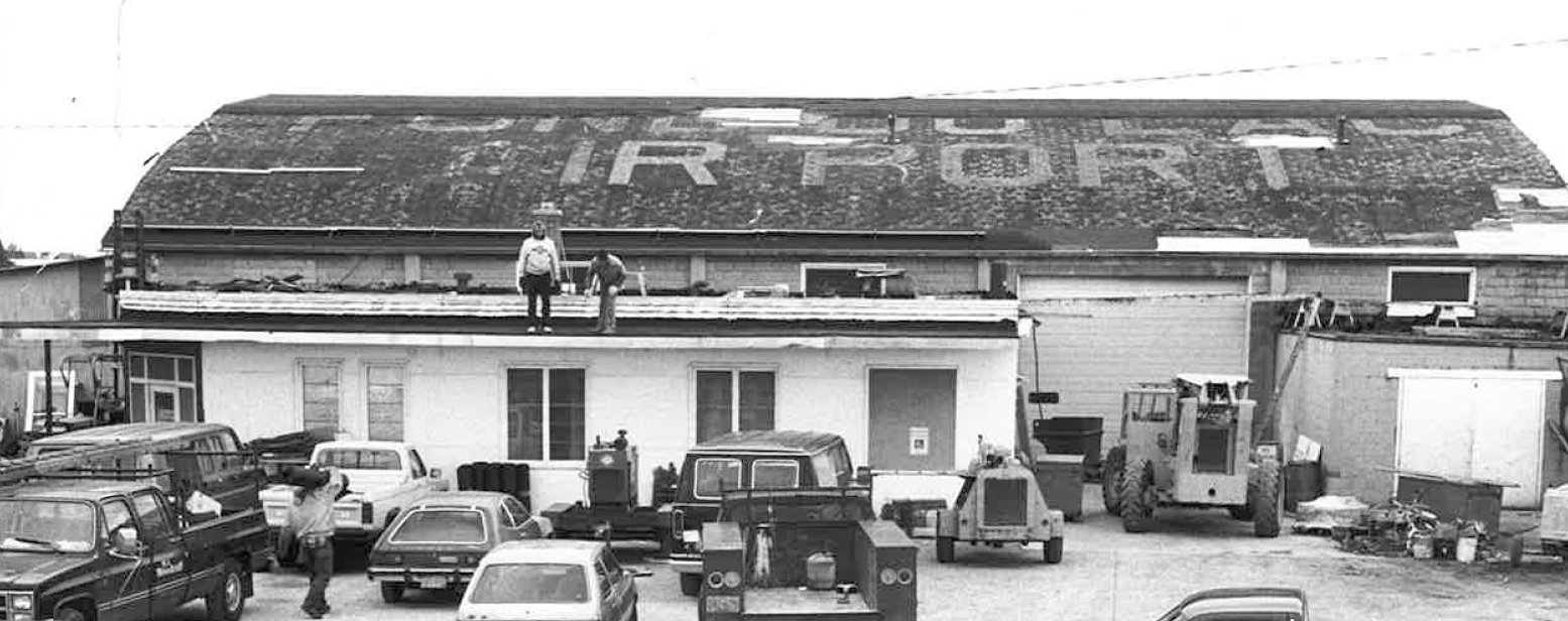
A circa 1990s photo of the original Fond du Lac Airport hangar (courtesy of Nicole Blatz of the C. D. Smith Company),
with the airport name still visible though faded on its roof.
A circa 2010-2017 photo looking southeast at a former hangar on the southeast corner of the site of the original Fond du Lac Airport (courtesy of Lee Corbin).
Lee Corbin reported, “I verified with the CEO of the C.D. Smith Company that their building is the old hangar.”

A circa 2010-2017 aerial view looking east at the former hangar on the southeast corner of the site of the original Fond du Lac Airport (courtesy of Lee Corbin).
A 2015 aerial view looking north at the site of the original Fond du Lac Airport, with the former hangar remaining at the southeast corner (bottom-right).
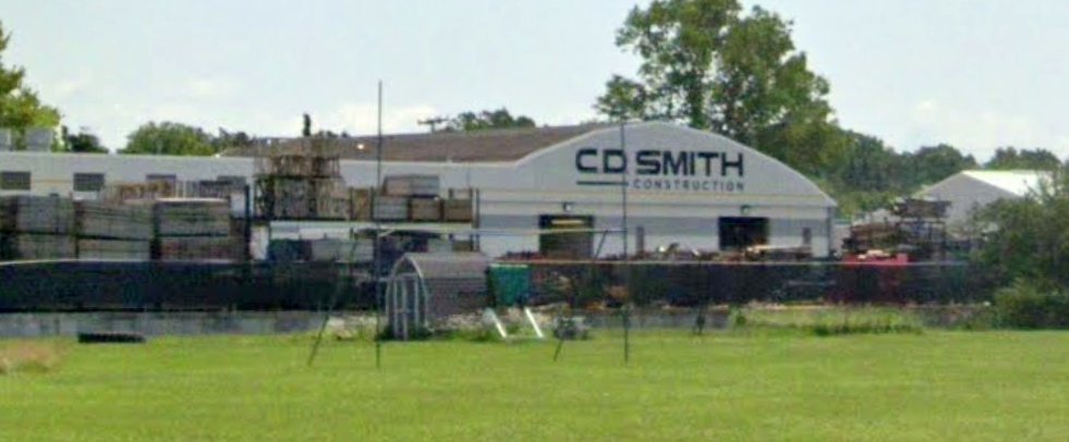
A July 2019 photo looking southeast at a former hangar on the southeast corner of the site of the original Fond du Lac Airport, reused by the C.D. Smith Construction company.
The site of the original Fond du Lac Airport is located northwest of the intersection of State Route 23 & Prairie Road.
Thanks to Lee Corbin for pointing out this airfield.
____________________________________________________
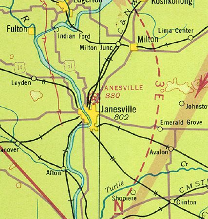
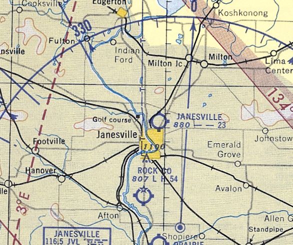
Janesville City Airport, Janesville, WI
42.712, -89.01 (West of Milwaukee, WI)
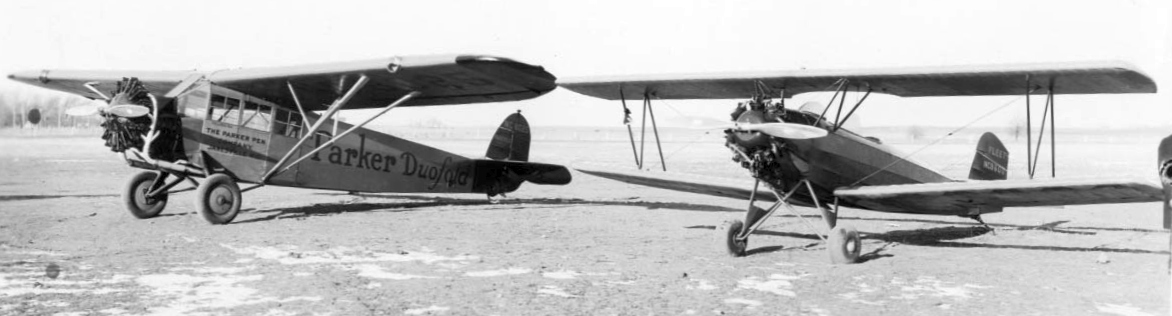
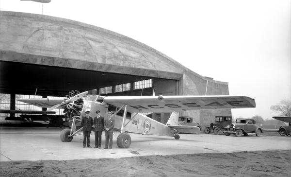
A circa 1929 photo (courtesy of Geoffrey Parker) of Parker Pen’s first plane (a Fairchild FC-2W2) & Kenneth Parker's Fleet Model 1 at the Janesville City Airport.
According to Geoffrey Parker, “Janesville’s first airport was known as Janesville City Airport.
It was located on the northern fringe of town just west of Highway 26, bordered approximately by Kennedy Road to the east & Black Bridge Road to the south.
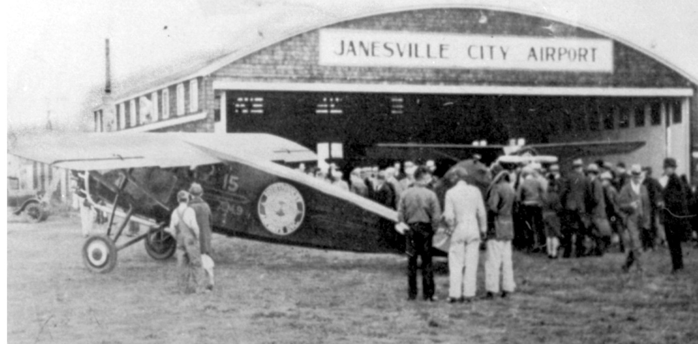
The earliest photo which has been located of Janesville City Airport was a circa 1929 photo (courtesy of Geoffrey Parker)
of Parker Pen’s first plane (a Fairchild FC-2W2) & Kenneth Parker's Fleet Model 1.
According to Geoffrey Parker, “A journal kept by my grandfather [Kenneth Parker], an active pilot, said:
'The field had been in use for at least 2 years before [1930].'”
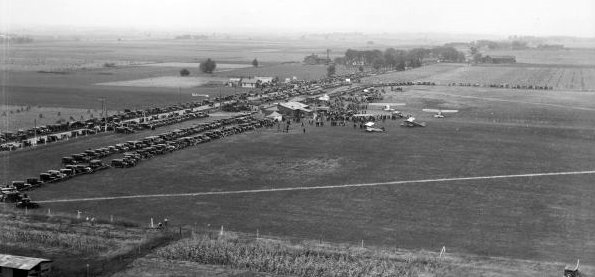
A circa 1930 photo (courtesy of Lee Corbin) of an aircraft race held at Janesville City Airport, with large numbers of spectators.
A circa 1930 photo (courtesy of Geoffrey Parker) of Janesville City Airport.
According to Geoffrey Parker, “This photo probably shows the official opening, if not of the airport then of the hangar.
The airport was officially opened on 8/9/30.”
Camy Matthay reported, “The Janesville Airport... I am 99% sure that my father [Frank Matthay] was at the opening of the hangar,
and that he also kept his own plane (a Stearman Cloudboy) at the Janesville Airport in the 1930s.”
The earliest aeronautical chart depiction which has been located of Janesville City Airport was on the June 1931 Milwaukee Sectional Chart.
It depicted Janesville City as a commercial/municipal airport.
Geoffrey Parker continued, “My grandfather’s Stinson was personally delivered to the City Airport by Eddie Stinson.
Probably the biggest airport event was when Wiley Post & Harold Gatty flew in on 8/9/31.
They stayed at my grandfathers house & after delivering a local radio speech that evening left the following day.
This was only several weeks after their famous flight around the world.
Air mail service began during 1931: I believe that Northwest Airlines carried the mail.”
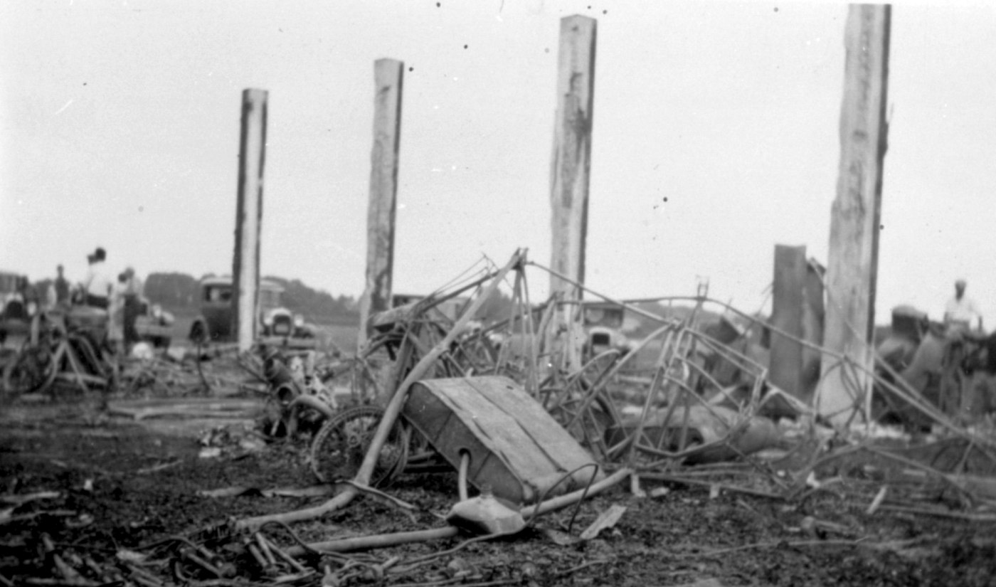
A 6/29/32 photo (courtesy of Geoffrey Parker) of the remains after the Janesville City Airport hangar fire.
Geoffrey Parker observed, “I assume that [my grandfather's] Stinson’s remains are in the foreground.”
Geoffrey Parker continued, “Airport boundary lights were first in use in August, 1932.
For most of that time there was, I believe, a single building.
That building was destroyed in a fire in 1933; it was deemed 'suspicious' as there was an ongoing disagreement
related to the 'milk wars' wherein anyone who sold milk for less than an agreed price might be punished - the owners were apparently doing just that.
All of the planes kept in the hangar were destroyed; my grandfather’s Stinson SM-8A Junior among them.
Eventually another hangar replaced it. And later a second private hanger housing Parker Pen’s plane (then a Cessna T-50 Bobcat) was built.
Not too long after that Parker moved to the current JVL field.”
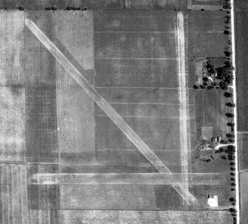
A 7/26/37 USDA aerial view of Janesville City Airport (from the WI Historic Aerial Imagery Finder)
depicted the field as having 3 unpaved runways & a hangar on the southeast side.
The June 1942 Milwaukee Sectional Chart depicted Janesville as a commercial/municipal airport.
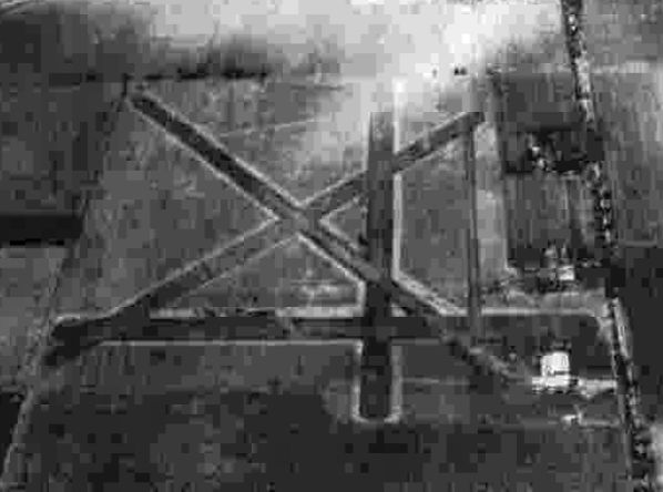
A circa 1942-45 aerial view looking north in the 1945 AAF Airfield Directory (according to Scott Murdock)
depicted Janesville City Airport as having 4 unpaved runways, with several hangars on the southeast side.
The 1945 AAF Airfield Directory (courtesy of Scott Murdock) described Janesville Airport as a 100 acre rectangular property having 4 sod runways, the longest measuring 2,600' northwest/southeast,
The field was said to have a single 80' x 52' metal hangar, and to be owned & operated by private interests.
A circa late 1940s – early 1950s aerial view looking south (courtesy of Geoffrey Parker)
depicted Janesville City Airport as having 4 unpaved runways, with several hangars on the southeast side.
The last aeronautical chart depiction which has been located of Janesville City Airport was on the May 1953 Milwaukee Sectional Chart (courtesy of Ron Plante).
It depicted Janesville City Airport as having a 2,300' unpaved runway.
Note that it also depicted the larger Rock County airport south of the town, which would soon replace Janesville City Airport.
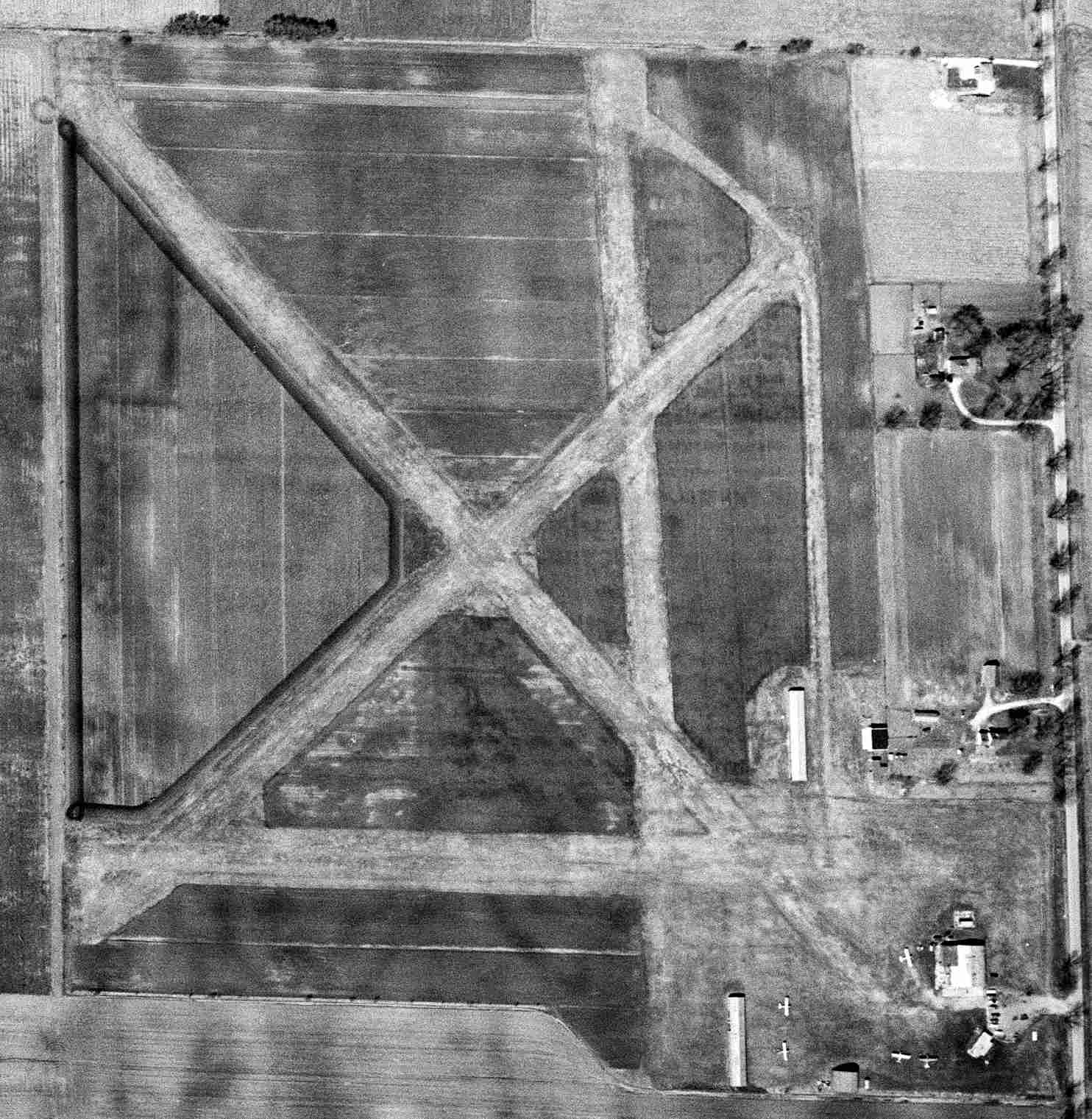
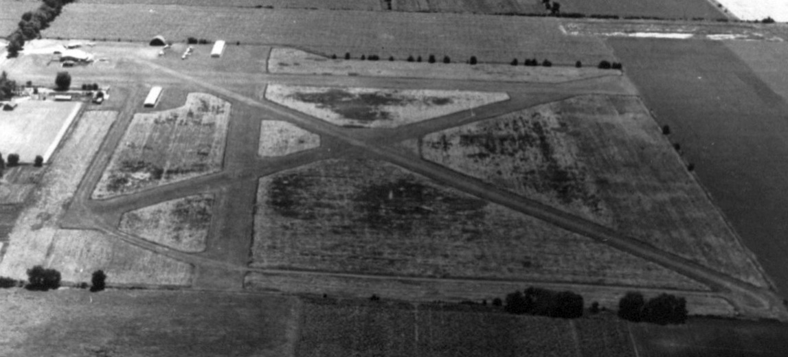
The last photo which has been located of Janesville City Airport was a 4/17/55 USGS aerial view.
It depicted Janesville City Airport as having 4 unpaved runways, with several hangars & 4 light single-engine aircraft on the southeast side.
Janesville City Airport presumably closed at some point between 1955-58, as it was no longer depicted on the 1958 USGS topo map.
A 1992 aerial photo showed no trace remaining of Janesville City Airport, with the site having become an industrial park.
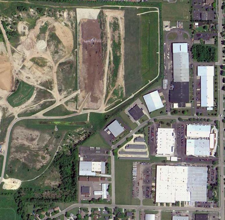
A 2014 aerial view showed no trace remaining of Janesville City Airport.
The site of the original Janesville Airport is located northwest of the intersection of Kennedy Road & Foster Avenue.
Thanks to Geoffrey Parker for pointing out this airfield.
____________________________________________________
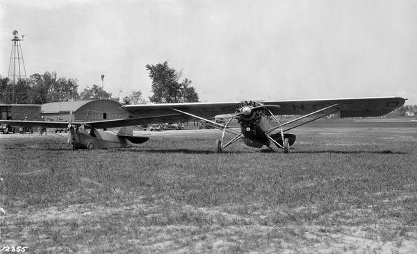
Larson Brothers Airport, Larsen, WI
44.2, -88.64 (Northwest of Milwaukee, WI)
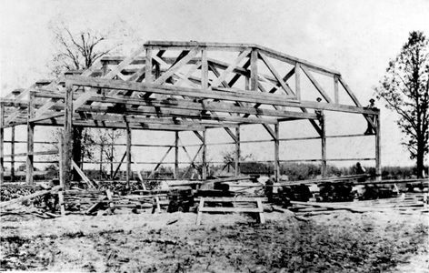
A circa 1922 photo of a hangar under construction at Larson Brothers Airport.
According to the National Park Service, “The Larson Brothers Airport was the first airport in Winnebago County
and one of the earliest Wisconsin airports outside Milwaukee.
It housed the first Wisconsin agency selling government-approved planes, and for 20 years served as a center for state aviators.
This well-maintained airport represents one of the earliest forms of airport design in Wisconsin.
The Larson Brothers Airport opened in the town of Clayton in 1922.
Four young farmers developed the Larson Brothers Airport: Roy, Clarence, Newell and Leonard Larson.
They began by clearing an 80-rod long runway behind the barn of their family farm.”
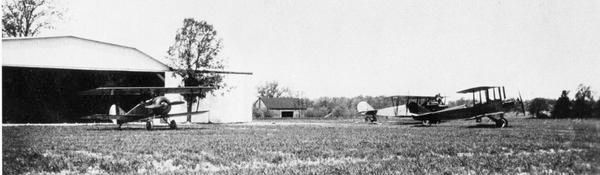
A 1923 photo of 3 airplanes (including a Canuck & a J-1 Standard) in front of a hangar at Larson Brothers Airport.
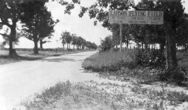
A 1923 photo of the sign at the entrance to “Larson Flying Field”.
The National Park Service continued, “In 1924 Roy Larson flew from this airport barnstorming the state for the LaFollette-Wheeler presidential campaign.
In 1924 they built a 6-plane hangar modeled after designs in an aviation magazine.
At first they only gave lessons & ran a flying circus, touring county fairs and barnstorming throughout the Midwest;
with the construction of the hangar they were able to accommodate transient as well as local aviators.”
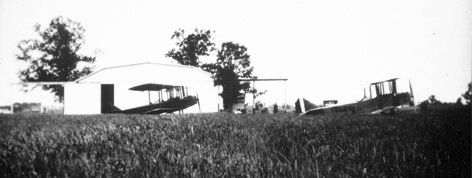
A 1920s photo of 2 Standard biplanes in front of a hangar at Larson Brothers Airport.
The National Park Service continued, “They also built & serviced planes, forming the Roy Larson Aircraft Company in 1926.
In 1927 the Larson brothers incorporated all their activities under the name Wisconsin Airways.
While modest in size & appearance, the facilities were comparable to those in more metropolitan areas.
The Larson Brothers Airport also enjoyed a statewide reputation in spite of its rural location.
Students Clyde Lee & Merle Zuehlke went on to instruct & manage at airports in Milwaukee.
Major James Wood & Howard Morey began airlines with airplanes purchased here.
Elwyn West, another pioneer aviator, stored his airplane here.
Roy Larson in 1928 flew passengers & supplies to president Coolidge's camp on the Brule River.”
Roy Larson died in a crash in 1929.
The National Park Service continued, “By 1932 the Larson Brothers Airport had achieved sufficient notice among state aviators
to be lionized in the Milwaukee Journal as the 'finest airport in the state.'
Ultimately its rural location contributed to the airport's decline.”
Larson Brothers Airport was not depicted on the October 1936 or subsequent Green Bay Sectional Charts.
A 1937 aerial view of Larson Brothers Airport (from the WI Historic Aerial Imagery Finder, courtesy of Al Hatz)
depicted the field as having a grass north/south runway, with the hangar on the west side.
The National Park Service continued, “[In the 1930s] sod landing fields gave way to cinder runways, which in turn were paved & lengthened as airplanes increased in size & power.
The high cost of these improvements caused many small airports to close, the fields returning to farms or lost to city expansion.
In the face of these changes the Larson Brothers Airport continued operation until closed by federal mandate at the outbreak of World War II.
Leonard Larson maintained the airport for his family's use.
The hangar is a one-story rectangular building of frame construction with a gambrel roof, vertical lap siding, and fieldstone foundations.”
The National Park Service continued, “The site includes a 6-airplane hangar & a sod landing field.
The airport is open by appointment only. Please call 920-836-2886 to arrange this with Abe & Theda Eckstein, daughter of Leonard Larson,
who are happy to meet visitors at the main road, take them to the airport & talk about the history of the airport & Wisconsin aviation.”
In 1985 a historical marker was erected commemorating the Larson Brothers Airport.
Leonard Larson continued to operate the field until 1990.
A 2010 photo of the Larson Brothers Airport hangar.
A 2010 photo looking along the well-kept grass runway at Larson Brothers Airport.
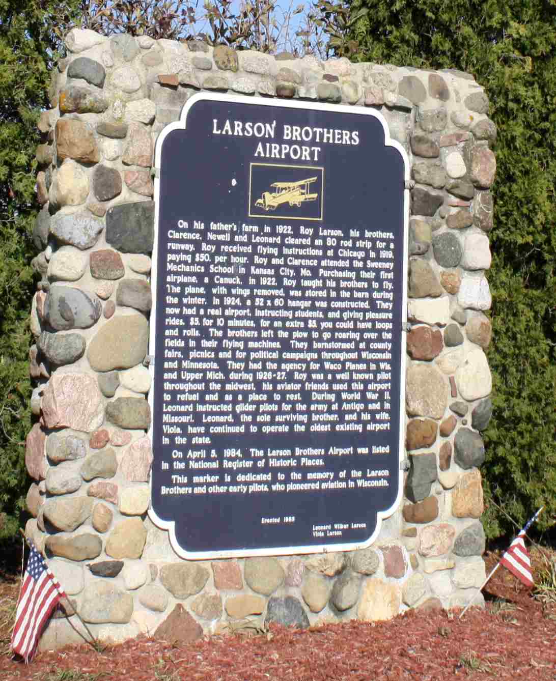
A 2010 photo of the historical marker commemorating the Larson Brothers Airport.
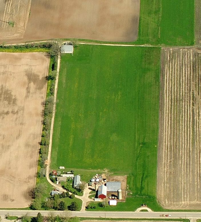
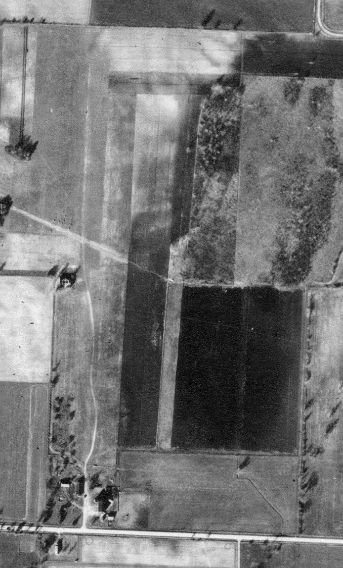
A circa 2011 aerial view looking north along the Larson Brothers Airport runway, with the hangar at top-left.
A 2013 aerial view looking northwest at Larson Brothers Airport.
The site of Larson Brothers Airport is located northwest of the intersection of Winchester Avenue & Hickory Avenue.
Thanks to Michael McMurtrey for pointing out this airfield.
____________________________________________________
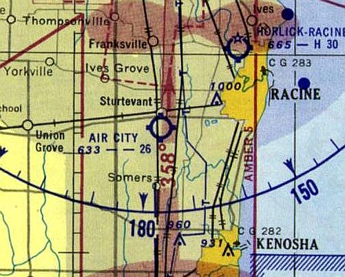
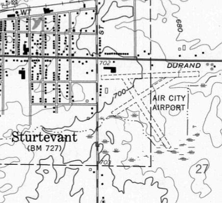
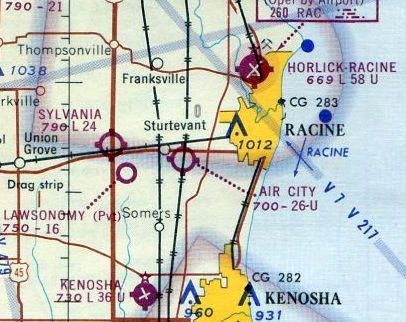
Air City Airport, Sturtevant, WI
42.695, -87.892 (South of Milwaukee, WI)
Air City Airport, as depicted on the June 1931 Milwaukee Sectional Chart.
According to Mark Langenfeld, “A document in the Wisconsin Historical Society archives
suggests Air City Airport was originally intended as an 'aviation community' or 'air park' (certainly one of the first to be proposed).
That never happened, but is interesting nonetheless.”
According to the Davis Monthan Airfield Register, “Sometime in 1928-29 [Eddie Hedeen] moved to Racine & took charge of Air City Airport.”
According to EAA Chapter 838, “Ed Hedeen established Wisconsin’s largest flying school at Air City Airport in Sturtevant.”
The earliest depiction which has been located of Air City Airport was on the June 1931 Milwaukee Sectional Chart.
The earliest photo which has been located of Air City Airport was a 1937 aerial view (from the WI Historic Aerial Imagery Finder, courtesy of Al Hatz).
It depicted Air City as having 4 unpaved runways, with a few small buildings on the northwest side.
A circa 1930s photo of Ed Hedeen with a Waco F-2 biplane at Air City Airport.
According to the Davis Monthan Airfield Register, Eddie Hedeen “managed [Air City Airport] until at least 1937.”
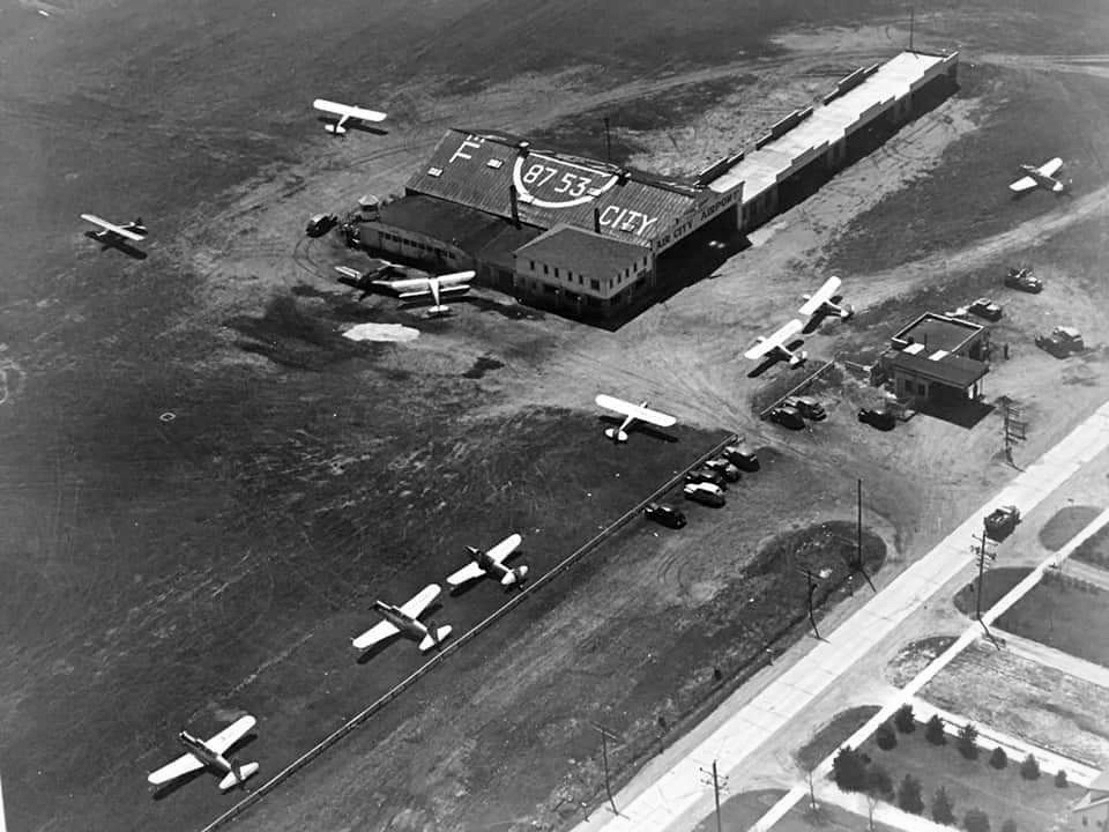
A circa 1940s aerial view (courtesy of Ron Johnson) looking southwest at Air City Airport.
A total of 11 single-engine aircraft were visible, including several military surplus trainers, parked near the hangars.
The road in the lower right was Highway 11 (Durand Avenue).
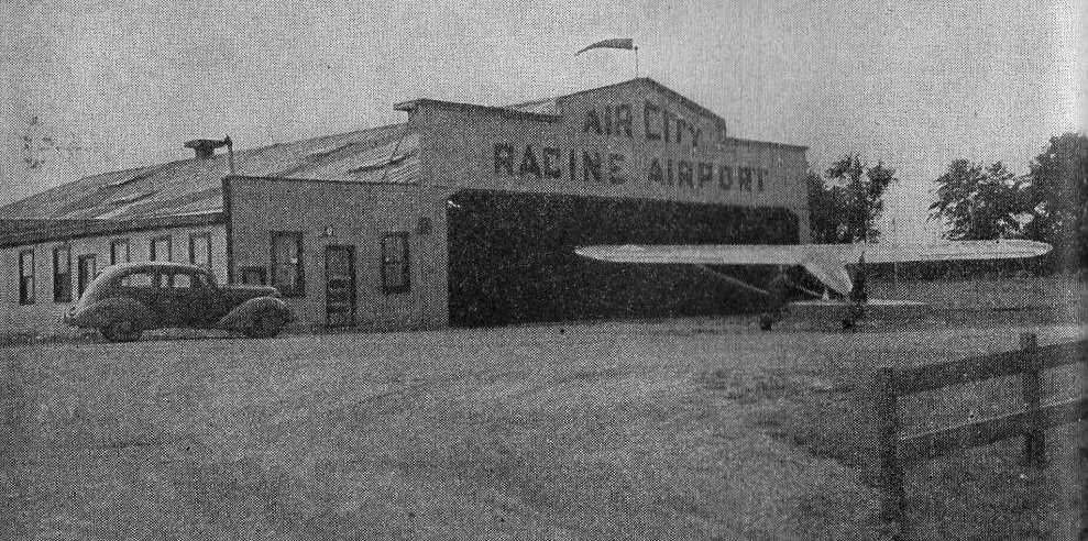
An undated photo of a single-engine aircraft outside the “Air City Racine Airport” hangar, from the 11/15/43 Motor Service Magazine (courtesy of George Adams).
The
article was entitled “Car Dealer Opens Airport After
the War Right Now”,
and talked about how Hudson card dealer L.W. Wiese had decided not to wait for the end of the war to open operations at Air City Airport.
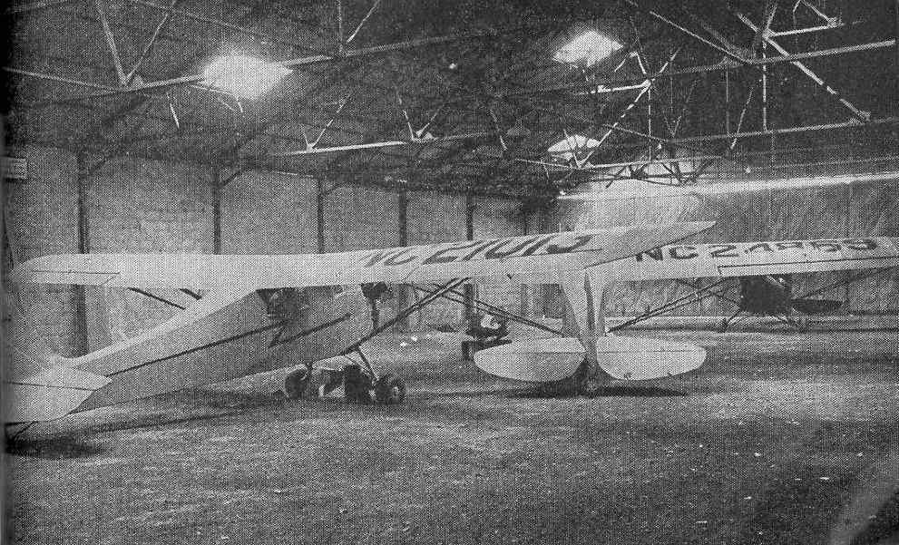
An undated photo of 3 Piper Cubs inside an Air City hangar, from the 11/15/43 Motor Service Magazine (courtesy of George Adams).
The November 1952 Milwaukee Sectional Chart depicted Air City as having 2,600' unpaved runway.
The last topo map depiction which has been located of Air City Airport was on the 1959 USGS topo map.
It depicted Air City as having 3 unpaved runways, with a few small buildings on the northwest side.
Ron Johnson recalled, “Air City Airport... I remember spending a lot of time there as a kid in late 1950s / early 1960s.”
According to Mark Langenfeld, “Air City... From about 1962 and through 1964, its primary use was as an early skydiving dropzone known as Aero Sports.”
The last photo which has been located of Air City Airport was a 1964 photo by Mark Langenfeld
“of a somewhat-rare Howard DGA-15P tricycle gear conversion that was used as the primary jump ship for that operation.”
Mark Langenfled recalled, “Air City continued operations into at least 1964, likely 1965,
before it was closed, subdivided & developed into residential & commercial lots.
The airport closed shortly after the dropzone ceased operations & relocated.”
The last aeronautical chart depiction which has been located of Air City Airport was on the December 1965 Milwaukee Sectional Chart (courtesy of Ron Kunse).
It depicted Air City as having 2,600' unpaved runway.
Air City Airport was no longer depicted on the May 1970 Milwaukee Sectional Chart (courtesy of Alex Hauzer).
The 1972 USGS topo map depicted streets & houses covering the site of Air City Airport.
A 2000 USGS aerial photo showed no trace remaining of Air City Airport.
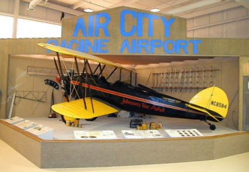
A pre-2013 picture of Ed Hedeen's Waco at an exhibit commemorating Air City Airport at the EAA Chapter 838 museum.
A 7/28/11 aerial view showed, as Mark Langenfled observed, “The original hangar (undoubtedly repurposed) & appended tavern (the Airport Inn) remain intact”,
at the northwest portion of the Air City Airport site.
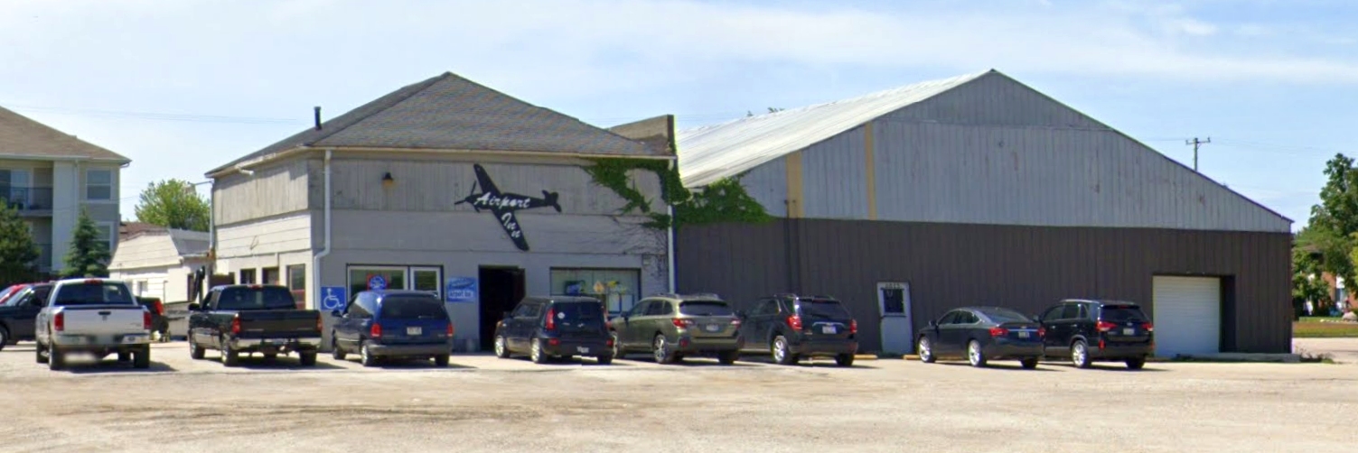
A July 2019 photo looking south of the former Air City hangar, reused as the Airport Inn, 8821 Durand Avenue.
The site of Air City Airport is located southeast of the intersection of Durand Avenue & 90th Street.
____________________________________________________
43.747, -87.777 (North of Milwaukee, WI)
Kohler Airport, as depicted on the June 1931 Milwaukee Sectional Chart.
According to the WI Aviation Hall of Fame (courtesy of Michael McMurtrey),
barnstormer Melvin Thompson “in 1928 moved to the Kohler Airport,
and became Governor Walter Kohler's personal pilot.”
The earliest depiction which has been located of Kohler Airport was on the June 1931 Milwaukee Sectional Chart.
It depicted Kohler as a municipal/commercial airport.
In 1936 Thompson became manager of the Kohler Airport.
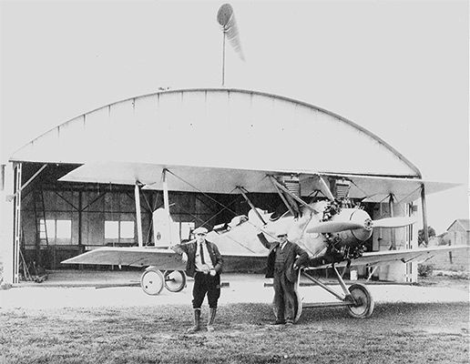
The earliest photo which has been located of Kohler Airport was a circa 1930s photo of Carl Kohler's Aeronca
and "The Village of Kohler," a Mahoney-Ryan-Brougham owned by Walter Kohler (and a sister-ship to the "Spirit of St. Louis”.

A 1937 USDA aerial view of Kohler Airport (from the WI Historic Aerial Imagery Finder)
depicted the field as an irregularly-shaped unpaved airfield with an airport circle marking in the center.
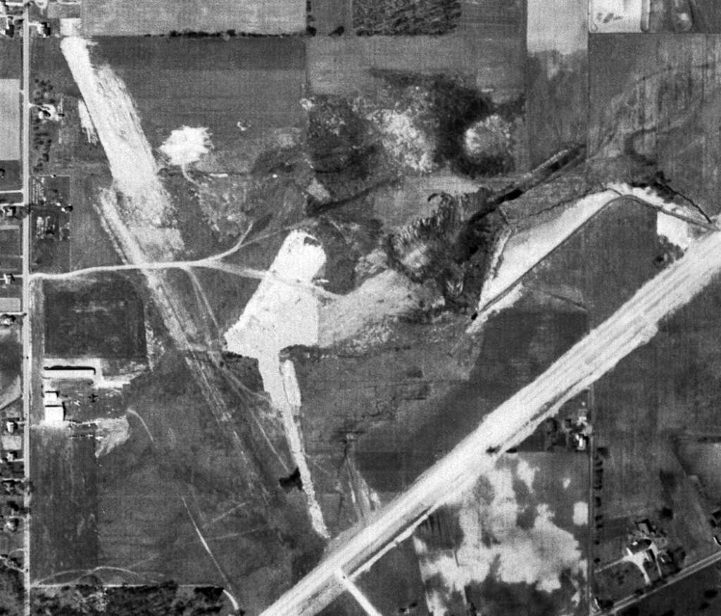
A 5/15/52 USGS aerial view of Kohler Airport showed the construction for the new Greenfield Road
which had evidently taken some land from the airport along the southern edge.
Several hangars were on the west side of the field, around which were visible at least 10 light planes.
The last aeronautical chart depiction which has been located of Kohler Airport was on the November 1952 Milwaukee Sectional Chart.
It depicted Kohler as having 2,800' unpaved runway.
The 1954 USGS topo map depicted Kohler Airport of having a fairly unusual configuration of 2 unpaved runways on the west side
along with a 3rd unpaved runway to the east which was not connected to the other runways.
Jules Gilpatrick recalled, “I soloed at Kohler Airport in 1955.
My instructor was Melvin Thompson who used to be Herb Kohler's personal pilot.
It was very active right after WW II & Mel did a lot of G.I. Bill training there.
There were also lots of war surplus airplanes in civilian hands.
I knew people who claimed they bought new Stearmans in the crate from the government for $400.
AT-6's, BT-13's and PT-19's, -23's and -26's abounded as well as Kohler's old cabin Waco (which Mel flew rides in)
and his old UC-78 in which he also flew rides & gave multi-engine training.
I rode a bus all the way out there almost every weekend just to help out wherever I could & maybe get a ride in an AT-6 or anything available.”
Scott Hoftiezer recalled, “My dad (Allen Hoftiezer) learned to fly at Kohler Airport.
He was taught by Melvin Thompson. Mel stuttered & dad was deaf in one ear, so it took a few extra sessions.
He'd bought a Ryan PT-23 after WW2 & Mel taught him to fly it.
He got rid of that & acquired a Fairchild PT-26 which we flew until 1974. He later got his hands on a Stearman N2S-3, which always had been his dream aircraft.”
The Kohler Airport was the leading airport in the Sheboygan area until the county airport was opened in 1959.
According to the WI Aviation Hall of Fame (courtesy of Michael McMurtrey),
Melvin “Thompson remained at the Kohler Airport until it closed in 1961.”
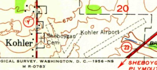
Kohler Airport was still depicted on the 1970 USGS topo map, even though it had evidently been closed for 9 years by that point.
The 1974 USGS topo map no longer depicted Kohler Airport.
A 1992 USGS aerial photo showed that Willow Creek Drive had been built through the center of the Kohler Airport property,
and there was no trace remaining of any airport buildings.
A 7/24/11 aerial view showed no trace remaining of Kohler Airport.
The site of Kohler Airport is located east of the intersection of Highland Drive & Willow Creek Drive.
Thanks to Michael McMurtrey for pointing out this airfield.
____________________________________________________
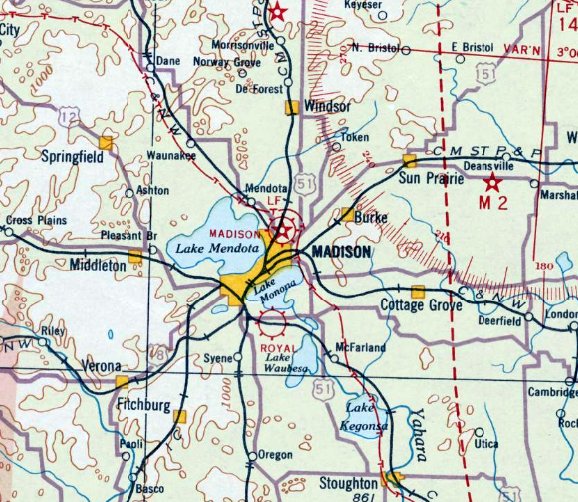
Royal Airport / Pennco Field / Four Lakes Airport, Monona, WI
43.045, -89.35 (Southeast of Madison, WI)
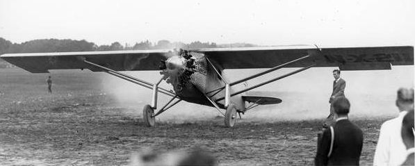
An 8/22/27 photo of Charles Lindbergh landing the Spirit of St. Louis, his Ryan NYP at Royal Airport.
According to bloomingrovehistory.org, “The airfield known originally as Pennco Field was created from part of the McCauley farm,
located between the Dane Country Fairgrounds & the Yahara River. It was later named Royal Airport.
Howard Morey made a forced landing in a field near Madison in December,1925.
He called his wife's cousin, E. N Quinn, who drove out to get him & help tie down the plane.
Morey taught Quinn to fly & together they operated a business including landing field & hangars, flying schools, and aeronautical stunt shows.
Later they established the first regular commercial air traffic from Wisconsin to Chicago and regular contract air mail service for Madison.
The first hangar was built in 1926 by Madison Airways Co.
It was a Trachte company metal building, 100' wide, that could shelter 17 planes.”
According to bloomingrovehistory.org, “Royal Airways Corporation formed in 1927.
Quinn & Don Anderson, publisher of the Wisconsin State Journal, persuaded Colonel Charles Lindbergh to come to Madison”,
only 3 months after his triumphant transatlantic flight.
The earliest depiction of Royal Airport which has been located
was an 8/22/27 photo of Charles Lindbergh landing the Spirit of St. Louis, his Ryan NYP at Royal Airport.
This stop was one of only 2 appearances made in Wisconsin during Lindbergh's triumphant national tour.
A 1927 photo of Lindbergh's famous Spirit of St. Louis Ryan monoplane inside a hangar at Royal Airport.
According to bloomingrovehistory.org, “On 11/23/27, airmail contract service was inaugurated in Madison,
with the first flight leaving Royal Airport carrying 15,000 letters.”
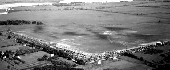
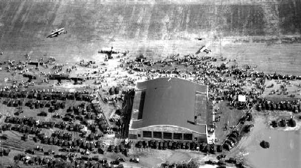
A 1928 aerial view of Royal Airport apparently taken during some kind of event, with hundreds of spectators.
The field consisted of an open grass area with a hangar along one side.
A 1928 aerial view of Royal Airport apparently taken during some kind of event, showing 3 hangars & one monoplane.
A 1928 photo of a Waco biplane (model undetermined) taking up 2 passengers from Pennco Field.
A 4/17/28 photo of an "American Girl" movie group & a pilot in front of a Waco biplane marked “Royal Airways Corp.” at Royal Airport.
The earliest aeronautical chart depiction which has been located of Royal Airport was on a 1930 Airway Chart.
A 1930 aerial view of a Royal Airport hangar, surrounded by hundreds of spectators, with 7 planes on the field.
Royal Airport, as depicted on the June 1931 Milwaukee Sectional Chart.
A 1932 photo of an Hamilton H-47 Metalplane (identified by H.G. Frautschy) in front of a Royal Airport hangar.
The last aeronautical chart depiction which has been located of Royal Airport was on a 1935 Regional Aeronautical Chart.
A 6/27/37 USDA aerial view of Royal Airport (from the WI Historic Aerial Imagery Finder)
depicted the field as having an unpaved north/south runway, with an airport circle marking at the north end.
Four light single-engine aircraft were parked near a hangar & some T-hangars on the west side,
and a larger aircraft was parked near a paved ramp on the north side.
According to bloomingrovehistory.org, “A few years later the advent of the large transport planes made Royal's facilities inadequate,
and the City of Madison purchased 290 acres north of the city.
Difficulties in developing the marshy area during the depression caused Madison to suspend efforts there.
So the city leased Royal Airport for its municipal field for $2,000 per year, and provided lighting & improvements.
Royal Airport continued to serve Madison until 1938 when the new Municipal Airport was finally completed & opened with Howard Morey as manager.”
According to Mark Hess, Royal Airport was “used by the Civil Air Patrol from 1942-45.”
The last photo which has been located of Royal Airport was a circa 1942-45 aerial view looking north in the 1945 AAF Airfield Directory (according to Scott Murdock).
The directory described Royal Airport as a 135 acre L-shaped property having 2 loam & sod runways, measuring 3,000' north/south & 2,800' east/west.
The field was said to have 5 metal hangars, the largest measuring 60' x 50', and to be owned & operated by private interests.
According to Mark Hess, Royal Airport was “closed sometime in the mid- to late-1940s.”
The airport evidently reopened at some point between 1945-52 under the name of Four Lakes,
as that is how it was depicted on the November 1952 Milwaukee Sectional Chart, with a 2,700' unpaved runway.
Four Lakes Airport evidently closed (for reasons unknown) at some point between 1952-55,
as it was no longer depicted on the 1955 USGS topo map.
A circa 2005-2012 photo of a historical marker at the site of Royal Airport.
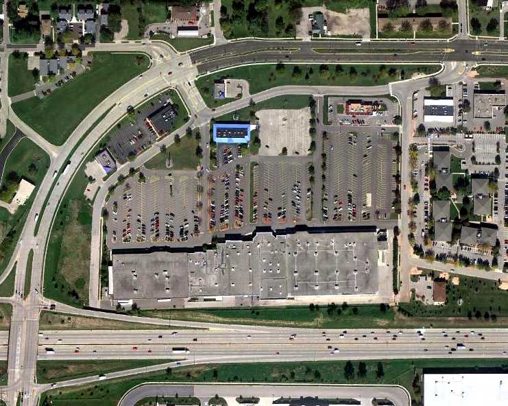
A 9/27/10 aerial view showed no trace remaining of Royal Airport.
H.G. Frautschy reported in 2012, “I was helping one of our board members take a few pieces of useful material
from a project to repurpose a movie theater on the south side of Madison,
and only after the work was done did I realize that the property was on the grounds of the old Royal Airport.”
The site of Royal Airport is located southwest of the intersection of South Towne Drive & Frazier Avenue.
____________________________________________________
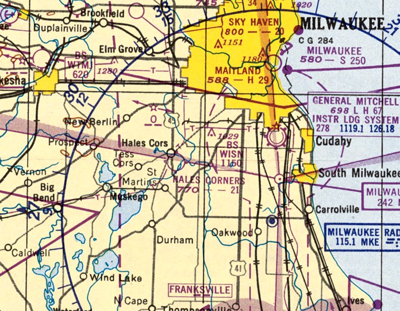
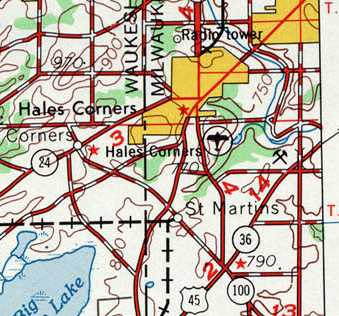
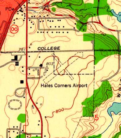
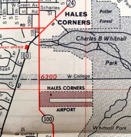
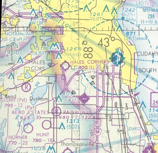
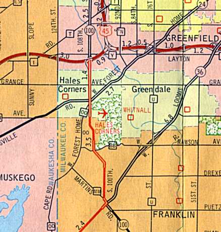
Hales Corners Airport, Hales Corners, WI
42.928, -88.043 (Southwest of Milwaukee, WI)
A November 1947 photo of 2 Vultee BT-13 Valiants at a snowy Hales Corner Airport (courtesy of David Faige).
This general aviation airport was evidently established at some point between 1946-47
(like hundreds of other airports in the post-WW2 aviation boom),
as it was not yet listed among active airfields in the 1945 AAF Airfield Directory (according to Scott Murdock)
nor depicted on the June 1946 Milwaukee Sectional Chart (courtesy of Jim Stanton).
The earliest depiction of Hales Corner Airport which has been located
was a November 1947 photo (courtesy of David Faige) of a Vultee BT-13 Valiant & a North American AT6 Texan, with snow on the ground.
The original name of the airport may have been “Skyway”, as that was the hand-written caption on the photo.
The earliest aeronautical chart depiction which has been located of Hales Corners Airport was on the May 1950 Milwaukee Sectional Chart.
It depicted Hales Corners as having a 2,100' unpaved runway.
Reportedly the first EAA fly-in was held in 1953 in Hales Corners,
and the EAA Museum was located in the town (but evidently not at the airport) for several years.
Carolyn (Gardner) Wiars reported, “My daddy use to own the Hales Corners Airport – 1950s (Al & Vi Gardner).
I learned to fly before I received my driver’s license.
I was the youngest female pilot in Wisconsin in the 1950s that attended the Breakfast Fly In 7/18/54
at the Dawn Patrol Breakfast, sponsored by Flint’s Civil Air Patrol.
Audrey & Paul (Howard) Poberezny, from the Experimental Aircraft Association used to fly out of my Dad’s airport,
and attend lots of parties in the hangars of the airport with many others.”
A 4/8/55 USGS aerial photo depicted Hales Corners Airport as having 3 unpaved runways, with several small hangars & 4 single-engine aircraft on the west side.
Bob Kacmarcik recalled, “The east/west runway paralleled the tree line. The northwest/southeast runway was rarely used.
The object to to east of the intersecting runways was a little shelter that when the Sky Knights were jumping, was used as a recovery point.
They would wait for all the jumpers to land, carry their gear to the little building then be driven back to the large building pictured behind the Cessna 182 jump plane where their parachutes would be repacked.
The Sky Knights parachute club began at Hales Corners, started by Jeff Searles.”
Hales Corners Airport, as depicted on the 1958 USGS topo map.
The 1959 USGS topo map depicted Hales Corners Airport as having 2 perpendicular unpaved runways, with several small buildings along the west side.
Larry Palmersheim recalled, “Hales Corners Airport... I grew up on the farm immediately north of this airport.
I lived there from 1959-71, and my mother continued to live there until this past September [2011].
There were 2 runways used, the main east/west runway & a secondary, little-used northeast/southwest runway
which began at the edge of Whitnal Park (east extent) and merged with the east/west runway like a crooked Y.
A narrow strip of trees separated these runways on the eastern aspect.
College avenue (not Kay Parkway) formed the northern border of the airport.
The EAA facility was located in a small building between Highway 100 (the west border of the airport) and Highway OO.
Access was from Highway OO.
The office was a Quonset hut located approximately 75 yards from Highway 100
(west border which currently would be just north of Pick & Save) just north of the runway.”
Larry continued, “At the split between the east/west & northeast/southwest runways was a junked T-6.
If us kids would try to sneak out to it invariably someone would come charging in a car to chase us away.
For several years in the 1960s the northeast/southwest runway would be used for skydiving.
My father would become quite upset with errant parachutists landing in his beanfield.
One fall we recovered a reserve parachute from the field which I have to this day.
In the early 60s a ride in the T-6 Texan would cost $10 for 10 minutes. I never did this but to this day wish I had.
Early RC [radio-controlled model aircraft] enthusiasts would also use this secondary runway space to fly their planes, in the 1960s.
I would often ride my bike down to watch them.”
Hales Corners Airport, as depicted on a circa 1960 road map (courtesy of Kevin Walsh).
Bob Kacmarcik recalled, “I would ride my bike to the Hales Corners Airport.
The airport's main entrance was at what is now apartments at roughly 6420 S 108th St, Franklin,
though just behind the Schoolway School Bus Company grounds; the airport did extend to the north & College Avenue.
Christmas of 1960 my favorite gift from Santa was a Kodak Kodex #1 bellows camera that took black & white 620 film.
After doing my school work & duties at home, off I would go to the airport on my bike with my new camera.
My Mother’s cousin, Al Svoboda, was the Fixed Base Operator at Hales Corners!
I ended up being the excited 14 year old cutting the grass, fueling aircraft, cleaning windshields of bugs, wiping oil from the underside of cowlings, selling sectional charts & candy bars.
Uncle Al never paid me for my hard work, but he took me flying instead.
I learned in later years, that Uncle Al was doing the test flying of many aircraft that Chris,
the Airframe & Powerplant Mechanic on the field, had just repaired, so I logged instruction in MANY different aircraft of the day.
The Hales Corners airport played an important part in the beginnings of the EAA with Paul Poberezny having an office on the field
and the earliest EAA museum in a Quonset hut on the Northeast corner of W Rawson Avenue & North Cape Road.
Some of my best memories are of those days.”
A March 1961 photo by Bob Kacmarcik of planes & hangars to the west of the main Quonset hangar at Hales Corners Airport.
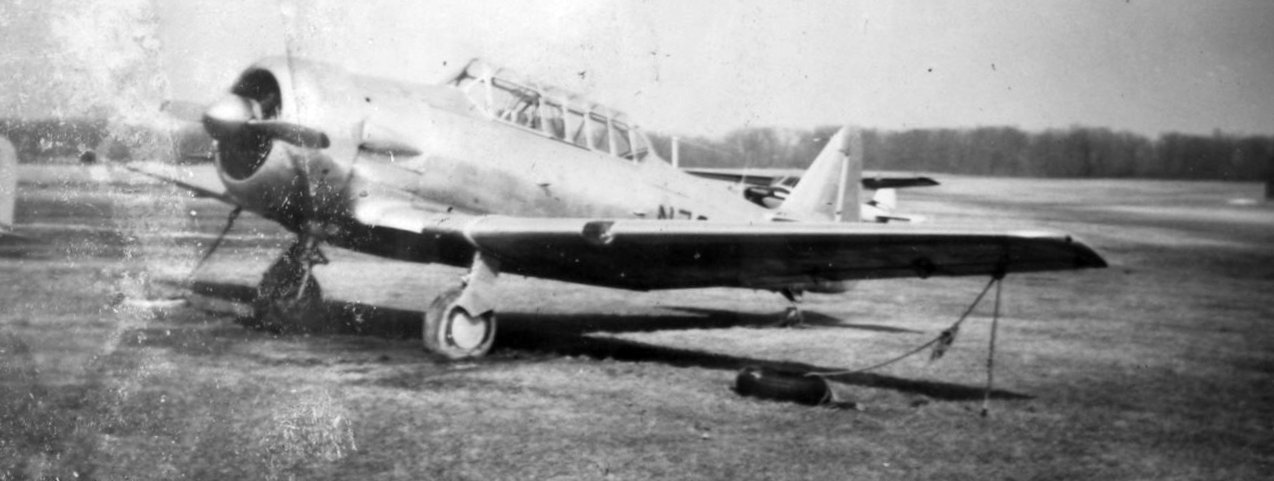
A March 1961 photo by Bob Kacmarcik of a North American T-6 Texan warbird at Hales Corners Airport.
A 1963 photo by Bob Kacmarcik of a 1956 Cessna 182 parachute jump plane at Hales Corners Airport.
Bob Kacmarcik recalled, “The large building pictured behind the Cessna 182 jump plane [is] where their parachutes would be repacked & do their pre-jump check list.
The steep-roofed building behind the 5729B numbers on the 182 is our Fixed Base Operator office; it was an old gas station office & moved to the airport.
That is where I would ring up gas & oil sales... sell sectionals & candy bars & just provide a place for pilots and passengers who were passing through or had airplanes based at Hales Corners.”
A circa 1963 photo by Bob Kacmarcik of a an Ercoupe in front of a Hales Corners Airport Quonset hut.
Bob Kacmarcik recalled, “That is one of the first airplanes Uncle Al taught me to fly.
In fact, on one of our first flights, he fell asleep when we were maybe 200' in the air.
I flew around the countryside for an hour or so. He did wake up when I was on final approach to Runway 9 back at Hales Corners, and yes, I did miss the high tension wires, Wink.”
A circa 1963 photo by Bob Kacmarcik of a a Hughes 269 or 300 helicopter at Hales Corners Airport.
A 1963 photo by Bob Kacmarcik of spectators watching a skydiver land at Hales Corners Airport.
A May 1963 photo by Bob Kacmarcik of a Civil Air Patrol Cessna 140 in front of the lane at Hales Corners Airport main meeting building & parachute repacking shop.
A 1963 aerial photo depicted Hales Corner Airport as having a single grass east/west runway,
with 18 light aircraft parked around a few small buildings on the northwest side.
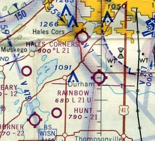
The December 1965 Milwaukee Sectional Chart (courtesy of Ron Kunse) depicted Hales Corners Airport as having a 2,100' unpaved runway.
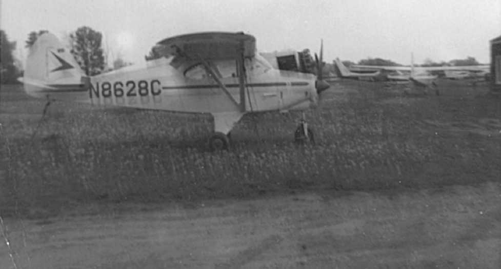
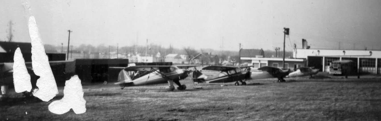
A 5/30/68 photo of a Piper Tri-Pacer & a few Cessnas at Hales Corners Airport (courtesy of David Faige).
David recalled, “It was at Hales Corners Airport that I got my first ride in an airplane (5/30/68).
I believe the Cessna 150 in the background was the aircraft that I had my first flight in.
The airport had a grass field & a Quonset-like structure for a hangar.”
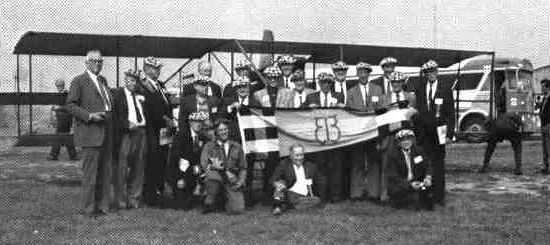
The last ground-level photo which has been located of Hales Corners Airport was a 1969 photo of the “Early Birds” standing in front of a 1912 Curtiss plane.
Jack recalled, “I learned to fly out of Hales Corners Airport, [in the] early 1970s.
In the spring the field would flood from melting snow & puddling in the middle of the east/west 2,000' grass runway.
There was a big dip in the center of the runway. So he would move the planes to Mitchell Aero (MKE) for a few weeks.
The other runways were not used anymore at that time. I also remember that when you took off to the west, you had to clear some high voltage power lines.
In the hot summer days this could be a little hairy (even worse at night).
People would also fly in for the day and walk to the EAA museum across the street. This is before they (EAA) moved to Oshkosh.
Lots of memories at that quiet little airfield.”
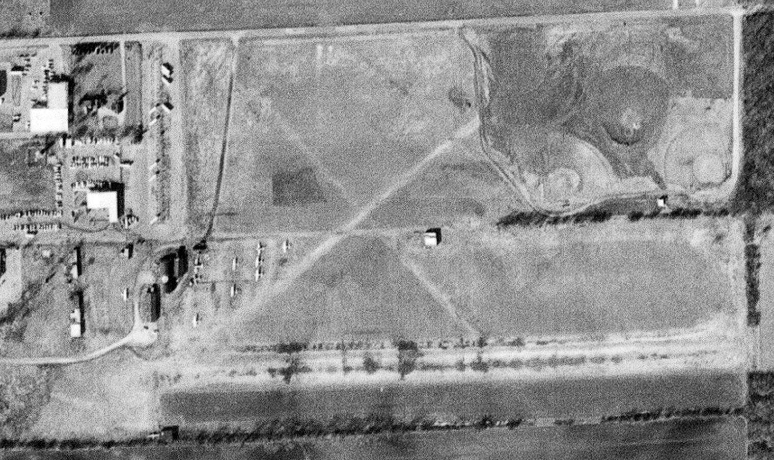
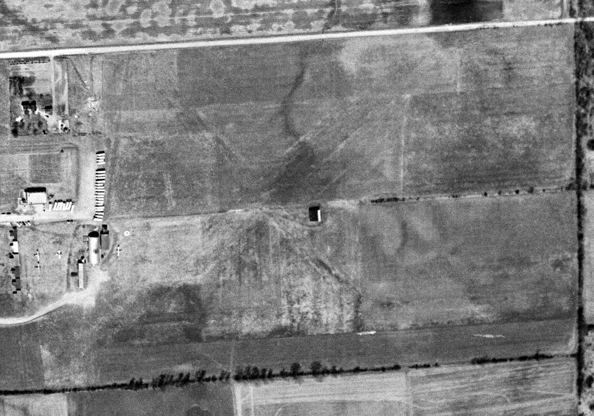
The last photo which has been located of Hales Corners Airport was a 3/1/76 USGS aerial view, which showed 10 light aircraft parked on the west side.
The last aeronautical chart depiction which has been located of Hales Corners Airport was on the May 1977 Chicago Sectional Chart (courtesy of John Ferrara).
It depicted Hales Corners as having a 2,000' unpaved runway.
According to Jack, Hales Corners Airport “closed in August 1977. At the time it closed, a guy had 3 Cessna 150s (N4054J, N63157, and 7809F) that he would rent out, $12/hour wet.
He had a lease to run the airport, but the owner sold the land to a developer & the airport was no more. ”
Hales Corners Airport was still depicted on a 1978 street map (courtesy of David Faige).
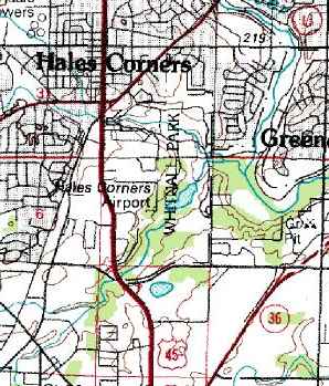
The last depiction which has been located of Hales Corners Airport was on the 1978 USGS topo map.
It depicted Hales Corners as having a single east/west runway.
Hales Corners Airport was no longer depicted on the 1980 USGS topo map
or the May 1985 Chicago Sectional Chart (courtesy of Jonathan Westerling).

A June 1995 photo by David Faige looking ESE at College Avenue, the site of Hales Corner Airport.
According to Larry Palmersheim, “Our farmhouse, where my mother lived until October 2011, would be just 50' to the left of the curb on the bottom.
The main east/west runway would have been approximately 125-150 yards south of this road.”
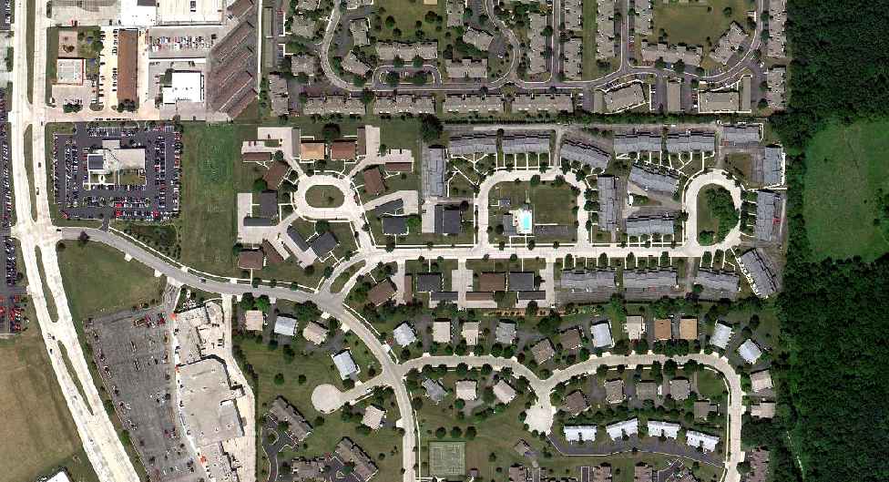
A 7/29/11 aerial view showed no trace remaining of Hales Corners Airport.
According to Larry Palmersheim, “The main east/west runway would have been between the townhouse development at the top of the photo & the adjacent development below it.”
The site of Hales Corners Airport is located southwest of the intersection of Route 45 & Whitnall Edge Road.
____________________________________________________
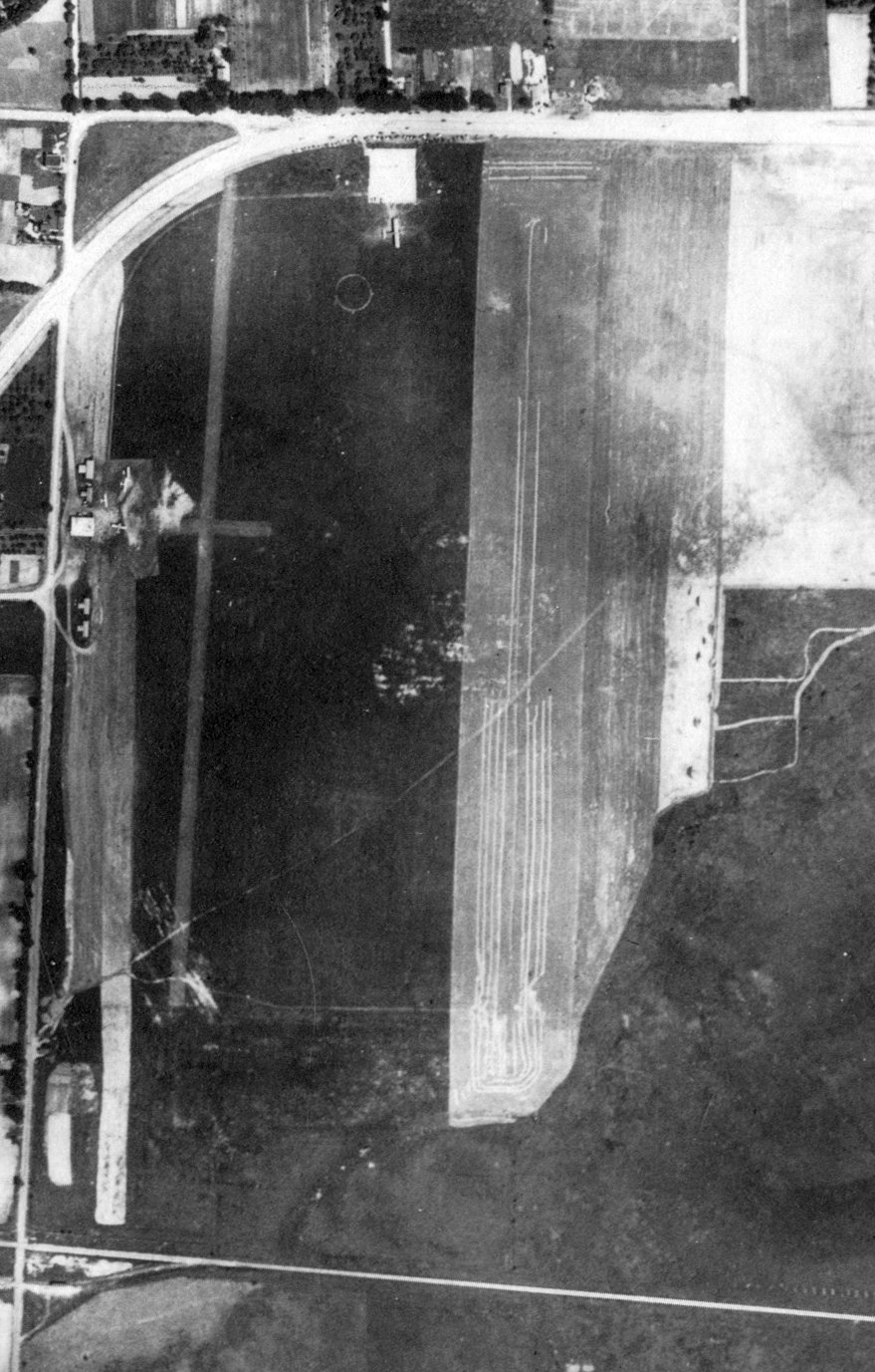
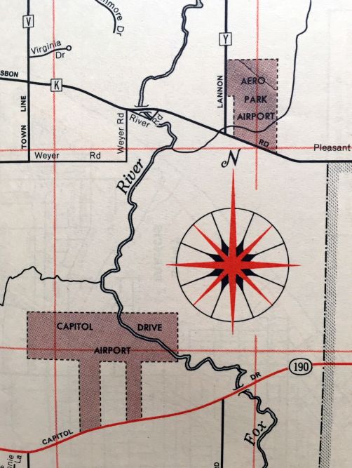
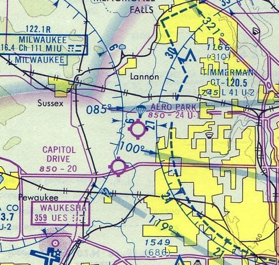
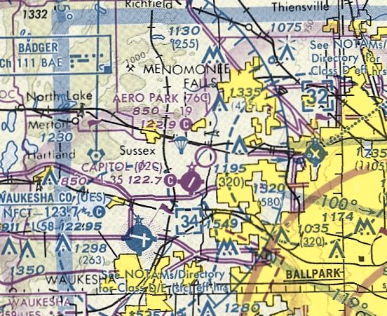
Aero Park Airport (76C), Menomonee Falls, WI
43.108, -88.164 (Northwest of Milwaukee, WI)
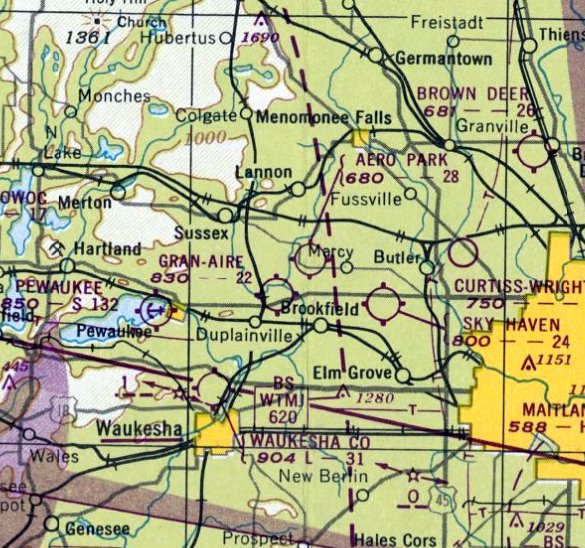
Aero Park Airport, as depicted on the June 1949 Milwaukee Sectional Chart.
According to Mark Hess, “Aero Park Airport was built in 1947 or 1948 according to Civil Air Patrol records.”
Aero Park Airport was not yet depicted on the December 1948 Milwaukee Sectional Chart.
According to Mark Hess, “A CAP Squadron was located there. The CAP Unit started on 7/2/49.
The airfield was the 3rd-largest in WI at that time.”
The earliest depiction which has been located of Aero Park Airport was on the June 1949 Milwaukee Sectional Chart.
It depicted Aero Park as having a 2,800' unpaved runway.
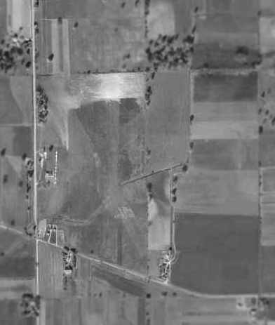
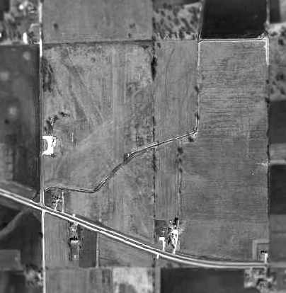
The earliest photo which has been located of Aero Park Airport was a 1950 aerial view (courtesy of Chris Kennedy).
It depicted Aero Park as having several grass runways, with about a dozen light aircraft visible on the west side of the field.
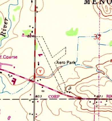
The 1959 USGS topo map depicted Aero Park as having 2 unpaved runways, with a few small buildings along the west & south sides.
The 1960 WI Airport Directory (courtesy of Chris Kennedy)
depicted Aero Park as having three sod runways, with the longest being the 2,700' northwest/southeast strip.
Aero Park Airport, as depicted on a circa 1960 road map (courtesy of Kevin Walsh).
The 1962 AOPA Airport Directory described Aero Park
as having 3 sod runways, with the longest being the 2,700' Runway 13/31.
The operator was listed as Silent Wings, Inc., and the field was said to offer fuel & tiedowns.
A 1963 aerial view of Aero Park Airport (courtesy of Chris Kennedy)
depicted the field with noticeably fewer aircraft (only 3) on the field than was seen in the 1950 photo.
Bill Case recalled, “I had first come upon Aero Park via a friend who was learning to fly gliders there, in 1964.
I went to the airport & learned that you could get lessons there.
There was an active glider operation with Carl Scharschmidt running the airport & flying the tow plane.
I continued flying gliders there & eventually got a glider rating.
I remember a Jim Schmidt as one of the pilots there who flew his own aircraft (a Taylorcraft) which was tied down at the field.
At the time there was an active skydiving operation at the field & a Cessna 182 being used as a jump aircraft.
A conversation with Phil Smith who ran the Milwaukee Skydivers, offered a chance to fly the 182 with loads of jumpers,
the owner of the aircraft was contacted & I was given a check ride & subsequently began flying lifts for the skydivers.
That led to a few jumps as well & continued until Easter Sunday of 1966
when another pilot caught the aircraft on fire from overpriming it & it burned to the ground destroying the aircraft.
I had many happy weekends at the airport as well as in the bar/restaurant & flying in & out of the airport.
I believe Carl's wife was named Sophie & they lived nearby to the airport.”
A 1970 aerial view depicted a total of 5 light aircraft on the field.
The 1971 Chicago Sectional Chart depicted Aero Park as having a 2,400' unpaved runway.
The May 1975 Chicago Sectional Chart (courtesy of Mitchell Hymowitz)
depicted Aero Park as having a 2,400' unpaved runway.
Peter Sarnosky recalled, “Aero Park... I learned to skydive there in 1978 & was a member of the Wisconsin Skydivers, the club at the field.
I knew Carl & Sophie & our club meetings were held in the restaurant & bar. What a great place that was. Lots of grassroots aviation there.”
A 1980 aerial view depicted a total of 4 light aircraft on the field, including 1 glider.
The 1982 AOPA Airport Directory (courtesy of Ed Drury) described Aero Park
as having three sod runways, with the longest being the 2,700' Runway 15/33.
The operator was listed as Silent Wings, Inc.,
and the field was said to offer tiedowns, flight instruction, and plane rental.
A 1990 aerial view showed that a new hangar had been added at some point between 1980-90,
but there were no aircraft visible on the field.
Bill Schlafer reported of Aero Park, "This small general aviation airport served light aircraft, ultralights,
towed hangliders, and at least several small single-engine fixed-wing aircraft.
One of the unique features of the airport was that the north-south orientated runways crossed a narrow culvert
which allowed a small creek to flow across the south end of the field.
The airport was often closed in the spring after heavy rains due to standing water.
Much of the surrounding area is swampy.
The airport had a bar & restaurant, several small free-standing hangars & a row of T-hangars.
During the 1990s there was an active skydiving club in operation at Aero Park.
I recall watching the skydivers free-fall & then float down to the airport from the nearby golf course where I often played.
Watching the overloaded Cessna used as a jump plane struggling to take off from the sod field
was always a bit exciting due to the power lines that crossed the end of Runway 18 next to the roadway.
Indeed the power lines caused several accidents over the years including the Cessna 182 jump plane."
The last aeronautical chart depiction which has been located of Aero Park Airport was on the October 1993 Chicago Sectional Chart (courtesy of Ron Plante).
It depicted Aero Park as having a mere 1,900' unpaved runway.
A 1995 aerial view depicted a single light plane on the field.
A 1999 aerial view of Aero Park from the WI Airport Directory.
The field was depicted as having three grass runways, with the longest being the 1,880' Runway 15/33.
A hangar was depicted along the west side of the field. The Fixed Base Operator was listed as Aero Wing, Inc.
The field was said to conduct parachute & ultralight operations, and to be open to ski aircraft in wintertime.
In the 2000 USGS aerial view of Aero Park, a single light aircraft was visible just southeast of the hangar.
A July 2001 article in the Milwaukee Journal-Sentinel described how an ultralight pilot was injured in a crash at Aero Park
when he suffered an engine failure after takeoff.
Bill Schlafer recalled, "I believe the skydiving operation ceased after that accident
and other recent accidents & incidents may have contributed to the airport's eventual demise."
A circa 2001-2005 USGS aerial view showed the Aero Park runways & buildings remained intact,
but there was no sign of current aviation use at Aero Park.
A 2003 aerial view looking northwest at the buildings & hangar at Aero Park (courtesy of Gary Dikkers).
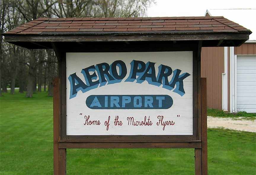
A 2004 photo of the sign for Aero Park Airport, “Home of the Microlite Flyters” (courtesy of Gary Dikkers).
Bill Schlafer reported in 2004, "I was at the airport this last summer where EAA Young Eagle flights were held."
As of December 2004, the FAA Airport Facility Directory data for Aero Park (as published on airnav.com)
described the field as having 3 turf runways,
with the longest being the 1,880' Runway 15/33.
A total of 27 aircraft were listed as being based on the field (3 single engine aircraft & 24 ultralights).
The field was said to conduct an average of 120 takeoffs or landings per week,
and it was said to conduct parachute & ultralight operations.
Bill Schlafer reported in December 2004, "Sometime in early December the operations were closed & the field was plowed up.
I have not been able to find out why the airport was closed
or if the plowing was done in preparation for planting crops or to discourage any attempted landings.
It was never listed for sale, and its closure didn't even make the local news."
"Capitol Airport also resides just a couple of miles to south,
which also may have been a factor in closing the airport.
Having 2 airports in such close proximity had to lead to conflicts for airspace.
There is also quite a bit or new residential development in the area driving the demand for undeveloped tracts of land."
"The T-hangars have been torn down & the other buildings stripped in preparation of demolition.
There is no evidence of aircraft at the site. The windsock & runway markers have been removed."
"The closing of Aero Park leaves Waukesha County with only 2 operational airports (that I know of):
Crites Field - Waukesha, and Capitol Airport in nearby Brookfield."
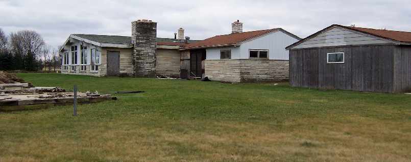
A December 2004 photo by Bill Schlafer of "the remains of the restaurant/clubhouse/bar.
The building on the right was a small hangar which is still intact, but empty.
The foundation of another hangar can be seen in the lower left of the photo."
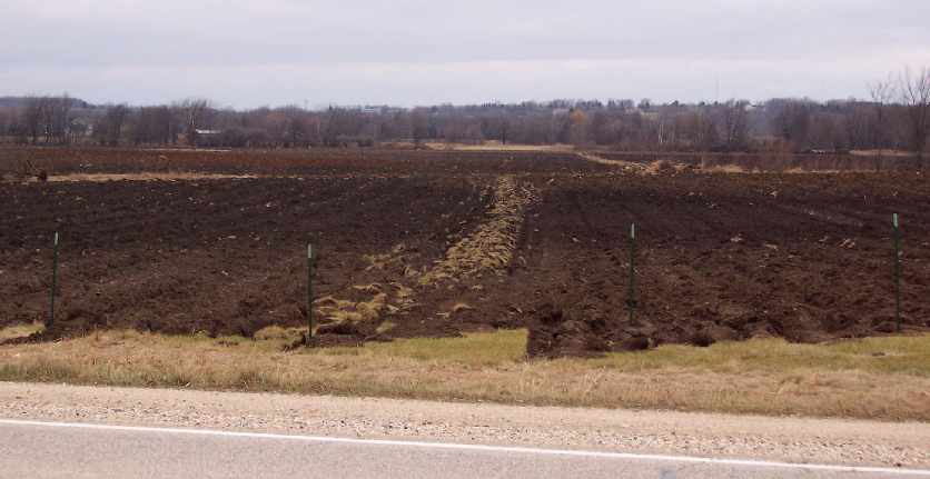
A December 2004 photo by Bill Schlafer looking North along the centerline of what was Runway 36,
taken from the roadway on the South end of the field.
A 2005 aerial view showed that all of the buildings at the site had been removed.
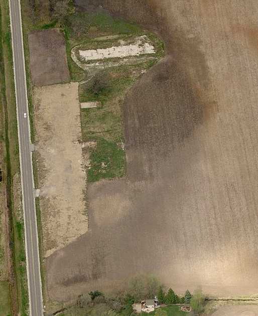
A circa 2005-2010 aerial view looking north showing the hangar foundations which remain at the site of Aero Park.
The site of Aero Park Airport is located northeast of the intersection of Lisbon Road & Lannon Road.
Thanks to Bill Schlafer for pointing out the unfortunate closure of this airfield.
____________________________________________________
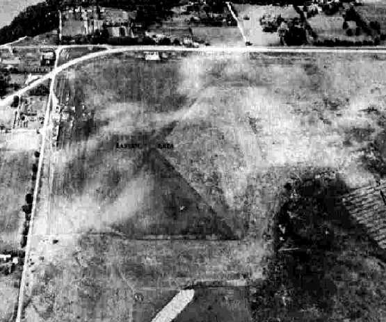
Cronin Field / Rainbow Airport (Y78), Franklin, WI
42.865, -88.005 (Southwest of Milwaukee, WI)
Cronin Field / Rainbow Airport, as depicted on a 4/8/55 USGS aerial view.
Leon Rediske recalled, “I'm the son of Ed Rediske, who started Rainbow Airport in the fall of 1946.
Ed began small, with a Piper J-3 Cub N98612, then another N3259N, then a Piper Super Cruiser PA-12 N4172M.
Ed began with a partner, a fellow by the name of Roy Younker, who was in a family that owned a Chevrolet Dealership.
Because this airport was started very soon after WWII, planes & automobiles were nearly impossible to get.
However, a deal was made to supply a Chevrolet to the Kanup Brothers who were a Piper dealer on Mitchell Field.
In return we were able to get an early J-3, N98612.”
Leon continued, “The airport was initially known as Cronin Field, for a couple of years.
Everybody asked why do you call it Cronin Field, when your name is Rediske.
We would explain that it was named that after the first Aviator from Wisconsin to be killed in WWII, who was Cronin.
The name didn't fly. Ed said we needed a new name, a new beginning.
One day after a storm, there was a beautiful, vivid, rainbow... and dad said, that's it... we'll call it Rainbow for a new beginning,
and the elusive pot of gold at the end of the Rainbow.”
Leon continued, “Ed did a lot of the building of buildings, and as I remember, Roy would come out to the airport & 'survey his kingdom',
walking the parameters of the property, but seldom working to build this airport.
Soon, Roy was bought out by my Grandfather, Harvey Fowles.
Together, Ed & Harvey built hangars, and expanded the operation. Later, Harvey was bought out.”
Leon continued, “This operation was still part time, as Ed worked as a Dental Equipment salesman during the day,
and after work, went to the airport & continued to build.
Weekends we were there all days.
I helped my grandmother, Emma Fowles, gather rocks off of the runways
and place them in a remote area by the use of a tractor & a stone boat.
Emma didn't drive, so I learned to drive the tractor at an early 5 years old.”
Leon continued, “We began a flight training base, which it remained until its close in November 1996.
Early on, one of our aircraft tie-down tenants, Wes Parks, worked for Allis Chalmers, and had access to their experimental tractors.
Since our operation had a severe need for a tractor, and couldn't afford one,
Wes usually could find an experimental unit for us to use. What a pal!”
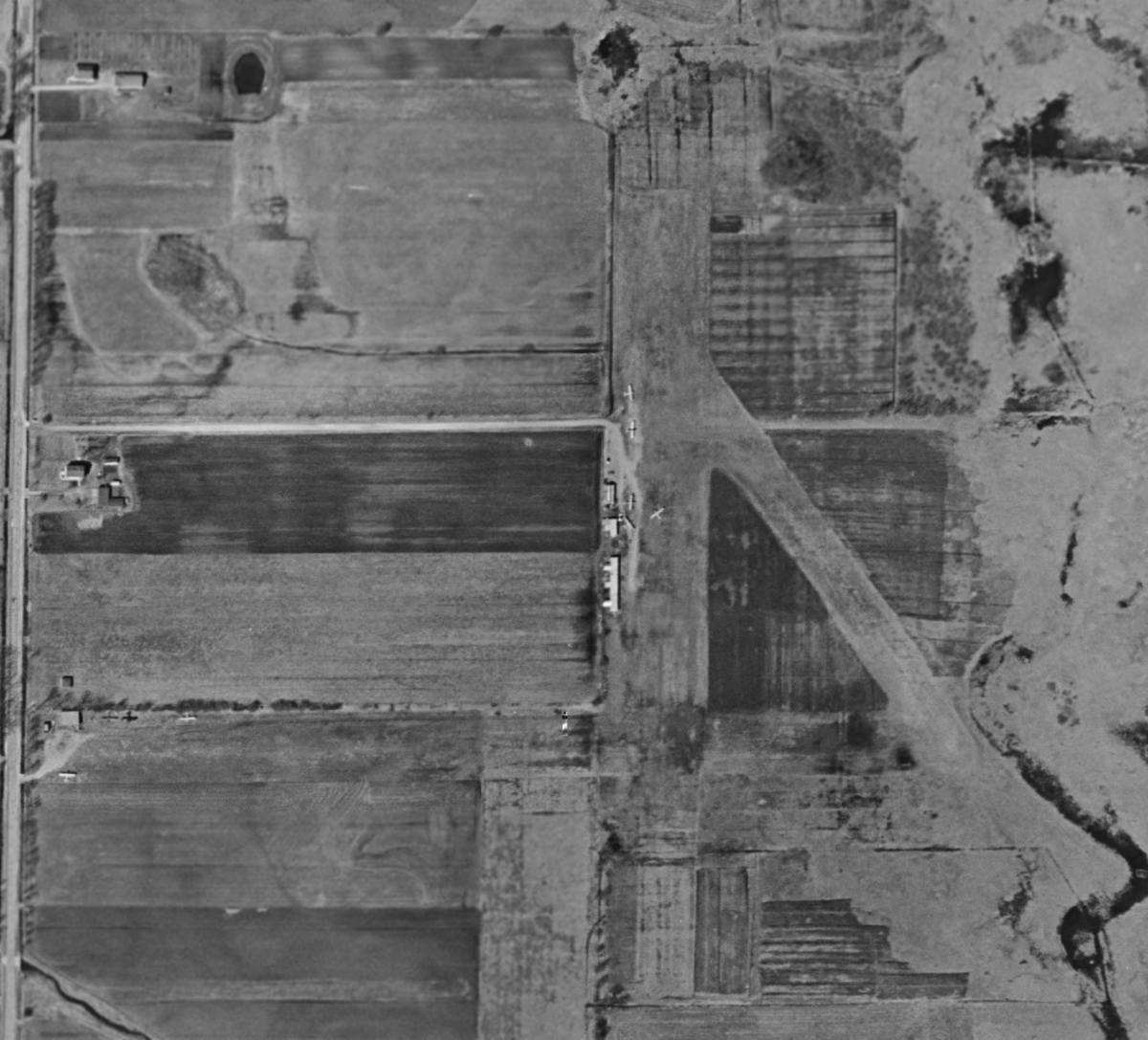
The earliest depiction which has been located of Rainbow Airport was a 4/8/55 USGS aerial view.
It depicted Rainbow Airport as having 2 unpaved runways,
with 8 single-engine planes parked near some small hangars on the west & southwest sides.
Rainbow Airport was not yet depicted on the May 1955 Milwaukee Sectional Chart.
Leon Rediske recalled, “Before 1956 when Ed quit his Dental job to work the airport full time,
we were open for business, but were not on the aeronautical charts.
This led to many funny incidents. If a plane landed, and the pilot was not someone we knew locally, we knew the pilot was lost.”
Leon continued, “There were many ways macho pilots tried to find out where they were.
They would never admit they were lost (we always told them before they left, but had many chuckles watching the lost pilots).
One way they used to find where they were was to buy fuel.
When they got their gas receipt, they found they were in 'Franklin' Wisconsin.
However the only Franklin on the aeronautical chart was near Sheboygan,
clearly some 45 miles away... and it didn't have an airport.
Our Franklin, South of Milwaukee, was not listed. Pilots didn't think they were that far off course.
Man would they pour over their charts, sweat pouring from their brows!
It was one of many fun things that went on there.”
Leon continued, “In 1956, Ed began full time, and the airport went on the chart. That ended all of our 'lost pilot fun'.
However it increased business, as folks would use our airport to have access to Milwaukee's South side,
the Milwaukee Metro Auto Auction, and many times vendors for AC Spark Plug division of GM which had a plant near us.
AC Spark Plug was by now making an inertial guidance system for commercial airliners
and also for the Lunar Lander some time later.”
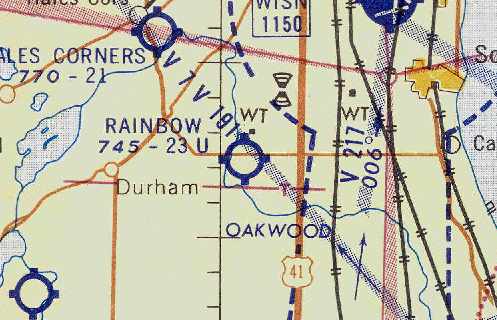
The June 1959 Milwaukee Sectional Chart (courtesy of Chris Kennedy) described Rainbow Airport as having a 2,300' unpaved runway.
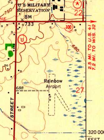
The 1959 USGS topo map depicted Rainbow Airport as having 2 unpaved runways, along with a few small buildings along the west side.
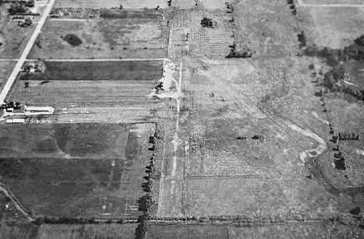
An aerial view looking north at Rainbow Airport from the 1960 Sky Eye Wisconsin Airport Directory (courtesy of Chris Kennedy).
It described Rainbow Airport as having a total of 4 sod runways, with the longest being the 2,300' north/south & east/west strips.
A 1963 aerial view depicted a dozen light aircraft on the west side of the field.
The December 1965 Milwaukee Sectional Chart (courtesy of Ron Kunse)
depicted Rainbow Airport as having a 2,100' unpaved runway.
Leon Rediske recalled, “By the mid 1960s we had converted
from our original Cubs & Champs as trainers into the more modern Cessna 150s.
We debated for a long time regarding the conversion,
as the Champs were $8/hour & the Cessnas were to be $13.
Would the customers pay that high a price? We tried a Cessna.
In a month, nearly all our students had converted over to it,
and it became obvious that we needed another new Cessna & the day of the Cubs & Champs was over.
In the late 1960s, I left my job with Allis Chalmers Electronics to become a full-time flight instructor.
When I wasn't on duty as an instructor, I did grass cutting, and helped with aircraft maintenance.”
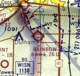
The 1970 Milwaukee Sectional Chart (courtesy of John Voss) depicted Rainbow Airport as having a 2,600' unpaved runway.
Leon Rediske recalled, “In 1973, I bought the operation from my father Ed, or rather began the payments... he slowly retired to Florida.
From all the years of helping our mechanics, I qualified to take the mechanics test & passed that.
So now in addition to instructing, I was an A&P mechanic, and I also continued to mow the grass, be an aircraft salesman & CEO. I wore many hats.”
Bob Kacmarcik recalled, “Cessna Aerobat N6053J was owned by Rainbow Airport.
In the summer of 1975, John Moody, the father of the ultralight, flew his Icarus II at Rainbow.
He walked it to the east end of Runway 27, ran west with it strapped to his back, got airborne & just cleared the block hangar as he flew westward.”
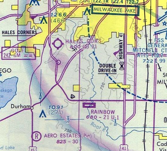
Rainbow Airport apparently gained a paved runway at some point between 1970-75,
as the May 1975 Chicago Sectional Chart (courtesy of Mitchell Hymowitz)
depicted Rainbow as having a 2,100' paved east/west runway.
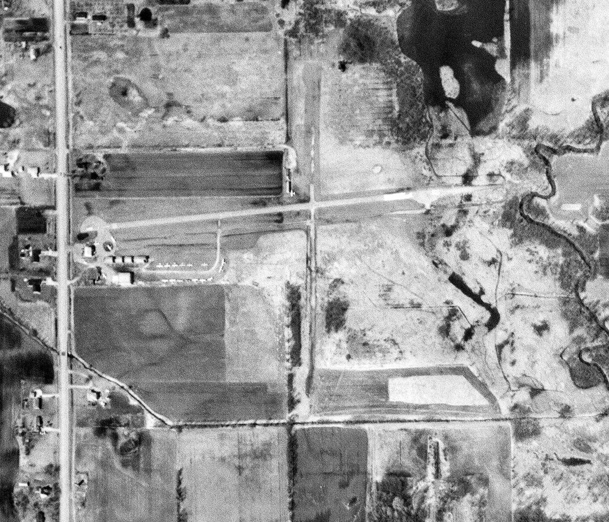
The last aerial photo which has been located showing Rainbow Airport in operation was a 3/19/76 USGS aerial view.
It depicted the field as having a paved east/west runway & unpaved north/south runway.
A total of 18 light single-engine planes were seen parked near hangars on the southwest & northwest sides.
The 1982 AOPA Airport Directory (courtesy of Ed Drury) described Rainbow Airport
as having a 2,125' asphalt Runway 9/27 & a 1,975' turf Runway 18/36.
The operator was listed as Rainbow Airport Inc. (a Cessna dealer).
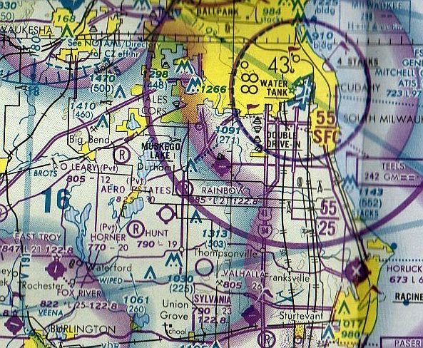
The last aeronautical chart depiction which has been located of Rainbow Airport was on the May 1985 Chicago Sectional Chart (courtesy of Jonathan Westerling).
It depicted Rainbow as having a single 2,100' paved east/west runway.
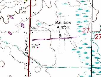
The 1987 USGS topo map depicted the paved Runway 9/27, as well as two grass runways.
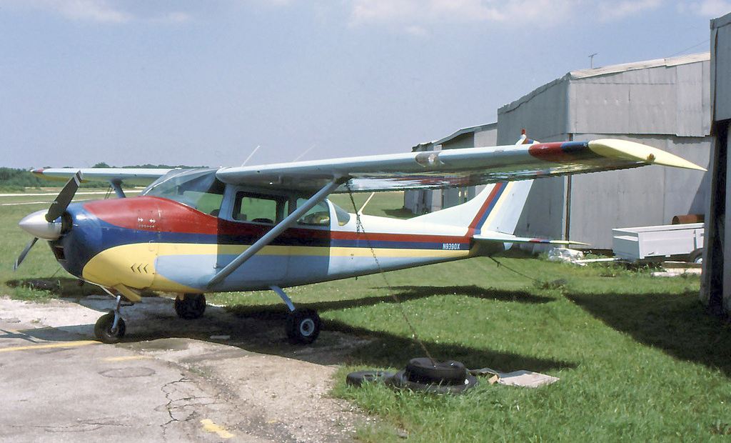
A 7/25/90 photo by Derek Heley of a Cessna 182E (appropriately painted with a rainbow) at Rainbow Airport.
A 1995 aerial view depicted 7 light aircraft on the west side of Rainbow Airport.
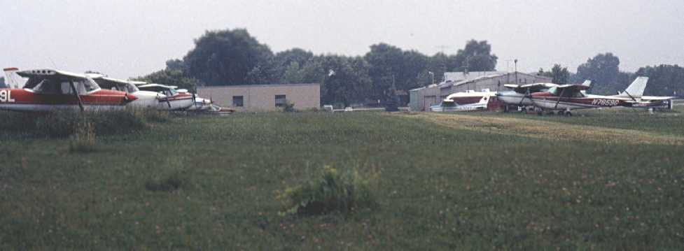
The last photo which has been located showing aircraft at Rainbow Airport was a June 1995 photo by David Faige,
“looking west, showing the parked aircraft. Some of them don't seem to have been flown in a while.”
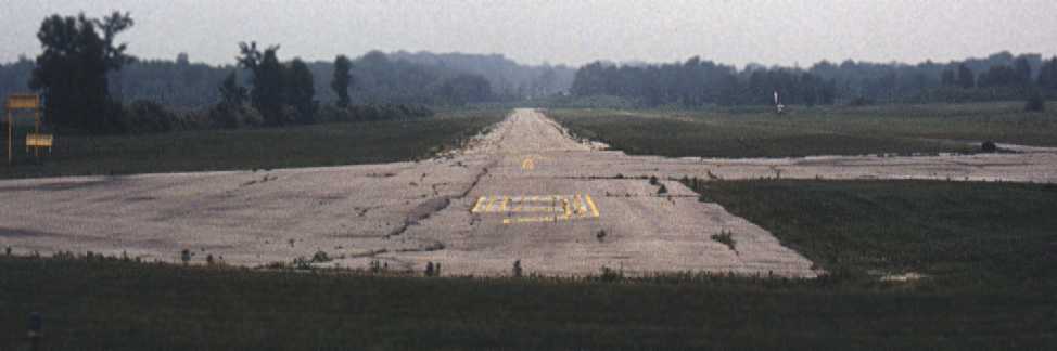
A June 1995 photo by David Faige looking east along Rainbow's Runway 9.
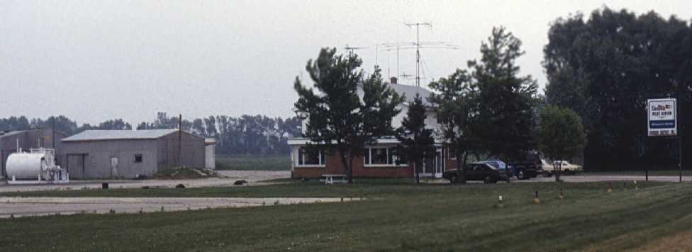
A June 1995 photo by David Faige of Rainbow Field's office, “looking SSE, as seen from the side of South 76th Street.”
Leon Rediske recalled, “The Milwaukee County Park Commission forced us out of our home & property.
Initially, they gave us 30 days to leave, but after some negotiation, they gave us 11 months to conclude our business ending 11/1/96.
We had been there some 50 years.”
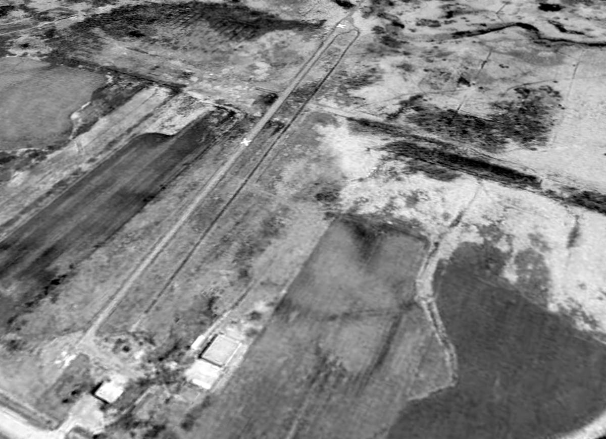
A 2000 USGS aerial view looking northeast showed the abandoned paved runway at Rainbow was still in very good condition,
with several closed-runway "X" symbols visible along its length.
The airport was still mostly intact, with what appeared to be several hangars remaining on the west side of the property.
But several other hangars had been removed between 1995-2000.
Andrew Pyzyk reported in 2003, "I passed the site about a year ago & noticed one remaining building."
Leon Rediske reported in 2006, “They [the Milwaukee County Park Commission] since have torn down the home & office, and all the buildings except the large concrete block hangar,
which they use to store mowers in for the Oakwood golf course located 1 mile East.
Since then, the hard surface runway cracks have grown up some reasonable-sized trees in the 10 years since we left.”
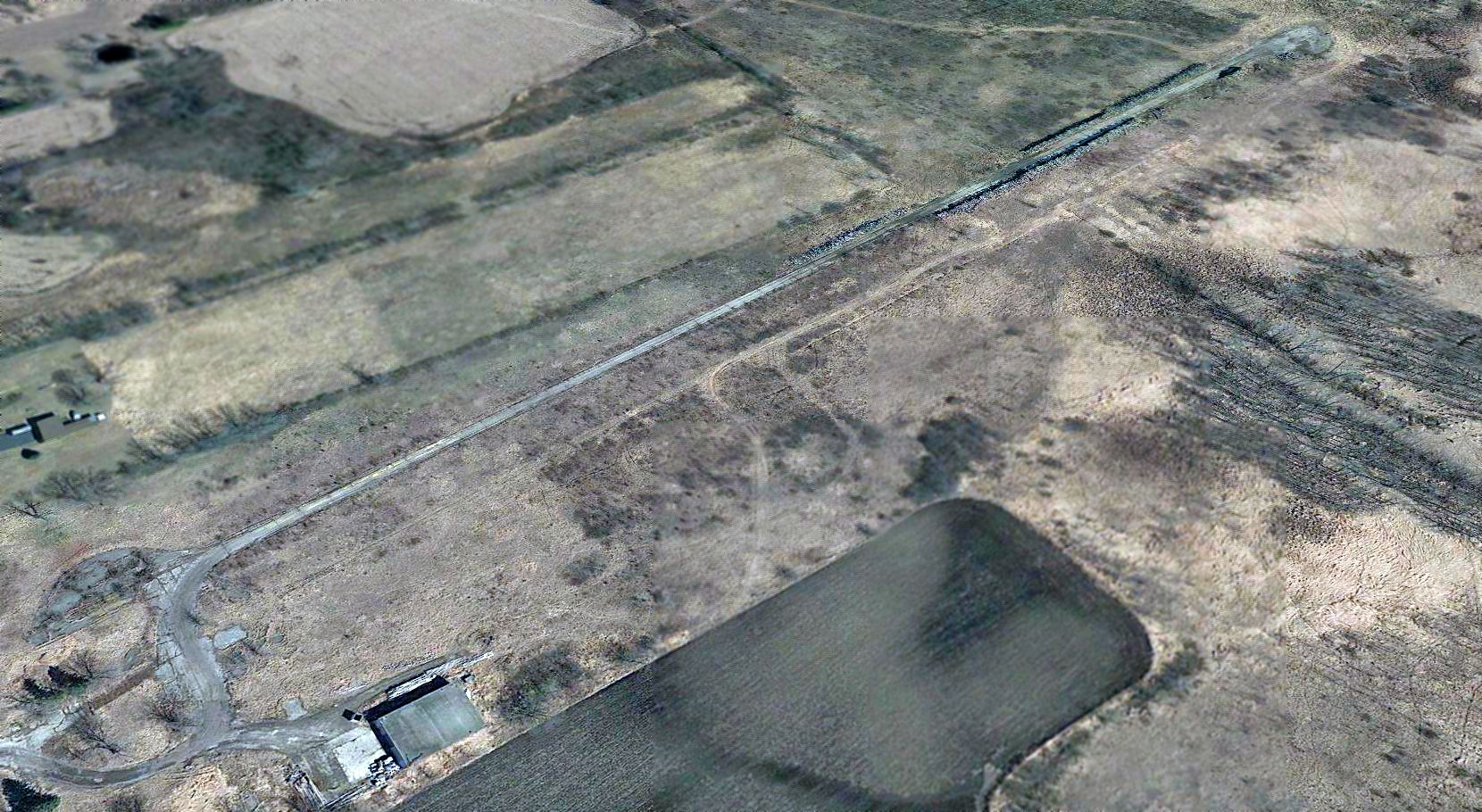
A 2018 aerial view looking northeast at the site of Rainbow Airport showed the paved runway remained intact though deteriorated, without any markings still visible.
A single hangar remained standing on the west side.
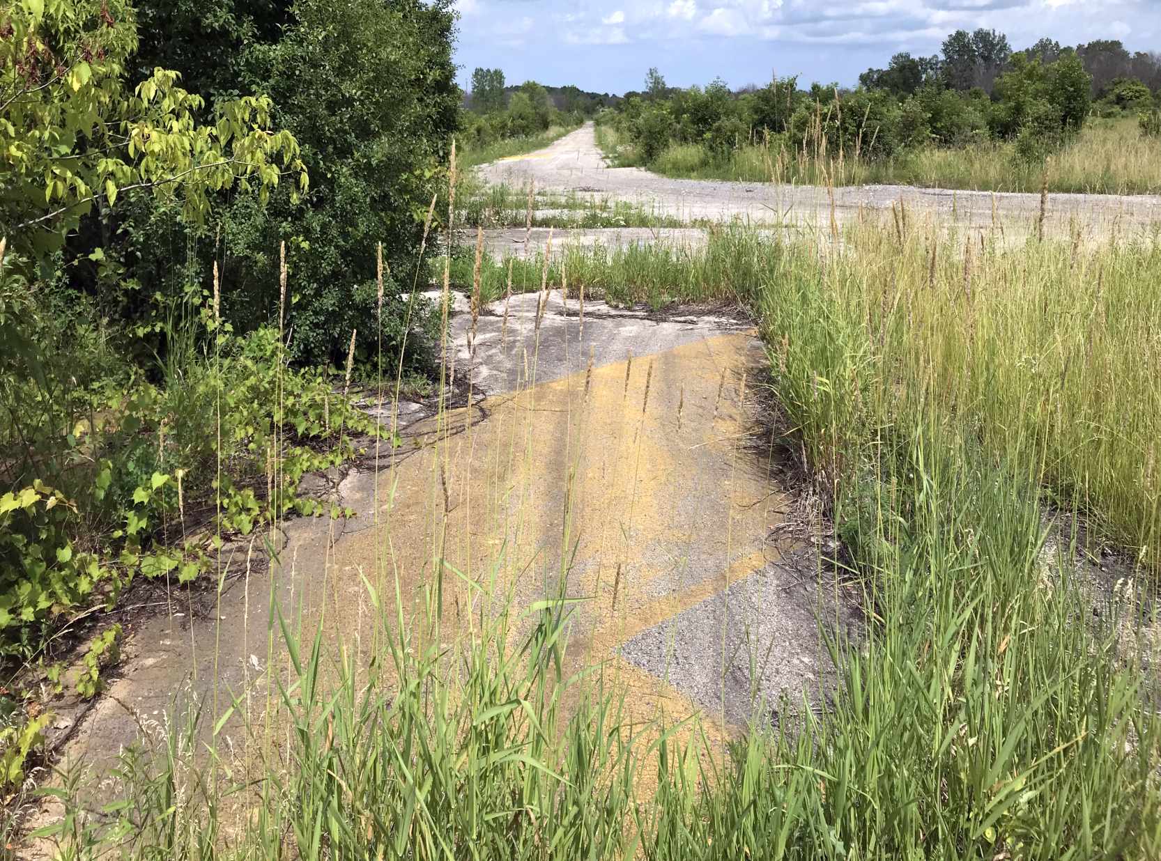
A 7/5/19 photo by Matt Franklin looking along the remains of Rainbow Airport's runway pavement, showing the yellow runway markings.
Matt reported, “Other than the runway, it's not very aviation feeling-y anymore. You can tell it’s municipally-owned by the power polls outside & the test striping on the runway.”
A 7/5/19 photo by Matt Franklin of a former Rainbow Airport hangar.
Rainbow Airport was located southeast of the intersection of Ryan Road & South 76th Street.
____________________________________________________
Maitland Airport, Milwaukee, WI
43.032, -87.9 (East of Downtown Milwaukee, WI)
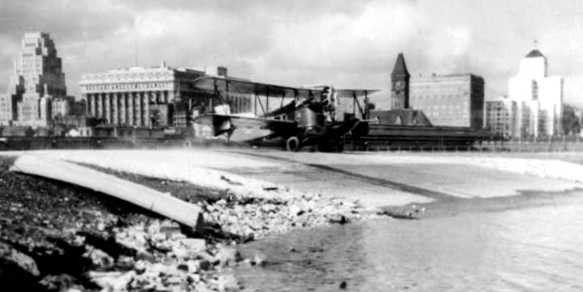
A circa 1930 photo of a Loening Air Yacht, an odd-looking single-engine biplane seaplane, descending Maitland's seaplane ramp.
This small general aviation airport located along the banks of the Milwaukee Bay was opened in 1927,
according to the Milwaukee County Website (via Mark Mathu).
According to a Milwaukee Magazine article, “For several years, the Loening C-2C Air Yachts of Kohler Aviation [operated from Maitland],
promoting their service as the 'Bridge that Spans Lake Michigan'.
Featuring floats & an open cockpit, the ungainly planes hopped from Milwaukee to Muskegon, MI, and on to Grand Rapids, MI,
where passengers caught up with trains bound for Detroit & points east.
With one-way trips running $18, the service was pricey even in flush times,
which September 1929, the month the service started, certainly was.”
As the Milwaukee Journal reported in 1930, “No other large city is said to have the natural advantage presented to Milwaukee,
by which an airplane can taxi up to a railroad terminal & discharge its passengers within a few feet of a waiting train.”
The earliest photo which has been located of Maitland Field
was a circa 1930 photo of a Loening Air Yacht descending Maitland's seaplane ramp.
The earliest aeronautical chart depiction which has been located of Maitland Airport was on the June 1931 Milwaukee Sectional Chart.
It depicted both the landplane & seaplane facilities.
According to a Milwaukee Magazine article, 2 Kohler planes crashed in 1933, and “The airline filed for bankruptcy the following year.
Maitland wasn’t a desirable place for planes... flat tires occurred frequently due to nails & broken glass that surfaced from the old landfill beneath.
And prevailing winds hit planes on the runway cross-ways instead of head on, as pilots prefer.
And then there were what one report artfully called the 'mental hazards' of navigating the airport,
which included Downtown’s tall buildings & 2 gigantic smokestacks just off the southern end of the runway.”
The earliest directory listing of Maitland Airport which has been located
was in the 1934 Department of Commerce Airfield Directory (according to Chris Kennedy).
It listed an "Air Marine Terminal" as being located "on lake front, 3,000' north of harbor entrance,
on east side of business section of city, near C & N W depot."
The airfield was said to consist of a 1,000' north/south earth field, within which was a single 900' macadam runway.
An 8/4/37 USDA aerial view of Maitland Airport (from the WI Historic Aerial Imagery Finder)
depicted the field as having an unpaved airfield area, with an airport circle marking at the south end.
What appear to be 2 T-hangars were located on the north end, but no aircraft were visible.
The Milwaukee Magazine article continued, “None of that stopped local inventor & entrepreneur Tony Lange,
however, who stepped in after Kohler left.
Lange, who leased the property from 1937-46, brought along energy & a more glamorous name: the 'Milwaukee Seadrome'.
The staff was also more glamorous. Virginia Considine was a Kentucky beauty queen (Mountain Laurel Festival, 1940)
who filled in when Lange’s secretary, Daisy, went on vacation during the summer.
The field’s marketing was upscale, too. An invitation to the Seadrome’s 'Formal Opening' touted the field’s services for the 'Modern Industrialist',
including 'larger bi-motor equipment for personal & public relations use'.”
The Milwaukee Magazine article continued, “Lange’s son William remembers him as a tireless worker
who put in 7 days a week at the field, despite the long commute from their Pewaukee home.
But when the winds were right, Lange lived every commuter’s dream, flying above the snarled traffic before touching down at their lakeside cottage out west.”
William says a neighbor complained – not about the noise, but because his own kids “would not greet him coming home from work...
They all went down to the lake [to watch] the seaplane land & taxi to the pier.”
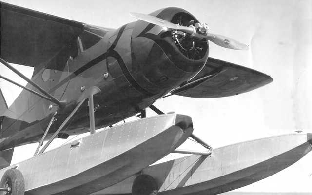
A circa 1940 photo of a Howard DGA floatplane of Lange Aviation, presumably at Maitland Field.
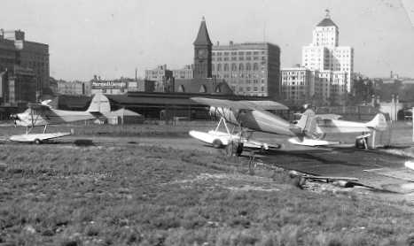
A circa 1940 photo of a 3 floatplanes at Maitland Field.
No airfield at this location was listed among active airfields in the 1945 AAF Airfield Directory (according to Scott Murdock).
It might have been temporarily closed during WW2, like many other small general aviation airports.
The June 1946 Milwaukee Sectional Chart (courtesy of Jim Stanton) depicted both Maitland Airport & the adjacent Milwaukee Seadrome.
According to a Milwaukee Magazine article, Tony Lange leased the airport until 1946.
An undated aerial view looking southeast from Charles Zweng's 1947 "Airport Operation & Management".
Originally captioned, "Downtown Milwaukee landing strip opened in Milwaukee by Lange Aviation, operator of adjacent Milwaukee Seadrome."
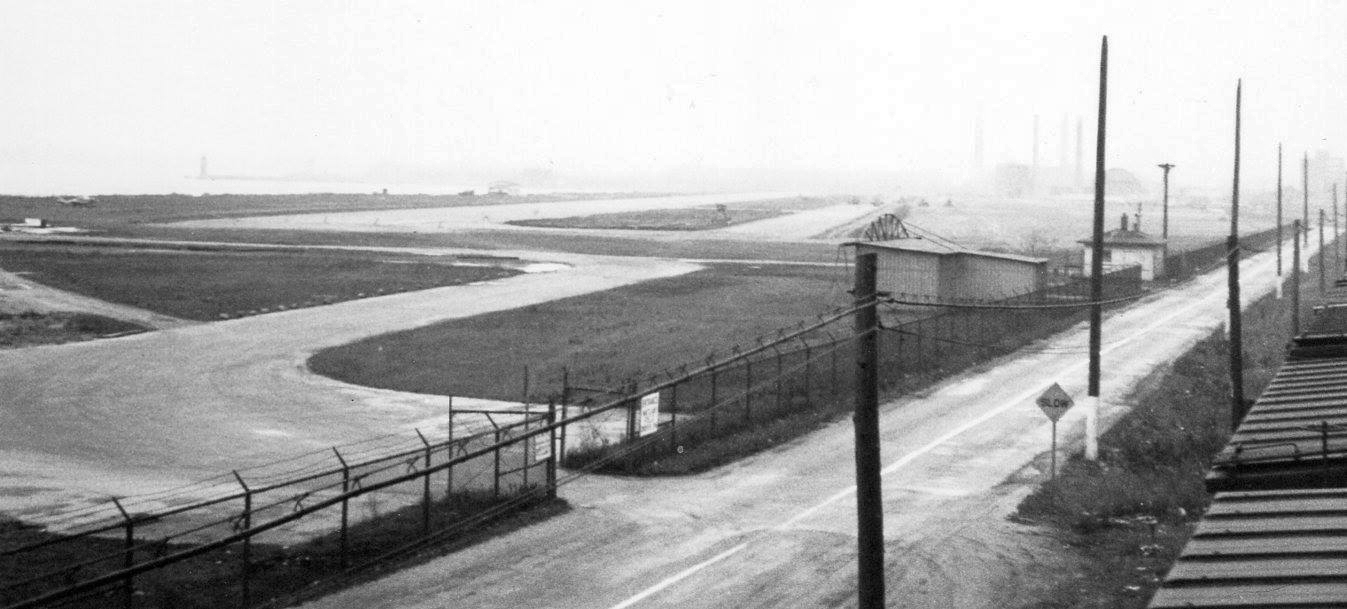
An undated photo looking southeast at Maitland Airport (courtesy of Lyman Hatz).
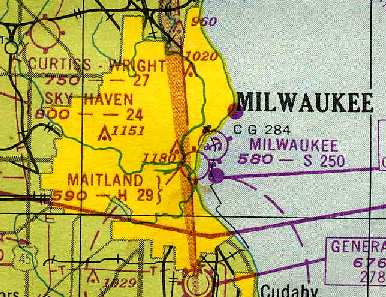
The 1948 Sectional Chart (courtesy of Chris Kennedy)
depicted Maitland Airport as having a 2,900' hard-surface runway.
The last aeronautical chart depiction which has been located of Maitland Airport
was on the 1949 Milwaukee Sectional Chart (courtesy of Donald Felton).
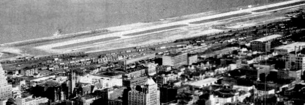
An undated aerial view looking southeast at Maitland Airport from a September 1953 article (courtesy of Robert Brown),
which described Maitland as having a 2,900' paved runway & 10 T-hangars with permanent tenants
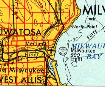
Maitland Airport & the adjacent Milwaukee Seaplane Base, as depicted on the 1954 USGS topo map.
Maitland Field had its adherents: Edward Gerhardy, president of the Greater Milwaukee Committee,
told the Milwaukee Sentinel in 1955 that the field was “one of the most valuable assets Milwaukee has,”
before claiming the site as perfect for yet another new aviation fad: helicopters,
which would make “regular freight runs between downtown Milwaukee & such cities as Chicago, Madison, Green Bay, and Grand Rapids.”
According to a Milwaukee Magazine article, “Maitland was averaging fewer than 7 landings a day in 1955, and the field was losing $1,000 a month.”
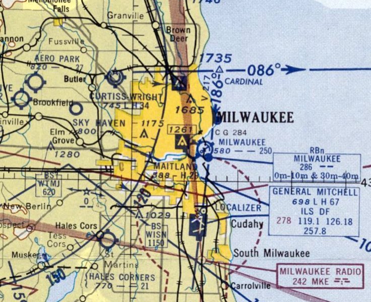
The last aeronautical chart depiction which has been located of Maitland Airport was on the May 1956 Milwaukee Sectional Chart.
It depicted both Maitland Airport & the adjacent Milwaukee Seaplane Base.
In the mid-1950s the Army began looking for sites to house Nike missiles for Milwaukee-area batteries,
and Port Director Harry Brockel was more than happy to turn Maitland over to them.
“Seaplanes… have completely disappeared from the area,” the Sentinel reported.
Maitland Airport was evidently closed at some point in 1956,
as it was no longer depicted on the December 1956 Milwaukee Sectional Chart.
The property of the former Maitland Airport was reused starting in 1957
as the location of the Army's M-20 Nike missile launch site,
one of 8 Nike batteries which eventually provided anti-aircraft defense for the city of Milwaukee.
The battery's first 12 Nike-Ajax missiles were delivered “under cover of darkness… by 6 trucks & a police escort” in 1957.
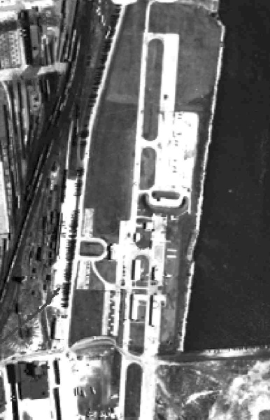
A circa late 1950s / early 1960s aerial view (courtesy of Dana Wyatt) showing the Nike missile battery built over the Maitland Field runway.
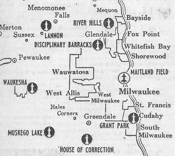
A circa 1950s map showing the Nike missile battery at Maitland Field along with the other Nike batteries ringing Milwaukee.
Rick Gerou recalled of the Maitland Nike battery: "I have vivid memories of those missiles - which I once got to see elevated.”
The 1958 USGS topo map still labeled the site "US Military Reservation", with several buildings
and no longer depicted any trace of an airfield.
At some point after 1958, Nike Battery M-20 was upgraded with the much more capable second-generation Nike Hercules missile.
Looking beyond the lifespan of the Maitland Nike battery, some urged resurrecting the airfield,
but by then, officials were set against it, as it was perceived to cost too much & serve too few.
“Over our dead bodies that airstrip will be revived,” Brockel said in 1961.
A 1963 aerial view showed a remaining paved north/south runway & parallel taxiway of the former Maitland Airport.
The missile launchers of Nike site M-20 were located on the northeast side of the former runway.
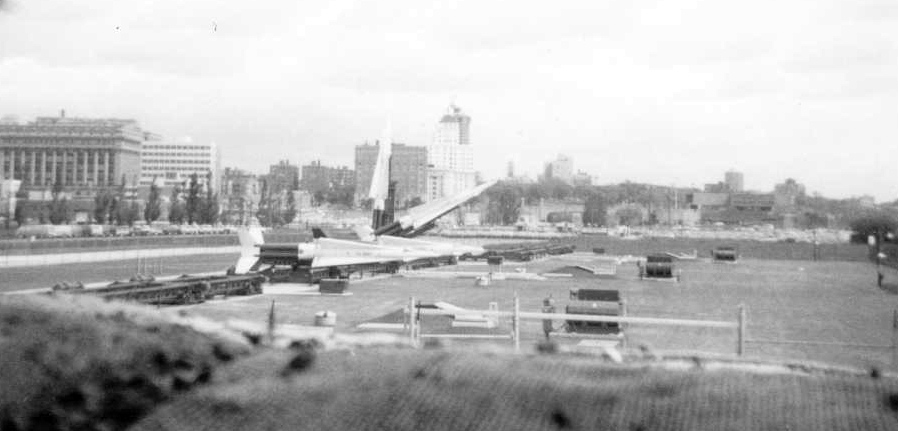
A November 1968 photo by Dana Wyatt looking northwest at a row of 4 Nike Hercules missiles at Battery M-20.
Dana Wyatt observed, “You can still see a portion of the airport runway to the left of the missiles.
Downtown Milwaukee [is visible] in the background.
These were taken from a security point for our warhead building, between the 1st & 2nd security checkpoints to the launching area.
The warhead building was surrounded by an earthen berm as high as the building to deflect any explosion upward, thus protecting the surrounding area.”
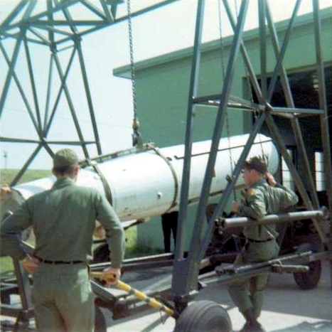
A 1969 photo by Dana Wyatt “of the last missile being put into its storage/shipping container.
Dana Wyatt reported, “Nike Missile site M-20 was deactivated in 1969.
I was one of the missile techs that help close it down.”
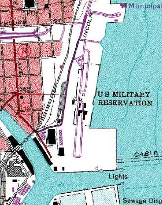
The 1971 USGS topo map still labeled the site "US Military Reservation",
with 2 roads in the same location as the runway shown in the above aerial photo.
A 1995 aerial view showed no remaining trace of the former airport,
with the site having been covered by a road & industrial facilities.
Richard Rajchel reported in 2003 that the airport site is currently "the Summerfest grounds.
Nearly all summer there are festivals there, including Summerfest,
which is one of the largest music festivals anywhere."
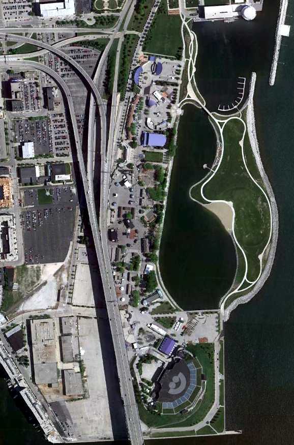
A 5/28/10 aerial view showed the Maitland Airport site had been redeveloped as a park, although the road sharing the runway alignment was still perceptible.
The site of Maitland Airport is located near the present-day intersection of East Chicago Street & Interstate 794.
____________________________________________________
Richard Bong AFB, Kansasville, WI
42.625, -88.15 (Southwest of Milwaukee, WI)
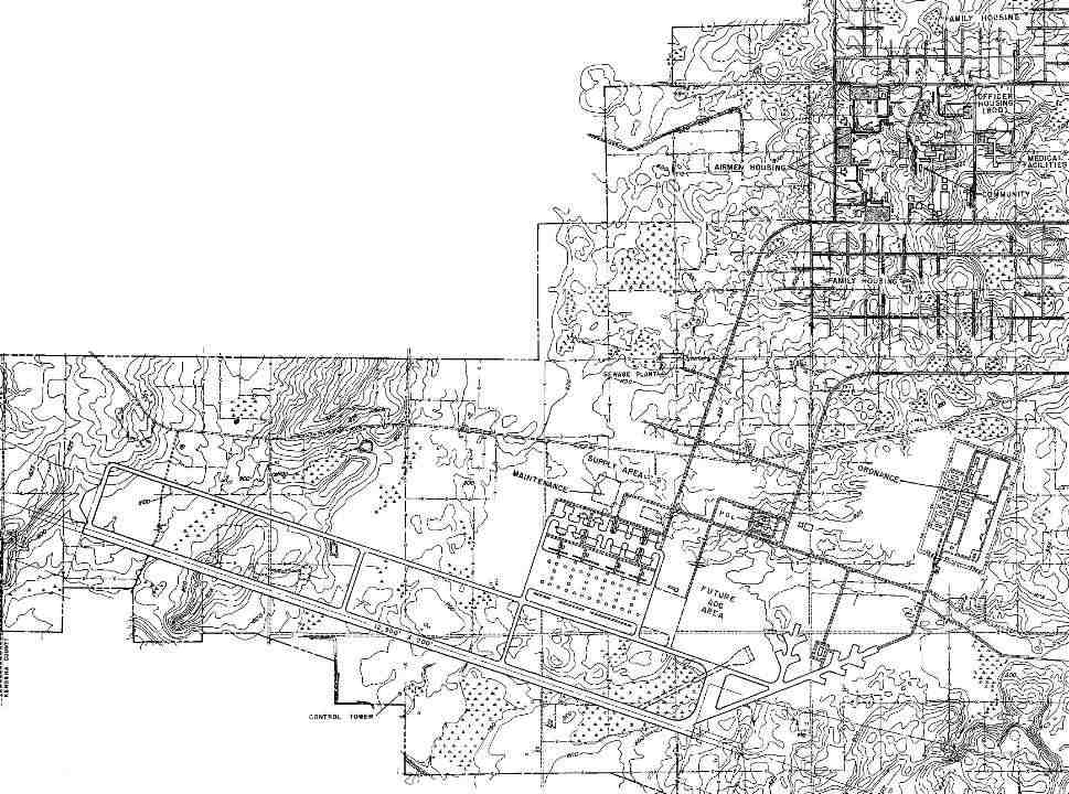
A 10/1/57 Air Force plan of the layout of the extensive planned facilities of “R.I. Bong Air Force Base” (courtesy of Kevin Rutherford).
The idea of an air force base for the Chicago area began in 1951
when it was realized that the air traffic at O'Hare International Airport would soon over-saturate control facilities.
The Air Force then instructed the Aerospace Defense Command to study the possibility
of locating a base which would house 2 fighter interceptor squadrons within a 70-mile radius from the city.
The aim of the base was to protect the Milwaukee & Chicago areas from attack by Soviet bombers.
A survey team then selected a site south of the unincorporated community of Kansasville, Wisconsin.
According to Scott Murdock, this property was originally known to the Air Force as the Kansasville Area.
On 8/30/54, the ADC requested funds for development of the site.
The 56th Fighter-Interceptor Group was scheduled to move to the base as soon as it was completed.
According to Bobby Pallamolla, “The land which was used for the base was prime farming land
which sadly the farmers got next-to-nothing for a base which was never used.”
A 1955 USGS aerial photo did not yet show any construction, just farmland.
It was redesignated Richard Bong Air Force Base on 12/1/55.
According to GlobalSecurity, the planned base was named after Richard Ira Bong,
a Wisconsin native who eventually became the leading American Ace of all time.
Construction barely begun in 1956 when the ADC began to doubt the selecting the site.
The new commander of the command pointed out that new problems in air traffic control would develop
and that the community of Lake Geneva, WI, only 18 miles west
had protested violently when a site there had been proposed for the location of the Air Force Academy.
His recommendations were to select a site north of Milwaukee where the location would be beneficial to not only the Air Defense Command,
but the Strategic Air Command, which was planned to be the base tenant at the time.
During 1956 & 1957, Strategic Air Command devised a program where the units were to be dispersed throughout the country,
which in theory would lessen losses from a direct enemy attack.
Bong became one of these bases.
Only the drainage system was being built in the middle of 1957 & the acquisition of land was not even complete.
At that time, the scheduled date of the moving of the 2 squadrons was changed to mid-1960.
On 6/5/57, the major command for the base was changed to the Strategic Air Command.
The 2 ADC squadrons that were planned to be located there became tenants at the base.
As technology increased, the Air Defense Command was able to reduce its aircraft & continue its strength.
One of the O'Hare ADC squadrons was eliminated in 1958 while another was transferred to K.I. Sawyer AFB.
The earliest depiction which has been located of Bong AFB was a 10/1/57 Air Force plan
of the layout of the extensive planned facilities of “R.I. Bong Air Force Base” (courtesy of Kevin Rutherford).
It depicted a typical runway layout for a Strategic Air Command bomber base,
with a single 12,300' northwest/southeast runway, with a parallel taxiway on the north side.
A control tower was situated midway along the south side of the runway, and a ramp with 12 hangars was along the north side.
A taxiway from the southeast runway end led to 2 sets of SAC “Christmas tree” dispersal pads,
and a road from those led to an “Ordnance” area to the northeast.
An extensive street grid to the northeast of the airfield contained several housing areas.
Much of this infrastructure was never to be built.
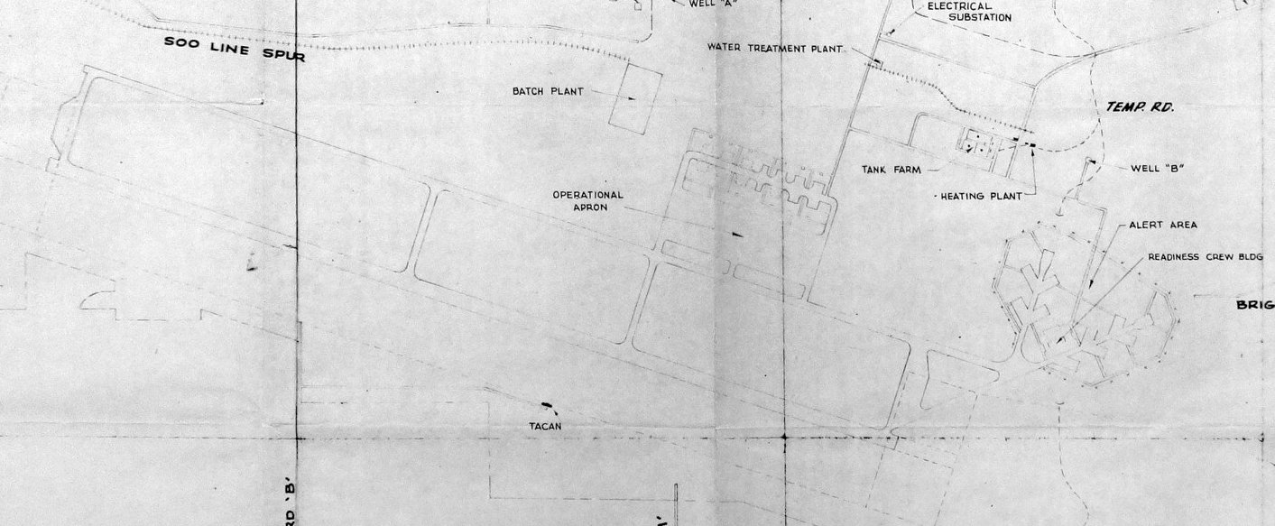
An undated plan of Bong Air Force Base, showing the runway, parallel taxiway, Operational Apron, and Alert Area.
As a result of SAC's dispersal plan, the 4040th Air Base Squadron was activated on 8/1/58 to maintain Bong AFB.
The base was also assigned to the 8th Air Force as well.
The planned tenants of the base were a bomber wing & an air refueling wing.

The earliest depiction of Bong AFB which has been located was a circa late-1950s aerial view of the runway & other infrastructure under construction
(photographed by Bobby Pallamolla in 2008 hanging on the wall of the Bong Recreation Area Visitor Center).
A circa late-1950s photo of the Bong AFB runway being graded (courtesy of the Burlington Historical Society, via Bobby Pallamolla).
A circa late-1950s aerial view of 3 above-ground fuel or water tanks which were built adjacent to the Bong runway (courtesy of Bobby Pallamolla).
On 1/1/59 responsibility for the base was transferred from the 8th Air Force & 4040th Air Base squadron to the 2nd Air Force.
Interestingly, the tenant 4040th was made up of 2 servicemen when this move occurred.
The Air Force then realized that the units planned for the base could be accommodated at other existing bases.
Since the base would no longer be needed, the Air Force announced on October 1 that Bong would be closed.
That same day, all construction was halted, including remaining work on the 12,900' runway.
The 4040th, now made up of 12 servicemen & no civilians was discontinued on 12/1/59.
The decision to close the base was due to the realization that the B-58 Hustler could be accommodated at other bases
through the elimination of B-47 Stratojet units ahead of schedule.
Bong Air Force Base was declared excess on 8/23/60.
The 1960 USGS topo map depicted “Richard Bong Air Force Base (Abandoned)”
as having a runway & parallel taxiway.
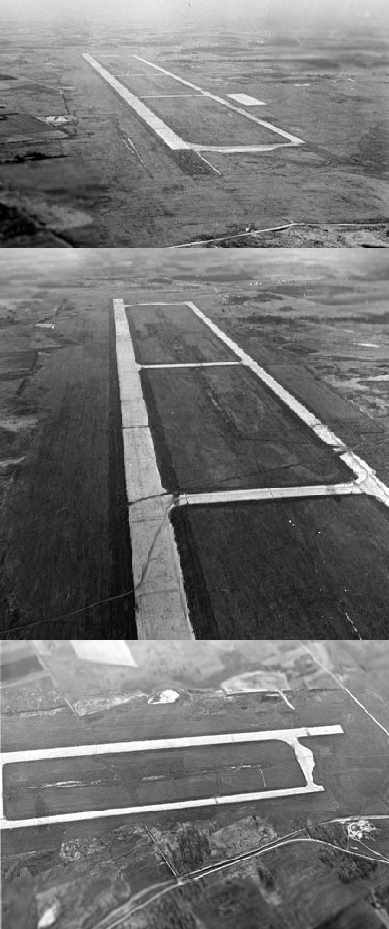
Three circa 1960 aerial views of the newly-constructed, massive runway & parallel taxiway at Bong AFB,
taken from a 440th Airlift Wing C-119 (via MSgt Brady Kiel).
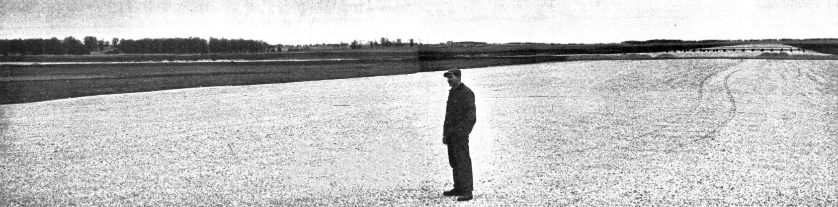
A circa 1961 photo of farmer John Kerkman staring glumly at Bong AFB's barren expanse of clay & gravel, standing where his family’s home once stood.
Stretching beyond him is the unused two & a half mile runway.
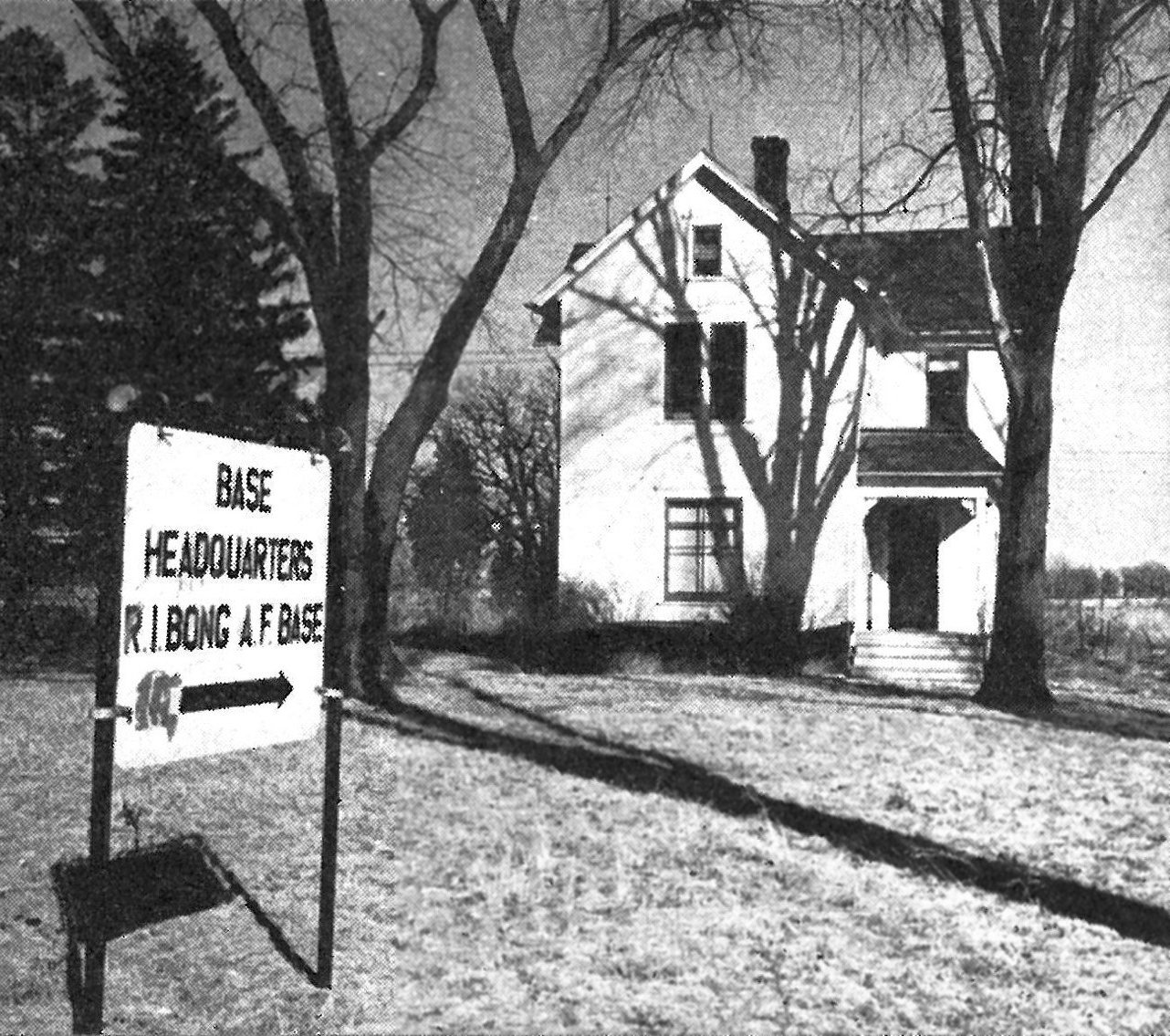
A circa 1961 photo of Bong AFB's Headquarters building, a repurposed generations-old family farmhouse.
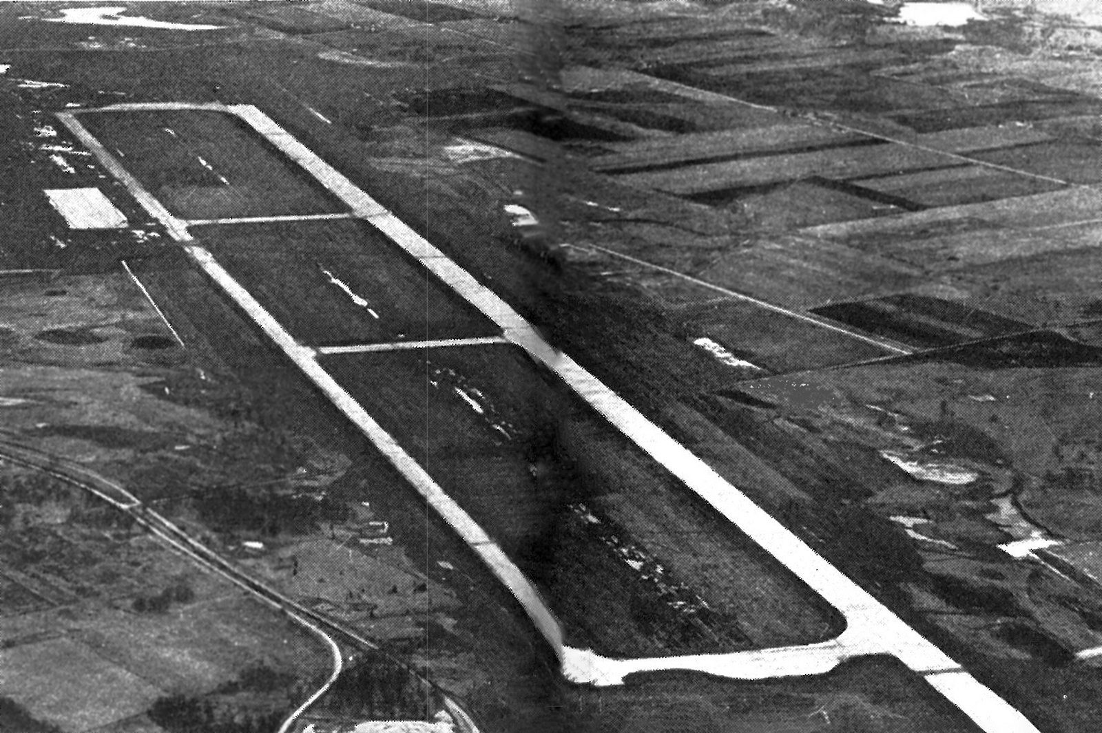
A circa 1961 aerial view looking southeast at Bong AFB's massive paved runway & parallel taxiway.
Secretary of the Air Force James H. Douglas, Jr. later explained the decision to close Bong by saying:
"Finally we realized that by 1961-62 when Bong would be ready,
we would have several other medium bomber bases empty of squadrons & we really don't need Bong."
Thus Bong AFB was abandoned before ever being completed.
During the 1960s, the aborted AFB property was used as a training site for Special Forces units headed for Viet Nam.
This was the only military usage of the property.
However, there was apparently a civil aviation reuse of at least a portion of the Bong AFB property.
Bill Case recalled, “Myself & 2 other individuals opened a skydiving operation at Bong AFB in 1967-69.
We used a nearby farm as our base of operations, working out of an old chicken coop, and keeping a Cessna 180 tied down next to a barn.
The operation at Bong was in a farmhouse located on the south eastern corner of the base.
We put in a Pea Gravel landing pit, in 1968-69.
It was a small operation but busy on weekends.
Our favorite hangout after hours was the adjacent Mars Cheese Castle to the east on the interstate, the son of the owner was a skydiver.
On the circa 1960 aerial views, in the top view at the bottom edge you will see a white dirt road leading from left to right,
that would have been our 'runway' and the farm house was just out of view at the bottom left of the picture.”
The site was depicted as "Aband arpt" on the May 1970 Milwaukee Sectional Chart (courtesy of John Voss).

The last photo which has been located showing the Bong AFB runway still intact was a 9/23/71 USGS aerial photo.
According to Bobby Pallamolla, “After the Air Force finally abandoned it,
there was talk of making it into a reliever airport for Chicago/Milwaukee because of the massive runway still there.
After that fizzled, the state stepped in & bought the land.”
In 1974 the state bought the 4,515-acre property of the former AFB,
and it became the Richard Bong State Recreation Area, the state's first recreation area.
According to Bobby Pallamolla, “The 3 large above-ground storage tanks were removed around the time the state bought the land around 1974.”
Brian Siegl recalled, “The Bong Airbase... In the 1970s my wife & her siblings were there many times
because her father used to build & fly free-flight model airplanes.
Bong was the preferred location for local & national competitions, as well as casual flying, due to the wide open spaces (and that it was a 'real' airport).
Harry would wind up the prop & let the models go, and my wife & the rest of the crew would have to run after them & retrieve them
(especially important if a crosswind took a plane into the underbrush off the runway area).”
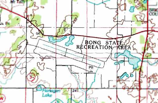
The 1978 USGS topo map depicted the runway layout of the never-completed Bong AFB,
labeling the site as the “Bong State Recreation Area”.
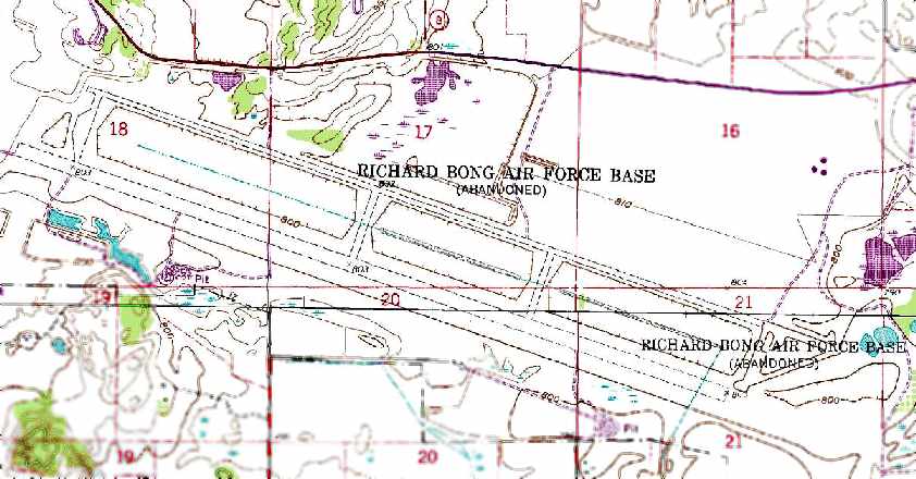
The 1987 USGS topo map depicted “Richard Bong Air Force Base (Abandoned)”
as having a runway & parallel taxiway.
A recent map of the former runway area at the Bong State Recreation Area.
Among many activities conducted at the park,
the area of the huge aborted runway is used for flying hang gliders & ultralight aircraft.
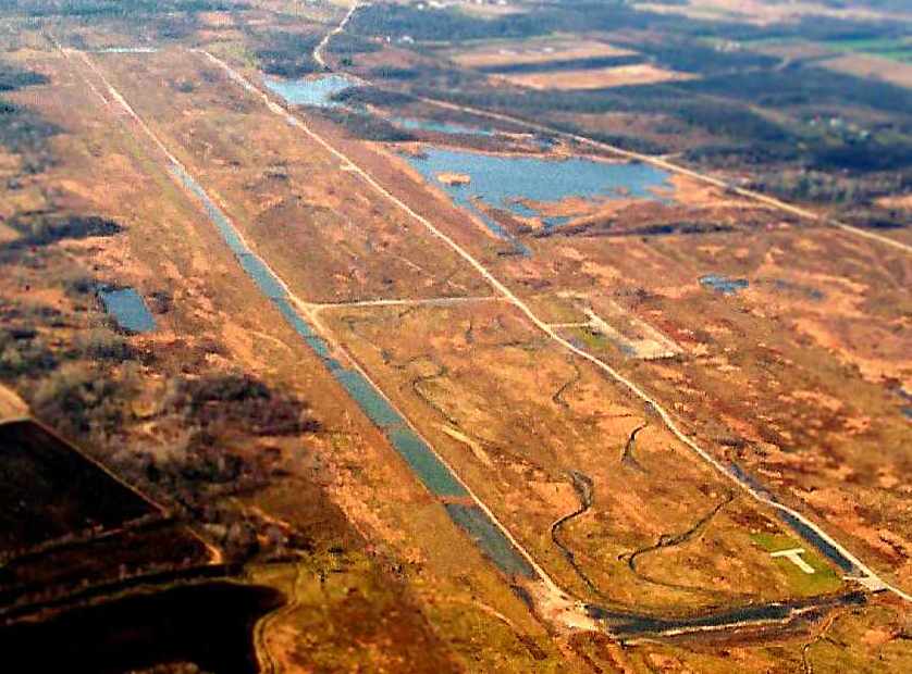
A November 2001 aerial view by Gary Dikkers looking west at the remains of the Bong runway.
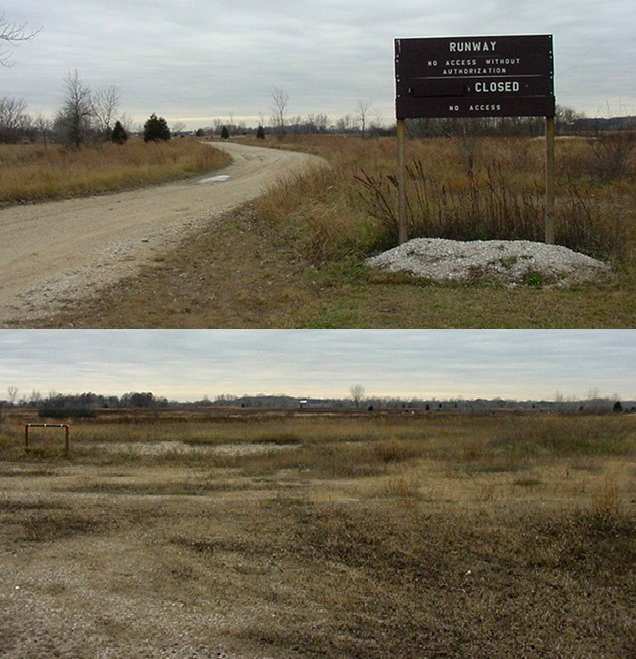
Two 2003 photos by Scott Murdock of the runway area of the former Bong AFB.
Scott reported, "I was pleased to see that the state maintained the name of the property,
and that they describe the base & its namesake in their visitor pamphlet.
In fact, the signs refers to the runway area as - the runway!
I was able to drive the length of the park road that now sits on the intended parallel taxiway.
On a different day I might have walked on the intended runway, but I arrived during a special pheasant hunt.
Not being a participating hunter, I had to stay on the paved road & out of the runway area."
A circa 2006 aerial view shows large closed-runway “X” symbols which are still maintained on either end of the massive former runway,
put there by the park rangers to discourage any use of the runway by aircraft.
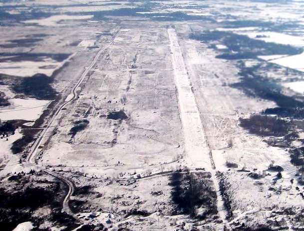
A 1/17/07 aerial view by Mark Pasqualino showed the Bong AFB runway remains quite distinct in the snow.
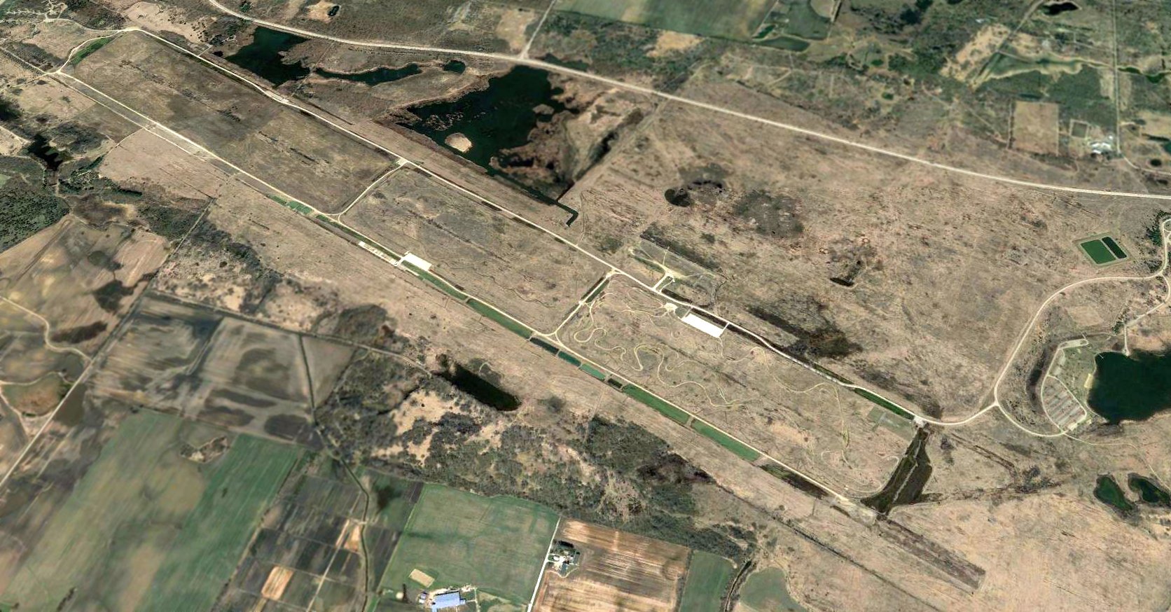
A 2017 aerial view looking northwest at the remains of the massive Bong AFB runway & parallel taxiway.
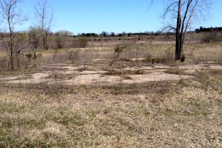
A 2018 photo by Bobby Pallamolla of the concrete foundation of where one of the round fuel/water tanks (of the total of 3) once stood, on the site of Bong AFB.
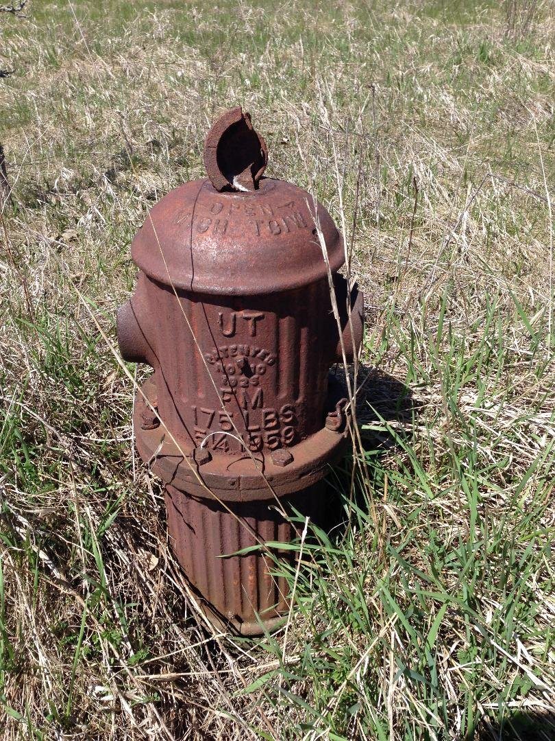
A 2018 photo by Bobby Pallamolla of a fire hydrant (dated 1959) built for Bong AFB, “still there in the middle of nowhere.”
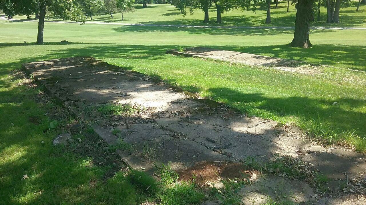
A 2019 photo by Bobby Pallamolla of foundations for the Bong AFB airmens' barracks, now on the Brighton Dale Golf Course.
Bobby Pallamolla reported in 2018, “The Brighton Dale Golf Course is presently where the Family/Officer housing & Base Hospital
would have been on the Northeast part of the old base had it been fully built.”
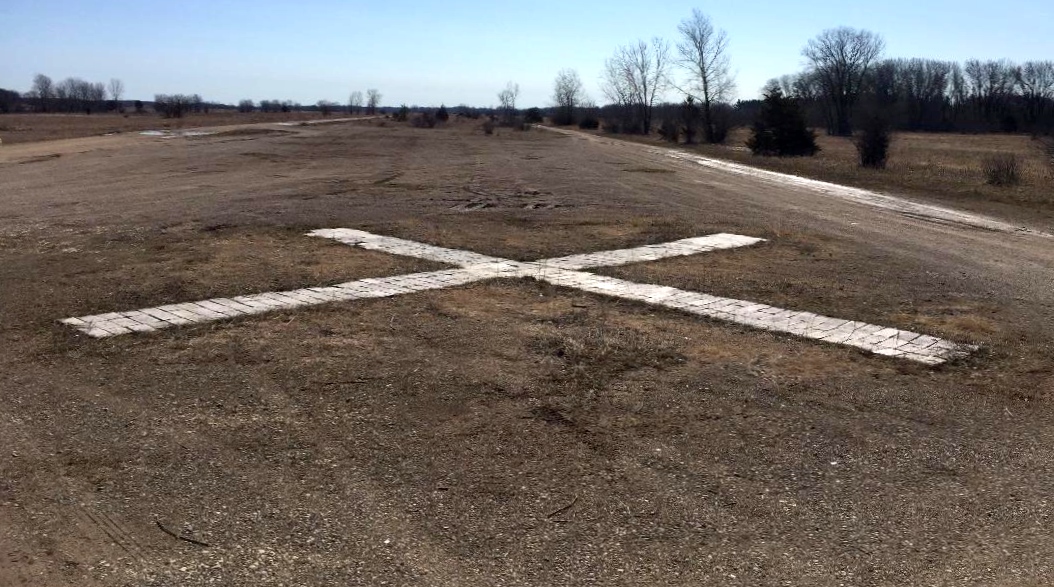
A 4/2/20 photo by Bobby Pallamolla “at the former Bong Air Force Base, at the end of the 12,900' runway.”
____________________________________________________
Or if you prefer to contact me directly concerning a contribution (for a mailing address to send a check),
please contact me at: paulandterryfreeman@gmail.com
If you enjoy this web site, please support it with a financial contribution.
____________________________________________________
This site covers airfields in all 50 states.