Abandoned & Little-Known Airfields:
Texas: Western Corpus Christi area
© 2002, © 2023 by Paul Freeman. Revised 1/27/23.
This site covers airfields in all 50 states: Click here for the site's main menu.
____________________________________________________
Please consider a financial contribution to support the continued growth & operation of this site.
Cabaniss NOLF (revised 1/26/23) – Corpus Christi Airport (original location) / Cliff Maus Airport (revised 1/26/23) - Cuddihy NAAS (revised 1/13/22)
NOLF 26832 / Field #36 (revised 6/11/16) - Rodd NAAS (revised 1/27/23) - NOLF 21305 / NOLF #40 / Waldron Field (revised 1/27/23)
____________________________________________________
Naval Outlying Landing Field #26832 / Field #36, Driscoll, TX
27.68, -97.78 (West of Corpus Christi, TX)

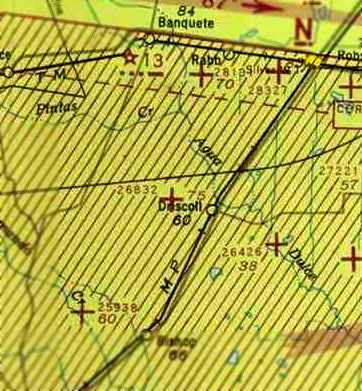
NOLF 26832, as depicted on the July 1943 Corpus Christi Sectional Chart (courtesy of David Brooks).
Naval Outlying Landing Field #26832 was one of a large number of satellite airfields built during WW2
to support Navy flight training in the Corpus Christi area.
Field #26832 may have been constructed at some point in 1943,
as it was not yet depicted on the February 1943 Corpus Christi Sectional Chart (courtesy of Jim Stanton).
The earliest depiction which has been located of Naval Outlying Landing Field #26832
was on the July 1943 Corpus Christi Sectional Chart (courtesy of David Brooks).
It depicted NOLF 26832 as an auxiliary airfield.
Brian Rehwinkel reported, “According to a 1943 Navy memo, this field consisted of 250 acres of land.
During most of its use during WWII, Field # 36/ Designation 26832 was assigned to NAAS Cuddihy Field.”
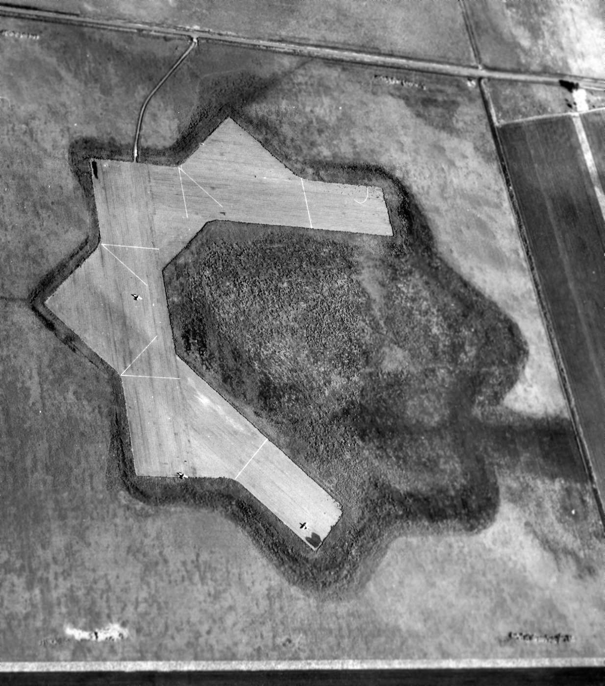
The earliest photo which has been located of Corpus OLF Field 36 was a 12/14/44 US Navy aerial view looking north (from the National Archives, courtesy of Brian Rehwinkel).
It depicted Field 36 as having 4 asphalt runways, making up half of the 8 runway layout which had been cleared.
Note the presence of 3 single-engine aircraft on the runways.
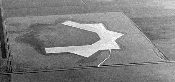
A circa 1940s aerial view looking south at Corpus OLF Field 36 (courtesy of Brian Rehwinkel).
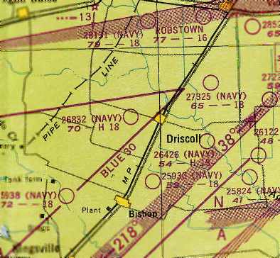
"26832 (Navy)” was still depicted as an active airfield
on the 1949 Corpus Christi Sectional Chart (courtesy of Chris Kennedy).
It was described as having an 1,800' hard-surface runway.
NOLF 26832 was evidently closed at some point between 1949-50,
as it was not longer depicted at all on the February 1950 Corpus Christi Sectional Chart.
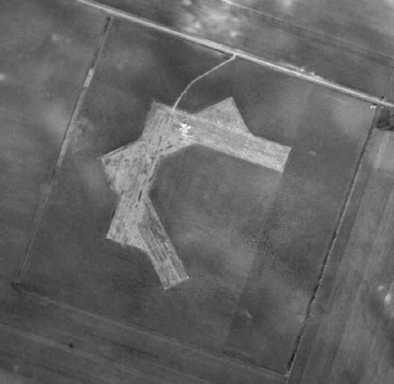
A 12/22/1951 aerial photo of In the photo of Field # 36 / OLF 26832 (courtesy of Brian Rehwinkel).
Brian observed, “You see the repeat of the partial star-shaped runway layout.”
The field had a total of 4 runways. There did not appear to be any buildings at the site.
Also note the “36” - the field # painted in large numerals.
Brian observed, “Similar to the Pensacola area fields, the large concentration of training fields necessitated the marking of fields for pilots.”
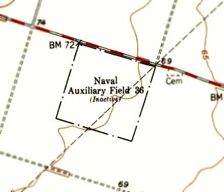
Field 36 NOLF 26832 was evidently abandoned by the Navy at some point between 1949-44,
as it was labeled as “Naval Auxiliary Field 36 (Inactive)” on the 1954 USGS topo map.
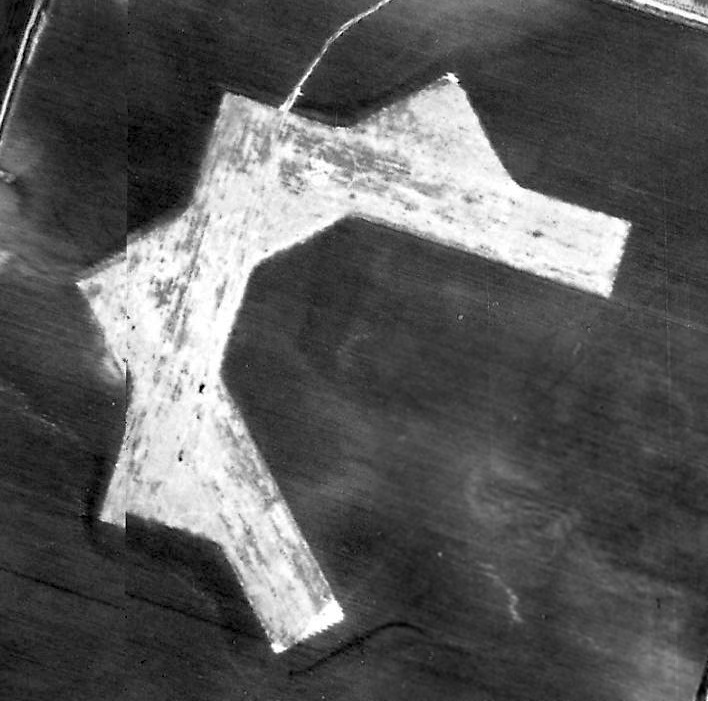
The last photo which has been located showing the airfield pavement of OLF 26832 was a 1955 USGS aerial view.
A 1960 USGS aerial view showed the NOLF 26832 pavement had been removed, but the ghosted trace of the runways was still recognizable.
NOLF 26832 was no longer depicted at all on the July 1969 Brownsville Sectional Chart (courtesy of Chris Kennedy)
nor on the 1969 USGS topo map.
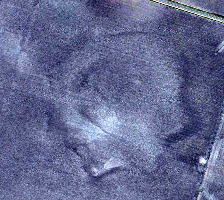
The last photo which has been located showing the slightest recognizable race of the OLF 26832 runways was a 11/2/09 aerial view.
No trace of the OLF 26832 runways was still perceptible in an 11/22/11 aerial photo.
The site of Field #26832 is located southeast of the intersection of Route 665 & CR-85.
____________________________________________________
Corpus Christi Airport (original location) / Cliff Maus Airport, Corpus Christi, TX
27.77, -97.44 (Southwest of Houston, TX)
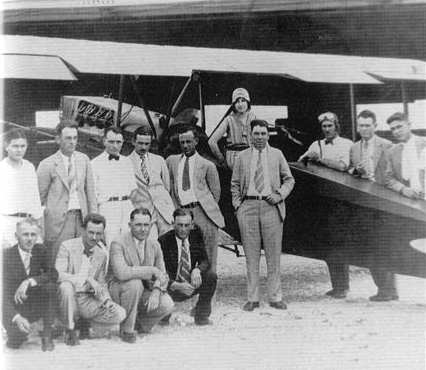
A 1929 photo of the first meeting of the Corpus Christi Aero Club,
founded by Cliff Maus & R. J. Roberts (courtesy of Steve Cruse).
According to the 2/20/02 issue of the Corpus Christi Caller-Times,
Corpus Christi didn't get around to building its first airport until 1928.
That was after Charles Lindbergh flew over Port Aransas on his "goodwill hop" from Washington to Mexico City.
Lindbergh could have landed in Corpus Christi, city leaders thought, if there had been an airport.
Voters passed a $50,000 bond issue in 1928 to build an airport
and the city bought a 180 acre pasture off old Brownsville Road.
The airport consisted of a hangar, business office, and shell runway.
The runway had not been completed when aviator Cliff Maus landed his plane
at the new field with his business partner Bob Maverick on board.
Shortly afterwards in 1928, a new airline company moved to the airport.
It was the Texas Air Company (TAC) owned by Maus & Maverick.
It was mainly a crop-dusting operation, but on the first day at Corpus Christi the company was hired to fly 2 golfers to a tournament in San Antonio.
Maus' first crop-dusting job was on the Weil farm near the airport.
Corpus Christi also hired Maus to spray the city with mosquito insecticide.
Maus & Maverick began a flying school, the Southern Academy of Aeronautics, with lessons priced at $5 / flight.
After one month, the school graduated its first 2 pilots: J. A. Knolle & J. Luther Petty.
Regular passenger service began in 1929.
Southern Air Transport, using a 6-seater Fokker, operated between San Antonio, Corpus Christi, and Brownsville.
A round-trip flight cost $27.
By the end of 1930, the city's airport was humming, with some 250 planes (military & commercial) landing per month.
The Army Air Corps, flying out of Kelly Field in San Antonio, began using Corpus Christi as a stopover for training flights.
The airport was enlarged & 3 runways forming a large "A" were added.
Cliff Maus was named the airport manager at a salary of $250 a month.
For 3 days in 1930, an exhibition team led by Clyde "Upside Down" Pangburn gave demonstrations at the airport.
People were taken up for flights over the city for $1 each.
In 1931, a brief stop was made by Jimmy Doolittle,
who touched down for 16 minutes during his attempt to set a new speed record from Ottawa, Canada, to Mexico City.
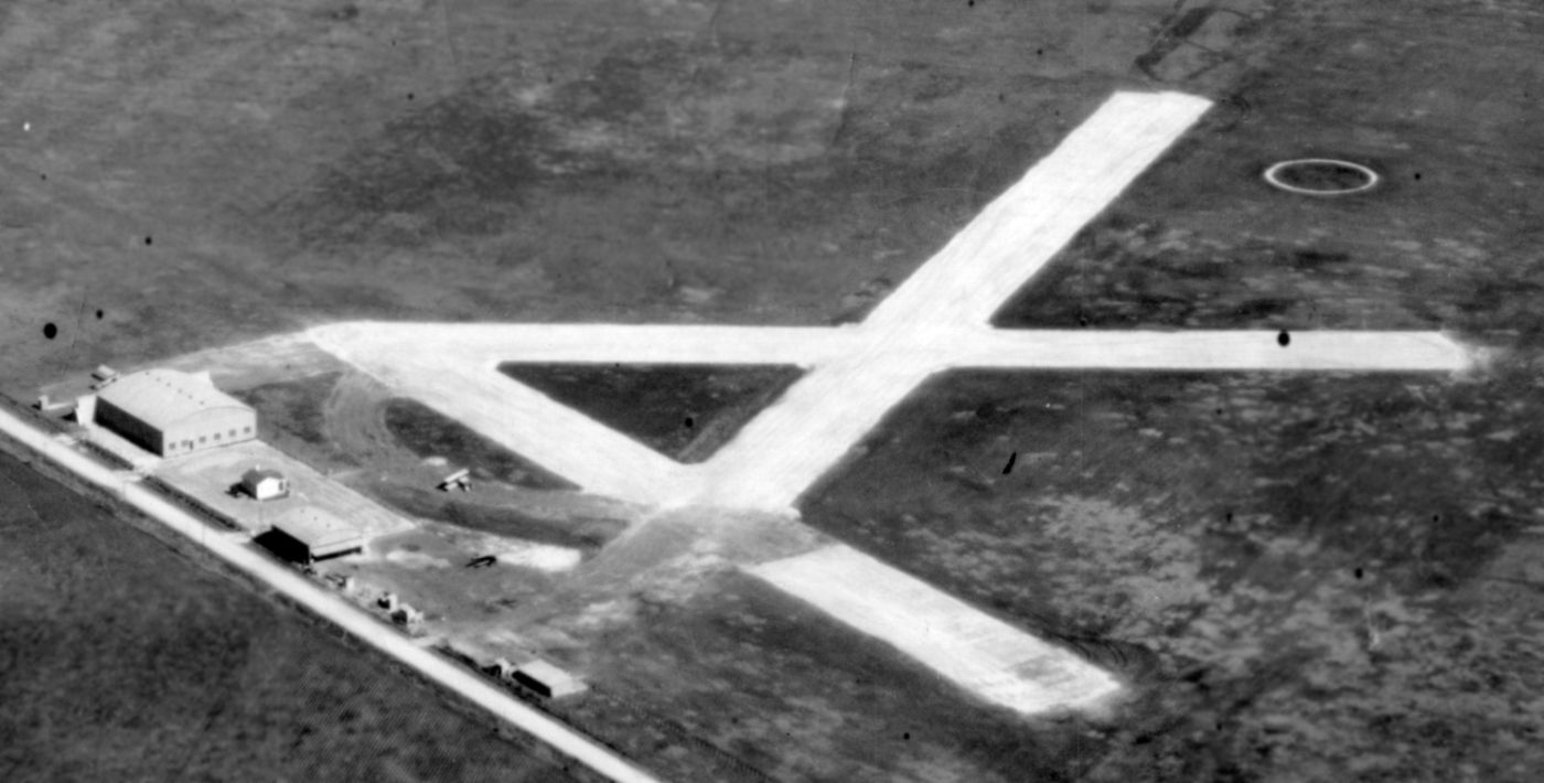
The earliest photo which has been located showing the facilities at Cliff Maus Field was a 1931 aerial view looking east (courtesy of Michael Bludworth).
It depicted Cliff Maus as having 3 runways, with 2 hangars, an office, and a biplane on the west side.

A 6/1/32 photo of bags of mail being unloaded from an American Airways 10-passenger Fairchild at Corpus Christi Municipal Airport.
This was the airport's biggest event yet, the start of air mail & passenger service to Corpus Christi.
When the Fairchild took off for San Antonio, it carried 360 pounds of mail, inaugurating regular air-mail service for Corpus Christi.
Cliff Maus left as airport manager in 1934 to take a job with Braniff Airways.
He was killed soon afterwards when his plane crashed in a thick fog on the outskirts of Fort Worth.
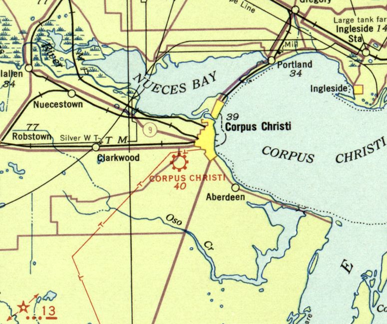
The original Corpus Christi Airport, as depicted on the August 1935 Corpus Christi Sectional Chart.
Braniff began flying out of Corpus Christi in 1935 with a 6-passenger Lockheed Vega.
Later that spring, it switched to a 10-passenger Lockheed Electric on its Dallas-Brownsville flight.
The following year, Braniff added a Corpus Christi-Houston flight.

A 1936 aerial view looking south depicted Corpus Christi Airport as having 3 runways, with 2 hangars, an office, and several small planes on the northwest side.
Eastern Air Lines began flying out of Corpus Christi in 1939.
After Cliff Maus's death, the City Council voted to change the name of the airport to Cliff Maus Municipal Airport.
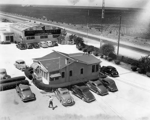
A circa 1939-40 aerial view looking west at the Cliff Maus Airport passenger terminal & Mike's Flying Service hangar.
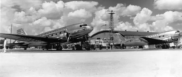
A 1940 photo of two Douglas DC-3s in front of a Cliff Maus Airport hangar & the beacon light tower.
It was labeled as Cliff Maus Airport on the June 1941 Corpus Christi Sectional Chart.
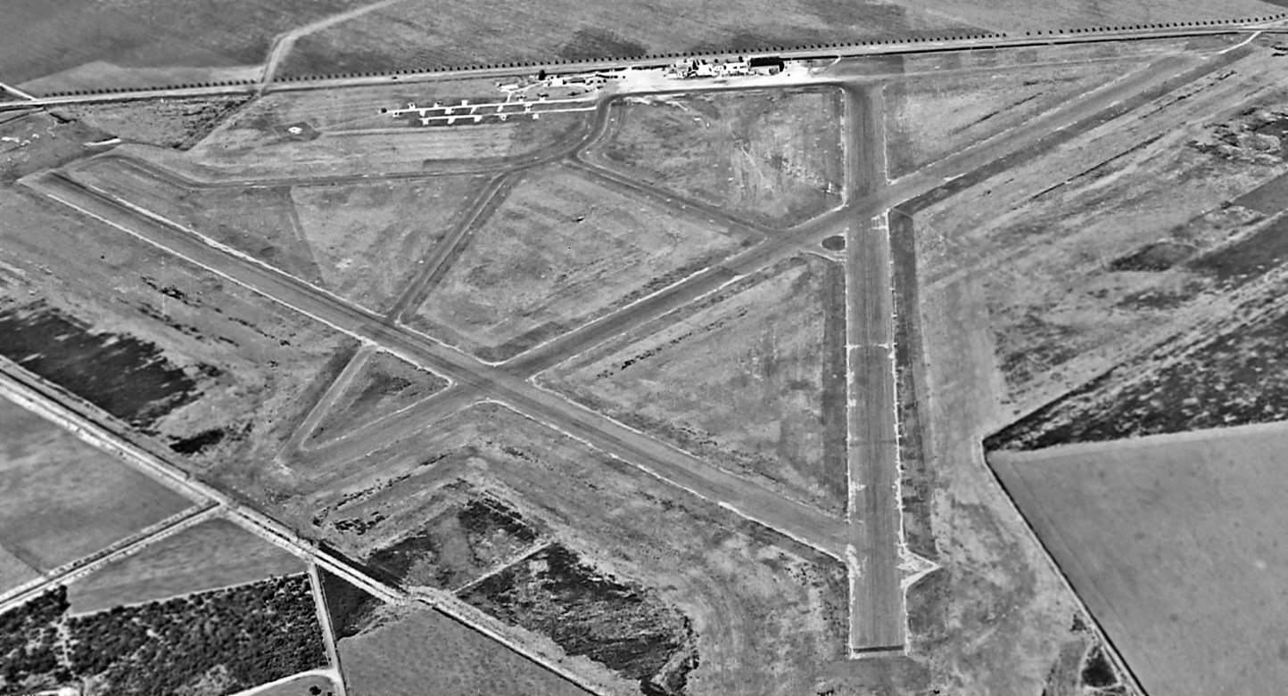
An 11/12/42 National Archives aerial view looking northwest at Cliff Maus Airport (courtesy of Brian Rehinwkel).
The field had 3 paved runways, and a ramp with some buildings on the northwest side.
Brian Rehinwkel observed, “As you can see, the field is still somewhat out in the country.
There are aircraft at the field, but it is a little difficult to see them. My guess is the Navy used this field early in the war.”
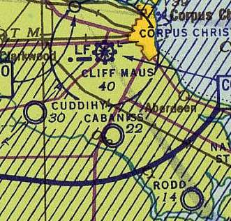
Cliff Maus Airport, as depicted on the February 1943 Corpus Christi Sectional Chart (courtesy of Jim Stanton).
David Brooks recalled, "I flew in & out of there several times on Braniff & Trans Texas before it was shut down.
It was small from my recollections, the 'long' runway being only about 4,000'.
I had a Braniff pilot friend who flew to Corpus Christi
and he complained about its small size; he flew Convair 340s.
The terminal building was very small, each carrier had about 10 feet of counter space.
Eastern, Braniff and Trans Texas were the only carriers & there were less than 20 flights per day."
In 1947, the city of Corpus Christi assumed operation of Cuddihy Field, a former WW2 Navy airfield.
Cuddihy competed with Cliff Maus, and the city considered enlarging Cuddihy & making it the city's major airport.
Many private aircraft moved to Cuddihy after 1947.
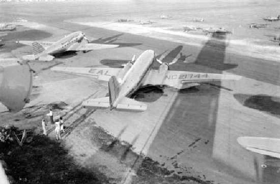
A circa 1940s photo of dignitaries boarding a DC-3 at Cliff Maus Field
for the short flight to the new Corpus Christi International Airport (courtesy of Steve Cruse).
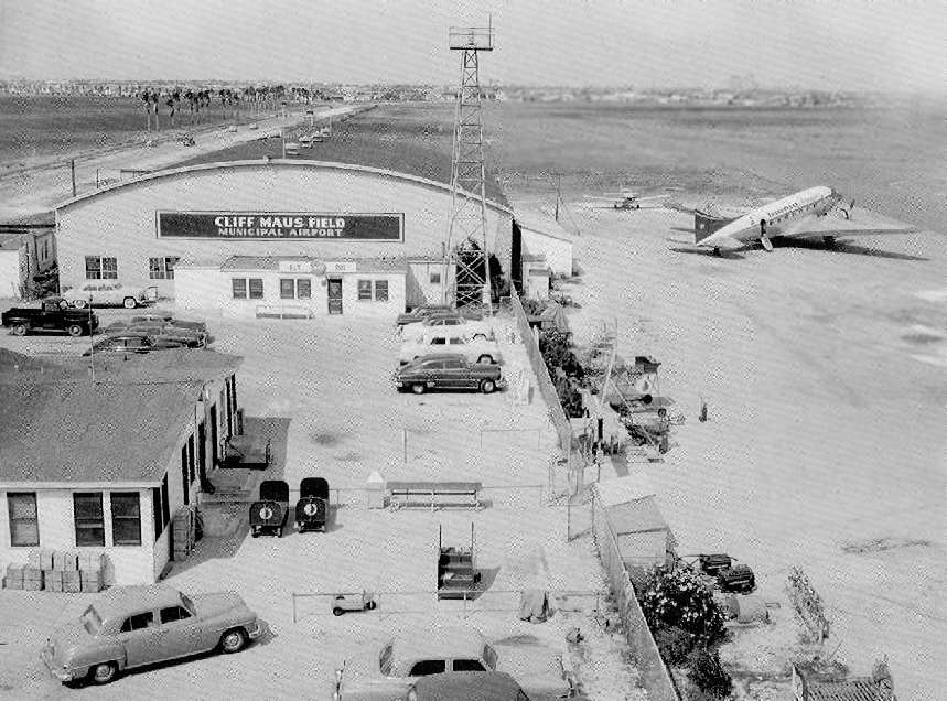
A 1949 view of a DC-3 at in front of a hangar (courtesy of Steve Cruse).
The 1949 Corpus Christi Sectional Chart (courtesy of Chris Kennedy)
described Cliff Maus Airport as having a 4,500' hard-surface runway & a control tower.
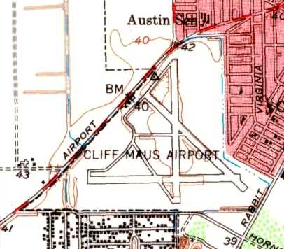
The 1951 USGS topo map depicted Cliff Maus Airport as having 3 paved runways,
taxiways, ramps, and several hangars on the northwest side of the field.
Victor Gonzalez recalled, “I was 4 years old when we moved to Airport Road & Navajo Street.
The landing / take-off patterns were right over our rooftops.
Those Convairs, DC-3s, DC-6s shook our old house on a daily basis.
At night, when there was a prevailing southern wind, they would light up our yards with their powerful landing lights.
I spent most of my spare time at the airport visiting all the buildings,
from the check-in counters to the kitchens, the hangar, the Government small building (weather bureau).
I made friends with Leslie, a porter for Braniff Airways.
I would help him sweep the DC-3s and fit new white cloth seat protectors
for some fountain soft drinks served right out of the stainless steel food & drink containers on board.
I would spent days around the airport, and also wave 'bye'
to the pilots passing north on Airport road on their way home or to the Driscoll Hotel.”
Victor continued, “One of my biggest thrills was in October of 1952,
when campaigning Richard Nixon stopped by Corpus Christi on his leased Braniff Airways DC-6.
They cut the barbed wire fence at the end of the north runway next to airport road
and made a make-shift driveway for cars to go in to the airport near the runway.
School was let out half day & I went to see the speech this man gave from a wooden platform they had constructed.
Two beautiful Braniff stewardesses were waiting by the top of the stairs to the plane waiting there.
They invited me & a friend to sit in the pilot's seat...
From the captains' seat I could look down to Mr. Nixon speaking for Dwight Eisenhower.”
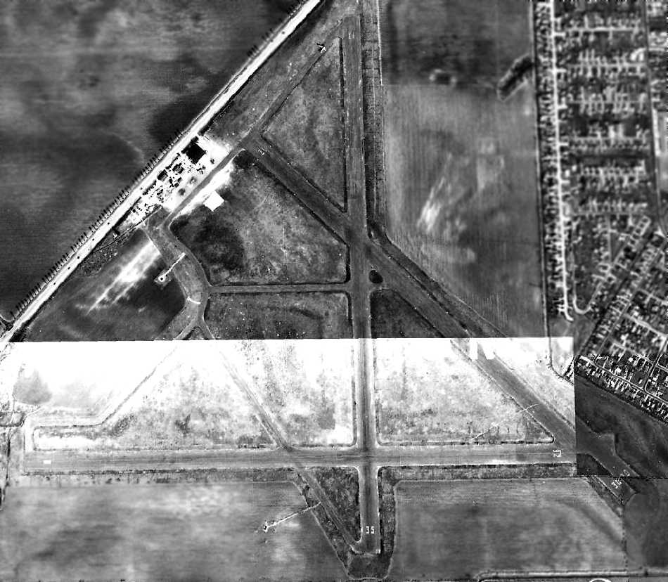
A 3/4/54 aerial view depicted Cliff Maus Field as having 3 paved runways,
with a ramp with several buildings on the northwest side.
A single aircraft was on the ramp, and a DC-3 was visible was visible on a taxiway on the north end, taxiing for takeoff on Runway 17.
In the early 1950s, the need for a larger airport became evident; there was not enough room to expand Cliff Maus.
The city began looking for a new location.
The Portland area was considered, but it was decided that this would conflict with the Navy's flight paths.
The city decided in 1955 to build a new airport in the Clarkwood area.
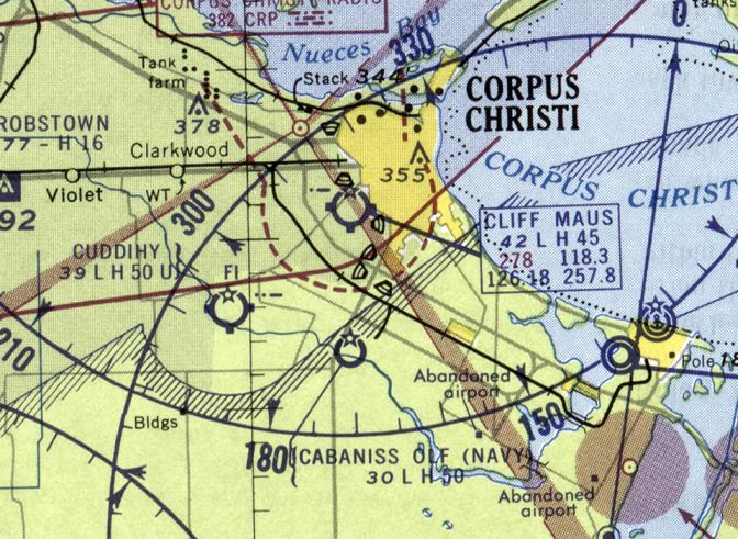
The last aeronautical chart depiction which has been located showing Cliff Maus Airport still open was on the March 1960 Corpus Christi Sectional Chart.
It depicted Cliff Maus as having a 4,500' paved runway.
Corpus Christi International Airport opened in 1960.
Mayor Ellroy King & Eastern Airlines President Eddie Rickenbacker were flown on a DC-3
for the short flight from Cliff Maus Field to the new Corpus Christi International Airport.
Cliff Maus Airport presumably closed after the opening of the new field.
A 3/5/61 aerial view showed that the runways & buildings remained intact at Cliff Maus,
but the airport appeared abandoned, with no aircraft visible.
Cliff Maus Airport was still depicted on the 1964 Corpus Christi Sectional Chart (courtesy of John Voss),
although it was labeled "closed".
The Aerodromes table on the chart described the field as having a total of 3 runways,
with the longest being a 4,503' asphalt runway.
A 1967 aerial photo showed a road had been built through the center of Cliff Maus Airport, along Runway 17/35.
But the rest of the runways remained intact, along with the hangars.
In 1970, the Corpus Christi State School was opened, built on 201 acres that formerly were the site of the Cliff Maus Airport.
Kent Dyer recalled, "I used to live in Corpus Christi, and worked at the Corpus Christi State School.
The story I hear is that as TDMHMR was building the State School,
it was hampered by constantly digging up tarmac.
To this day, if you want to plant a tree, they pull out the backhoe."
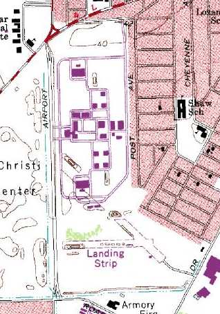
The remains of the 2 runways were still depicted along the southeast end of the airport property in the 1975 USGS topo, labeled “Landing Strip”.
A 3/5/79 aerial view showed that a golf course had begun to cover the western portion of the airport site.
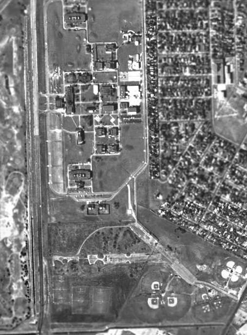
The remains of the 2 runways at the southeast end of the former airfield were still visible in the 2002 USGS aerial photo.
Several ball fields had been built among the remains of the runways.
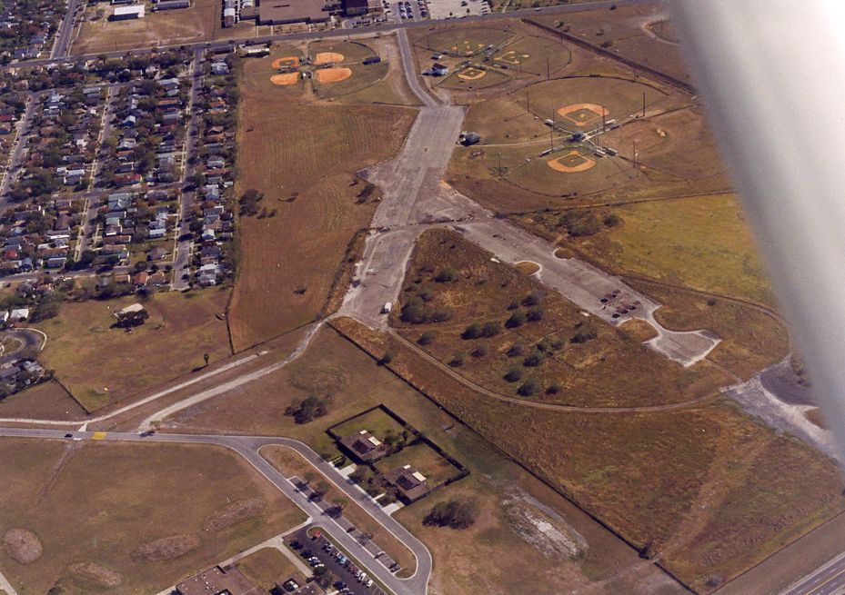
A 2003 aerial view by Dick Merrill looking southeast along the remains of 2 runways at the site of Cliff Maus Airport.
As of 2004, one of the 3 buildings on the northwest side of the airport property appears to date from its airport days,
but all of the hangars had been removed at some point between 1967-2004.
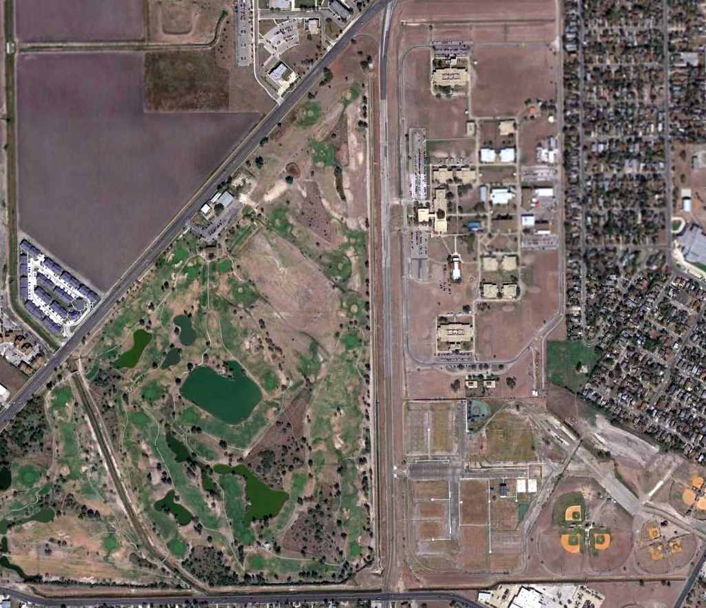
An 11/22/11 aerial photo showed Airport Road passing over the alignment of Cliff Maus Airport's Runway 17/35,
and remains of 2 runways at the southeast end of the former airfield were still recognizable.
The southern portion of the former airport is labeled "Airport Park" on recent street maps.
The site of Cliff Maus Airport is located southeast of the intersection of Old Brownsville Road & Airport Road,
appropriately enough.
____________________________________________________
Cuddihy Naval Auxiliary Air Station / Cuddihy Field Airport (07TE), Corpus Christi, TX
27.72, -97.51 (South of Corpus Christi International Airport, TX)
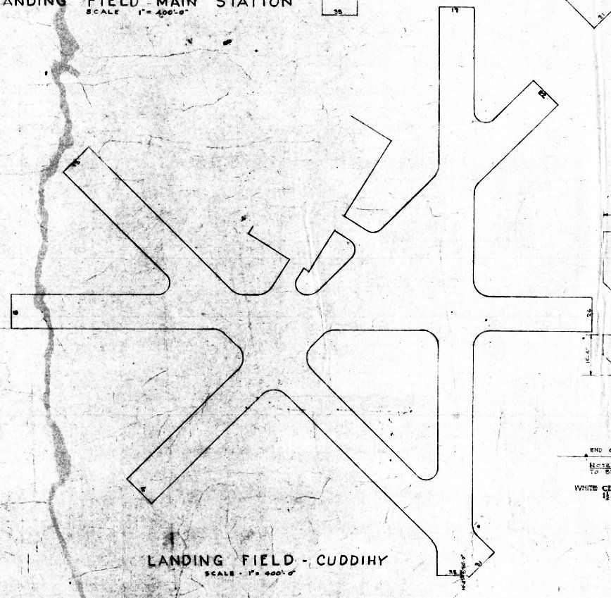
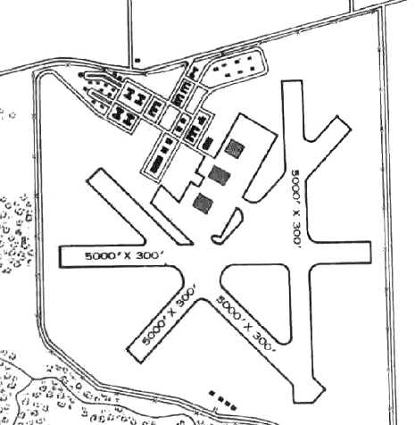
A 4/23/40 plan for Cuddihy Field (courtesy of Jonathan Smith).
This airfield was used during WW2 as one of 3 satellite fields for Corpus Christi NAS,
which conducted primary & advanced flight training for American cadets & those of several foreign countries.
The date of construction of Cuddihy Field has not been determined.
The earliest depiction which has been located of Cuddihy Field was a 4/23/40 plan (courtesy of Jonathan Smith).
It depicted Cuddihy as having 4 paved runways & a large paved ramp area on the north side.
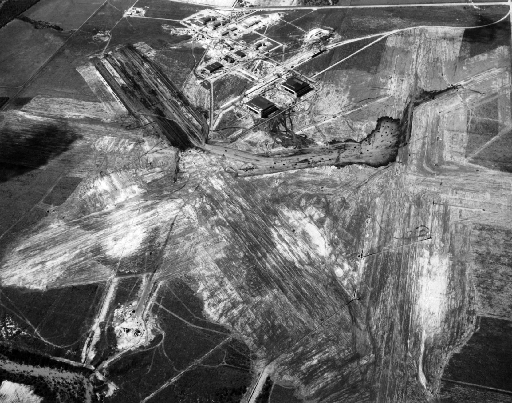
The earliest photo which has been located of Cuddihy Field was a 5/9/41 USN aerial view looking north (courtesy of Jonathan Smith).
It depicted Cuddihy still under construction, with 2 of the the hangars & some buildings having been built, but the runways still being cleared.
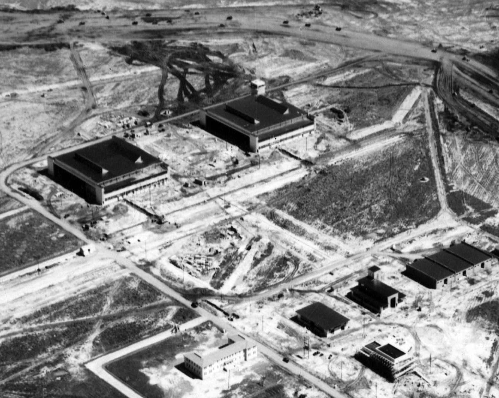
A 5/9/41 USN aerial view looking south (courtesy of Jonathan Smith) showing 2 of Cuddihy's hangars (1 with the control tower) & some other buildings having been built.
Cuddihy Field was not yet depicted on the June 1941 Corpus Christi Sectional Chart.
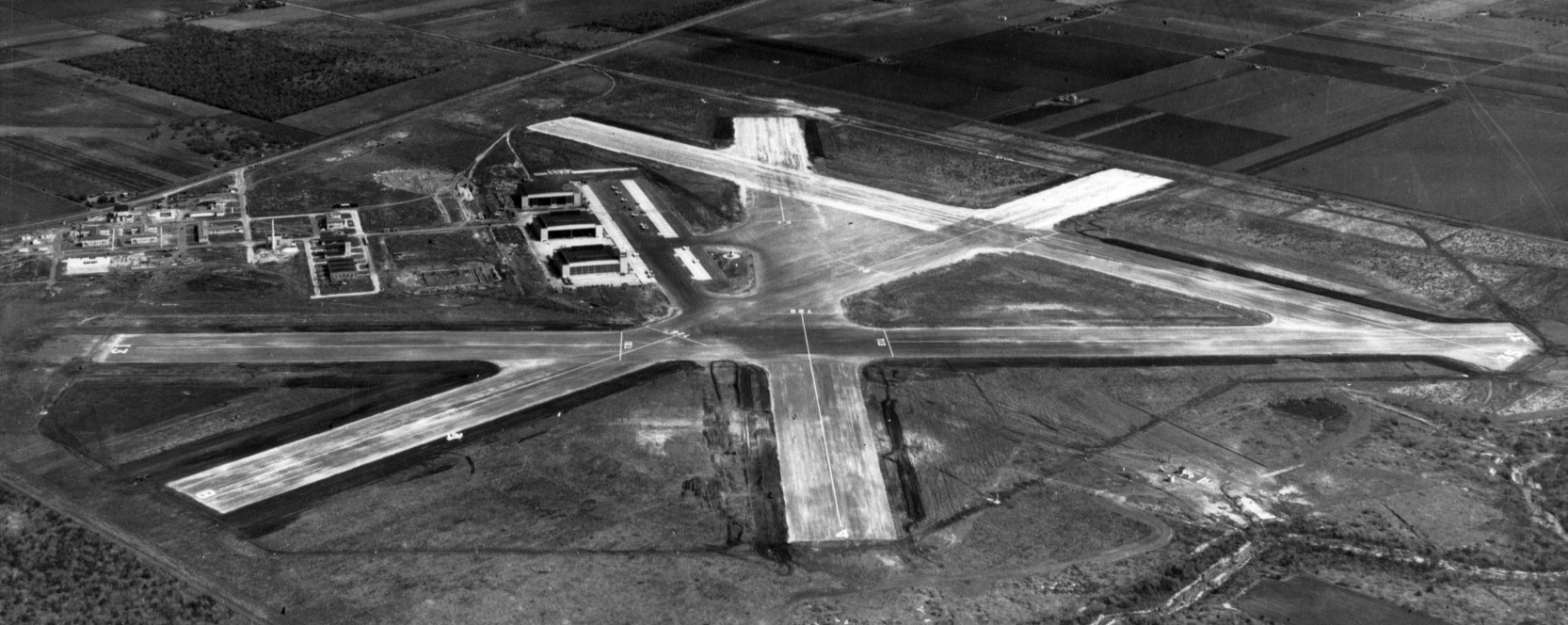
A 12/6/41 USN aerial view looking east (courtesy of Jonathan Smith) showed Cuddihy Field having been completed within the past 7 months, including the 3rd hangar, paved ramp, and 4 paved runways.

The earliest aeronautical chart depiction of Cuddihy Field which has been located
was on the February 1943 Corpus Christi Sectional Chart (courtesy of Jim Stanton).
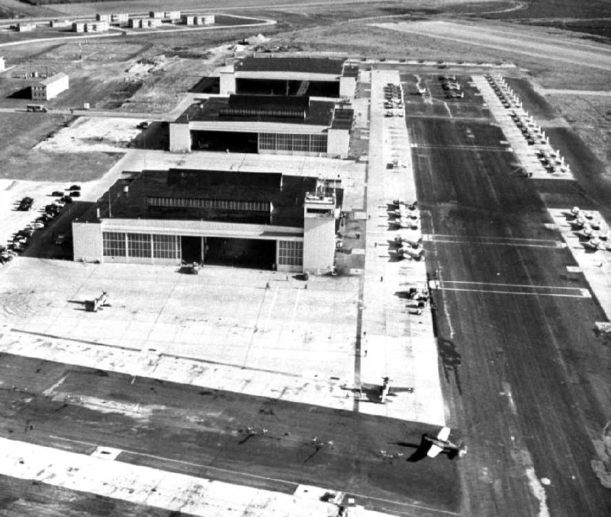
A WW2-era aerial view looking northeast at the 3 Cuddihy hangars, with large numbers of Navy single-engine aircraft parked on the ramp.
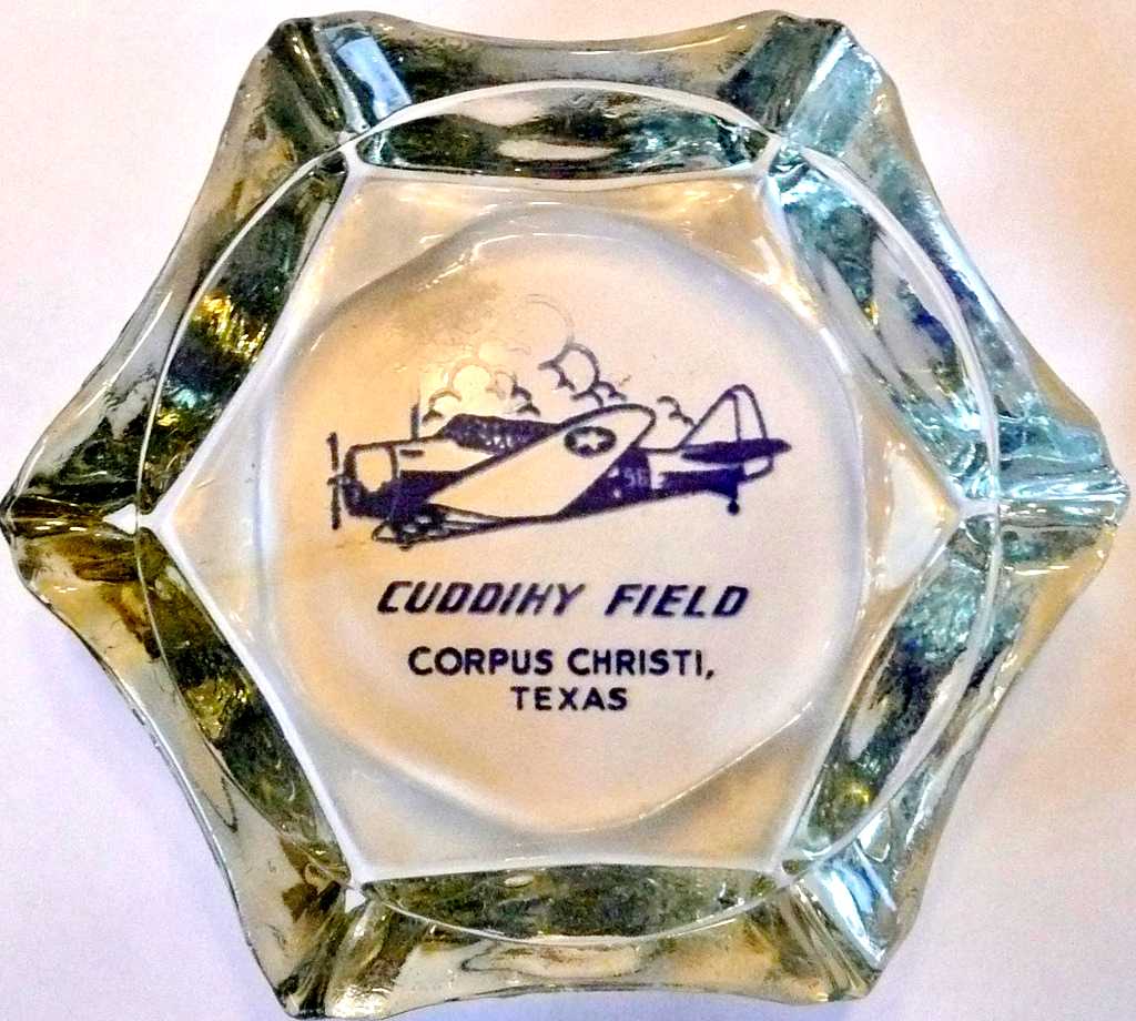
A circa 1940s ashtray from Cuddihy Field.
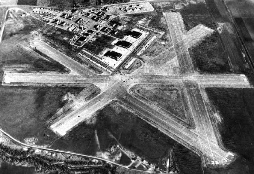
A 1944 aerial view looking north at Cuddihy (National Archives photo).
The 1945 AAF Airfield Directory (courtesy of Scott Murdock) described Cuddihy Field
as an 803 acre irregularly-shaped field having 4 asphalt 5,000' runways.
The field was described as having 3 steel 96' x 28' hangars.
Cuddihy was listed as having a total of 7 outlying fields: 27221 Outlying Field #30 (6 mi W), 28523 Outlying Field #31 (7.9 mi NW),
27325 Outlying Field #32 (10 mi W), 28327 Outlying Field #33 (11 mi WNW), 26426 Outlying Field #34 (12 mi WSW),
28131 Outlying Field #35 (16 mi WNW), and 26832 Outlying Field #36 (17 mi W).
Cuddihy was closed at an unknown date after WW2.
It was used for a few months in 1947 as the temporary campus
of the Arts & Technological College (later to become Texas A & M University at Corpus Christi).
In 1947, the city of Corpus Christi assumed operation of Cuddihy Field,
and it began to be used as a civil airport.
Most private aircraft were moved from Corpus Christi's Cliff Maus Airport to Cuddihy Field in 1947.
The 1949 Corpus Christi Sectional Chart (courtesy of Chris Kennedy)
described Cuddihy Field as having a 5,000' hard-surface runway & a control tower.
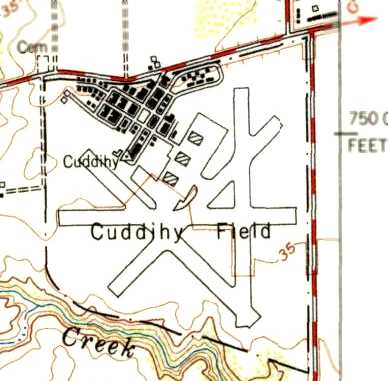
The 1954 USGS topo map depicted Cuddihy Field as having 4 paved runways, 3 hangars, and a large number of buildings.
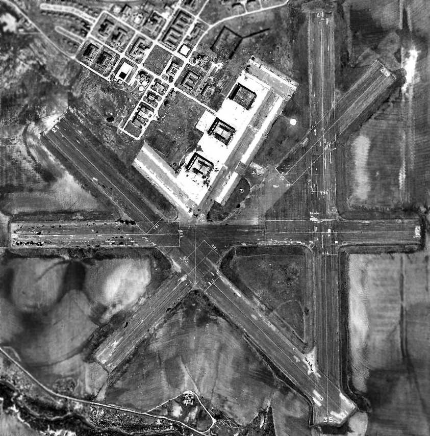
A 3/4/56 aerial view depicted at least 4 aircraft on the ramp at Cuddihy Field.
The runways appeared to be painted with markings subdividing them into aircraft carrier practice outlines.

The March 1960 Corpus Christi Sectional Chart depicted Cuddihy Field as having a 5,000' paved runway.
A December 1961 aerial view no longer showed any aircraft on the field at Cuddihy, but all 4 runways remained largely intact.
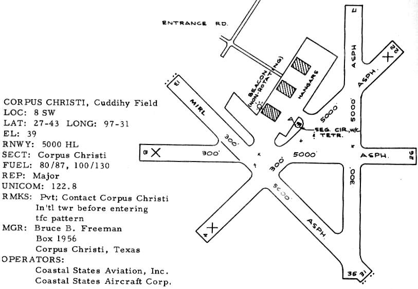
Cuddihy had become a private airfield by 1963, as that is how it was listed in the 1963 TX Airport Directory (courtesy of Steve Cruse).
It depicted Cuddihy as having 2 of the 4 original runways still maintained.
The operators were listed as Coastal States Aviation Inc & Coastal States Aircraft Corp.
The last photo which has been located showing aircraft at Cuddihy Field was a 1968 aerial view,
which showed 5 light single-engine aircraft parked near the southwestern hangar,
and all 4 runways remained intact, although deteriorated.
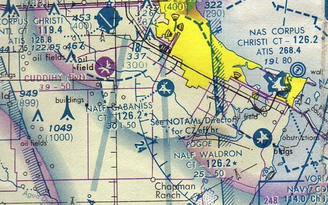
The July 1979 Brownsville Sectional Chart (courtesy of Jim Hackman) depicted Cuddihy as a private field having 4 paved runways.
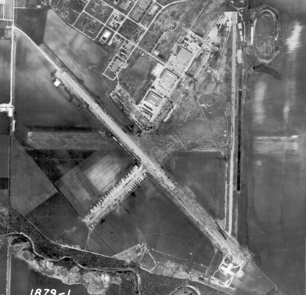
A 3/19/79 aerial view (courtesy of Jonathan Smith) showed that Cuddihy's Runways 4/22 & 8/26 had been removed at some point between 1967-79.
Two light aircraft appeared to be parked near a post-WW2 hangar on the northwest side of Runway 13.
The 1982 AOPA Airport Directory (courtesy of Ed Drury) described Cuddihy as a private field with a single 5,000' asphalt Runway 13/31.
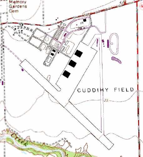
The 1989 USGS topo map depicted Cuddihy Field as having one full-width runway (13/31),
whereas the former Runway 17/35 was shown as being considerably narrower than its original width.

A 1990 photo by John Voss of the 3 ex-Navy hangars at Cuddihy.
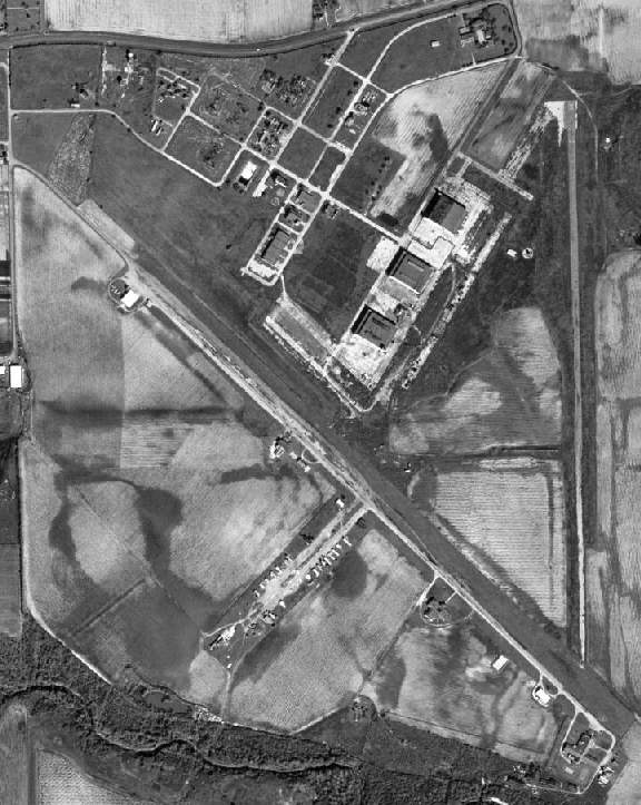
A 1995 USGS aerial photo showed Cuddihy Field's ramp area to be in very poor condition, but all 3 hangars were still standing.
Only one runway was still maintained (13/31, 5,000' long), but appeared to be in poor condition.
The north/south runway still existed, in a similar state.
All of the east/west runway & most of the northeast/southwest runway had been broken up.
A small civilian hangar had been built at some point between 1968-95 adjacent to the northwest side of Runway 13/31.
According to Jeffery Sternberg (who visited Cuddihy in 2001),
numerous small industrial buildings lined the remaining active runway.
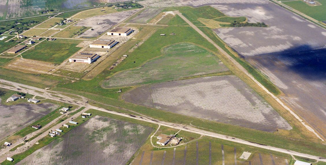
A 2003 aerial view by Dick Merrill looking northwest at the 3 hangars & other remains of Cuddihy Field.
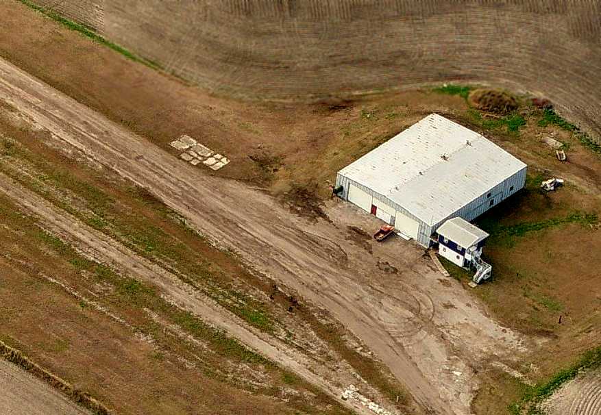
A circa 2006 aerial view looking south at the civilian post-WW2 hangar adjacent to Cuddihy's Runway 31/31.
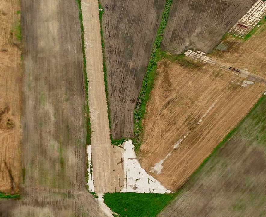
A circa 2006 aerial view looking south at the remains of Cuddihy's Runway 17 pavement.
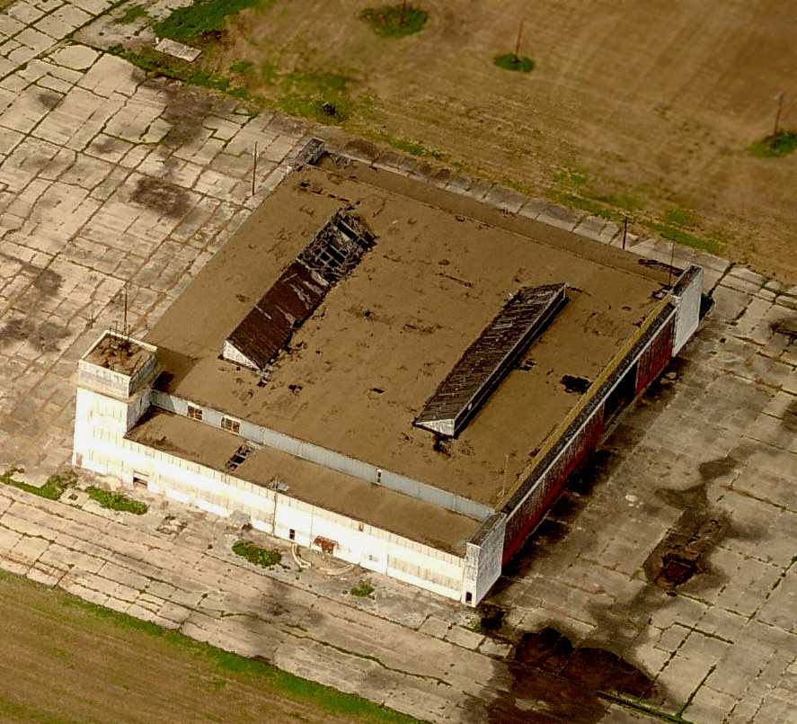
A circa 2006 aerial view looking west at the southern-most of Cuddihy's 3 hangars, with the attached control tower.
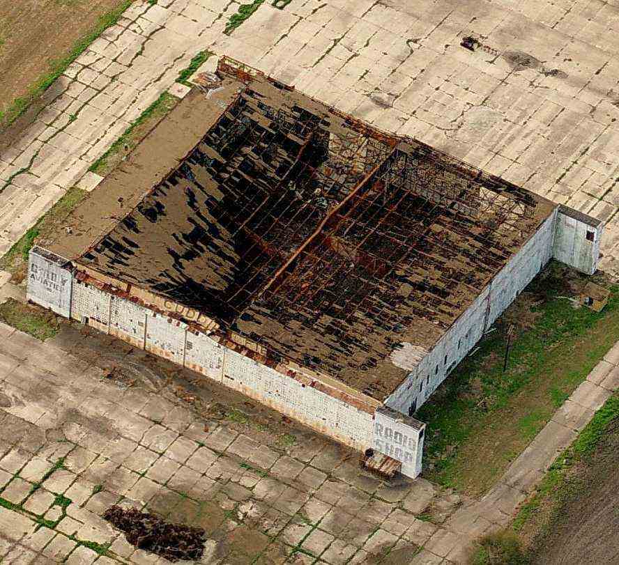
A sad sight for anyone with an appreciation of our nation's aviation history -
a circa 2006 aerial view looking south at the northern-most of Cuddihy's 3 hangars, which has had most of its roof caved in.
Note the lettering “Cuddihy Field” along the top of the near side of the hangar,
as well as the lettering on the sides, which appear to say “Cuddihy Aviation” (?) & “Radio Shop”.
As of 2008, Cuddihy was still listed as an active private airfield, Cuddihy Field Airport,
with a single 5,000 asphalt Runway 13/31.
The owner was listed as Jimmy Adair, with one multi-engine aircraft based at the field.
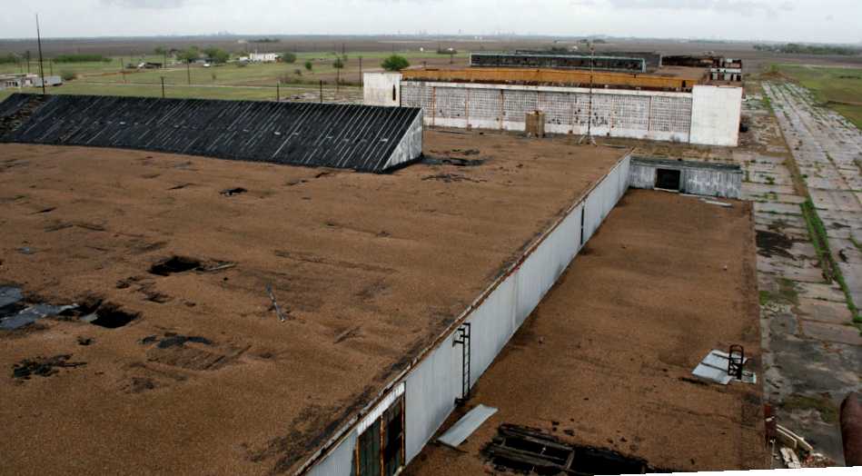
A 12/22/09 view above the deteriorating hangars at Cuddihy.
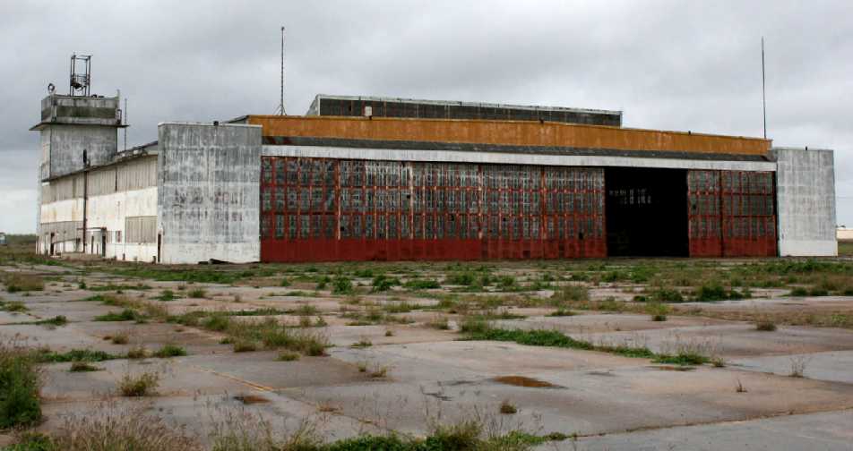
A 12/22/09 view of a hangar with the control tower at Cuddihy.
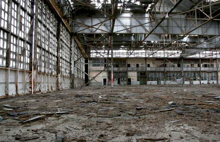
A 12/22/09 interior view of a deteriorating Cuddihy hangar.
What a crime to see all this aviation infrastructure just wasting away.
A 2010 aerial photo showed Cuddihy's 3 ex-Navy hangars were still erect.
A 2012 aerial photo showed all 3 of Cuddihy's ex-Navy hangars had been removed at some point between 2010-2012.
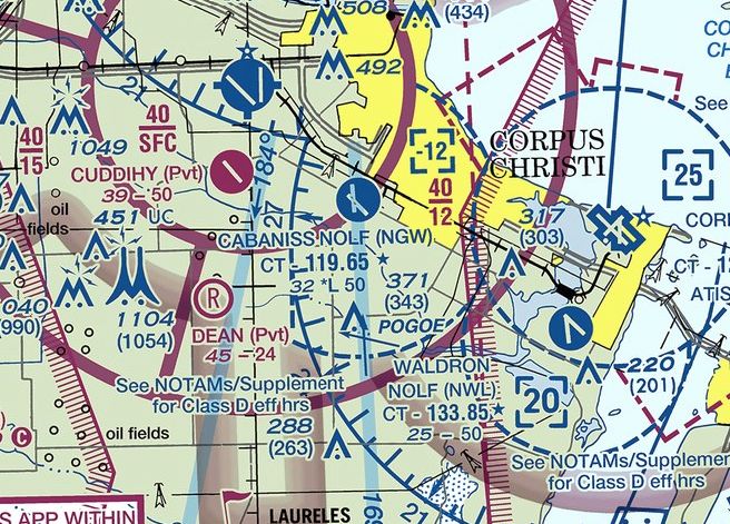
The 2016 Brownsville Sectional Chart depicted Cuddihy Airfield as having a single 5,000' paved runway.
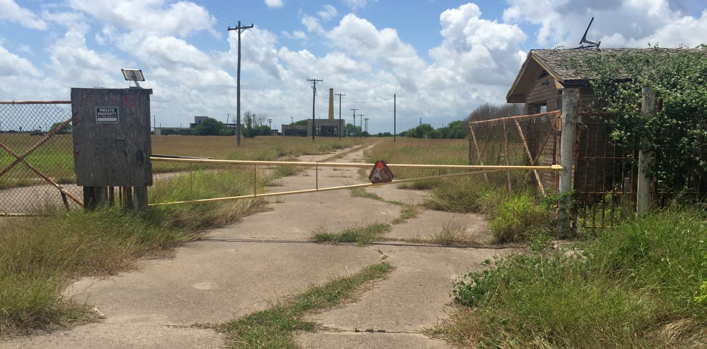
A 4/14/17 photo by Paul Freeman looking southwest at the former Cuddihy gate & guard shack, with other former base buildings visible in the background.

A 4/14/17 photo by Paul Freeman looking north at the foundations of Cuddihy's 3 Navy hangars.
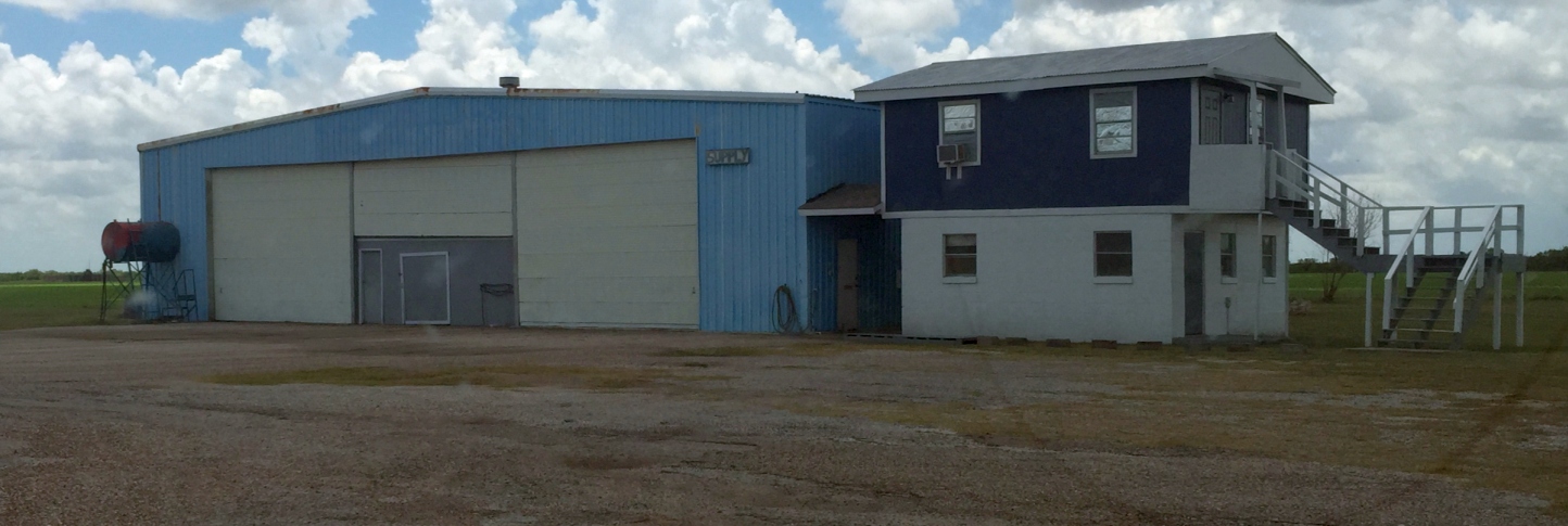
A 4/14/17 photo by Paul Freeman looking west at at the civilian post-WW2 hangar adjacent to Cuddihy's Runway 31/31.
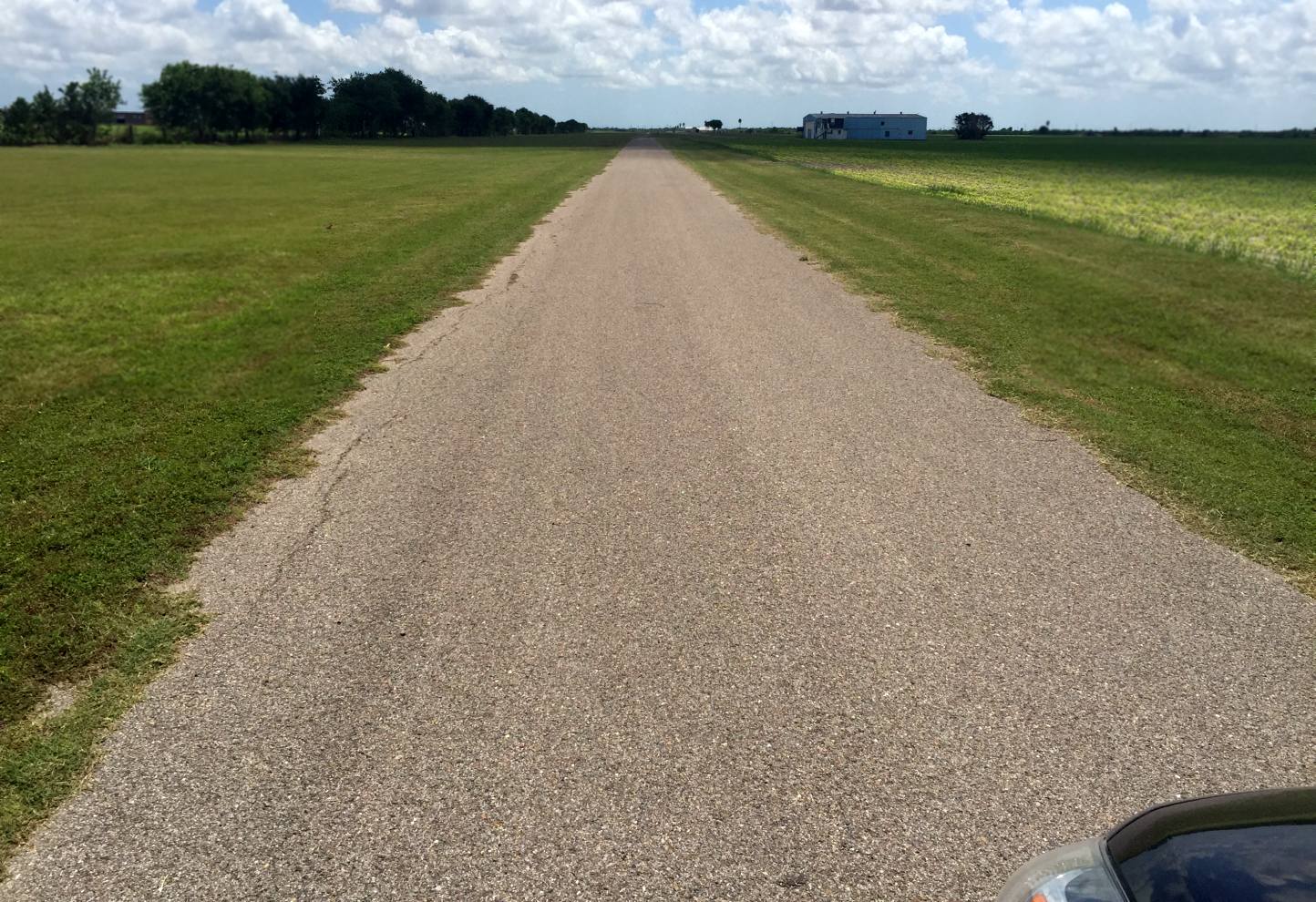
A 4/14/17 photo by Paul Freeman looking southeast along the remains of Cuddihy's Runway 13.
____________________________________________________
Rodd Naval Auxiliary Air Station, Corpus Christi, TX
27.65, -97.38 (Southeast of Cabanis NOLF, TX)
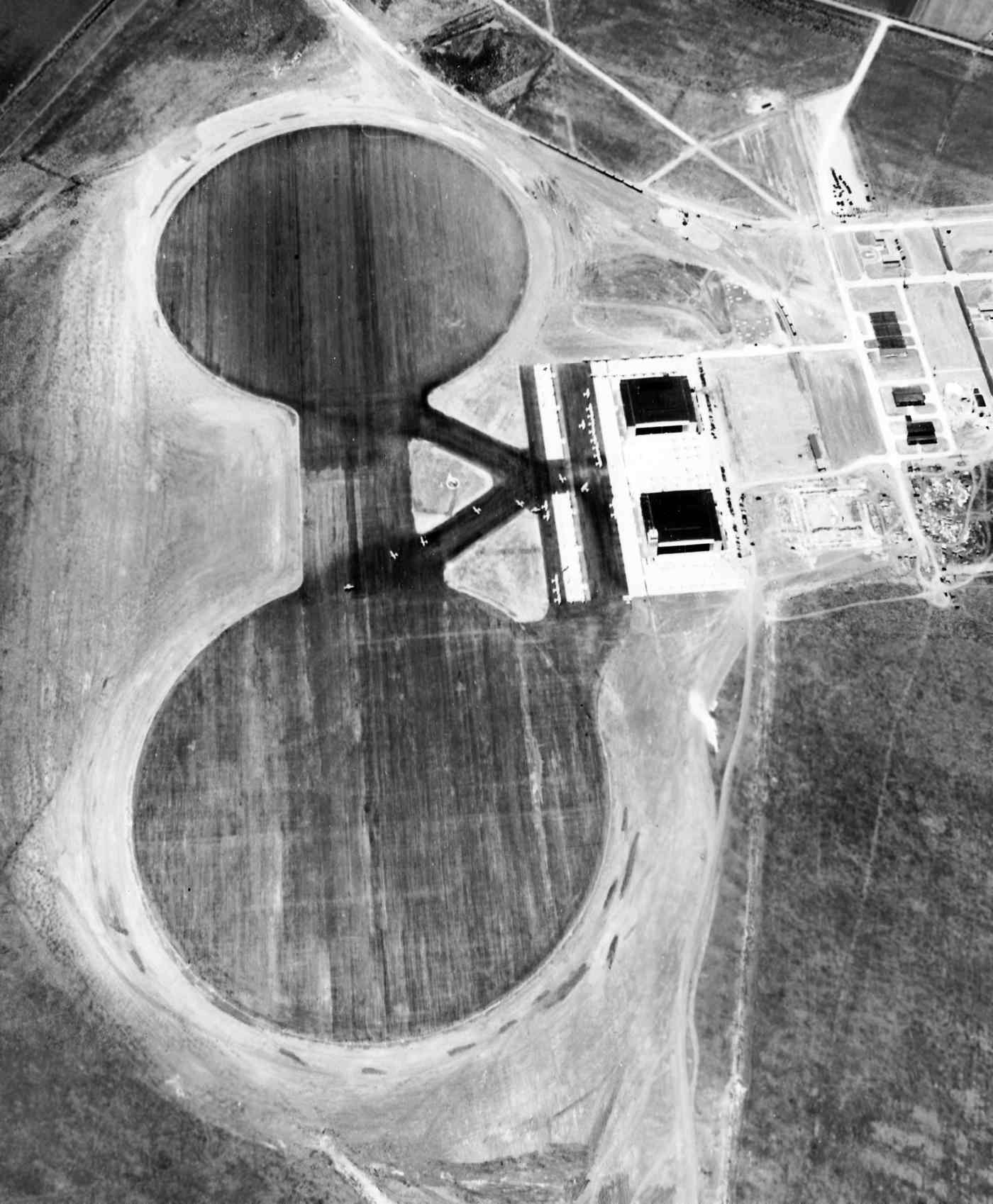
A remarkable 8/19/41 aerial view looking north at Rodd Field in its original configuration (from the National Archives, courtesy of Brian Rehwinkel).
The federal government acquired 861 acres on this site in 1940, and activated Rodd Field in 1941.
Rodd Field was used for Naval Cadet flight training
& as an auxiliary landing field for the nearby Naval Air Station Corpus Christi.
Rodd Field was not yet depicted on the June 1941 Corpus Christi Sectional Chart.
The earliest depiction which has been located of Rodd Field was an 8/19/41 aerial view (from the National Archives, courtesy of Brian Rehwinkel).
It depicted Rodd Field in its primary training days, in its original airfield configuration,
with 2 large circular asphalt landing mats, and and ramp with 2 hangars on the east side.
Brian Rehwinkel observed, “There were no runways yet.
This was very similar to NAAS Bronson Field in Pensacola (2 landing mats) & NAAS Cecil Field (a single landing mat) in Jacksonville…both fields originally had only landing mats.”
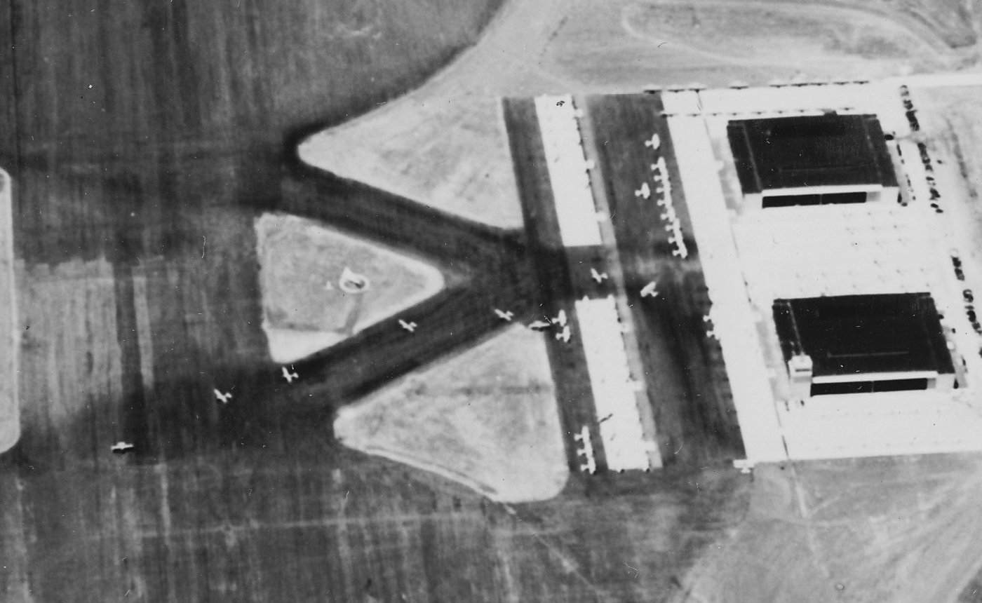
A close-up from the 8/19/41 aerial view of Rodd Field (from the National Archives, courtesy of Brian Rehwinkel),
showing several dozen Navy trainers on the ramp, and a stream of several heading out onto the landing mat.
Brian Rehwinkel observed, “I believe the runways were added to Rodd Field in 1942.”
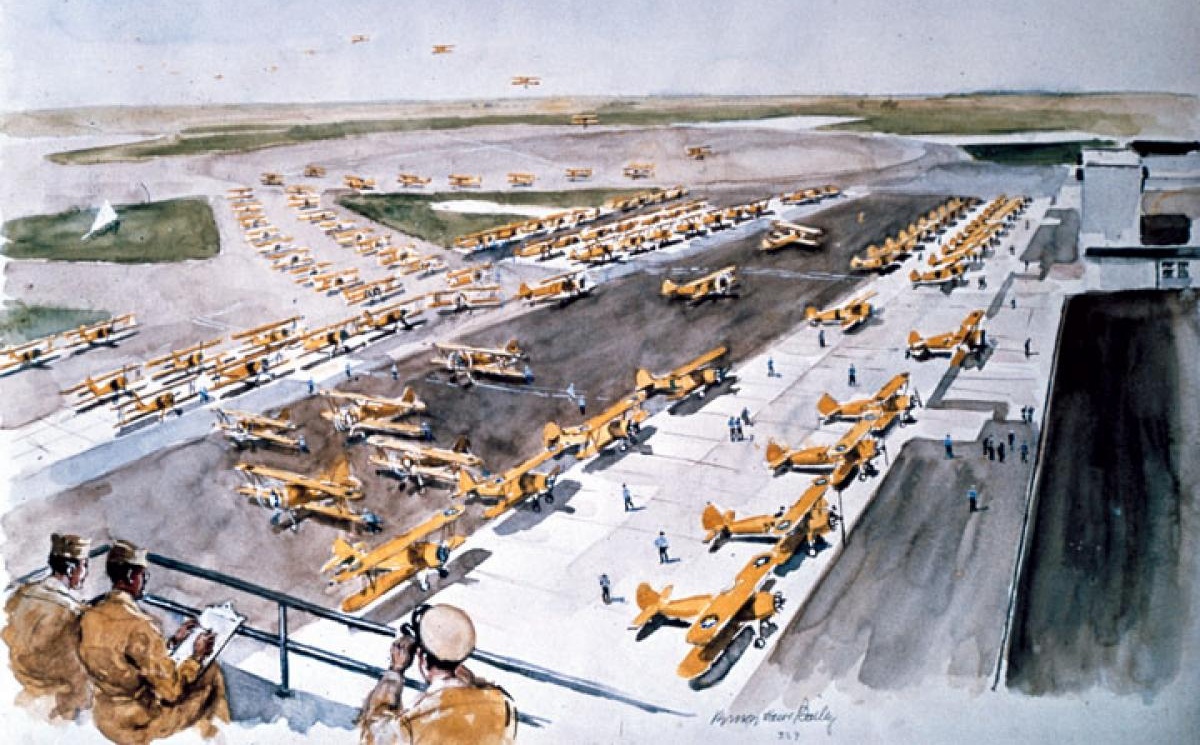
A watercolor by Vernon Bailey of a 1942 scene of a huge number of Naval Aircraft Factory N3N-3 biplane trainers filling the Rodd Field ramp.
Rodd Field eventually consisted of a total of 4 paved 6,100' runways,
taxiways, a ramp area, 3 hangars, and a street grid with a total of 75 buildings.
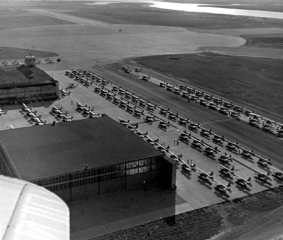
A December 1942 aerial view looking southwest at the Rodd Field ramp (courtesy of Gerry Asher),
showing over a hundred biplane trainers, along with hangars, a control tower, runways, and the circular landing mat.
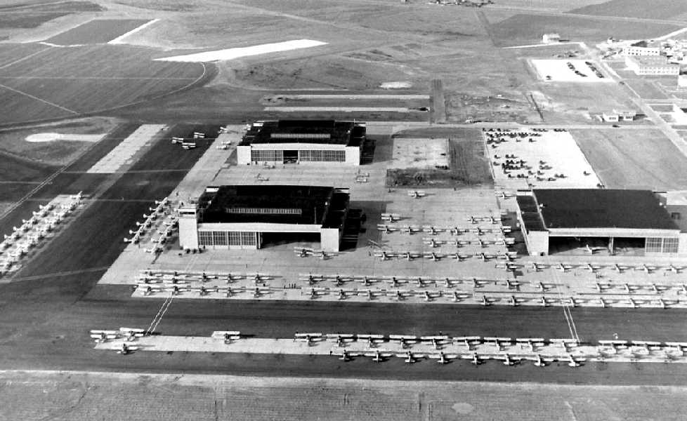
A December 1942 aerial view looking west at the Rodd Field ramp (courtesy of Gerry Asher),
showed a huge assemblage of biplane trainers, along with 3 hangars, a control tower, runways, and the circular landing mat.

The earliest aeronautical chart depiction of Rodd Field which has been located
was on the February 1943 Corpus Christi Sectional Chart (courtesy of Jim Stanton).
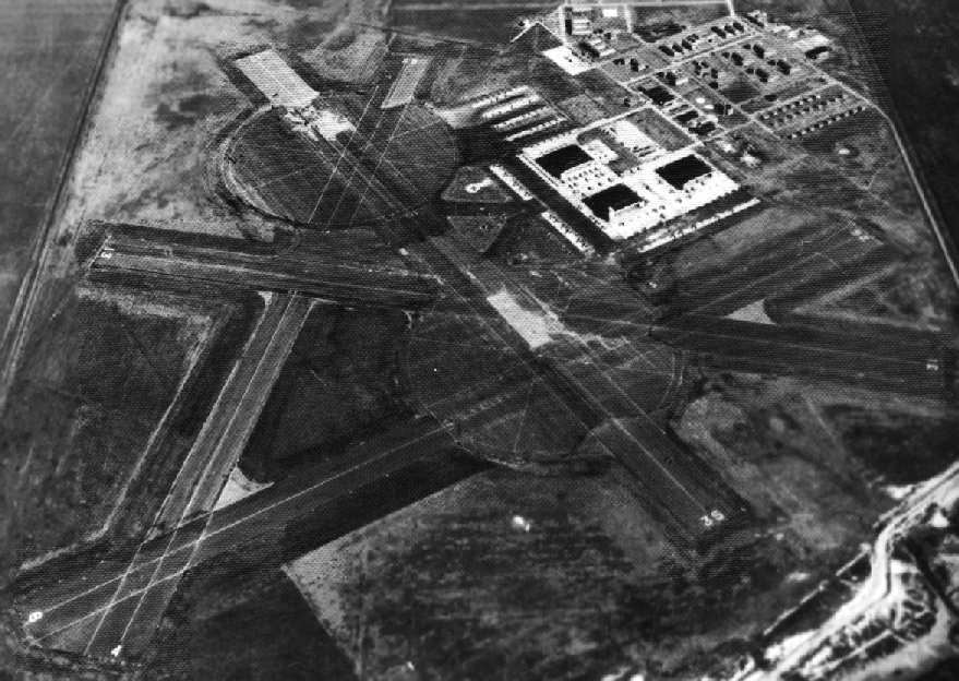
A 1944 aerial view looking northeast at Rodd Field (National Archives photo).
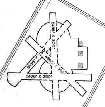
The 1945 AAF Airfield Directory (courtesy of Scott Murdock) described Rodd Field
as a 861 acre irregularly-shaped field having 4 bituminous runways, the longest being the 5,138' north/south & northeast/southwest strips.
The diagram also depicted 2 paved circular landing mats.
The field was described as having 3 steel & metal 200' square hangars,
Rodd was listed as having a total of 9 outlying fields:
24311 Outlying Field #1A (3.1 mi SW), 22514 Outlying Field #1B (6.5 mi WSW),
21811 Outlying Field #1C (5 mi S), 22215 Outlying Field #1D (8.5 mi SSW),
22912 Outlying Field #10 (5 mi SSW), 23416 Outlying Field #11 (7.6 mi SW),
22521 Outlying Field #14 (14 mi SW), 24025 Outlying Field #25 (17 mi WSW),
and Rockport NOLF 03022 (4.5 miles north of Rockport), which was reused as Aransas County Airport.
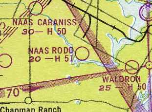
"NAAS Rodd" was still depicted as an active airfield
on the 1949 Corpus Christi Sectional Chart (courtesy of Chris Kennedy),
and was described as having a 5,100' hard-surface runway.
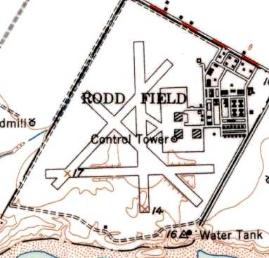
The 1951 USGS topo map depicted Rodd Field as having 4 paved runways, 3 hangars, a control tower, and numerous buildings.
A 1/22/69 article from The Beehive (courtesy of Ford Lauer) said that 2 hangars were relocated from Rodd Field to Chase Field in 1954.
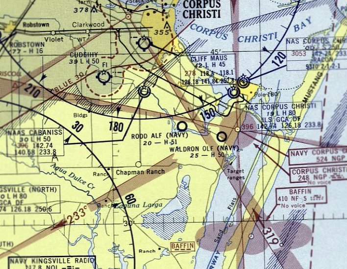
The last aeronautical chart depiction which has been located of Rodd Field was on the March 1956 Corpus Christi Sectional Chart.
It depicted "Rodd ALF (Navy)" as having a 5,100' paved runway.
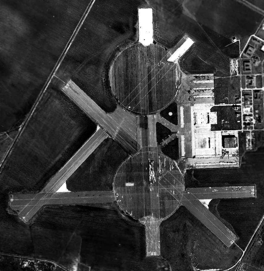
Rodd Field appeared to have been closed by the time of a 3/4/56 aerial view, as no aircraft were visible on the field,
and 2 of the 3 hangars had been removed.
The runways remained intact, consisting of 4 paved runways along with 2 giant circular landing pads.
Rodd Field was evidently closed at some point in 1956,
as it was no longer depicted on the September 1956 Corpus Christi Sectional Chart.
Rodd Field's property was declared excess in 1958.
Michael Binder reported, “After Rodd Field was declared excess in 1958, NASA came along soon after.
NASA had begun surveying locations for Mercury tracking stations, and Rodd was selected.
The remaining Navy hangar was chosen for office space & other functions, with the tracking antennae erected on the west side of the hangar roof.
These antennae were used for both Mercury & Gemini, as both were low-earth orbit missions.”
The General Services Administration sold portions of the Rodd Field property to several private parties in 1960.
The March 1960 Corpus Christi Sectional Chart depicted Rodd as “Abandoned Airfield”.
A 1961 aerial view showed no significant change in the Rodd Field remains.
Michael Binder reported, “For Apollo a much larger antenna was needed - a 30-foot dish - to communicate with a lunar-ranging vehicle.
This is when the additional land on the west side of the former NAAS was transferred by GSA to NASA, in 1964.”
GSA transferred 136 acres of the northern portion of the base to NASA in 1964,
which established the Texas Manned Space Flight Network Tracking Station at the site.
Michael Binder reported, “While NASA was still using the old hangar, new facilities were built to the north of the hangar by 1967.”
The Texas MSFN Tracking Station opened in 1967, and was operated by the Bendix Field Engineering Corporation.
The station's administrative offices were located in the last former Navy hangar, referred to as the main operations building.
In addition to the administration offices, the hangar housed telemetry systems, command system,
computers, and other communications equipment.
Located about one mile south of the hangar was the VHF Acquisition Aid equipment.
The Unified S-Band system & power generating equipment were located a half mile north of the hangar.
During the Apollo Program, this Texas station acted as a remote station,
remoting telemetry data, tracking information, and voice communications to MCCH in Houston.
The station also acted as an uplink facility between the lunar vehicles & the MCCH Control Center.
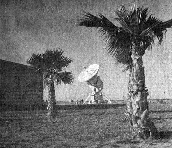
A late 1960s US Government photo of the Manned Space Flight Network Tracking Station's Unified S-Band Dish at Rodd Field.
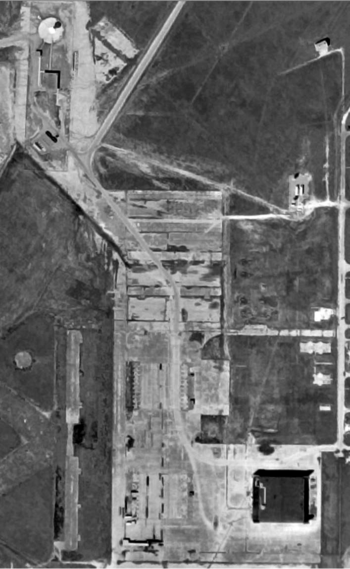
A 10/9/67 USGS aerial photo of the site of Rodd Field, showing the NASA Apollo tracking station dish antenna at upper-left,
and the NASA Mercury/Gemini antenna mountings on the west side of the last Rodd Field hangar at lower-right.
By the time of the July 1969 Brownsville Sectional Chart (courtesy of Chris Kennedy),
the airfield at Rodd was no longer depicted at all.
Michael Binder reported, “After the Skyab3 mission [1973], NASA gave up its Corpus Christi tracking station.”
The NASA facility was closed by 1974, at which point their property was transferred back to GSA.
The 1975 USGS topo map no longer depicted any runways on the property (just one remaining hangar),
and labeled the property as “NASA tracking facility”.
Tom Harper recalled, “I was assigned to the Corpus Christi Army Depot from 1975-78
and we were using the hangar on Rodd Field to store helicopter components awaiting repair & return to service.
The hangar was in bad condition at the time.
The NASA building was still there & should been saved as part of our space program history.”
The July 1979 Brownsville Sectional Chart (courtesy of Jim Hackman) no longer depicted Rodd Field, not even as an abandoned airfield.
A 1979 aerial view showed most of Rodd's runway pavement had been removed,
but the outlines of the runways were still plainly recognizable.
The Rodd property was conveyed in 1980 to the City of Corpus Christi, which built Bill Witt Park.
The park still exists today on that part of the property.
The 1984 USGS topo map labeled the property as “Radio facility”.
A 1985 aerial view showed the outlines of the runways were still plainly recognizable.
The City of Corpus Christi acquired 175 acres along the southern periphery of the airfield 1987-1988,
which became Oso Creek Park.
A 1990 aerial view showed a housing development had been built over the northwest portion of the Rodd runways.
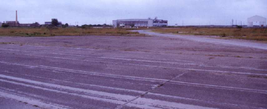
A 1990 photo by John Voss of the remaining hangar at NAAS Rodd.
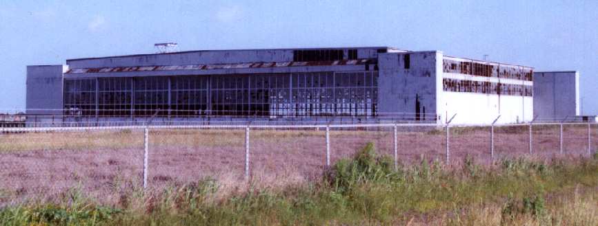
A 1990 closeup by John Voss of the remaining hangar at NAAS Rodd.
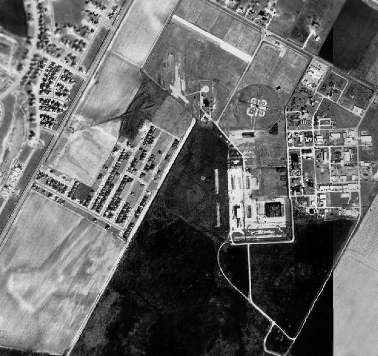
A 1995 USGS aerial photo showed the outline of the southwest intersection of the runways was still barely discernible.
A visit to the site in 2001 by Jeffery Sternberg provided an update of the status of Rodd.
Most of the ramp area also still existed,
as well as one of the 3 hangars (which was in an advanced state of deterioration).
The street grid & a number of small concrete buildings still existed.
Most of the runways had been removed,
with the exception of an 800' segment of the east/west runway
(visible as a white line in the above aerial photo, north of the baseball diamonds),
which was currently used as a parking lot for the baseball fields.
The control tower remained, just south of the remaining runway segment.
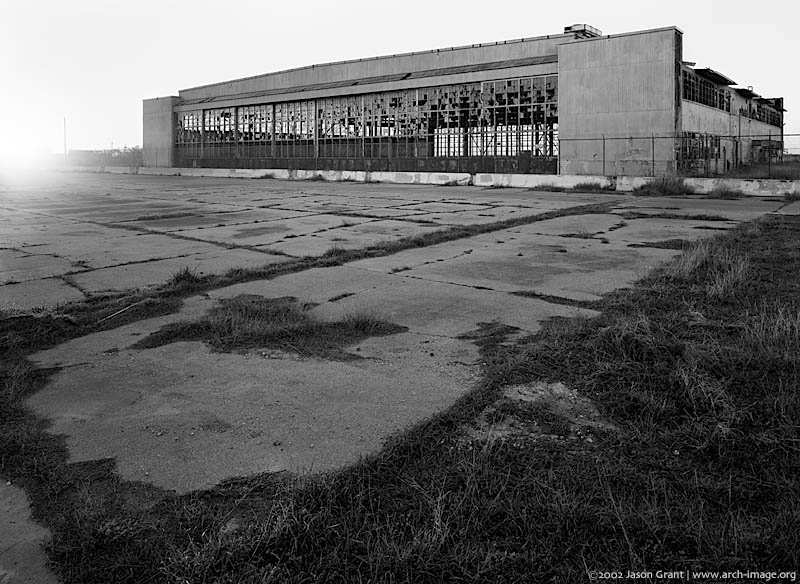
A 2002 photo by Jason Grant of the remaining hangar at Rodd.
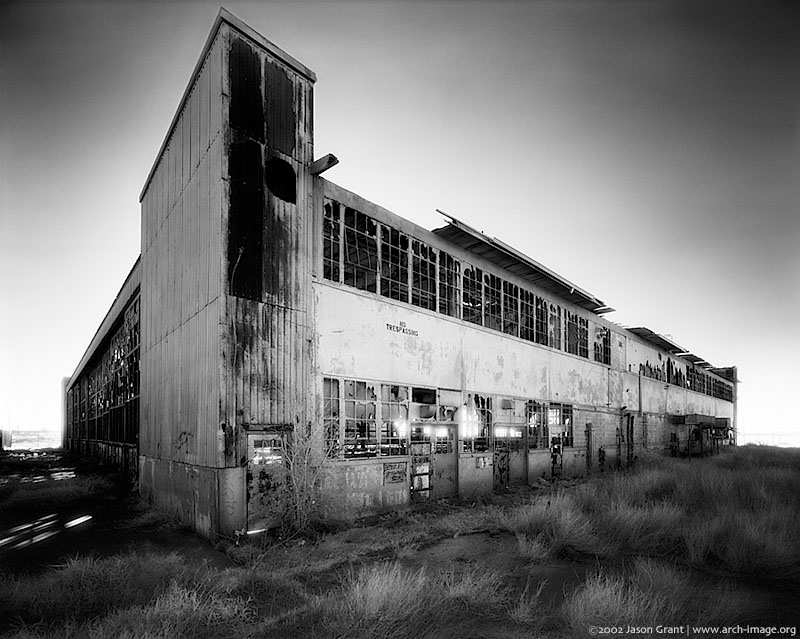
A 2002, starkly-beautiful photo by Jason Grant of the remaining hangar at Rodd.
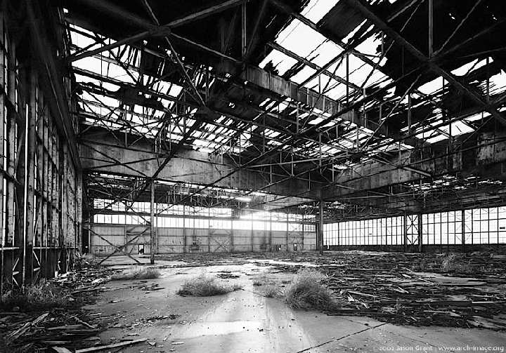
A 2002 photo by Jason Grant of the wrecked interior of the remaining hangar at Rodd.
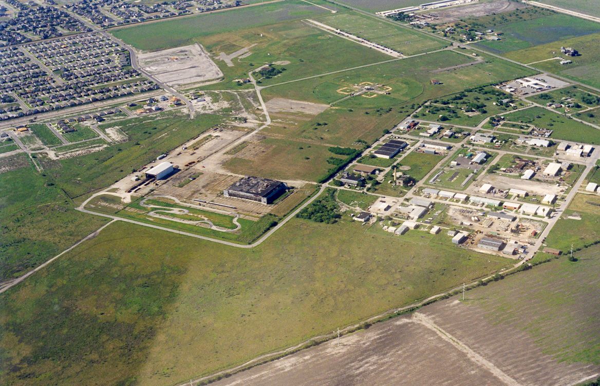
A 2003 aerial view by Dick Merrill looking northwest at the hangar & other remains of Rodd Field.
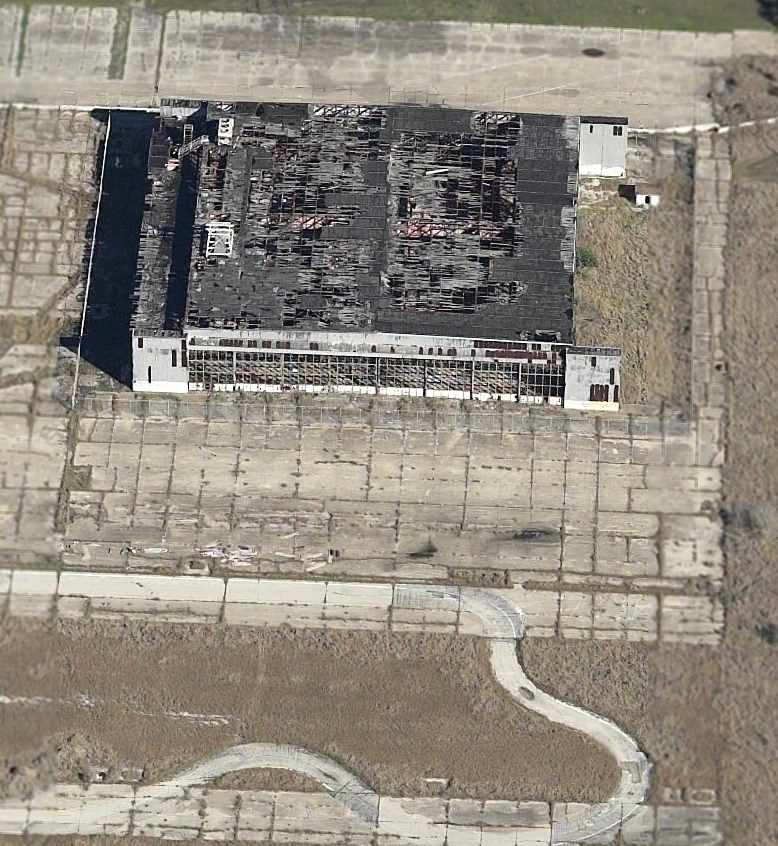
A circa 2005 aerial photo looking north at the sole remaining hangar at Rodd.
A 2006 aerial photo showed Rodd's last deteriorated hangar remained standing.
A 2008 aerial view showed that Rodd's last hangar had been removed.
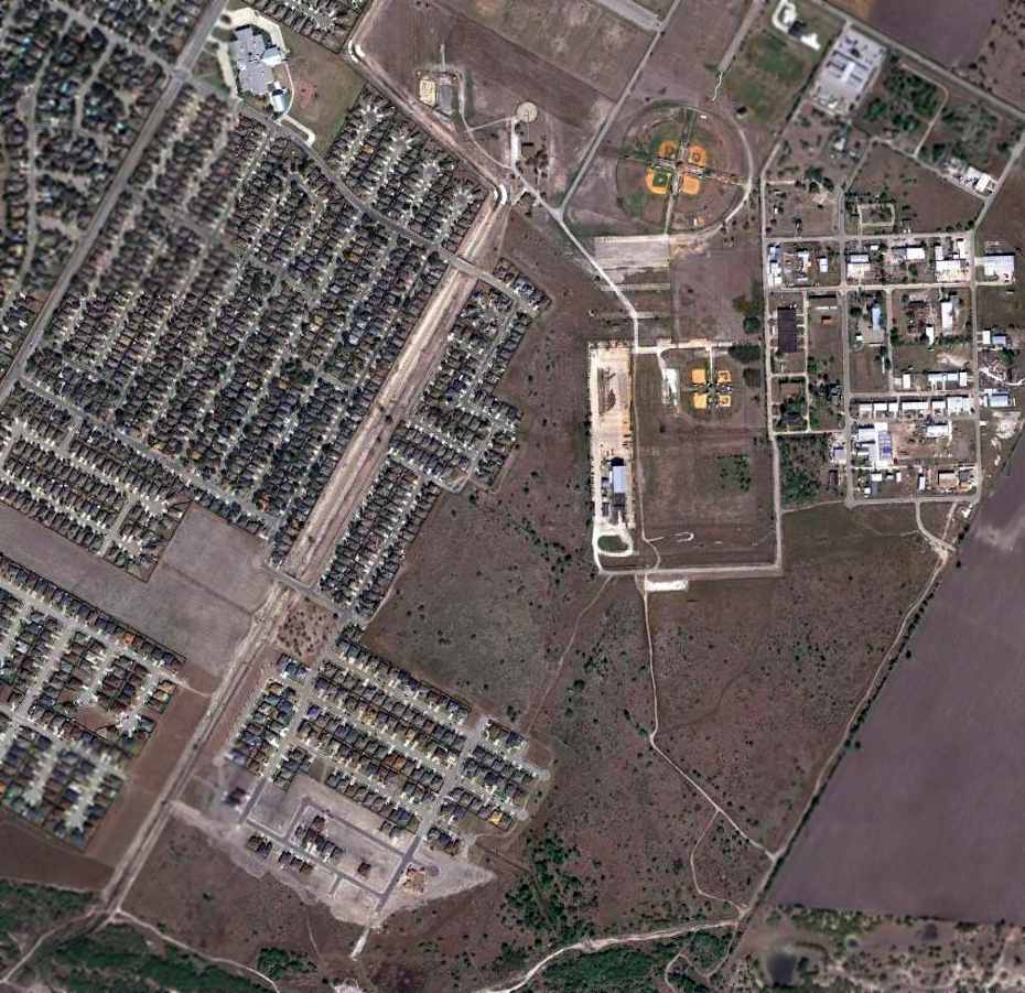
An 11/22/11 aerial photo showed a portion of Rodd's concrete ramp is the only remaining trace of this once extensive military airfield.
Trevor Phillips-Levine reported in 2014, “I am currently stationed in Kingsville as a flight instructor for the US Navy.
It pains me to say, but a lot of the airfields in South Texas are disappearing in the sands of time & development.
I just bought a new house & much to my surprise, I discovered it was upon remnants of the old Rodd Field.
The hangars are gone & the remaining concrete has either been torn up or is in a serious state of degradation.”
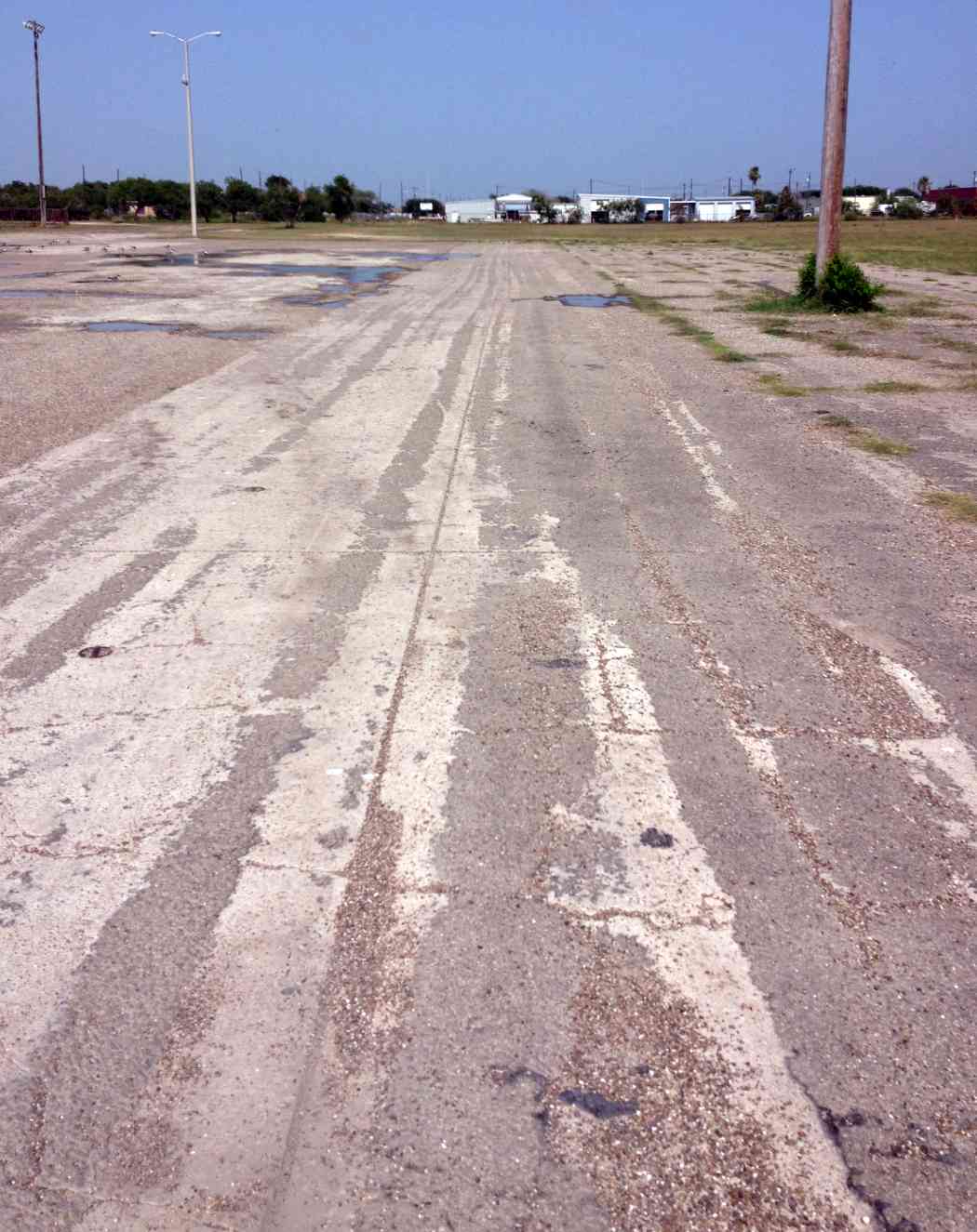
A 7/10/14 photo by Trevor Phillips-Levine of “The north ramp of NAAS Rodd, now a parking lot for some little league baseball diamonds.
Most of the ramp concrete is gone save for where a steel rebar company now sits.
The location of their steel shelter approximates the location of where one of the hangars used to sit.”
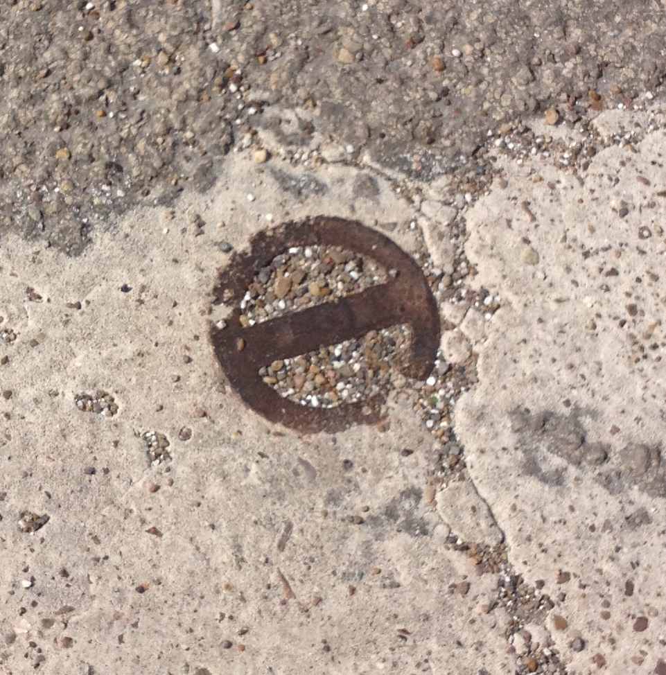
A 7/10/14 photo by Trevor Phillips-Levine oat the site of NAAS Rodd, showing “A tie-down pad eye is still visible in the north ramp concrete.”
A 1996 Army Corps of Engineers report gives more details of Rodd.
____________________________________________________
Cabaniss Naval Auxiliary Air Station (NGW), Corpus Christi, TX
27.7, -97.44 (Southwest of Downtown Corpus Christi, TX)
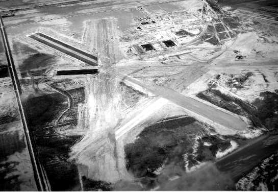
A 1941 aerial view looking northeast at Cabaniss Field while it was still under construction.
This field was built in 1941 as one of 3 satellite airfields for nearby Corpus Christi Naval Air Station,
which conducted primary & advanced flight training for American cadets & those of several foreign countries.
The earliest depiction which has been found of Cabaniss Field
was a 1941 aerial view looking northeast, showing the field while it was still under construction.
Four runways had been graded & partially paved, and 2 hangars were under construction.

The earliest aeronautical chart depiction of Cabaniss Field which has been located
was on the February 1943 Corpus Christi Sectional Chart (courtesy of Jim Stanton).
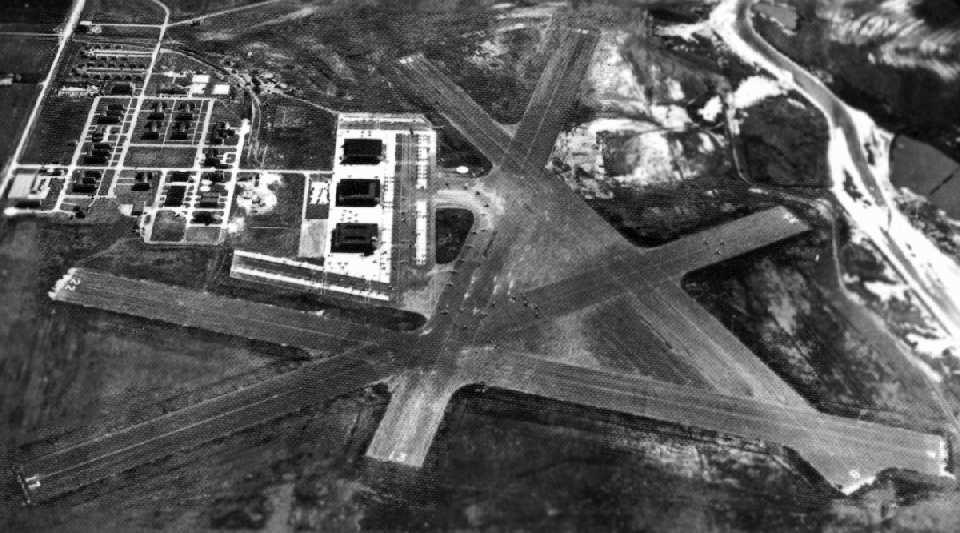
A 1943 aerial view looking east at Cabaniss Field (National Archives photo).
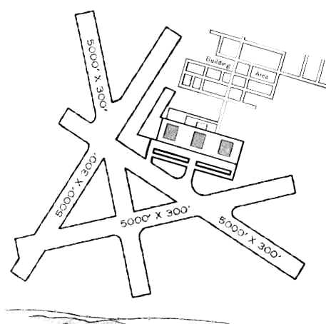
The 1945 AAF Airfield Directory (courtesy of Scott Murdock) described Cabannis Field
as a 1,003 acre irregularly-shaped field having 4 asphalt 5,000' runways.
The field was described as having 3 steel 100' x 28' hangars.
Cabannis was listed as having a total of 10 outlying fields: 25117 Outlying Field #2A (8.2 SW), 25519 Outlying Field #2B (10 mi SW),
24823 Outlying Field #2C (14 mi SW), 25824 Outlying Field #2D (14 mi WSW), 25413 Outlying Field #20 (4.7 mi SSW),
26117 Outlying Field #21 (6.7 mi WSW), 26122 Outlying Field #22 (11 mi WSW), 24720 Outlying Field #23 (11 mi SW),
25326 Outlying Field #24 (16 mi WSW), and 25930 Outlying Field #26 (20 mi WSW).
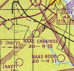
"NAAS Cabaniss" was still depicted as an active airfield
on the 1949 Corpus Christi Sectional Chart (courtesy of Chris Kennedy),
and was described as having a 5,000' hard-surface runway.
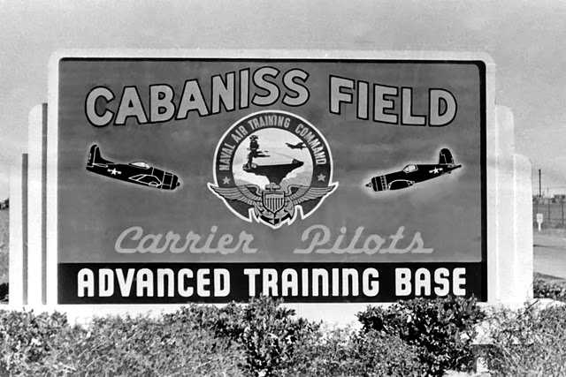
A 1949 photo of a sign for Cabaniss Field, showing an F8F & F4U.
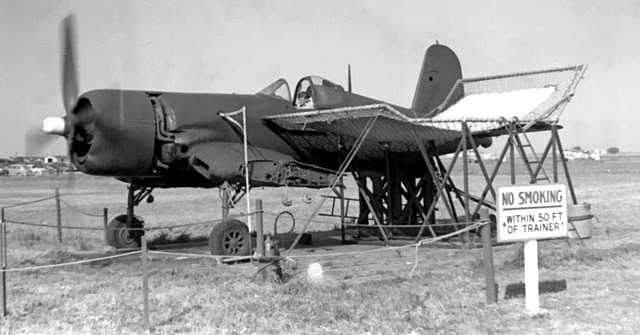
A 1949 photo of a F4U Corsair at Cabaniss Field which has been modified into a static “Trainer”, either for maintenance or pilot training.
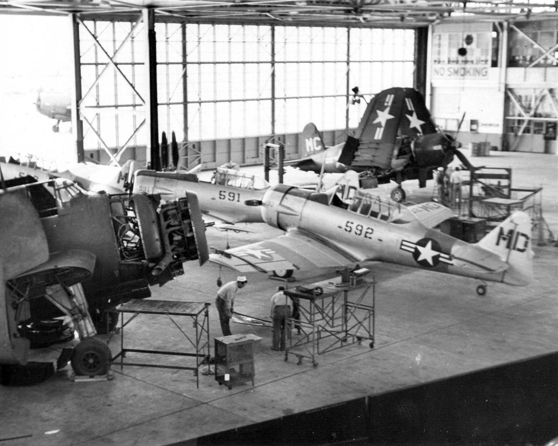
A 1949 USN photo of Navy North American SNJ-6 Texans assigned to Advanced Training Unit 5 inside a Cabaniss Field hangar,
along with a Grumman TBM-3 Avenger & a Vought F4U Corsair.
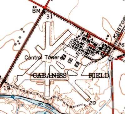
The 1951 USGS topo map depicted Cabaniss Field as having 4 paved runways, 3 hangars, a control tower, and numerous buildings.
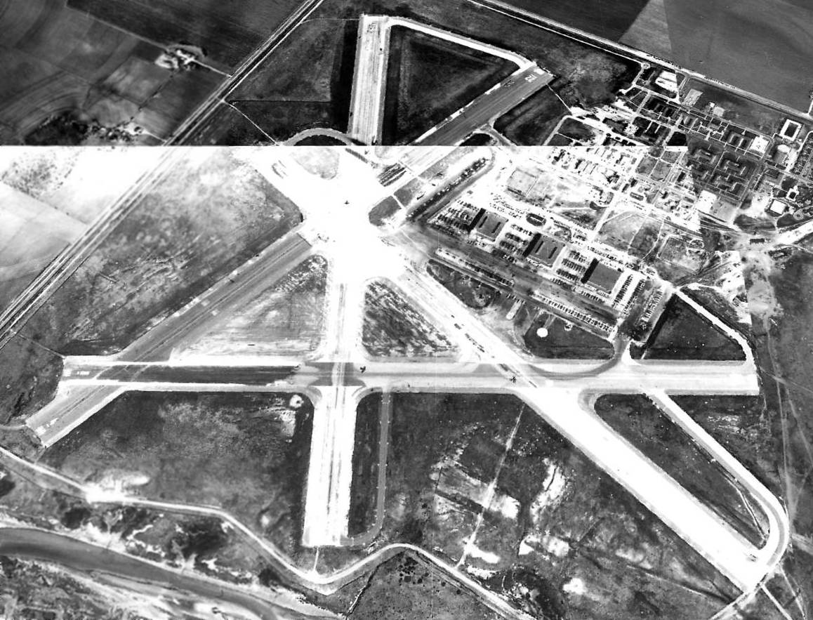
A 1955 aerial view looking north at Cabaniss Field showed 3 aircraft on the runways.
M.L. Shettle recalled, “Cabaniss had been used in the 1950s for A-1 Skyraider training.
Cabaniss closed in 1958 & the A-1 pipeline was moved to NAS Corpus. They still used Cabaniss for practice landings.”
Ed Hickey recalled, “I was stationed at Cabaniss briefly from March-June 1958 while awaiting Navy Class 'P' school.
I was attached to public works where I mowed lawns. They were amazed that people were checking in when the base was closing.
We lived in the CPO quarters, 3 to a room. All the buildings were there & a few T-28 aircraft.
As families moved out of on-base housing public works secured the buildings, removed all useful equipment and toted it to one of the hangars for shipment out.”

The March 1960 Corpus Christi Sectional Chart depicted “Cabaniss OLF (Navy)” as having a 5,000' paved runway.
Cabaniss was evidently closed by the Navy at some point between 1960-64,
as the 1964 Corpus Christi Sectional Chart (courtesy of John Voss) described the field as "permanently closed".
At some point after 1964, Cabaniss was reopened as a satellite airfield for Navy use.
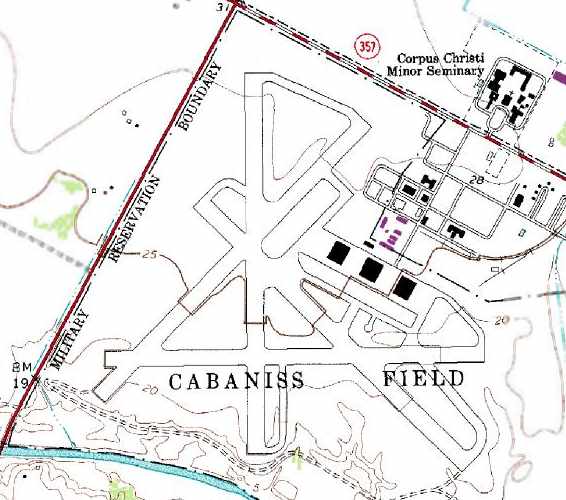
“Cabaniss Field”, as depicted on the 1975 USGS topo map.
A large number of the buildings to the northeast of the airfield had been removed at some point between 1951-75.

The July 1979 Brownsville Sectional Chart (courtesy of Jim Hackman) depicted NALF Cabaniss as having 4 paved runways.
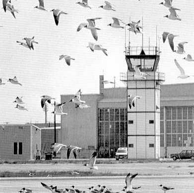
A 1984 photo of seagulls shooting touch & go landings in front of Cabiniss' control tower & hangar (courtesy of Steve Cruse).
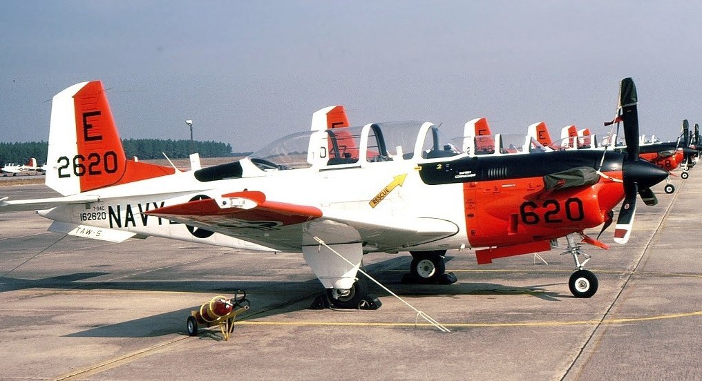
A 1989 photo of a row of Beech T-34C Mentors at Cabiniss Field.
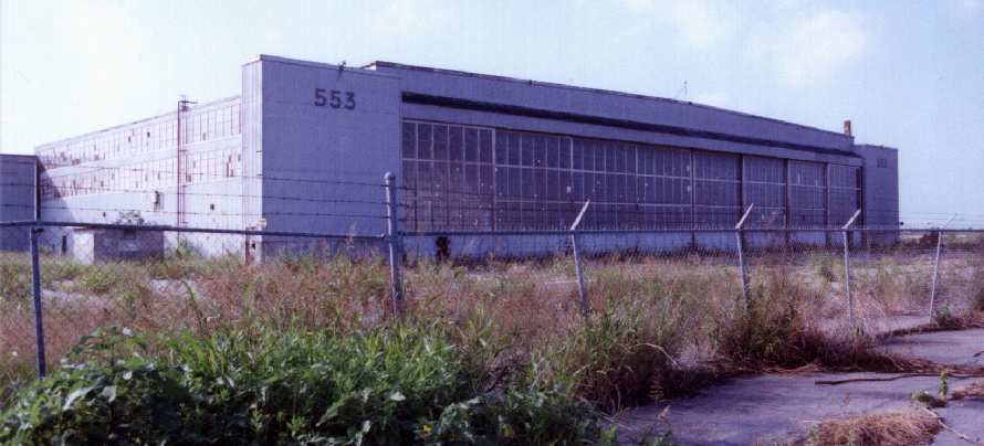
A 1990 photo by John Voss of a remaining hangar at Cabaniss.
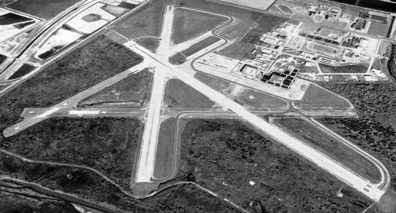
A 1995 USGS aerial view looking north at Cabaniss Field showed that the northwestern hangar had been removed at some point after 1975.
One light single single-engine aircraft (a T-34?) was visible on the northwest/southeast runway.
On 5/11/97 a Continental Airlines pilot misjudged the location of Corpus Christi International Airport
and landed his Boeing 737 on the Cabaniss airfield instead – 4.5 miles away from his intended destination.
“It essentially was pilot error & he landed on the wrong runway," said Continental spokesman Ray Scippa.
“It's unusual, obviously, but it's something that could happen & did.”
He said the jet, which took off from Houston with 59 people aboard, landed around 10:40am at Cabaniss Field.
The runway at Cabaniss is about 3,000' shorter than the strip at Corpus Christi International.
Passengers had to wait on the plane for almost 3 hours before buses arrived to take them to the right airport,
said Leah Godfrey, whose 9-year-old son, Stephen, was on the plane.
“The runway was all cracked, not as smooth as the airport runway we usually land on.
It looked funny, and it was bumpy,” said Stephen, a 4th-grader at Andrews Elementary School in Portland.
“After we landed, the stewardess told us to stay in our seats & that they had made a mistake.”
None of the people aboard Flight 1760 was hurt.
The 54 passengers & their luggage were taken by bus to the airport where they were supposed to have flown.
Another crew was sent to take the plane back to Houston, where Continental is based, Scippa said.
A Continental spokeswoman said the flight returned to Houston Intercontinental after 9 pm Sunday.
Scippa said the original crew of 5 members was pulled so the airline could conduct an internal investigation.
“The pilot has said that he thought he was lined up with the right airfield,”
said Federal Aviation Administration spokesman Roland Herwig, who is based in Oklahoma City.
“But the reason is still under investigation.”
He said the investigation will include interviews with the pilot, air traffic controllers and dispatchers.
The National Transportation Safety Board also will investigate.
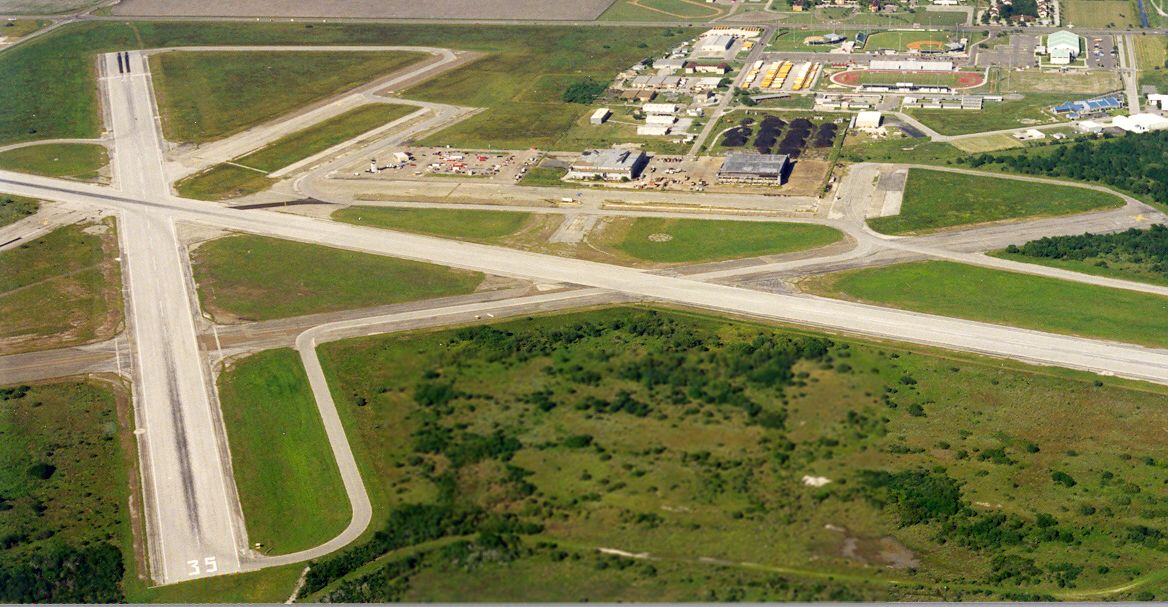
A 2003 aerial view by Dick Merrill looking north at Cabaniss Field.
As of 2003, a total of 4 runways still remained at Cabaniss.
Runways 13/31 & 17/35 were still operational (both 5,000'), and Runway 13/31 was lighted.
Cabaniss had an active tower, and it was used primary for multi-engine day & night touch & go's.
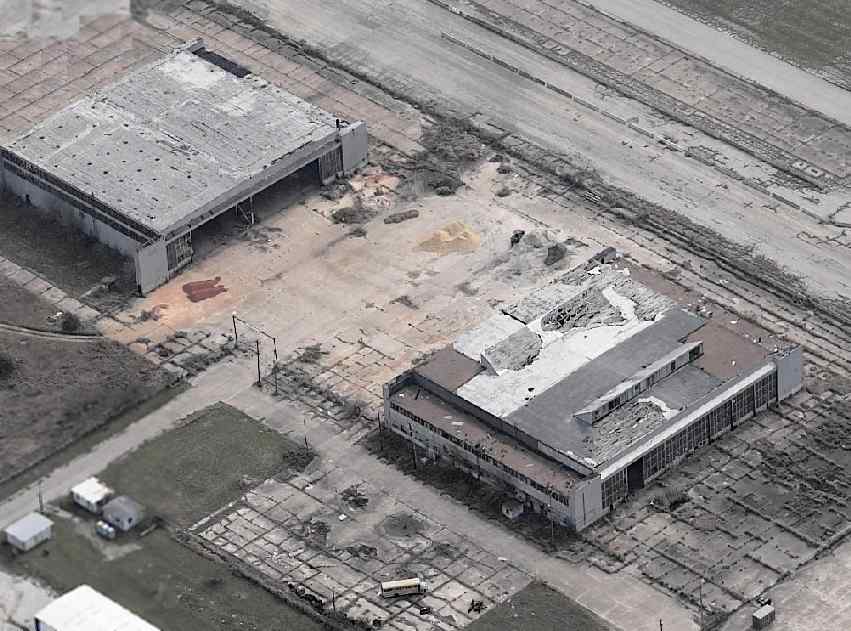
A circa 2005 aerial photo looking south at the 2 remaining hangars at Cabaniss -
showing the very poor condition of the facilities.
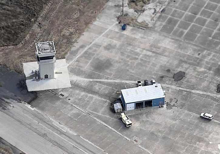
A circa 2005 aerial photo looking east at Cabaniss's control tower & fire department -
both of which appear to be of relatively recent construction.
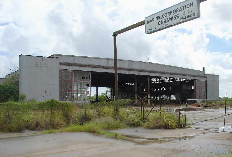
A 2007 photo by Jesse O'Neal of the sign for the “Marine Corporation Cabaniss Inc.” which sits in front of an abandoned Cabaniss hangar.
Jesse O'Neal reported in 2007, “I am an air traffic controller.
I spend most of my days at either field [Waldron & Cabaniss] working traffic or playing cards, depending on workload.
About 6 months ago I ventured into the hangers at Cabaniss, it was really neat.
The paintings were still on the walls from years ago, when it was a schoolhouse,
all paintings had a 'pay attention in class' theme.”

A 2007 photo by Jesse O'Neal of the interior of an abandoned Cabaniss hangar.
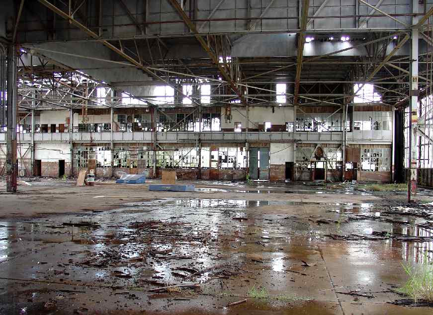
A 2007 photo by Jesse O'Neal of the interior of an abandoned Cabaniss hangar.
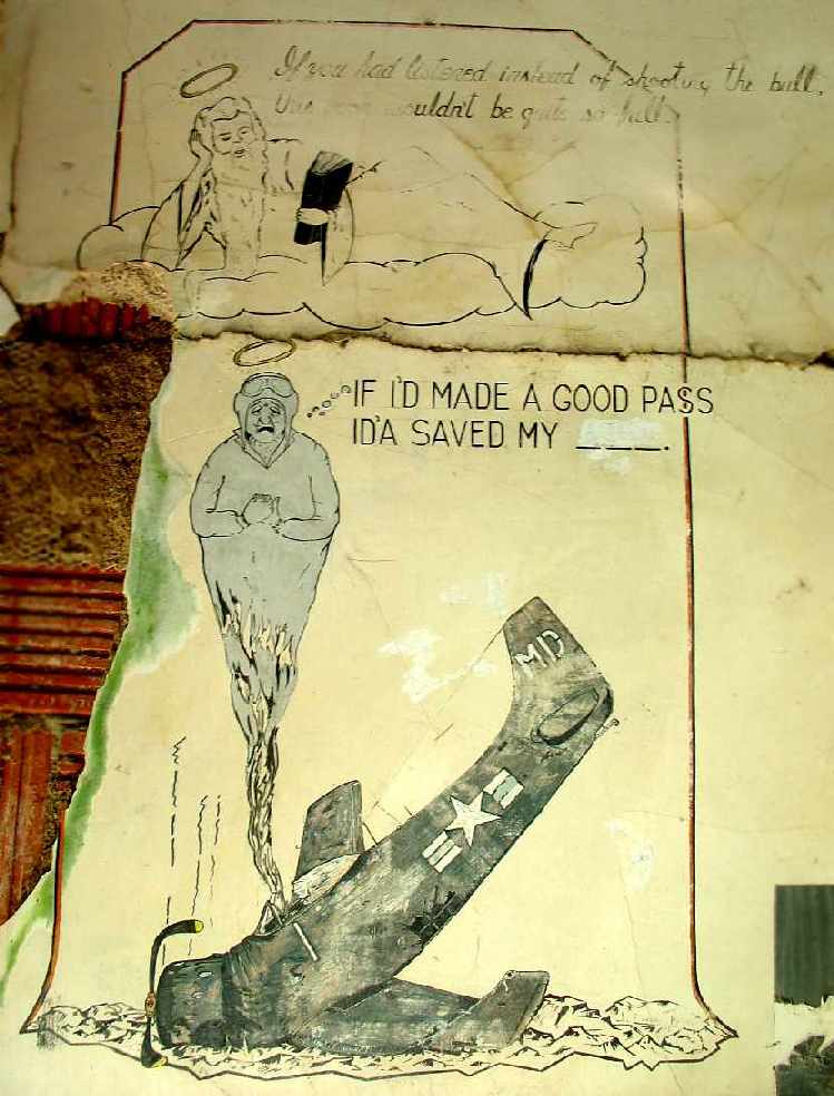
A 2007 photo by Jesse O'Neal of mural of an A-1 Skyraider inside an abandoned Cabaniss hangar.
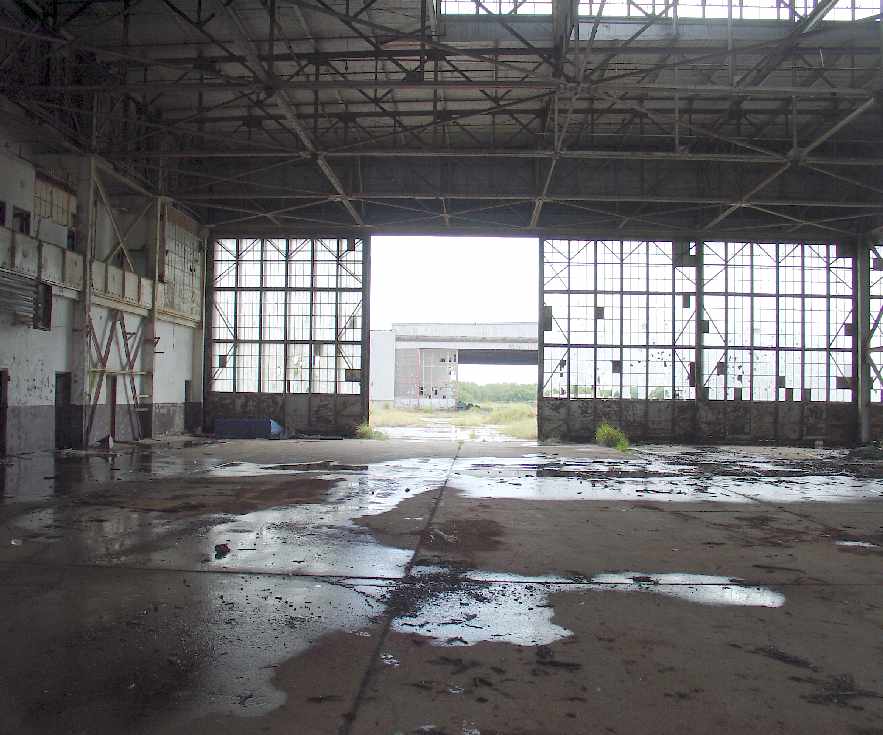
A 2007 photo by Jesse O'Neal of looking outward from one abandoned Cabaniss hangar toward another.
Navy flight instructor Trevor Phillips-Levine reported in 2014, “Cabaniss is still used by the NAS Corpus Christi T-44 & TC-12 advanced students for practice pattern work.”

The 2016 Brownsville Sectional Chart depicted Cabaniss NOLF as having 2 paved runways, with the longest being 5,000'.
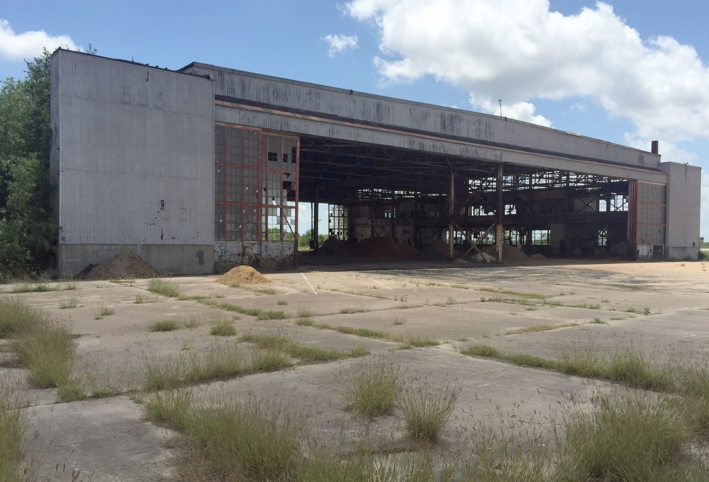
A 4/14/17 photo by Paul Freeman looking southeast at the southeastern remaining Cabaniss hangar.
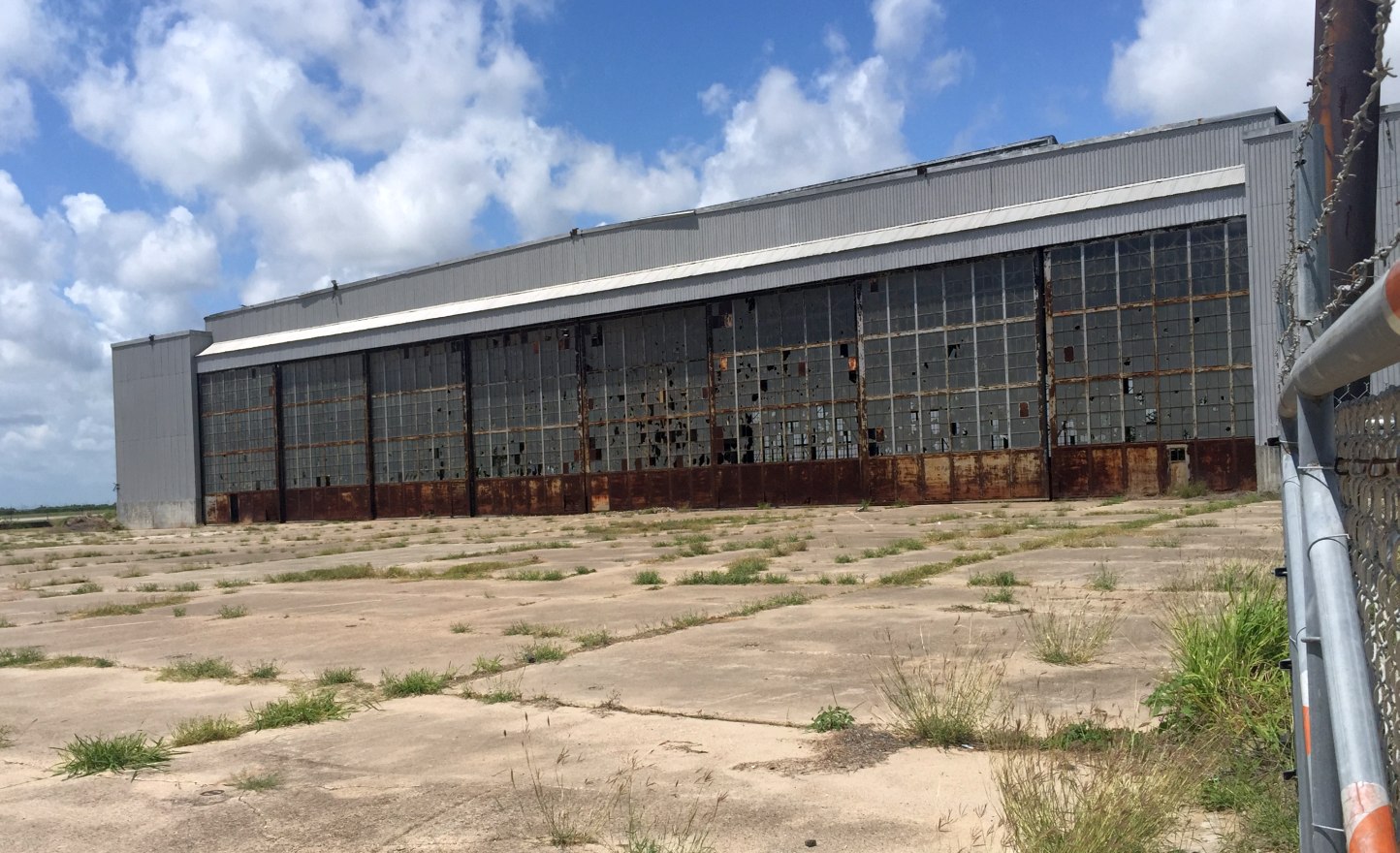
A 4/14/17 photo by Paul Freeman looking west at the northwestern remaining Cabaniss hangar.
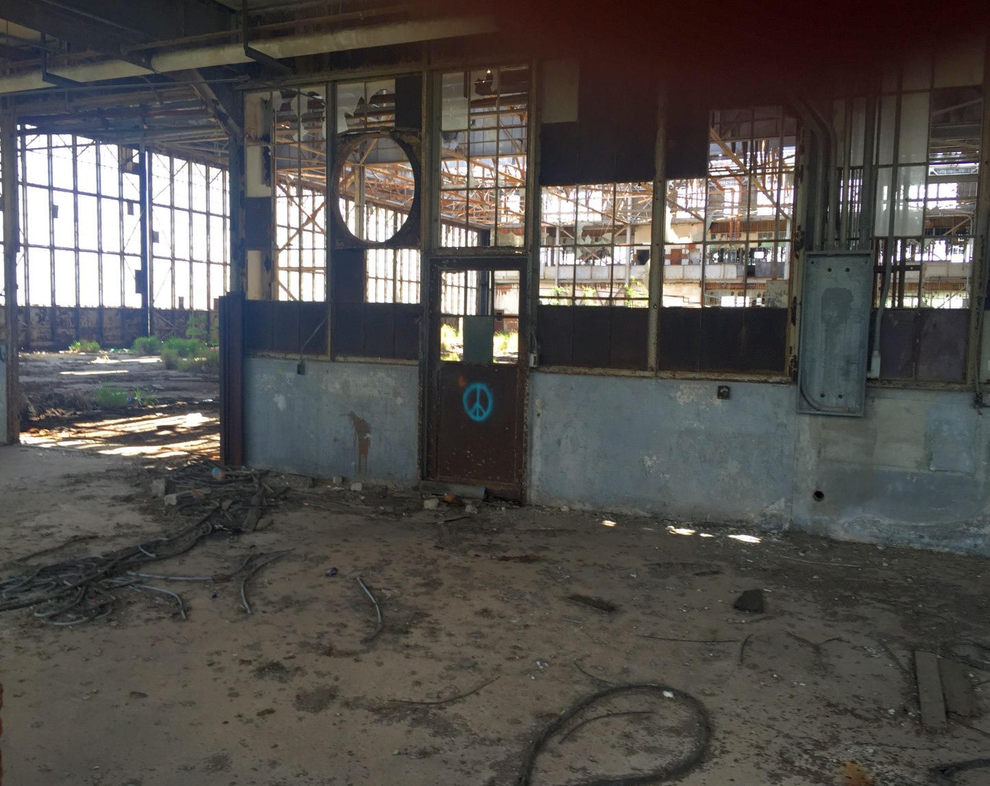
A 4/14/17 photo by Paul Freeman looking southwest into the interior of the northwestern remaining Cabaniss hangar.
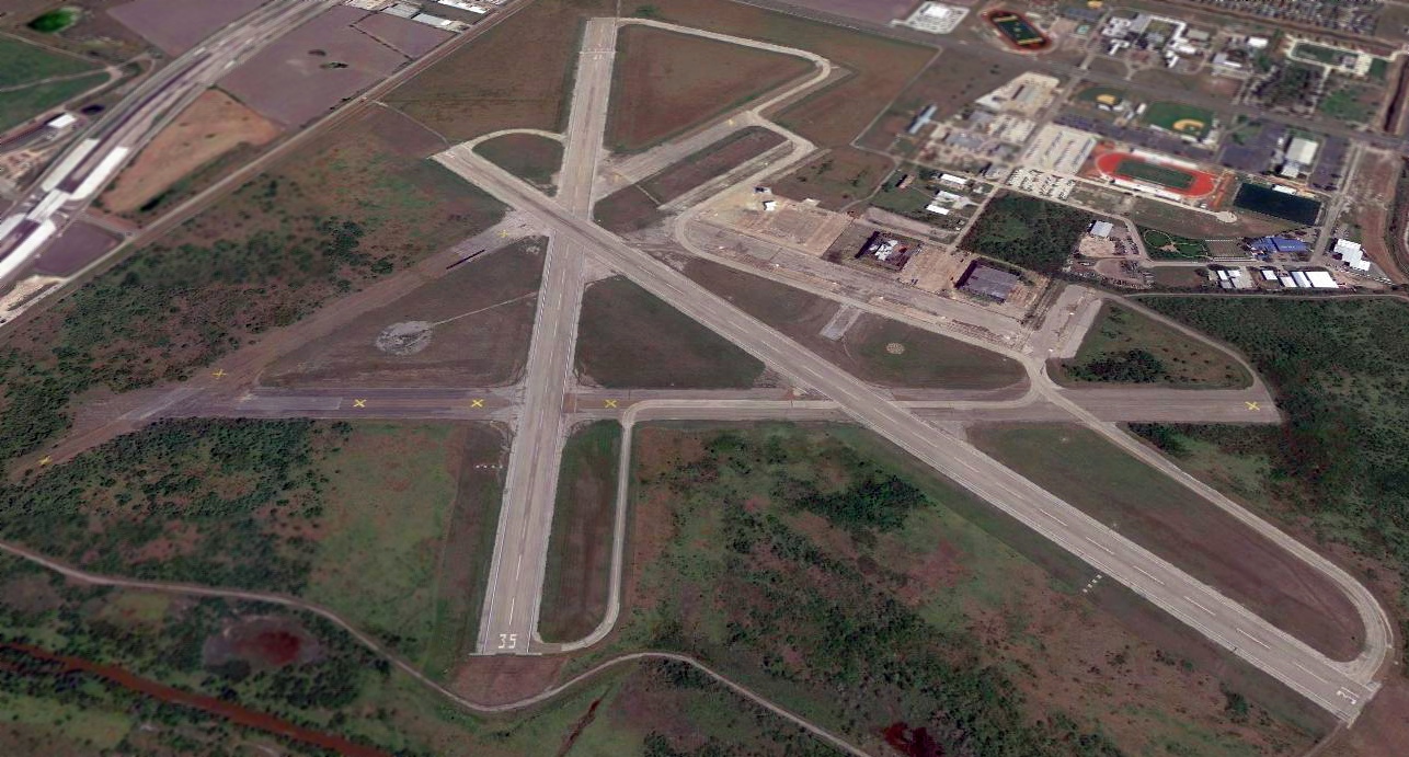
An 8/29/17 aerial view looking north at Cabaniss Field showed that 2 of the hangars remained standing.
Carl Gross (Corpus Christi International Airport Operations Manager) reported in 2018, “The abandoned Navy hangars at Cabaniss Field have recently been demolished”
____________________________________________________
Naval Outer Landing Field 21305 / NOLF #40 / Waldron Field, Corpus Christi, TX
27.635, -97.31 (South of Downtown Corpus Christi, TX)
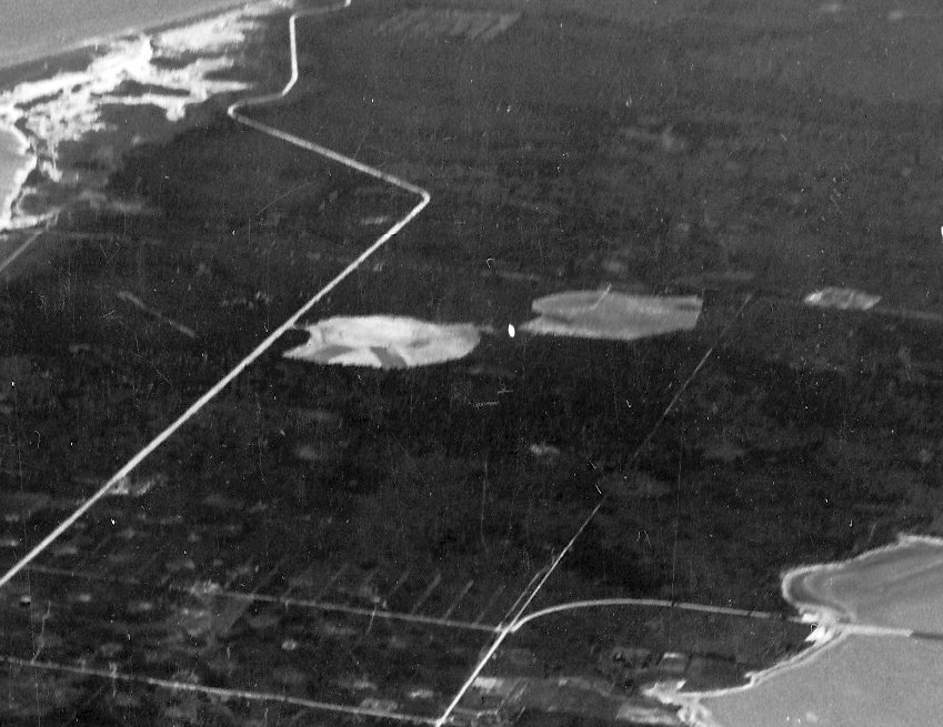
NOLF 21305 & NOLF #40, as seen in a circa 1941-42 aerial view looking south (National Archives photo, courtesy of Brian Rehwinkel).
This set of outlying fields was built to support high-volume flight training at nearby Corpus Christi Naval Air Station.
The date of construction of Naval Outer Landing Field 21305 & NOLF #40 has not been determined,
but NAS Corpus Christi was commissioned in 1941.
No airfield was depicted at this location on the June 1941 Corpus Christi Sectional Chart.
The earliest depiction which has been located of NOLF 21305 & NOLF #40 was a circa 1941-42 aerial view looking south (National Archives photo, courtesy of Brian Rehwinkel).
It depicted an adjacent pair of clearings within which were runways extending out from a circular landing mat.
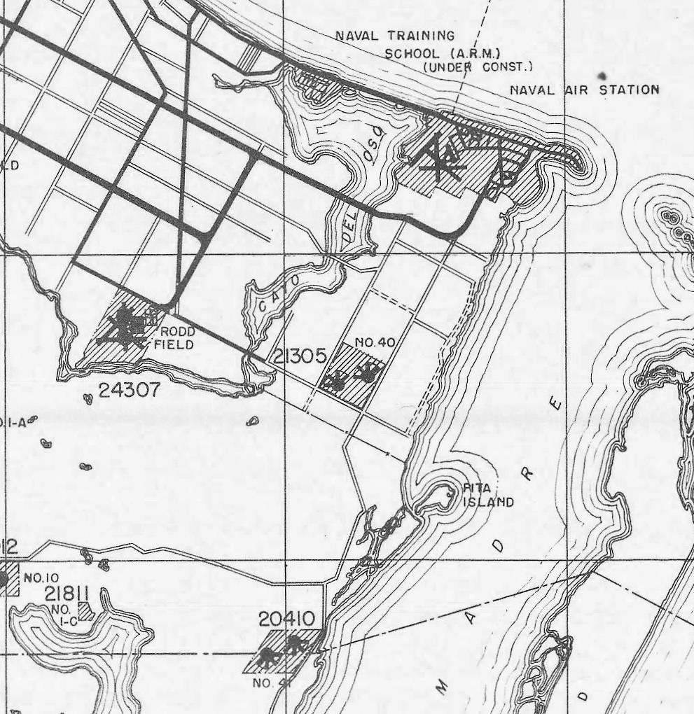
Naval Outer Landing Field 21305 & NOLF #40, as depicted on a June 1942 map of NAS Corpus Christi & its Outlying Fields (courtesy of Brian Rehwinkel).
It depicted a pair of identical Outlying Fields closely packed together: the western field labeled “21305” & the eastern field labeled “No. 40”.
Both had 4 paved runways extending toward the west, northwest, north, and northeast, extending out from a paved circular landing mat.
In 1943, NOLF 21305 & NOLF #40 were replaced by a much larger single airfield built on the site, Waldron Field.
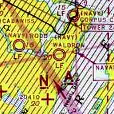
The earliest aeronautical chart depiction which has been located of Waldron Field
was on the July 1943 Corpus Christi Sectional Chart (courtesy of David Brooks).
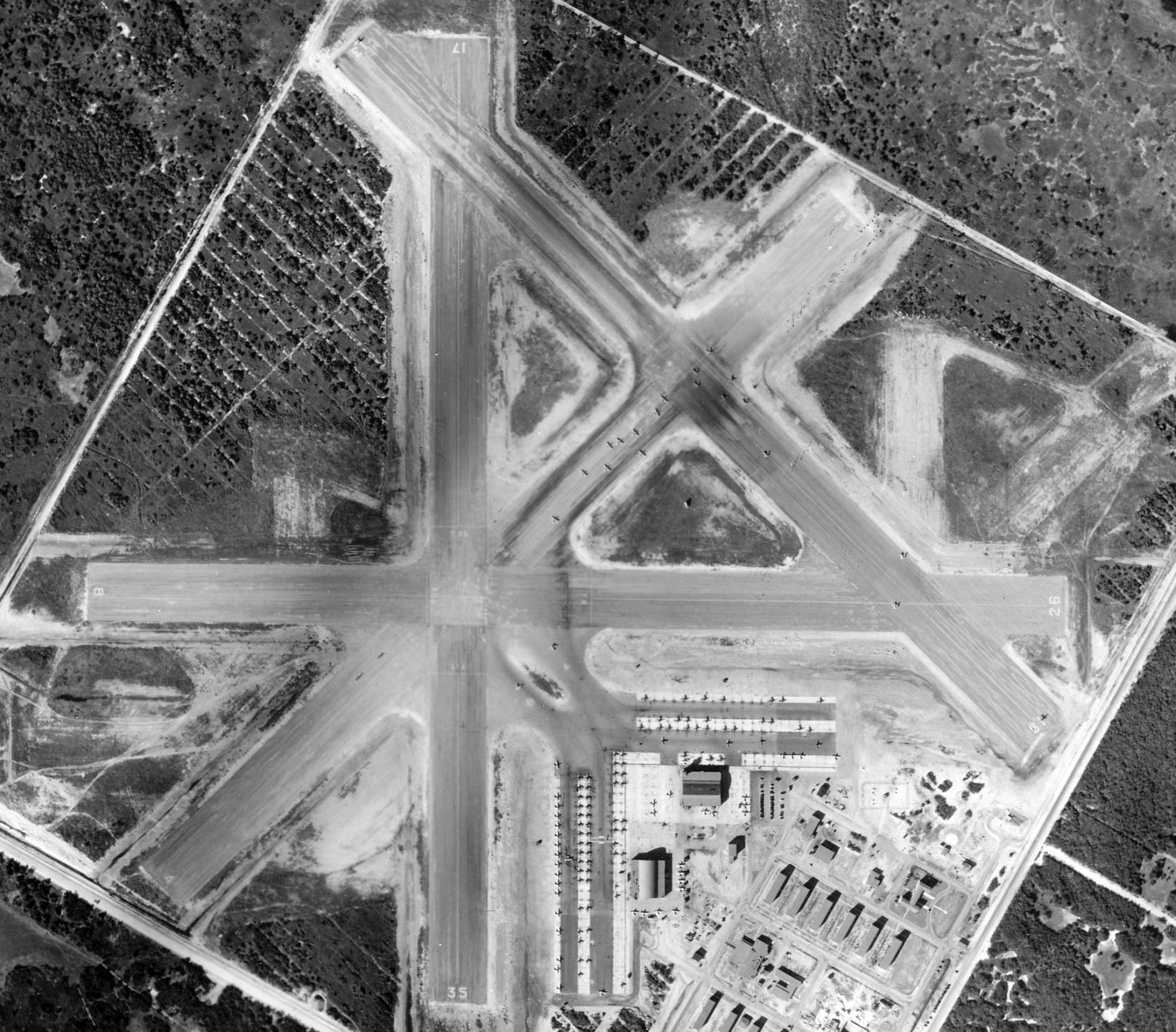
The earliest photo which has been located of Waldron Field was a 1/15/44 aerial view (National Archives photo, courtesy of Brian Rehwinkel).
It depicted Waldron as having 4 paved runways, large ramps, 2 large hangars, and over 100 aircraft.
Also note the traces of the runways of the much-small predecessor NOLF 21305 & NOLF #40 airfields, on the southwest & northeast sides.
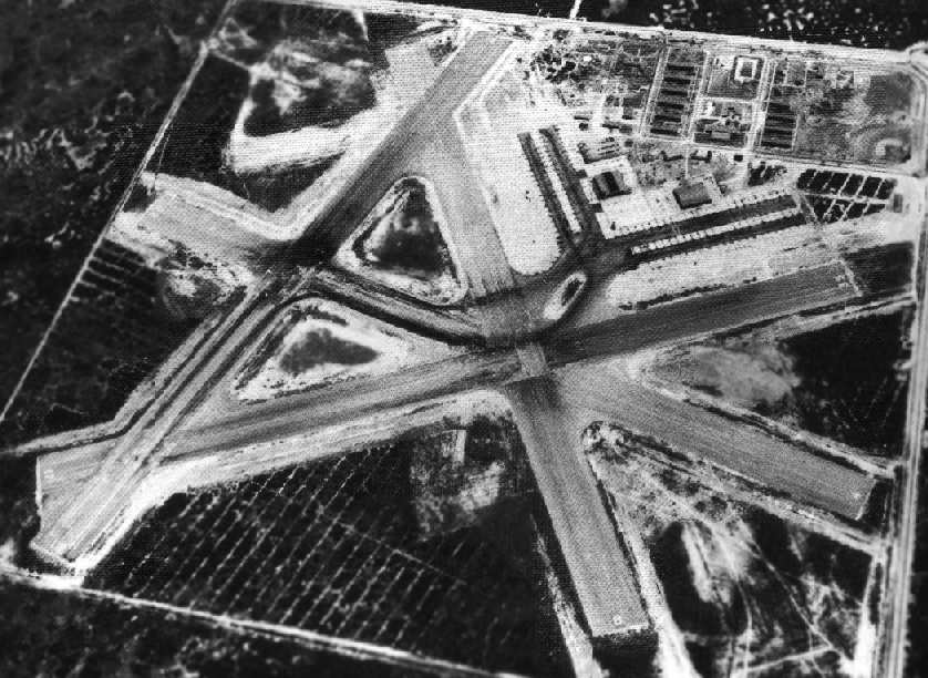
A 1944 aerial view looking southeast at Waldron Field (National Archives photo).
It depicted the field as having 4 paved runways, large ramps, and 2 large hangars.
A WW2-era matchbook cover from Waldron Field (courtesy of Steve Cruse).
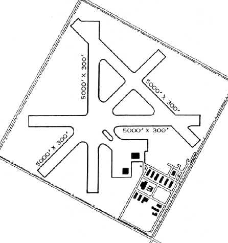
The 1945 AAF Airfield Directory (courtesy of Scott Murdock) described Waldron Field
as a 640 acre square-shaped field having 4 bituminous 5,000' runways.
The field was described as having 2 wooden 192' x 125' hangars.
Waldron was listed as having a total of 4 outlying fields: 21917 Outlying Field #12 (12 mi SW), 23521 Outlying Field #13 (15 mi SW),
23425 Outlying Field #15 (20 mi SW), and 20410 Outlying Field #41 (5 mi SSW).
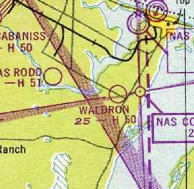
"Waldron" was still depicted as an active airfield on the 1949 Corpus Christi Sectional Chart (courtesy of Chris Kennedy),
and was described as having a 5,000' hard-surface runway.
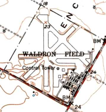
The 1951 USGS topo map depicted Waldron Field as having 4 paved runways, a control tower, and numerous buildings.
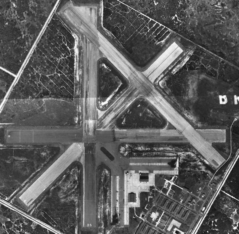
A 1955 USGS aerial view showed the Waldron Field runways were still marked as active, but there were no aircraft visible on the field.
The last photo which has been located showing both hangars remaining standing at Waldron Field was a 1961 aerial view.
M.L. Shettle recalled, “In early 1963, we used Waldron for TS-2A Field Carrier Landing Practice.”
Waldron was evidently closed by 1964,
as it was labeled "Aband airport" on the 1964 Corpus Christi Sectional Chart (courtesy of John Voss).
A 1967 aerial photo showed that the southern hangar had been removed at some point between 1961-67,
along with most of the smaller buildings to the southeast.
However, the field was brought back into limited use by the Navy at some point between 1964-69
as an Outlying Field for NAS Corpus Christi,
as "OLF Waldron (Navy)" was once again depicted as an active airfield
on the July 1969 Brownsville Sectional Chart (courtesy of Chris Kennedy).
A 1979 aerial view showed Waldron Field's northern hangar had been removed at some point between 1967-79.

The July 1979 Brownsville Sectional Chart (courtesy of Jim Hackman) depicted NALF Waldron as having 4 paved runways.
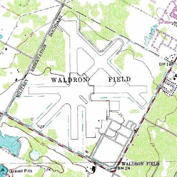
The 1989 USGS topo map depicted Waldron Field as having 4 paved runways.
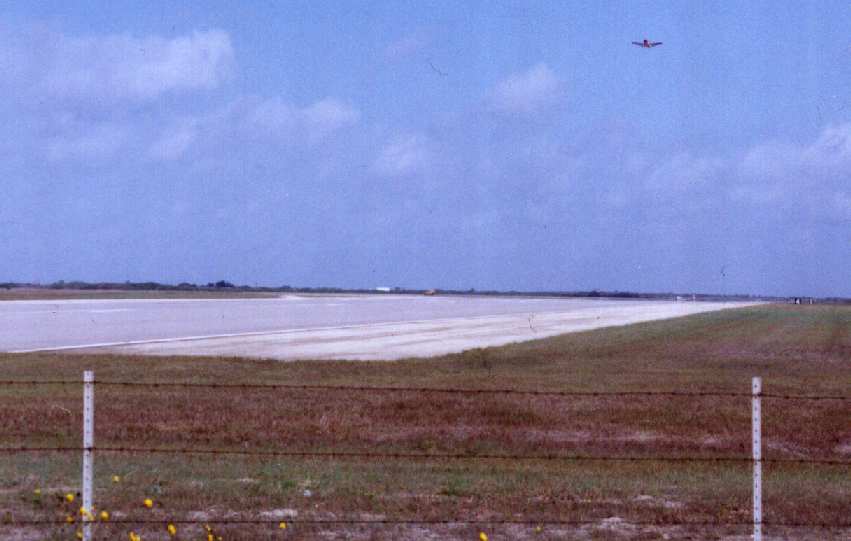
A 1990 photo by John Voss of a Navy T-34C Turbo Mentor at Waldron.
A 1995 USGS aerial photo showed that 2 of Waldron's runways were still maintained (with the primary runway being 5,000'),
while 2 others had been abandoned but were still discernible.
Both hangars were gone, the ramps being completely clear.
USNR LtJg. R.E. Hight reported in 2001 that Waldron was still used as a NOLF for NAS Corpus Christi.
No squadrons were based there, but T-34s used the field to practice touch & go's.
A 2002 aerial photo showed that a new control tower had been built along the northern edge of the ramp at some point between 1995-2002.
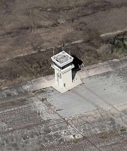
A circa 2005 aerial photo looking north at Waldron's control tower -
which appears to be of relatively recent construction.
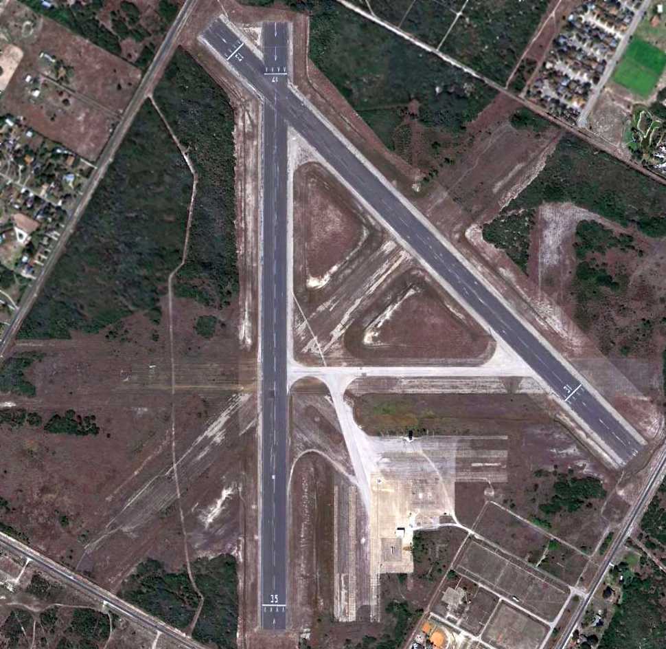
An 11/22/11 aerial view showed that the only buildings located along Waldron's ramp
were the control tower & a small metal building for the fire department, both of relatively recent construction.
Navy flight instructor Trevor Phillips-Levine reported in 2014, “Waldron is still used, but I am not sure for how much longer.
T-34Cs are about to be retired & I am not sure if they'll put T-6s to use down there.
Most of them head north while the T-34s primarily use the south.”

The 2016 Brownsville Sectional Chart depicted Waldron NOLF as having 2 paved runways, with the longest being 5,000'.
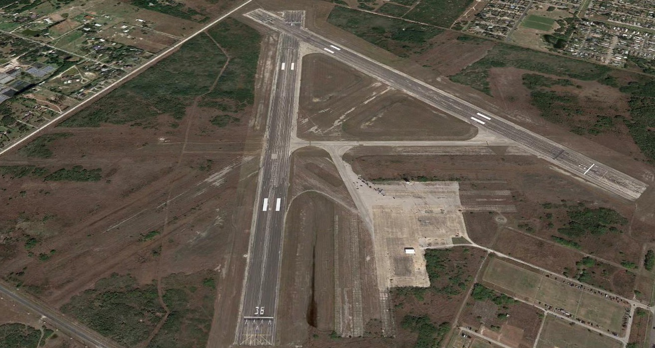
A 2020 aerial view looking north showed Waldron Field's runways remained marked as active.
Jason Buseman reported in April 2021, “The Sports Car Club of America rented Waldron NOLF once a month for car racing.
We just drove by & the field looks like it always does & the tower & fire building still look to be fine. They are repaving the runways.”
____________________________________________________
Or if you prefer to contact me directly concerning a contribution (for a mailing address to send a check),
please contact me at: paulandterryfreeman@gmail.com
If you enjoy this web site, please support it with a financial contribution.
____________________________________________________
This site covers airfields in all 50 states.