Abandoned & Little-Known Airfields:
Eastern South Dakota
© 2002, © 2025 by Paul Freeman. Revised 7/26/25.
This site covers airfields in all 50 states: Click here for the site's main menu.
____________________________________________________
Please consider a financial contribution to support the continued growth & operation of this site.
Brown Landing Strip (revised 7/26/25) - Estelline Municipal Airport (added 1/28/18) - Lake Preston Airport (1st location) (added 9/18/23)
Lake Preston Airport (2nd location) (revised 7/26/25) - Skie Air Service Landing Field (revised 11/20/20)
____________________________________________________
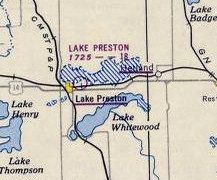
Lake Preston Airport (original location), Lake Preston, SD
44.369, -97.361 (Northwest of Sioux Falls, SD)
Lake Preston Airport, as depicted on the 1950 Aberdeen Sectional Chart (courtesy of Jonathan Westerling).
Photo of the airport while in use has not been located.
The date of establishment of this little general aviation airport has not been determined.
According to Jonathan Westerling, “The original Lake Preston Airport was located on the northeast side of town on the lake.
It had 2 very short runways, just 1,800', and its location by the lake made the field unusable when wet.”
The earliest reference which has been located of Lake Preston Airport was in the 1948 Haire Airport Directory (courtesy of Jonathan Westerling),
It described Lake Preston Airport as having 2 unpaved 1,800' runways, oriented north/south & northwest/southeast.
The manager was listed as Harley Rauch.
The earliest depiction which has been located of Lake Preston Airport was on the 1950 Aberdeen Sectional Chart (courtesy of Jonathan Westerling),
It depicted Lake Preston Airport as having a mere 1,800' unpaved runway.
The original Lake Preston Airport was evidently closed at some point between 1950-53,
as it was described as Abandoned in the 1953 Airman's Guide (courtesy of Jonathan Westerling).
A 1956 aerial photo did not show any recognizable trace of the original Lake Preston Airport.
A 2023 aerial photo did not show any recognizable trace of the original Lake Preston Airport.
Thanks to Jonathan Westerling for pointing out this airfield.
____________________________________________________
Lake Preston Airport (2nd location) (Y34), Lake Preston, SD
44.357, -97.385 (Northwest of Sioux Falls, SD)
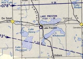
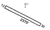
The 2nd location of Lake Preston Airport, as depicted on the 1959 Aberdeen Sectional Chart (courtesy of Jonathan Westerling).
Photo of the airport while in use has not been located.
A 1956 aerial photo did not yet show any trace of an airport at this location.
According to Jonathan Westerling, “In the summer of 1959, a somewhat larger municipal airport was constructed in a new location southwest of the town [of Lake Preston].
It had a 2,400' turf runway.”
The earliest depiction which has been located of the 2nd location of Lake Preston Airport was on the 1959 Aberdeen Sectional Chart (courtesy of Jonathan Westerling),
It depicted Lake Preston Airport as having a 2,400' unpaved runway.
According to the Aberdeen Sectional Chart, a rotating beacon was added in 1967.
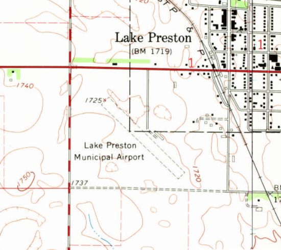
The earliest topo map depiction which has been located of the 2nd location of Lake Preston Airport was on the 1968 USGS topo map.
It depicted “Lake Preston Municipal Airport” as having an unpaved northwest/southeast runway, with 1 small building on the northeast side.
According to Jonathan Westerling, “A hangar holding several planes was built on the north side of the runway at some point prior to 1976.”
The 1974 Flight Handbook (courtesy of Jonathan Westerling) depicted Lake Preston Municipal Airport as having a 2,370' unpaved Runway 12/30.
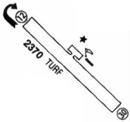
The 1983 Flight Guide (courtesy of Jonathan Westerling) depicted Lake Preston Municipal Airport as having a 2,370' turf Runway 12/30, with an unpaved ramp & 1 small building on the northeast side.
The earliest photo which has been located of the 2nd location of Lake Preston Airport was a 1984 aerial view.
It depicted an unpaved northwest/southeast runway, with 1 small building on the northeast side, but there were no aircraft on the field.
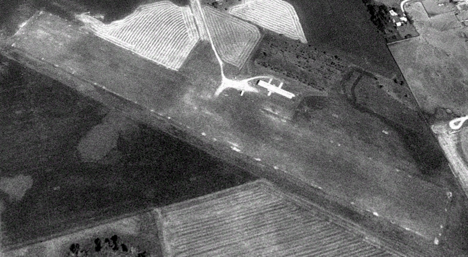
The earliest photo which is available of the 2nd location of Lake Preston Airport was a 1991 aerial view looking northeast.
It depicted an unpaved northwest/southeast runway, with 1 small building on the northeast side, but there were no aircraft on the field.
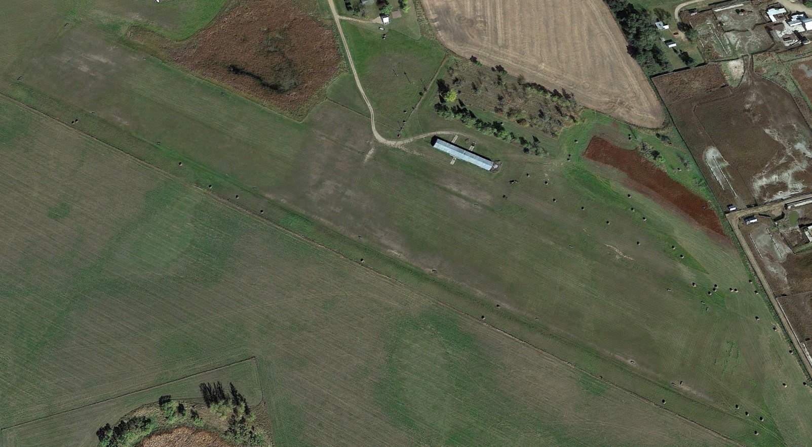
A 2014 aerial view looking northeast showed Lake Preston Airport remained in the same configuration, but still with no aircraft on the field.
Jonathan Westerling reported, “This little airstrip served its city for 60 years. In May of 2019 the City Council voted to close their airport.”
As reported in KELO Media, "The public airport in Lake Preston will be allowed to close, the SD Aeronautics Commission decided.
Community leaders want to put the property to use instead as a site for economic development.”
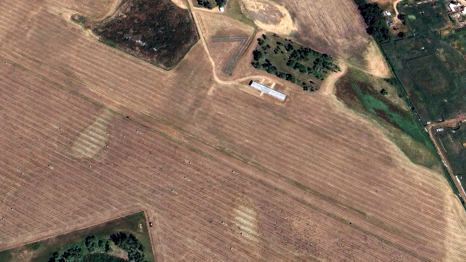
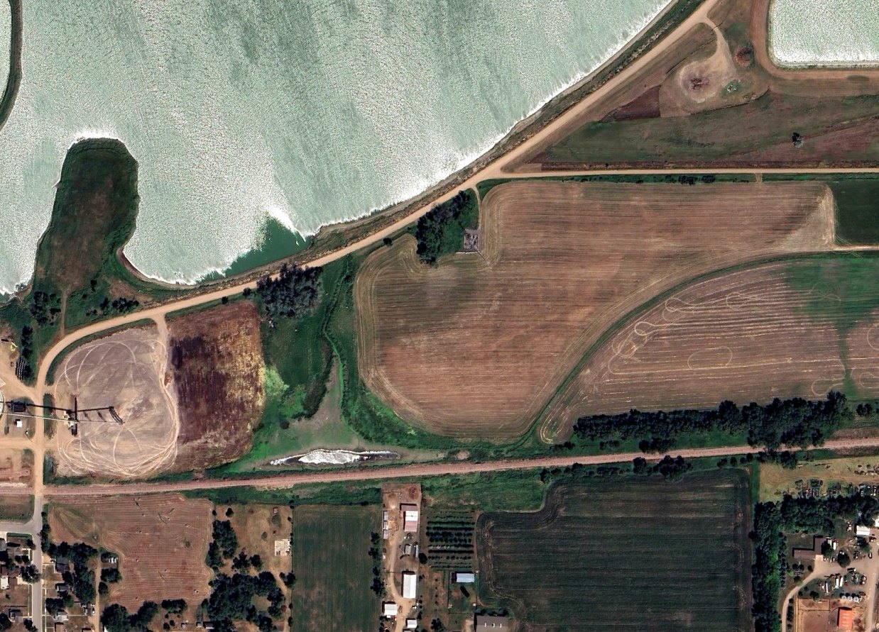
Sadly, a 2023 aerial view looking northeast showed Lake Preston Airport's runway had reverted to farmland, but the former hangar still remained.

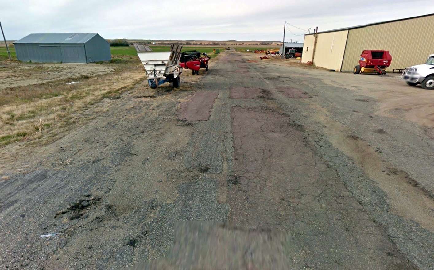
A 2024 photo looking east at the former Lake Preston Airport hangar.
Thanks to Jonathan Westerling for pointing out this airfield.
____________________________________________________
Brown Landing Strip, Winner, SD
43.377, -99.878 (West of Sioux Falls, SD)
Brown Landing Field, as depicted on an 11/16/74 USGS aerial photo (courtesy of Lee Corbin).
Photo of the airport while in use has not been located.
The date of establishment of this airfield on the west side of Winner has not been determined.
According to Dave Howard (Winner Airport Manager in 2020), “I spoke with Don Bice, the former airport manager & he knows some about the old airport.
He said Brown Oil put in the runway just west of South County Road just south of where Mathis Implement is now.
Denny Flynn & Clarence Raschky had agricultural aviation operations there in the 1950s & 1960s.”
Strangely, Brown Landing Field was not depicted at all on Sioux City Sectional Charts from 1950/60/69,
nor on USGS topo maps from 1959 or 1986.
The earliest depiction which has been located of Brown Landing Strip was a 1955 aerial photo,
which depicted a single northwest/southeast runway.
There were no aircraft visible on the field.
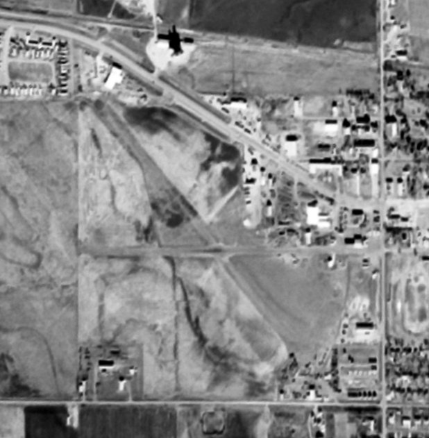
The earliest depiction which is available of Brown Landing Strip was an 11/16/74 USGS aerial photo (courtesy of Lee Corbin), which depicted 2 runways.
A 1998 aerial photo (courtesy of Lee Corbin) depicted Brown Landing Strip as having 2 runways, which appeared to have been paved.
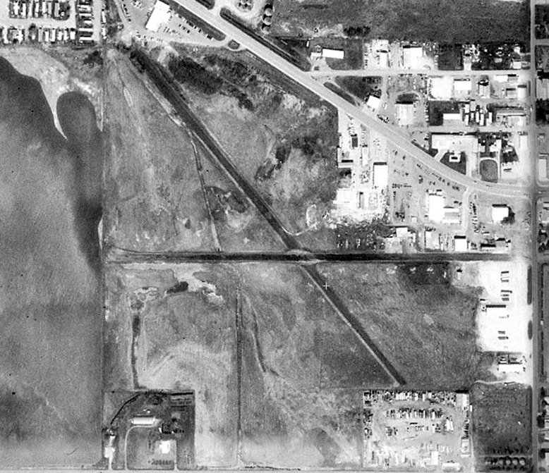
A 2013 aerial photo (courtesy of Lee Corbin) depicted Brown Landing Strip as having 2 runways,
with the east/west strip still having asphalt pavement, but the northwest/southeast strip was no longer paved.
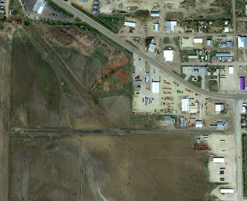
A 2015 photo looking west along the asphalt remains of the Brown Landing Strip east/west runway.
Thanks to Lee Corbin for pointing out this airfield.
____________________________________________________
Estelline Municipal Airport, Estelline, SD
44.571, -96.91 (Southeast of Aberdeen, NE)
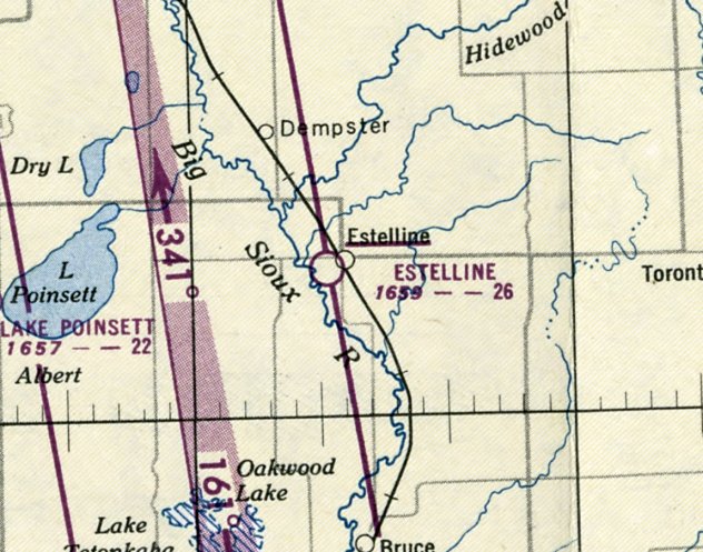
Estelline Municipal Airport, as depicted on the April 1950 Aberdeen Sectional Chart.
Photo of the airport while in use has not been located.
Yet another of America's hundreds (thousands?) of vanished grassroots small airports.
This small general aviation airport was evidently established at some point between 1945-50,
as it was not depicted on the December 1945 Aberdeen Sectional Chart.
The earliest depiction which has been located of Estelline Municipal Airport was on the April 1950 Aberdeen Sectional Chart.
It depicted Estelline as having a 2,600' unpaved runway.
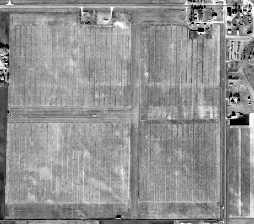
The earliest photo which has been located of Estelline Municipal Airport was an 11/20/66 USGS aerial view (courtesy of Lee Corbin).
It depicted Estelline as having 2 perpendicular grass runways, with a few small buildings on the northeast side.
There were no aircraft visible on the field.

The 1970 USGS topo map (courtesy of Lee Corbin) depicted Estelline Municipal Airport as having 2 perpendicular unpaved runways, with a small building on the northeast side.
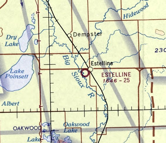
The last depiction which has been located of Estelline Municipal Airport was on the March 1971 Aberdeen Sectional Chart.
It depicted Estelline as having a 2,500' unpaved runway.
Estelline Municipal Airport was evidently closed (for reasons unknown) at some point between 1971-2014,
as a 2014 aerial view (courtesy of Lee Corbin) showed the property had been plowed up & reused for farming, with no trace remaining of the runways.
It is not known if any of the buildings on the northeast corner are former hangars.
Thanks to Lee Corbin for pointing out this airfield.
____________________________________________________
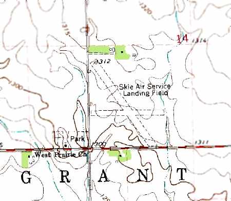
Skie Air Service Landing Field (1D9), Lennox, SD
43.304, -96.842 (North of Lincoln, NE)
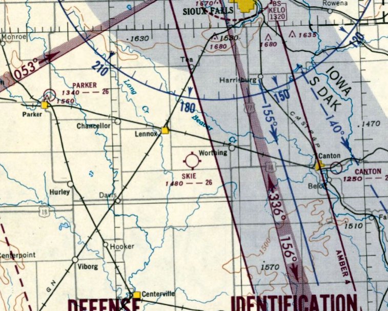
Skie Airfield, as depicted on the September 1951 Sioux City Sectional Chart.
This small general aviation airport was evidently established at some point in 1951,
as it was not yet depicted on the May 1951 Sioux City Sectional Chart.
The earliest depiction of the Skie Airfield which has been located was on the September 1951 Sioux City Sectional Chart.
It depicted Skie as having a 2,600' unpaved runway.
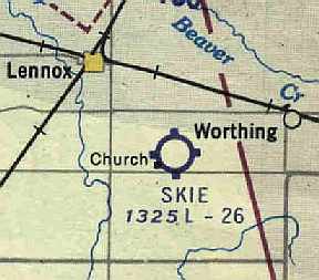
Skie Airfield, as depicted on the June 1960 Sioux City Sectional Chart (courtesy of Chris Kennedy).
It depicted Skie as having a 2,600' unpaved runway.
The 1962 AOPA Airport Directory described the Skie Air Service Landing Field
as having 2 sod runways (2,630' Runway 13/31 & 1,950' Runway 9/27), and said that the airport offered fuel, tie-downs, and charter.
The operator was listed as Marvin Skie.
The 1971 Flight Guide (courtesy of Chris Kennedy) depicted the runway configuration of the Skie Air Service Landing Field as basically unchanged.
It indicated that the field was attended irregularly, and did not depict any buildings at the airfield.
The 1978 USGS topo map depicted the Skie Air Service Landing Field as having 2 unpaved runways.
It did not depict any buildings at the airfield.
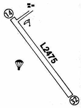
The Skie Air Service Landing Field had apparently started to decline within the next few years,
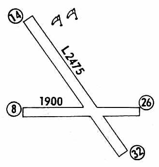
as the 1980 Flight Guide (courtesy of Chris Kennedy) depicted only a single runway (2,475' Runway 14/32), and indicated that the field was unattended.
A cluster of three buildings were depicted on the north side of the airfield, and a parachute drop zone was depicted on the west side of the field.
The status of the Skie Air Service Landing Field changed to that of a private field at some point between 1980-87,
as that was how it was depicted on the March 1987 Omaha Sectional Chart (according to Timothy Aanerud).
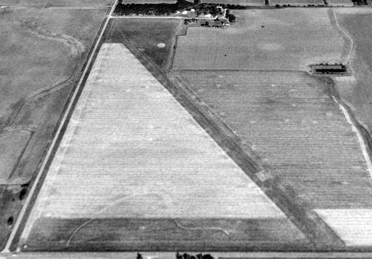
A 1998 USGS aerial view looking north showed Skie Air Service Landing Field's Runway 14/32 remained quite recognizable,
but the land of the former crosswind Runway 8/32 had apparently been returned to cultivation.
Skie Air Service Landing Field was still depicted as a private airfield on the 1998 Word Aeronautical Chart.
The Skie Air Service Landing Field was evidently was closed at some point between 1998-2004,
as it was no longer listed as an airfield in the 2004 Airport/Facility Directory.
Skydive Adventures reported, “Marv Skie Airfield was closed due to the passing of Marv. Parachute operations moved to Luverne MN.”
The name of Marvin Skie has been recognized as the Lincoln County Airport (10 miles to the north) has been renamed Marv Skie-Lincoln County Airport.
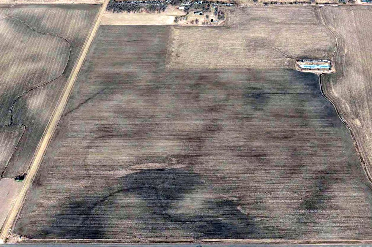
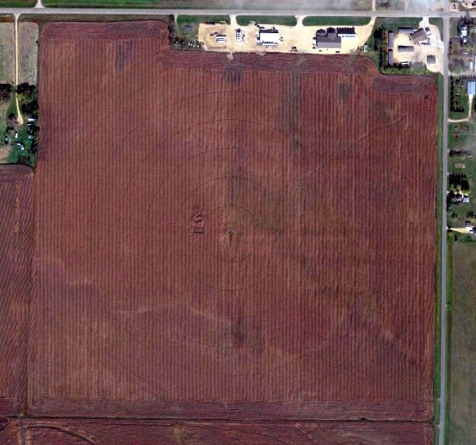
A 2015 aerial view looking north showed no trace remaining of Skie Air Service Landing Field.
The site of the Skie Air Service Landing Field is located northeast of the intersection of 468th Avenue & 282nd Street.
____________________________________________________
Or if you prefer to contact me directly concerning a contribution (for a mailing address to send a check),
please contact me at: paulandterryfreeman@gmail.com
If you enjoy this web site, please support it with a financial contribution.
____________________________________________________
This site covers airfields in all 50 states.