Abandoned & Little-Known Airfields:
Pennsylvania: Northwestern Philadelphia area
© 2002, © 2025 by Paul Freeman. Revised 3/16/25.
This site covers airfields in all 50 states: Click here for the site's main menu.
____________________________________________________
Please consider a financial contribution to support the continued growth & operation of this site.
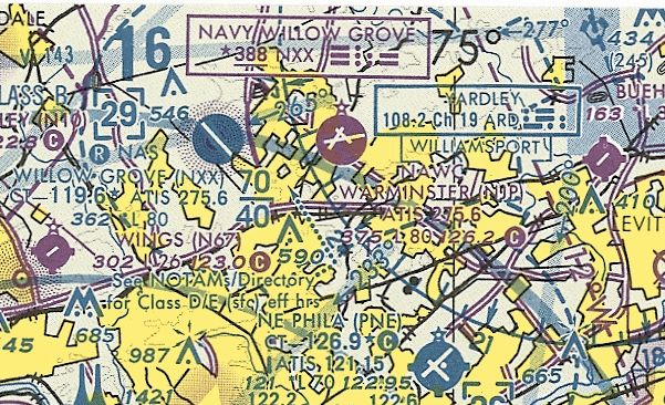
Brewster Navy Airfield / Johnsville NAS / Warminster NAWC (revised 3/14/25) - Montgomeryville Airport / Gloster Airport / Hi-Line Airport / 309 Airport (revised 10/9/23)
Perkiomen Valley Airport (revised 3/14/25) - Turner Field (revised 3/16/25) - Warrington Airport (revised 3/14/25)
____________________________________________________
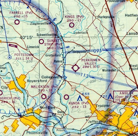
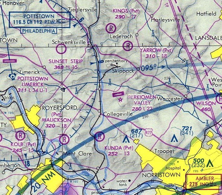
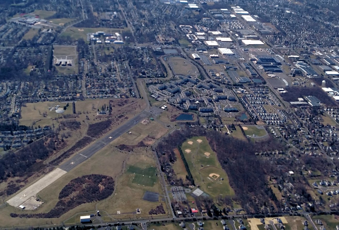
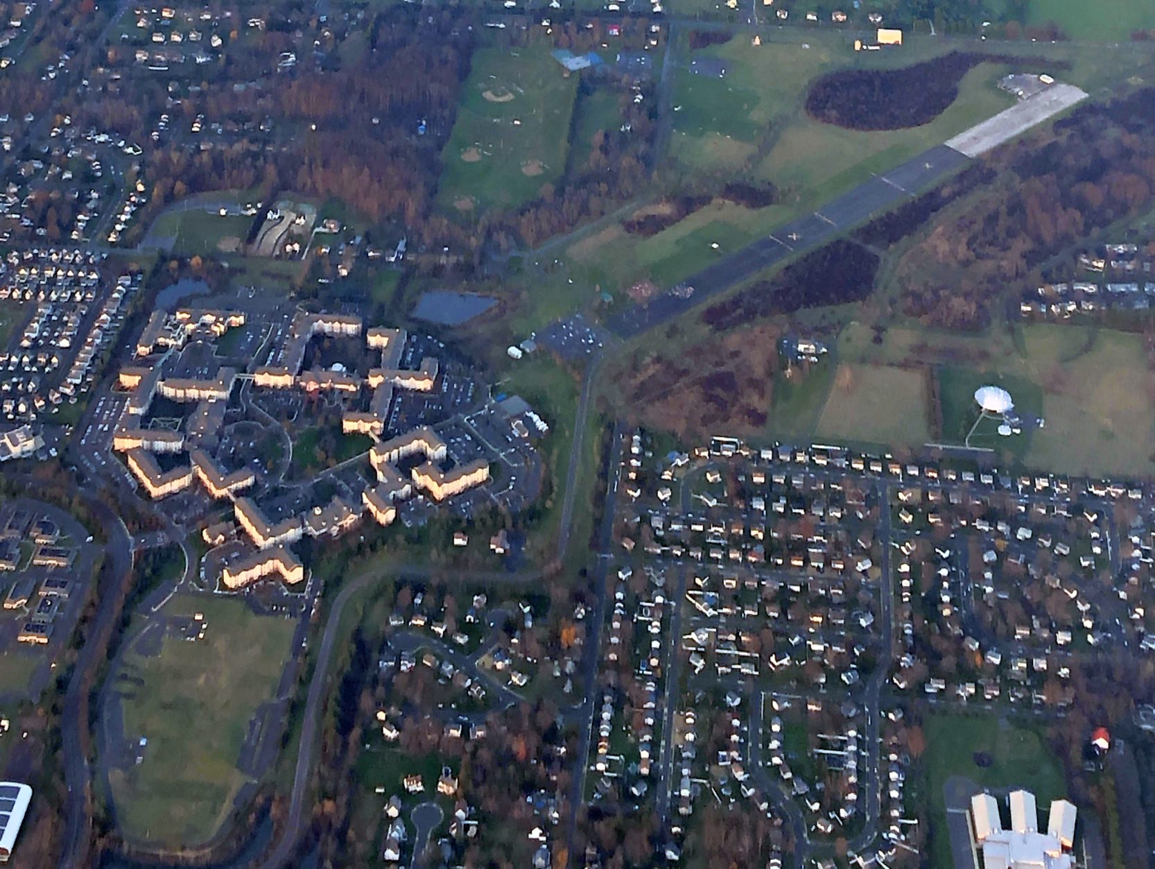
Perkiomen Valley Airport (N10, 32PA), Collegeville, PA
40.204,-75.43 (Northwest of Philadelphia, PA)
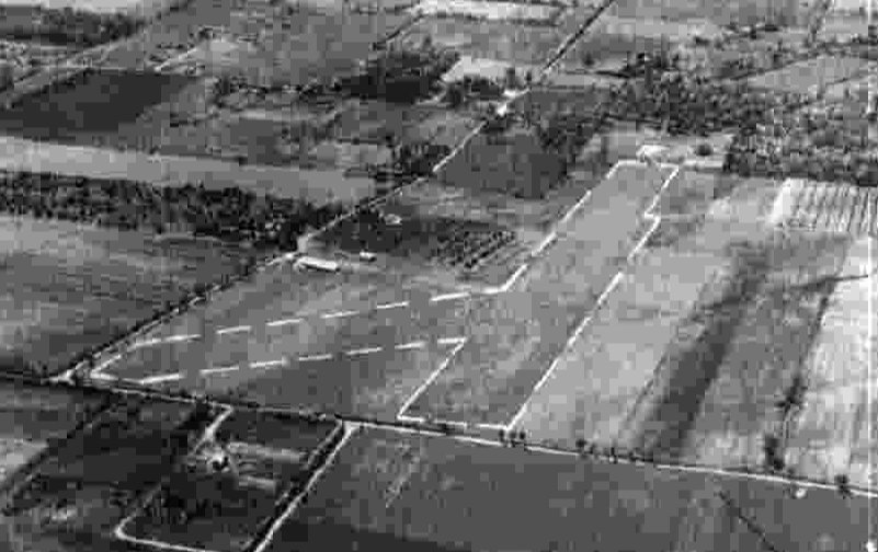
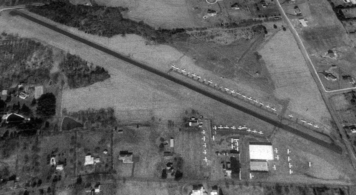
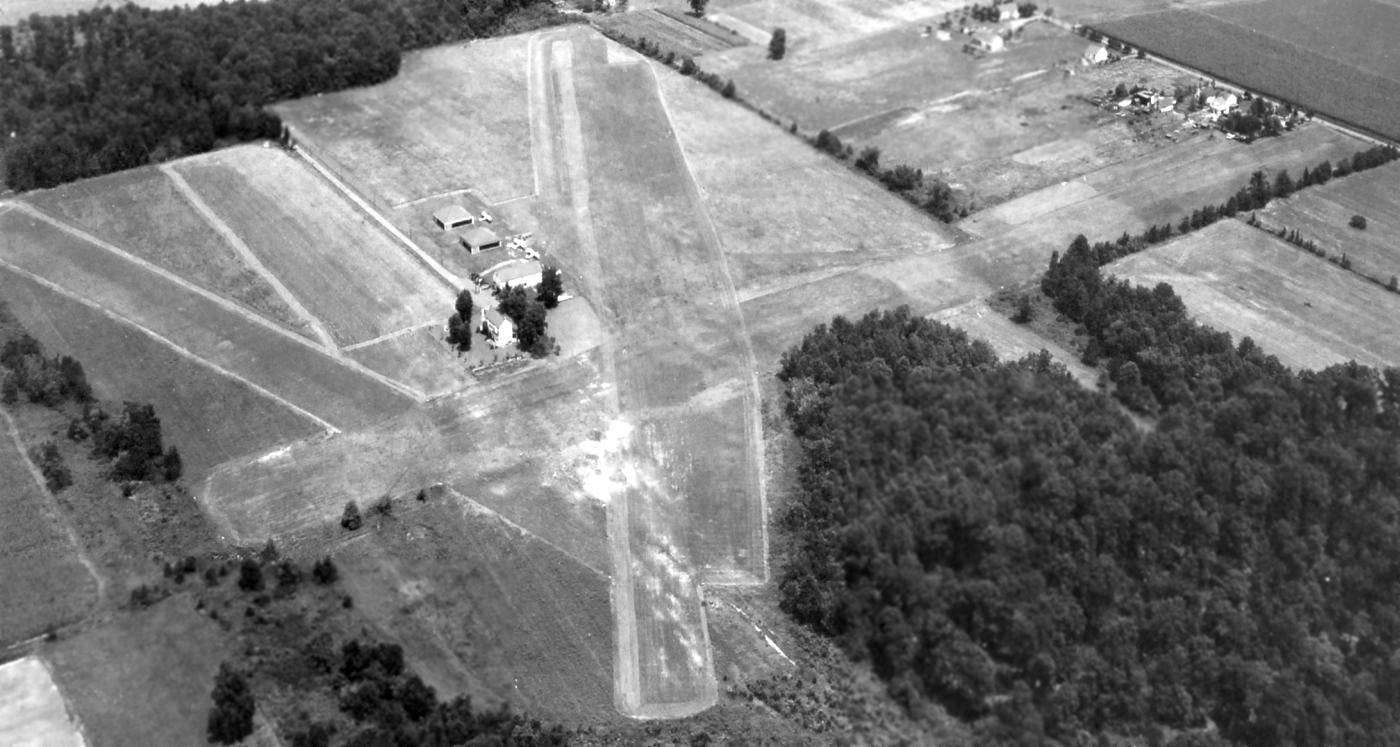
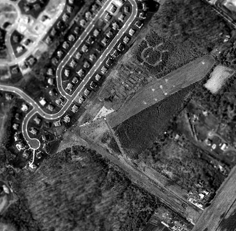
A 10/14/40 aerial view looking west at Perkiomen Valley Airport from the 1945 AAF Airfield Directory (courtesy of Scott Murdock).
Yet another nice grassroots general aviation airports which have been swallowed up by growth of the Philadelphia suburbs.
According to Wikpedia, Perkiomen Valley Airfield was opened on 3/1/38.
However, Perkiomen Valley Airfield was not yet depicted on the March 1940 NY Sectional Chart.
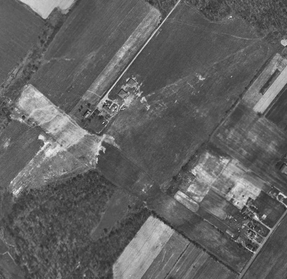
The earliest depiction which has been located of Perkiomen Valley Airport was a 10/14/40 aerial view looking west from the 1945 AAF Airfield Directory (courtesy of Scott Murdock).
It depicted Perkiomen Valley Airport as having 2 unpaved runways, with a few small buildings on the south side.
The earliest aeronautical chart depiction which has been located of Perkiomen Valley Airport was on the October 1941 NY Sectional Chart.
It depicted Perkiomen Valley as a commercial/municipal airport.
The 1945 AAF Airfield Directory (courtesy of Scott Murdock) described Perkiomen Valley Airport
as having an all-way sod field having 3 runways, the longest being 2,200' east/west.
The field was said to have 2 hangars, and to be owned & operated by private interests.
According to Barbara West, a “big B-17 or B-12 aircraft emergency-landed at Perkiomen Valley Airport around 1945.
I was around 5 or 6 years old & remember playing in & around the plane with other kids. That plane parked there for years.
The big plane never flew out of there because there was not enough runway length.”
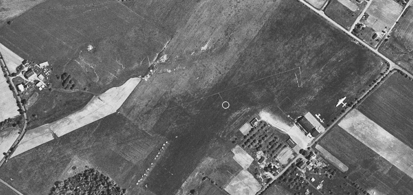
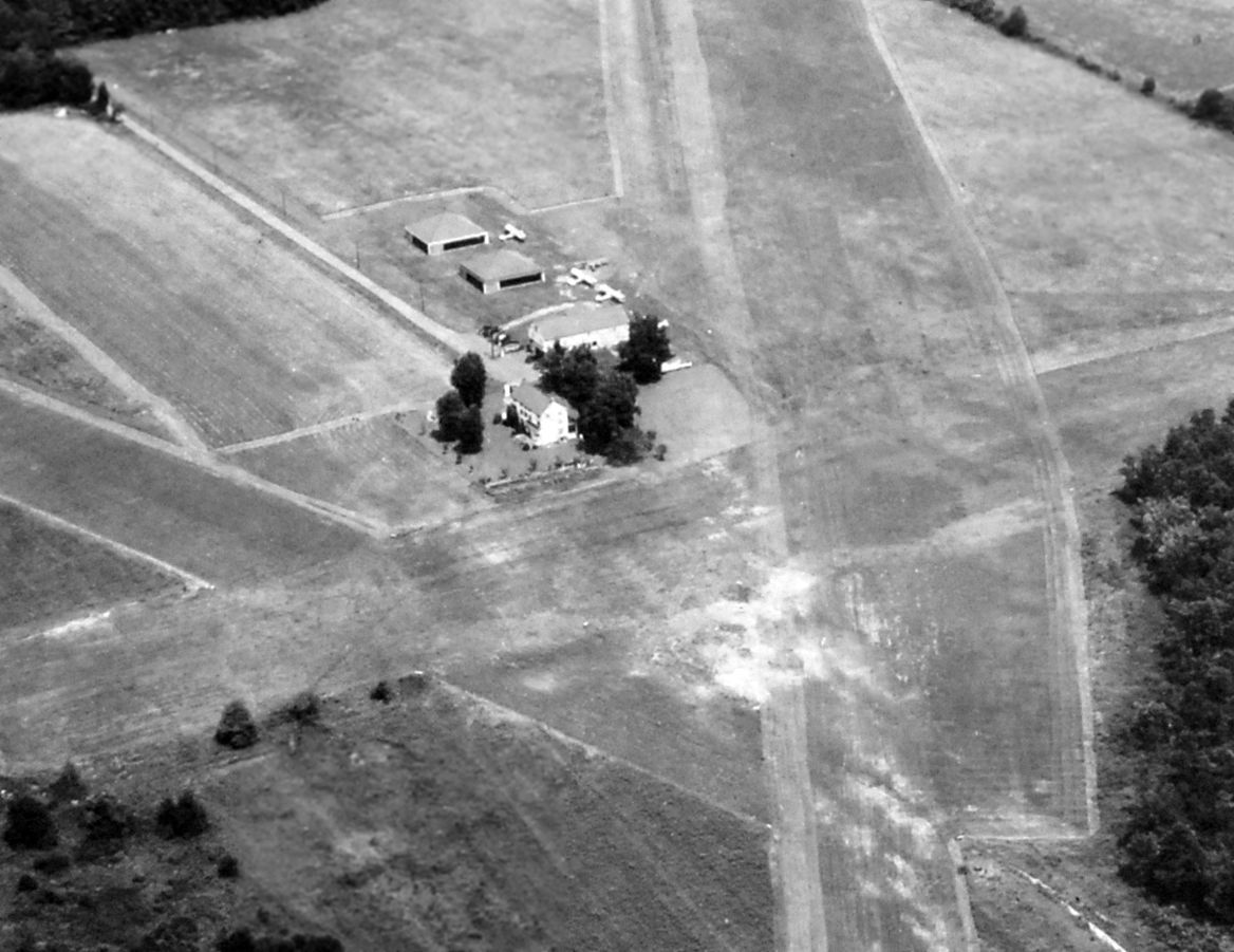
A 5/20/48 USGS aerial photo depicted Perkiomen Valley Airport as having 2 unpaved runways & a few small buildings along the southeast side.
A single-engine & 2 twin-engine planes were parked near the hangar on southeast side, along with a larger 4-engine plane, which incredibly appeared to be the B-17 bomber mentioned by Barbara West as having flown in 3 years before.
A 1950 aerial photo showed the B-17 had departed Perkiomen Valley Airport at some point between 1948-50.
The earliest topo map depiction which has been located of Perkiomen Valley Airport was on the 1951 USGS topo map.
It depicted Perkiomen Valley Airport as an irregularly-shaped property outline with a few small buildings along the southeast side.
A 1965 aerial view depicted Perkiomen Valley Airport as having 2 unpaved runways & a few small buildings along the southeast side.
A total of 14 light aircraft were visible parked on the field.
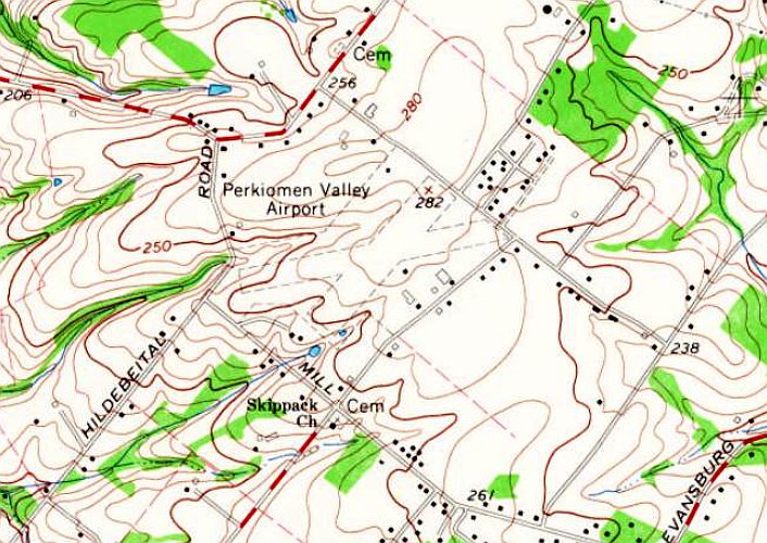
The 1966 USGS topo map depicted Perkiomen Valley Airport as having 2 unpaved runways & a few small buildings along the southeast side.
The 1966 Philadelphia Local Aeronautical Chart depicted Perkiomen Valley Airport as having a 3,000' unpaved runway.
A 1971 aerial view depicted Perkiomen Valley Airport as having gained a paved northeast/southwest runway at some point between 1966-71.
A total of 28 light aircraft were visible parked on the field.
The February 1973 Philadelphia Local Aeronautical Chart depicted Perkiomen Valley Airport as having a 2,300' paved northeast/southwest runway.
Steve Custer recalled, “As a high school Junior in 1974 I was a charter member, inaugural treasurer, and an eventual President
of Aviation Explorer Post 259 started at Perkiomen Valley Airport, sponsored by airport owner Lane Jubb.
The 3 years I spent flying with the Explorer Post 259 out of Perkiomen Valley Airport are some of my most cherished, and some of the most heartbreaking memories of my life.
Lane Jubb was a friend, as was my fixed-wing Instructor Colin Smith, and all the Post Advisors who shared their noteworthy lives & considerable experience with a bunch of kids.
These included air-traffic controllers, U.S. Navy carrier aviators, stewardess’, private pilots, and others.
The most noteworthy of these advisers was my dear friend, aerobatics, and helicopter Instructor Bruce Hayward.
Bruce was a former New York City helicopter tour pilot who served as a fixed-wing & helicopter instructor & charter pilot at Perkiomen Valley Airport, all at the age of 21.”
The 1983 USGS topo map depicted Perkiomen Valley Airport as having a paved northeast/southwest runway.
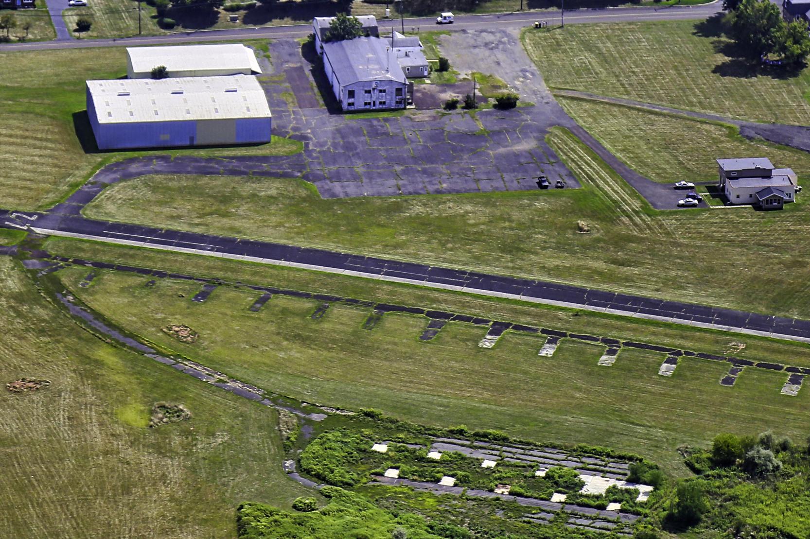
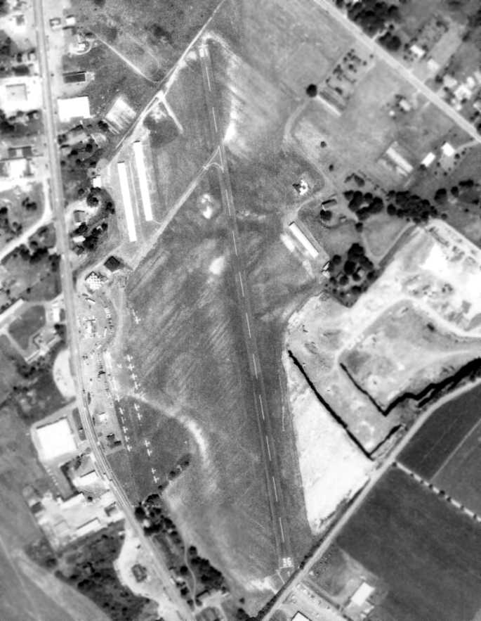
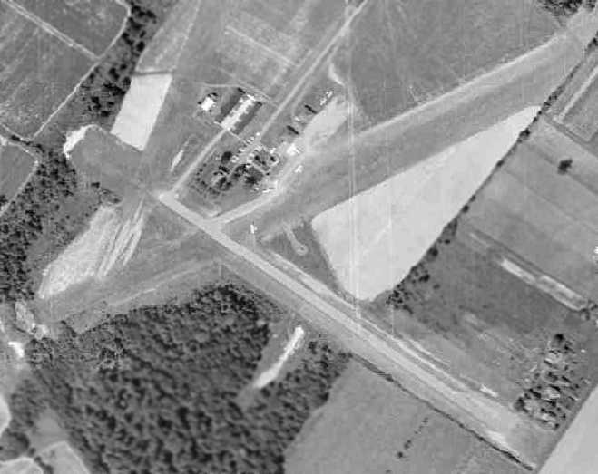
A 1992 USGS aerial view looking northwest depicted Perkiomen Valley Airport at perhaps the zenith of its popularity, with no less than 42 light aircraft visible parked on the field.

An 8/5/07 photo of a pretty 1945 Aeronca 7AC-90 at Perkiomen Valley Airport.
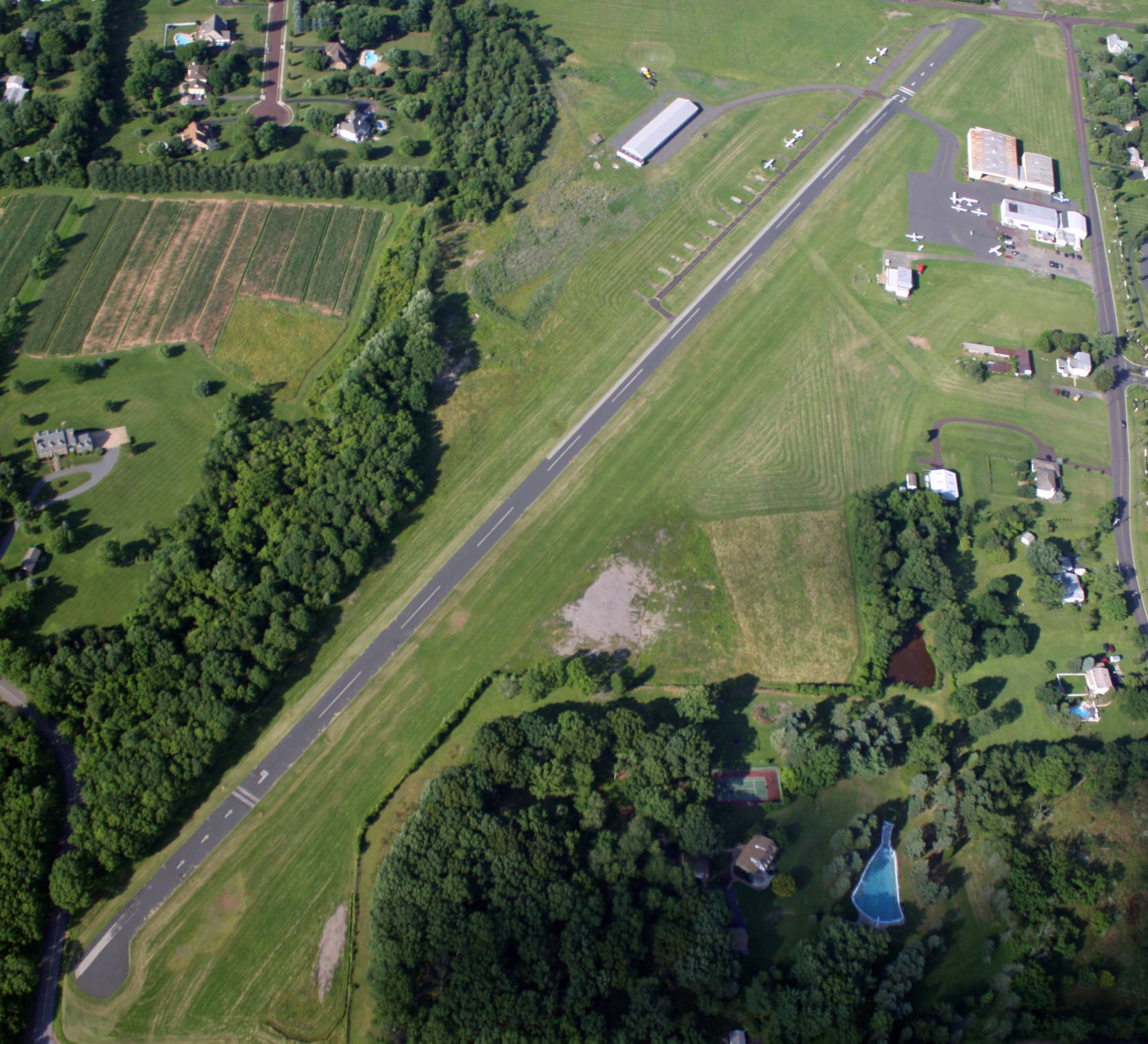
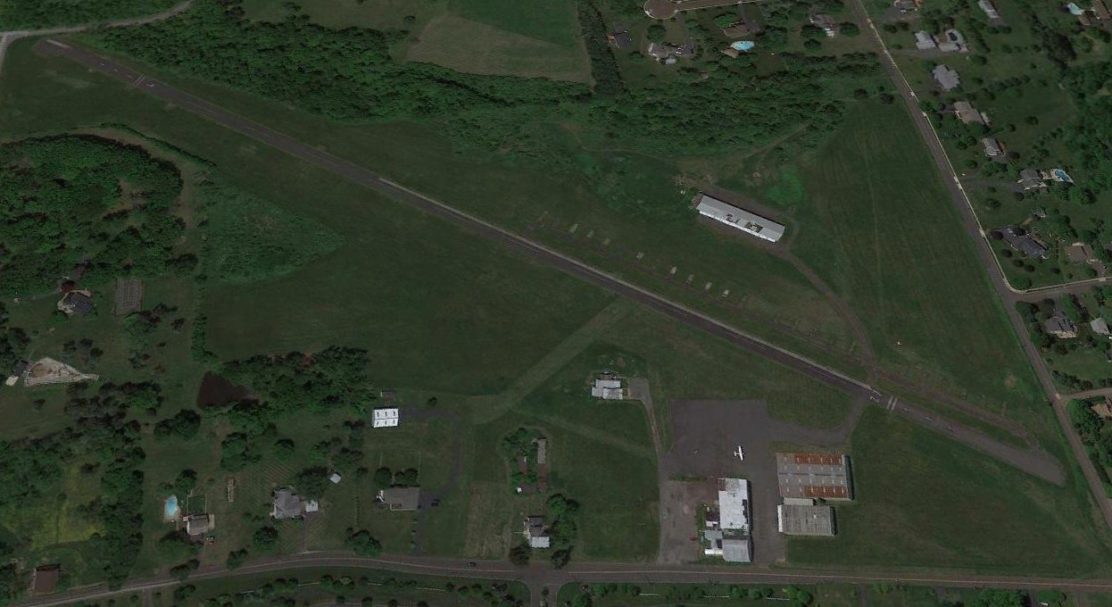
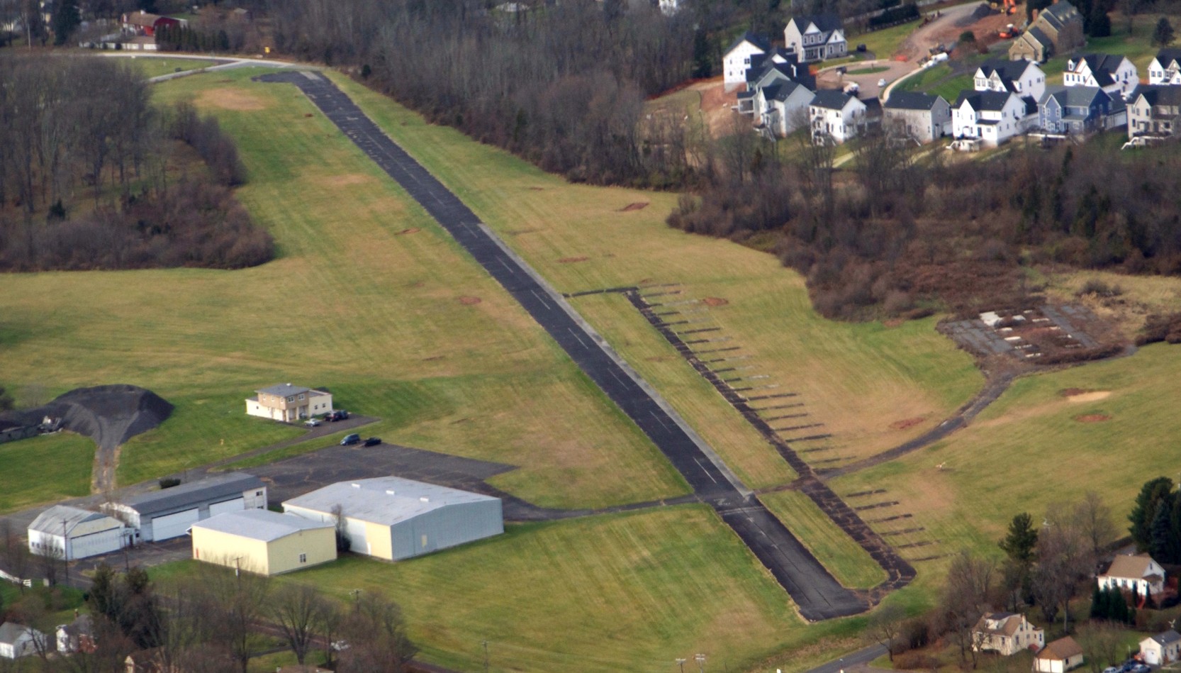
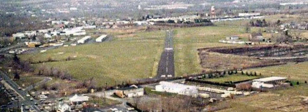
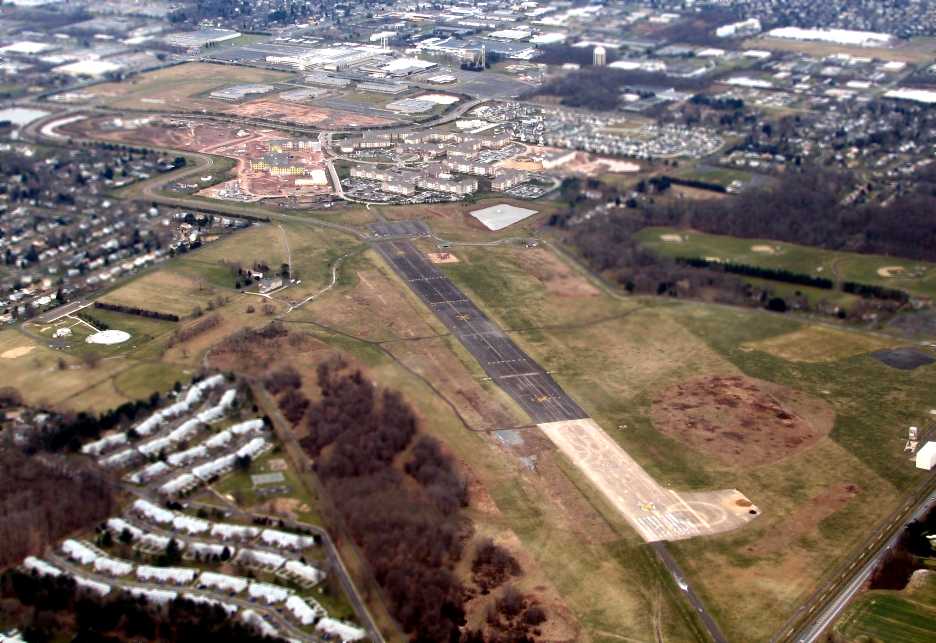
A 7/5/08 aerial view looking east at Perkiomen Valley Airport.
For the year ending 3/15/12, the FAA's Airport/Facility Directory data described Perkiomen Valley Airport as conducting an average of 1,293 takeoffs or landings per month.
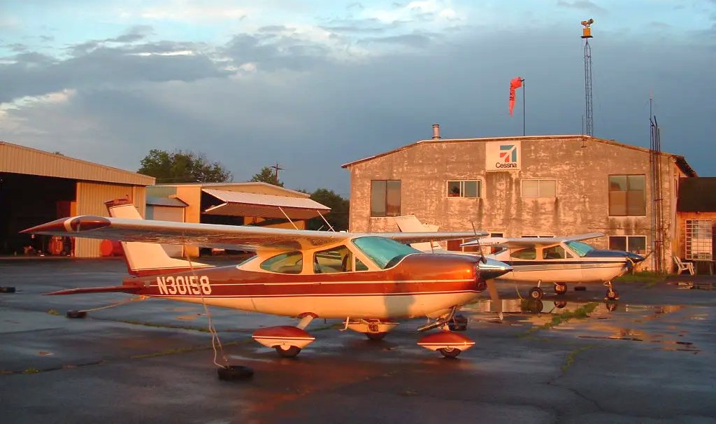
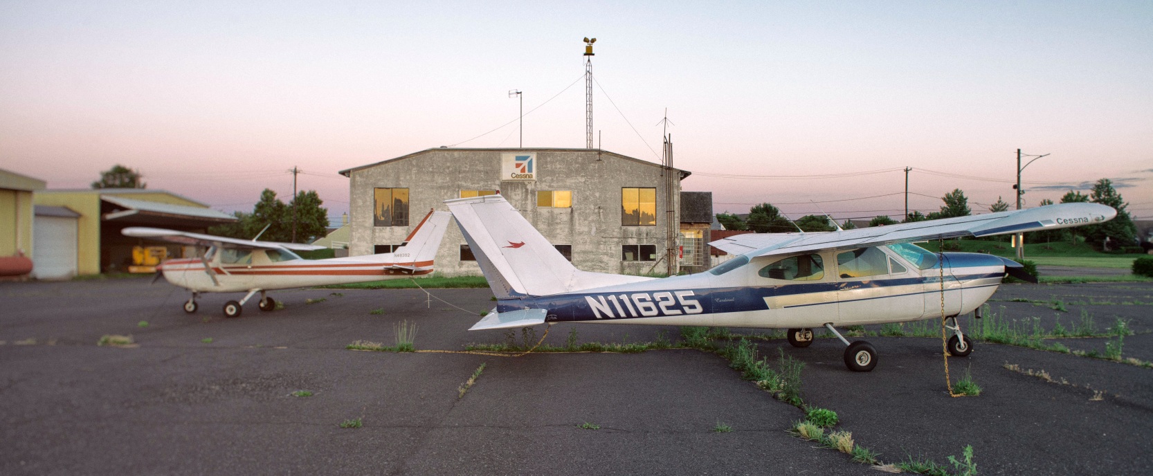
A circa 2013 photo of 2 Cessna 177 Cardinals parked in front of the Perkiomen Valley Airport hangars.
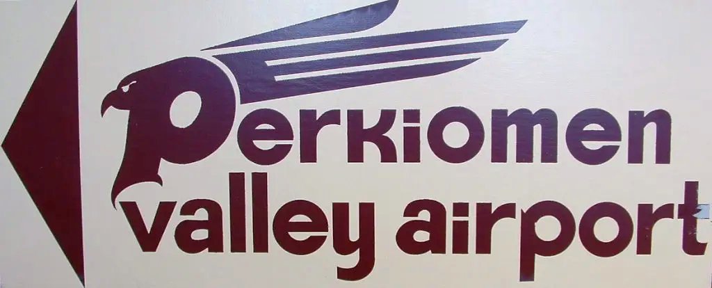
A circa 2013 photo a Perkiomen Valley Airport sign.
A 6/6/14 photo of a Cessna 152 & 177 parked in front of the Perkiomen Valley Airport hangars.
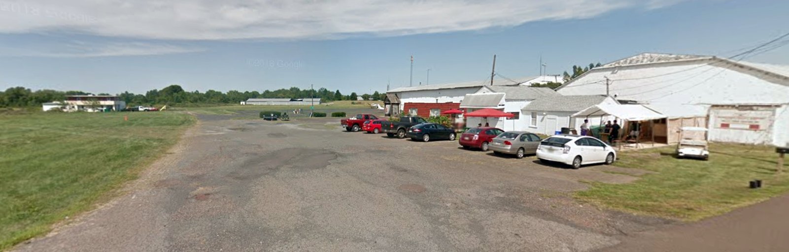
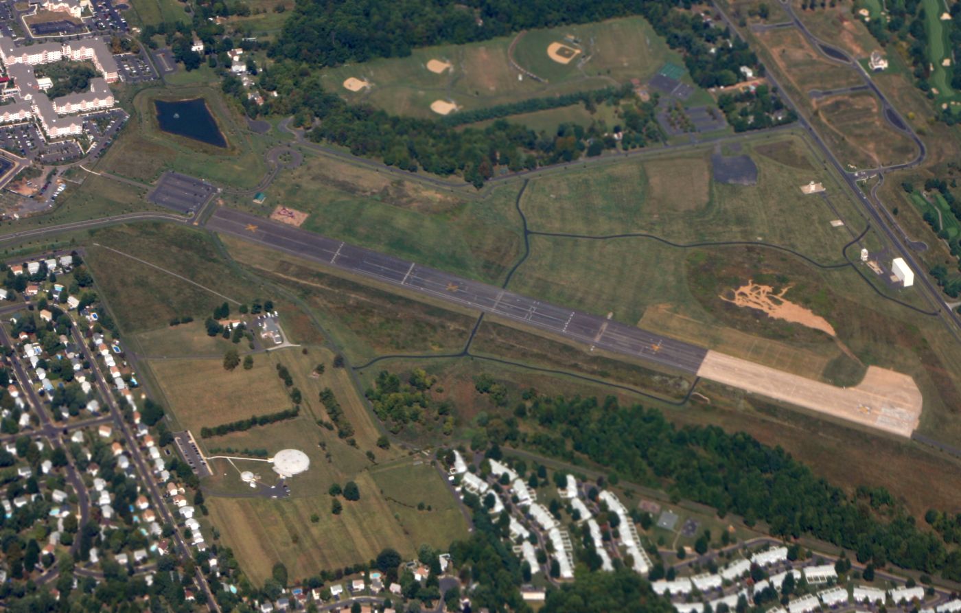
A September 2015 photo looking north at Perkiomen Valley Airport.

A September 2015 photo looking northwest at the Perkiomen Valley Airport hangars.
The last photo which has been located showing an aircraft at Perkiomen Valley Airport was a 2016 aerial view looking northwest.
Compared to previous photos, what a sad sight: showing a lone aircraft parked on the ramp.
For the year ending 9/20/18, the FAA's Airport/Facility Directory data described Perkiomen Valley Airport as conducting an average of 22 takeoffs or landings per month.
An 11/29/19 aerial view looking east at Perkiomen Valley Airport showed the field devoid of aircraft.
The hangar on the north side had been removed at some point between 2016-19.
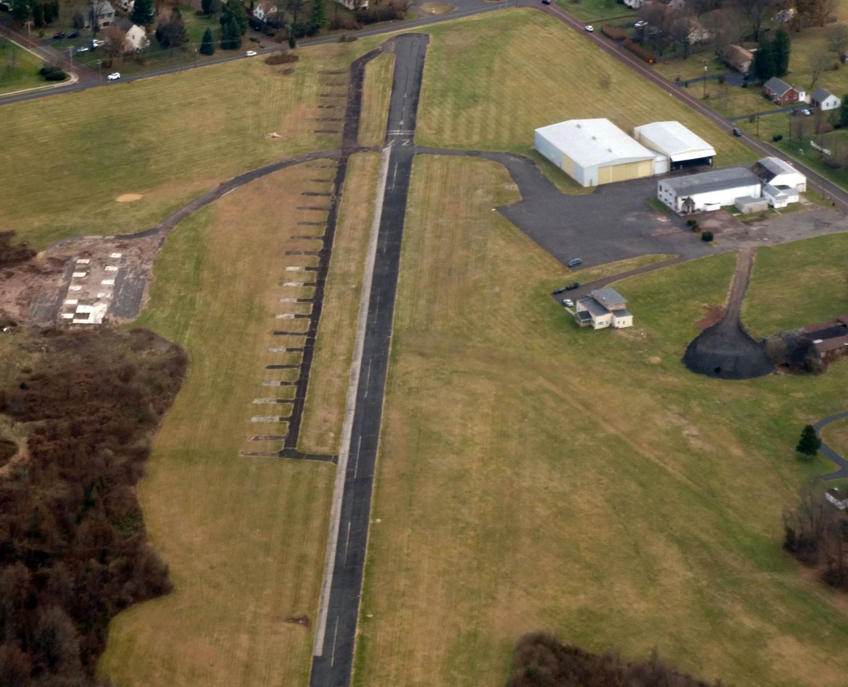
A 2020 aerial view looking northwest at Perkiomen Valley Airport in a similar fashion as the 2019 photo.
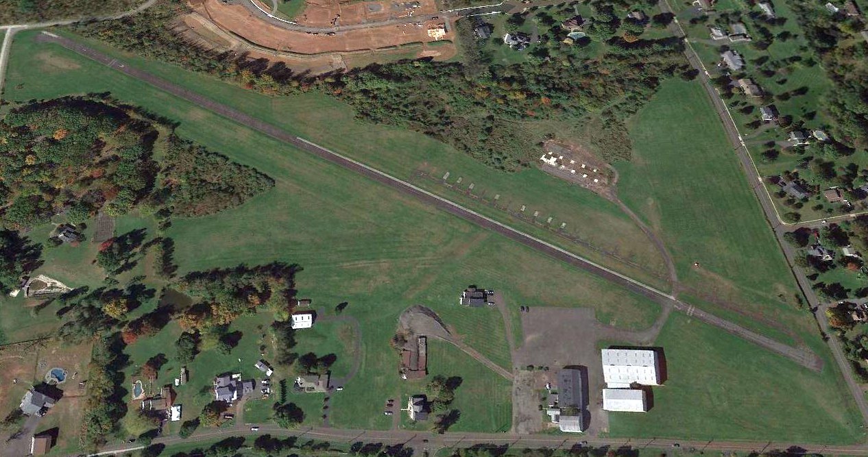
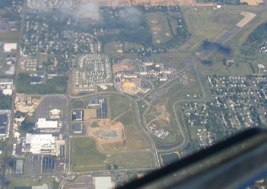
A circa 2021 3-D photo looking west at Perkiomen Valley Airport showed the field remained mostly intact, but the ramp was being used to store construction vehicles.
According to Wikipedia, “Perkiomen Valley Airport covers an area of 60 acres. Valley Forge Aviation is a fixed-base operator located on the field.”
It listed the owner as “Estate of Lane Jubb”.
As of 2021, Perkiomen Valley Airport's status was evidently changed to a private airfield, and its identifier changed from N10 to 32PA.
The FAA's Airport/Facility Directory data described Perkiomen Valley Airport as being owned by PV53 LLC, and managed by David Rittenhouse.
The field was said to have a single asphalt 2,880' Runway 9/27, “in poor condition”, and to have 3 single-engine based aircraft.
The 2021 Philadelphia Local Aeronautical Chart depicted Perkiomen Valley Airport as a private airfield having a 2,900' paved northeast/southwest runway.
According to Wikipedia, Perkiomen Valley Airport “closed in March 2021.”
Tom Doblmaier reported in 2021, “Perkiomen Valley Airport has been removed from the latest GPS database.
The runway is not marked with 'X's but I found comments which indicated it was closed in March this year & it looks like a developer has bought the land.”
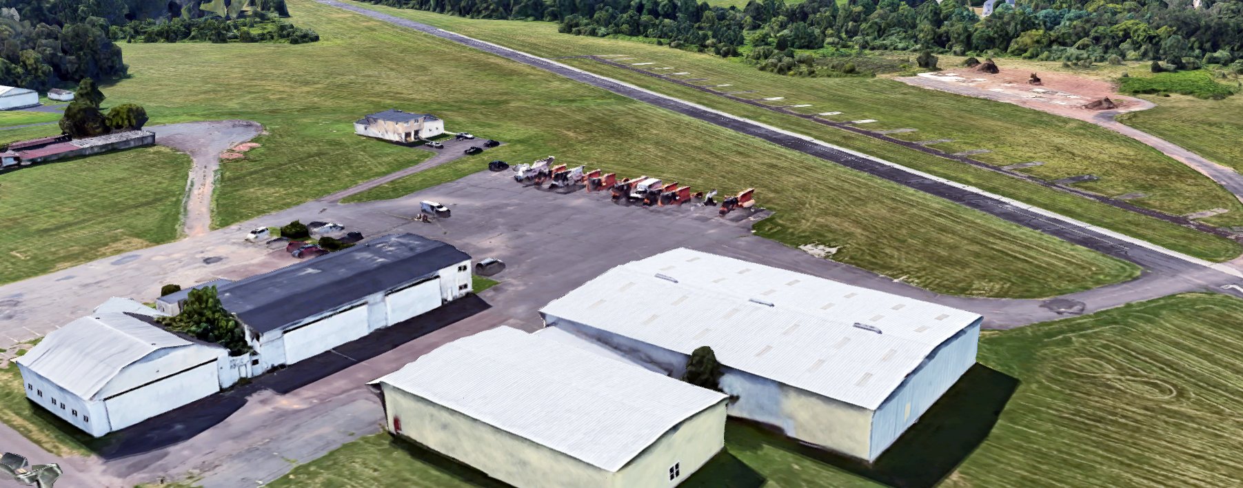
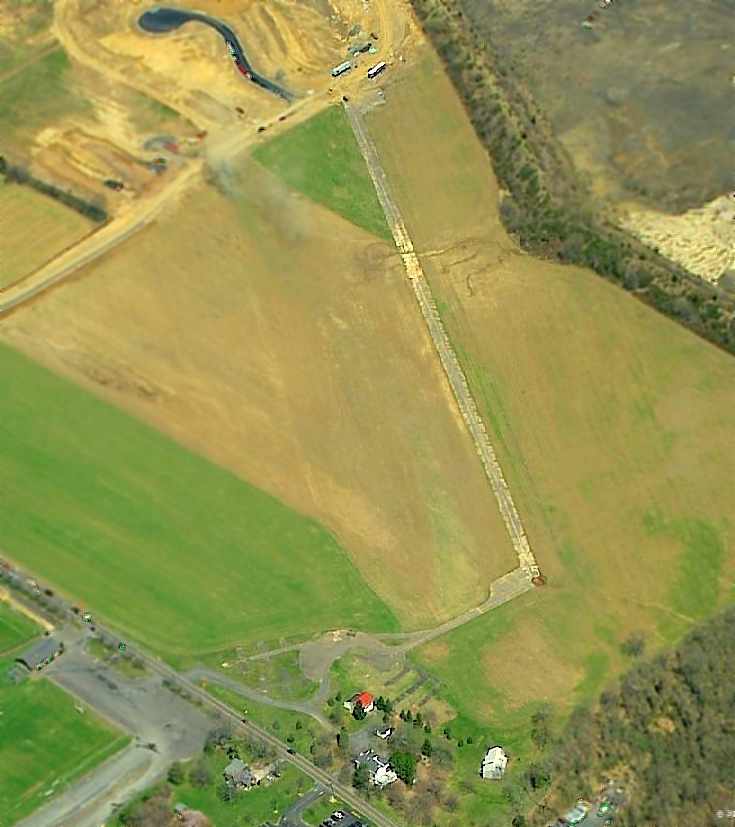
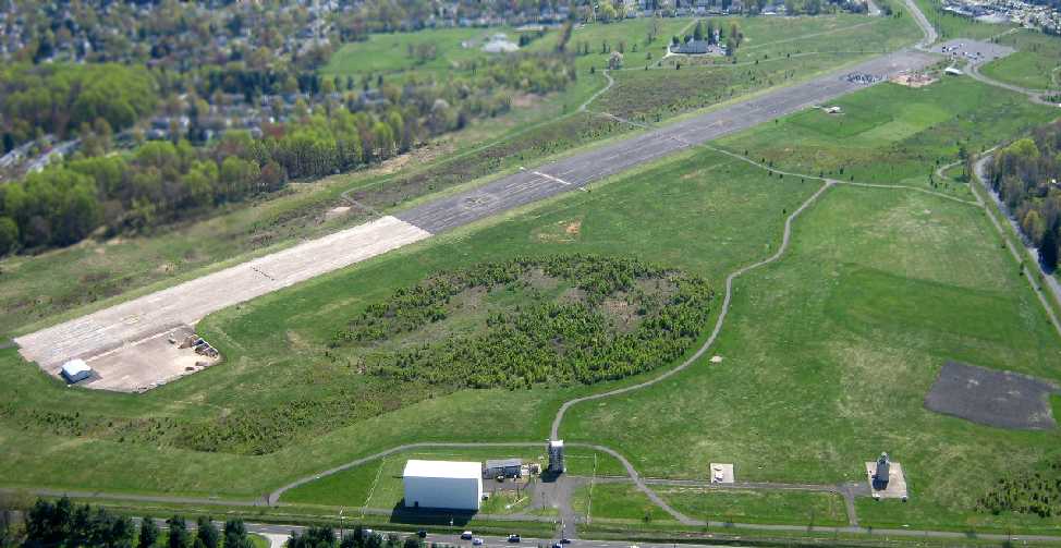
A 12/16/21 aerial view by Tom Doblmaier looking west at Perkiomen Valley Airport.
A 12/16/21 aerial view by Tom Doblmaier looking southeast at the Perkiomen Valley Airport hangars.
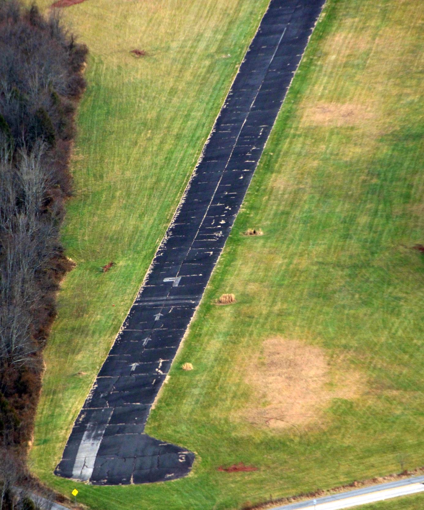
A 12/16/21 aerial view by Tom Doblmaier looking east at the Perkiomen Valley Airport Runway 9 pavement.
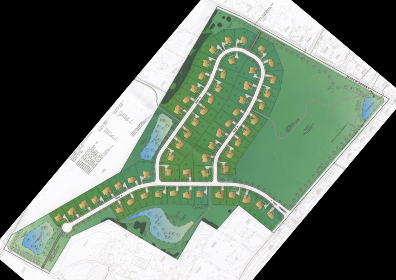
A 2022 plan for the Mill Run Subdivision which is proposed for the site of Perkiomen Valley Airport (courtesy of Tanya Kateusz).
Tanya Kateusz reported in 2022, “Perkiomen Valley Airport is still being used at the moment, as a couple of private planes still fly out occasionally.
We can only hope that someone comes along & makes an offer to keep the airport or that Interest rates will go up & make it too costly for the developer to build.
We have 502 signatures with opposition to this development. I believe our Township will rule on July 13th to allow for this Cluster Option to be used for this space.
It still has to go through DEP for environmental. We still have our fingers crossed.”

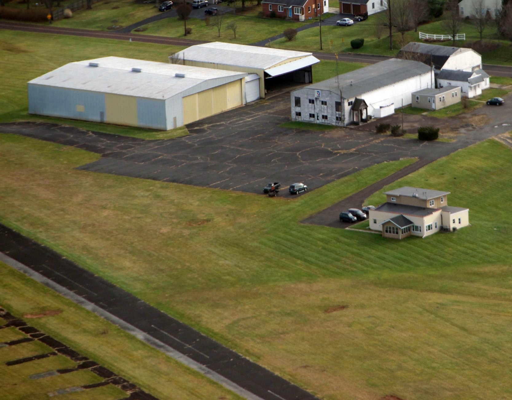
A 9/3/22 aerial view by Ed Figuli looking northwest at Perkiomen Valley Airport.
Ed reported, since its closure “it has been just wasting away. I think there are plans to build homes on the property. Easily done in this area northwest of Philadelphia.”
A 9/3/22 aerial view by Ed Figuli looking south at the hangars on the south side of Perkiomen Valley Airport.
Ed reported, “The hangars & administration building are still standing. They appear to be used by whoever is on the field now.
I think there was another hangar on the north side of the field. I think those tiedowns were almost always filled back in the heyday of General Aviation.
Of course this was 'the sticks' from Philadelphia back then. Now it is the burbs with limited places to build homes so away goes the airport.
I’m sure there will be McMansions on this property within the next few years.”
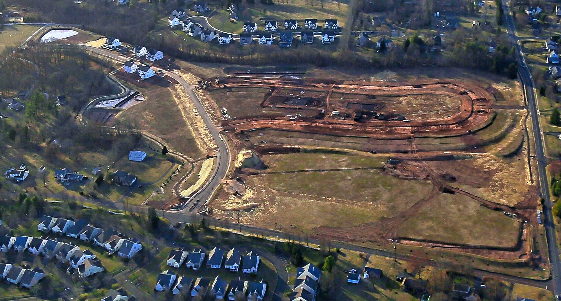
A June 2024 aerial view by Mary Wunder looking southeast at Perkiomen Valley Airport.
S. Holliday reported, “All but 1 hangar [are] gone (maybe someone bought the hangar & is waiting for relocation).
It's hard to see in the photo but the runway has been ground-up. A rumor is that a B-17 is buried under the hangar.”
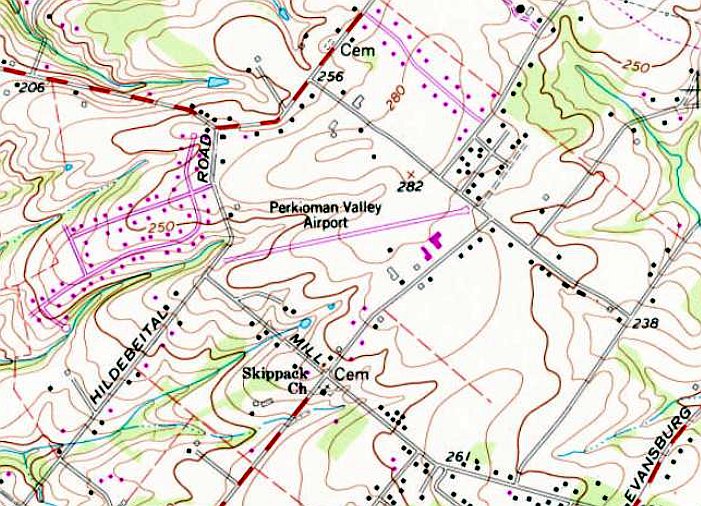
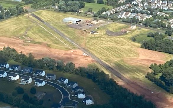
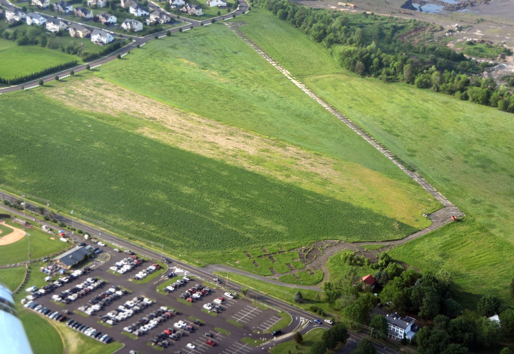
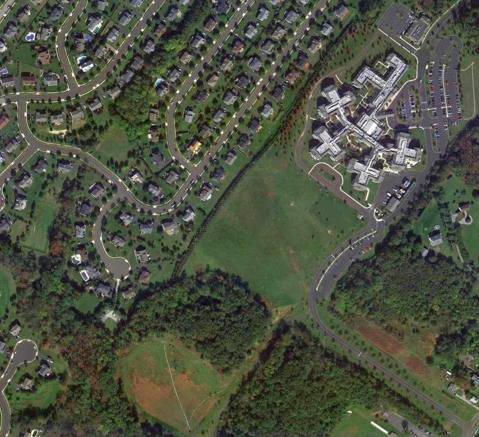
A 3/13/25 aerial view by Ed Figuli looking northwest at the Perkiomen Airport site.
Ed observed, “There is nothing left of the former airport. All the hangars, FBO buildings, and runway are gone. Sad to see. The departure end of Runway 27 is where the pond is on the left side of the construction area.”
As of 2025, street maps label the site of Perkiomnen Valley Airport as the Charterfield Landing housing development.
Steve Custer observed, “How sad so many general aviation airports with such rich & significant history
have fallen victim to the greed-fueled & flawed logic of surrounding them, up to the threshold, with housing developments.
Why after an airport has existed for 40, 50, 60 or more years is everyone suddenly surprised & asking, 'Where did all these airplanes come from?'”
Thanks to Tom Doblmaier for pointing out this airfield.
____________________________________________________
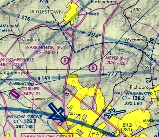
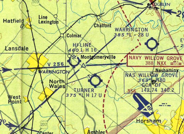
Warrington Airport (8N9), Warrington, PA
40.26, -75.14 (North of Willow Grove NAS, PA)
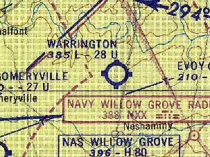
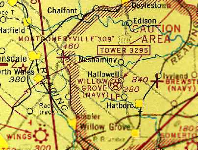
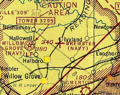
Warrington Airfield (and a large number of other little airports), as depicted on the January 1947 NY Sectional Chart.
This is yet another one of the large number of vanished little airports which used to surround Philadelphia.
Warrington Airfield was apparently built at some point between 1946-47,
as it was not depicted on the 1943 USGS topo map,
listed in the 1945 AAF Airfield Directory (courtesy of Scott Murdock), or depicted on the July 1946 NY Sectional Chart.
The earliest depiction of Warrington Airfield which has been located was on the January 1947 NY Sectional Chart.
It depicted Warrington as a commercial/municipal airport.
According to Ken Samen (Vice Chairman Warrington Township Historic Commission),
“The Warrington Airfield once operated on farmland owned by the Cadwallader family.
The Cornell family would later buy this property.
The Airfield began operation shortly after World War II, when Norman Cornell provided part of his property to his son Ernest Cornell,
who had returned from WWII, and wanted to continue his love of flight.”
In 1947 the "Brewster Flying Club" relocated from Somerton Airport to the Warrington Airport
and took on the name of "Warrington Flying Club".
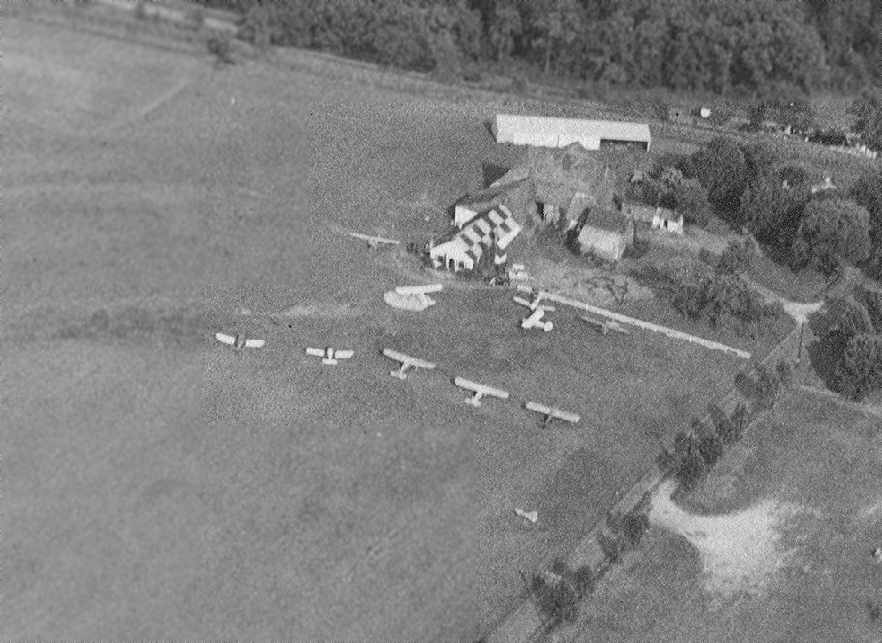
The earliest photo which has been located of Warrington Airport was a 6/17/48 aerial view.
It depicted Warrington as having 2 unpaved runways, with several buildings & 7 light aircraft visible at the south end of the field.
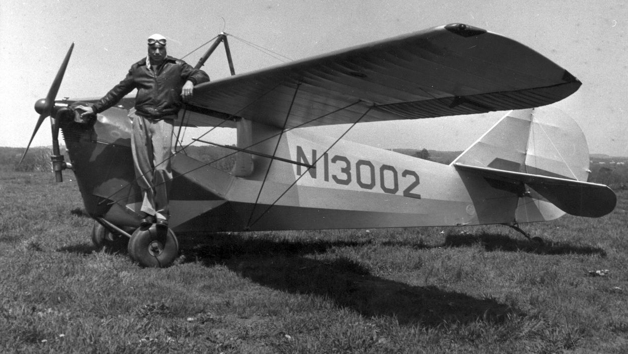
A circa 1940s photo of an unidentified pilot on top of N13002, A 1932 Aeronca C-3, serial #A217, at Warrington Airport.
According to Ken Samen, “Alby Cornell took over management of the Airfield in 1951.
Alby’s services at the airfield include flight lessons, transportation, and plane storage.
Later it would be commonplace for providing shuttle services to the Philadelphia Airport.”
The Warrington Flying Club moved to Montgomeryville Airport on 10/11/53 by a majority vote of the membership.
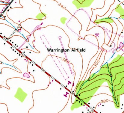
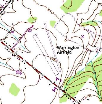
The 1953 USGS topo map depicted a “Warrington Airfield” label on an empty field, with no other details.
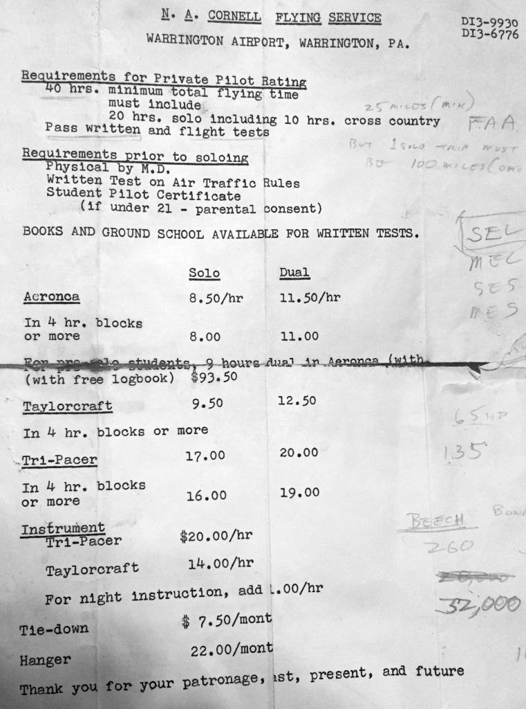
A 1950s price list that Joe Brett paid for his lessons at Warrington Airport (courtesy of Alan Brett).
Alan Brett reported, “My father took lessons at Warrington Airport in the 1950s with Albie (owner of the airport).”
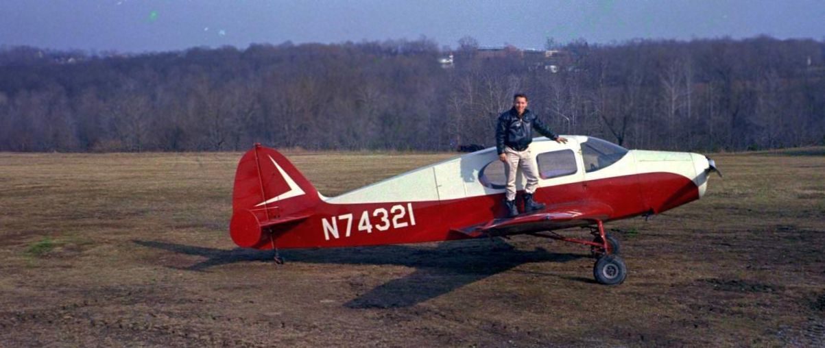
A circa 1950s photo of an unidentified pilot on top of N74321, at 1947 Bellanca 14-13-2 Cruisair Senior, serial #1434, at Warrington Airport.
The 1957 PA Aeronautical Chart (courtesy of Mike Keefe) described Warrington as having 2 turf runways: a 2,600' northeast/southwest strip & a 1,425' east/west strip.
The operator was listed as Norman Cornell.
A 1958 aerial view depicted Warrington as having 2 unpaved runways, with several buildings & 9 light aircraft visible at the south end of the field.
The Aerodromes table on the 1958 NY Sectional Chart (courtesy of Norman Freed) described Warrington as having 2 runways,
with the primary runway being a 2,500' turf strip.
The 1959 Philadelphia Local Aeronautical Chart (courtesy of Chris Kennedy) depicted Warrington Airport as having a 2,800' unpaved runway.
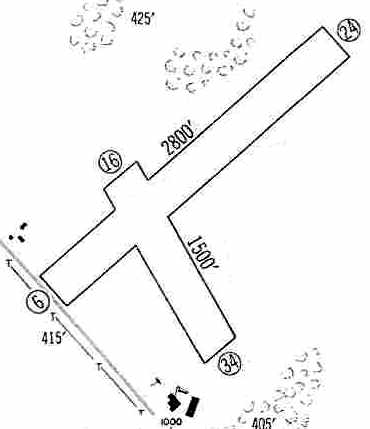
The 1960 Jeppesen Airway Manual (courtesy of Chris Kennedy) depicted Warrington as having 2 unpaved runways (2,800' Runway 6/24 & 1,500' Runway 16/34),
along with 2 buildings at the south end of the field.
A circa 1960 aerial photo of Warrington Airport (courtesy of Ken Samen of the Warrington Township Historic Commission)
showed ten single-engine aircraft clustered around a few small hangars.
A circa 1960 photo of a Stinson V-77 Warrington Airport, with a Taylorcraft behind it (courtesy of Ken Samen).
The 1962 AOPA Airport Directory described Warrington as having 2 runways,
with the longest being the 2,800' sod Runway 6/24, and listed the operator as N. A. Cornell.
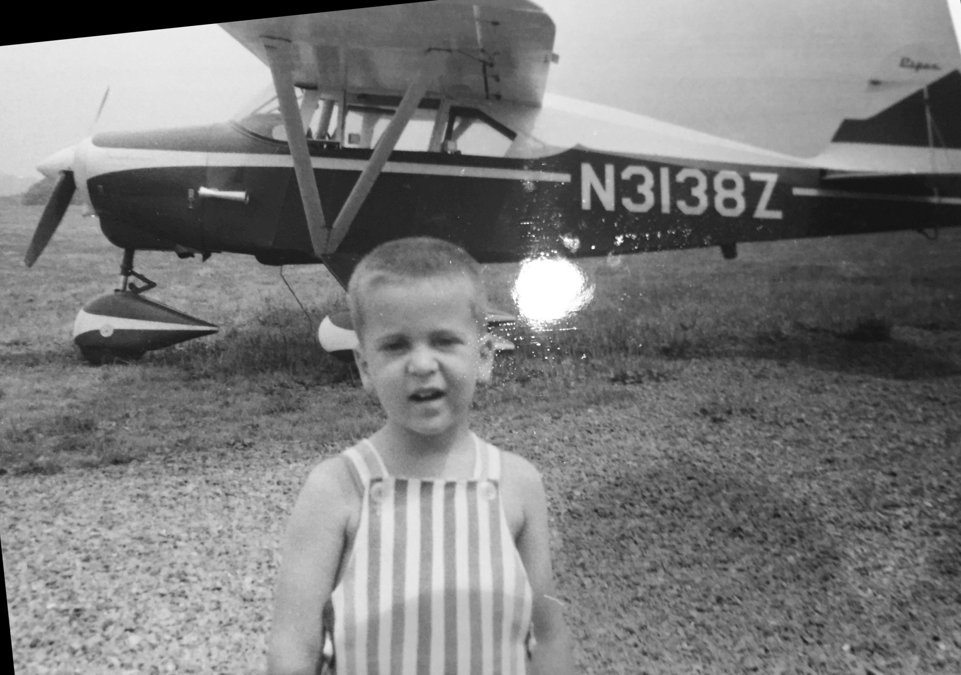
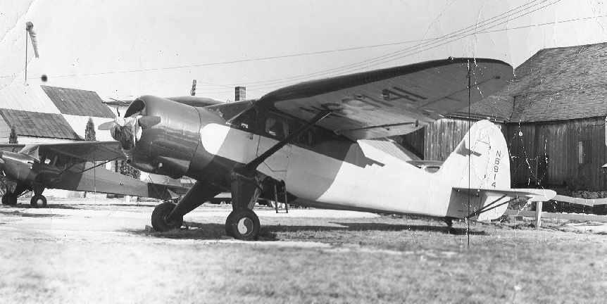
A 1963 photo by Joseph Brett of Alan Brett in front of N3138Z, a 1959 Piper PA-22-150 at Warrington Airport (courtesy of Alan Brett).
The 1968 USGS topo map depicted a “Warrington Airfield” label on an empty field, with no other details.
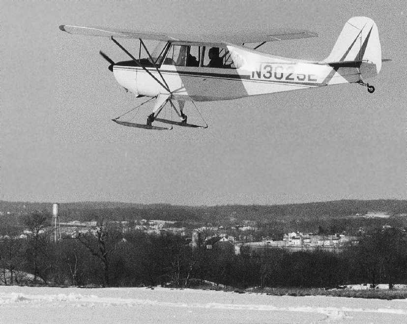
A March 1969 photo of a ski-equipped Aeronca Champion 7AC at Warrington Airport (courtesy of Ken Samen).
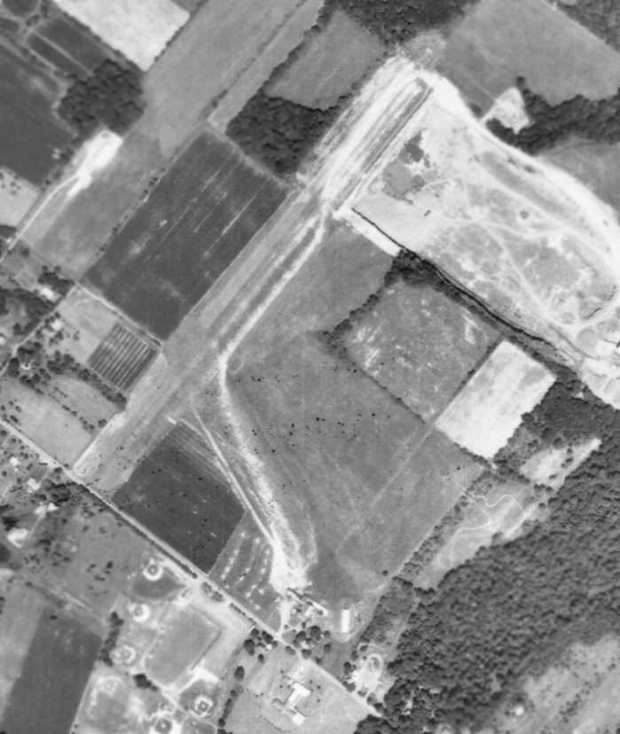
An 8/17/71 aerial photo of Warrington Airport depicted the field as having 2 unpaved runways,
with a large number of aircraft visible at the south end of the field.
According to Ken Samen, “The main runway at Warrington was paved in 1973.”
The northeast/southwest unpaved runway was replaced by a considerably shorter paved runway, oriented northwest/southeast.
The airport's property had shrunken somewhat, as a quarry had eaten up a northern chunk of the property.
The 1973 USGS topo map depicted Warrington Airfield's new paved runway in addition to the original unpaved runway.
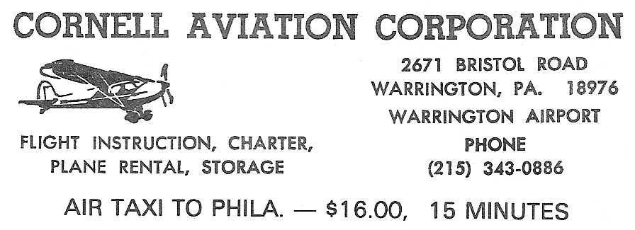
An advertisement for Cornell Aviation Corporation at Warrington Airport (courtesy of Ken Samen).
The ad was printed in "Guide to Warrington Township 1973-74 Edition", a booklet produced by the township to promote business & government services.
Keith Ebel recalled, “While stationed [at NADC Warminster] I learned to fly
and took my first flight in a Piper PA-28-150 on 1/19/75 at the Warrington Airport with Albert Terry as my CFI.
I was always a little freaked out because the Warrington runway had a big 'dip' in the middle & dropped off severely at the North end.”
The February 1975 Philadelphia Terminal Aeronautical Chart depicted Warrington Airport as a private airfield having an 1,800' unpaved runway.
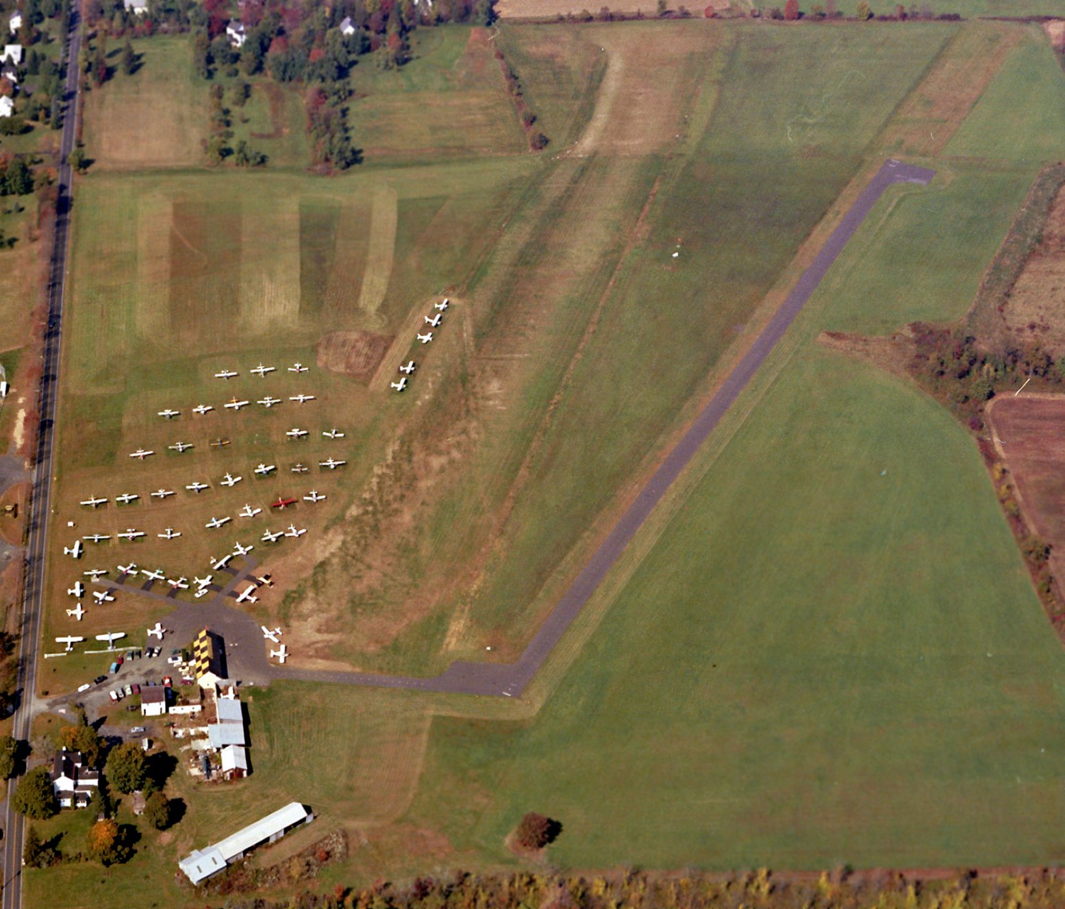
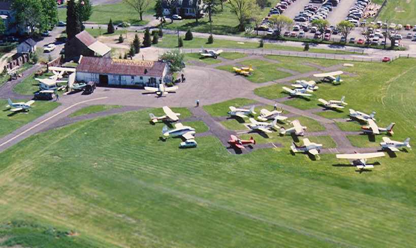
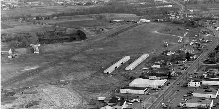
A 10/7/78 aerial view looking west (from the Dallin Aerial Survey Collection, courtesy of the Hagley Museum & Library) depicted Warrington Airport as quite well-used, with several dozen light planes visible.
The 1982 AOPA Airport Directory (courtesy of Ed Drury) described Warrington as having a 1,600' asphalt Runway 17/35 & a 1,800' turf runway 15/33.
What was previously the field's primary runway (6/24) had apparently been abandoned.
The operator was listed as Cornell Aviation. The remarks said, "Limited to single engine aircraft under 2,000 lbs."
Warrington was still listed among active airports in the 1986 Flight Guide (according to Chris Kennedy).
The 1987 Philadelphia Terminal Aeronautical Chart (courtesy of Gwen Shafer) depicted Warrington Airport as having a 2,300' unpaved runway.
A 1991 aerial photo looking north while on approach to Warrington Airport's Runway 35
(courtesy of Ken Samen of the Warrington Township Historic Commission).
It depicted Warrington as having a single paved runway, along with several hangars & light aircraft to the west.
A 1991 aerial photo of Warrington Airport's ramp (courtesy of Ken Samen of the Warrington Township Historic Commission)
depicted a well-used airfield, with a total of over 20 light aircraft, including one twin-engine aircraft.
According to Ken Samen, “The Warrington Airfield closed in 1991.”
Alby Cornell stated that the field was not closed due to neighbor complaints, “It was just time for him to retire.”
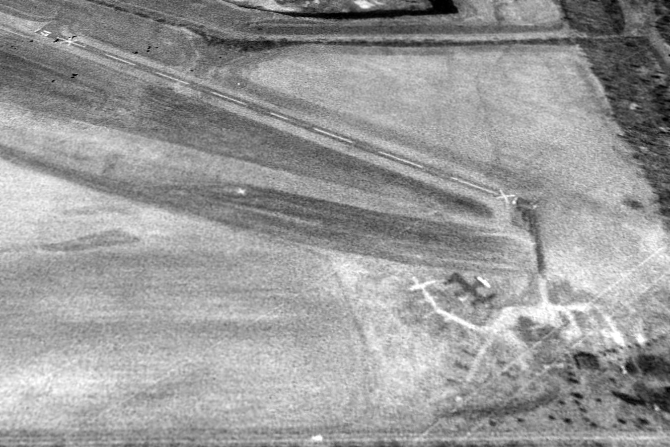
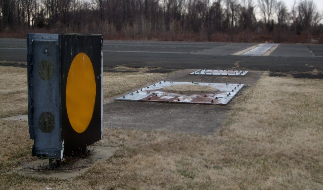
A 1992 aerial view looking northeast at Warrington Airport, shortly after it was closed, with closed-runway “X” symbols on each runway end, and devoid of planes.
By the time of the 1993 New York Sectional Chart, Warrington Airfield was no longer depicted at all.
The 2 runways of Warrington Airfield were still depicted on the 1995 USGS topo map.
In a circa 2001-2005 aerial photo, Warrington's former paved runway was still largely intact, including the Runway “35” markings.
The hangar had been removed, but a house still remained near the former ramp at the bottom of the picture.
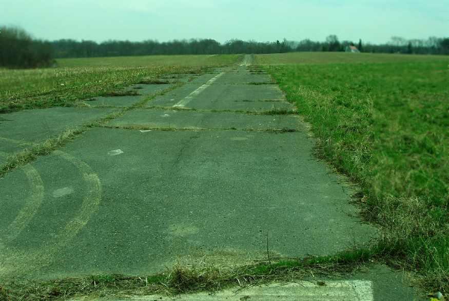
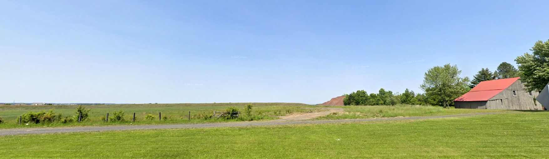
A 2005 photo (courtesy of Ken Samen) looking along the abandoned runway of Warrington Airport.
According to Ken Samen, “In 2005 the remnants of the asphalt airfield are being removed to make way for a large housing development.”
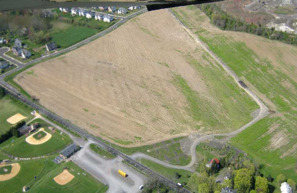
A 4/13/12 aerial view by Mike Schatz looking north at the remains of Warrington Airport, “taken from my Cessna 152 at about 1,000' AGL.”
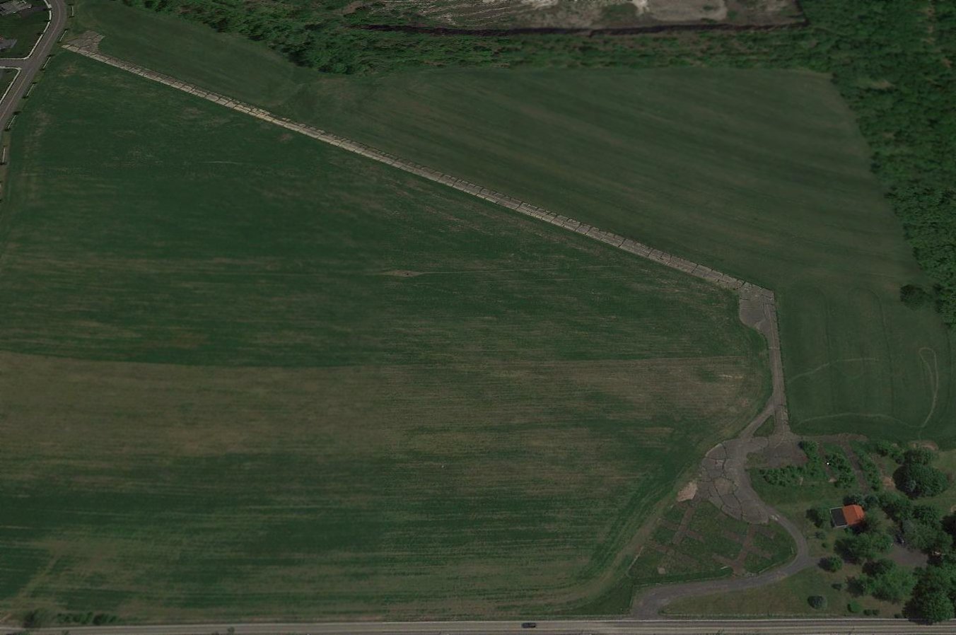
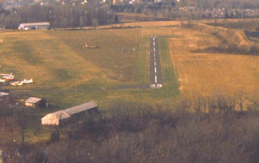
A 2016 aerial view looking northeast at the remains of Warrington Airport.
A 5/26/18 aerial view by Tom Doblmaier looking north at the site of Warrington Airfield. A shame to see this nice little paved runway going to waste.
A 2023 photo looking northeast at the site of Warrington Airfield's hangar shows that the property remains unredeveloped 32 years after the nice little airport closed.
The Warrington Airfield site is located northwest of the intersection of Easton Road & Bristol Road.
Thanks to Greg Bullough for pointing out this airfield.
____________________________________________________
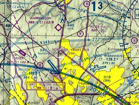
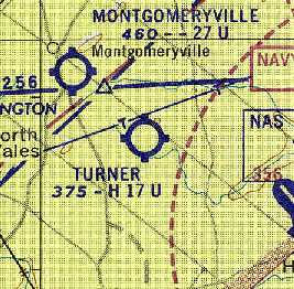
Montgomeryville Airport / Gloster Field / Hi-Line Airport / 309 Airport, Montgomeryville, PA
40.24, -75.24 (Northwest of Willow Grove NAS, PA)
Montgomeryville “309” Airport was labeled on the 1943 NY Sectional Chart (courtesy of Chris Kennedy) as “Montgomeryville '309'”.
This small general aviation airport was evidently established at some point between 1942-43,
as it was not yet depicted on the March 1942 NY Sectional Chart (according to Chris Kennedy).
The earliest depiction of Montgomeryville Airport which has been located was on the 1943 NY Sectional Chart (courtesy of Chris Kennedy).
It depicted the field as an auxiliary airfield - labeled as “Montgomeryville “309”,
a reference to Route 309 which ran adjacent to the airport.
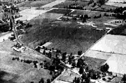
The earliest photo which has been located of the Montgomeryville Airport
was a circa 1942-45 aerial view looking north from the 1945 AAF Airfield Directory (courtesy of Scott Murdock).
It depicted the field as an open grass area.
The airfield in Montgomeryville was evidently renamed Gloster Field at some point between 1943-45,
as the 1945 AAF Airfield Directory (courtesy of Scott Murdock) listed the field as “Gloster Field (309 Airport)”.
It described the field as a 95 acre irregularly-shaped property within which were 4 sod runways, the longest being a 2,200' north/south strip.
The field was said to have a single 70' x 50' metal hangar, and to be privately owned.
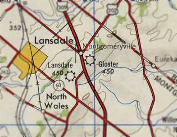
The airfield in Montgomeryville was evidently renamed Gloster at some point between 1943-47,
as that is how it was labeled on the 1947 USGS topo map.
The January 1947 NY Sectional Chart depicted Gloster as a commercial/municipal airport.
A 1948 aerial view depicted the Montgomeryville / Gloster Airport
as having a single north/south grass runway, with a checkerboard-roofed hangar on the west side.
A total of 5 aircraft were visible on the west side of the field.
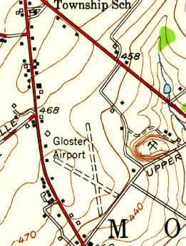
The 1952 USGS topo map depicted Gloster Airport as having 2 unpaved runways, with several small buildings along the southwest side.
A 9/13/58 aerial view (from Penn Pilot) depicted the Montgomeryville / Gloster Airport as having a single north/south grass runway,
with several hangars on the east & west sides (the hangar on the east had evidently been added at some point between 1948-58).
A total of 6 aircraft were visible on the west side of the field.
The airfield was evidently renamed “Hi-Line” at some point between 1952-61,
as that is how it was depicted on the 1961 Philadelphia Local Aeronautical Chart (courtesy of Tim Zukas).
It depicted Hi-Line as having a 1,600' paved runway.
The October 1963 Philadelphia Local Aeronautical Chart (courtesy of Boom Powell) depicted Hi-Line Airport as having a mere 1,600' paved runway.
The airfield was evidently renamed back to Montgomeryville at some point between 1963-65,
as the 1965 NY Sectional Chart depicted Montgomeryville Airport as having a 2,700' unpaved runway.
Montgomeryville evidently gained a paved runway at some point between 1965-67,
as the 1965 NY Sectional Chart depicted the field as having a 1,600' paved north/south runway.
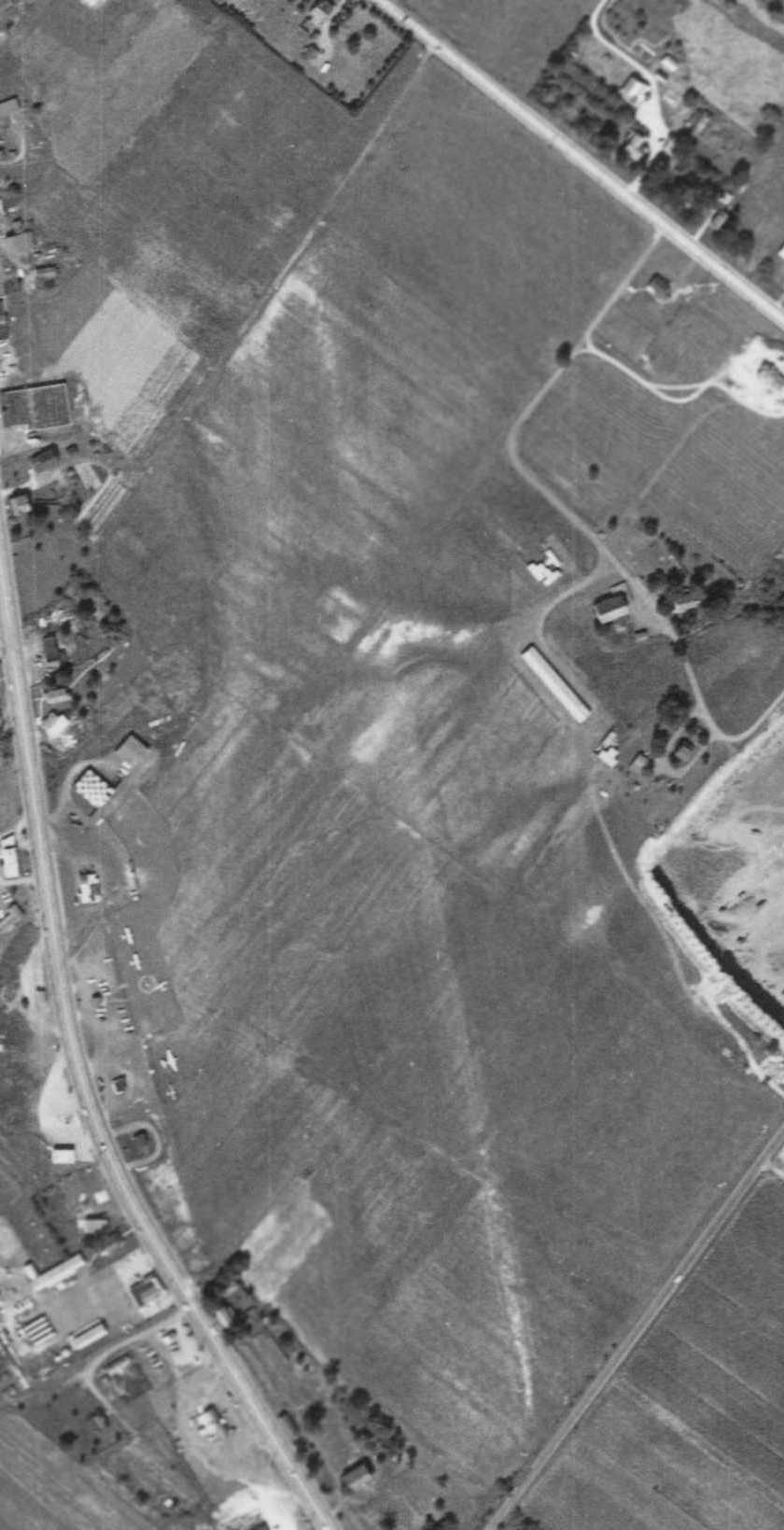
An 8/17/71 aerial view depicted Montgomeryville Airport in a very healthy state, with over 25 light aircraft visible parked on the field,
two rows of T-hangars on the northwest side of the field, and another row of T-hangars on the east side.
The field had a paved Runway 18/36.
An undated aerial view looking southeast at Montgomeryville Airport.
A 1974 photo (courtesy of Donald Pond) depicted several Civil Air Patrol aircraft at Montgomery field, including a military surplus Beech T-34 Mentor.
Donald recalled, “CAP Squadron 904 was originally based out of Montgomeryville & flew search & rescue missions from there.”
The last aeronautical chart depiction which has been located of Montgomeryville Airport was on the 1975 NY Sectional Chart.
It depicted Montgomeryville as having a single 2,700' paved north/south runway.
The last directory listing which has been located of Montgomeryville Airport was in the 1976 AOPA Airports USA Directory (according to Chris Kennedy).
The last photo which has been located of Montgomeryville Airport was a 4/8/78 aerial view looking north (courtesy of John Fitch), showing the field only a few months before it was evidently closed.
Montgomeryville Airport was evidently closed (for reasons unknown) at some point between 1976-78,
as it was depicted as an abandoned airfield on the December 1978 NY Sectional Chart.
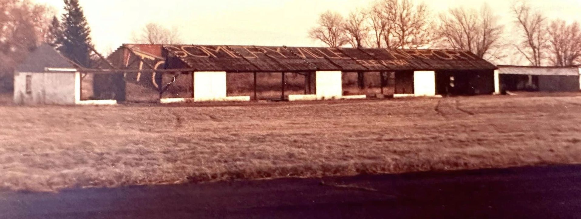
An undated view of a former hangar which had “Montgomeryville Airport” painted on its roof, presumably taken after the airport's closure.
The 1983 USGS topo map showed several large buildings occupying the site of Montgomeryville Airport.
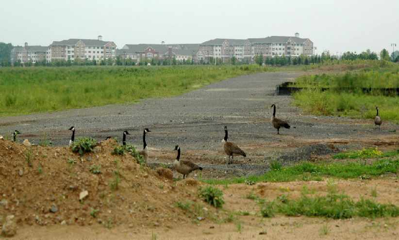
A 1992 USGS aerial photo showed that no trace of Montgomeryville Airport remained, with the site having been covered by a shopping center.
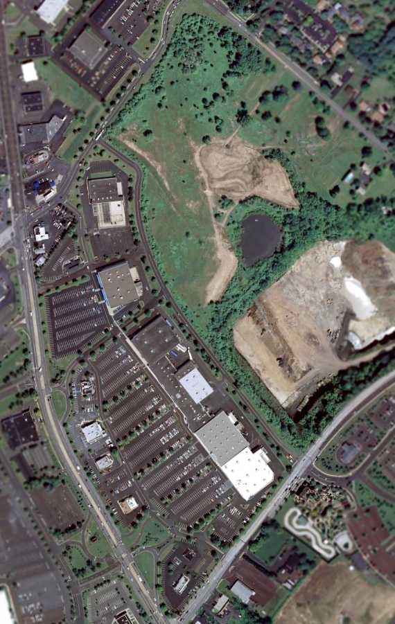
A 2007 aerial photo shows not a trace remaining of Montgomeryville Airport.
Street maps in 2008 show the southern portion of the Montgomertyville Airport site is covered by a shopping center called “Airport Square”.
The site of Montgomeryville Airport is located north of the intersection of Route 202 & Route 309.
____________________________________________________
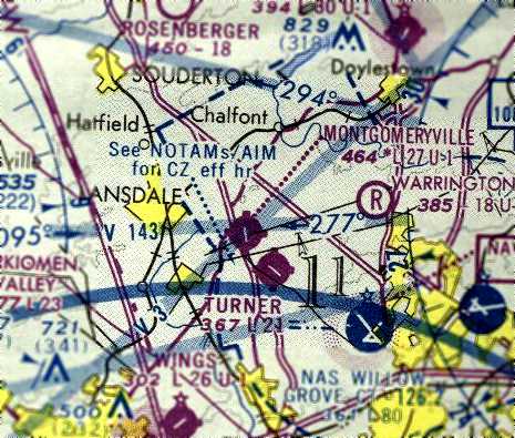
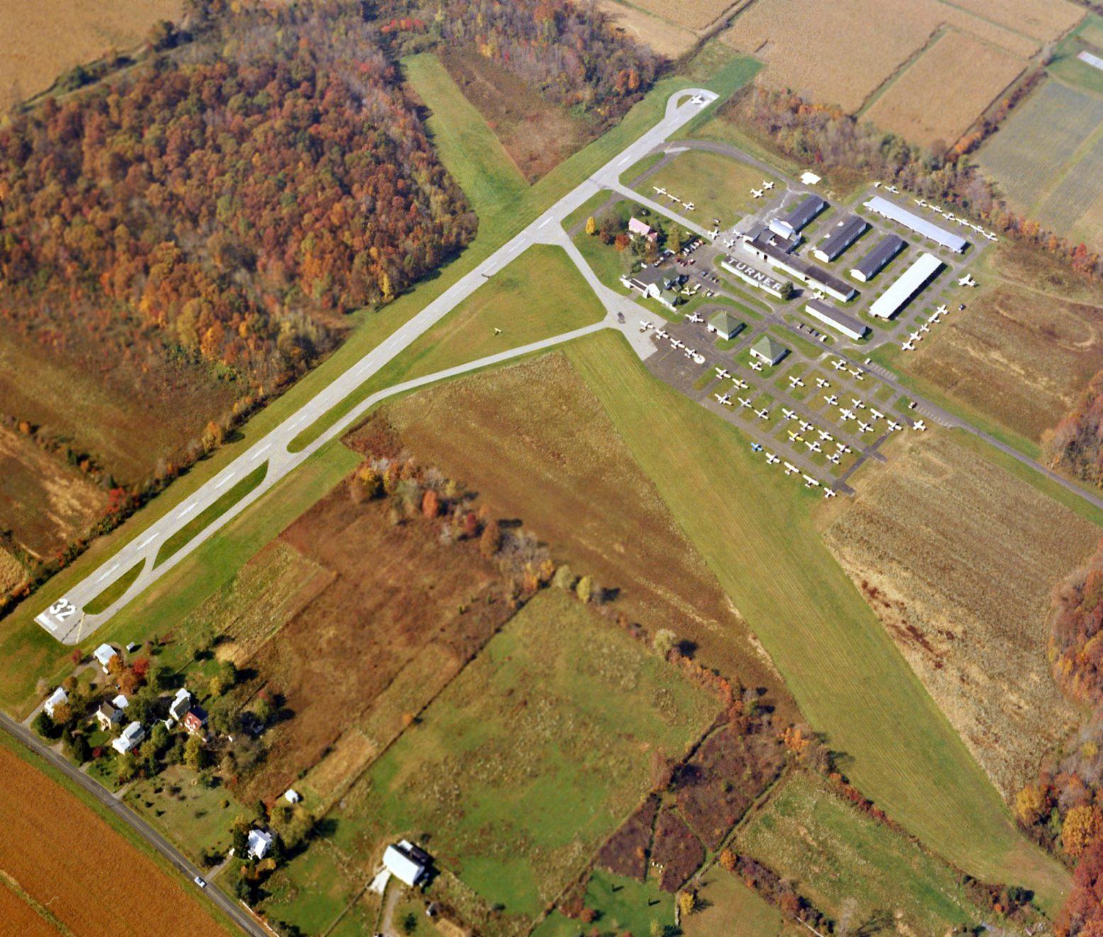
Turner Field, Prospectville, PA
40.22, -75.21 (Northwest of Willow Grove NAS, PA)
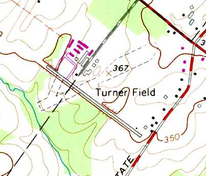
Turner Field (and a large number of other little airports), as depicted on the January 1947 NY Sectional Chart.
This small general aviation airport was located only 3 miles west of the Willow Grove Naval Air Station.
Turner Field was apparently built at some point between 1945-47,
as it was not depicted on the 1945 NY Sectional Chart (courtesy of Norman Freed)
nor listed in the 1945 AAF Airfield Directory (courtesy of Scott Murdock).
The earliest depiction of Turner Field which has been located was on the January 1947 NY Sectional Chart.
It depicted Turner as a commercial/municipal airport.
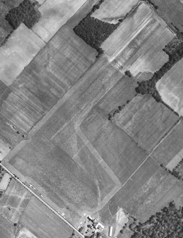
The earliest photo which has been located of Turner Field was a 5/2/48 aerial view.
It depicted the field as having 3 grass runways, with several buildings & one light aircraft on the north side of the field.
A 1949 aerial view looking northeast at Turner Field (courtesy of Steve Moyer)
showed Turner to have 3 grass runways, with 2 hangars & 2 other buildings on the north side of the field.
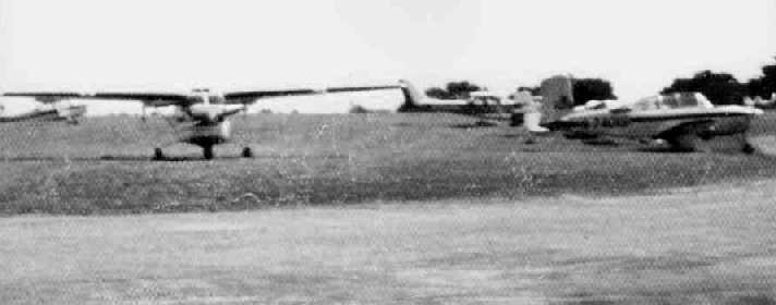
A closeup from the 1949 aerial view of Turner Field (courtesy of Steve Moyer) showing 3 taildragger single-engine aircraft parked near the hangars.
The 1957 PA Aeronautical Chart (courtesy of Mike Keefe) described Turner as having 3 turf runways, with the longest being the 2,300' east/west strip.
The operator was listed as Arthur Turner.
The primary runway at Turner apparently gained a paved section within the next year,
as the Aerodromes table on the 1958 NY Sectional Chart (courtesy of Norman Freed) described Turner as having a total of 3 runways,
with the primary runway having a 1,700' macadam section within a total length of 2,300'.
A 1958 aerial view depicted Turner Field's new paved runway, along with 7 light aircraft.
A 1958 photo (courtesy of Barie Blizard, enhanced by Steve Moyer) of Art Turner (owner of Turner Field) in front of his first Aeronca, at Turner Field.
Turner Field, as depicted on the 1959 Philadelphia Local Aeronautical Chart (courtesy of Chris Kennedy).
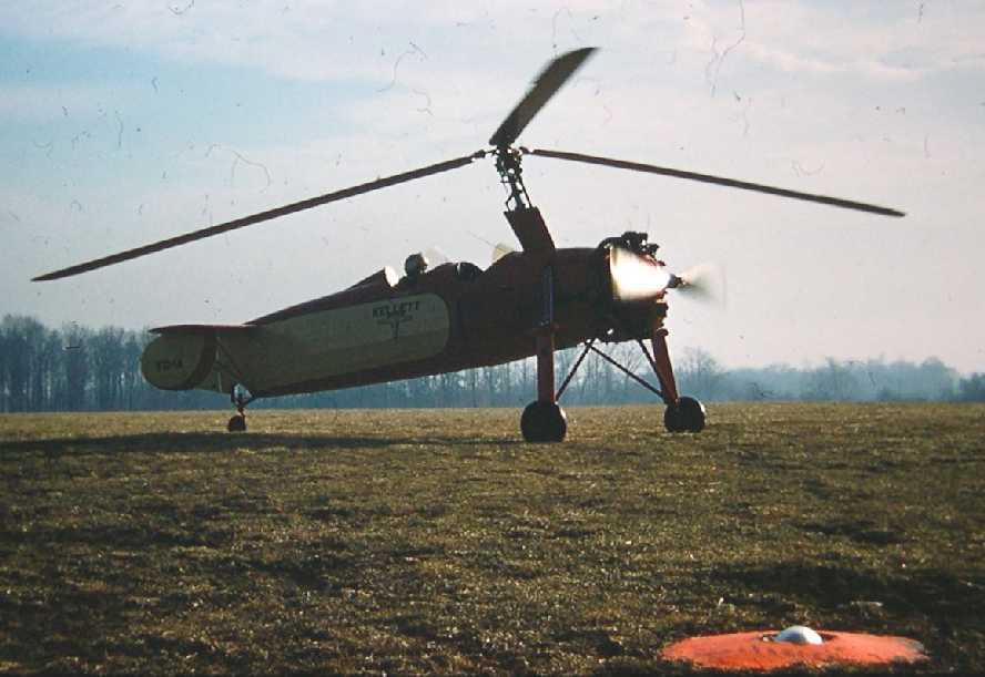
A May 1959 photo by Barie Blizard of a Kellett KC-1A autogiro at Turner Field.
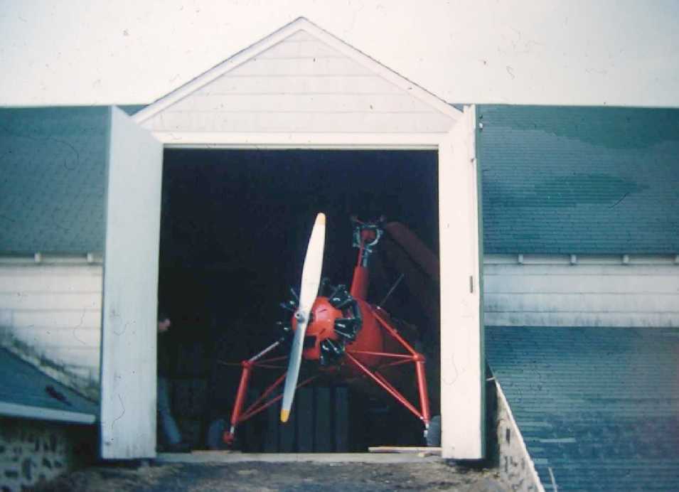
An undated (circa 1959) photo by courtesy of Barie Blizard of a Kellett KC-1A autogiro folded upside the barn at Turner Field.
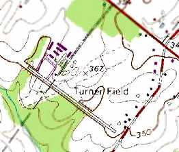
No airfield was depicted at this location on the 1960 USGS topo map.
Jim Frankenfield recalled, “I was Chief Pilot / Designated Pilot Examiner working for Art Turner's Turner Airfield Inc. [from] 1960-71.”

The 1960 Jeppesen Airway Manual (courtesy of Chris Kennedy) depicted Turner Field as having a single 2,050' paved Runway 13/31
a 2,300 unpaved Runway 7/25, and a 1,900' unpaved Runway 3/21.
Several hangars were depicted just north of the runway intersection.
The 1962 AOPA Airport Directory described Turner Field as having 2 runways, and listed the operator as A. V. Turner.
Steve Moyer recalled, “Bud Turner (Art’s son) was my best friend & was killed on 11/22/62 while flying from Avoca to Turner Field.
They descended into Blue Ridge Mountain early in the evening.”
Tom Bright took flying lessons at Turner Field in the early 1960s, and recalled that Bud Turner was killed in a crash of his Piper Aztec.
"The newspaper later that week gave the details that his altimeter indicated 2,500' MSL,
but the Aztec was found at 1,500', just short of the crest of a wooded hill."
Tom also recalled that Turner Field flight instructor "Jim Frankenfield was part-owner of a homebuilt parasol wing plane."
Jim Frankenfield clarified, “That would have been the first completed EAA Chapter project, a Corben Baby Ace, built by EAA Chapter 60 Bethlehem,
which I occasionally flew into Turner's in 1960-61.”
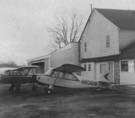
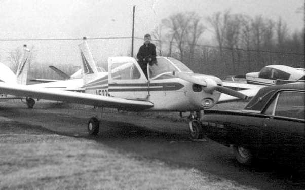
A 1965 photo by Nathan Sturman of an Aeronca 7AC Champion N83618 at Turner Field.
Nathan Sturman took his first flying lesson at Turner Field in 1963.
"It was a crisp Tuesday morning in 1963, and I was on summer vacation
when I removed the sum of twenty dollars from my savings account...
and bicycled the 25 kilometers from my home in Philadelphia to Turner's Field, now closed.
It was a long, hot ride through pleasant countryside, with the occasional fright of being chased by an unfriendly dog.
I arrived at Turner's Field at about noon.
Instructors Ike Blair & Jim Frankenfield were lounging around the living room/office in the white farmhouse.
The airplane I was to get my first lesson in was a chocolate brown & cream 1946 Aeronca 7AC Champion, N83618,
equipped with a 65 hp Continental engine & big funny splashguards above its balloon tires."
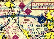
Turner Field was described on the Aerodromes table on the 1965 NY Sectional Chart (courtesy of John Voss)
as having 2 runways, with the longest being a 2,100' asphalt strip.
The remarks included, "Runway 3/21 closed."
The 1966 USGS topo map still depicted Turner field as having a single paved northwest/southeast runway, along with an unpaved northeast/southwest strip.
A large number of hangars were depicted north of the runway intersection.
A 1968 photo of Frank Palmer on his father's Cherokee 160 at Turner Field, which was based there in the 1960s & 70s.
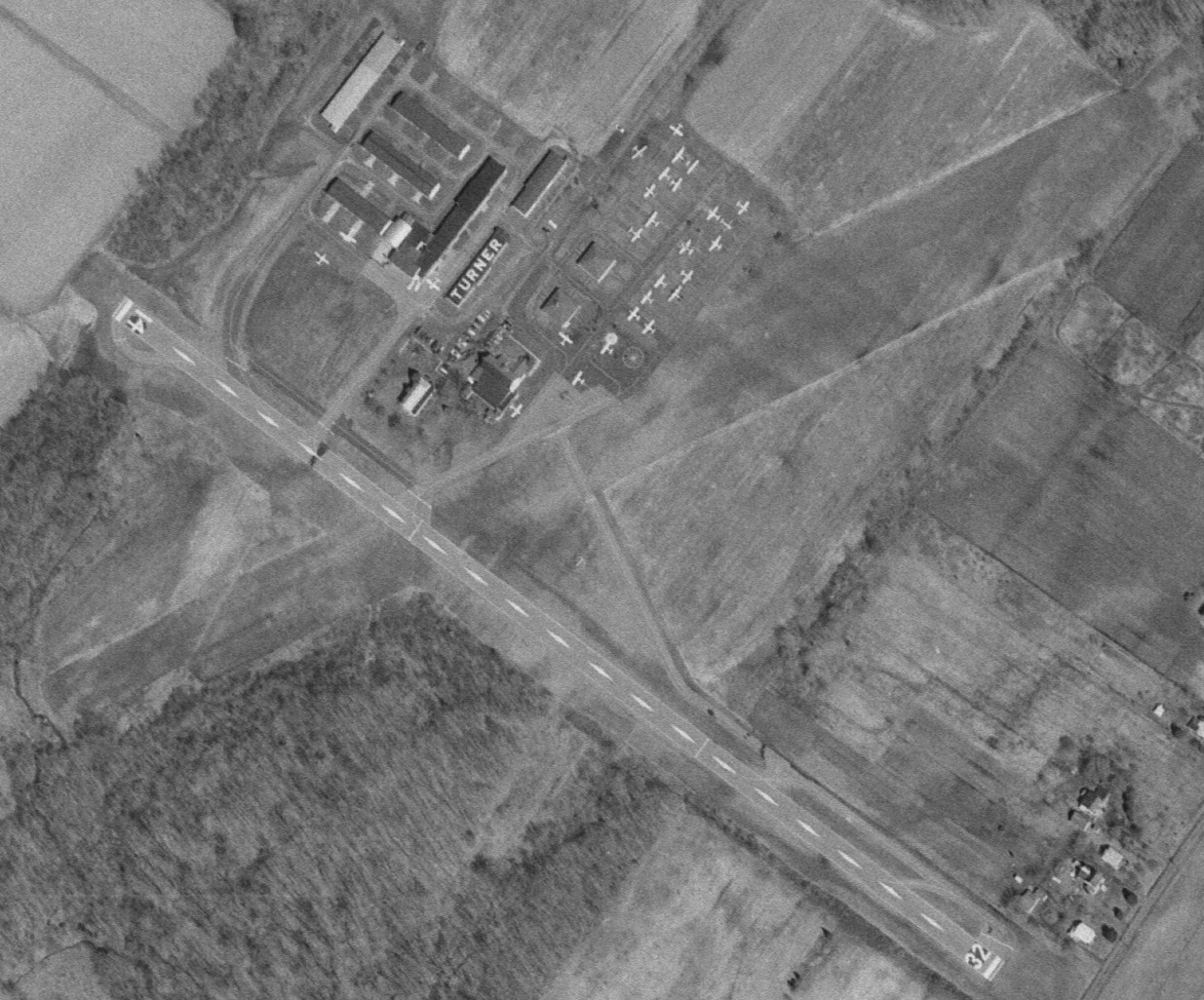
A 3/27/73 USGS aerial photo of Turner Field depicted the field as having a paved Runway 14/32 & a crosswind grass strip.
Over 30 light aircraft were visible on the field.
Turner Field, as depicted on the 1975 Washington Sectional Chart (courtesy of Ed Drury).
A 1977 photo of Joe Mattern taxiing with his instructor Rich in a Piper Cherokee 140 at Turner Field.
Joe recalled, “I was 12 years of age & took flight instruction there. It cost $22/hour to fly with an instructor in a Piper Cherokee 140.”
The last photo which has been located showing Turner Field in operation was a 10/22/79 aerial view looking west (from the Dallin Aerial Survey Collection, courtesy of the Hagley Museum & Library).
The airport was quite well-used, with several dozen light planes visible.
The 1986 Flight Guide (according to Chris Kennedy) described Turner Field as having a 2,126' paved Runway 14/32 & a 2,200' turf Runway 7/25.
The last aeronautical chart depiction which has been located of Turner Field was on the 1987 Philadelphia Terminal Aeronautical Chart (courtesy of Gwen Shafer).
It depicted Turner as having a single 2,100' northwest/southeast runway.
According to Bob Zambelli, Turner Field "closed just before I moved here in 1989."
The area around the little airfield had become densely developed, which most likely precipitated its closure.
The 1992 USGS topo map still depicted Turner Field as having a single paved northwest/southeast runway, along with an unpaved northeast/southwest strip.
Several hangars were depicted north of the runway intersection.
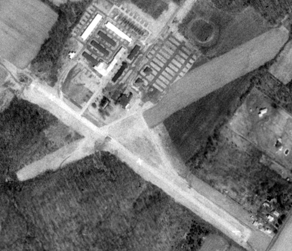
Turner Field had already been closed for several years by the time of a 3/28/92 USGS aerial photo.
The paved runway was marked with closed "X" symbols, and all of the planes were gone, although numerous individual hangars remained standing.
Turner Field was no longer depicted on the December 1993 NY Sectional Chart (courtesy of Ron Plante).
Dennis Cooney reported, “Mrs. Turner... (widowed I believe) moved out [from the Turner house on the airport property]
in 1997-98 after selling out to the developer of the neighborhood.”
A sad sight for anyone who appreciates general aviation airports -
the April 2001 USGS aerial photo shows that the outline of the 2 former runways of Turner Field were still recognizable,
even though the northwestern part of Turner Field had been gobbled up by a new housing development.
It appeared as if all of the pavement of the former Runway 14/32 had been removed,
but it appeared as if a small piece of ramp pavement still remained, just north of the former runway intersection.
A later (circa 2001-2002) aerial photo showed that even the former runway outlines were no longer extant, construction having covered the site.
Dennis Cooney reported, “We bought the [Turner] house in 2002. There was one owner in between us & Mrs. Turner.”
A 10/7/11 aerial photo showed no trace remaining of Turner Field.
____________________________________________________
Brewster Navy Airfield / Johnsville Naval Air Station /
Warminster Naval Air Warfare Center (NJP), Warminster, PA
40.2, -75.07 (North of Philadelphia, PA)
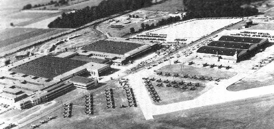
A circa 1942-43 aerial view looking north at the Brewster plant at Warminster (courtesy of Tom Beamer),
with large numbers of newly-constructed aircraft parked in the foreground.
This airfield was originally the site of the Brewster Aircraft factory,
which designed & manufactured military aircraft during WW2.
Brewster's existing facilities in NJ & NY could not be expanded sufficiently to cope with wartime production demands,
so the company moved to a new site in Warminster, PA in 1941.
The Brewster airfield was not yet depicted on the November 1942 NY Sectional Chart.
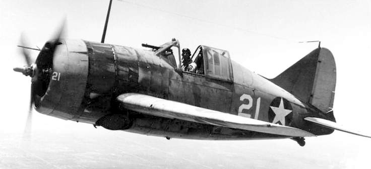
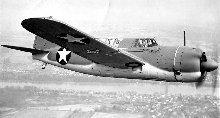
A 1942 US Navy photo of a Brewster F2A-3 Buffalo.
Brewster designed & manufactured the F2A-3 Buffalo & SB2A Buccaneer during WW2.
The earliest aeronautical chart depiction which has been located of the Warminster airfield was on the 1943 NY Sectional Chart (courtesy of Chris Kennedy).
It depicted "Brewster (Navy)" as an auxiliary airfield.
Tony Coulter recalled, “My mother Marie (Wall) Coulter was the first female Air Traffic controller at NAS Johnsville starting in 1943.”
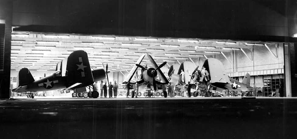
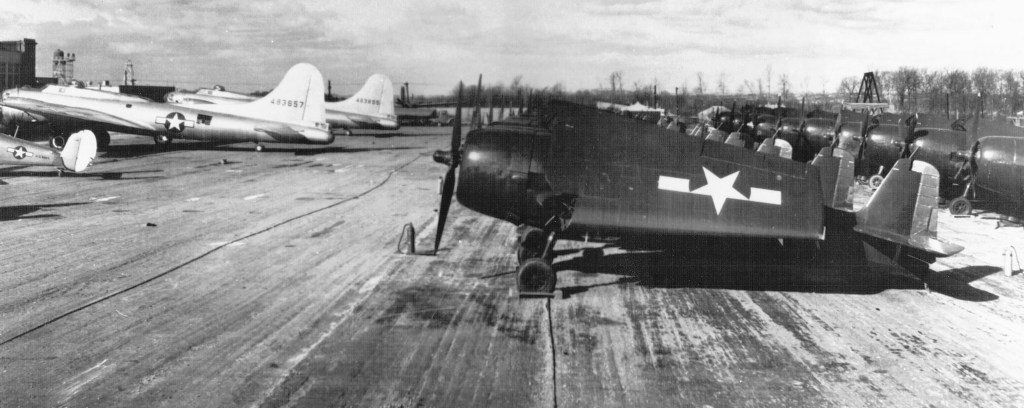
An undated WW2-era view inside the Brewster plant, showing a number of completed F3A Corsairs.
Brewster manufactured a total of 735 examples during WW2 of the F3A,
which was a license-built copy of the Chance-Vought F4U Corsair.
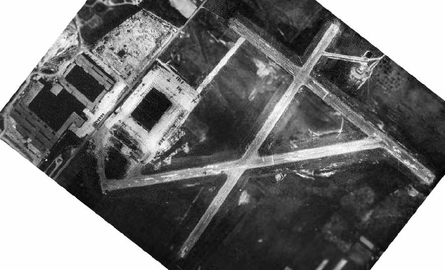
A WW2-era view of Johnsville Naval Air Modification Unit airfield (National Archives photo)
showed the field to consist of 3 paved runways,
with the former Brewster factory on the west side of the field.
A July/August 1943 aerial view of a Brewster SB2A Buccaneer dive bomber, manufactured in Johnsville (courtesy of Tony Coulter).
Brewster was a very troubled aircraft company.
Their F2A Buffalo was quickly withdrawn from service in the Pacific, as it was completely outclassed by contemporary Japanese fighters.
Even after switching to licensed production of the Corsair (a very successful design), Brewster still had major problems.
Deliveries of the F3A were habitually late (complicated by a labor strike), and quality control problems were uncovered.
F3As were redlined at a lower speed & prohibited from aerobatics after several examples shed their wings, which were later traced to poor quality wing fittings.
None were issued to front-line combat units.
According to Tom Beamer, Brewster also had serious labor problems, so serious that the Navy actually took control of the plant briefly.
Because of this it was known derisively as "the Bucks County Playhouse".
After its takeover by the government, the Brewster plant was eventually closed.
Following the closure of Brewster, the Warminster facility became a USN base in 1944.
A circa 1942-45 aerial view looking northeast at Brewster Field from the 1945 AAF Airfield Directory (courtesy of Scott Murdock)
depicted the field as having 3 paved runways, with the Brewster factory buildings on the west side.
The 1945 AAF Airfield Directory (courtesy of Scott Murdock) described Brewster Field
as a 300 acre rectangular property within which were 3 seal-coated runways, the longest being a 3,200' east/west strip.
The field was said to have three 280' x 100' brick hangars, and to be privately owned & operated.
No airfield was depicted at this location on the 1946 USGS topo map.
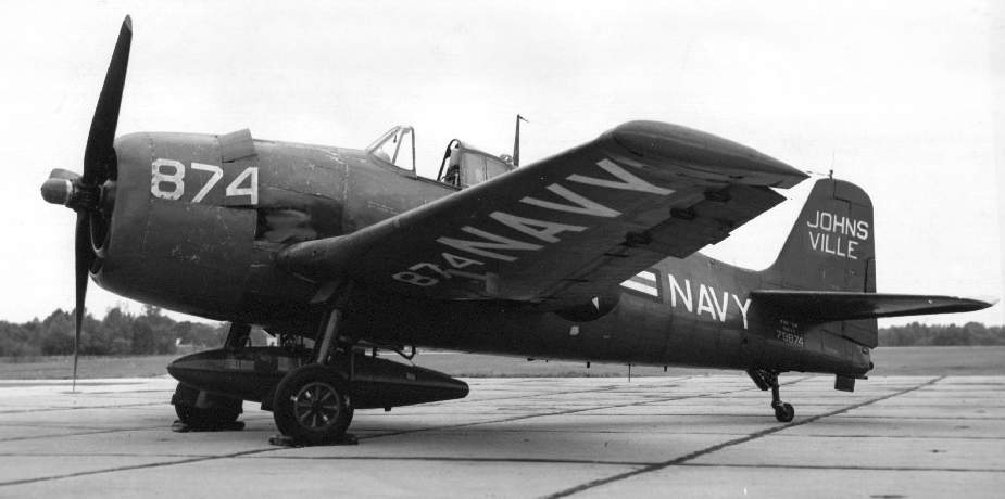
An undated USN photo of a Grumman F6F-5K Hellcat at NADC Johnsville (courtesy of John Voss).
A circa 1940s-50s photo (courtesy of John Allen) of the Warminster ramp.
John observed, “It looks like what appear to be a Navy SNJ, two B-17s (Navy PB-1W) pulled up to the hangar & several rows of what look like F6Fs with very little markings.
I was told they were early drones flown from the back of the PB-1s.
It was taken from the control tower area, looking toward Jacksonville Road.
I came across it on a wall in a tool shop back in 1979. I was stationed there for about 6 years in the 1970s & 1980s.”
The field was labeled as “Johnsville NAF” on the 1947 USGS topo map.
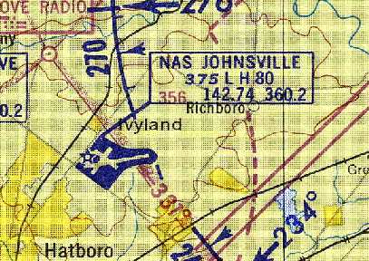
The January 1947 NY Sectional Chart depicted the “Johnsville “(Navy)” airfield.
A 1948 aerial view depicted the field in its WW2 configuration, with 3 relatively short runways.
A total of 6 aircraft were visible on the northwest ramp, most larger multi-engine aircraft.
A 1950 aerial view still depicted the field in its WW2 configuration, with 3 relatively short runways.
After the end of WW2, Warminster eventually became the headquarters of the Naval Air Warfare Center.
Laboratory space at the facility eventually totaled more than a million square feet,
including what was in 1952 the world's largest human centrifuge.
Bob Supina recalled, “In the early 1950s I grew up in the village of Penns Park.
My Father worked at the Johnsville Naval Air Development Center (Warminister).
Penns Park was inside the 8 mile radius of NADC, so Navy planes mostly stayed in their airspace.
My Father was Supervisor of the building of the first guided missiles, the Gorgon. The Gorgon was the Grandfather of the cruise [missile].
We used to see the drones fly over head. The drones were painted red & my Father told us that they were radio controlled.
On occasion, at night a plane would fly over with a brilliant search light in the belly. It would light up the entire area like daylight.
For some unknown reason, the Navy had a dump on the outside of the fenced compound.
My Father used to frequent it for useable 'stuff'. I still have several old instruments from crashed planes, a bucket full of hydraulic fittings,
and a control stick with bomb button from a Corsair.”
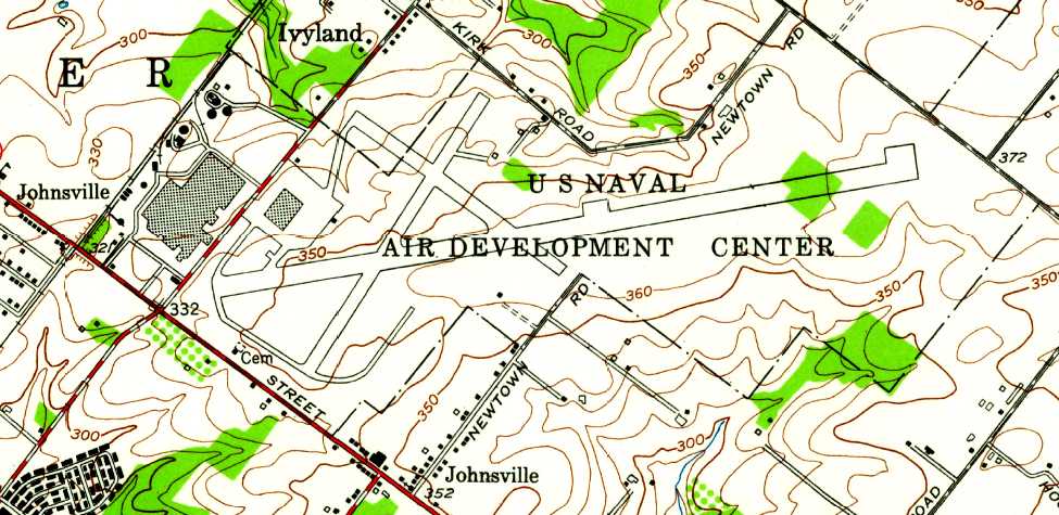
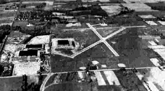
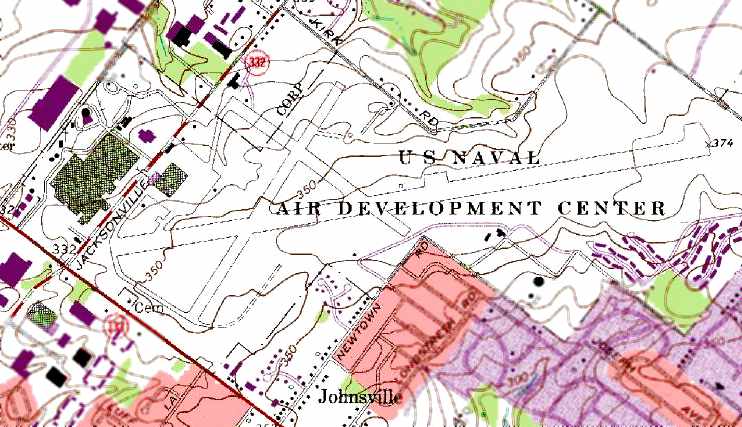
“U.S. Naval Air Development Center”, as depicted on the 1952 USGS topo map.
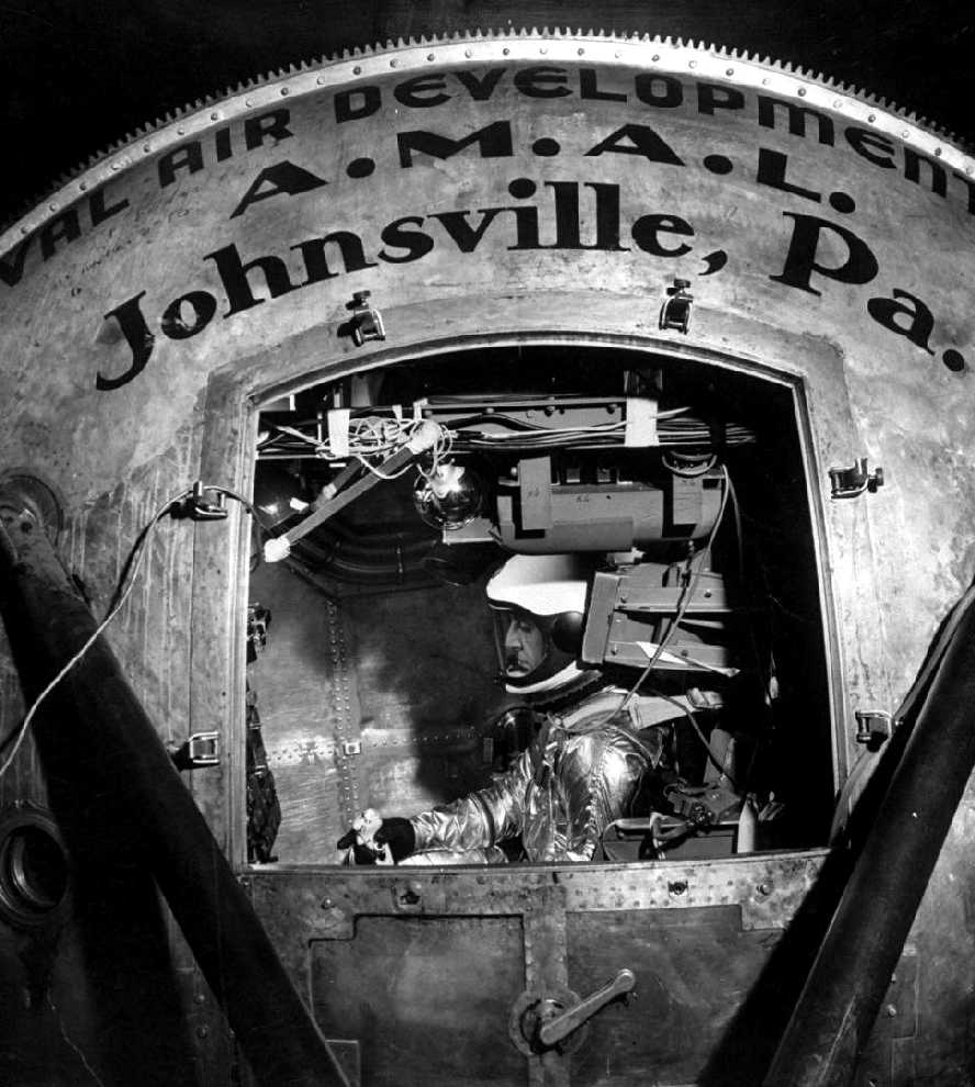
A September 1957 photo by Ralph Morse of famed test pilot Scott Crossfield
testing a new Air Force space suit in the Johnsville centrifuge.
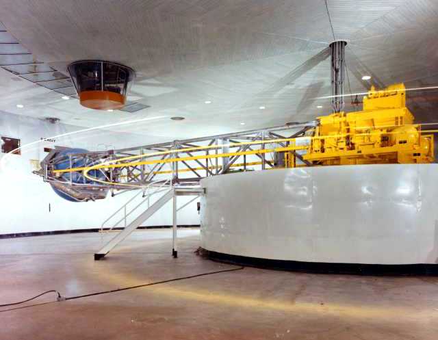
A circa 1950s view of the interior of the Johnsville centrifuge.
The primary runway was apparently lengthened at some point between 1950-57 for jet operations,
as the 1957 PA Aeronautical Chart (courtesy of Mike Keefe)
described "NAS Johnsville" as having an 8,000' paved runway.
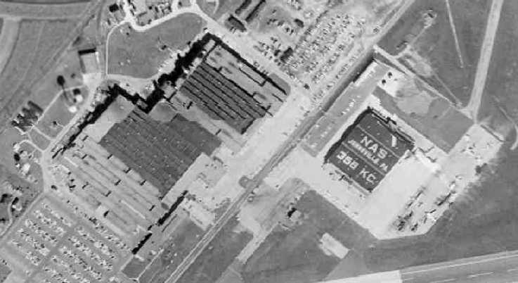
A 1958 aerial view depicted the hangar painted with “NAS Johnsville PA 358 KC”, with a variety on aircraft parked on the ramp.
"NAS Johnsville" was depicted on the 1959 Philadelphia Local Aeronautical Chart (courtesy of Chris Kennedy)
as having 3 paved runways, with the longest being an 8,000' east/west runway.

A circa 1960s aerial view of the NAS Johnsville hangar, along with several P-2s, an E-1, and other aircraft.
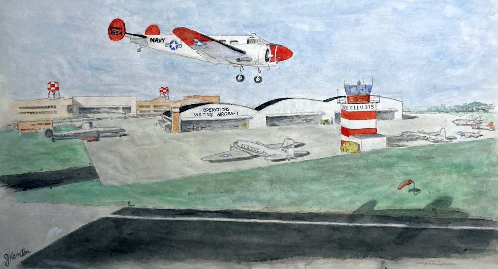
A circa 1965 aerial view by Jack Kenton looking north at NAF Johnsville.
Jack Kenton recalled, “NAF Johnsville... I grew up in the area & spent 8/64-3/68 there as a Naval aviator flying a number of airplanes, mostly the NC-121.”
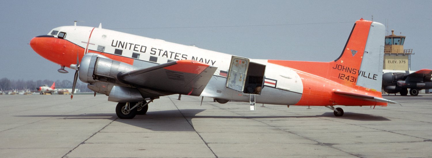
A 4/20/65 photo by Stephen Miller of a Navy Douglas C-117D, 12431 C/n 43395, with the NAF Johnsville tower in the background.
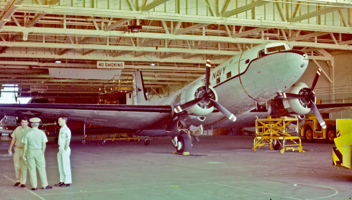
A circa 1967 photo by Jack Kenton of a Douglas R4D inside an NAF Johnsville hangar.
A 1967 aerial view by Jack Kenton looking east at NAF Johnsville.
Jack Kenton recalled, “Normal traffic pattern would not have you in this position for landing on Runway 09.
When I was there (1964-68) the only usable runway was 09/27. By 1967, we had taken to parking our NC-121 Constellation on the closed runway to the left.
The ramp space around the hangar had always been tight & it was not uncommon to have to put the propellers in reverse & back the plane into a space (after having been out flying).”
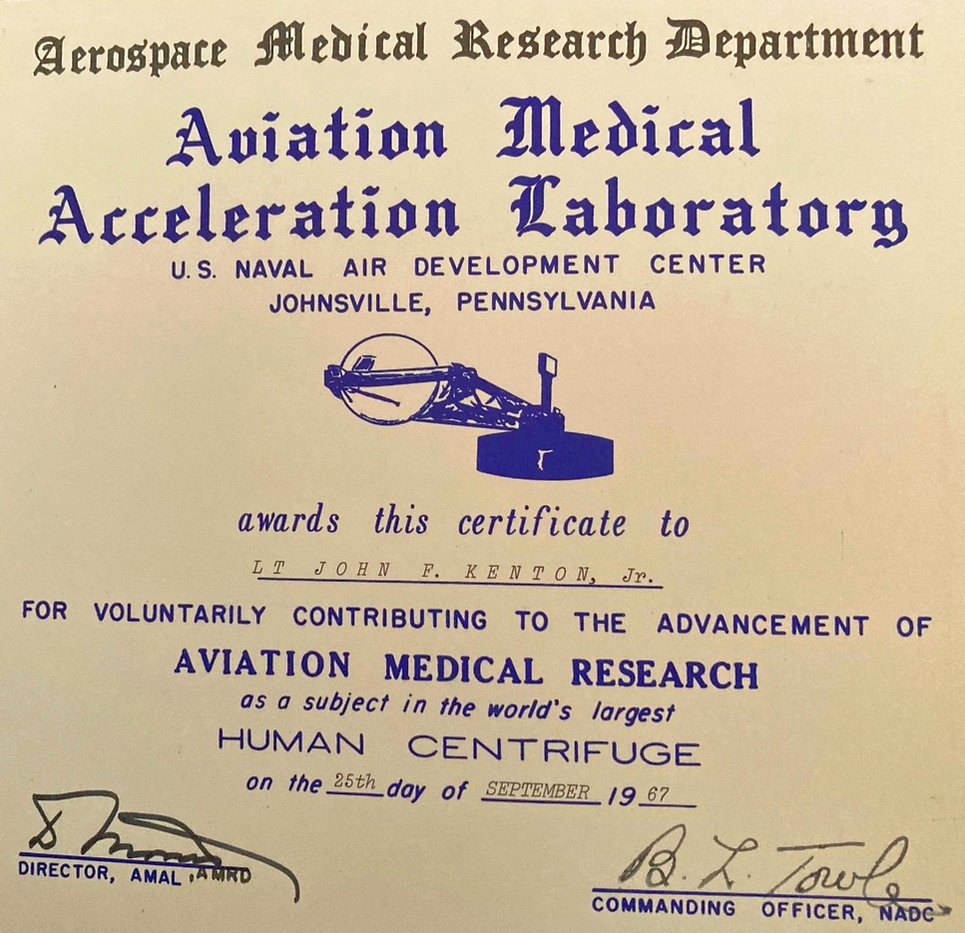
A 9/25/67 certificate of Jack Kenton's ride in the Johnsville centrifuge. Jack recalled, “The centrifuge was programmed for an F8U in a tailspin & I was to try to recover from the spin.”
A circa mid-1960s aerial view of Warminster (courtesy of Harry Kidd).
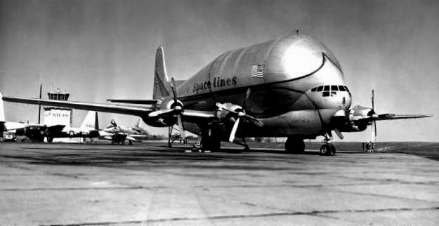
An Aero-Space Lines Super Guppy at Warminster in the 1960s (courtesy of Harry Kidd).
Emil Di Motta recalled, “I had the good fortune to be stationed at NAF [Johnsville] as a project pilot from March 1966 until I left the Navy 10/1/68.
At the time I was a young Lieutenant, fresh from Vietnam & VP-28.”
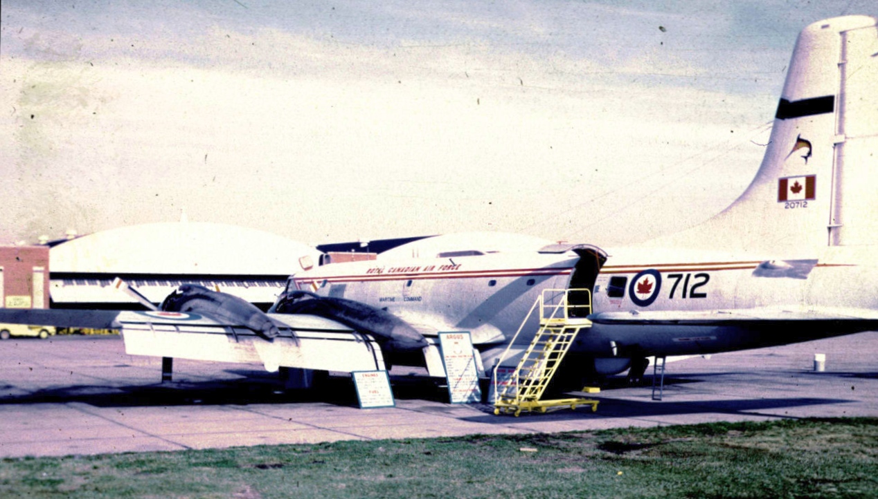
An October 1967 photo of a Canadair CP-107 Argus of RCAF Squadron 415 in front of an NAS Johnsville hangar.
A painting by Jack Kenton of a Navy Beech SNB/C-45 returning to Naval Air Development Center Johnsville in 1967.
Jack Kenton reported, “The Navy’s SNB/C-45 was the administrative airlift machine back then. I flew a lot of engineers & scientists to other Navy facilities on the East Coast (Norfolk, Pax River, Groton/New London).”
A 1968 photo of a Douglas NRA-3A Skywarrior at NAS Johnsville.
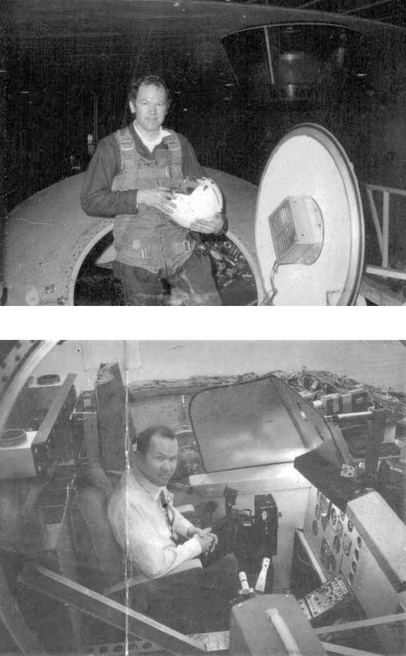
A circa 1969 photo of James Frankenfield in a research cockpit inside the Johnsville centrifuge.
James Frankenfield recalled visiting the Johnsville centrifuge, “when they were investigating the spin recovery techneque of the F-4 Phantom (I crashed from 30K),
and investigating the 'tuck-under' recovery of the Boeing 720 in severe turbulence (I did better on this one).
We at Turner were teaching Don Morway, who worked in the centrifuge, and his dad, toward their Private Pilot Certificates.
And so Don would invite me & the instructors at Turner over to 'fly' the centerfuge. Lots of fun!
The F-4 had an oscillating spin characteristic, going from nose extremely 'down' to way 'up', during the 360 degrees of a one turn spin,
and the procedure discovered by the centrifuge operators was that, at the 'top' of the oscillation, a full reversal of control positions, opposite the spin direction,
for a window of opportunity of one & a half seconds, then neutralize controls, would stop the spin...
however, releasing the controls too soon would allow continuation of the spin, conversely, holding too long & the spin would reverse itself, and go in the opposite direction.
In the Boeing 720 mockup, the pilot sat on a hydraulic 'shake table', and round & round we go,
with the 'shake' becoming more severe as we went, simulating clear air turbulence, until it became difficult to even focus on the panel.
When it 'tucked under', the procedure was to go to full power, since the thrust line was below the center of pressure & center of gravity,
and that 'moment arm' would help 'push' the nose up. It worked! I pulled 2.5G they told me... I didn't even feel it.”
Emil Di Motta recalled, “The F-4 project in the centrifuge... I was one of the first 'thrill seekers' to take that project for a spin.
They had 4 cameras taping everything that I did. After the familiarization spin watching & just flying, they turned on the tape for me to see what was going to happen.
I gave them a thumbs up & started the run. My plan was to stop the flat spin & then recover. It’s amazing how fast you can fall from 50,000 feet!
I used full rudder & pulled one engine back to flight idle & afterburner on the other to stop the spin.
That’s when I hit the water (Chesapeake Bay). I spun for another 5 or 10 minutes & asked to do it again. The actual tape ran for a little over 90 seconds.
I got into about 16 seconds of the 2nd ride & grabbed the ejection ring between my legs which killed the tape.
I knew yesterday’s breakfast was about to make a special delivery. Deep breathing & tightening the leg muscles got me through that.”
Bob Johnston recalled, “In 1970 I received orders to the Aerospace Medical Research Department,
a tenant command at The Naval Air Development Center (NADC) in Warminster.
To the locals, the base was simply called 'Johnsville', but within the Navy lexicon, the word 'Johnsville' did not exist.
My understanding is that there WAS originally a village called 'Johnsville' that was obliterated
either when Brewster developed the land or in the post-WW2 runway extension.
'Warminster' was a township, albeit a very rapidly growing suburban township of Philadelphia.
'Warminster' didn't seem to have a specific town associated with it,
but just shopping centers & suburban sprawl (which would later doom the facility).
Somewhere along the way, when the Navy eliminated NAS Johnsville
and came up with the new commands of NADC & Naval Air Facility (NAF),
the decision was made to link them to 'Warminster' rather than 'Johnsville',
so we had Naval Air Development Center & Naval Air Facility Warminster.”
Bob continued, “It was easy to figure out which of the commands had jurisdiction over what assets
because the base was bisected by [Jacksonville] Road.
To the west of [Jacksonville] was NADC, with the old Brewster production buildings
and the administration building & AMRD (which owned the centrifuge),
and to the east of [Jacksonville] was NAF with the runway, hangars, a barracks, a chow hall and of course the aircraft.
Probably 95% of the staffing of NADC was civilian, with the reverse being true at NAF.
Practically speaking, NAF existed only to serve NADC.
We had no other organizations on board that might utilize the airfield - no reservists, no flying club, etc.
Those were all a few miles down the road at NAS Willow Grove.
The bifurcated command structure gave the Navy some choice (and duplicated) billets for senior officers - 2 CO's, 2 XO's, etc.
I could never see any other purpose to our top-heavy staff.”
Bob continued, “In 1970 we had 21 aircraft on board representing 14 types.
Every aircraft was either 'N'- designated (no longer able to perform its designed mission) or 'X'-designated (experimental).
The birds served as project platforms, and nothing more.
Our projects ran the gamut - from aerial measurement of ice depths to ECM.
We installed and tested all manner of new radars & ASW electronics
and designed & tested the system adopted by the Army to drop sensors along the Ho Chi Minh Trail.
We even requisitioned the Army's P-2V Neptunes from the inventory of excess aircraft
created by upgrading Naval reserve squadrons to the P-3.
We converted the Neptunes, repainted them & lettered them for the US Army.
Droning was another specialty - we made up F-4 drones & P-2V drone controllers from retired aircraft.
Finally, AMRD had a strong presence in human factors engineering, including ergonomics & cockpit design.
For many of our birds the project became more important than the aircraft,
which left us flying types that the Navy has long since retired from active duty (example: the EC-121C Super Constellation - we had 2 of them).
We had the last flying early model A-4s & F-4s. Parts supply was a nightmare, as was qualified mechanics & pilots.
Occasionally type-qualified pilots had to be borrowed from active duty squadrons & put on TDY with us.
We even used reservists from Willow Grove, although for some odd reason they were paid & flew as civilian contract pilots(?).”
Bob continued, “Even in 1970, I felt that the handwriting was on the wall for NADC.
Suburban sprawl was growing all around us & it made no sense to me to have NAEC at Mustin Field in Philadelphia,
NADC at Warminster and WST (Weapons System Test) at Patuxent River.
We NEVER, by the way, were authorized to keep any ammunition on base or to use the aircraft's weapons systems.
The only ammo in the base's bunker was 0.22 & 0.45 caliber for the base pistol team, of which I was the team captain.
We could not even land aircraft that had weapons on board.
Flight ops were conducted on weekdays only & probably averaged 6 landings & takeoffs per day.
On many days there were no flight ops at all,and a dozen takeoffs & landings marked a very, very busy day.
As I recall,the field was also secured from, say, 2300 hours to 0500 hours to keep down noise complaints
and mainly because we didn't need to fly at those times.
Aircraft that were delayed beyond our securing time usually diverted to Willow grove or occasionally to MC Guire AFB.
We almost lost the base pistol range due to a FOD scare.
It turned out that neighborhood kids were sneaking onto the base and digging 0.45 slugs out of the pistol range backstop
and then shooting them all over the place with their slingshots.”
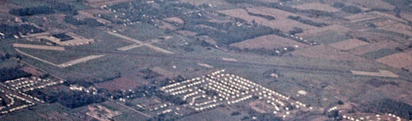
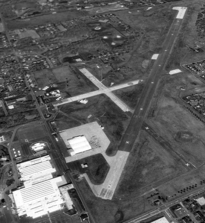
An 8/7/71 aerial view of Warminster, showing the single east/west active runway, as well as the 2 other abandoned runways.
A closeup from the 8/7/1 aerial view of Warminster, showing what appears to be 4 P-3s & a C-130 on the ramp.
A 6/9/72 photo by Stephen Miller of Navy Kaman HH-2D Seasprite, 149033 C/n 37, operated as a YSH-2E testbed by the NADC at Warminster.
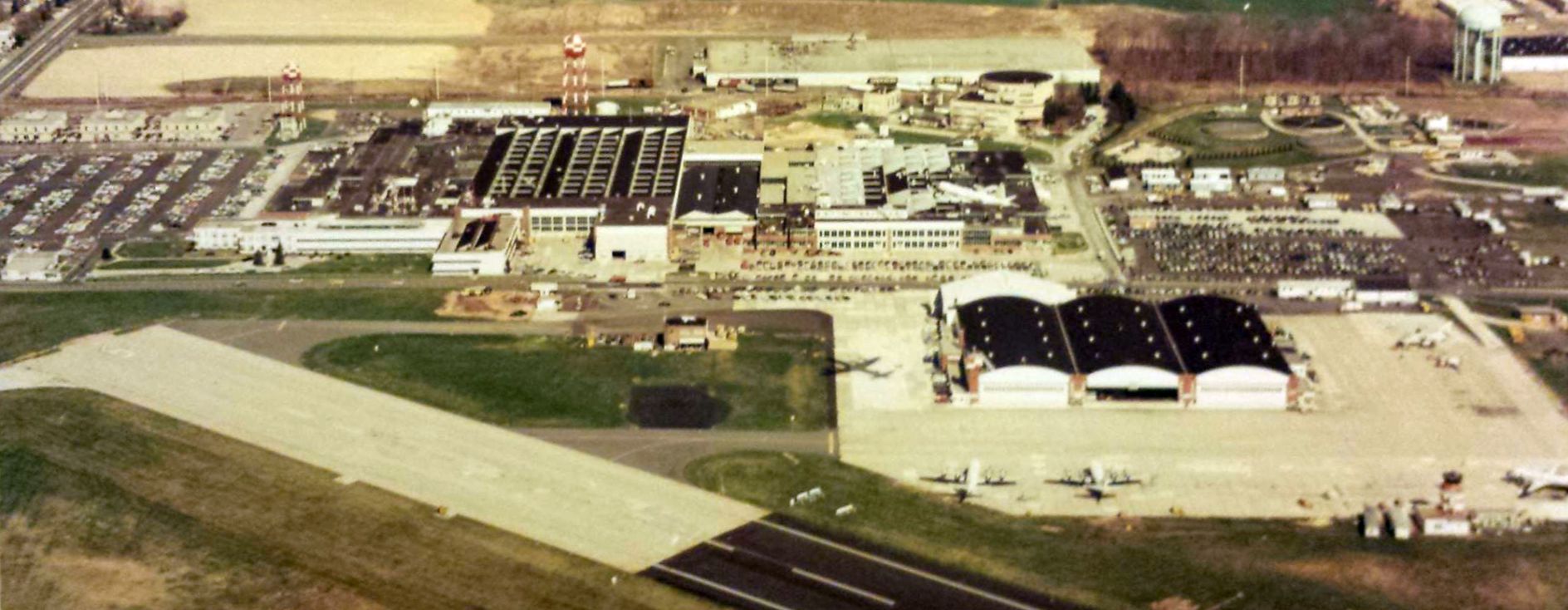
A circa 1970s aerial view showing the former Brewster factory, the centrifuge, and several P-3s in front of the Warminster hangars.
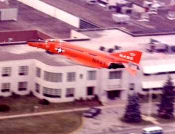
A circa 1970s photo of a bright red QF-4B Phantom in NADC markings passing low over the former Brewster factory.
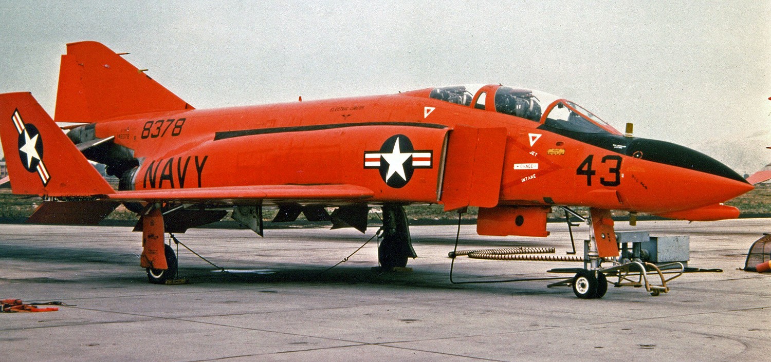
A 1973 photo of a bright red QF-4B Phantom, 148378, C/n 63 at Warminster. This early-production F-4B had been converted to a QF-4B.
Keith Ebel recalled, “I was stationed at NADC Warminster from 1974-78
working alongside civilian contract engineers on the Navy's LAMPS (Light Airborne Multipurpose System) program -
the Navy's Anti-Submarine Warfare platform used from the stern helipads of D & DE class ships.
I was an AX3 (Aviation Anti-Submarine Warfare Technician 3rd Class).”
Keith recalled that after learning to fly at the nearby Warrington Airport,
“I later transferred to the Warminster Flying Club at the base with P-3 Plane Commanders as the flight instructors.”
Tom Kahlert recalled, “As an Army Aviator, I flew USN & USMC H-53s out of Warminster in support of those same labs.”
NAS Warminster, as depicted on the 1975 Washington Sectional Chart (courtesy of Ed Drury).
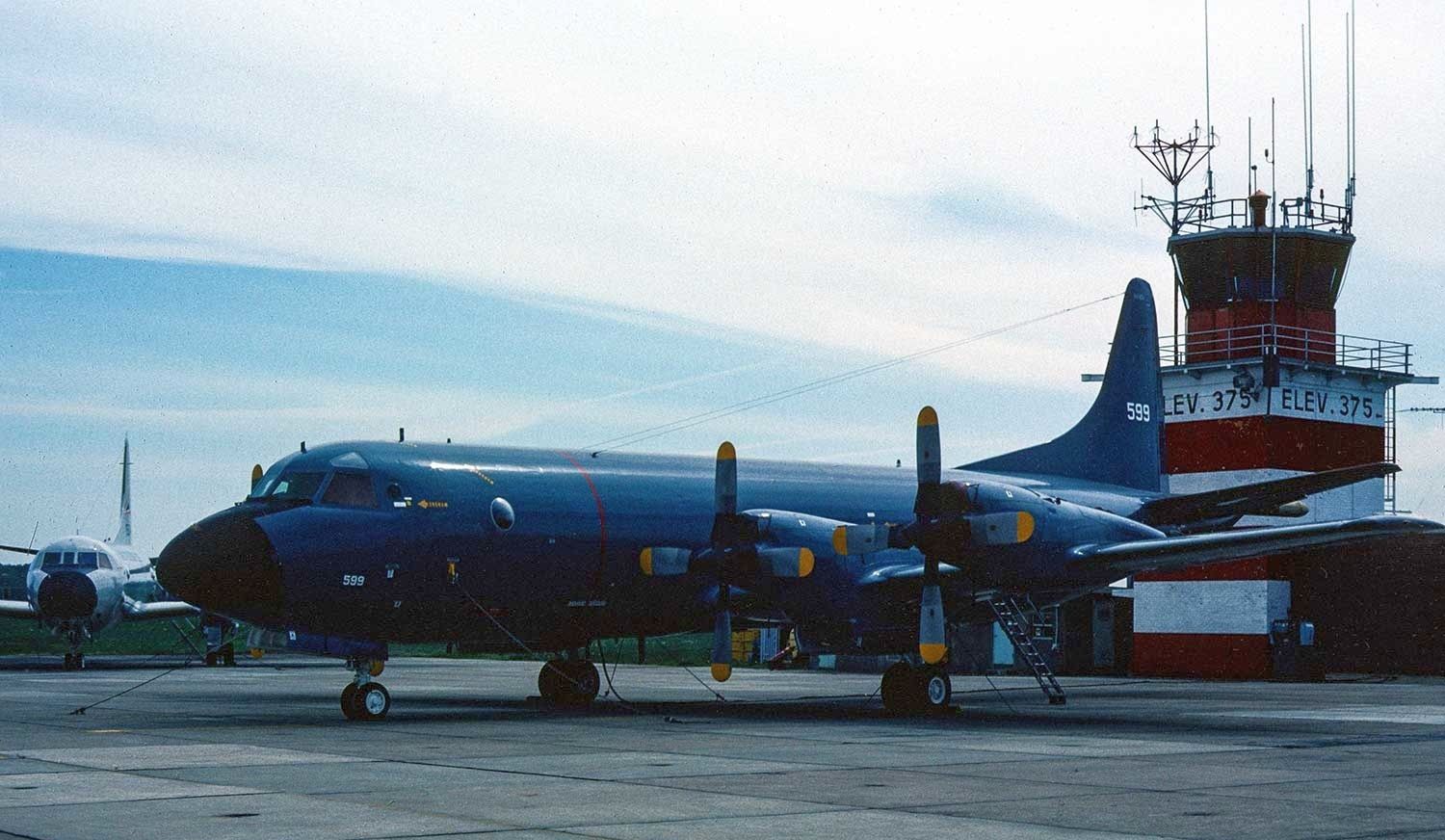
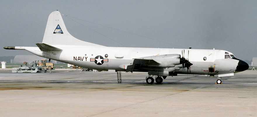
A 6/11/80 photo of a Norwegian Air Force Lockheed P-3B Orion in front of the Warminster control tower.
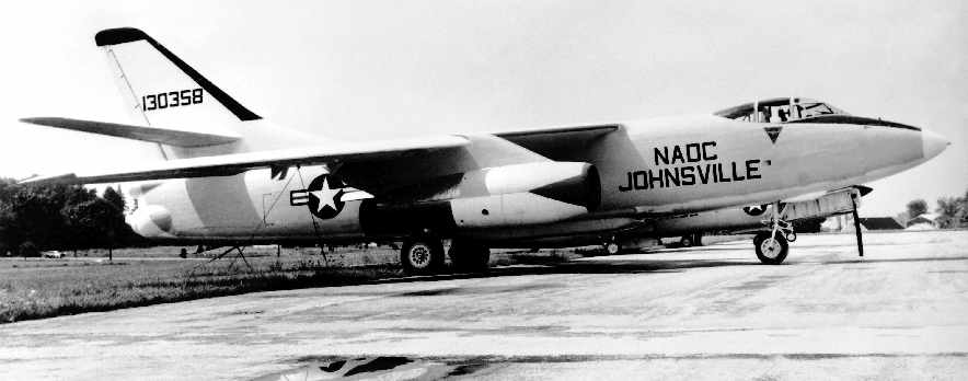
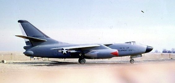
A February 1983 DOD photo of a A3D-1P Skywarrior at NADC Johnsville.
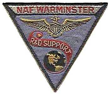
An undated patch for NAF Warminster R&D Support.
The 1987 Philadelphia Terminal Aeronautical Chart (courtesy of Gwen Shafer) depicted NADC Warminster as having 3 paved runways.
The 1988 USGS topo map depicted the 3 runways of the US Naval Air Development Center, as well as the former Brewster factory.
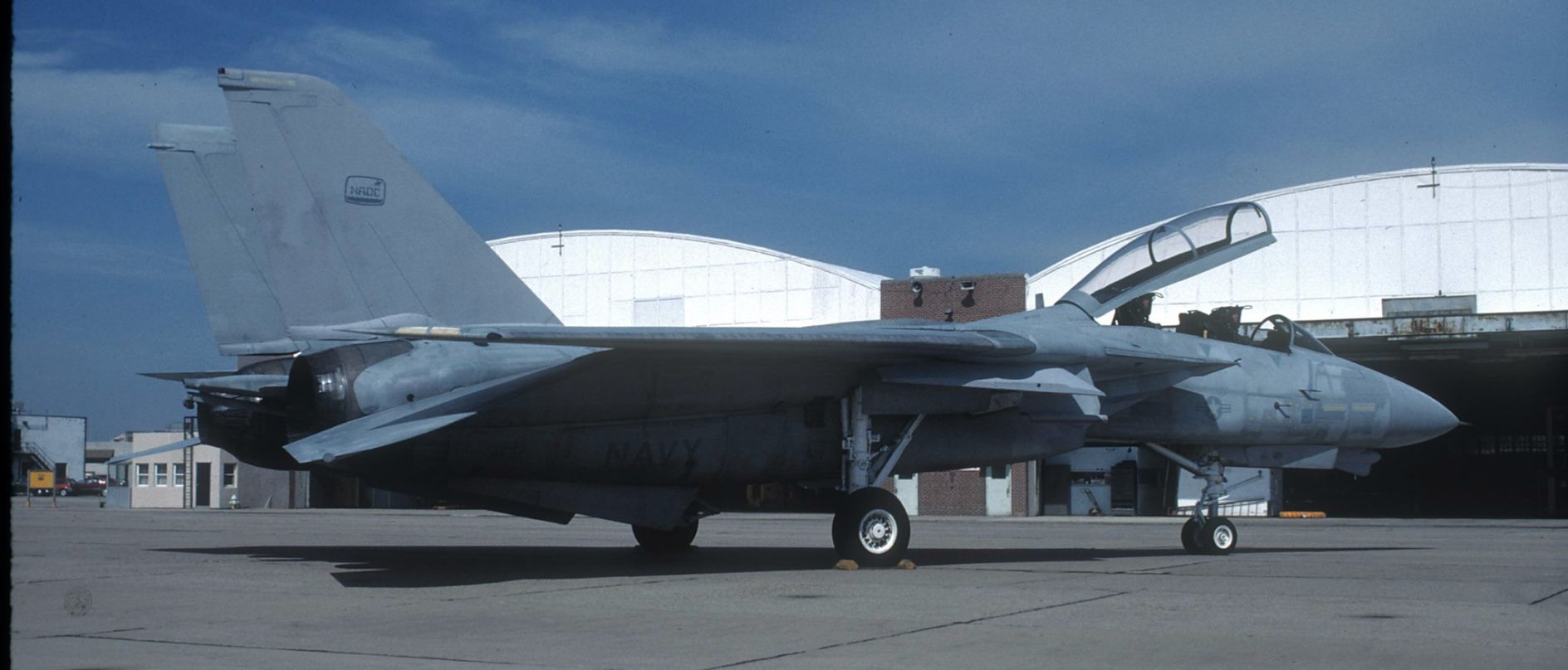
A May 1990 photo of a Grumman F-14 Tomcat in front of the Warminster hangars.
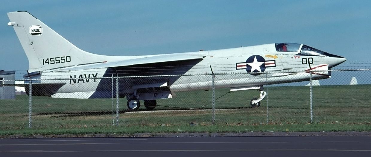
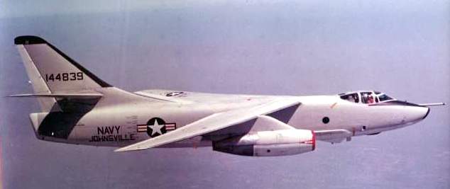
An August 1990 photo of Vought F-8K Crusader serial #417, a Warminster gate guard.
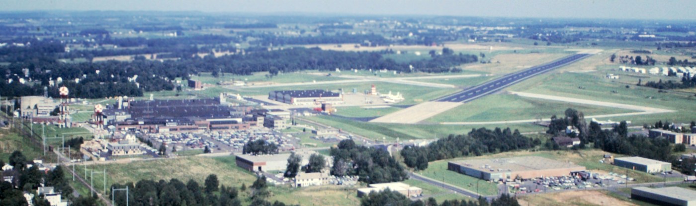
A 4/13/92 USGS aerial view looking northeast at Warminster, shortly before the base's closure. Note the 4 P-3s on the ramp.
The last photo which has been located showing Warminster while still an operational airfield was a June 1993 DOD photo of a P-3 Orion at Warminster, used for laser testing.
The last aeronautical chart depiction which has been located showing Warminster still open was on the March 1994 Washington Sectional Chart (courtesy of Ron Plante).
It depicted Warminster as having 3 paved runways, with the longest being 8,000'.
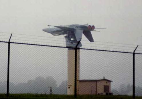
A 1994 photo by Christopher Ness of an F/A-18 Hornet mounted inverted on an antenna test mount at Warminster.
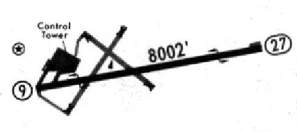
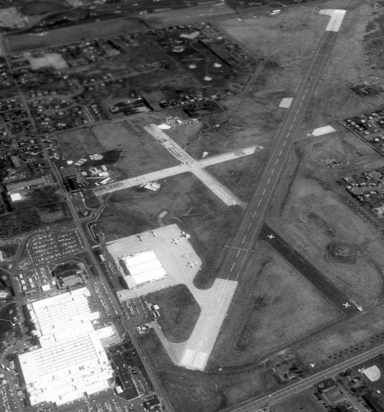
The airfield layout of NAWC Warminster, from a 1994 airport directory.
"Warminster (NAWC)" was still listed among active airfields in the 1995 Jeppesen Airport Directory.
It was depicted as having a single 8,002' paved Runway 9/27,
along with the 2 shorter paved crosswind runways (which had been abandoned).
In a consolidation move, Warminster was closed at some point between 1995-96, with NAWC moving to Patuxent River NAS.
Glenn Palaschak recalled, "My last major job as a contractor was in 1996 for Honeywell
at the great Warminster Naval Air Research Center.
I spent about 7 months there converting a guard force monitored fire & security system
in a 5-million square-foot complex that had 2,600 workers just a few months before,
to a remote central station alarm system, because there were no workers, just us armed government guards.
I shot many, many rolls of film of the inside of the buildings, hangars and control tower on the airport site,
the g-force room, the astronauts' training areas, the GPS development areas, the indoor research submarine, etc.
The place was so amazing & spooky, it was as though the 2,600 workers got up one day & went home never to come back.
The bowling team pics, the desks, some family photos, all the department signs, the super high security devices etc. were still standing.
The lockers had many, many Vietnam-era Navy decals.
The office building for the officers had a cement and brick face that said 'Brewster Aviation'
and the inside of the office building was so military with the green paint job & built-in wood cabinets, high cost government issue,
that I thought I was in a Pearl Harbor movie."
The airfield was still depicted on the August 1998 Philadelphia Terminal Aeronautical Chart (courtesy of John Ferrara),
but it was labeled "NAWC Warminster (Closed)".
At the time of its closure, the only runway still maintained was 8,002' Runway 09/27.
Two other paved runways still existed, along with taxiways, a ramp & a large hangar.
The last photo which has been located showing the Warminster airfield as largely intact was a 4/23/99 USGS aerial view looking northeast.
An undated aerial view looking southeast at the Warminster antenna test range, showing an A-6 & F-18 inverted-mounted & an inverted A-7 on the ground.
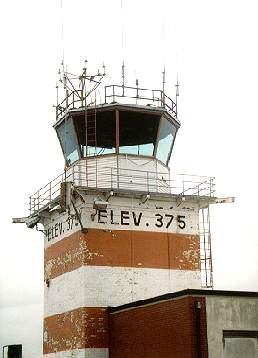
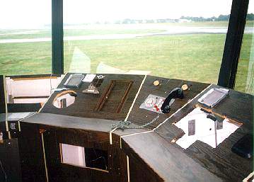
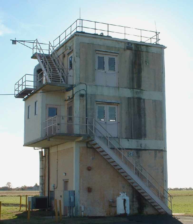
The Warminster tower, shortly after the base's closing. Photo by Bob Greenwood.
A 2001 photo of the demolition of a former Navy Warminster office building at Warminster.
A 2001 USGS aerial photo showed the Warminster airfield still remained mostly intact,
although some of the northern portion of the former southeast/northwest runway had been removed.
The local government planned to reuse portions of the base's office facilities as the "North American Technology Center".
Other large office buildings were demolished in 2001.
As millions of federal tax dollars were spent to construct the aviation infrastructure at Warminster,
it would have made an excellent reliever airport for the Philadelphia area.
But it would make more sense to tear down all of that paid-for infrastructure, right?
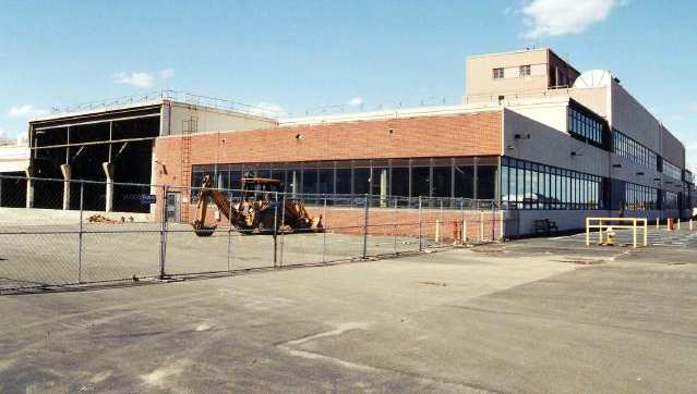
Three hangars that had been on the site since it first operated as a manufacturing plant for Brewster were never even considered a candidate for subleasing.
Their wooden structure was categorized as a fire hazard & were torn down in 2002 to make way for Ann’s Choice retirement village.
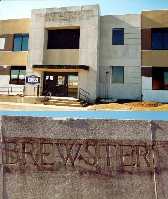
Two April 2002 photos by Willim Dougherty of the Brewster lettering on the former Brewster factory building.
The original lettering had been covered by Navy signage on the building for 60-some years, which was then removed, revealing the original lettering.
According to local pilot Tom Kramer, "It will never again be used as an airport. The runway destruction has begun.
As of about a month ago [2003], there were huge sections already dug up.
As an aside, at least one of the aircraft used for radar testing, an F-14 sans engines,
was towed on it's own gear one night from Warminster, across the Delaware River toll bridge
and over to South Jersey Regional Airport in NJ & the Air Victory Museum where it resides today."
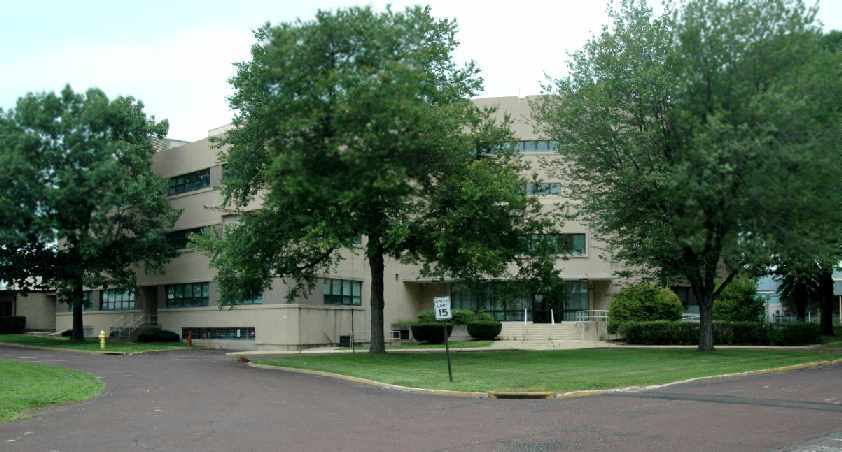
A Warminster resident reported in 2003, "As of now, the site is the home to an office complex, a park, and a retirement community.
I understand it is no longer the North American Technology Center. All the buildings were gutted & refurbished as office buildings.
The south borders of fencing have been removed. The runways, taxiways, and control tower have all been completely demolished.
The terrain has also been recontoured. A new road (Johnsville Boulevard) has been constructed connecting Street Road & Jacksonville Road.
The site is still the location of the Doppler 10,000 radar.
Most of the airfield will now be the home to the Warminster Township Park & the Ann's Choice retirement community."
A 2004 photo of a closed-runway "X" symbol on a remaining segment of the former Warminster runway.
A 2004 photo of the former Warminster fire/rescue garage, now reused to hold ambulances.
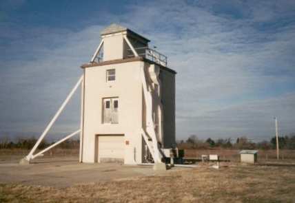
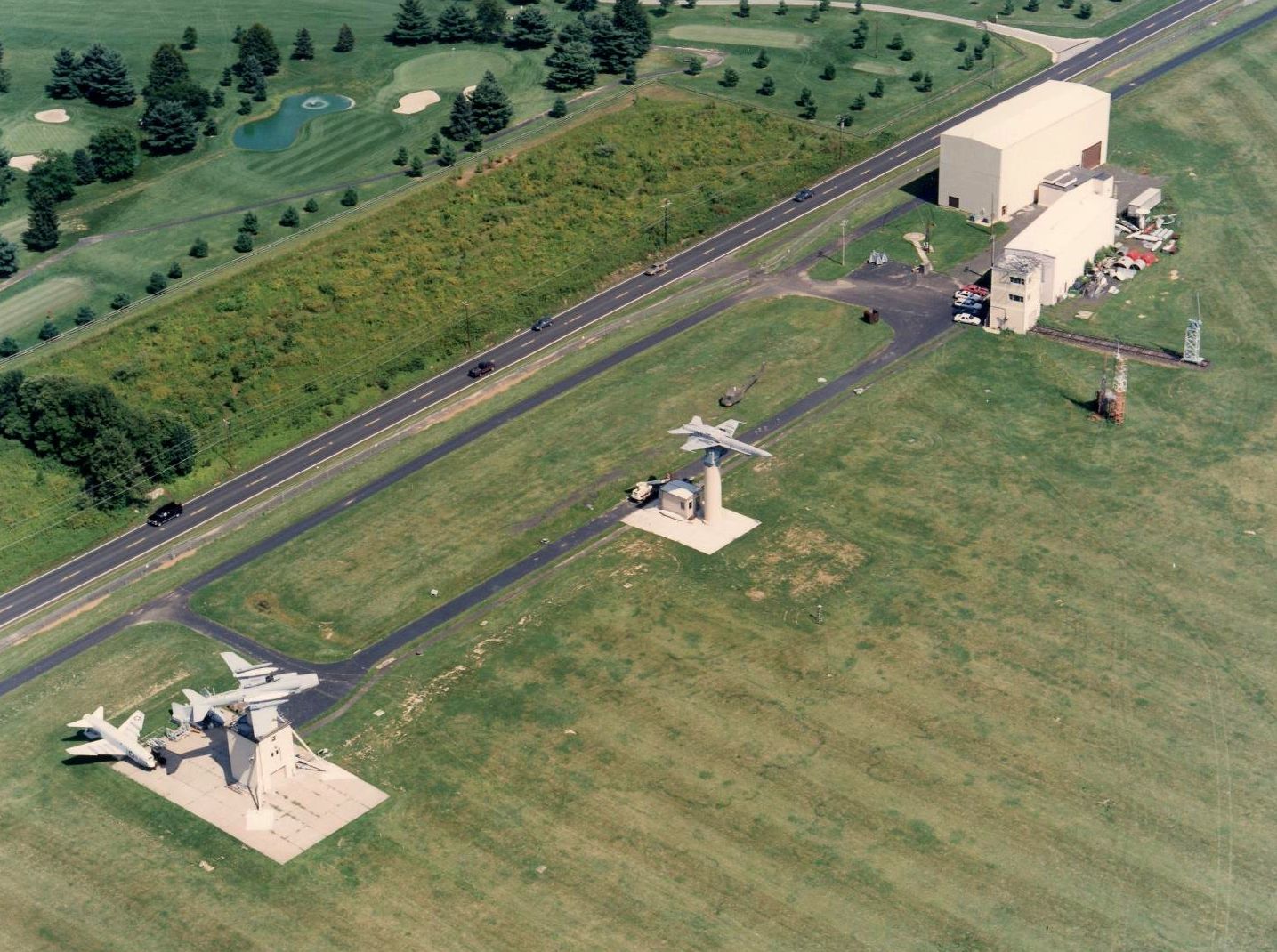
A 2004 photo of a former Warminster test tower which used to hold an inverted aircraft, which remains on Bristol Road.
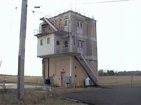
A 2004 photo of an unidentified tower which remains standing at Warminster.
A Warminster resident visited the airfield site in 2004, and reported:
"What I can tell you is Warminster Township has too much open land to deal with & the place looks like a mess.
Fortunately, the control tower still exists & should remain there & about 1/3 of the northeast end of the main runway still exists.
Rather than tear up miles of taxiways & runway, Johnsville Boulevard was built over the pavement running north from Street Road,
bending left, and then going west into Jacksonville Road.
Saddest of all, the historic Brewster hangars were demolished despite attempts to convert them to indoor soccer facilities.
I ran out of film at the centrifuge. That facility remains untouched & it appears the Navy may still have ownership of it.
I think it's protected since it's a historical site, but that doesn't explain why the hangars were demolished."
A 2004 photo by Christopher Ness of "all that's left of the runways & the current group flying out of it."
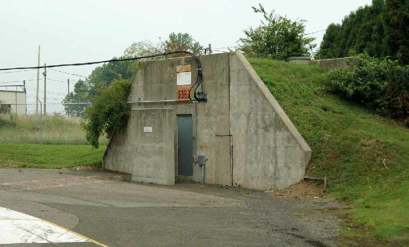
A 2004 photo by Christopher Ness of the ammunition bunker, previously used to store rocket charges (right next to the 200' ejection seat tower).
A 2004 photo by Christopher Ness of the building which previously housed the centrifuge. "A great deal of the NASA training took place in this building."
An October 2004 photo by Aaron Kuhn of the west end of the former runway.
"In the background on the horizon you see the Anne's Choice Senior living Community built on other decomissioned Johnsville base land.
Running horizontally across the runway you can see the large concrete blocks that are placed every thousand feet across the runway
(to stop planes from landing one can only assume!)."
An October 2004 photo by Aaron Kuhn of the east end of the former runway,
showing "the remaining thousand feet of the runway. The intersection in the distance is Bristol Road & Hatboro Road."
An October 2004 photo by Aaron Kuhn of the sign that resides on the Northwestern side of the base along Newtown road.
The 3 remaining structures on Bristol road can be seen to the left of the sign.
The text of the sign reads: "This property has been acquired through the Federal Lands to Parks Program of the National Park Service,
Department of the Interior for use by the general public."
An October 2004 photo by Aaron Kuhn of a former Warminster test tower.
Aaron Kuhn visited the site of Warminster in October 2004. His report:
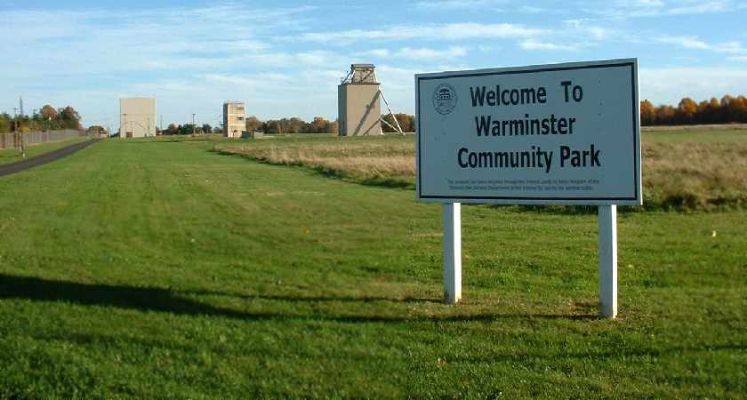
"The Warminster Community Park now resides on the land I took these photos from.
If tomorrow's election day referendum for a $10 million improvement to this park passes,
then these structures & the runways will be removed to make way for sports fields on the site!"
However, Aaron Kuhn provided an update a few days later, after the election:
"On the $10 million parks referendum that may affect Johnsville NAS - it did not pass.
So it looks like the old runway remnants will be there for a while still."
A 2005 aerial photo by Paul Freeman, taken from a Diamond Eclipse at 8,000 feet, looking northeast at the former NAS Warminster.
Note that the former Brewster Aircraft factory still remained standing (at bottom-left),
but the former main hangar across the street had been removed at some point between 2001-2005,
and replaced by several smaller new buildings.
A circa 2002-2005 aerial photo looking north at the former Brewster Aircraft factory on the west side of the Warminster site.
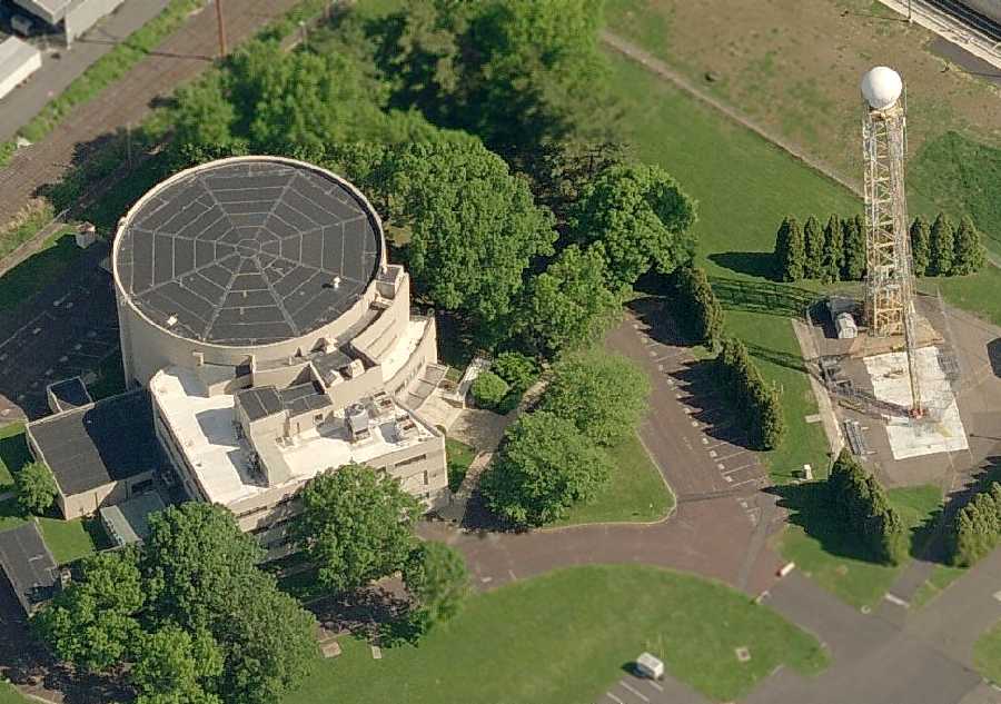
A circa 2006 aerial view looking north at the historic Warminster centrifuge building.
According to Christopher Ness, “The radar ball is a recent add-on belonging to one of the local TV stations weather department.
The tower is from the NASA (NACA) period.
The smaller diagonal tower that connects to the heavier tower with the radome was a track for a rocket seat similar to an ejection seat trainer.
This was used to test the effects of sudden acceleration on the early astronauts.”
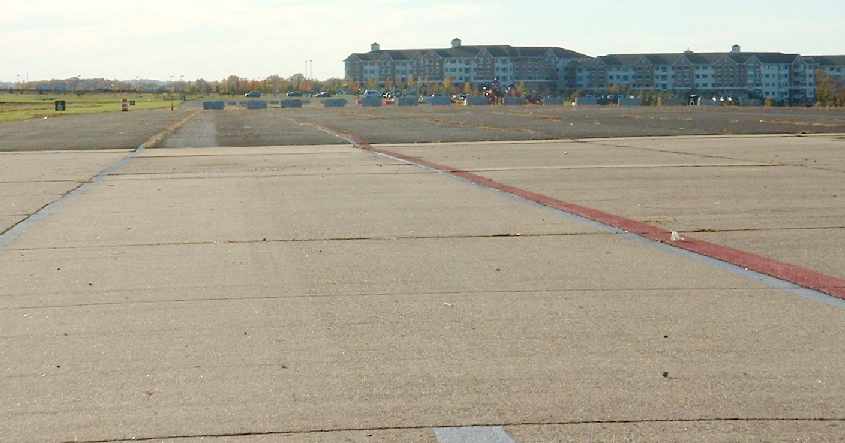
A 1/7/07 aerial view by Philip Kineyko of www.FlyinPhilsPhotos.com, looking southwest along the remaining half of the Warminster runway.
In the background are the new residential buildings which cover the remaining portion, and the former Brewster factory buildings.
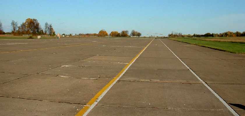
A 2007 aerial view by Stefan Krause looking northwest along the remaining half of the Warminster runway.
John Collins reported, “The low, round dome building at NADC Warminster south of the runway had an inertial navigation test lab in it.”
Note that the middle test tower (at right) had been removed by this point.
John Murawski reported in 2009, “The centrifuge building is indeed intact & in private hands.
The 50' arm, motor & gondola are still in place although the centrifuge is no longer operational.
Plans are underway to convert the facility into a space & science museum [The Johnsville Centrifuge & Science Museum].
Additionally, efforts are underway to recover the original gondola that was used for early testing.
It is being held in a storage yard by the Smithsonian.
NADC Museum organizers have been told it is theirs for the taking
if they can find a way to transport it from the storage site to Warminster.”
A 4/13/12 aerial view by Mike Schatz looking south at the remaining western half of the Warminster runway, “taken from my Cessna 152 at about 1,000' AGL.”
The test towers are also visible in the foreground.
A 4/13/12 aerial view by Mike Schatz looking southeast at the historic former Brewster factory, and the historic centrifuge in the foreground.
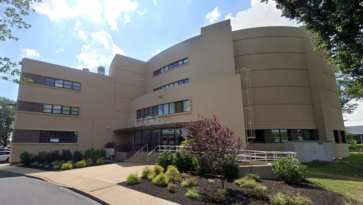
M. Allen reported in 2012 that the historic Warminster centrifuge & its building are being reused as a party-hosting facility, The Fuge.
He reported, “The centrifuge is still there! The pivot itself is used as the DJ booth, spotlight, and general controls. The capsule isn't used.
The place is more like a disco than anything else.”
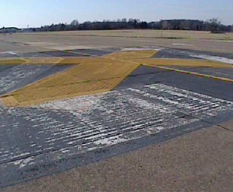
A March 2014 photo by Ron Plante of “what looked like remnants of the emergency arresting gear (BAK-something) at the eastern end of Runway 9/27.
I was unprepared for the MASSIVE development. I could not find the control tower, but I did manage to find what’s left of the runway at the Warminster Community Park.
There are concrete blocks along with yellow X markings. Off in the northeast corner I saw what may have been one of the test towers.”
A 3/5/17 aerial view by Dennis Boykin looking southwest at the remaining half of the Warminster runway.
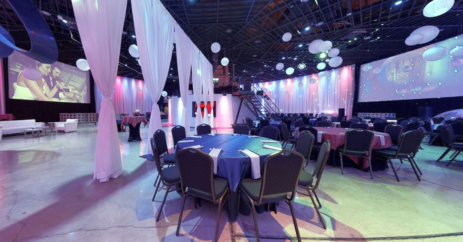
A 2018 photo of the interior of the historic Warminster centrifuge, reused as an event venue the “Fuge”.
A 2018 photo looking west at the historic Warminster centrifuge, reused as an event venue the “Fuge”.
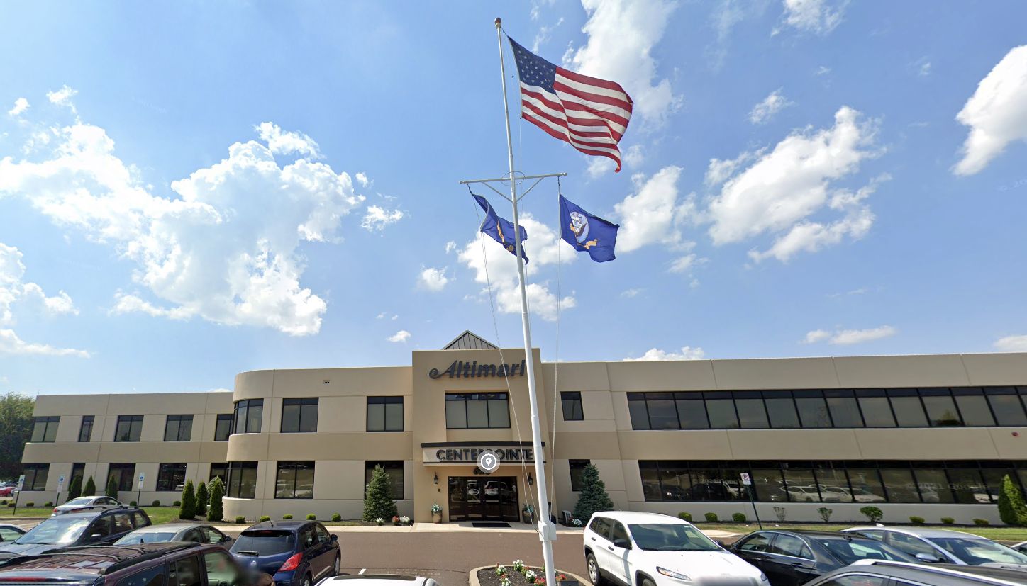
A 2019 photo looking northwest at the entrance to the WW2-era Brewster factory.
The “Brewster” lettering over the entrance which had been uncovered in 2002 had once again been covered, by an “Altimari” sign.
An 11/29/20 aerial view by Val Nasano looking northeast at the remaining half of the Warminster runway.
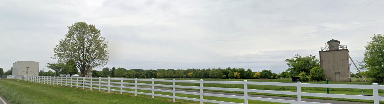
A 2023 photo looking south at the former Warminster test towers which remain on the east side of the site.
____________________________________________________
Or if you prefer to contact me directly concerning a contribution (for a mailing address to send a check),
please contact me at: paulandterryfreeman@gmail.com
If you enjoy this web site, please support it with a financial contribution.
____________________________________________________
This site covers airfields in all 50 states.