
Abandoned & Little-Known Airfields:
Southeastern New Mexico
© 2002, © 2024 by Paul Freeman. Revised 2/13/24.
This site covers airfields in all 50 states: Click here for the site's main menu.
For a 4th year, the NM pages of this website are sponsored by the New Mexico Pilots Association:
____________________________________________________
Please consider a financial contribution to support the continued growth & operation of this site.
Carlsbad Aux AAF #1 (revised 6/14/21) - Carlsbad Caverns Airpark (revised 6/14/21) - Cree Meadows Airport / Ruidoso Municipal Airport (revised 3/11/20)
Eunice Airport (2nd location) / Lea County Eunice Airport (revised 2/13/24) - Hobbs AAF / Hobbs Municipal Airport / Crossroads International Airport / Hobbs Industrial Airpark (revised 8/28/23)
Hobbs Aux AAF #4 (revised 10/15/16) - Knowles Aux AAF #1 (revised 2/13/24)
___________________________________________________________
Eunice Airport (2nd location) / Lea County Eunice Airport, Eunice, NM
32.456, -103.242 (Northeast of El Paso, TX)
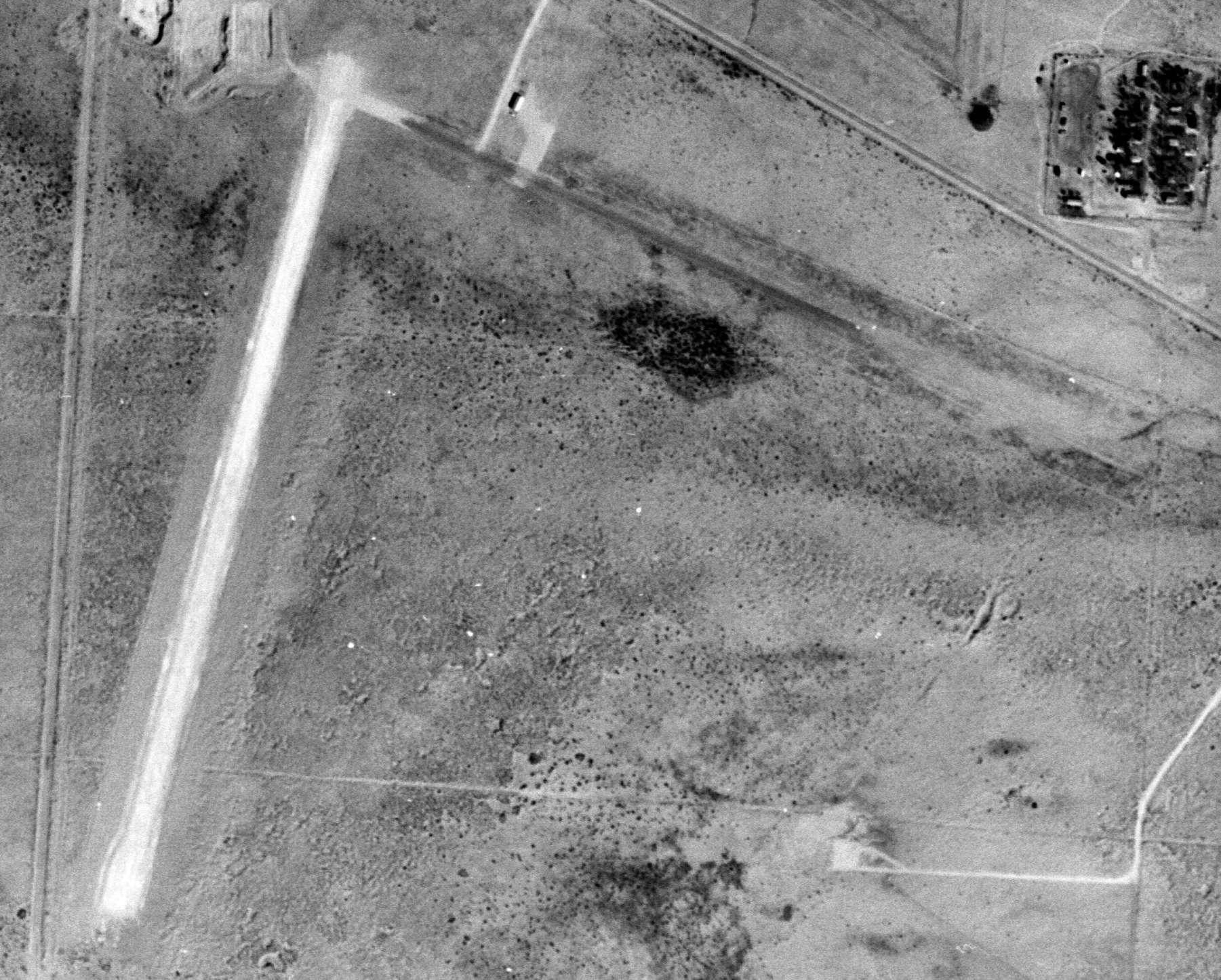
Eunice Airport, as depicted on a 3/8/57 USGS aerial view.
The 2nd location of Eunice Airport (northwest of the town) was evidently established at some point between 1953-55,
as it was not yet depicted on the August 1953 Roswell Sectional Chart.
The earliest depiction which has been located of the 2nd location of Eunice Airport (northwest of the town) was a 1955 aerial photo.
It depicted Eunice Airport as having 2 unpaved runways, with a small building on the north side.
The earliest depiction which is available of the 2nd location of Eunice Airport (northwest of the town) was a 3/8/57 USGS aerial view.
It depicted Eunice Airport in the same fashion as the 1955 photo.
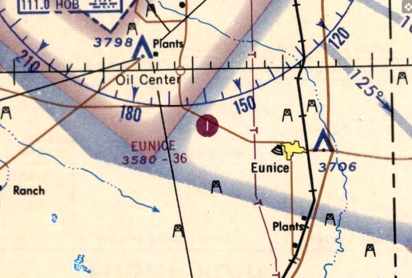
The earliest aeronautical chart depiction which has been located of the 2nd location of Eunice Airport (northwest of the town)
was on the June 1965 Roswell Sectional Chart (courtesy of Lee Corbin).
It depicted Eunice Airport as having a single north/south paved 3,600' runway.
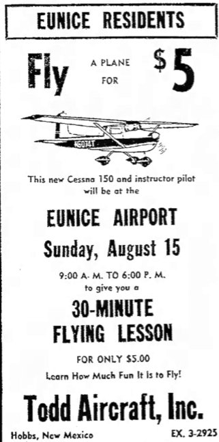
An advertisement for Eunice Airport from the 8/15/65 Hobbs Daily News (courtesy of Lee Corbin).
An article in the 5/12/76 Hobbs Daily News (courtesy of Lee Corbin)
said that the Commissioners had decided to abandon Eunice Airport as the low use of the airport did not justify the maintenance costs.
However, this was evidently not done, as the airport continued in operation for another 30 years.
A 1977 aerial photo showed Eunice Airport had been improved, with both runways having been paved at some point between 1957-77.
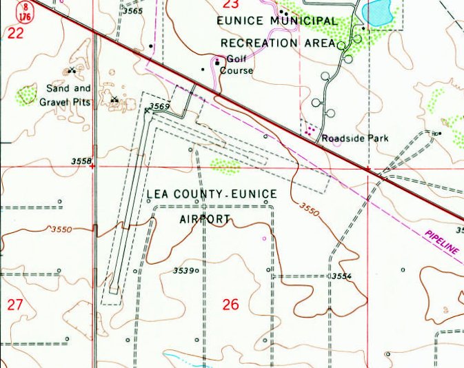
The 1979 USGS topo map (courtesy of Lee Corbin) depicted “Lea County Eunice Airport”
as having a paved northeast/southwest runway & a shorter unpaved northwest/southeast runway.
No buildings were depicted on the field.
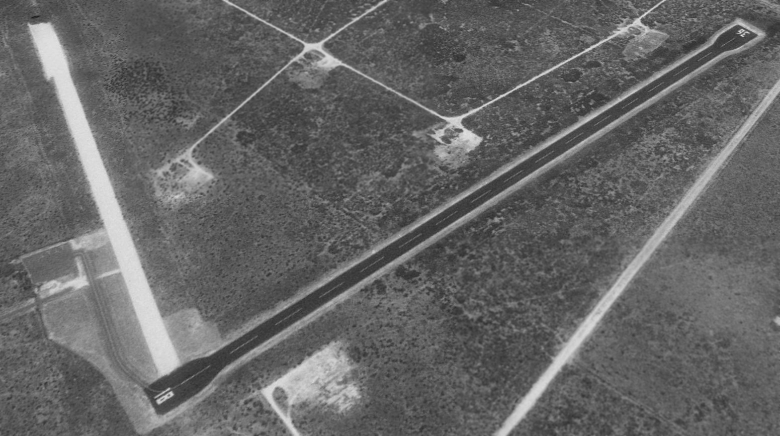
The earliest photo which is available of Eunice Airport was a 1997 aerial view looking southeast.
It depicted Eunice Airport as having an asphalt Runway 18/36, with an unpaved crosswind runway, and a small ramp on the north side.
There were no buildings or aircraft on the field.
A 2005 aerial view showed yellow closed-runway “X” symbols had been painted on Eunice Airport's asphalt Runway 18/36.
According to Lee Corbin, Eunice Airport “was shut down in May 2006.”
The 2016 Albuquerque Sectional Chart depicted Eunice Airport as an abandoned airfield.
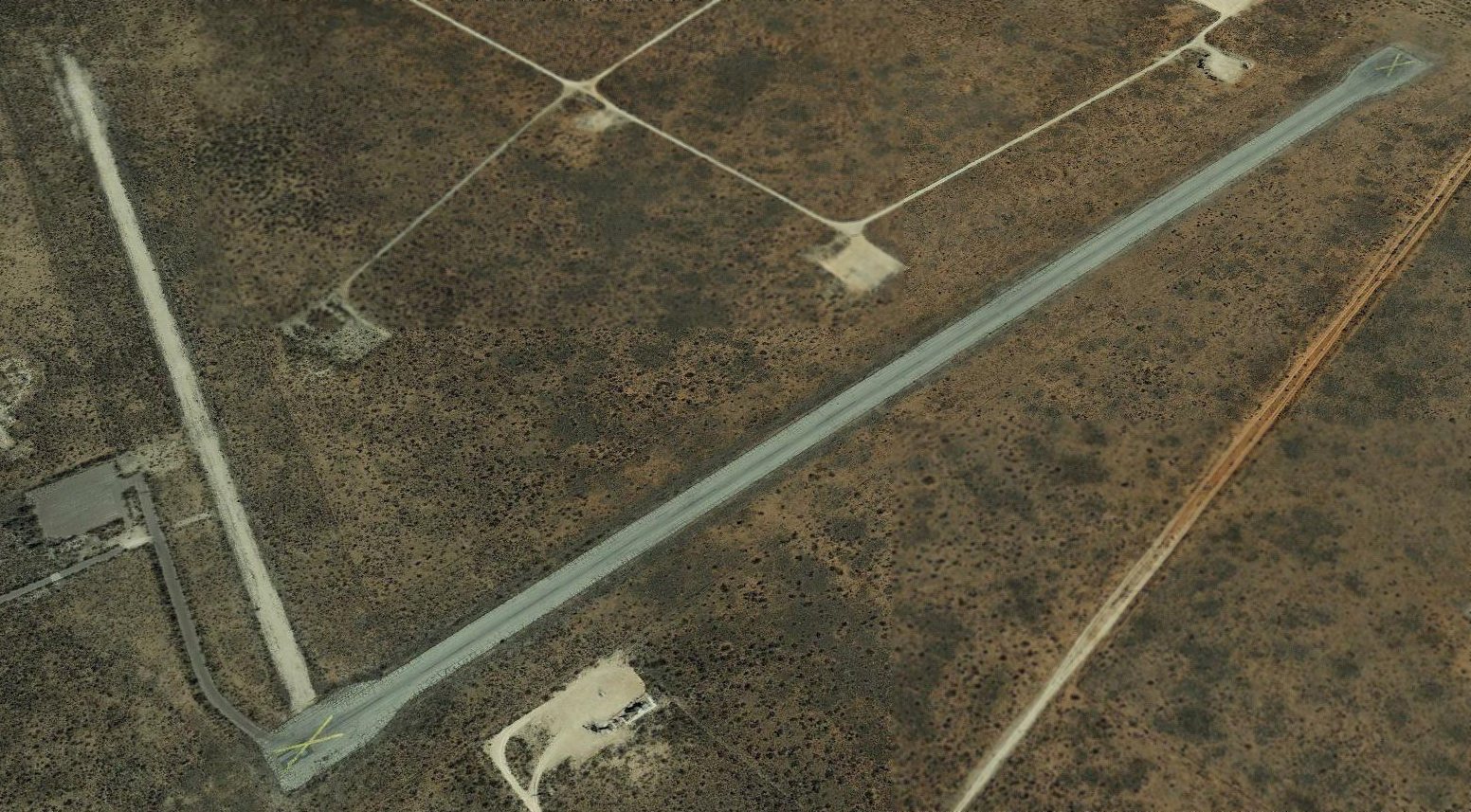
A 2019 aerial view looking southeast showed yellow closed-runway “X” symbols on Eunice Airport's asphalt Runway 18/36, but the airport otherwise remained intact.

A 2021 photo looking south at the former Eunice Airport entrance,
Thanks to Lee Corbin for pointing out this airfield.
____________________________________________________
Hobbs Army Airfield / Hobbs Municipal Airport / Crossroads Intercontinental Airport /
Hobbs Industrial Airpark (HBB), Hobbs, NM
32.765, -103.215 (Southwest of Lubbock, TX)
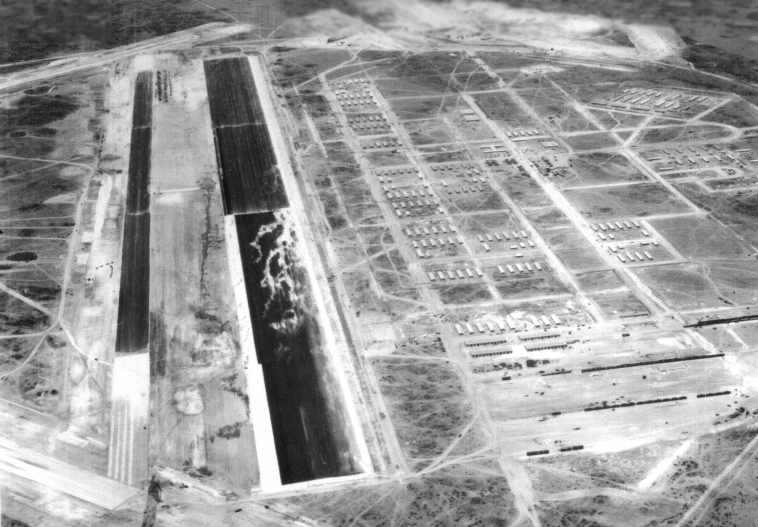
A circa early-1940s aerial view looking northwest at Hobbs AAF (courtesy of Lou Thole),
taken while the field was still under construction (note the lack of any hangars along the ramp).
Hobbs was selected as the location for a new airfield & training base on 2/16/42.
Hobbs Army Airfield was established for the use of the 2nd Air Force for the 50,000 Pilot Training Program.
Hobbs AAF was not yet depicted on the June 1942 Roswell Sectional Chart.
The City purchased land for the airfield from B. J. Caudill & D. N. Huston,
then leased the land to the Federal Government for $1/year for 25 years.
Construction began on Hobbs Army Air Field in June 1942.
Hobbs was operated by the Western Flying Training Command,
with the first class of bombardier students beginning training at Hobbs on 9/7/42,
and the first class of 4-engine pilot training (B-17 bombers) began 12/14/42.
In 1942-43, Hollywood celebrity Jimmy Stewart went through a 4-engine training course in the Boeing B-17 Flying Fortress at Hobbs, to check out as a first pilot, or aircraft commander.
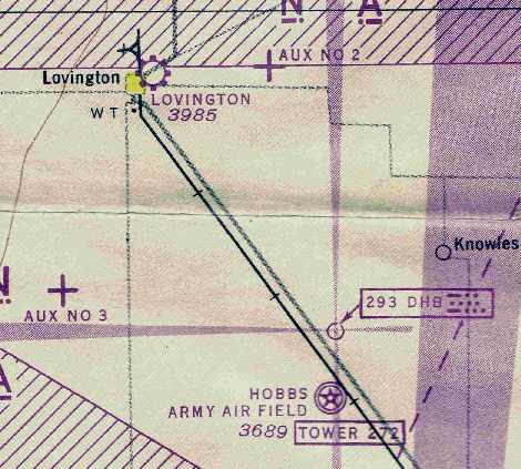
The earliest chart depiction which has been located of Hobbs AAF as an active airfield
was on the August 1943 Roswell Sectional Chart (courtesy of Chris Kennedy).
It also depicted 2 of its auxiliary airfields.
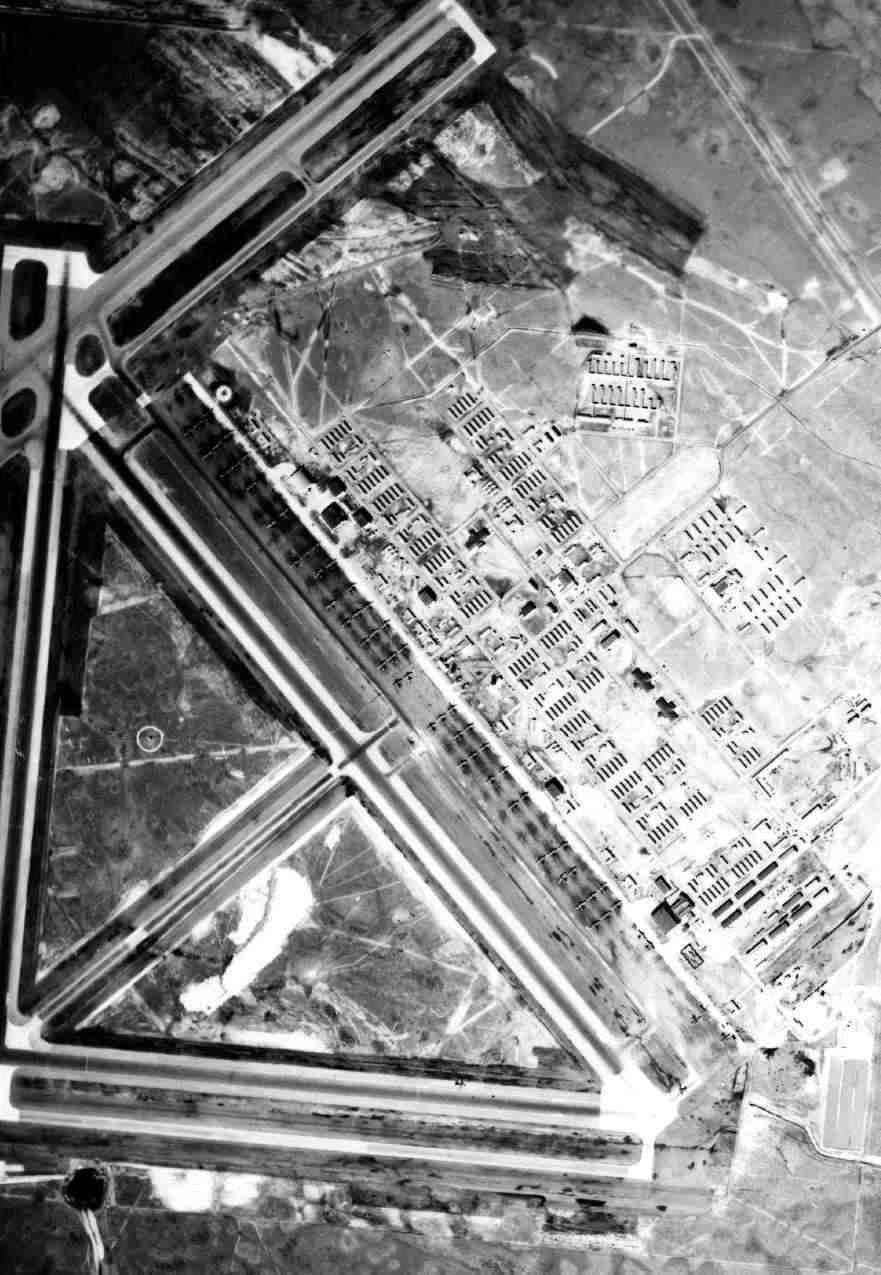
An impressive undated (WW2-era) aerial view of Hobbs AAF,
showing over 50 B-17s on the ramp & runways, and a large number of hangars & buildings.
During WW2, Hobbs AAF had a total of 6 satellite airfields: Knowles Aux #1 (14 miles northeast of Hobbs AAF),
Hobbs Aux #2 (east of Lovington), Hobbs Aux #3 (southwest of Lovington),
Hobbs Aux #4 (19 miles west of Hobbs AAF), Wink Aux (3.5 miles WNW of Wink, TX), later reused as Winkler County Airport,
and Hobbs Municipal Aux #6 (5 miles south of Hobbs AAF), later reused as Lea County Regional Airport.
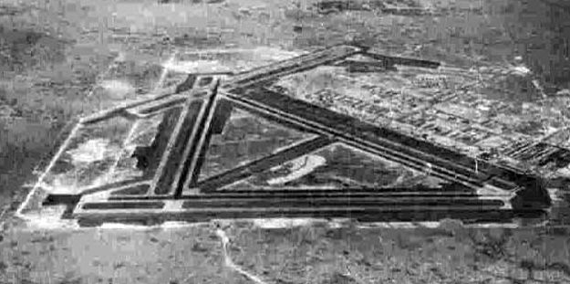
A circa 1943-45 aerial view looking north at Hobbs AAF from the 1945 AAF Airfield Directory (courtesy of Scott Murdock).
The final buildings at Hobbs AAF were completed in April 1944.
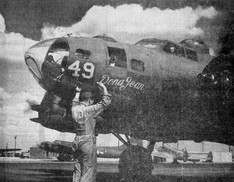
An undated photo of a B-17 heading out on a training mission from Hobbs,
from a circa 1945 issue of the Hobbs Daily News-Sun.
Another B-17 & a C-45 are visible in the background.
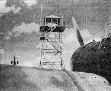
An undated photo of the Hobbs control tower, visible over the wing of a AT-6 Texan,
from a circa 1945 issue of the Hobbs Daily News-Sun.
With the end of WW2, pilot transition training at Hobbs terminated in August 1945.
In the post-war drawdown, the Army Air Force was faced with the task of deciding which training bases to decommission
and which ones could contribute to the post-war Air Force mission.
Although the majority of its airfields were designed & built as temporary facilities,
there were some, such as the NM's Roswell AAF or Kirtland Field,
that were converted to permanent air bases for the soon-to-be established United States Air Force.
Naturally, for economic reasons, most cities located near these temporary airfields hoped that their base would be chosen to remain open.
It appears from official Army documents that the Hobbs Army Air Field was a “borderline case” with regard to closure.
The airfield had originally been scheduled to close on 10/31/45,
however, this directive was almost immediately canceled when the Army Air Forces decided to assign the base
to the Air Technical Service Command for use as an aircraft storage facility.
The Army began disposing of excess property at Hobbs AAF as early as November of 1945.
Despite the fact that Army officials had no authority to dispose of any structures or equipment to individual citizens
(that would come later under the authority of the War Assets Administration),
they began the process of decommissioning the base by boarding up unused buildings
and shipping equipment & supplies to other military bases across the country.
“Scrap” lumber, created by the “inadvertent” demolition of excess buildings,
was used to build crates & packing cases for the materials to be shipped out.
By 1946, still prior to the base being declared surplus,
newspaper advertisements in the Hobbs Daily News-Sun offered fuel cells from the airfield for sale.
Readers were told they could be used for “feed & water troughs, rowboats, duck-blinds, sandboxes, and chicken coops”
and ranged in price from $1-$3.25 depending upon size.
Also on sale were a variety of excess goods & materials, such as desks, chairs, filing cabinets, window
coverings, small motors, wiring, plumbing, paint, pipe, and an assortment of tools.
In the spring of 1947, perhaps forecasting events to come the following year,
the War Assets Administration began to authorize the selling of buildings to individuals or groups.
In February of that year, C. T. Rice, an authorized disposal agent, advertised Army barracks buildings for sale,
calling them the “biggest value in years” and offering a 10% discount to World War II veterans.
Sealed bids were opened in May for 112 former airfield buildings,
including 32 barracks, 16 administration buildings, 12 recreational buildings, and 11 officers’ quarters.
By the end of 1947, there were only 194 buildings (out of more than 350) still intact on the air base.
On 3/28/48, the Hobbs Daily News-Sun ran the headline, “HAAF Goes Back to Nature.”
The paper reported that only one Army officer, a Major A. A. Chamberlain, together with 50 civilian employees,
was left on base to coordinate the final stages of base shutdown before the War Assets Administration took control of the property in May.
In the meantime, the federal government began negotiations with the city of Hobbs for the return of the airfield to the city.
Hobb's mission as an aircraft storage facility was terminated on 5/1/48,
when the Air Force declared the Hobbs AAF facility as “surplus”
and transferred it to the War Assets Administration for final disposal of all buildings, structures, and equipment.
In December, the City of Hobbs received a quitclaim deed from the Federal Government,
giving the city ownership of the former air base.
This deed came with the stipulation that the base be maintained as an airport
and that the federal government could take back the property in case of a national emergency.
Even after ownership of the base was transferred to the City of Hobbs in December of 1948,
the Air Force entertained proposals from the city & the state’s congressional delegation to reopen the base.
In April of 1950, there was an abortive attempt to move a large hangar to the Lea County Airport
when a strong wind gust destroyed one-half of the structure en route.
Harold Brown recalled, “We started out moving 2 of the B-17 hangars (one at a time) & the first one collapsed not far from the air base.
They put the hangars on some moving tracks that were used to move oil derricks & pulled them a little less than 5 miles to the present location with bulldozers.
My dad was in construction & my brother dug into some of the buried stuff left from the base.
He nearly got into trouble but it blew over about digging out there with machinery.”
It was not until October of 1952 that the Department of Defense officially shut the door on reopening the former airfield.
With little hope of convincing the Air Force to reopen the base, the city began to make other development plans.
While excess buildings continued to be auctioned off,
in 1953 the city decided to rehabilitate the “Los Llanos” Victory Housing Project
for use as apartments to alleviate the severe housing shortage that arose following the war.
Renamed “Air Base City,” the property had 176 apartments, a church, a self-serve laundry, grocery store and drug store.
The city even repaired & redecorated the former airfield’s theater & gymnasium.
A 9-hole golf course was completed by the end of 1954.
The city entered into a contract with local realtors to manage the rental properties;
however, the two parties eventually had a falling out, the city abandoned the project,
and the houses & other buildings were eventually sold or demolished.
The massive Hobbs AAF was subsequently reused as a civil airport.
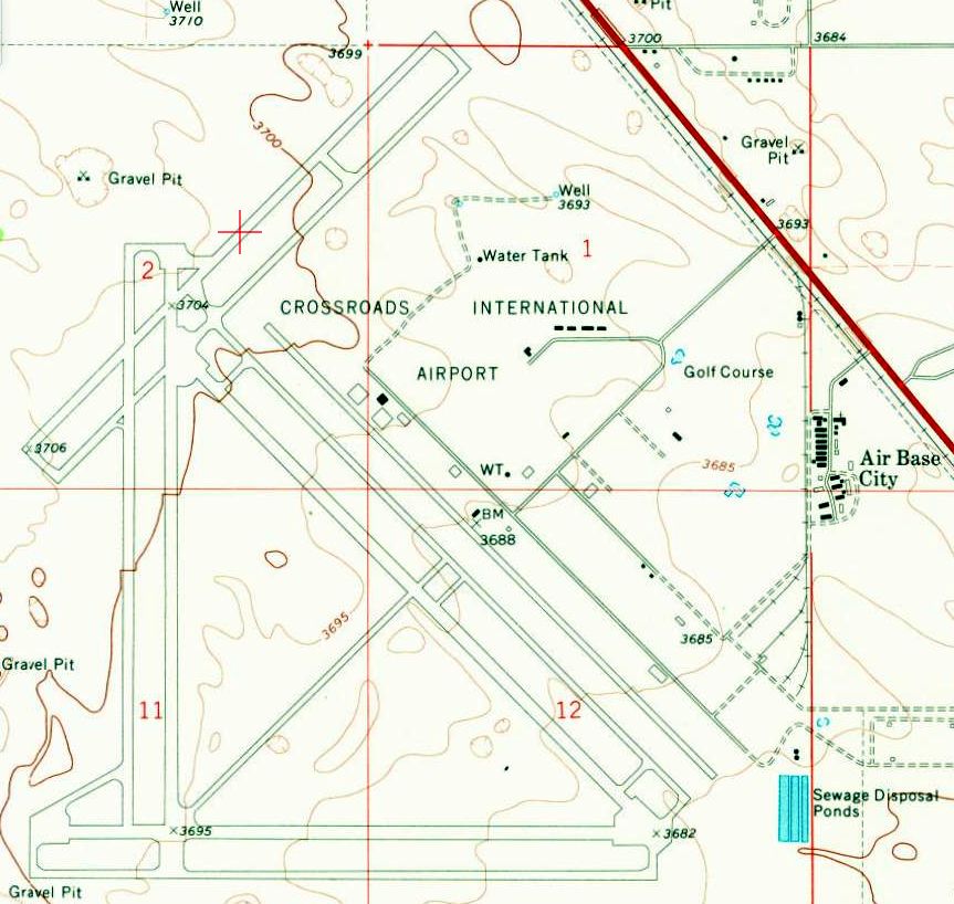
The 1960 USGS topo map depicted the massive airfield of the former Hobbs AAF as Crossroads International Airport,
with 4 paved runways, taxiways, ramps, but only a few remaining buildings.
Hobbs Municipal Airport was listed among active airports in the 1962 AOPA Airport Directory, with 4 paved runways.
In the 1960s, the city of Hobbs turned to the idea of developing the former Hobbs Army Air Field into a recreation area & industrial park.
The 9-hole golf course built in the mid-1950s was enlarged to 18 holes in 1965
and encompassed areas formerly used for officers’ living area, including the officers’ club & dining facilities,
several squadron barracks, 2 of the 3 enlisted men’s mess halls, and part of the motor pool area.
"Hobbs Municipal" was listed as an active airport on the 1966 Roswell Sectional Chart (courtesy of John Voss).
The Aerodromes table described the field as having 4 runways (with the longest being an 8,810' asphalt runway),
but the remarks said "Paving no longer maintained”, and the field was labeled as “Hazardous”.
Max Clampitt told the story of how a retired Air Force general-turned-entrepreneur came to town in the late 1960s
and proposed the idea of turning the old airfield into an intercontinental airport.
The city invested funds in some rehabilitation projects at the former base;
however, in the end, the venture never materialized.
As Max recalled, “The deal fell through, and he left town in the dark of the night.”
It was labeled "Crossroads Intercontinental Airport" on the 1971 NM Aeronautical Chart (courtesy of Fred DeGuio), and depicted with 3 runways.
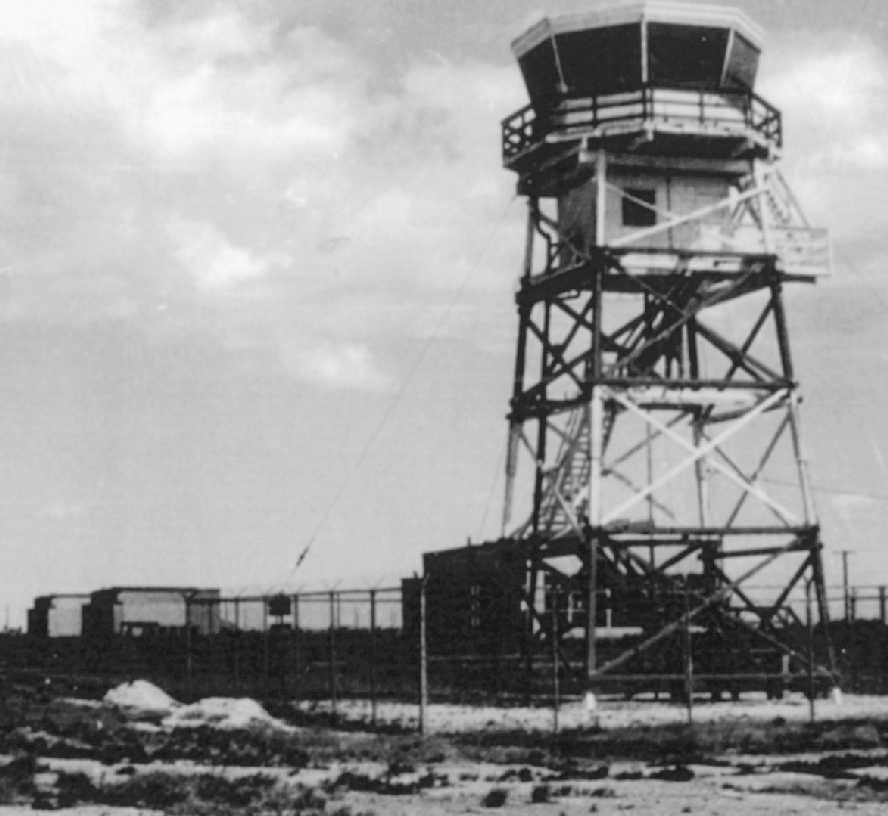
A 1973 photo of the refurbished Hobbs AAF control tower & 3 remaining hangars.
It was labeled "Hobbs Industrial Airpark" on the 1974 NM Aeronautical Chart (courtesy of Fred DeGuio), and depicted once again with all 4 runways.
The failed redevelopment endeavor did revitalize an interest developing the long-dormant property, by the 1970s called the Hobbs Industrial Air Park.
In 1975, Halliburton oil field services became the first major lessee on land along Highway 18,
while other smaller organizations, such as Hobbs Motor Sports & the National Soaring Society,
leased parts of the landing field in the 1980s & 1990s for drag racing events & a glider field, respectively.
Other parcels were sold to a private company (Cam-Hobbs), to Lea County for construction of a correctional facility & medical center,
to the State of New Mexico for a new National Guard Armory, and to the New Mexico Junior College for a new campus,
which included the Hobbs Army Air Field’s ordnance area (several armament “igloos” were reused as storage facilities by the college).
Other improvement to the property included the construction of the Harry McAdams State Park, which is now owned by the city.
This beautiful park, with its picnic areas, ponds, grass and large shade trees,
occupies land that formerly included the base headquarters, administrative area, and parade ground.
The construction of the park, golf course, and other new buildings resulted in obliterating nearly all traces
of buildings & foundations associated with the former Hobbs Army Air Field.
Other large buildings, such as the hangars, stayed around through the 1970s.
They were used for a variety of purposes – everything from warehousing potatoes
to building the huge radio antennas (82 feet in diameter) for the Very Large Array,
one of the world’s premier astronomical radio observatories
(eventually installed on the Plains of San Agustin 50 miles west of Socorro, NM).
It was labeled "Hobbs Industrial Airpark" on the 1974 NM Aeronautical Chart (courtesy of Fred DeGuio), but depicted with only 2 runways.
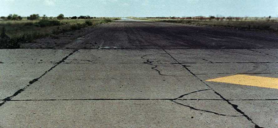
A June 1988 photo by Steve Schmidt looking southwest along a Hobbs taxiway,
“Taken at the middle of the large ramp area, looking straight down the taxiway that leads out to what I believe is Runway 36/18.
It was in good shape & free of tumbleweeds, etc. from what I could see.”
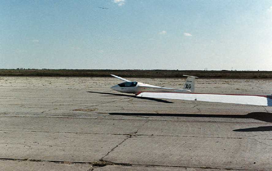
A June 1988 photo by Steve Schmidt of a glider rolling out on the Hobbs ramp, with another glider visible overhead.
Steve recalled, “The gliders were landing on the ramp itself that day - not using any of the runways.
The southernmost runway was being used as a dragstrip, and I attended races there as late as 1992.”
It was labeled "Industrial Airpark", a private airfield on the 1990 NM Aeronautical Chart (courtesy of Fred DeGuio), and once again depicted with all 4 runways.
Harold Brown recalled, “The old base has been used for several things over the years.
A local man got the contract to build huge antennas that are used for space signals & are in the movie "Contact" [1997].”
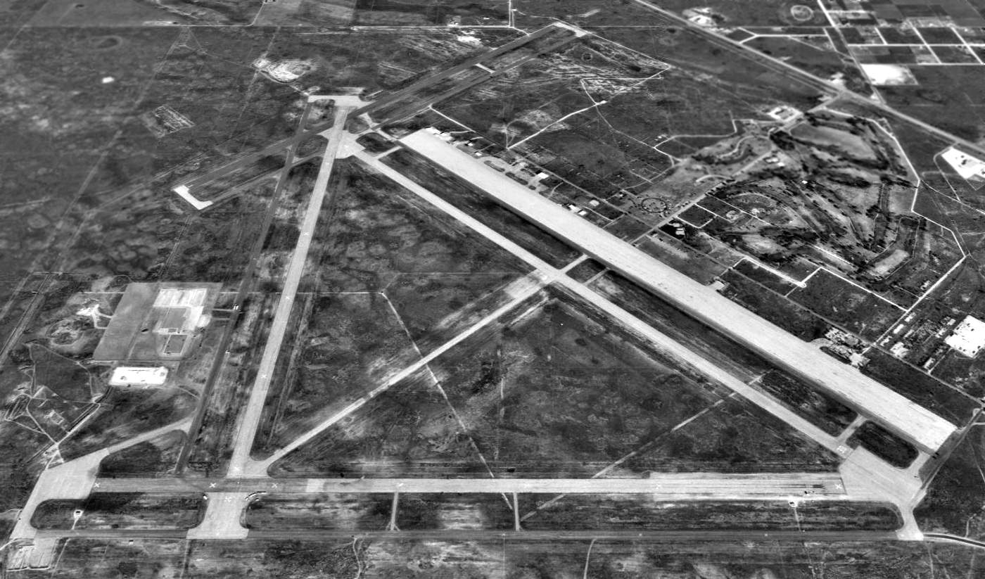
A 1997 USGS aerial view looking north at the remains of the massive Hobbs airfield.
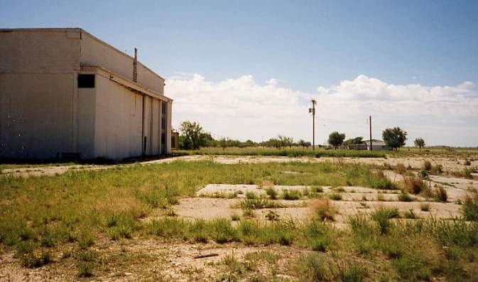
A 1997 photo by Scott Murdock of a remaining hangar at Hobbs.

A 1997 photo by Scott Murdock of an abandoned munitions storage igloo at Hobbs.
A 2003 aerial photo looking north at Hobbs by Dick Merrill.
As of 2003 the Hobbs airfield was still operated as Hobbs Industrial Airpark, a private airfield used for glider operations.
The National Soaring Foundation is based at Hobbs.
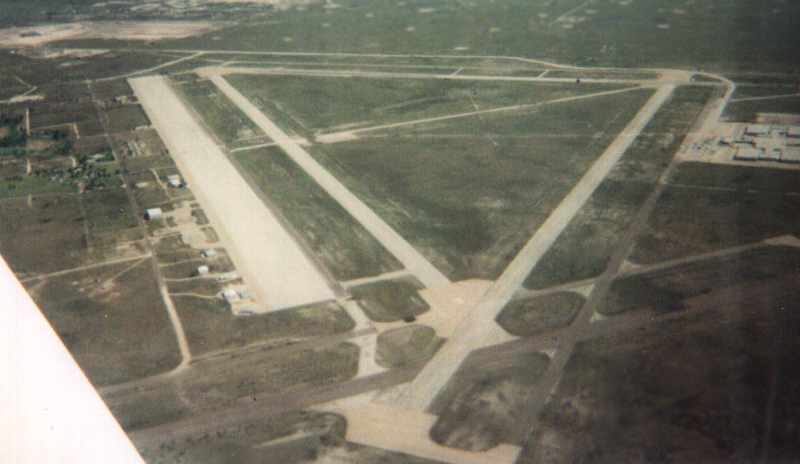
A 2004 aerial photo looking southeast at Hobbs by Harold Brown (courtesy of Lou Thole).
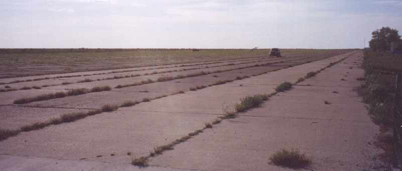
A 2004 photo by Lou Thole of the massive ramp at Hobbs.
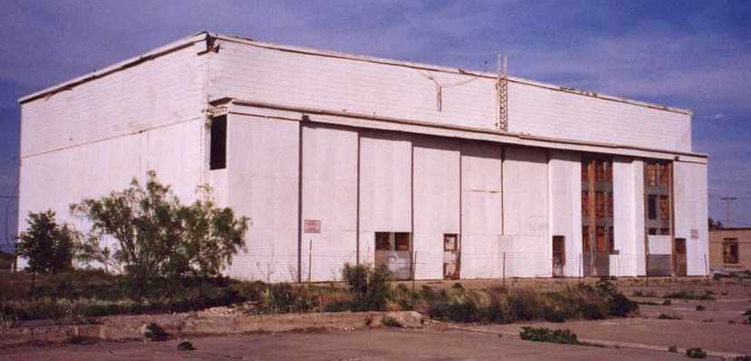
A 2004 photo by Lou Thole “of the sole remaining hangar at Hobbs.
The building has been condemned & is no longer in use.”
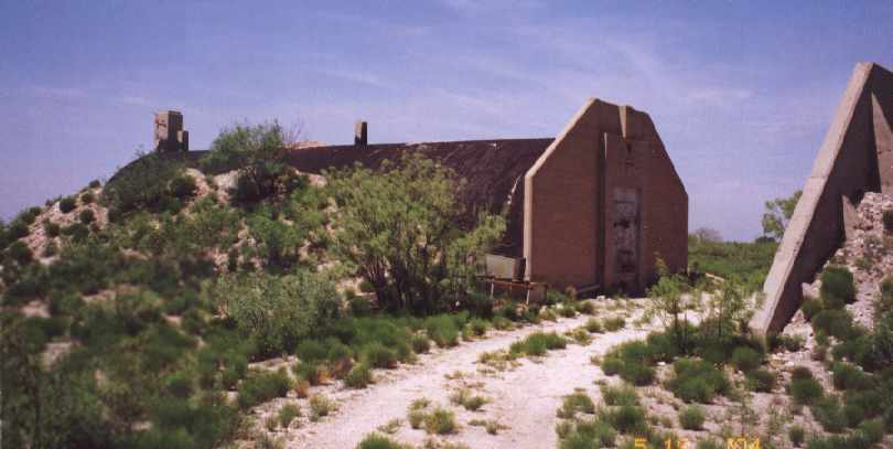
A 2004 photo by Lou Thole of an abandoned ordnance bunker at Hobbs.
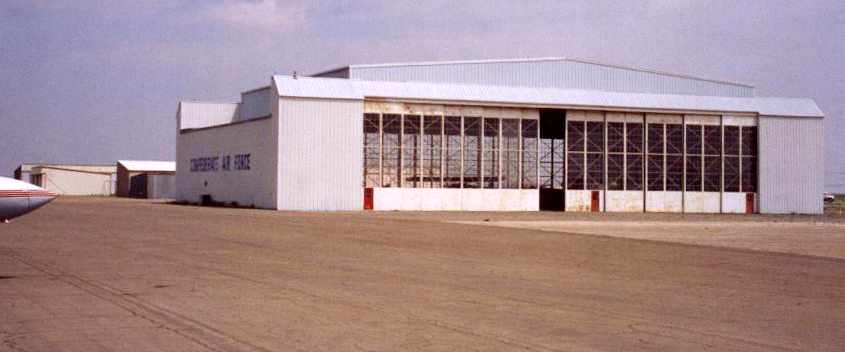
A 2004 photo by Lou Thole a hangar originally from Hobbs AAF, but which was relocated after WW2 to the Hobbs Municipal Airport.
The former Air Command hangar was rehabilitated for use by the Confederate (now Commemorative) Air Force.
The last remaining squadron hangar was torn down by the City of Hobbs in 2006
after it fell into disrepair & thus became a safety hazard.
David Martin reported in 2011, “The Hobbs Industrial Airpark is the headquarters of the Soaring Society of America.
They have held many soaring competitions there including the world championships in 1983.
The most recent contest was the 18 Meter Nationals held this year.”
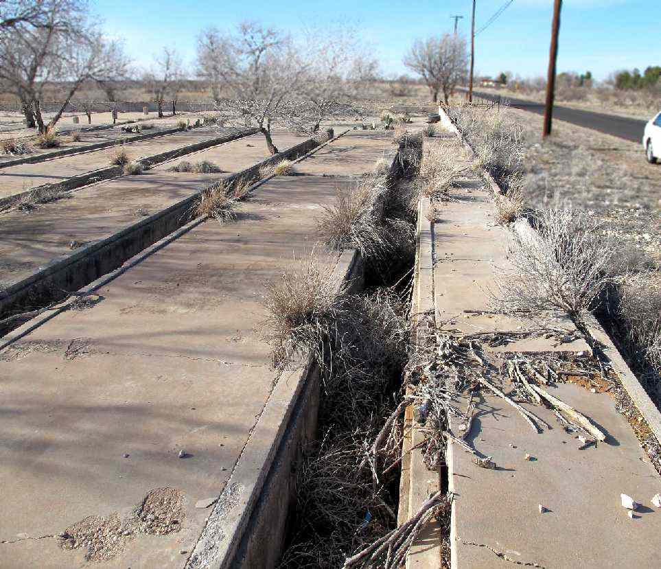
A January 2012 photo by Don Dennis at the former Hobbs AAF of a “foundation with open culverts.
I cannot find any information or other photos indicating the purpose of this foundation.”
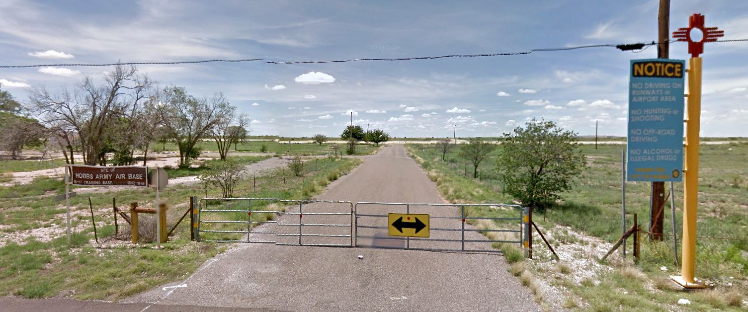
A 2013 looking southwest at the entrance to the Hobbs airfield area.
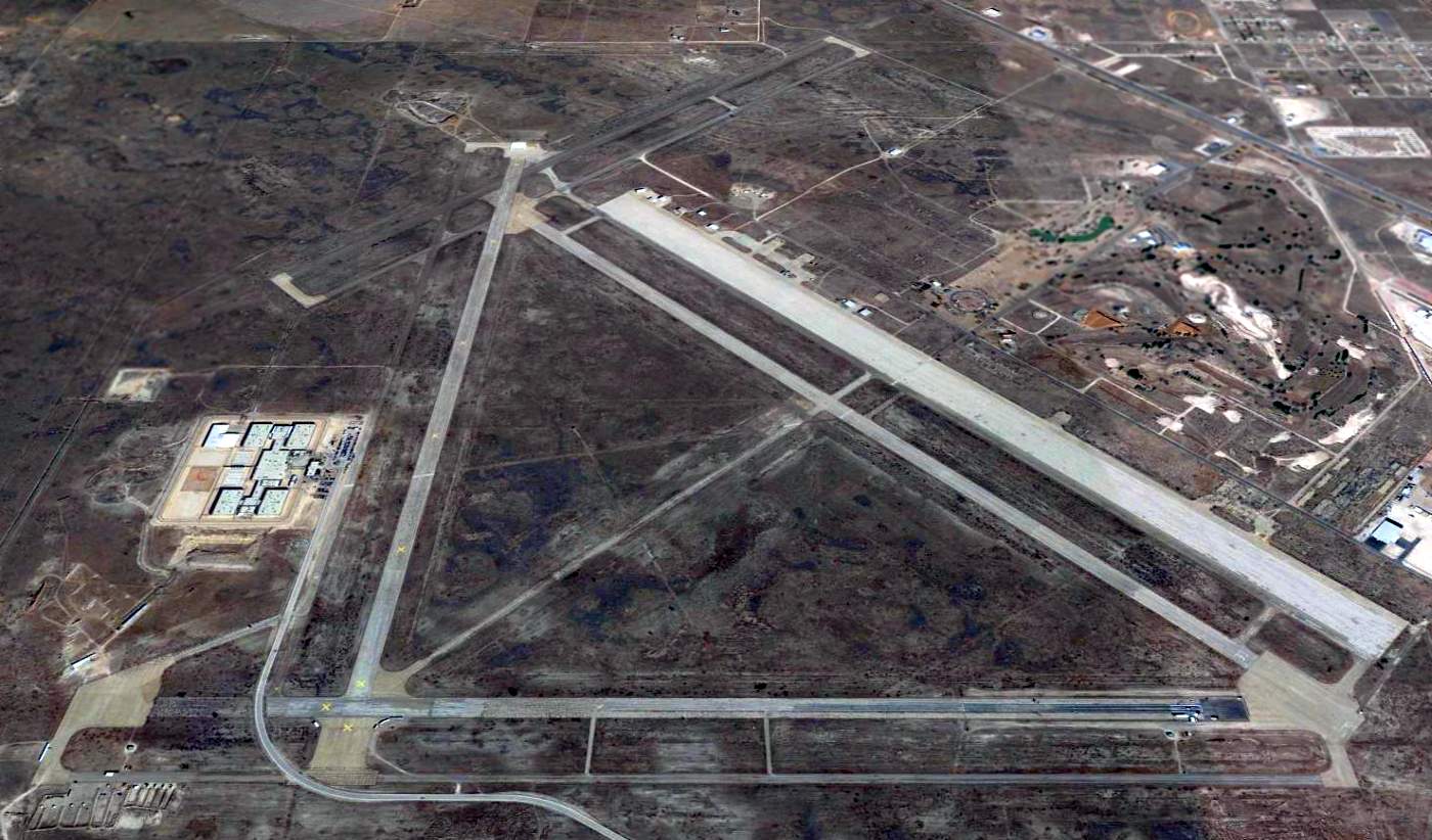
A 2014 aerial view looking north at the remains of the massive Hobbs airfield.
The 2020 NM Aeronautical Chart (courtesy of Fred DeGuio) depicted “Industrial” as a private airfield with 2 runways.

A 2022 photo looking north along the remains of Hobbs Runway 35.
See also: Forgotten Fields of America by Lou Thole.
______________________________________________________
Knowles Auxiliary Army Airfield #1, North of Hobbs, NM
32.955, -103.12 (Southwest of Lubbock, TX)
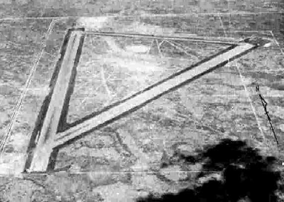
“Hobbs AAF Auxiliary #1” as depicted on a 10/8/43 aerial view looking north
from the 1945 AAF Airfield Directory (courtesy of Scott Murdock).
This field was used during WW2 as one of 4 satellite airfields for Hobbs AAF (14 miles southwest),
which trained bombardiers & the crews of 4-engine bombers.
Knowles Aux #1 may have been constructed at some point in 1943,
as it was not yet depicted on the August 1943 Roswell Sectional Chart (courtesy of Chris Kennedy).'
The earliest depiction of the Knowles Aux #1 airfield which has been located
was a 10/8/43 aerial view looking north from the 1945 AAF Airfield Directory (courtesy of Scott Murdock).
It depicted “Hobbs AAF Auxiliary #1” as having 2 paved runways.
The 1945 AAF Airfield Directory (courtesy of Scott Murdock) described “Hobbs AAF Auxiliary #1”
as an irregularly-shaped property having 2 asphalt 7,000' runways, oriented north/south & northeast/southwest.
The field was said to not have any hangars, to be owned by the U.S. Government, and operated by the Army Air Forces.
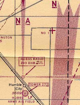
The earliest aeronautical chart depiction of the Knowles Aux #1 airfield which has been located
was on the 1945 Roswell Sectional Chart (courtesy of Chris Kennedy).
It depicted Hobbs Aux #1 in relation to its parent airfield.
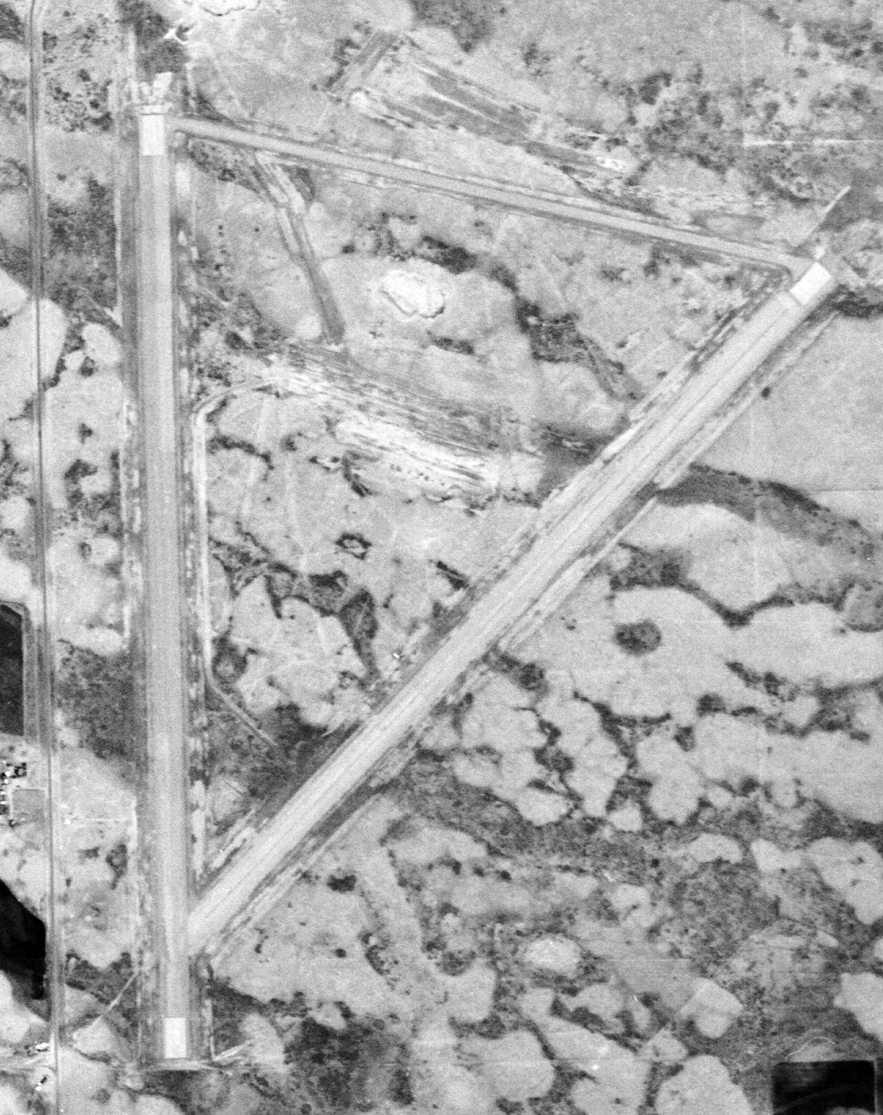
A 4/6/54 USGS aerial view depicted the Knowles Aux #1 airfield as having 2 paved runways with a connecting taxiway.
There were no ramps, hangars, or other improvements.
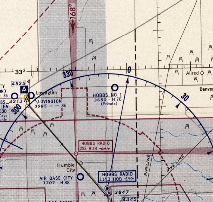
The last aeronautical chart depiction which has been located showing the Hobbs Aux #1 Airfield still in operation was on the March 1956 Roswell Sectional Chart.
It depicted “Hobbs No 1” as a private airfield having a 7,000' paved runway.
The Hobbs Aux #1 Airfield was evidently closed at some point in 1956,
as it was no longer depicted on the October 1956 Roswell Sectional Chart.
It appears to not ever have been reused for civilian aviation, most likely due to its extremely remote location.
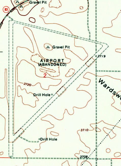
The 2 runways & taxiway of Knowles Aux #1 were labeled “Airport (Abandoned)" on the 1960 USGS topo map.
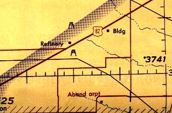
The former Knowles Aux #1 was labeled simply as "Aband arpt" on the 1966 Roswell Sectional Chart (courtesy of John Voss).
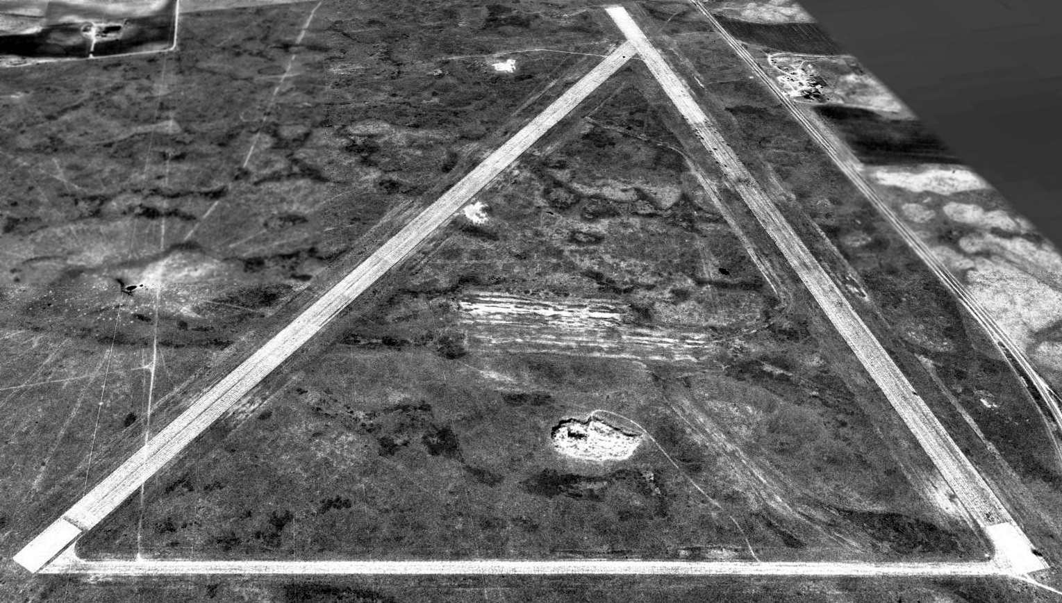
A 1990 aerial view looking south showed the 2 paved runways of the former Knowles Aux AAF still remained in quite good condition, though deteriorated.
Knowles Aux #1 was still depicted on 1998 aeronautical charts as an abandoned airfield.
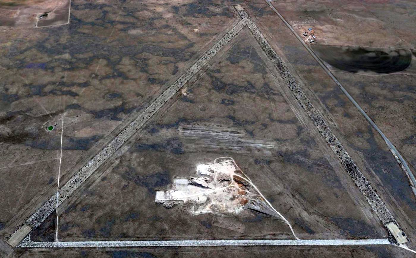
A 2014 aerial view looking south showed the 2 paved runways of the former Knowles Aux AAF still remained in quite good condition,
with some mining taking place in between the runways.
Harold Brown reported in 2016 of the Hobbs auxiliary airfields: “To go out to some of these old auxiliary strips, I can't believe how nature reclaimed her earth.
There are Elm trees 12-14 inches & maybe larger growing up in the old runways.”

A 2023 photo looking southeast at the Knowles Aux AAF entrance gate.
______________________________________________________
Hobbs Auxiliary Army Airfield #4 / Hobbs Municipal Auxiliary #4, Buckeye, NM
32.723, -103.533 (Southwest of Lubbock, TX)
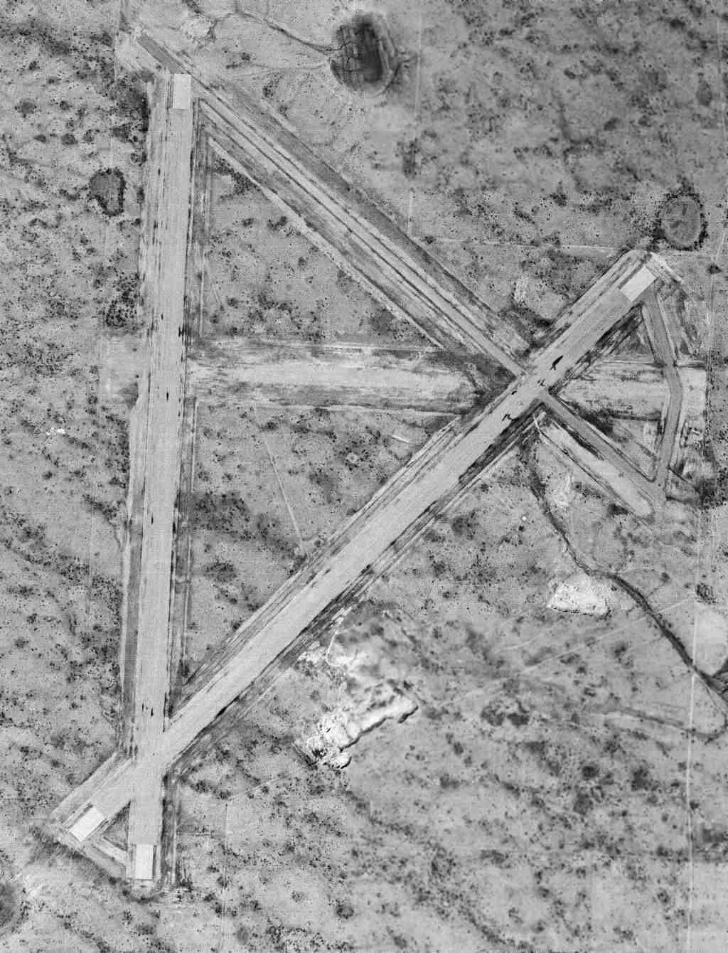
A 3/17/57 USGS aerial view of Hobbs Aux #4.
Photo of the airfield while in use has not been located.
This field was built during WW2 as one of 4 satellite airfields for Hobbs AAF (19 miles east),
which trained bombardiers & the crews of 4-engine bombers.
The date of construction of Hobbs Aux #4 has not been determined, but the parent field (Hobbs AAF) was established in 1942.
The Hobbs Aux #4 airfield was apparently abandoned prior to 1945,
as it was not depicted at all on the 1945 Roswell Sectional Chart (courtesy of Chris Kennedy)
and was not listed among the active auxiliaries of Hobbs AAF in the 1945 AAF Airfield Directory (courtesy of Scott Murdock).
The earliest depiction which has been located of Hobbs Aux #4 was a 3/17/57 USGS aerial view.
It depicted the field as having 4 paved runways.
The airfield was located in an extremely remote area, with no roads visible leading to the airfield.
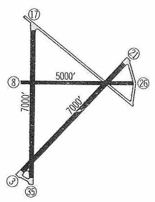
Hobbs Aux #4 was apparently reopened at some point between 1945-60 as a civil airfield,
as that was how "Hobbs Muncipal Aux #4" was listed in the 1960 Jeppsen Airway Manual (courtesy of Chris Kennedy).
The field was depicted as having 3 paved runways (7,000' Runways 3/21 & 17/35, and 5,000' Runway 8/26).
No ramp or buildings were depicted on the field, which was said to be unattended.
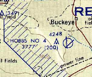
Hobbs #4, as depicted on the December 1962 USAF Operational Navigation Chart (courtesy of Chris Kennedy).
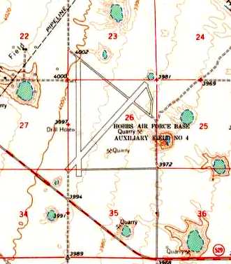
The 1963 USGS topo map depicted the 2 runways & taxiway of “Hobbs Air Force Base Auxiliary Field #4”.
The Aerodromes table on the 1966 Roswell Sectional Chart (courtesy of John Voss)
described Hobbs #4 as having 2 runways (with the longest being an 7,000' asphalt runway),
and the remarks said "Private. Hazardous (mesquite & weeds)."
At some point after 1966 the Hobbs #4 airfield was abandoned again, as it was not depicted at all on the 1973 & 1975 USGS topo maps.
The runways were still clearly depicted on the 1984 USGS topo map, labeled simply "Abandoned".
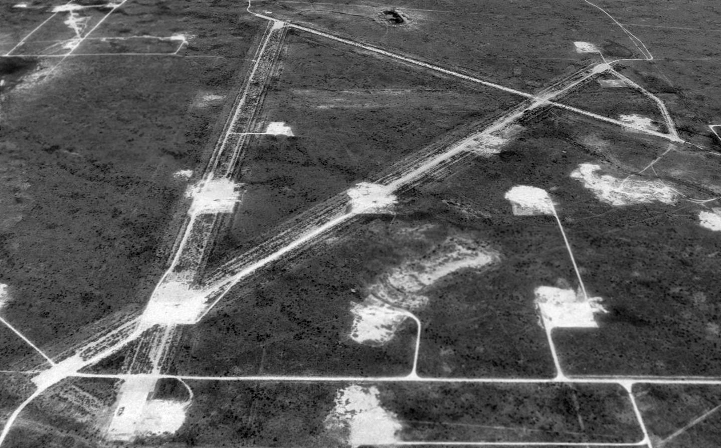
A 1996 USGS aerial view looking north shows the Hobbs Aux #4 runways deteriorated but still recognizable, although oil wells peppered the area.
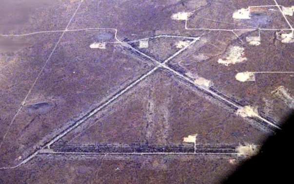
A 2003 aerial photo of Hobbs Aux #4 by Bill Suffa, who reported, "The field was relatively easy to identify from the air.
I took this from 17,000 feet, and - as you can tell - I flew nearly directly over the field.
It looked like there was an oil well or 2 where one of the runways formerly was.
This had the distinctive shape of a military field. It's not on the sectional, and appears to be long-closed."
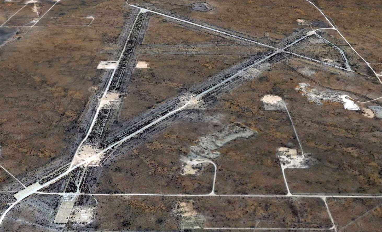
A 2014 aerial view looking north shows the Hobbs Aux #4 runways deteriorated but still recognizable, although oil wells peppered the area.
The Hobbs Aux #4 airfield is located northwest of the intersection of Route 529 & Route 238.
______________________________________________________
Cree Meadows Airport / Ruidoso Municipal Airport, Ruidoso, NM
33.36, -105.664 (Northeast of El Paso, TX)
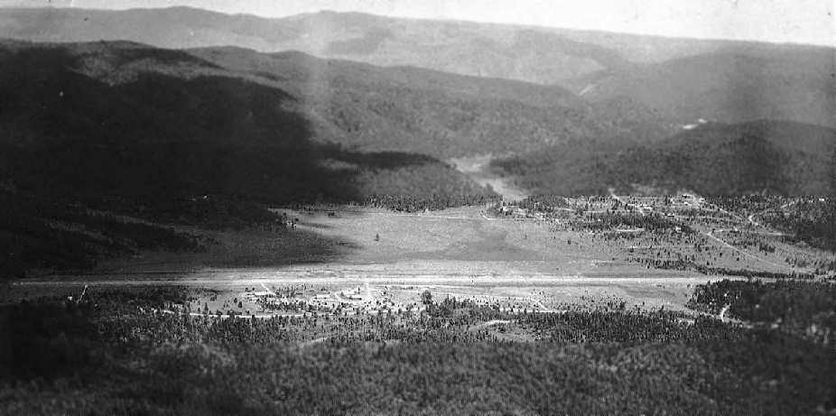
This general aviation airport was evidently established at some point between 1945-58,
as it was not depicted on the 1945 Roswell Sectional Chart (according to Chris Kennedy).
The earliest depiction which has been located of Cree Meadows Airport was the above circa 1958 aerial photo.
The surrounding high terrain was quite evident in that photo.
Tim Hawkins recalled, “Ruidoso Airport... Ralph Brown was the owner & a good friend of my parents.
He had several planes & ran a charter business out of that airport. I know it was in operation in the mid-1950s.
My Dad use to hunt golden eagles & other bounty animals from the 135 SuperCub that Ralph Brown [of Ruidoso's Brown Air Service] operated.
He took me deer hunting in the early 1960s using the SuperCub to land in mountains around Ruidoso.
An airport was never required.”
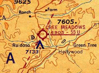
The earliest chart depiction which has been located of Cree Meadows Airport was on the March 1963 Roswell Sectional Chart (courtesy of Chris Kennedy).
It was depicted as having a 5,500' unpaved runway.
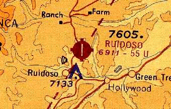
Within the next year, the airport had apparently been renamed Ruidoso Airport,
as that is how it was depicted on the June 1964 Roswell Sectional Chart (courtesy of Chris Kennedy).
Tim Hawkins recalled, “Ruidoso Airport... I started taking flying lessons at that airport in 1965 from Brown Air Service.”
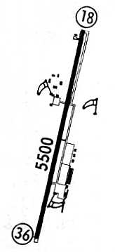
A 1967 airport directory (courtesy of Chris Kennedy) depicted Ruidoso Municipal Airport as having a single 5,500' paved Runway 18/36,
with a parallel taxiway on the east side, leading to a ramp with several hangars on the southeast side.
A small ramp on the northwest side also appeared to have several small hangars.
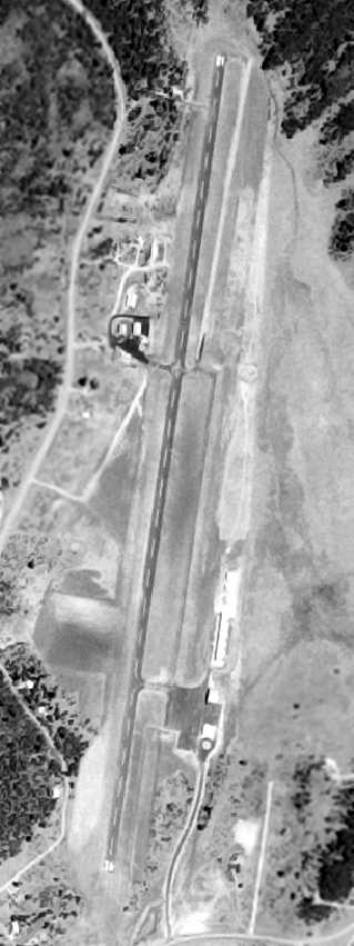
The last aerial photo which has been located of Ruidoso Municipal Airport was a 5/28/63 USGS aerial photo.
It depicted the field as having an asphalt Runway 18/36,
with a parallel taxiway on the east side, leading to a ramp with several hangars on the southeast side.
A small ramp on the northwest side also appeared to have several small hangars.
Wayne Westerman recalled, “I have been flying into Ruidoso since the late 1970s.
I really liked the old Ruidoso Airport because it was close to town.
However, it was a real bear when the wind was above 25 or 30 knots out of the west; lots of turbulence.”
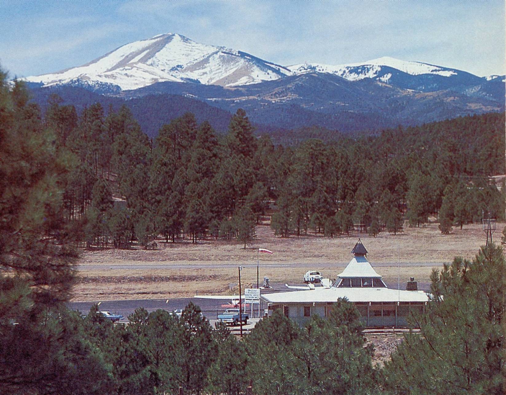
The last photo which has been located of Ruidoso Municipal Airport was a beautiful undated view looking west at the terminal building from the 1978 NM Aeronautical Chart (courtesy of Fred DeGuio).
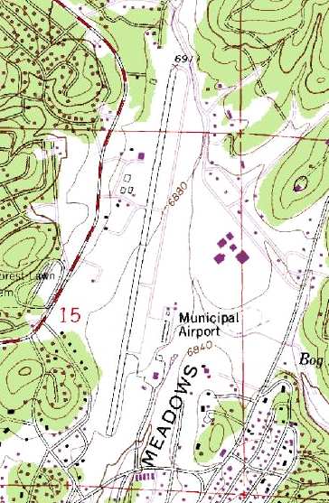
The 1982 USGS topo map depicted Ruidoso Municipal Airport as having a single north/south paved runway,
with a parallel taxiway on the east side, leading to a ramp with several hangars on the southeast side.
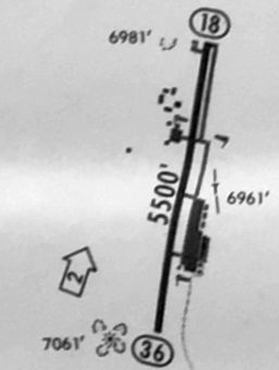
The last depiction wich has been located of Ruidoso Municipal Airport was on the 1984-85 NM Aeronautical chart (courtesy of Alex Hauzer).
It depicted Ruidoso as having a 5,500' paved Runway 18/36.
Fred DeGuio recalled, “The 1988 [NM Aeronautical] chart mentions that the new Sierra Blanca Airport was scheduled to open on 12/1/87
although my newspaper clippings indicate it opened on December 11, so the old Ruidoso Airport must have closed that day.”
According to Wayne Westerman, “Ruidoso Municipal Airport... was closed in the late summer of 1989,
Sierra Blanca Regional Airport’s opening coincided with the closing of the Ruidoso Airport.”
The reason for the replacement of the Ruidoso Airport was evidently the difficulty of the airport's approaches,
given the surrounding high terrain.
The Ruidoso Airport was no longer listed among active airfields in the 1993 Flight Guide (according to Chris Kennedy).
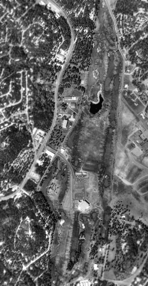
As seen in the 1996 USGS aerial photo, the site of the former airport was redeveloped as a public golf course,
the Links At Sierra Blanca, and the Ruidoso Convention Center.
The faintest trace of the former runway is still recognizable, but there are no obvious remains of the former airport.
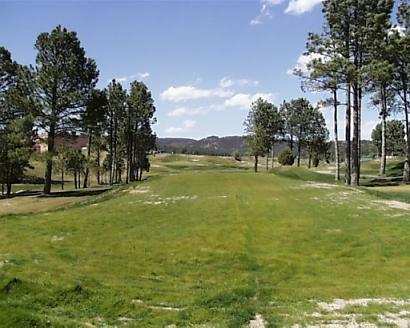
A recent photo of the Links At Sierra Blanca, the golf course covering the former airport.
The site of the Ruidoso Airport is located south of the intersection of Hull Road & Gavilian Canyon Road.
______________________________________________________
Carlsbad Auxiliary Army Airfield #1, Harkey Crossing, NM
32.26, -104.23 (Northeast of El Paso, TX)
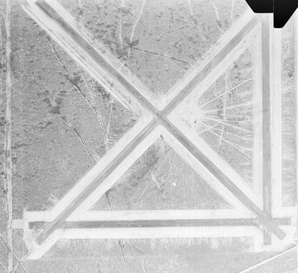
An 11/6/43 USGS aerial view of Carlsbad Aux #1.
Carlsbad Aux AAF #1 was built during WW2 as the sole satellite airfield of Carlsbad AAF (located 5 miles northwest),
which conducted specialized bombardier training.
Carlsbad Aux #1 was evidently constructed at some point between 1942-43,
as it was not yet depicted on a 1/30/42 USGS aerial view or the June 1942 Roswell Sectional Chart.
The earliest depiction which has been located of Carlsbad Aux #1 was an 11/6/43 USGS aerial view.
It depicted the field as having 4 asphalt runways.
Tom Bemis (of the Carlsbad Caverns National Park) reported of Carslbad Aux #1,
"During WW2 it was used in the development of Project X-Ray,
a top secret project to use bats to carry incendiary bombs into the attics of structures.
The bats were chilled to put them into a state of semi-hibernation.
When the bomb was dropped, it would open & the bats would warm up & take flight, starting a time delay fuse on the incendiary.
The bats would seek the nearest shelter, normally attics, and set them on fire. The bats were killed in the fire.
One of these bombs was left out too long, however and the bats escaped, burning down every structure on the Auxiliary Airfield.
See the book 'Bat Bombs', by Jack Couffer for the full story about the project & a photo of the field on fire."
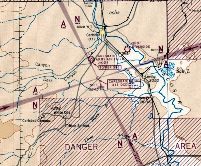
The earliest aeronautical chart depiction which has been located of Carlsbad Aux #1 was on the February 1944 Roswell Sectional Chart.
It depicted Carlsbad #1 as an auxiliary airfield.
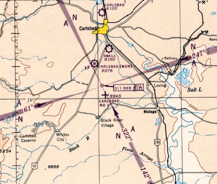
The earliest aeronautical chart depiction which has been located of Carlsbad Aux #1 was on the September 1947 Roswell Sectional Chart.
It depicted Carlsbad #1 as an auxiliary airfield.
Carlsbad Auxiliary AAF #1 was evidently abandoned at some point between 1947-48,
as nothing was depicted on the September 1948 Roswell Sectional Chart.
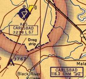
At some point between 1963-66, the northeast/southwest runway was apparently reused as a drag strip,
as that runway alone was depicted on the on the 1966 Roswell Sectional Chart (courtesy of John Voss), labeled "Drag strip".
Four unpaved runways were depicted on the 1973 USGS topo map, labeled as “Abandoned airfield”.
Tom Bemis reported in 2003, "The Carlsbad AAF Aux field was ripped up 15-20 years ago [1983-88]
because it was being used for drug drops."
A 1996 USGS aerial photo showed the runways were in a state of considerable deterioration.
It does not appear as if the had ever been reused for civil flying.
Carlsbad Auxiliary AAF was not depicted at all (even as an abandoned airfield) on 2002 aeronautical charts.
The Carlsbad VOR navigational beacon is located on the property of the former airfield
(in the southeast corner of the southern triangle formed by the runways).
Tom Bemis reported in 2003, "The foundations of the buildings still exist as do portions of one asphalt runway.
The best way in is to take Old Cavern Highway from Carlsbad,
turn right on Rainbow Road, and immediately turn lift on a faint dirt track
that cuts off at 45 degrees & parallels one former runway."
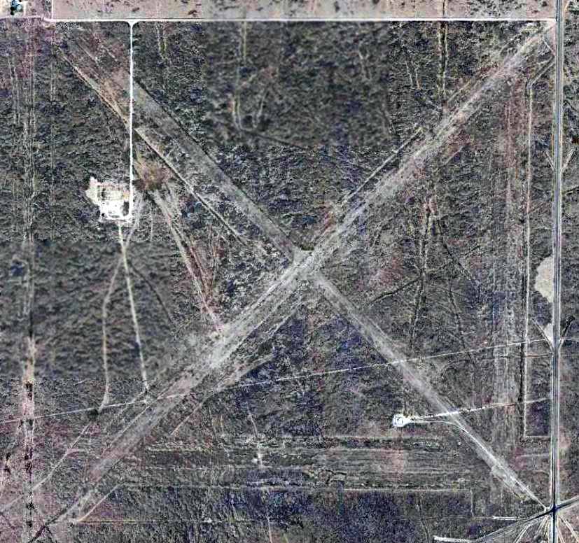
A 4/16/13 aerial photo showed the 4 runways were still recognizable but considerably deteriorated.
Carlsbad Auxiliary AAF is located northwest of the intersection of Old Cavern Highway & Bounds Road.
______________________________________________________
Carlsbad Caverns Airpark, Whites City, NM
32.177, -104.358 (Northeast of El Paso, TX)
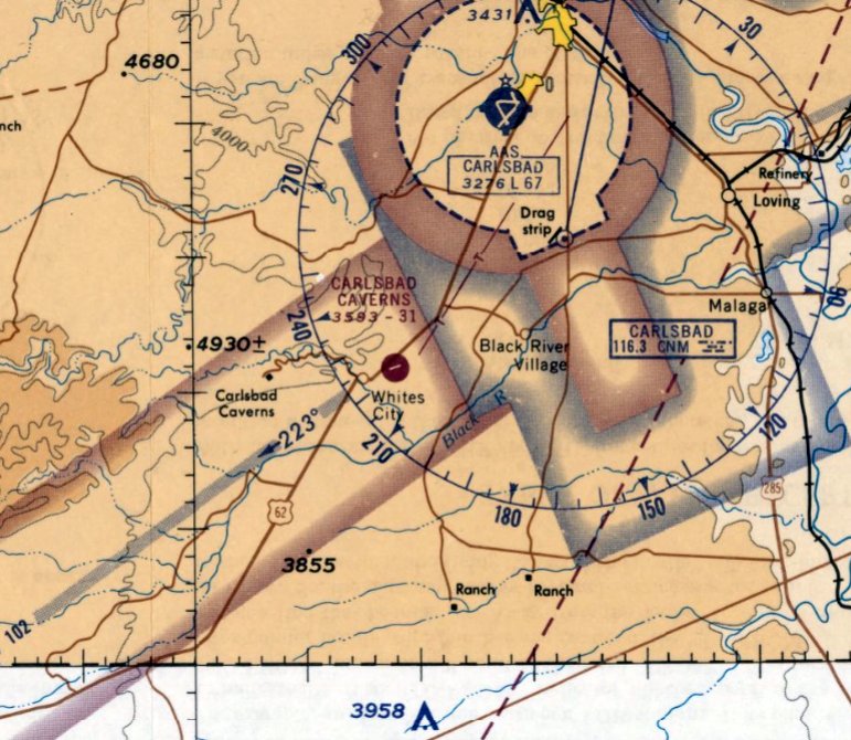
Carlsbad Carverns Airpark, as depicted on the June 1965 Roswell Sectional Chart.
According to William Hannah, this small general aviation airport was constructed by Jack White in approximately 1960.
However, Carlsbad Caverns Airpark was not yet depicted on the February 1961 Roswell Sectional Chart.
The earliest depiction which has been located of Carlsbad Caverns Airpark was on the June 1965 Roswell Sectional Chart.
The Aerodromes table on the 1966 Roswell Sectional Chart (courtesy of John Voss)
described Carlsbad Caverns Airpark as having 2 runways, with the longest being an 3,160' asphalt runway.
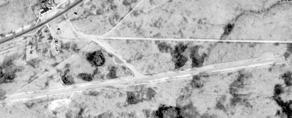
A 12/17/72 USGS aerial view depicted the Carlsbad Caverns Airpark as having a single paved east/west runway,
with a few small buildings on the northwest side of the field.
Stanley Blanton recalled, "The field was in use at least until the middle or late 1970s.
I drove this route often &recall seeing planes tied down occasionally.
I think the field was mainly used by tourists to the caverns. I believe there was one small hangar.
It can be seen in the aerial photo about 50 yards south of the highway & north of the runway."
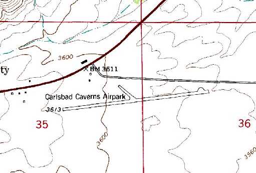
The 1979 USGS topo map depicted the Carlsbad Caverns Airpark as having a single paved east/west runway,
with one small building on the north side of the field.
The airfield was labeled "Carlsbad Cavern" on the 1986 El Paso Sectional Chart (according to Stanley Blanton).
The 1988-89 New Mexico Aeronautical Chart depicted "White City (Carlsbad Caverns)"
as having a single 3,800' Runway 7/25.
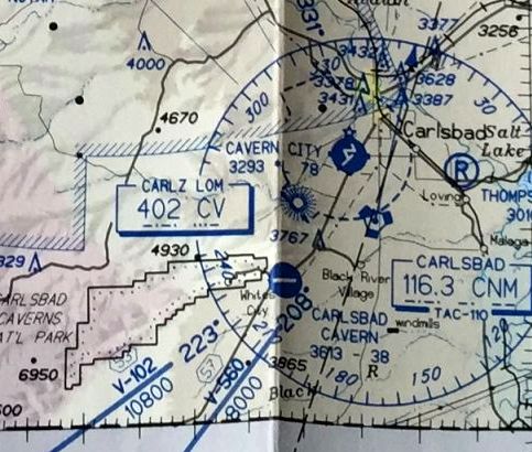
The last depiction which has been located of Carlsbad Cavern Airfield
was on the 1990-91 New Mexico Aeronautical Chart (courtesy of Alex Hauzer).
It depicted "Carlsbad Cavern" as having a single east/west 3,800' paved runway.
Frank Niehus recalled, “Carlsbad Caverns... I just looked up in my logbooks when we flew down & landed there: it was 10/1/95.
It had tall grass & weeds growing in the cracks. We landed & had our bicycles with us & rode to White City & spent night & went up to the caverns.”
Tom Bemis reported in 2003, "The White City airfield was closed about 10 years ago [1993]
because the county wouldn't help pay for the maintenance.
When it was operating, standard directions to pilots were to buzz the field once before landing to chase off the cows."
A 1997 USGS aerial photo showed the runway at Carlsbad Caverns Airpark still remained in somewhat decent condition.
Carlsbad Caverns Airpark was depicted as an abandoned airfield on 2002 aeronautical charts.
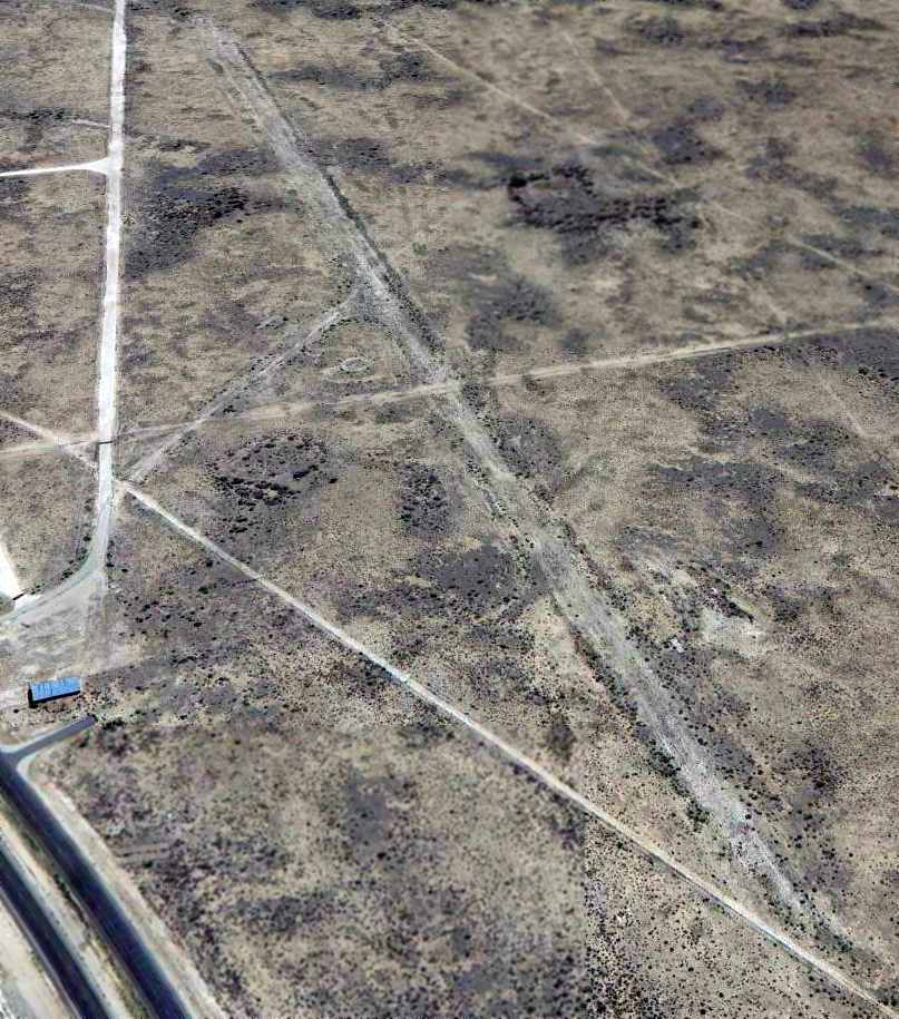
A 4/16/13 aerial view looking east at the remains of Carlsbad Caverns Airpark
showed the primary east/west runway as well as what appeared to be the remains of a crosswind runway.
Note the airport circle marking just west of the runway intersection,
and what appeared to be a building still standing on the northwest side of the site.
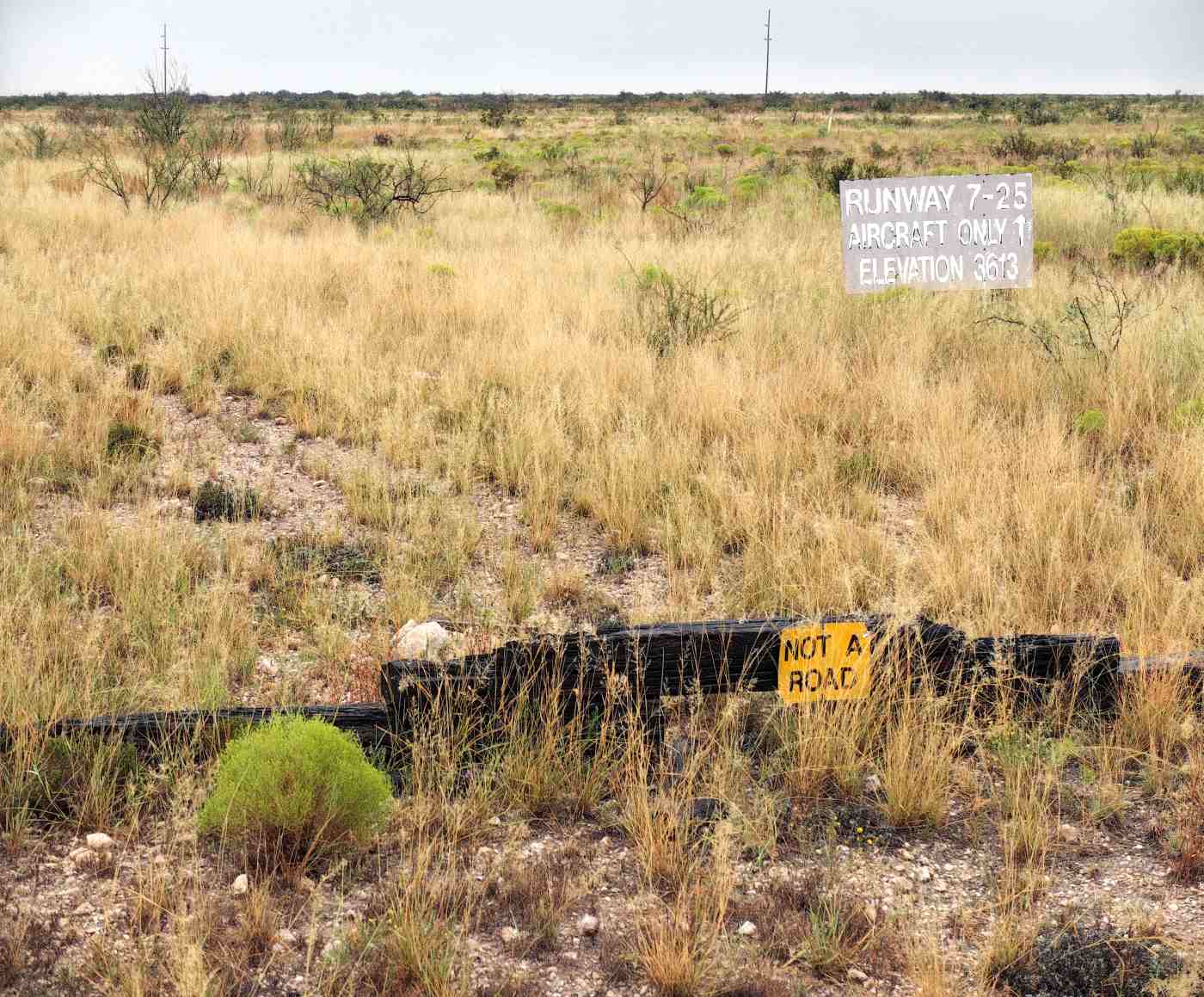
A 9/20/15 photo by Mike Legeros of the sign for Carlsbad Caverns Airpark's Runway 7/25.
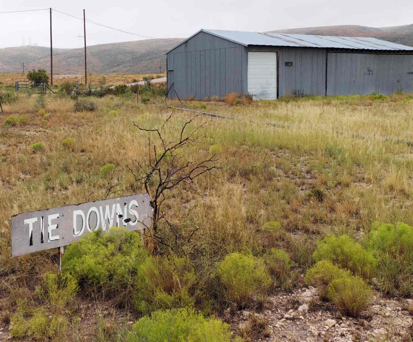
A 9/20/15 photo by Mike Legeros of the sign for Tie Downs at the site of Carlsbad Caverns Airpark.
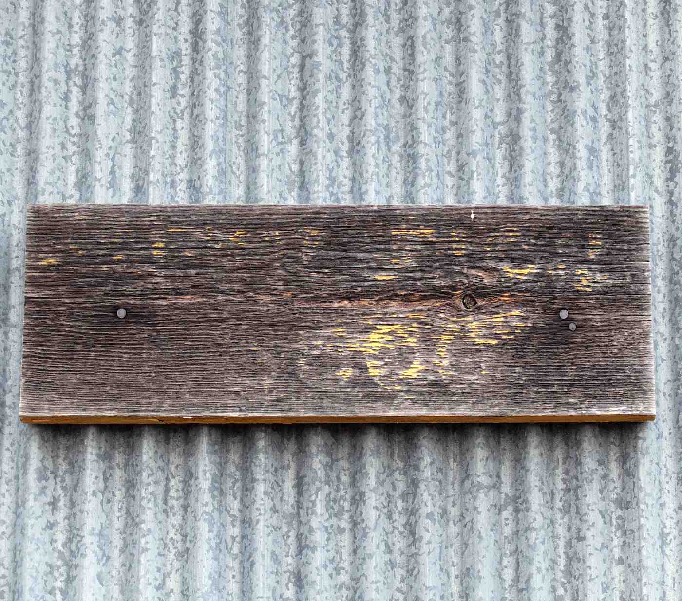
A 9/20/15 photo by Mike Legeros of the sign for the field elevation on Carlsbad Caverns Airpark's hangar.
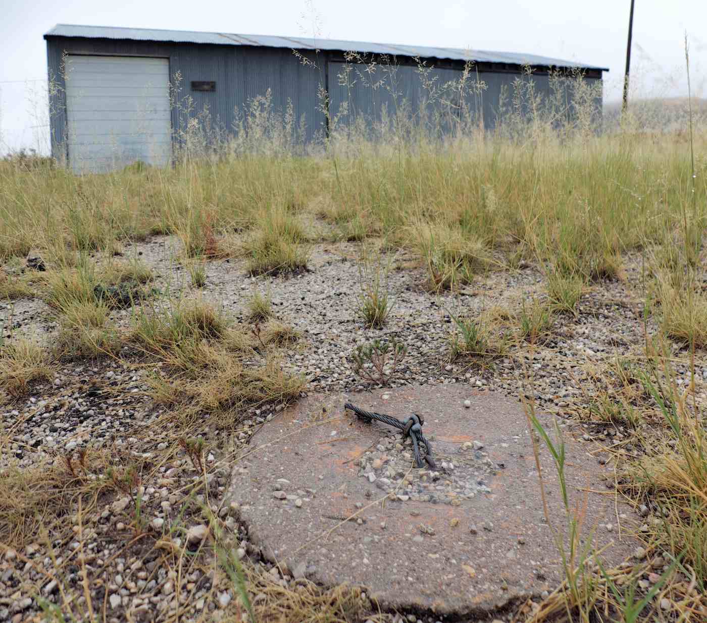
A 9/20/15 photo by Mike Legeros of a tie down in front of Carlsbad Caverns Airpark's hangar.
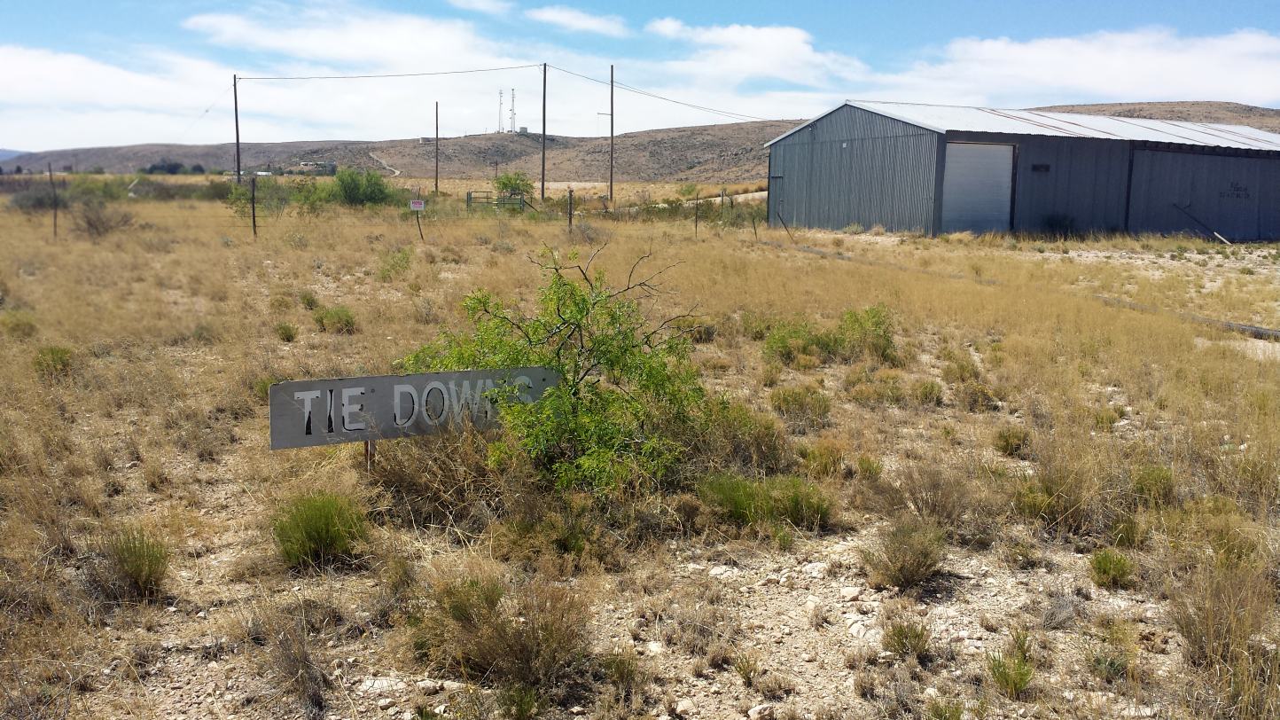
A 4/5/17 photo by Frank Niehus of the sign for Tie Downs in front of the former Carlsbad Caverns Airpark hangar.
Frank reported, “We were in our pickup camper & spent the night next to the building at the old caverns airstrip.”
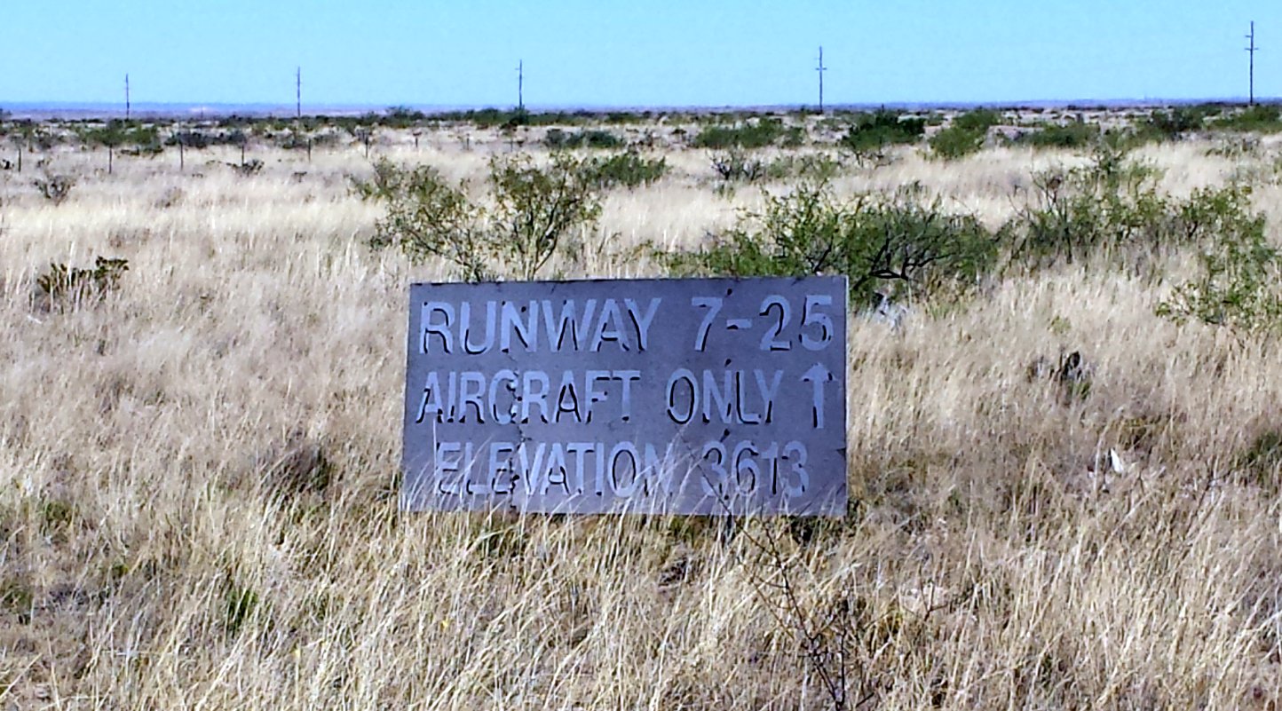
A 4/5/17 photo by Frank Niehus of the sign for Carlsbad Caverns Airpark's Runway 7/25.
Frank reported, “We couldn't find any evidence of a runway this spring except the signs that were still there. I don't know if they removed the blacktop but I saw no evidence of it.”
____________________________________________________
Or if you prefer to contact me directly concerning a contribution (for a mailing address to send a check),
please contact me at: paulandterryfreeman@gmail.com
If you enjoy this web site, please support it with a financial contribution.
____________________________________________________
This site covers airfields in all 50 states.