
Abandoned & Little-Known Airfields:
Central New Mexico
© 2002, © 2025 by Paul Freeman. Revised 11/21/25.
This site covers airfields in all 50 states: Click here for the site's main menu.
For a 4th year, the NM pages of this website are sponsored by the New Mexico Pilots Association:
____________________________________________________
Please consider a financial contribution to support the continued growth & operation of this site.
Clines Corners Airport (revised 2/22/19) - Magdalena Municipal Airport (original location) (revised 11/21/25)
Transwestern #7 Airfield (revised 11/21/25) - Transwestern #8 Airfield (revised 8/13/23)
___________________________________________________________
Magdalena Municipal Airport (original location), Magdalena, NM
34.124, -107.234 (Southwest of Albuquerque, NM)
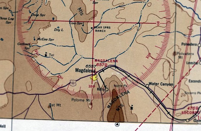
Magdalena Municipal Airport, as depicted on the January 1942 Albuquerque Sectional Chart.
The original airport for the town of Magdalena was located on the northeast side of the town.
Magdalena Municipal Airport was evidently established at some point between 1940-42,
as it was not yet depicted on the July 1940 Albuquerque Sectional Chart.
The earliest depiction which has been located of Magdalena Municipal Airport was on the January 1942 Albuquerque Sectional Chart.
It depicted Magdalena Municipal Airport as an auxiliary airfield.
The earliest photo which has been located of Magdalena Municipal Airport was on a 12/10/52 USGS aerial view.
It depicted 3 unpaved runways, with some small buildings on the southwest side.
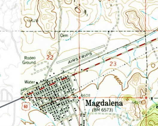
The 1959 USGS topo map depicted Magdalena Municipal Airport as 2 parallel runways, generically labeled as “Airstrips”.
The 1983/84 NM Aeronautical Chart (courtesy of Fred De Guio) depicted Magdalena Municipal Airport as having a 4,300' unpaved runway.
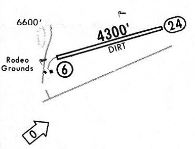
The 1983/84 NM Aeronautical Chart (courtesy of Fred De Guio) depicted Magdalena Municipal Airport as having a 4,300' dirt Runway 6/24,
with 2 small buildings on the southwest side.
The original Magdalena Municipal Airport (on the northeast side of the town) was evidently replaced at some point between 1983-84 by a new field a few miles west of the town,
as only the new field was depicted on the 1984/85 NM Aeronautical Chart (courtesy of Fred De Guio).
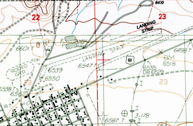
The 1985 USGS topo map depicted the runway of the original Magdalena Municipal Airport as an unpaved northeast/southwest runway, generically labeled as “Landing Strip”.
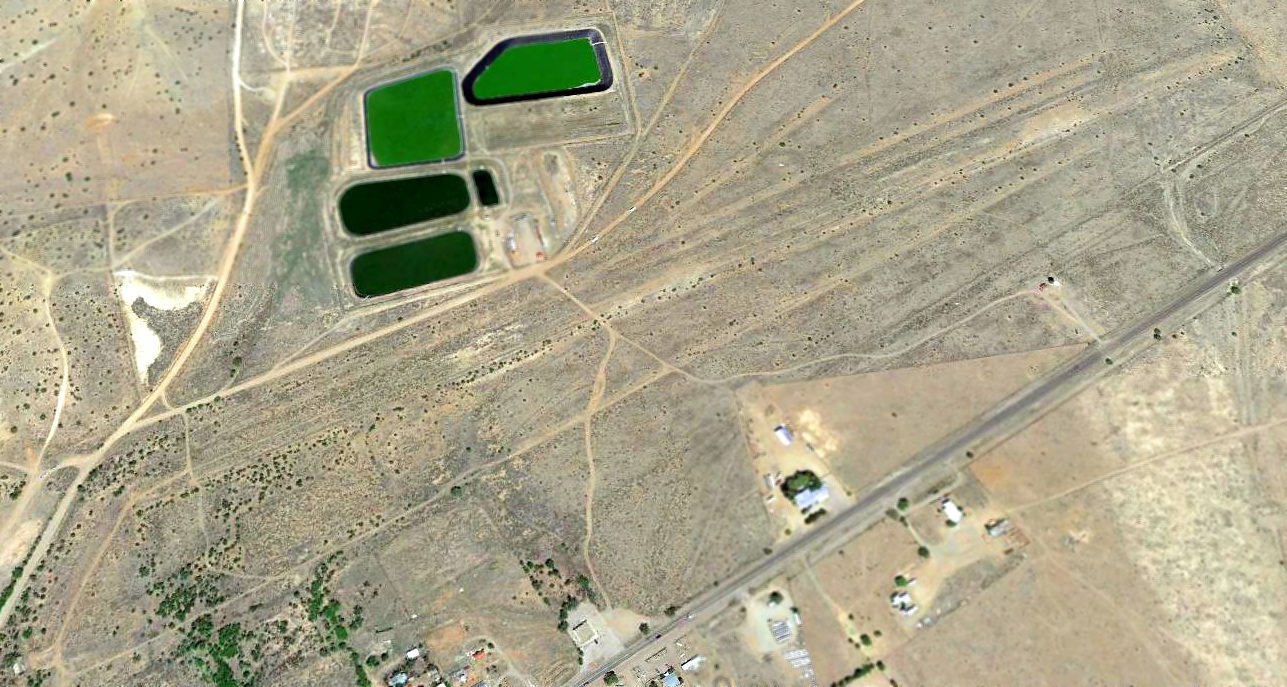
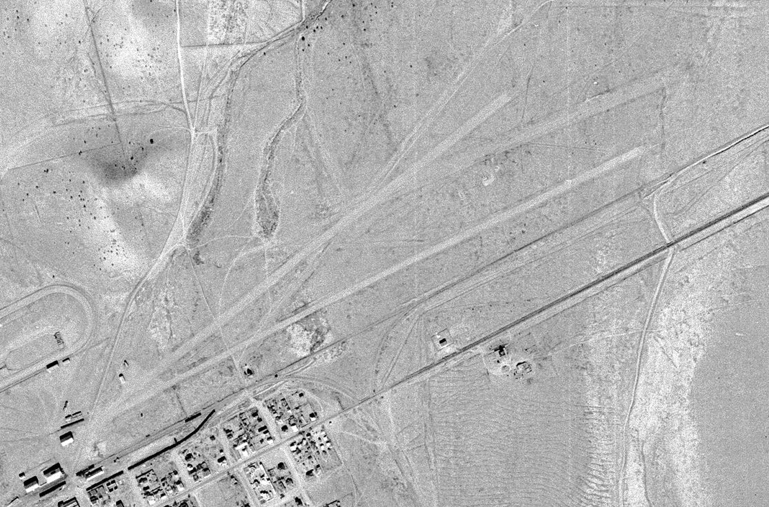
A 2017 aerial view looking northeast at the site of the original Magdalena Municipal Airport showed the unpaved runway remained recognizable.
One small building from the airport remained, at bottom-left of the photo.
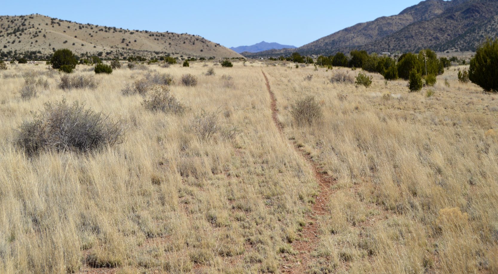
A 4/8/20 photo by Fred De Guio looking east from midfield along the former Runway 6 of the original Magdalena Municipal Airport.
Fred De Guio reported, “It is still a fairly clear area but with much new vegetation.”
Thanks to Fred De Guio for pointing out this airfield.
______________________________________________________
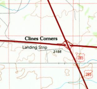
Clines Corners Airport, Clines Corners, NM
35.006, -105.673 (East of Albuquerque, NM)
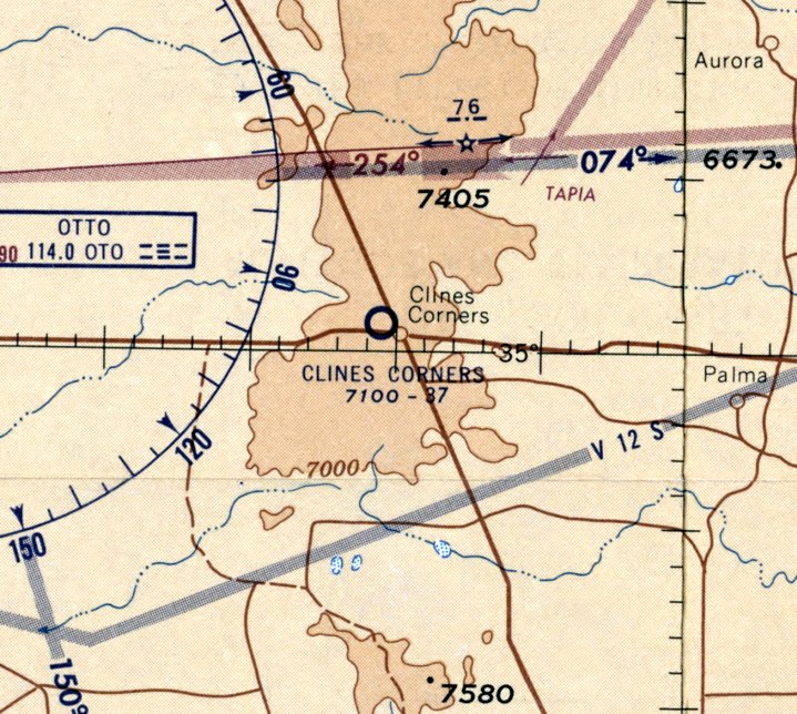
Clines Corners Airport, as depicted on the May 1958 Albuquerque Sectional Chart.
This small general aviation airport on the southwest side of the crossroads of Clines Corners was evidently established at some point between 1956-58,
as it was not yet depicted on the March 1956 Albuquerque Sectional Chart.
The earliest depiction which has been located of Clines Corners Airport was on the May 1958 Albuquerque Sectional Chart.
It depicted Clines Corners Airport as having a 3,700' unpaved runway.
Matt Franklin observed that this chart depicted Clines Corners Airport on the “wrong north side of the interstate, but I think this was a cartography error.”
An article in the 7/6/64 Hobbs Daily News (courtesy of Matt Franklin) entitled “Plane Crash Injures Two”
described a crash of a single-engine aircraft at the Clines Corners Airport after the plane had developed engine trouble & attempted to land at the airport.
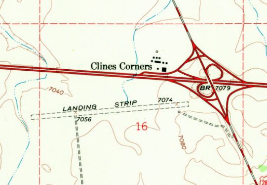
The 1966 USGS topo map depicted Clines Corners Airport as a single east/west unpaved runway, labeled simply as “Landing Strip”.
A single small building was depicted on the southeast side of the runway.
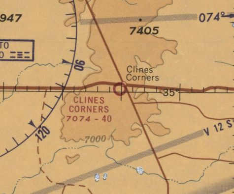
The last aeronautical chart depiction which has been located of Clines Corners Airport was on the February 1968 Sectional Chart (courtesy of Matt Franklin),
which depicted Clines Corners Airport as having a 4,000' unpaved runway.
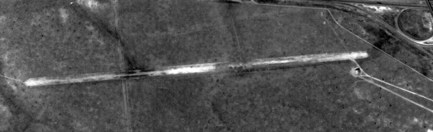
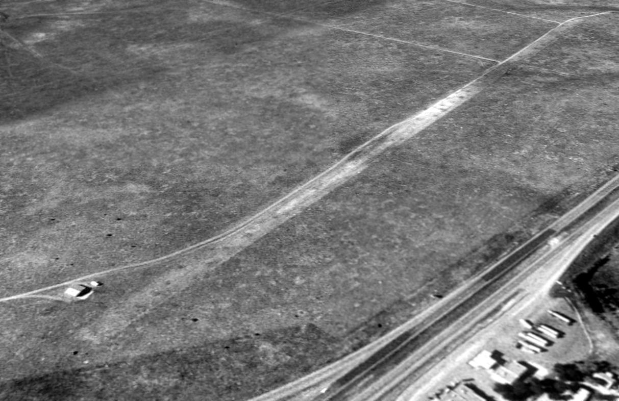
The only photo which has been located showing Clines Corners Airport while it was open was an October 1971 aerial photo from the 1971 NM Airport System Plan (courtesy of William Fitzpatrick).
It depicted Clines Corners Airport as single east/west runway with a small building on the southeast side.
The last topo map depiction which has been located of Clines Corners Airport was on the 1986 USGS topo map.
It depicted a single east/west runway, labeled simply as “Landing Strip”.
A 1996 aerial view looking southwest depicted Clines Corners Airport to have a single east/west unpaved runway, with a small hangar on the southeast side.
Clines Corners Airport was evidently abandoned (for reasons unknown) at some point between 1968-2000,
as it was no longer depicted on the 2000 Albuquerque Sectional Chart.
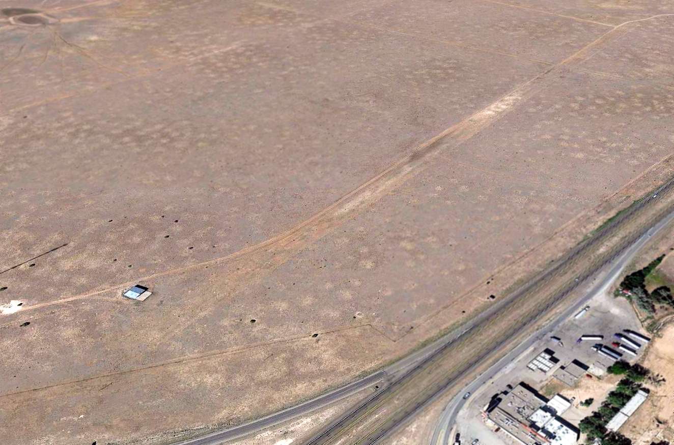
A 2014 aerial view looking southwest depicted the Clines Corners runway & hangar remaining unchanged.
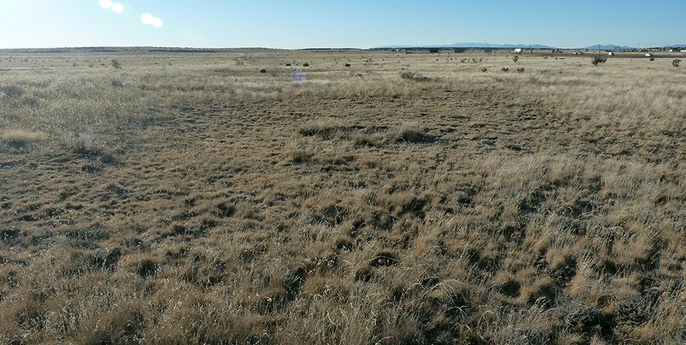
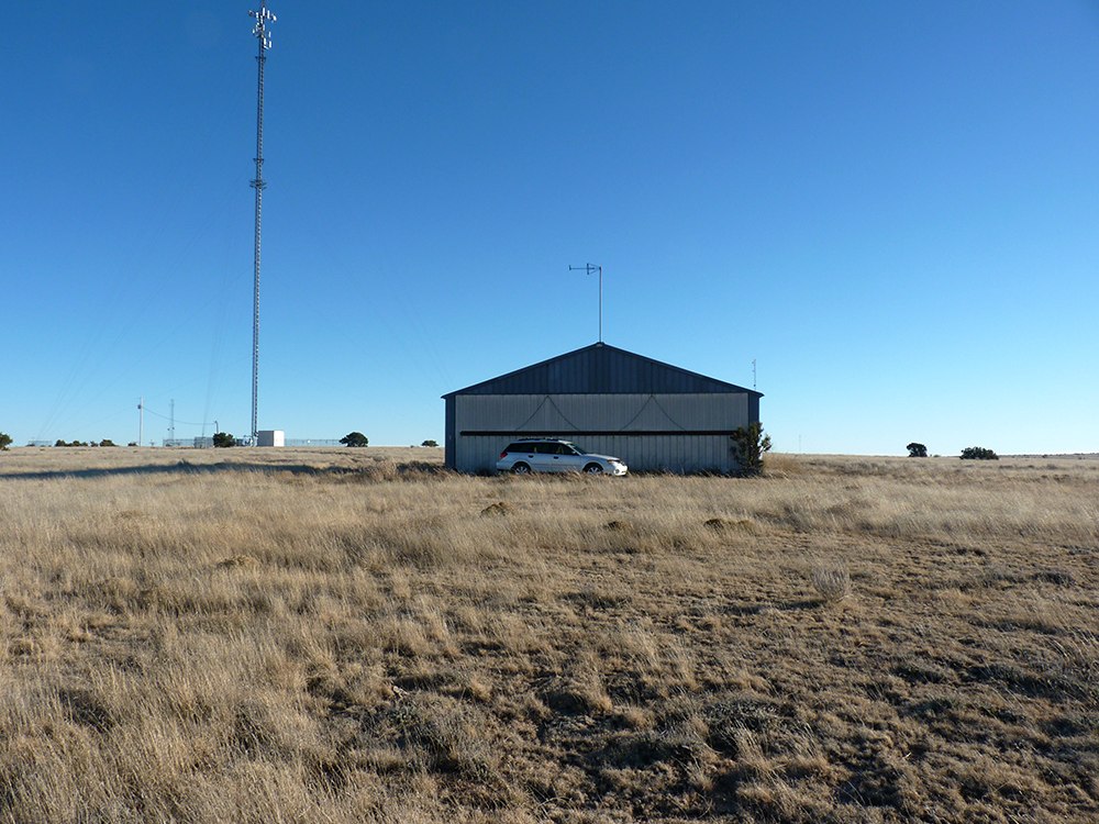
A 2014 photo by Matt Franklin looking west along the Clines Corners Airport runway.
Matt Franklin reported, “I happened to be passing through on my way back to Albuquerque & knew this was located just hundreds of feet from I-40.
I followed a modern dirt road to its termination at a communications tower & took a lesser-traveled path the remainder of the way to the hangar.
There is some compression of the scrub brush but not much. I was struck by the unevenness of the runway towards the western end.”
A 2014 photo by Matt Franklin of the Clines Corners Airport hangar.
Matt Franklin reported, “The pictures of the hangar show it to be in good sturdy condition.
I would venture to guess that someone is keeping up the maintenance on this, as it was shut tight so I couldn’t gauge the contents. There was a side door with pallets leaning around it.
On the eastern plains of New Mexico it can be very windy with no geographical features to break up the wind, and I can recall a rather lonely but sturdy structure standing up to forces.”
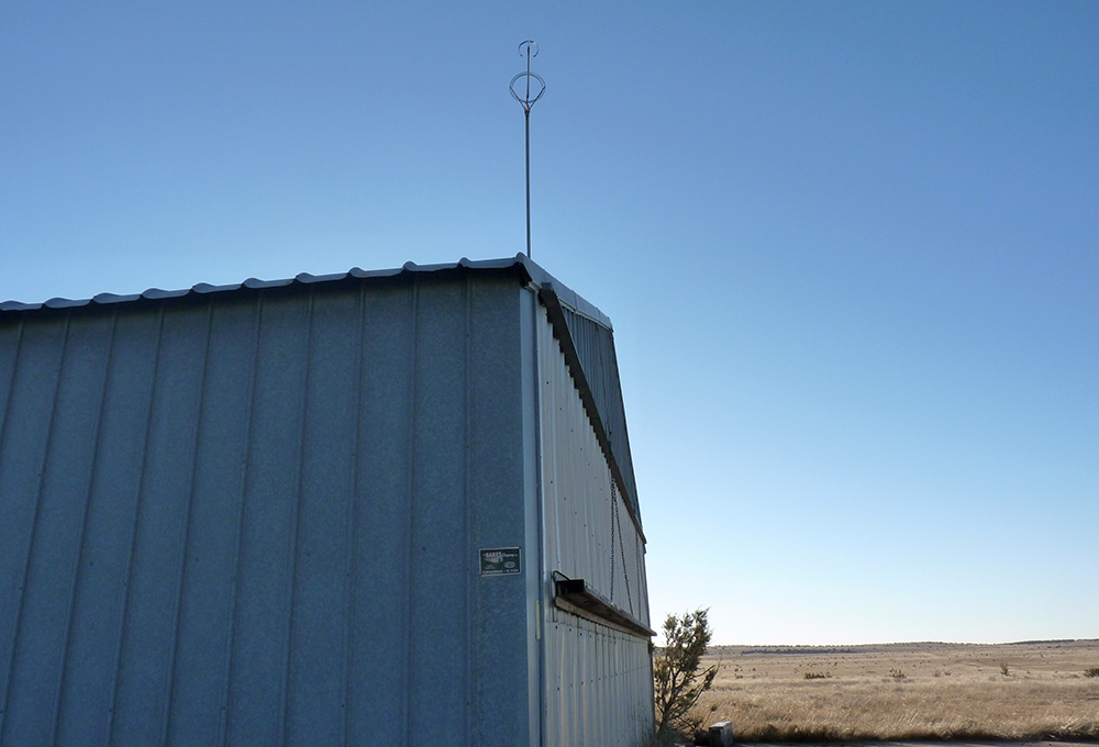
A 2014 photo by Matt Franklin of the Clines Corners Airport hangar. Matt Franklin reported, “The windsock on top of the roof had been stripped of its canvas.”
The site of Clines Corners Airport is located southwest of the intersection of Interstate 40 & Route 285.
Thanks to Matt Franklin for pointing out this airfield.
______________________________________________________
Transwestern #7 Airfield (77E), Mountainair, NM
34.32, -106.27 (Southeast of Albuquerque, NM)
Transwestern #7 Airfield, as depicted on a 2/13/2 USGS aerial view.
Transwestern #7 was apparently one of a string of private airfields owned by the Transwestern pipeline company,
whose pipeline runs adjacent to the airfield to the north.
Each of the Transwestern airfields were constructed adjacent to one of a series of compressor stations
located along the pipeline (according to a map located by David Brooks).
The Transwestern #7 Airfield may have been built at some point between 1970-71,
as it was not yet depicted on the February 1968 Albuquerque Sectional Chart nor on the 1970 USGS topo map.
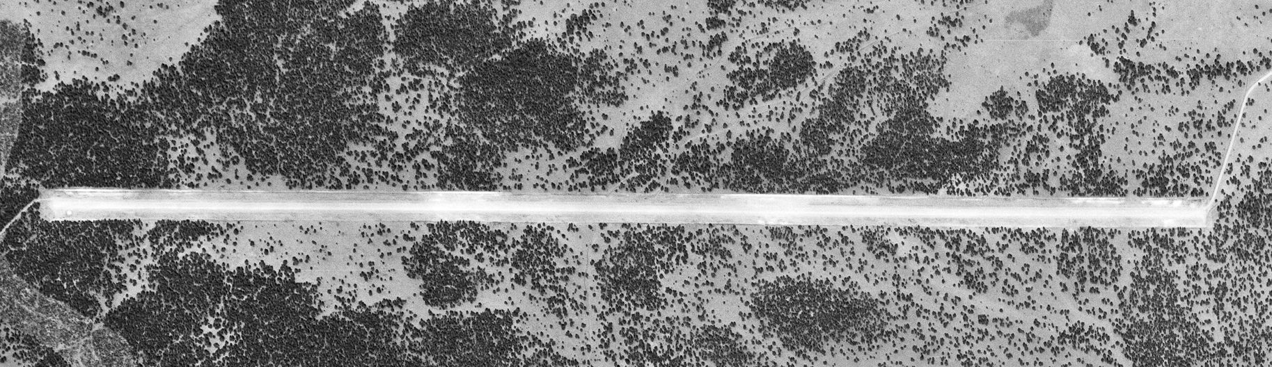
The earliest depiction of the Transwestern #7 Airfield which has been located was a 2/13/71 USGS aerial photo.
It depicted a single 7,600' east/west runway, without any other improvements.
![]()
The 1972 USGS topo map depicted the Transwestern #7 Airfield as a single 7,600' east/west runway, labeled simply as "Landing Strip".
![]()
The July 1977 World Aeronautical Chart (courtesy of Chris Kennedy) depicted "Transwestern #7" as a private field having a single 7,300' paved runway.
"Transwestern Pipeline #7" was listed as an active private airfield in the 1982 AOPA Airport Directory (courtesy of Ed Drury).
It was described as having a single 7,300' asphalt Runway 8/26, and the remarks said "Private. Use at own risk."
The Transwestern airfields were still depicted on the 1994 CG-19 Regional Aeronautical Chart (according to David Brooks).
The Transwestern #7 airfield was evidently abandoned at some point between 1994-97,
as it was no longer depicted on the 1997 Sectional Chart.
![]()
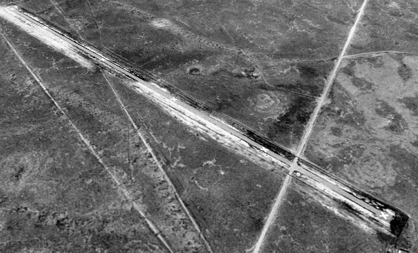
The Transwestern #7 airfield was apparently closed by 1997, as 10/14/97 USGS aerial view looking southeast depicted the runway as being painted with "X" closed runway markings.
No buildings or other aviation facilities were visible at the airfield.
The Transwestern #7 Airfield was depicted as an abandoned airfield on the 1998 World Aeronautical Chart.
![]()
A 7/24/11 aerial view looking southeast along the Transwestern #7 airfield showed the runway remained intact though deteriorated.
The Transwestern #7 Airfield is located 15 miles southwest of the intersection of Route 60 & Route 55.
Thanks to Chris Kennedy for pointing out this airfield.
______________________________________________________
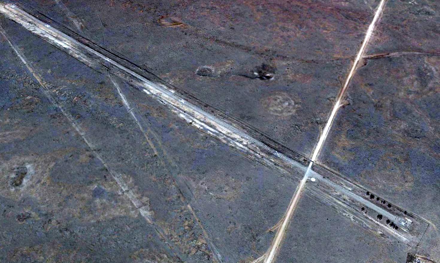
Transwestern #8 Airfield (62E), Laguna, NM, Corona, NM
33.924, -105.34 (Southeast of Albuquerque, NM)
![]()
A 9/3/73 USGS aerial photo of the Transwestern #8 Airfield.
Transwestern #8 was apparently one of a string of private airfields owned by the Transwestern pipeline company,
whose pipeline runs adjacent to the airfield to the south.
Each of the Transwestern airfields were constructed adjacent to one of a series of compressor stations
located along the pipeline (according to a map located by David Brooks).
The Transwestern #8 Airfield was apparently built at some point between 1968-73,
as it was not yet depicted on the February 1968 Albuquerque Sectional Chart.
The earliest depiction of the airfield which has been located was on a 9/3/73 USGS aerial photo,
which depicted Transwestern #8 as having a single northwest/southeast runway.
![]()
The 1981 USGS topo map depicted the Transwestern #8 Airfield as having a single runway, labeled simply as “Landing Strip”.
![]()
The July 1977 World Aeronautical Chart (courtesy of Chris Kennedy) depicted "Transwestern #8" as a private field having a single 5,000' paved runway.
Transwestern Pipeline #8 Airfield was listed as an active private airfield
in the 1982 AOPA Airport Directory (courtesy of Ed Drury), with a single 5,000' asphalt Runway 9/27.
A 1996 USGS aerial view looking northwest showed the Transwestern #8 runway was clearly marked with closed runway “X” symbols.
Transwestern Pipeline #8 was apparently kept open somewhat longer than the rest of the Transwestern airfields,
as the 1998 World Aeronautical Chart still depicted it as an active private airfield, with a 5,000' paved runway.
Transwestern Pipeline #8 Airfield apparently closed at some point between 1998-2003, as it was depicted as an abandoned airfield on 2003 aeronautical charts.
Bill Suffa overflew the Transwestern #8 airfield in 2003 & remarked,
"The airfield has big X's along the runway, but otherwise looks in good condition (as best I could tell at 17,000 ft)."
A 2016 aerial view looking northwest along the Transwestern #8 runway.
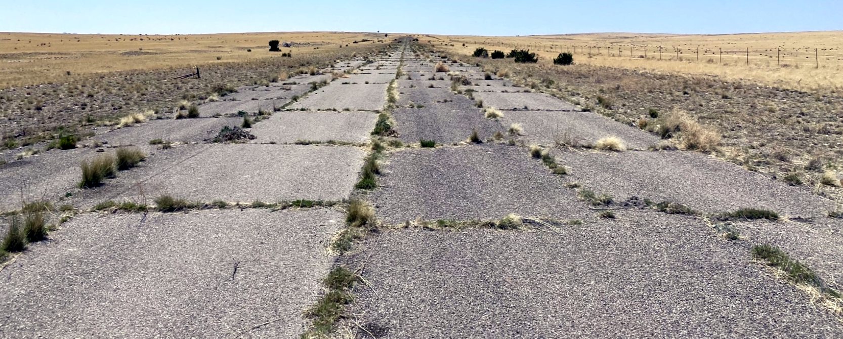
A 5/14/22 photo by Matt Franklin looking along the remains of the Transwestern #8 runway,
Matt reported, the “description of Transwestern #8 as being in an ‘extremely remote’ location is fair.
The runway is coated with grass growing through the cracks & a number of cowpats.
After driving down a well-maintained dirt road for 14 miles, I only mustered one spotting of a ranch house & a single-sided conversation with cows during which I mooed at various pitches to a veil of silence.”
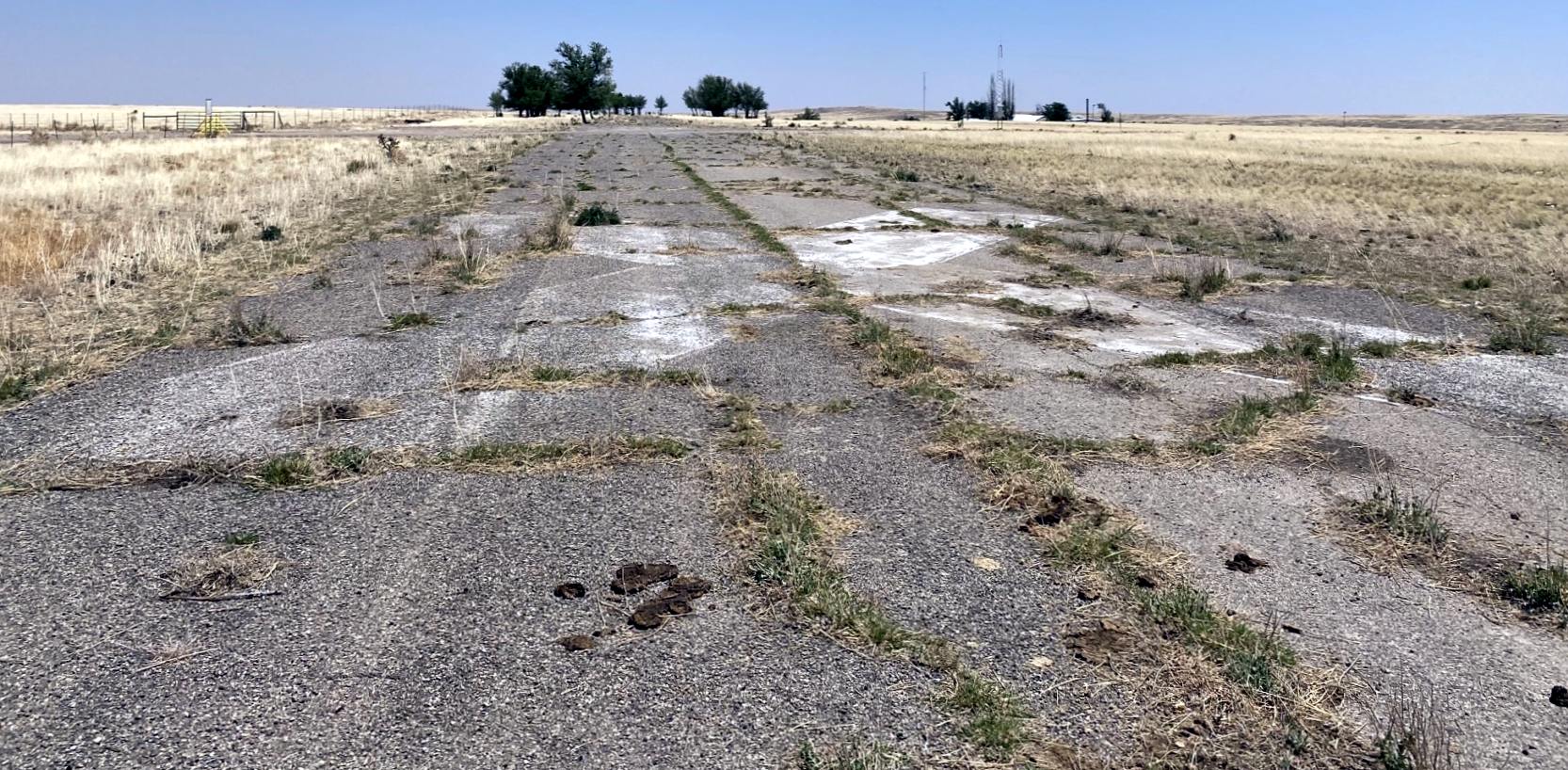
A 5/14/22 photo by Matt Franklin of the closed-runway “X” marking still visible on the remains of the Transwestern #8 runway.
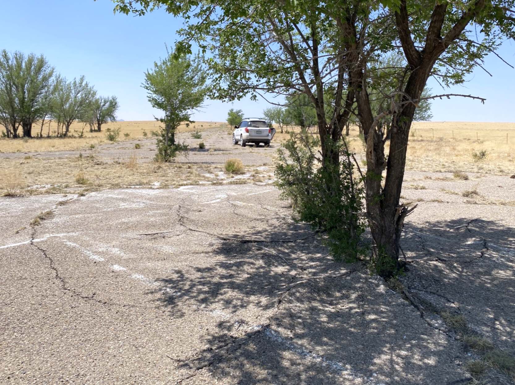
A 5/14/22 photo by Matt Franklin of the remains of the Transwestern #8 runway.
Matt reported, “A bundle of trees have secured residence at the east end of the runway, their seeds I suspect being nurtured by the adjacent natural gas pumping station in this otherwise yellow sea of low grass.”
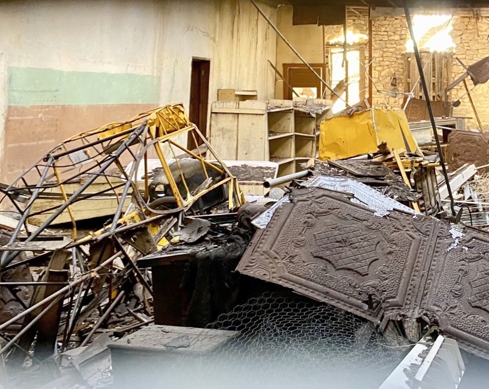
A 5/14/22 photo by Matt Franklin of the remains of a Piper Cub near the Transwestern #8 runway.
Matt reported, “In a nearby town, and at least a mile from the nearest airport, I spotted the remnants of a Piper Cub in the ruins of a boarded up store.
The engine cowling is unmistakable. Apparently they’ve been stored in there since the 1960s per a local.”
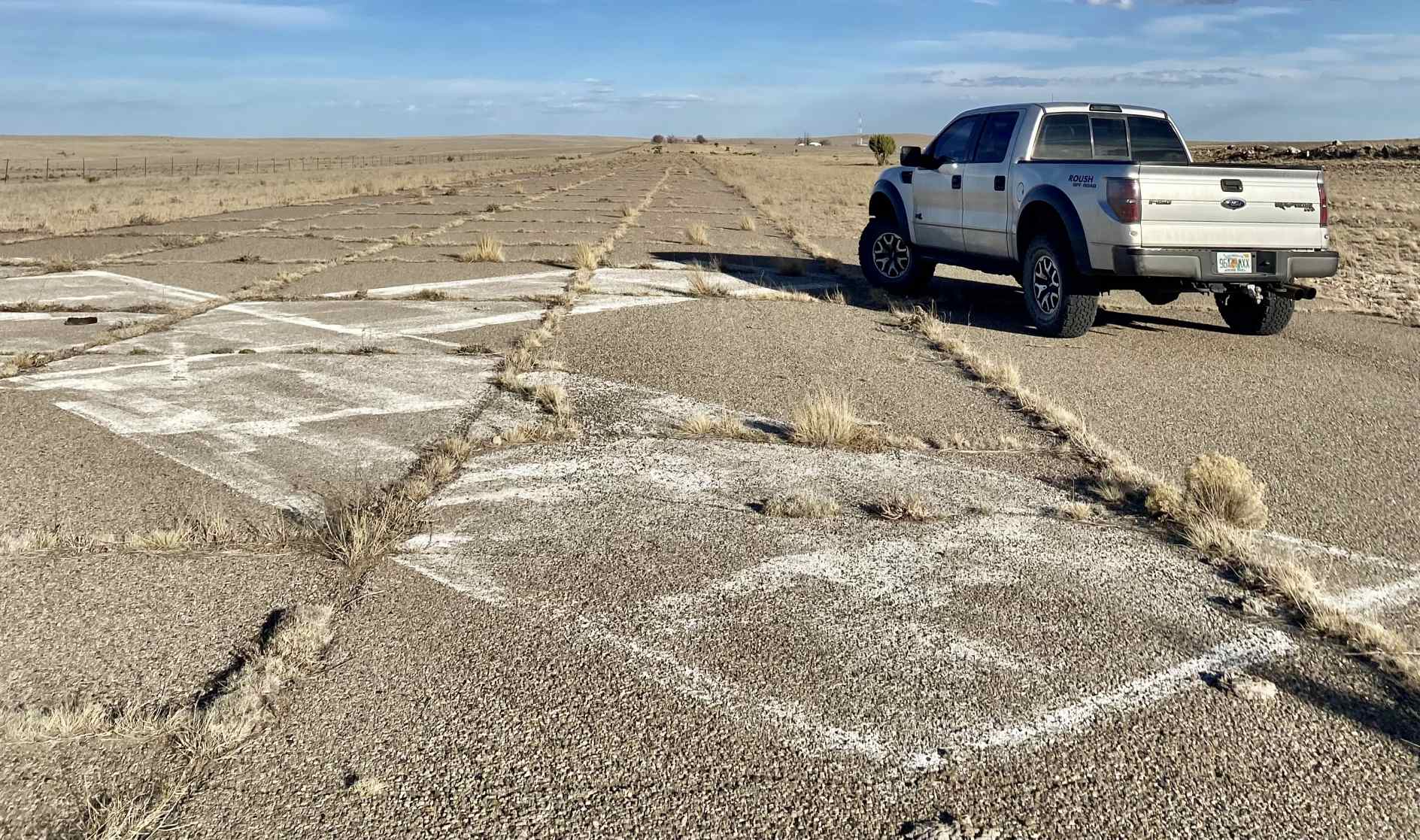
A 3/11/23 photo by Matt Franklin of the closed-runway “X” marking still visible on the remains of the Transwestern #8 runway.
Matt reported, “I drove to the other end of the runway this time as the cow pats were no obstacle.”
The Transwestern #8 airfield is located in an extremely remote & desolate area, 30 miles southeast of Corona, NM.
____________________________________________________
Or if you prefer to contact me directly concerning a contribution (for a mailing address to send a check),
please contact me at: paulandterryfreeman@gmail.com
If you enjoy this web site, please support it with a financial contribution.
____________________________________________________
This site covers airfields in all 50 states.