Abandoned & Little-Known Airfields:
Southeastern Nebraska
© 2002, © 2025 by Paul Freeman. Revised 9/11/25.
____________________________________________________
Please consider a financial contribution to support the continued growth & operation of this site.
Bruning AAF / Bruning State Airport / Mid-America Airport (revised 7/20/24) - Grundman Field (revised 9/11/25) - Rogert Airstrip (revised 9/11/25)
____________________________________________________
Rogert Airstrip (Y45), Waterloo, NE
41.275, -96.344 (West of Omaha, NE)
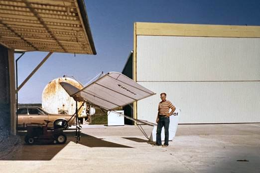
A circa 1977 photo of Carl Brady & an Eipper ultralight in front of the Rogert Airstrip hangars.
This small general aviation airport was evidently established at some point between 1971-76,
as it was not yet depicted on a 1966 aerial photo or the September 1971 Lincoln Sectional Chart.
Carl Brady recalled, “Don Rogert was the owner who built Rogert Airstrip.
From early 1976 until a flood washed out parts of the runway in 1978, a partner & I rented the smaller of the 2 hangars where we kept a Piper Navajo & a Cessna 185.
Rogert built the larger hangar – I think in 1976 – when he bought a Beech King Air. Bob Harvey was Rogert’s pilot for many years.
Don Rogert who owned the airstrip, was the owner of Hartford Sand & Gravel, and the airstrip was located just west of the gravel pit lake where they dredged for sand & gravel.
Our mechanic/pilot Jerry Morelock got his float rating in Florida, converted our 185 to floats, then checked out Rogert’s pilot, Bob Harvey in the gravel pit lake adjacent to the airstrip.
I don’t think the lake was ever officially declared a floatplane landing place, but Bob & Jerry flew in & out of there for a year or so.
My partner & I moved out following the flood of 1978.”
The earliest depiction which has been located of Rogert Airstrip was a circa 1977 photo of Carl Brady & an Eipper ultralight in front of the Rogert Airstrip hangars.
Carl recalled, “The Eipper was foot-launch with a West Bend engine backpack.
I never could get off the ground that day – could not run fast enough, hot & no wind –
but a skinny friend we called 'Rattlesnake' got it flying up to about 400’ before the West Bend went West & he landed across the gravel pit lake.”
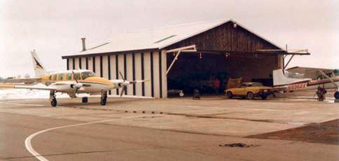
A Spring 1978 photo by Carl Brady of Piper Navajo 6719L beside Rogert Airstrip's small hangar, with Carl's daughter’s Triumph TR7 in front.
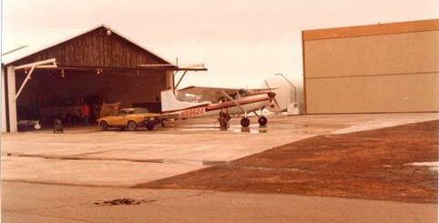
A Spring 1978 photo by Carl Brady of Cessna 185 N9662X in front of Rogert Airstrip's large hangar.
Carl Brady recalled, “Don Rogert, who was a larger than life character, built the new larger hangar when his New King Air would not fit in the small hangar.
The Navajo & 185 both fit in there just fine.
Rogert owned Hartford Sand & Gravel, and built a party building on the other side of the gravel pit lake, where he & his western guitar band would host parties.
He also had lots of Native American artifacts like arrowheads & tomahawks & fossils that turned up in the screens of the gravel operation on display in that building.”
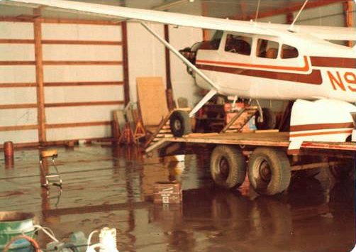
A 1978 photo by Carl Brady of Cessna 185 N9662X in Rogert Airstrip's hangar.
Carl recalled, “The nearby Platte River flooded in 1978. We winched our 185 up on a 5th-wheel trailer of mine where it rode out the flood.
The floor is covered with mud & the trailer tires are muddy.”
Carl Brady recalled, “We moved our Navajo over to MLE as did Bob Harvey with Rogert’s King Air.
The runway was extensively damaged with a couple of sections completely washed out.
Rogert fixed the runway & continued to use the airport for a while.
My last logbook entry for Rogert was 3/11/78. Jerry Morelock thinks that the runway was repaired & it continued in use into the 1980s.”
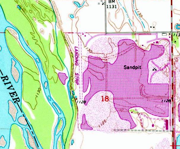
The earliest topo map depiction which has been located of Rogert Airstrip was on the 1983 USGS topo map.
It depicted a single unpaved north/south runway, generically labeled as “Landing Strip”, with 2 small buildings on the northeast side.
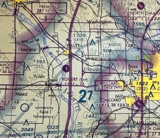
The earliest aeronautical chart depiction which has been located of Rogert Airstrip was on the August 1985 Omaha Sectional Chart.
It depicted Rogert as a private airfield having a single paved 2,600' north/south runway.
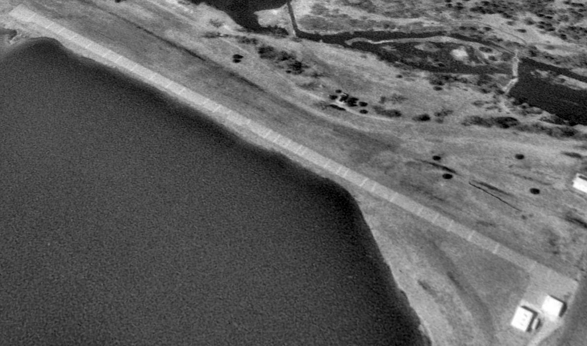
The earliest photo which has been located of Rogert Airstrip was a 1993 aerial view looking southwest.
It depicted Rogert as having a single paved north/south runway, with a paved ramp & 2 small hangars on the northeast side.
There were no aircraft visible on the field.
The last aeronautical chart depiction which has been located of Rogert Airstrip was on the February 1999 Omaha Sectional Chart.
It depicted Rogert as a private airfield having a single paved 2,600' north/south runway.
A 1999 aerial view showed Rogert Airstrip as remaining intact.
Rogert Airstrip was evidently closed (for reasons unknown) at some point between 1999-2003,
as a 2003 aerial photo showed a road (North 273rd Plaza) had been cut across the runway.
Rogert Airstrip was no longer depicted on the February 2006 Omaha Sectional Chart.
Rogert Airstrip was no longer depicted on the 2014 USGS topo map.
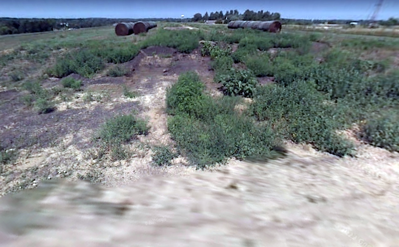
2018 aerial view looking southwest showed Rogert Airstrip's runway & 1 hangar remained intact, but with a road cutting across the runway.
Lee Corbin observed, “If they were going to destroy the runway by cutting a road across it, I wonder why they didn’t just use the runway as the road?”
Carl Brady reported in 2023, “The sand & gravel operation is now gone & an upscale housing development surrounds the remaining lake.”
Thanks to Lee Corbin for pointing out this airfield.
____________________________________________________
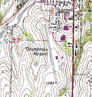
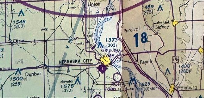
Grundman Field (3GN / 82NE), Nebraska City, NE
40.66, -95.86 (Southeast of Omaha, NE)
Grundman Field, as depicted on the June 1947 Des Moines Sectional Chart.
This small general aviation airport was located on the south side of the town of Nebraska City.
Grundman Field was evidently established at some point between 1946-47,
as it was not yet depicted on the December 1946 Des Moines Sectional Chart.
The earliest depiction of Grundman Field which has been located was on the June 1947 Des Moines Sectional Chart.
It depicted Grundman as a commercial/municipal airport.
The September 1948 Des Moines Sectional Chart (courtesy of Chris Kennedy) depicted Grundman as having a 2,200' unpaved runway.
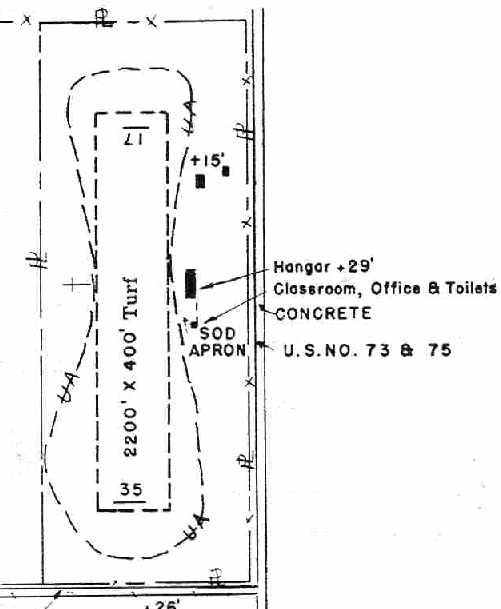
The 1950 NE Airport Directory (courtesy of Chris Kennedy)
depicted Grundman Field as having a single 2,200' turf Runway 17/35,
along with a single hangar, and a classroom/office building on the east side of the field.
Grundman's runway was apparently somewhat realigned at some point between 1950-65,
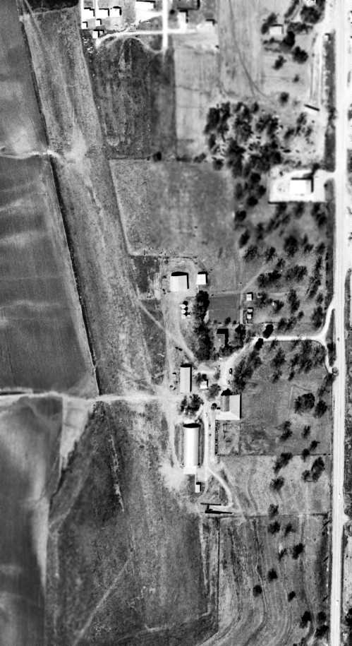
as a 5/1/65 USGS aerial photo depicted Grundman as having a single unpaved northwest/southeast runway, with a few small buildings along the east side.
Grundman apparently gained a paved runway at some point between 1965-84,
as the 1984 USGS topo map depicted Grundman Airport
as having a single 2,300' paved runway, with a few small buildings along the east side.
The last aeronautical chart depiction of Grundman Field which has been located was on the August 1985 Omaha Sectional Chart.
It depicted Grundman as having a single paved 2,700' northwest/southeast runway.
In a 1999 USGS aerial view looking northwest, it was not apparent if Grundman Field was still being actively used -
there were no aircraft visible on the field, or any other visible signs of current use.
Eric James reported in 2003, “I noticed the airport code was changed from 3GN to 82NE about one year ago.
I thought at the time they were moving public operations out of the city to the newer Nebraska City Municipal (AFK) to the south.
I believe Grundman Field has been abandoned within the past year.
Recently I was flight planning a cross country route over Nebraska...
I noticed the airport is now missing from the charts, not even depicted as an abandoned airfield.”
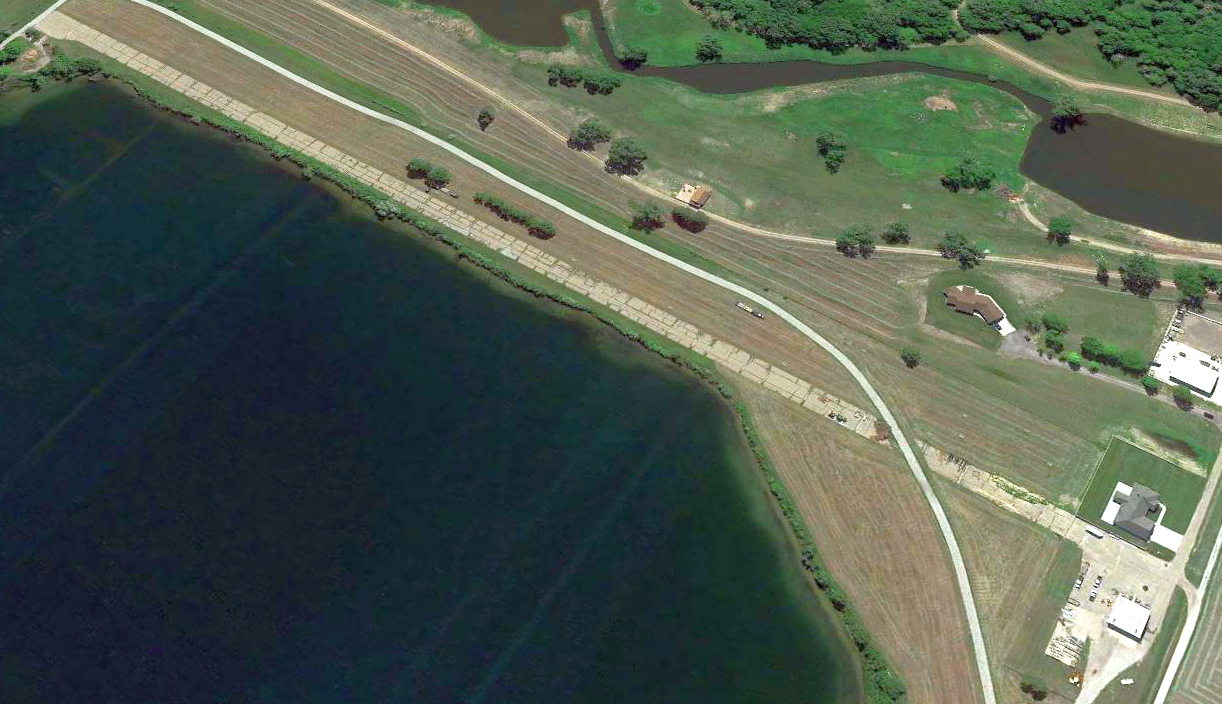
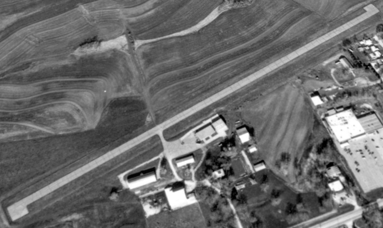
An August 2007 aerial view by Josh Thayer (courtesy of Eric James) looking east at the site of the former Grundman Field,
showing the remains of the paved runway.
The former hangars (just right of the center of the photo) were evidently removed at some point after the circa 2001-2005 photo.
Eric observed, “A road is being constructed across the old runway now.”
A 2007 photo looking northwest along the remnants of the Grundman Field asphalt runway pavement.
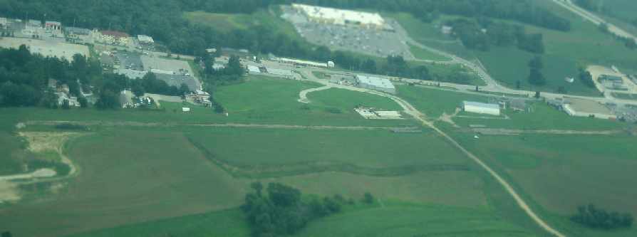
A 2012 aerial view showed the full length of Grundman Field's former runway was still recognizable, though deteriorated.
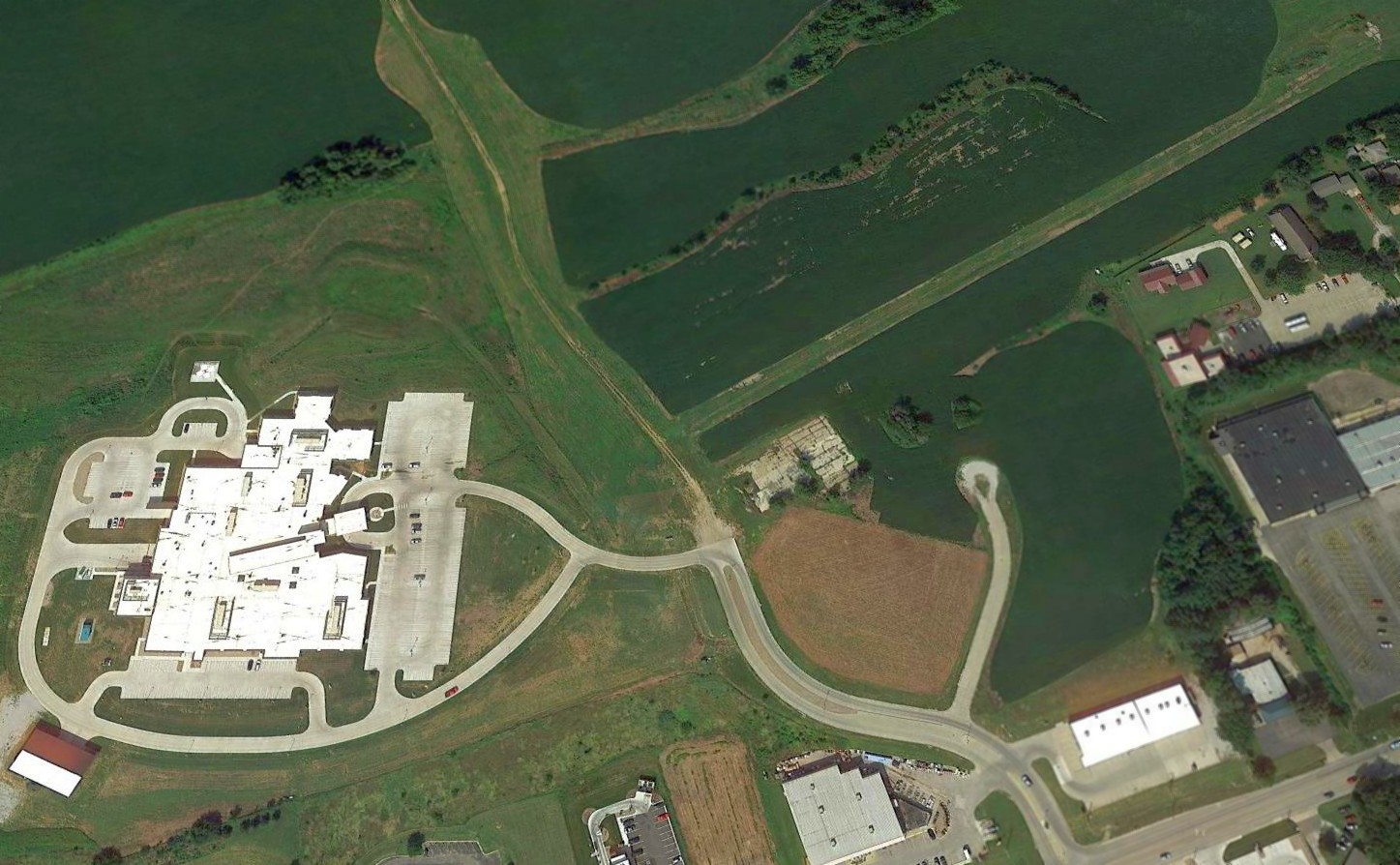
A 2015 aerial view looking northwest showed a complex had been built over the southern half of the Grundman Field property,
but the northern half of the runway & a portion of the ramp were still recognizable.
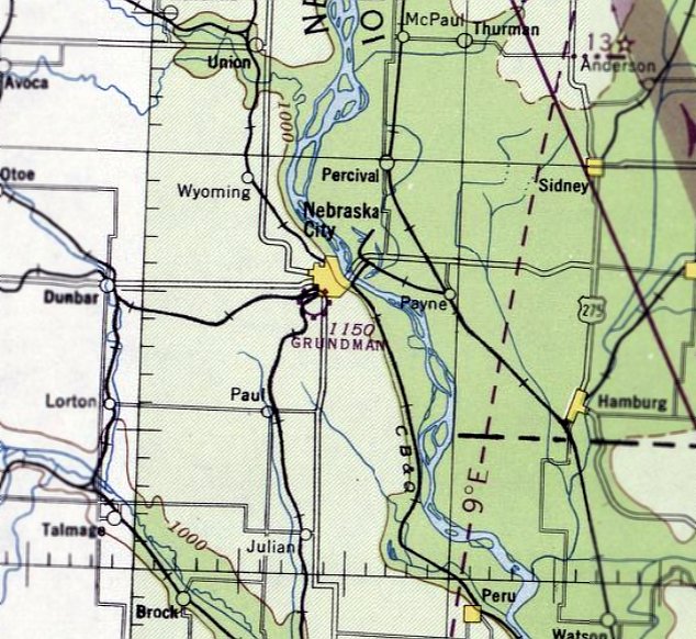
The site of Grundman Field is located northwest of the intersection of Route 2 & Business Route 75.
____________________________________________________
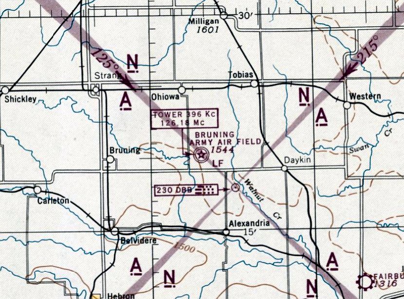
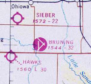
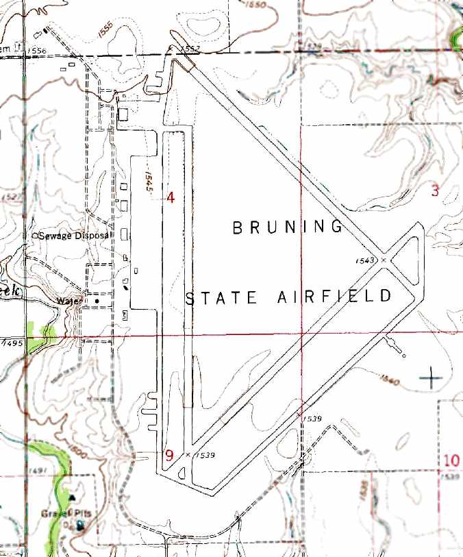
Bruning Army Airfield / Bruning State Airport / Mid-America Airport, Bruning NE
40.34, -97.43 (Southwest of Lincoln, NE)
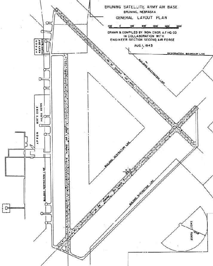
A 8/1/43 plan of Bruning AAF (courtesy of John Voss).
Bruning Army Airfield was not yet depicted on the July 1942 Lincoln Sectional Chart.
Bruning Army Airfield was built during WW2 for the Army Air Corps' 2nd Air Force.
The earliest depiction which has been located of Bruning AAF
was a 8/1/43 plan of the “Bruning Satellite Army Air Base” (courtesy of John Voss).
It depicted Bruning as a substantial airfield, having three 6,800' paved runways, taxiways,
numerous dispersal pads along the taxiways, and 2 paved aprons, one of which measured 2,135' x 600'.
Bruning also had a small bombing & gunnery range 3 miles southwest.
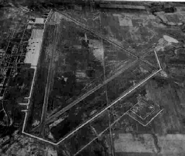
The earliest photo which has been located of Bruning AAF
was a 10/1/43 aerial view looking north from the 1945 AAF Airfield Directory (courtesy of Scott Murdock).
It depicted Bruning as having 3 paved runways & a large paved ramp on the west side.
The earliest aeronautical chart depiction which has been located of Bruning AAF was on the March 1944 Lincoln Sectional Chart.
Allen Salzmann recalled, “My uncle was a P-47 instructor at Bruning in 1944...
His first assignment after returning from his tour with the 81st Fighter Group.”
According to Wikipedia, the following units trained at Bruning AAF during WW2:
456th Bombardment Group: 8/2 – 10/8/43: 744th, 745th, 746th & 747th Bombardment Squadrons (B-24 Liberator),
449th Bombardment Group: 9/12- 12/3/43: 716th, 717th, 718th & 719th Bombardment Squadrons (B-24 Liberator),
487th Bombardment Group: 9/20 – 12/15/43: 836th, 837th, 838th & 839th Bombardment Squadrons (B-24 Liberator),
507th Fighter Group: 10/20 – 12/12/44: 463rd, 464th & 465th Fighter Squadrons (P-47 Thunderbolt),
508th Fighter Group: 11/15 – 12/18/44: 466th, 467th & 468th Fighter Squadrons (P-47 Thunderbolt),
23rd Fighter Squadron: November 1943 - March 1944: Component of 36th Fighter Group (P-47 Thunderbolt),
516th Fighter Squadron: 3/3 – 4/1/44: Component of 407th Fighter-Bomber Group (A-24 Dauntless & A-36 Apache),
517th Fighter Squadron: 3/3 – 4/1/44: Component of 407th Fighter-Bomber Group (A-24 Dauntless & A-36 Apache).
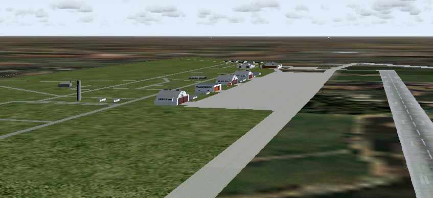
An image of the WW2-era configuration of Bruning AAF, from Flight Simulator scenery created by Bob Pearson.
The 1945 AAF Airfield Directory (courtesy of Scott Murdock) described “Bruning AAF”
as a 1,720 acre irregularly-shaped property having 3 concrete 6,800' runways.
The field was said to have 4 wooden hangars, with the largest being a 225' x 202' structure.
Bruning was described as being owned by the U.S. Government, and operated by the Army Air Forces.
Bruning AAF was declared surplus in 1946.
At some point between 1946-48, Bruning Field was reused as a civil field named Bruning State Airport.
Bruning Airport was depicted on the November 1948 Lincoln Sectional Chart (courtesy of Chris Kennedy)
as having a 6,800' hard surface runway.

The 1949 NE Airport Directory (courtesy of Beverly Hubka) depicted Bruning “State Owned Airport” as having 3 concrete runways, with the longest being the 6,800' Runway 17/35.
The operator was listed as Bruning Flying Service, with the manager listed as W. Shane.
An 8/14/53 USGS aerial view showed Bruning AAF remained intact, but did not show any sign of recent aviation usage.
The number of runways at Bruning had shrunk to one by 1960,
as the May 1960 Lincoln Sectional Chart (courtesy of Chris Kennedy)
described Bruning as having a total of 3 runways (with the longest being a 6,800' concrete strip),
although the remarks in the Aerodromes table said "Northwest/Southeast & Northeast/Southwest runways closed."
Bruning State Airport was listed among active airports in the 1962 AOPA Airport Directory, with a single 6,800' paved runway.
Within another 6 years, the maintained runway lengths at Bruning had been reduced in half,
as remarks in the Aerodromes table of the October 1968 Lincoln Sectional Chart (courtesy of Chris Kennedy)
said that the only remaining open runways were the northern 3,200' portion of the concrete Runway 17/35 & the northwestern 3,200 portion of the concrete Runway 13/31.
Runway 4/22 was said to be "permanently closed."
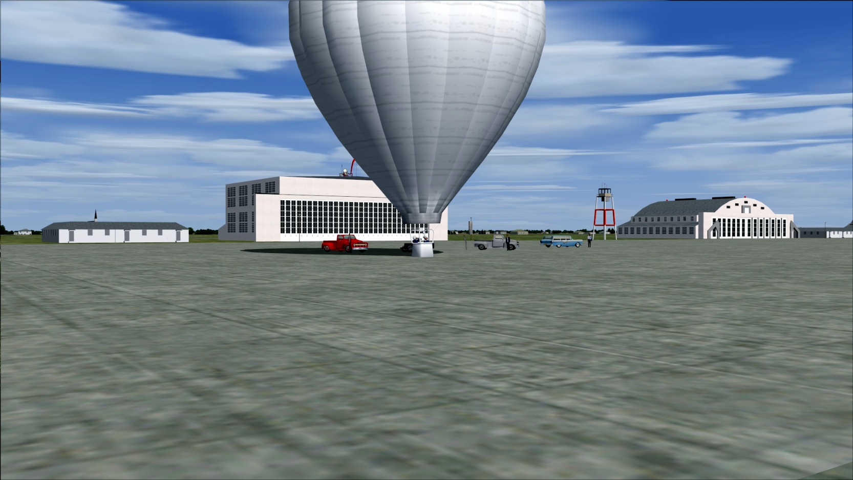
An undated flight simulator depiction of the first hot air balloon flight by Ed Yost at Bruning AAF.
The Bruning Airport was subsequently closed at some point within the next 2 years,
as it was labeled "Abandoned airport" on the 1970 Lincoln Sectional Chart (courtesy of Chris Kennedy).
The 1978 USGS topo map labeled the property as the “Bruning State Airfield”,
but that doesn't necessarily prove the airport was still open at that point.
The Bruning Airport was evidently reopened (once again) as a civilian airport at some point between 1978-81,
as it was labeled as “Mid-America Airport” on the 1981 USGS topo map.
This was most likely due to its use by the Mid-America Feed Yard, a large commercial cattle feed lot.
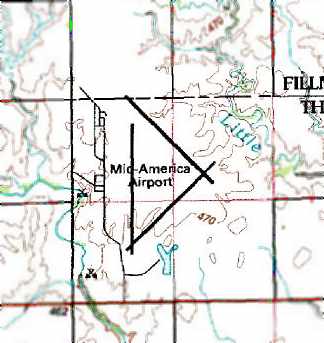
Bruning continued to be labeled as the “Mid-America Airport” on the 1990 USGS topo map.
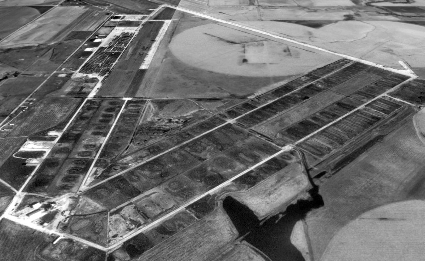
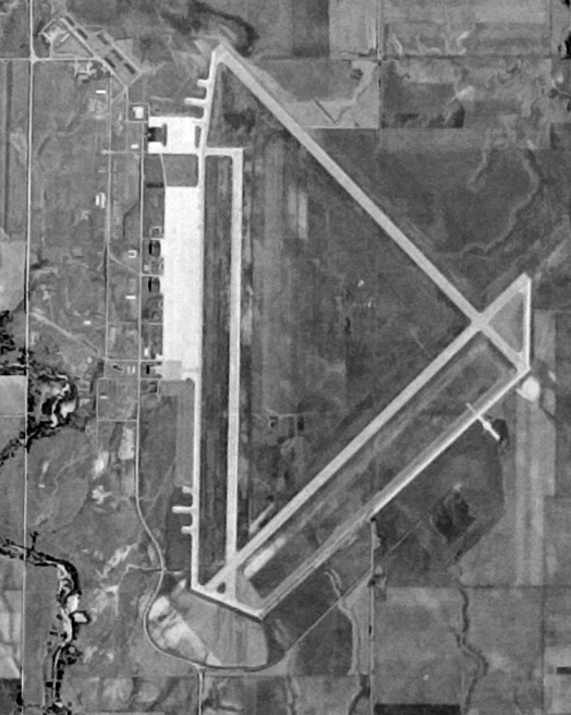
A 1993 USGS aerial view looking north showed portions of the pavement of Bruning's north/south & northeast/southwest runways had been removed,
but all of the northwest/southeast runway still remained intact.
Both parking aprons still remained intact, as did several hangars. However, there was no sign of any current aviation usage.
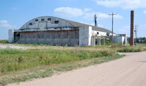
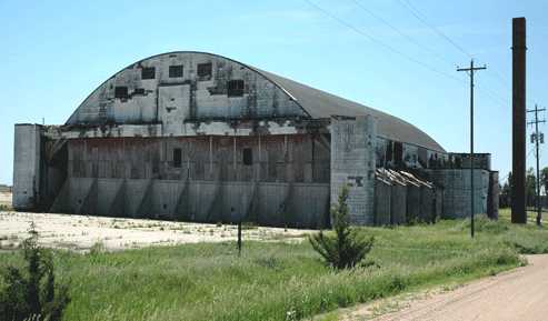
The exterior of the one of the 2 remaining hangars at Bruning (the former sub-depot hangar), photographed by Bob Carlson in 2003.
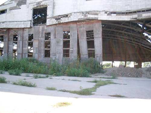
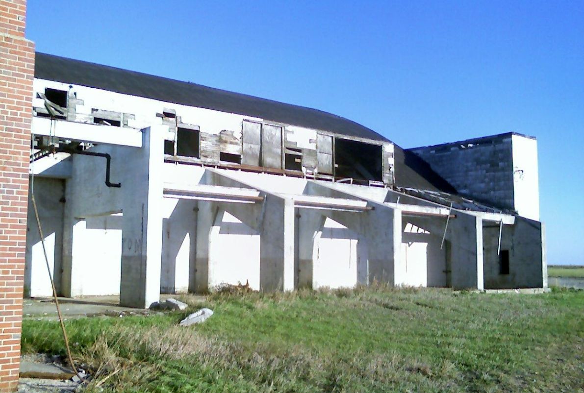
A sad sight - a 2003 photo by Bob Carlson of the interior of one of Bruning's remaining hangars (the former squadron hangar).
It is amazing that it is still standing!
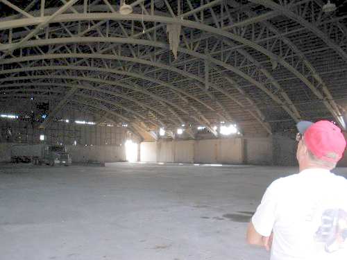
Another 2003 photo by Bob Carlson of the interior of one of Bruning's remaining hangars.
For an indication of the scale of the hangar, note the 18-wheeler tractor parked inside the hangar at the left-rear.
A 2003 photo by Bob Carlson of a remaining hangar at Bruning (at right),
along with the walls of a second hangar (center background)
and the traces of the foundation of a third hangar (right foreground).
He reported that the end of one of the runways was being used as a cattle feed lot.
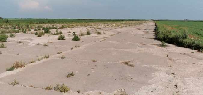
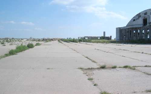
A 2004 photo by Robert Pearson looking along the former northwest/southeast runway, which remains completely intact.
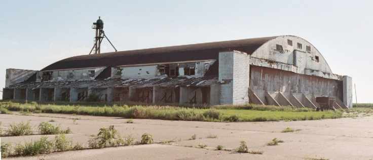
A 2004 photo by Robert Pearson of the former sub-depot hangar at Bruning, which remains in good shape.
Robert reported, "There were [originally] 4 east-facing hangars, by count of the chimneys.
Bruning AAF has 2 hangars remaining.
The doors have been replaced with retaining walls for grain storage."
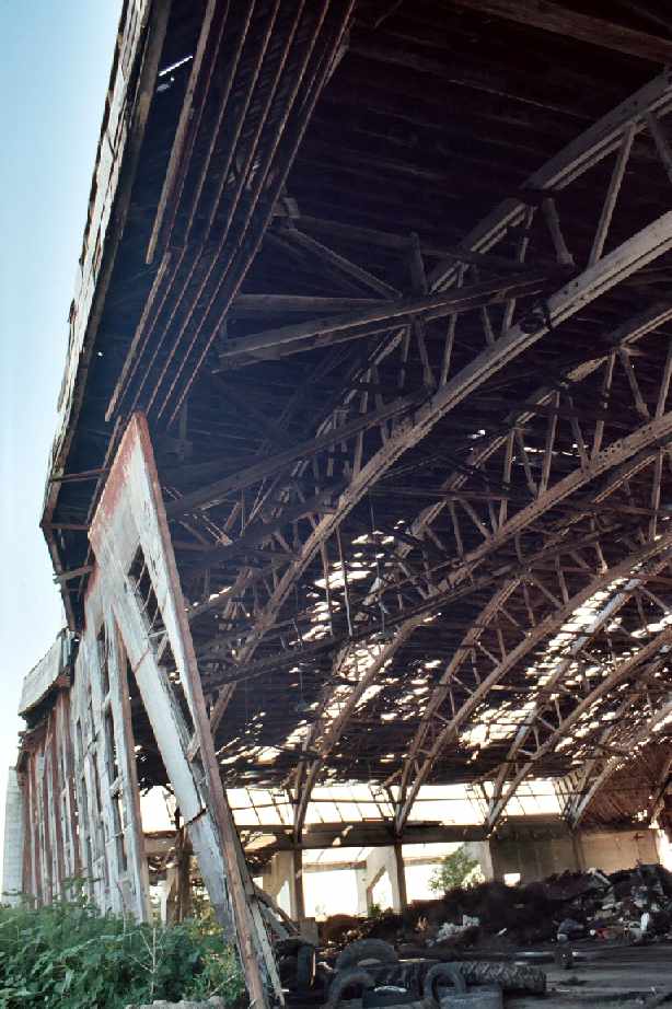
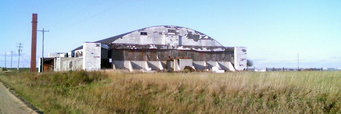
A 2004 photo by Robert Pearson of the former squadron hangar at Bruning - in bad shape.
Robert reported, "Bad news at Bruning… the last squadron hangar, which was not in great shape,
was hit by a tornado & it's listing toward the flight line at about a 15 degree angle.
I don't think its long for this world."
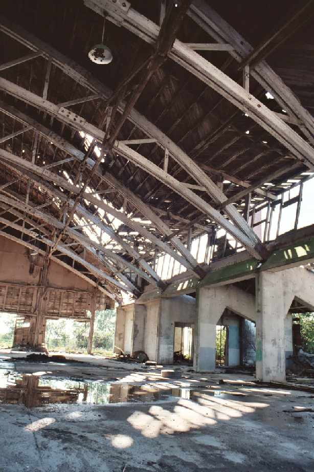
A 2004 photo by Robert Pearson of the interior of the former squadron hangar at Bruning.
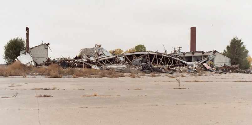
An October 2004 photo by Robert Pearson of the collapsed hangar at Bruning.
Robert reported, "Sad news, The Bruning squadron hangar apparently has caved in.
I saw no evidence of it being pulled down. It must have happened sometime in late summer.
No one there I talked to could provide a date."
Guillermo Rosas reported in 2005 that the former Bruning airfield was currently reused
as the home of Mid-America Feed Yard, a large commercial cattle feed lot.
It has not been determined when the use of the property as the “Mid-America Airport” ceased,
but as of 2007 the site was depicted as an abandoned airfield on the Sectional Chart.
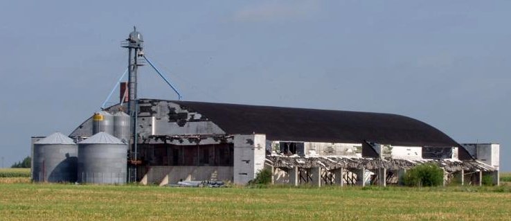
A 6/4/09 photo of the former sub-depot hangar at Bruning.
A circa 2013 closeup of the side of the former sub-depot hangar at Bruning.
A circa 2013 photo of the former sub-depot hangar at Bruning.
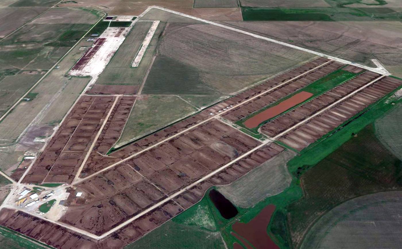
A 2014 aerial view looking north at the remains of the extensive Bruning airfield.
A pre-2022 photo of a remaining hangar on the north side of the Bruning Field site.
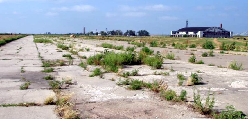
A pre-2022 photo looking south along remaining Bruning Field airfield pavement.
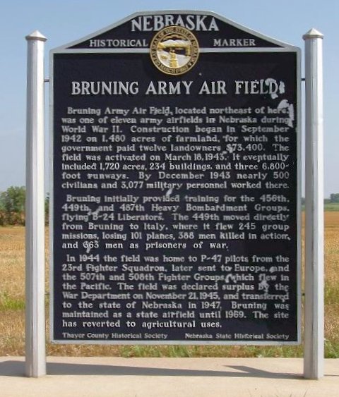
A pre-2022 photo of the historical sign commemorating Bruning Army Air Field along the north side of Highway 4 & west of the entrance to the feedyard.
____________________________________________________
Or if you prefer to contact me directly concerning a contribution (for a mailing address to send a check),
please contact me at: paulandterryfreeman@gmail.com
If you enjoy this web site, please support it with a financial contribution.
____________________________________________________
This site covers airfields in all 50 states.