Abandoned & Little-Known Airfields:
Eastern Montana
© 2003, © 2025 by Paul Freeman. Revised 5/24/25.
This site covers airfields in all 50 states: Click here for the site's main menu.
____________________________________________________
Please consider a financial contribution to support the continued growth & operation of this site.
(Old) Broadus Airport (revised 4/8/20) - Glasgow AFB / Valley Industrial Park Airport / Glasgow Industrial Airport (revised 8/29/24)
Glendive Airport (revised 10/17/18) - Oscar's Dreamland Airfield (revised 2/12/23) - Poplar Municipal Airport (1st location) (revised 5/24/25)
Poplar Airport (2nd location) (revised 5/24/25) - Veseth Airport / Malta Airport (revised 8/29/23)
____________________________________________________
Broadus Airport (original location) (KBDX), Broadus, MT
45.432, -105.419 (Southeast of Billings, MT)

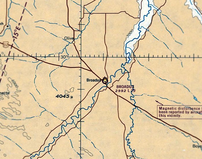
Broadus Airport, as depicted on the June 1967 Rapid City Sectional Chart.
The original airport for the town of Broadus was located on the southwest side of the town.
Broadus Airport was apparently established at some point between 1966-67,
as it was not yet depicted on the December 1966 Rapid City Sectional Chart.
The earliest depiction of Broadus Airport which has been located was on the June 1967 Rapid City Sectional Chart.
It depicted Broadus as having a 2,900' unpaved runway.
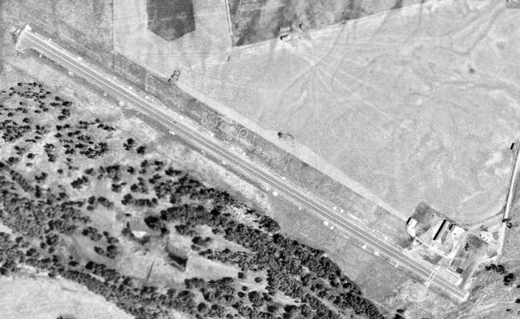
The earliest photo of Broadus Airport which has been located was an 8/4/72 USGS aerial view.
It depicted Broadus as having a single paved northwest/southeast runway, with a few small buildings on the east side.
No aircraft were visible on the field.
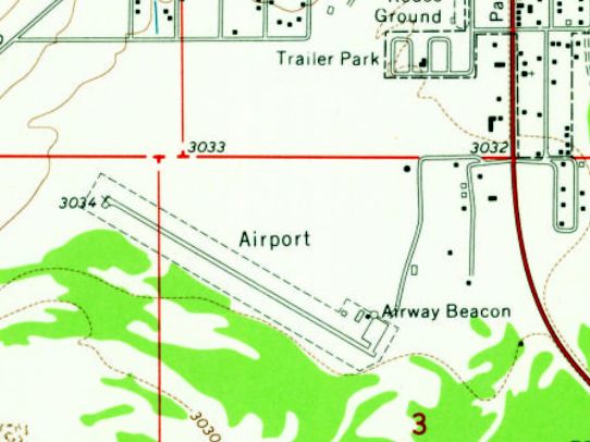
The 1973 USGS topo map depicted Broadus as having a single paved northwest/southeast runway,
with a few small buildings & an airway beacon on the east side.
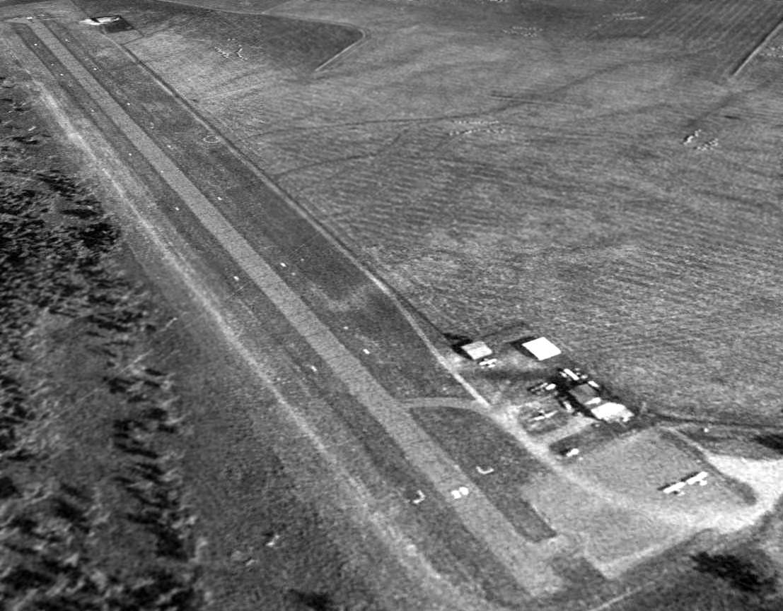
A 1996 USGS aerial view looking northwest depicted 4 single-engine aircraft on the Broadus Airport ramp.
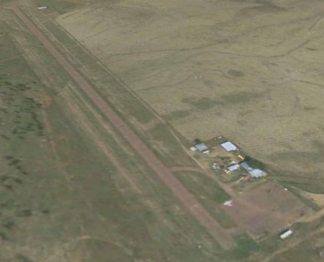
The last photo which has been located showing aircraft at the original Broadus Airport was a 2004 aerial view looking northwest,
which showed 2 single-engine aircraft on its ramp.
According to its FAA Airport/Facility Directory data, the original Broadus Airport comprised a total of 32 acres,
and had a single 3,150' asphalt Runway 11/29.
In 2006 a new Broadus Airport with a longer runway was constructed 4 miles to the northwest,
at which point presumably the old Broadus Airport was closed.
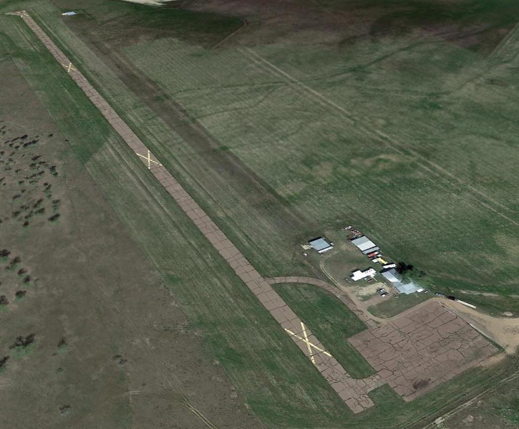
A 2014 aerial view looking northwest showed the old Broadus Airport remained intact, though the runway was marked with closed-runway “X” symbols.
The site of the old Broadus Airport is located at the southwest terminus of Airport Road, appropriately enough.
____________________________________________________
Oscar's Dreamland Airfield (9M3), Billings, MT
45.707, -108.62 (Southwest of Billings, MT)
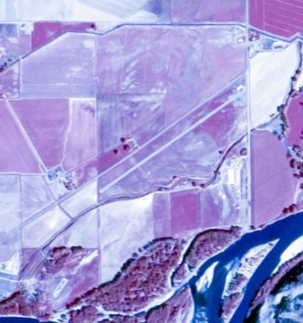
An 8/30/75 USGS aerial view of Oscar's Dreamland Airfield.
Oscar Cooke was a barnstormer in the 1920s & 1930s, flying his plane throughout Kansas.
He eventually opened up a museum of farm life which included at least one aircraft.
The Oscar's Dreampark Airfield was evidently constructed at some point between 1969-75,
as it was not yet depicted on the 1969 USGS topo map nor on a 8/27/69 USGS aerial photo.
The earliest depiction of Oscar's Dreampark Airfield which has been located was an 8/30/75 USGS aerial photo.
It depicted the field as having a single paved northeast/southwest runway, with a single building on the northeast side.
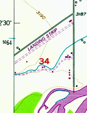
The 1975 USGS topo map depicted Oscar's Dreamland as having a single unpaved northeast/southwest runway,
labeled simply as “Landing Strip”, with a single building on the northeast side.
The 1989 AOPA Airport Directory (courtesy of Jonathan Westerling)
described “Airpark Oscar's” as having a single 3,070' asphalt Runway 3/21.
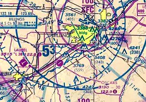
The only aeronautical chart depiction which has been located of Oscar's Dreamland Airfield
was on the 1991 Cheyenne Sectional Chart (courtesy of Jonathan Westerling).
It depicted Oscars as a public-use airfield with a single paved 3,000' northeast/southwest runway.
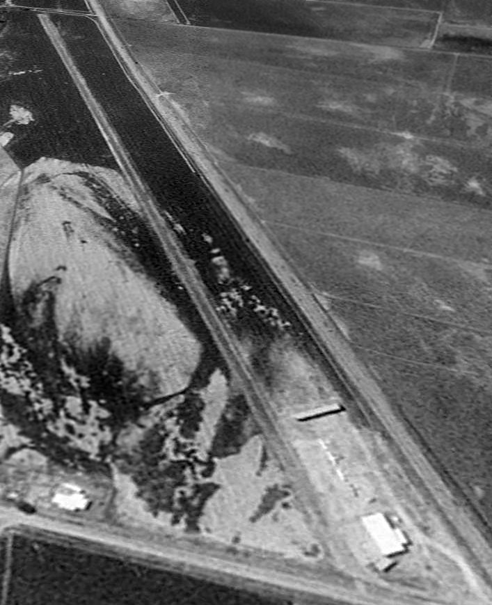
The only photo which has been located showing aircraft at Oscar's Dreamland Airfield was an 8/22/96 USGS aerial view looking west.
It depicted 4 single-engine aircraft parked next to the hangar on the northeast side of a paved runway.
According to the Oscarspark website, “The museum known as Oscar's Dreamland closed in 1998,
due to a forced sale of the antique collection to settle inheritance taxes.
With only the Pioneer town remaining the family renamed the town & surrounding area Oscar's Park.”
The airfield was presumably closed at the same time.
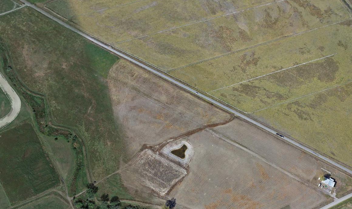
A 2019 aerial view looking west showed that the northeastern half of the Oscar's Dreamland runway remained, along with the hangar.

A September 2021 photo looking west at the former Oscar's Dreamland Airfield hangar.
As of 2023, street maps labeled the former Oscar's Dreamland Airfield hangar as the facility of Golden Valley Honey.
The site of Oscar's Dreamland Airfield is located southwest of the intersection of Wise Lane & Story Road.
____________________________________________________
Poplar Municipal Airport (1st location), Poplar, MT
48.13, -105.21 (Northeast of Billings, MT)
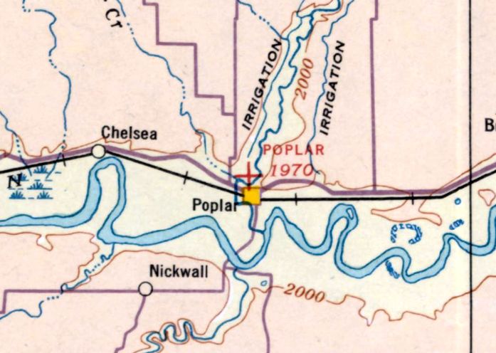
Poplar Municipal Airport, as depicted on the July 1935 Williston Sectional Chart.
The original airport for the town of Poplar was located on the north side of the town.
The date of establishment of Poplar Municipal Airport has not been determined.
The earliest depiction of Poplar Municipal Airport which has been located was on the July 1935 Williston Sectional Chart.
It depicted Poplar as an auxiliary airfield.
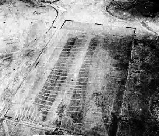
The earliest photo which has been located of Poplar Municipal Airport
was a 9/23/43 aerial view looking north from the 1945 AAF Airfield Directory (courtesy of Scott Murdock).
It depicted Poplar as consisting of a simple rectangular unpaved airfield, without any other improvements.
No aircraft were visible on the field.
The 1945 AAF Airfield Directory (courtesy of Scott Murdock) described Poplar Municipal Airport
as a 123 acre rectangular field, having a 2,710' x 1,940' sod field.
The field was described as being owned by the U.S. Department of Interior, Indian Service, but “Not in operation.”
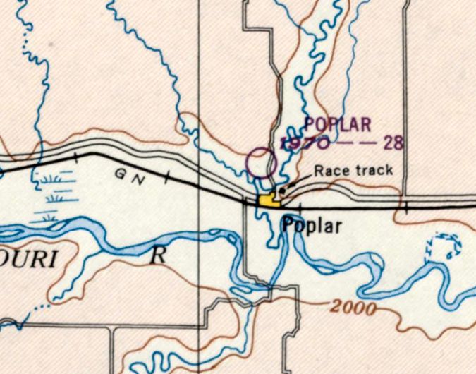
The last depiction of the original location of Poplar Municipal Airport (north of the town) which has been located was on the May 1947 Williston Sectional Chart.
It depicted Poplar as having a 2,800' unpaved runway.
At some point between 1947-48, the original Poplar Municipal Airport
was replaced by a more-substantial airport located adjacent to the northeast side of the town.,
as that was were it was depicted on the May 1948 Williston Sectional Chart.
No airfield remains of the original Poplar Municipal Airport were recognizable on the 1996 USGS aerial photo.
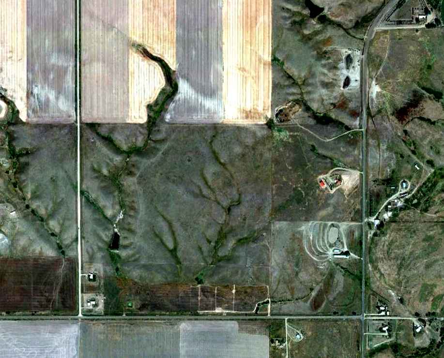
In a 9/10/10 aerial photo, no trace remained recognizable of the original location of Poplar Municipal Airport.
The site of the first location of Poplar Municipal Airport is located northwest of the intersection of Poplar River Road & Red Thunder Road.
____________________________________________________
Poplar Airport (2nd location), Poplar, MT
48.116, -105.181 (Northeast of Billings, MT)
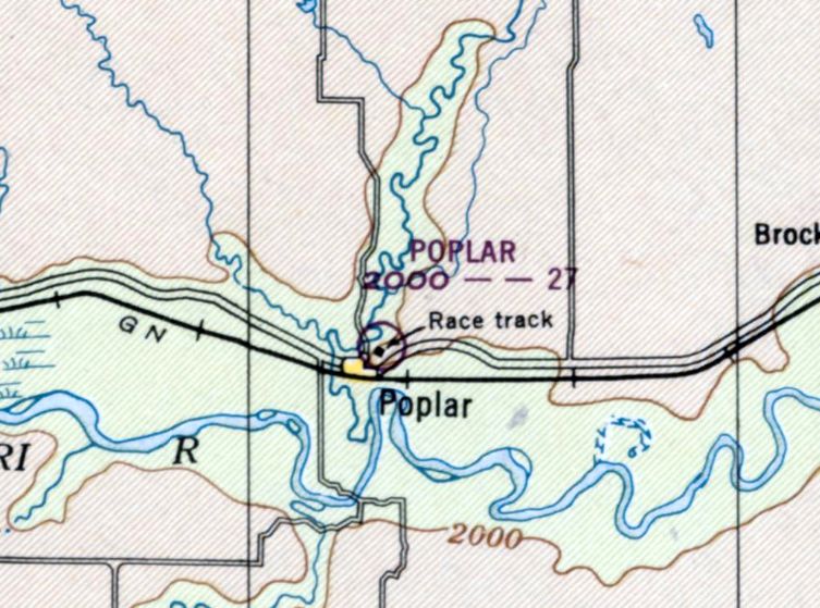
The 2nd location of Poplar Airport, as depicted in the May 1948 Williston Sectional Chart.
At some point between 1947-48, the original Poplar Municipal Airport was replaced by a more-substantial airport located adjacent to the northeast side of the town.
The earliest depiction which has been located of the 2nd location of Poplar Airport was on the May 1948 Williston Sectional Chart.
It depicted Poplar as having a 2,700' unpaved runway.
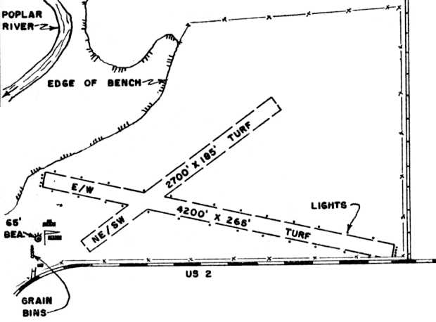
The earliest airport directory depiction which has been located of the 2nd location of Poplar Airport was in the 1961 MT Airport Directory (courtesy of Ron Dupas).
It depicted Poplar as having 2 turf runways (4,200' southeast/northwest & 2,700' northeast/southwest),
with 2 buildings & a beacon tower on the southwest side.
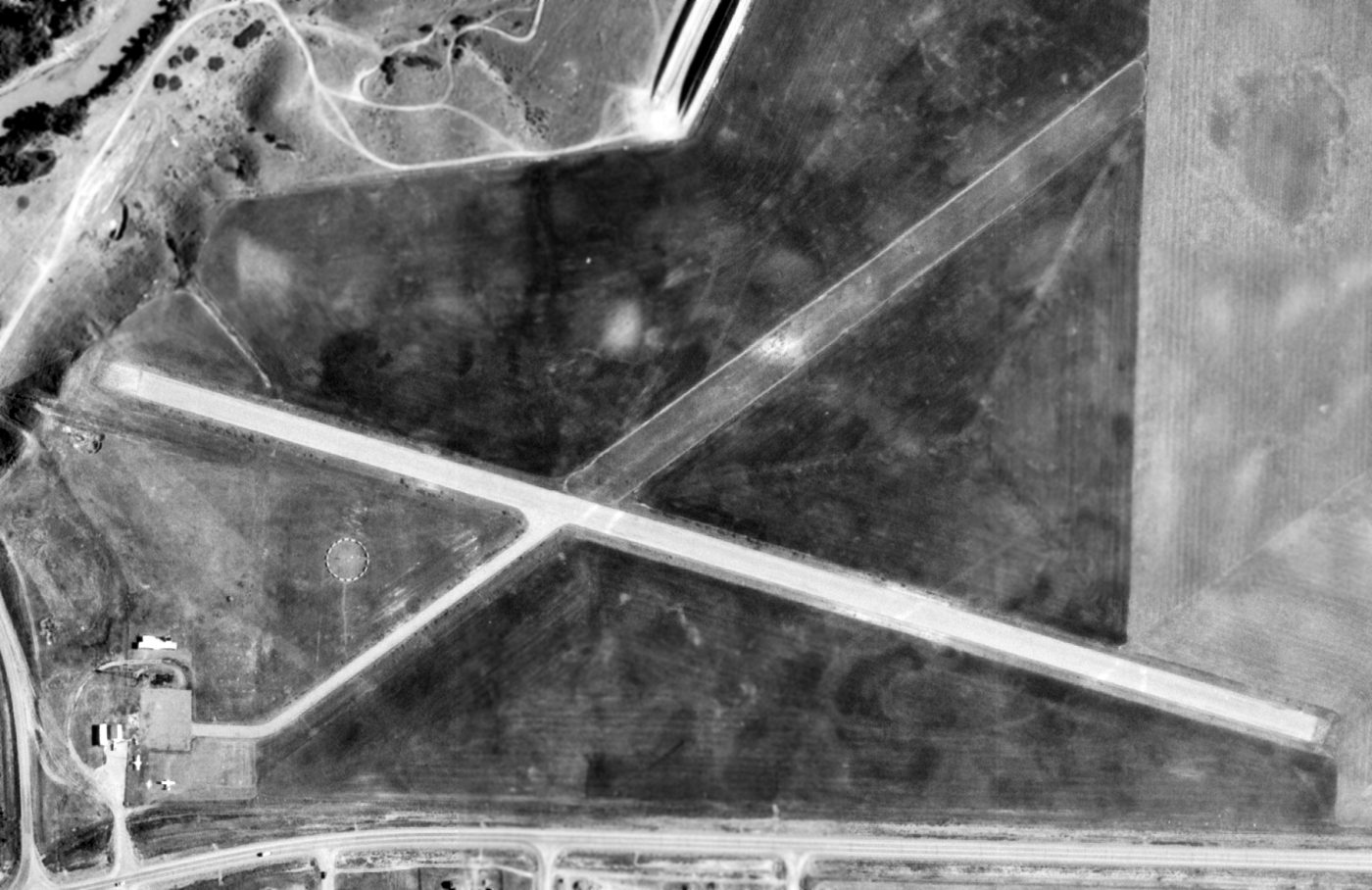
The earliest photo which has been located of the 2nd location of Poplar Airport was a 7/15/71 USGS aerial view.
It showed that Poplar's northwest/southeast runway had been paved at some point between 1961-71. Two light single-engine aircraft were visible on the ramp on the southwest side.
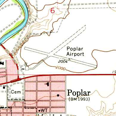
The 1972 USGS topo map showed that Poplar's northwest/southeast runway had been paved at some point between 1961-75.
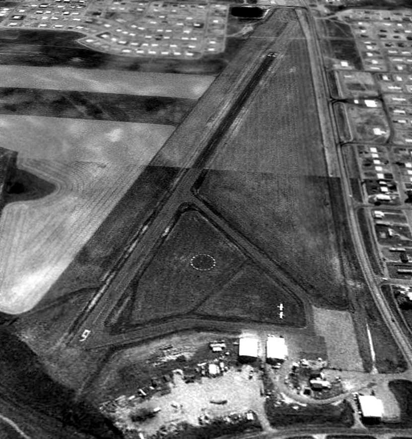
A 7/15/96 USGS aerial view looking west depicted the 2nd location of Poplar Airport
to have a paved Runway 9/27, with the former crosswind grass runway being barely recognizable.
A taxiway led to a ramp & several small buildings on the southeast side, and 2 single-engine aircraft were visible.
At some point between 2007-2009 a somewhat larger replacement Poplar Airport (its 3rd location) was built only 1 mile to the northeast.
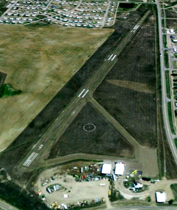
The last photo which has been located showing the 2nd location of Poplar Airport still in operation was a 6/23/09 aerial view looking west,
showing a solitary yellow single-engine aircraft on the field.
The housing development on the east side was intruding farther toward the field.
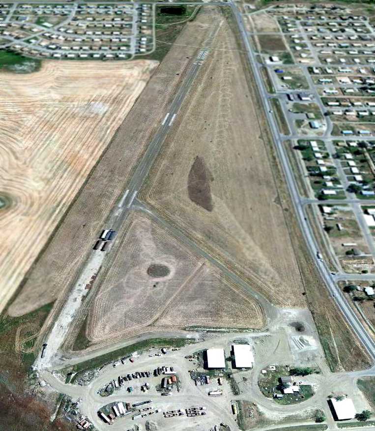
A 9/10/11 aerial view looking east at the 2nd location of Poplar Airport showed that the western portion of the runway pavement had begun to be removed.
The airport buildings & other pavement remained intact.
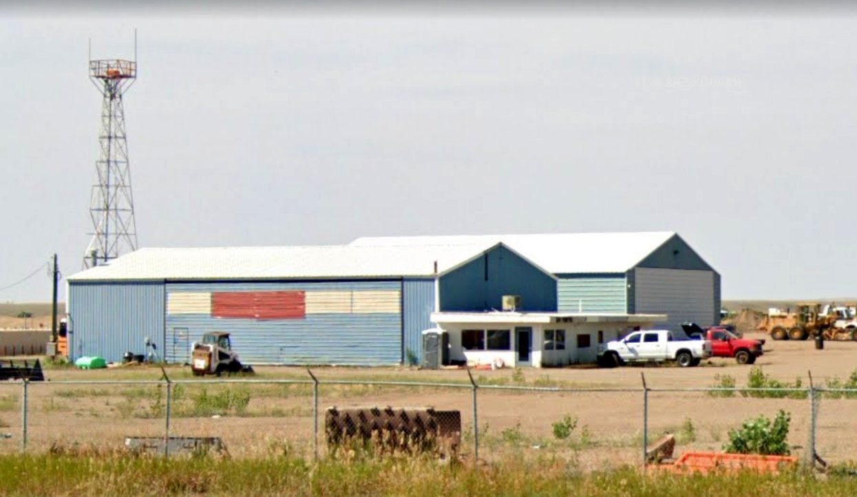
An August 2022 photo looking northwest at the airport beacon, hangars, and airport office which remain at the site of the 2nd location of Poplar Airport.
The site of the 2nd location of Poplar Airport is located northeast of the intersection of Route 2 & Dark Road.
____________________________________________________
Veseth Airport / Malta Airport, Malta, MT
48.349, -107.884 (North of Billings, MT)
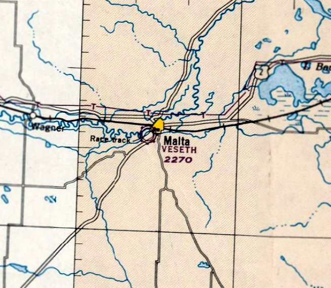
Veseth Airport, as depicted on the May 1945 Williston Sectional Chart.
This general aviation airport was evidently established at some point between 1944-45,
as it was not yet depicted at all on the September 1944 Williston Sectional Chart (according to Chris Kennedy).
The earliest depiction of Veseth Airport which has been located was on the May 1945 Williston Sectional Chart.
It depicted Veseth as a commercial/municipal airport.
At some point between 1945-48, the airport was evidently renamed Malta Airport,
as that is how it was depicted on the May 1948 Williston Sectional Chart (courtesy of Chris Kennedy).
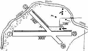
The 1960 Jeppesen Airway Manual (courtesy of Chris Kennedy)
depicted Malta as having 2 unpaved runways: 3,000' Runway 7/25 & 2,400' Runway 12/30.
A note cautioned that the runways were rough.
Several buildings (hangars?) were depicted on the northeast side of the field.
Malta evidently gained a paved runway at some point between 1960-65,
as the 1965 Jeppesen Airway Manual (courtesy of Chris Kennedy)
depicted Malta as having a 2,800' paved Runway 7/25, along with a 2,400' Runway 12/30.
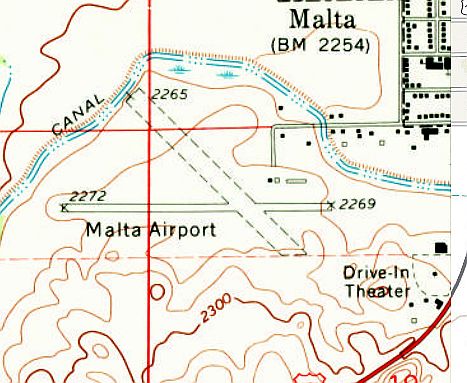
The 1968 USGS topo map depicted Malta as having a paved east/west runway & an unpaved crosswind runway,
along with a few small buildings on the northeast side of the field.
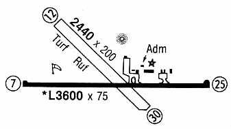
Malta's primary runway was lengthened slightly in the period between 1965-93,
as the 1993 Flight Guide (courtesy of Chris Kennedy)
depicted Malta as having a 3,600' paved Runway 7/25, along with a 2,440' Runway 12/30.
The field was noted to have operations by helicopters & crop dusters.
The operators on the field were listed as Mendel Flying Service & Russ Aero Flying Service.
A Non-Directional Beacon was depicted just north of the runway intersection.
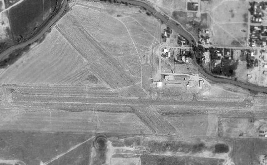
The 1996 USGS aerial photo depicted Malta as having a paved east/west runway & an unpaved northwest/southeast runway.
Several hangars were depicted on the northeast side of the field, but not a single aircraft was visible on the field.
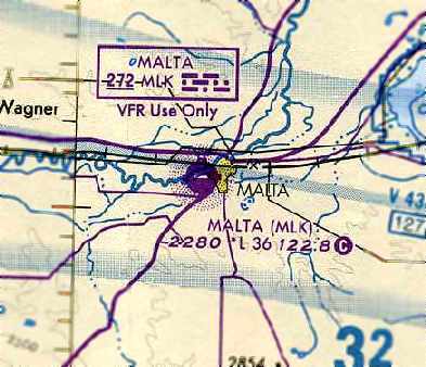
The last aeronautical chart depiction which has been located of the Malta Airport
was on the September 1997 Billings Sectional Chart (courtesy of Chris Kennedy).
It depicted Malta as having a 3,600' paved runway, along with its own Non-Directional Beacon.
According to Alan Bradley, “A new airport, M75, was built on the northwest side of town.
Hitch Aviation relocated as did the based aircraft. This happened in about 2002.
The new field has 2 GPS approaches & looks like it will be less hemmed in by the town.
While I hate to lose a general aviation airport, this is a success story!”
A 7/13/03 aerial view depicted closed-runway “X” symbols painted along the runway of the original Malta Airport.
The original Malta Airport was no longer depicted at all on the March 2004 Billings Sectional Chart (courtesy of Chris Kennedy).
A 1/1/05 aerial view did not depict any change in the status of the original Malta Airport.
A 6/23/09 aerial view showed the former Malta Airport runway had been reused for drag racing at some point between 2005-2009.
The unpaved crosswind runway was still apparent, and the former hangars remained standing.
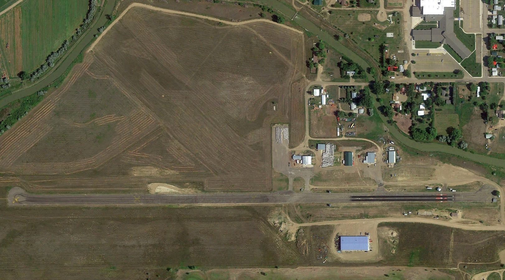
A 2014 aerial view looking showed the original Malta Airport remained largely in an unchanged configuration.
The site of the original Malta Airport is located at the terminus of Airport Road, appropriately enough.
____________________________________________________
Glendive Airport, Glendive, MT
47.13, -104.69 (North of Billings, MT)
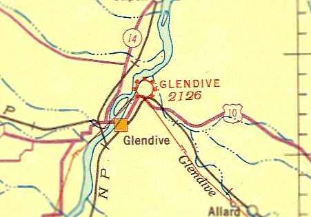
Glendive was depicted as a commercial/municipal airport on the June 1935 Sectional Chart (courtesy of Ken Meintzer).
Photo of the airport while open has not been located.
This general aviation airport apparently dated back to before 1933.
The earliest reference to the Glendive Airport which has been located
was in The Airport Directory Company's 1933 Airport Directory (courtesy of Chris Kennedy).
It described Glendive as a municipal airport, having 3 graded, rolled runways (with the longest being the 3,500' northwest/southeast strip).
The field was said to have a hangar, and to offer fuel.
The earliest depiction of Glendive Airport which has been located was on the June 1935 Sectional Chart (courtesy of Ken Meintzer).
It depicted Glendive as an commercial/municipal airport
The February 1942 2M Regional Aeronautical Chart (courtesy of Chris Kennedy) depicted Glendive as an auxiliary airfield.
Malcolm Soare recalled, “The old Glendive Airport... my father was the operator of the airport from April 1952 until February 1964.
It was a busy place with a local group of pilots that flew out of there & lots of transient aircraft.
We operated a maintenance shop, and had a lot of aircraft worked on there.”
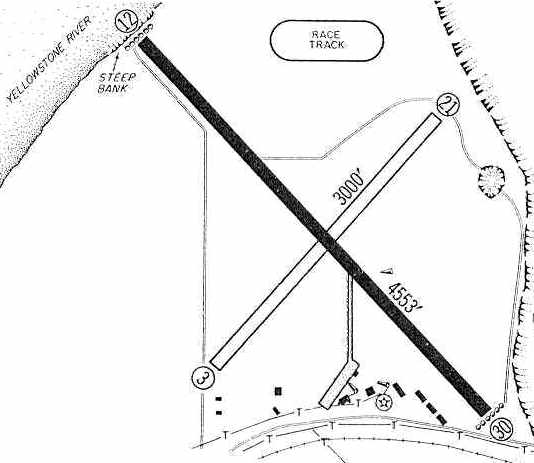
Glendive apparently gained a paved runway at some point between 1933-60,
as the 1960 Jeppesen Airway Manual (courtesy of Chris Kennedy) depicted the field as having a 4,553' paved Runway 12/30,
along with a 3,000' unpaved Runway 3/21.
A taxiway led to a ramp on the south side of the field, with numerous small buildings (hangars?).
Malcolm Soare recalled, “The old Glendive Airport... I soloed on that airport on 4/4/60.”
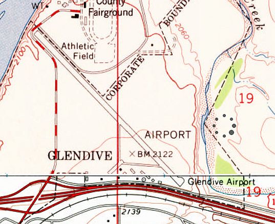
The 1967 USGS topo map depicted Glendive as having a single paved northwest/southeast runway,
but no longer depicted the unpaved crosswind runway.
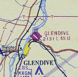
The April 1968 Miles City Sectional Chart (courtesy of Chris Kennedy) depicted Glendive as having a 4,500' paved runway.
Malcolm Soare reported, “The old Glendive airport closed at the end of 1969,
because Frontier Airlines were operating Convair 580 aircraft & the old airport couldn't be lengthened enough to support the new aircraft.”
The original Glendive Airport was depicted as “Abandoned Airport” on the October 1969 Miles City Sectional Chart.
It had been replaced by the Dawson Community Airport (4 miles northwest of Glendive),
which was located in farther out & offered more space for multiple paved runways.
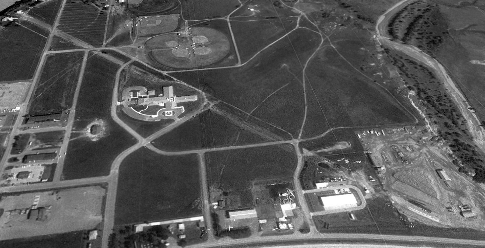
A 1996 USGS aerial view looking northeast at the site of Glendive Municipal Airport showed the outline of most of the paved runway was still quite recognizable.
However, much of the former airport site has been covered by baseball diamonds & several new buildings.
It is not known if any of the smaller buildings on the south side of the property date from the site's days as an airport.
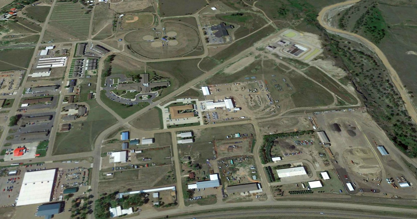
A 2016 aerial view looking northeast at the site of the Glendive airport showed that the northwest end of Runway 12 still remained,
but other portions of the airport site had been progressively covered by new construction between 1996-2016.
The site of the Glendive Airport is located northwest of the intersection of Interstate 94 & North Merrill Avenue.
____________________________________________________
Glasgow AFB / Valley Industrial Park Airport / Glasgow Industrial Airport (GSG), Glasgow, MT
48.42, -106.53 (North of Billings, MT)
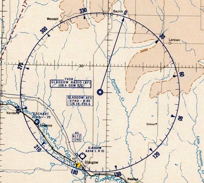
Glasgow AFB, as depicted on the November 1958 Williston Sectional Chart.
Construction began on this massive airfield in 1955.
Mike Morrissey recalled, “As an 11 year old I helped turn over the first shovel full of groundbreaking for the SAC base [Glasgow AFB].
My grandfather was one of 3 who lobbied for the SAC base.”
Glasgow AFB was not yet depicted on the October 1957 Williston Sectional Chart.
Glasgow AFB was activated in 1957 as a base for Air Defense Command interceptors,
which initially operated from a single 8,900' runway.
Glasgow was the home of the 467th Fighter Group from 1957-60,
and the 13th Fighter Interceptor Squadron from 1959-68, which were equipped with the F-101B Voodoo.
Glasgow AFB was not yet depicted on the 1958 USGS topo map.
The earliest aeronautical chart depiction which has been located of Glasgow AFB
was on the November 1958 Williston Sectional Chart.
It depicted Glasgow AFB as having a 8,900' paved runway.
According to "Air Force Bases" (USAF Research Division, courtesy of Steven McNicoll),
Glasgow was transferred to the Strategic Air Command in 1960,
and its runway was significantly expanded to 13,500' in length to support the coming operation of B-52 bombers.
In February 1961 the 326th Bombardment Squadron, equipped with B-52 aircraft,
moved to Glasgow Air Force Base as the nucleus for the organization of the 4141st Strategic Wing.
In its first year, this became the top wing in the 15th Air Force.

A September 1962 photo of a 13th Fighter-Interceptor Squadron McDonnell F-101B-90-MC Voodoo 57-0336 at Glasgow AFB.
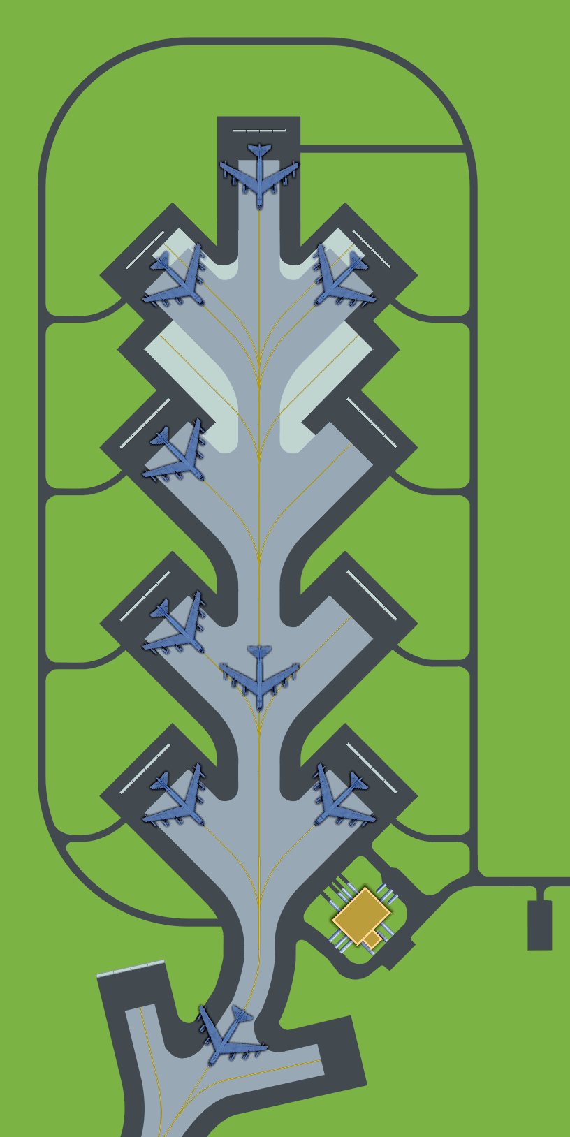
A depiction of B-52 bombers parked on the Glasgow AFB Alert Apron as it would have appeared circa 1961-68.
Informally called the "Christmas tree" because of its branch-like pads used to park B-52 bombers.
At lower-right is the partly subterranean Readiness Crew Building informally called the "Mole Hole".
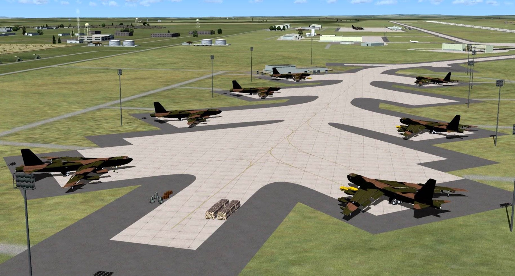
A flight simulator scenery depiction of B-52 bombers parked on the Glasgow AFB Alert Apron as it would have appeared circa 1961-68.
SAC units based at Glasgow included the 91st Bomb Wing (1963-68) & the 4141st Strategic Wing,
which operated B-52C & B-52D bombers & KC-135 tankers.
Charles Stapleton recalled, “I was stationed at Glasgow AFB from 2/27/62 - 3/13/65.
I was in the 13th Fighter Interceptor Squadron as a Weapons Control Technician working on the radar of the F-101B Voodoo.”
The earliest photo which has been located of Glasgow AFB was a September 1962 photo
of a 13th Fighter-Interceptor Squadron McDonnell F-101B-90-MC Voodoo 57-0336.
The 4141st Strategic Wing at Glasgow was inactivated in February 1963,
and its aircraft were transferred to the to 322nd Bombardment Squadron
(assigned to the 91st Bombardment Wing at Glasgow).
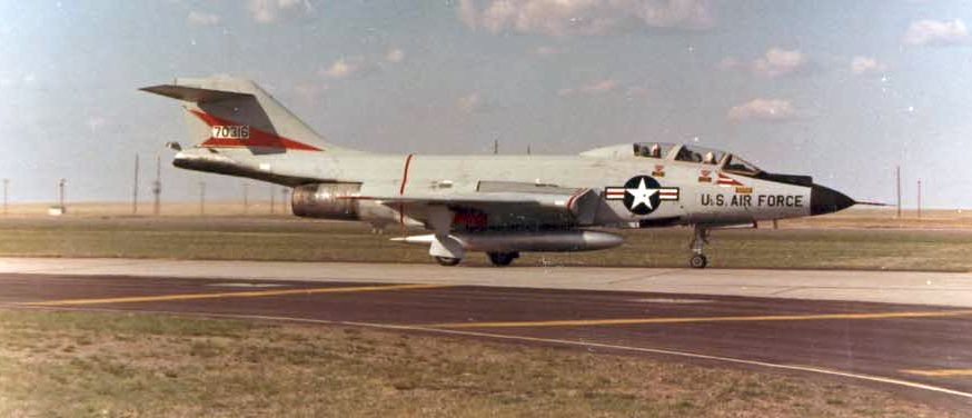
A 1965 photo of a 13th FIS McDonnell F-101B Voodoo interceptor taxiing at Glasgow AFB.

A mid-1960s photo of a 13th FIS McDonnell F-101B Voodoo interceptor in front of a Glasgow AFB hangar.
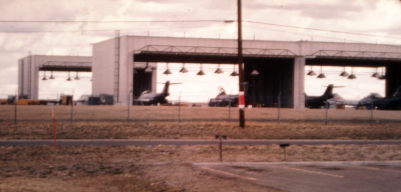
A 1965 photo looking northwest from Glasgow AFB's MG-13 radar shop at McDonnell F-101B Voodoo interceptor inside the 13th FIS hangars.
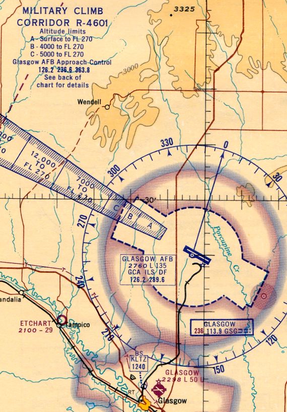
The July 1965 Williston Sectional Chart (courtesy of Ron Kunse)
depicted Glasgow AFB as having a 13,500' paved northwest/southeast runway.
Note the “Military Climb Corridor” which extended toward the northwest,
in the direction that ADC interceptors would be expected to scramble to intercept hostile bombers.
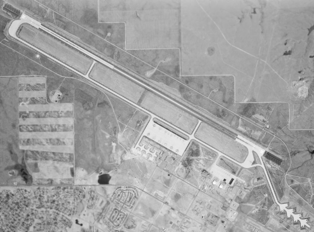
A 7/23/67 USGS aerial view of the massive Glasgow AFB.
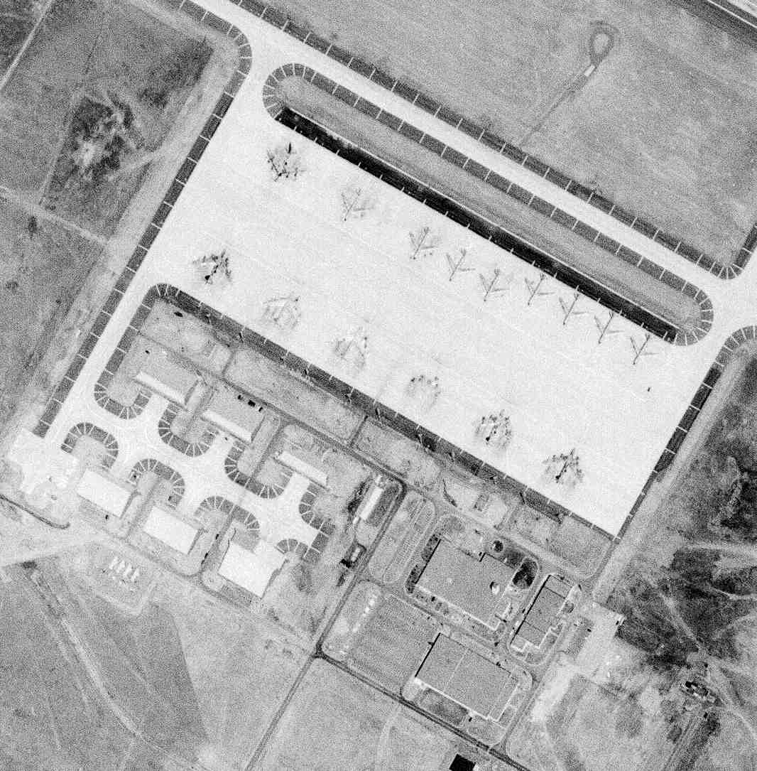
A closeup from the 7/23/67 USGS aerial view showing B-52 bombers & KC-135 tankers on the Glasgow AFB ramp.
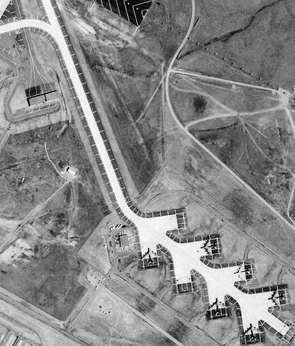
A closeup from the 7/23/67 USGS aerial view showing B-52 bombers on Glasgow AFB's “Christmas tree” alert pad.
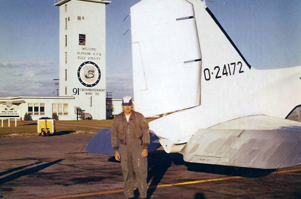
A 1968 photo of the last plane flown out of Glasgow AFB before its closure: a vintage Douglas C-47 transport.
Glasgow's 322nd Bombardment Squadron was inactivated in 1968.
Glasgow AFB was closed in 1968, with this massive facility having been open for only 11 years.
Mike Morrissey recalled, “It was a shocker when McNamara closed the base.
It had to remain open a little longer in order for the upgrade of the runways... then closed.
In a years time, high school went to 3 shifts, then at closure the student body was decimated & government money for GI kids just disappeared.”
Contractual operation & maintenance of the former Glasgow AFB property was assumed by AVCO Economics Systems Corporation in 1969.
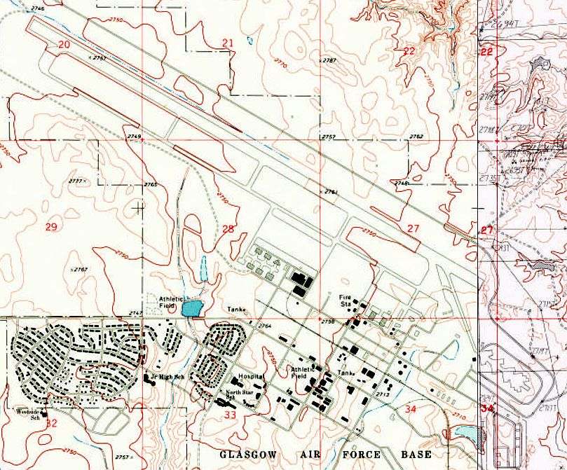
The 1969 USGS topo map depicted the extensive infrastructure of Glasgow AFB, one year after its closure.
The 1971 Billings Sectional Chart labeled the former Glasgow AFB as “Avco ESC“, with a 13,500' paved runway.
Glasgow was reactivated as a SAC dispersal field operations base during 1972-76,
and a major project was completed in 1973 to rehabilitate the runway surface, control tower & navigational aids.
During the 1970s, Glasgow was also intended to be used as an Army Safeguard Anti-Ballistic Missile depot,
to support construction of a second ABM complex northwest of Malmstrom AFB, but this was never completed.
When the base was closed by the military for the second time in 1976
it was so isolated & without business advantages that it sat idle for years.
The failure to attract any reuse of the massive infrastructure at the former Glasgow AFB
has been called "an example of failed local policies."
When the base closed, 16,000 people left the Glasgow area, a trend that continued among the civilian population.
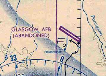
The October 1977 Billings Sectional Chart (courtesy of Chris Kennedy)
depicted Glasgow AFB as an abandoned airfield.
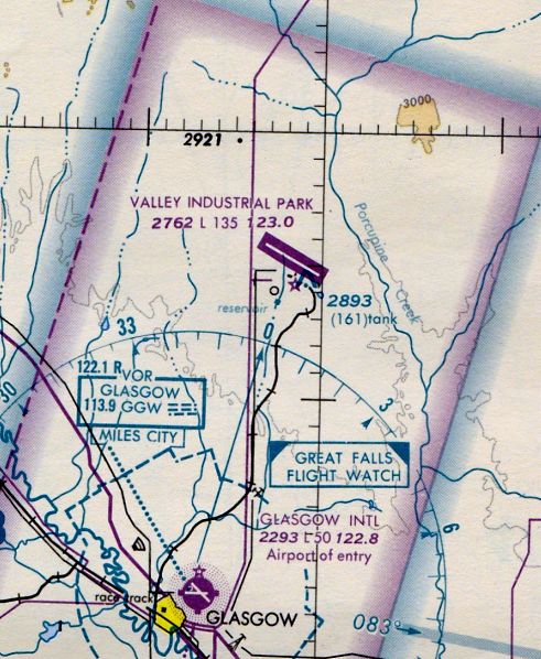
At some point between 1977-82, the former Glasgow AFB was apparently reopened as a civilian airport named “Valley Industrial Park” Airport,
as that is how it was labeled on the April 1982 Billings Sectional Chart (courtesy of Paul Columbus).
It depicted Valley Industrial Park as having a 13,500' paved northwest/southeast runway.
As of 1990 the massive Glasgow AFB base & all its infrastructure remained almost completely idle.
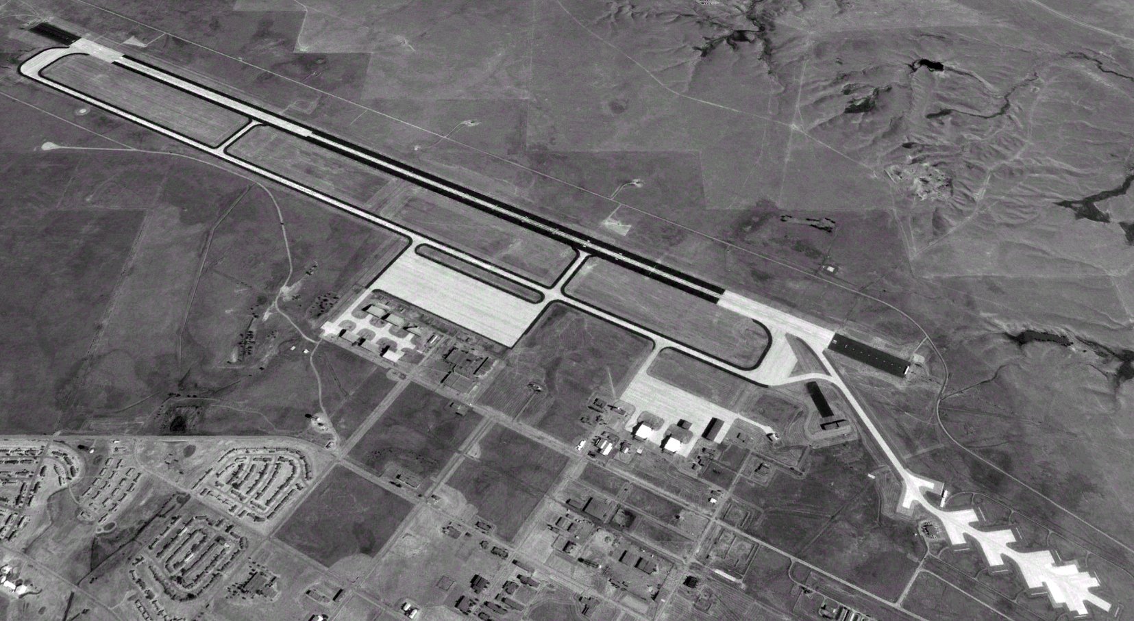
A 1996 USGS aerial view looking north at the former Glasgow AFB.
A recent aerial view looking northwest along Glasgow's massive single runway.
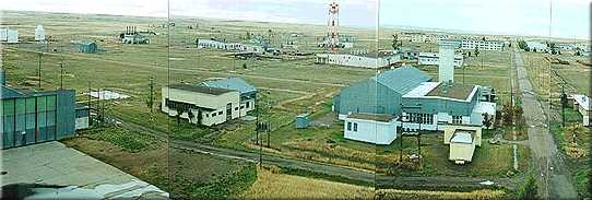
A recent photo of remaining military buildings at Glasgow.
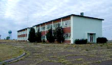
A 2001 photo of the former base headquarters building, by David Redman.

A 2001 photo of the control tower & fire department, by David Redman.
At an unknown date, the base began to be reused by a subsidiary of Boeing named "Montana Aviation Research Company".
They refer to the site as the Boeing Glasgow Flight Test Facility, and still use it as of 2002 for airliner flight testing.
It is currently listed in the Airport Facility Directory as a private airfield named "Glasgow Industrial Airport".
The published statistics list a total of only 30 aircraft operations per year.
The Glasgow airfield consists of a huge single runway, 10/28 (13,500' x 300'),
along with large ramp areas & 67 buildings (including numerous hangars).

A 2003 photo of a Piper Cherokee in front of the former Glasgow AFB control tower.
According to an article by Sebastian Steinke in the December 2003 issue of "Flug Review",
Glasgow was used in 2003 to host flight tests of the world's largest twin-engine aircraft, the first two examples of Boeing's new 777-300ER.
The test program includes "community noise testing", i.e. official measurements of the noise emitted by the two GE-90-115B turbofans,
which currently hold the title of the most powerful jet engines in the world.
The article pointed out that the solitude of Montana enables aircraft manufacturers
to complete these precision noise measurements much more quickly than normal, without any outside interference.
For this reason, the facilities have been hired not just for new Boeing models from the C-17 through to the 747-400ER,
but Embraer & Bombardier have also been carrying out flight tests & taxiing trials here on their new regional jets.
Over a dozen engineers, mechanics, and factory fire service personnel were flown in from Seattle for the Boeing test programs.
"Our overflight goal is the microphone field in the extended approach center line,
shortly before the touchdown zone", explained flight test director Jeffrey Scott.
"For example, I tell the pilots from downwind that we are still 15,000 feet away, and after a short countdown we turn onto the final approach.
This will entail taking up a precisely specified flight attitude, speed and rate of descent.
Recording will begin after a ground signal. Later on we will check whether we have kept precisely to all the requirements."
"We need absolutely calm air and, if possible, no low-lying clouds, as these actually alter the sound propagation", explained flight test director Scott.
For this reason, the meteorologists in Glasgow play an important role in the proceedings.
Shortly before the 777-300ER takes off for the test flight, a single-engine Boeing sensor aircraft takes off,
and then spirals its way to altitude over the measurement field,
measures the temperature & dewpoint at various altitudes & transmits this data to a ground station on the measurement field.
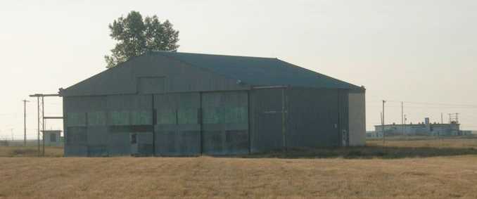
A 2005 photo of a small hangar on the southeast end of the Glasgow airfield,
which previously served as an F-101B MG-13 fire control system calibration shelter used by the 13th Fighter Interceptor Squadron.
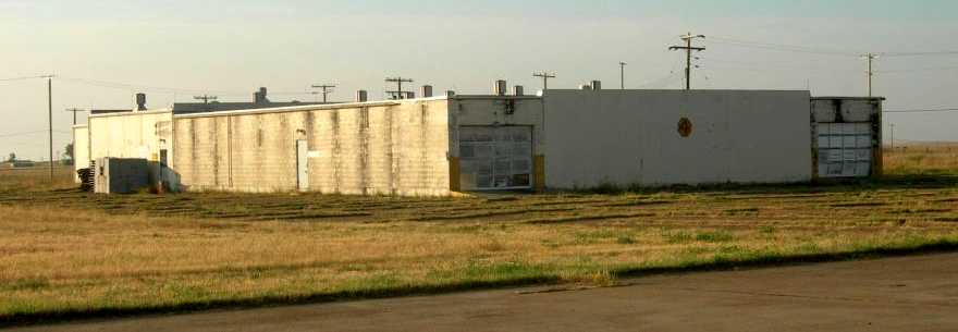
A 2005 photo of a facility on the southeast ramp used for storage & maintenance of Falcon air-to-air missiles used by Glasgow's 13th FIS F-101Bs.
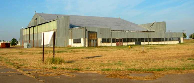
A 2005 photo of a hangar just east of Glasgow's control tower.
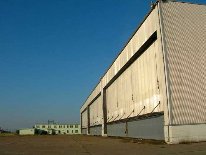
A 2005 photo of hangars on the southeast ramp used as "Ready Bays" for the 13th FIS's F-101B interceptors.
The 2-story building at the left was the 13th FIS Operations Center.
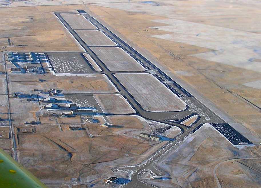
A 12/17/07 aerial view looking west along Glasgow's massive runway.
On 8/24/12 Boeing flew a loaned American Airlines 737-800 (N897NN) to Glasgow for a 3 month program as their ecoDemonstrator.
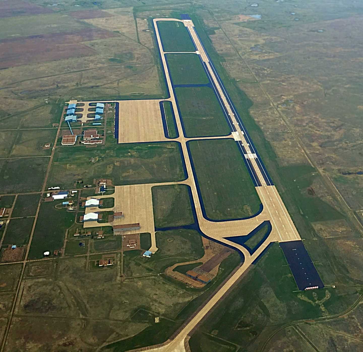
A 4/29/16 aerial view by Colin Graham looking west along Glasgow's massive runway.
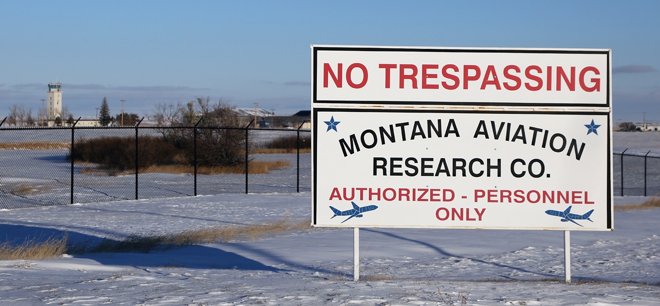
A November 2023 photo by David Jarray of the Montana Aviation Research Company sign at the former Glasgow AFB.
David reported, “The airfield looks in good shape; navaids/ILS antennae all had red lights on them. I saw a few cars/pickups entering the facility of the Montana Aviation Research Company but no aircraft in sight.
The base housing was in use with maybe an 1/8th of the houses occupied.”
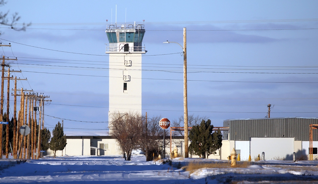
A November 2023 photo by David Jarray of the former Glasgow AFB tower.

A November 2023 photo by David Jarray of former Glasgow AFB hangars.
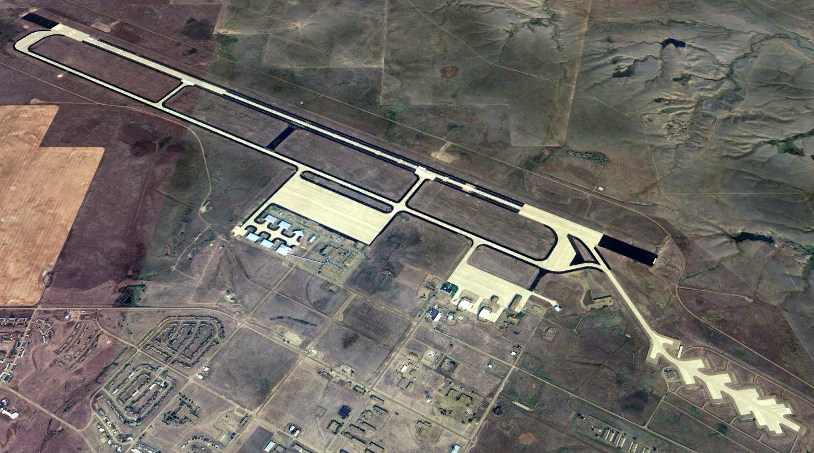
A 2023 aerial view looking north at the massive Glasgow airfield, with its massive single runway, the air defense interceptor alert pad, and the characteristic former B-52 “Christmas tree” dispersal pads at the southeast corner.
See also: http://www.globalsecurity.org/wmd/facility/glasgow.htm
____________________________________________________
Or if you prefer to contact me directly concerning a contribution (for a mailing address to send a check),
please contact me at: paulandterryfreeman@gmail.com
If you enjoy this web site, please support it with a financial contribution.
____________________________________________________
This site covers airfields in all 50 states.