Abandoned & Little-Known Airfields:
Southwestern Louisiana
© 2002, © 2025 by Paul Freeman. Revised 6/27/25.
This site covers airfields in all 50 states: Click here for the site's main menu.
____________________________________________________
Please consider a financial contribution to support the continued growth & operation of this site.
Gerstner Field (revised 6/27/25) - Lake Charles Airport / Louisiana Flyers Airport / East Lake Charles Airport (revised 1/13/23) - McArthur Drive Airport / Hub City Airport (added 6/24/25) - McFillen Airpark (revised 2/6/23)
____________________________________________________
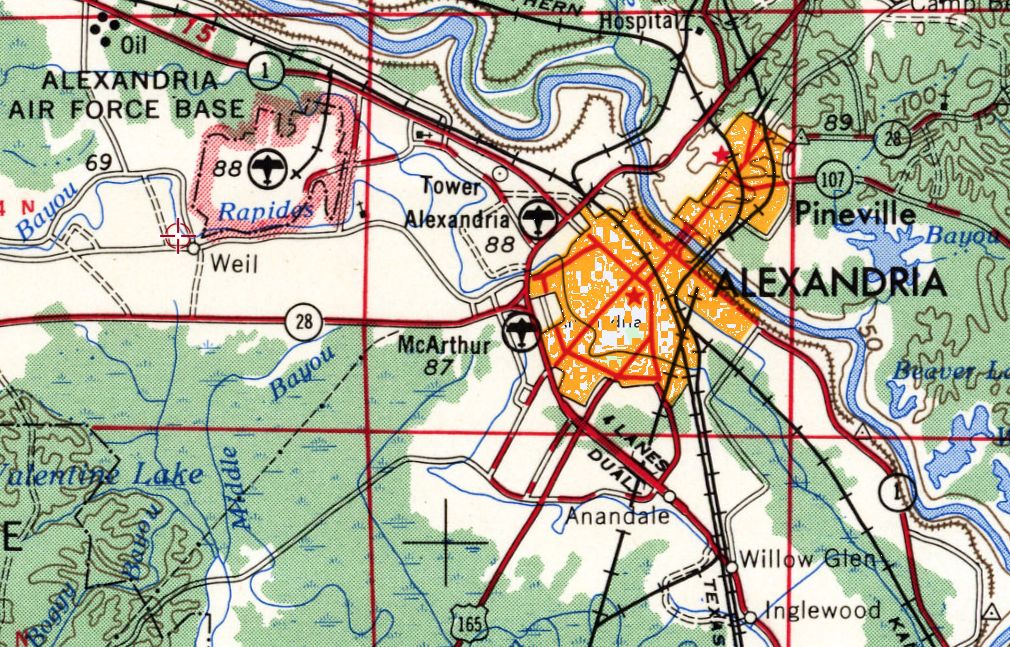
McArthur Drive Airport / Hub City Airport, Alexandria, LA
31.293, -92.48 (Northwest of New Orleans, LA)
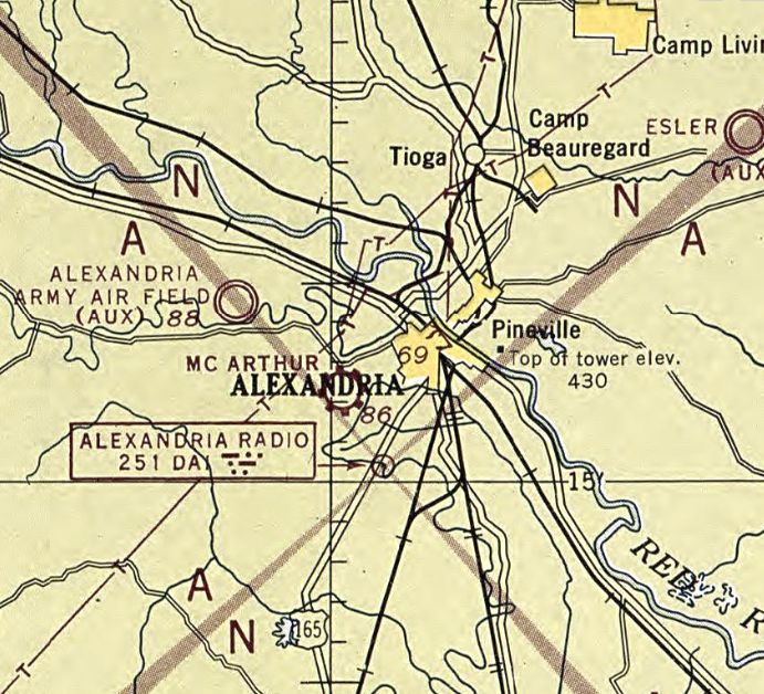
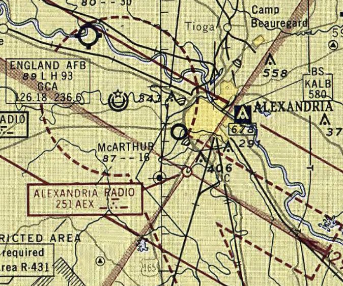
McArthur Airport, as depicted on the July 1946 Beaumont Sectional Chart.
McArthur Airport was evidently established at some point between 1945-46
(like hundreds of other small airports in the American post-WW2 aviation boom),
as it was not yet depicted on the 1945 Beaumont Sectional Chart.
The earliest depiction which has been located of McArthur Airport was on the July 1946 Beaumont Sectional Chart.
It depicted McArthur as a commercial/municipal airport.
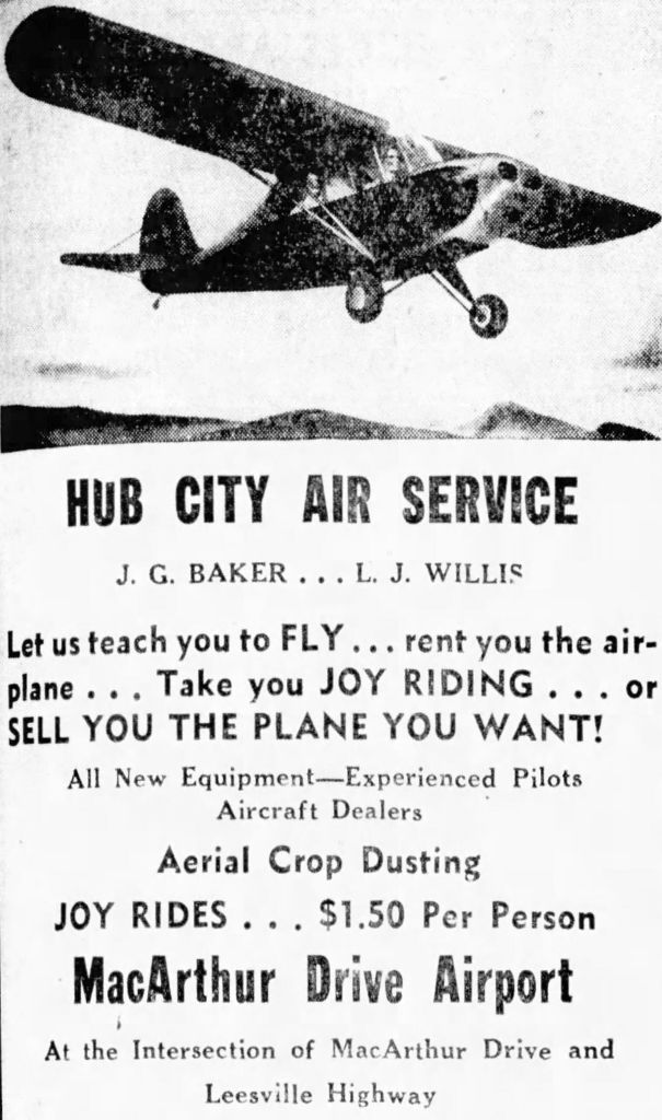
An advertisement for Hub City Air Service at McArthur Drive Airport, from the 7/19/46 Town Talk (courtesy of Lee Corbin)
offered crop dusting, flight instruction, aircraft rental, and joy rides.
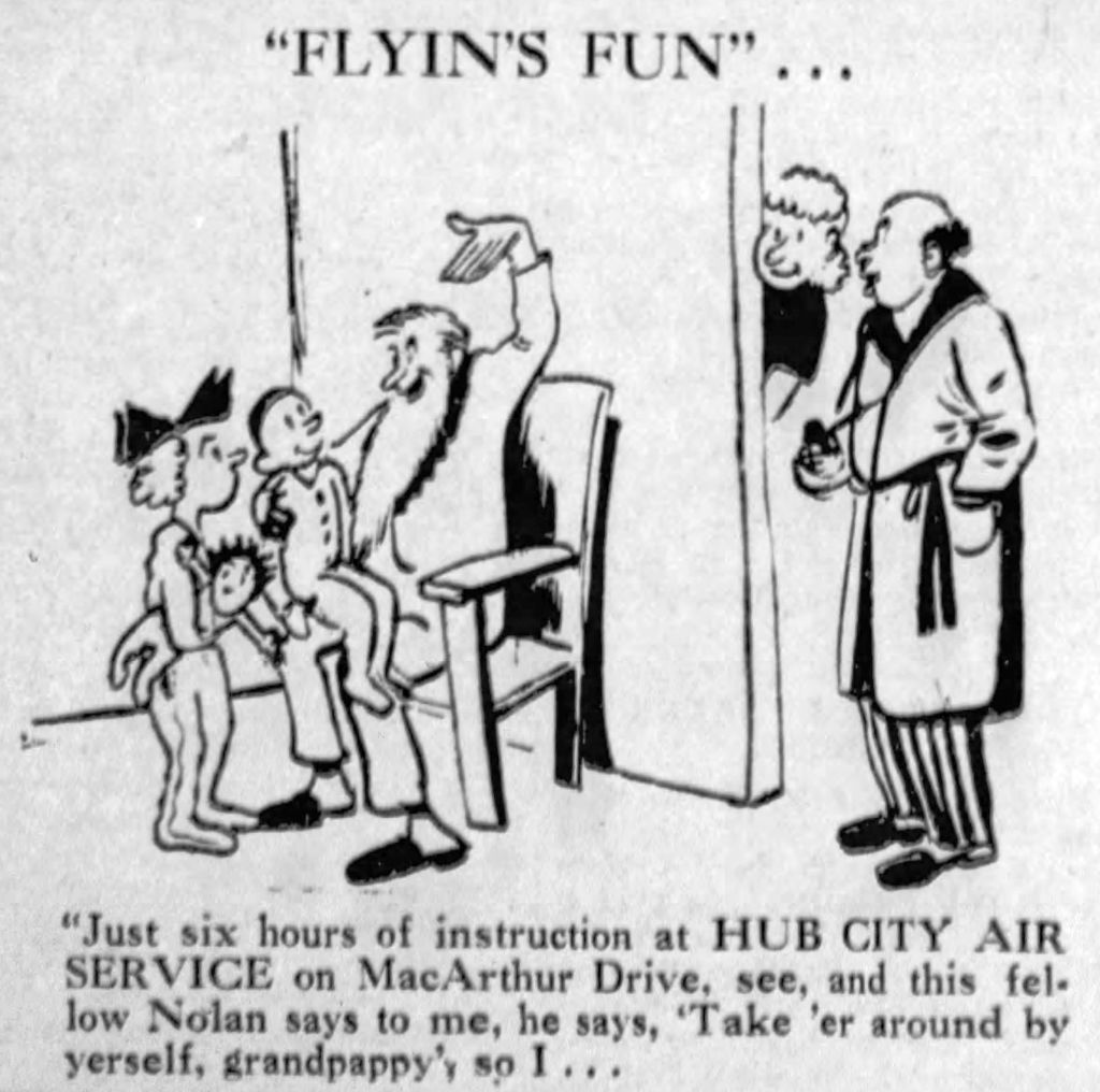
A fanciful advertisement for Hub City Air Service at McArthur Drive Airport, from the 5/15/48 Town Talk (courtesy of Lee Corbin).
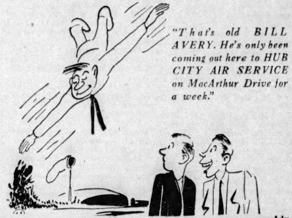
A fanciful advertisement for Hub City Air Service at McArthur Drive Airport, from the 6/11/48 Town Talk (courtesy of Lee Corbin).
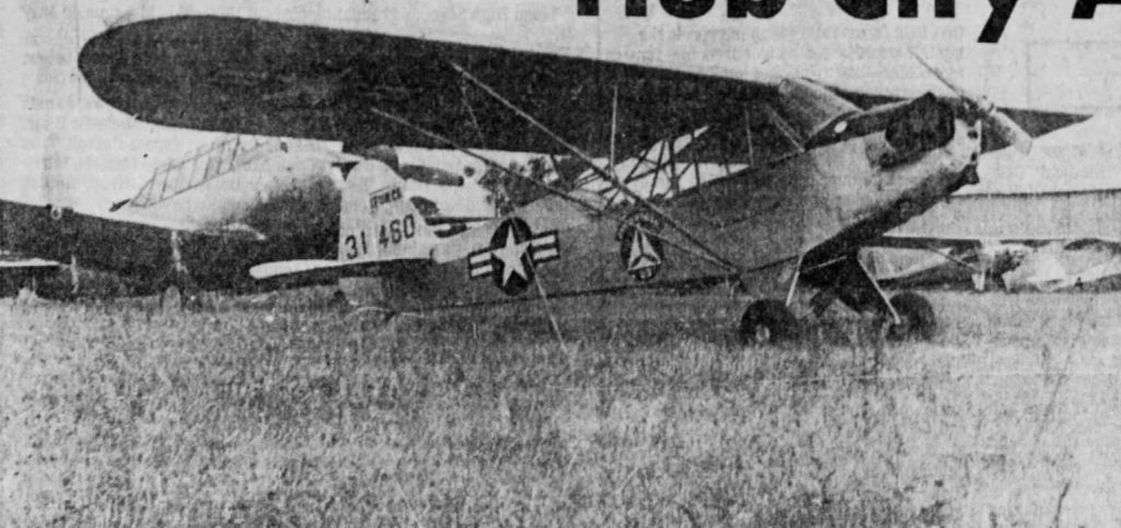
A 1949 photo by P.D. White of a Civil Air Patrol Piper L-4 Cub at Hub City Air Service at McArthur Drive Airport (courtesy of Lee Corbin).
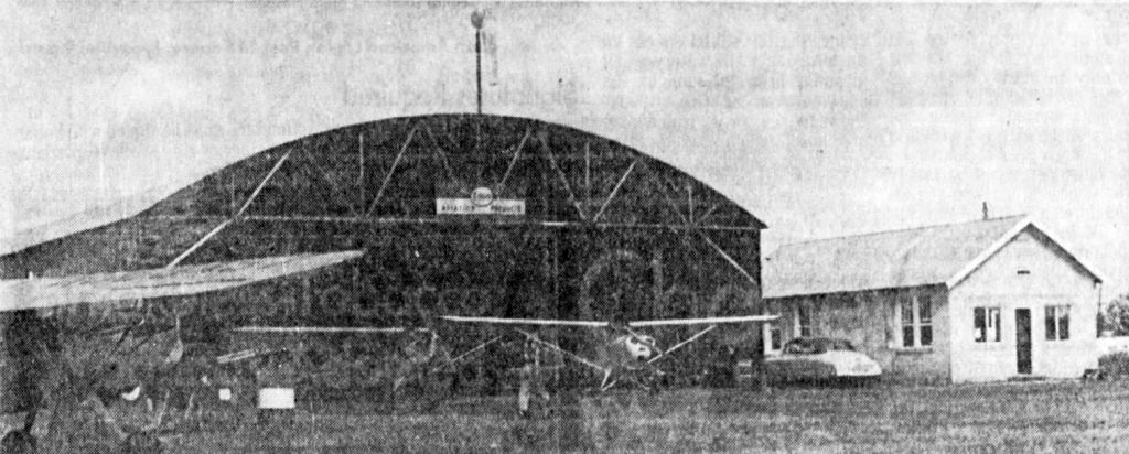
A 1949 photo by P.D. White of the Hub City Air Service hangar & office at McArthur Drive Airport (courtesy of Lee Corbin).
The earliest topo map depiction which has been located of McArthur Airport was on the 1955 USGS topo map.
The earliest aerial photo which has been located of McArthur Airport was a 3/8/55 USGS aerial view (courtesy of Lee Corbin).
It depicted McArthur as having 2 grass runways, with 4 light aircraft & some small buildings on the north side.
The last photo which has been located showing McArthur Airport in operation was a 1956 aerial view,
which showed 11 light aircraft parked on the north side.

An advertisement for Red River Air Service (“Formerly Hub City Airport on McArthur Drive”) from the 7/18/58 Town Talk (courtesy of Lee Corbin) offered dusting & spraying.
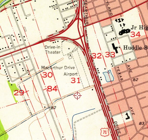
The last topo map depiction which has been located of McArthur Airport was on the 1958 USGS topo map.
It depicted McArthur Drive Airport as having a single unpaved northwest/southeast runway, with 2 small buildings on the northwest side.
The last aeronautical chart depiction which has been located of McArthur Airport was on the March 1959 Beaumont Sectional Chart.
It depicted McArthur as having a mere 1,600' unpaved runway.
McArthur Airport was evidently closed (for reasons unknown) at some point in 1959,
as it was no longer depicted on the August 1959 Beaumont Sectional Chart.
A 1962 aerial view showed the McArthur Airport hangar remained, but a commercial building had covered the middle of the former airfield.
The last depiction which has been located of McArthur Drive Airport was on the 1965 USGS topo map,
which continued to depict it in an unchanged fashion.
The 1974 USGS topo map no longer depicted McArthur Airport, instead showing streets & buildings having replaced it.
The former McArthur Airport hangar remained intact in a 1971 aerial photo.
A 1981 aerial photo showed a new larger building had been built onto the northeast side of the former McArthur Airport hangar.
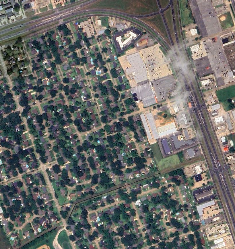
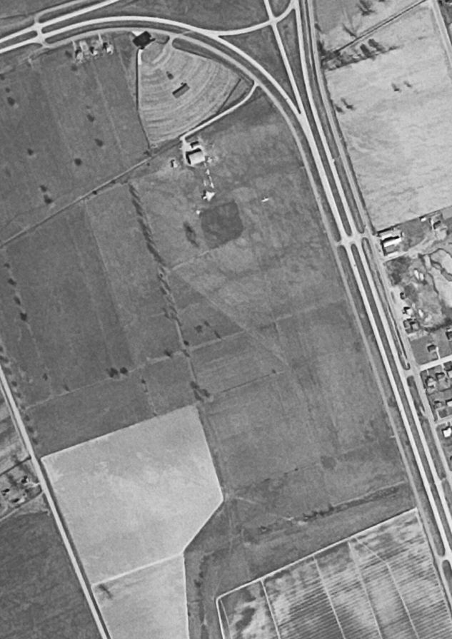
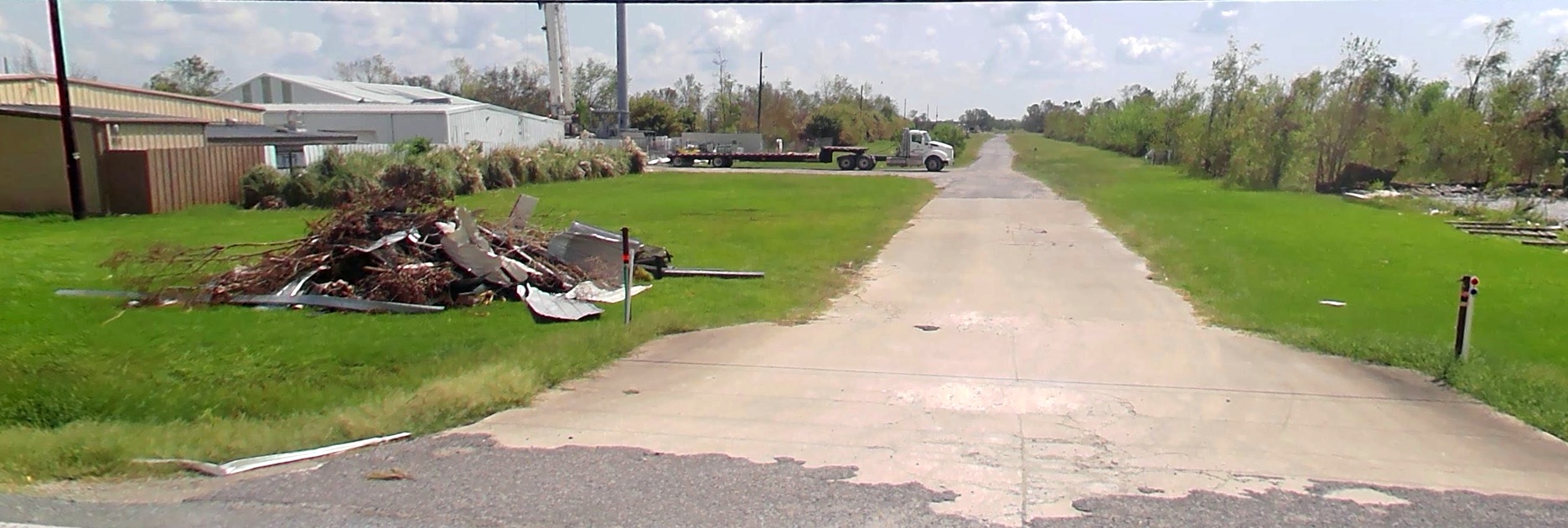
A 2023 aerial view of the McArthur Airport site, showing the Super1 Foods building on the northeast side, which still incorporates the former hangar on its back end.

A 2025 photo looking southwest at the McArthur Airport site, showing the Super1 Foods building, which still incorporates the former hangar on its back end.
____________________________________________________
Gerstner Field, Lake Charles, LA
30.116, -93.079 (West of New Orleans, LA)
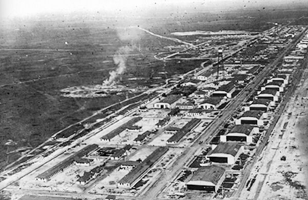
A 1918 aerial view looking southeast at the extensive hangars & other buildings at Gerstner Field.
According to Wikipedia, Gerstner Field was one of 32 Air Service training camps established in 1917 after the United States entry into World War I.
Gerstner Field was named for 2nd Lieutenant Fredrick Gerstner, who died in a 12/31/14 airplane crash.
He was killed when his plane crashed into the Pacific Ocean near Oceanside CA, drowning while participating as a passenger in the annual Mackay Trophy contest.
Beginning in June 1917, Lake Charles had tried to acquire an Army training camp, but the Army rejected the area as too flat for training foot soldiers.
Nevertheless, local officials continued to lobby for a military facility in the area to support the war effort.
In August 1917, they successfully convinced the Air Service to establish a flying training field.
The airfield was located 11 miles southeast of Lake Charles & consisted of 2 separate facilities.
The base was quite large, containing 24 hangars, 12 barracks for enlisted men, 12 buildings to house officers, 12 mess halls, 4 large warehouses, and numerous workshops & offices.
All buildings were painted green with white trimming.
The base was intended for 2,000 men, but reached a maximum of almost 3,000, requiring tents & improvised messes to accommodate them.
The first troops arrived in November 1917, before construction was completed.
Guards from the MS National Guard were followed by airmen & equipment from Chandler Field in Essington PA.
The first unit stationed there was the 45th Aero Squadron, which was transferred from Essington.
Some Curtiss JN-4 Jennys to be used for flight training were ferried into Gerstner from Kelly Field San Antonio TX,
however most of the planes to be used for flight training were shipped in wooden crates by railcar.
Training units assigned to Gerstner Field were: Post Headquarters, Gerstner Field - December 1919,
45th Aero Squadron (II), November 1917, Re-designated as Squadron "A", July - November 1918,
63rd Aero Squadron (II), April 1918, Re-designated as Squadron "B", July - November 1918,
64th Aero Squadron (II), April 1918, Re-designated as Squadron "C", July - November 1918,
75th Aero Squadron (II), March 1918, Re-designated as Squadron "D", July – November 1918,
143rd Aero Squadron (Service), November, 1917, Re-designated as Squadron "E", July–November 1918,
195th Aero Squadron, December 1917, Re-designated as Squadron "F", July – November 1918,
196th Aero Squadron, December 1917, Re-designated as Squadron "G", July – November 1918,
Squadron "H", July–September 1918,
Flying School Detachment (Consolidation of Squadrons A-F), November 1918 - November 1919.
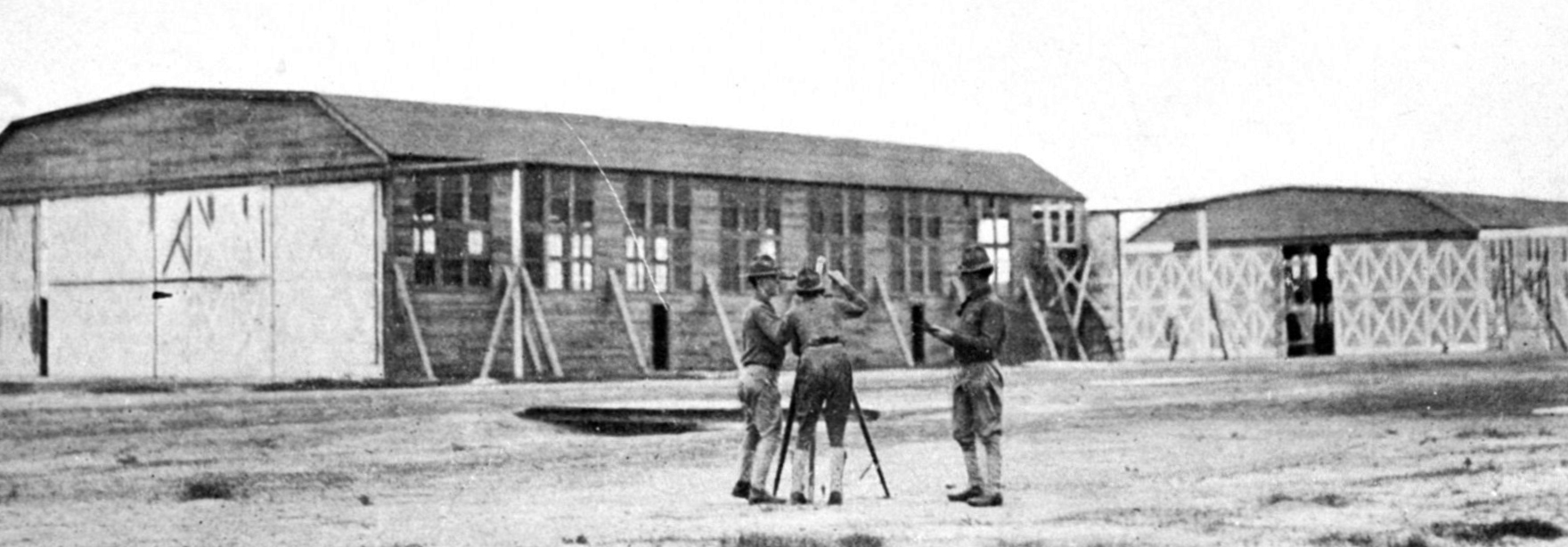
A 1918 photo of Army personnel making a reading at the end of the first minute of a pilot-balloon run in front of the Gerstner Field hangars.
Gerstner Field flight operations suffered tremendously from blowing sand that hampered flying & destroyed airplane engines.
A chronic lack of spare engines & parts prevented many repairs, thus leaving men idle and, at one time, as many as 2/3 of the camp's airplanes out of commission.
Sanitary conditions were probably never very good. The sewerage system was inadequate & drainage was poor.
The field was somewhat lumpy, so good landing spots were hard to find, and a severe mosquito problem made life at the base frequently unbearable.
Flying instruction was good, but the airplanes used to train pursuit pilots proved inadequate for truly valuable combat training.
The school for training flight instructors worked impressively well. The bureaucracy had some problems, but the base was usually well-managed.
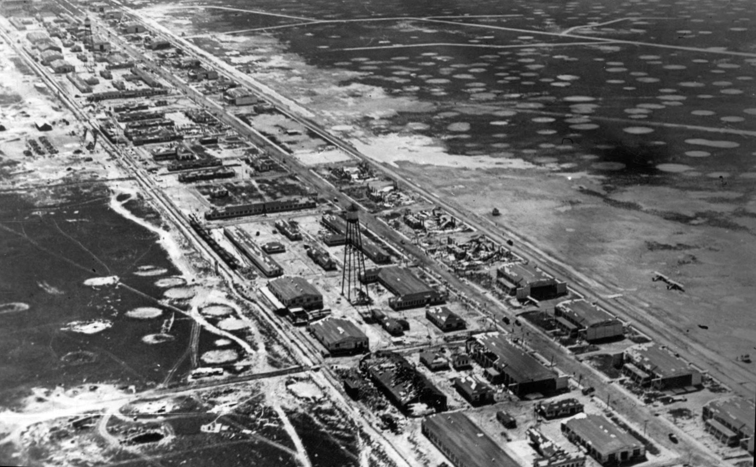
A circa 1918 aerial view looking southwest at the extensive hangars & other buildings at Gerstner Field, with only 2 planes visible on the field.
Gerstner Field suffered 2 incidents of massive destruction in its history.
The first occurred on 2/5/18 when a German submarine sunk the Tuscania, a British troopship, off the coast of Ireland.
Among the dead were 27 men of the 158th Aero Squadron. They had trained at Gerstner Field & had left the base less than 4 weeks before.
The second came from a hurricane that struck Southwest Louisiana on 8/6/18.
The storm killed 3 & injured 8 at the field & destroyed 96 planes.
The only building to survive at the Big Lake gunnery school was the mess hall, which was used as a temporary hospital.
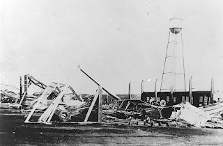
An undated photo of the wreckage at Gerstner Field, presumably from the 8/6/18 hurricane.
With the sudden end of World War I in November 1918, the future operational status of Gerstner Field was unknown.
Many local officials speculated that the U.S. government would keep the field open because of the outstanding combat record established by Gerstner-trained pilots in Europe.
Cadets in flight training on 11/11/18 were allowed to complete their training, however no new cadets were assigned to the base.
Also the separate training squadrons were consolidated into a single Flying School detachment, as many of the personnel assigned were being demobilized.
Finally, flight training activities ceased on 11/8/19.
In December 1919 Gerstner Field was deactivated as an active duty airfield, and a small caretaker unit was assigned to the facility for administrative reasons.
But by 1921, the decision had been made to phase down all activities at the base in accordance with sharply reduced military budgets & it was closed.
The War Department had ordered the small caretaker force at Gerstner Field to dismantle all remaining structures & to sell them as surplus,
and Gerstner never was used again as a civil airport or a military airfield.
Gerstner Field was not depicted on the 1932 USGS topo map.
A 1933 aerial view showed the row of foundations of 24 hangars & numerous other buildings.
Gerstner Field was not depicted on the December 1935 Beaumont Sectional Chart.
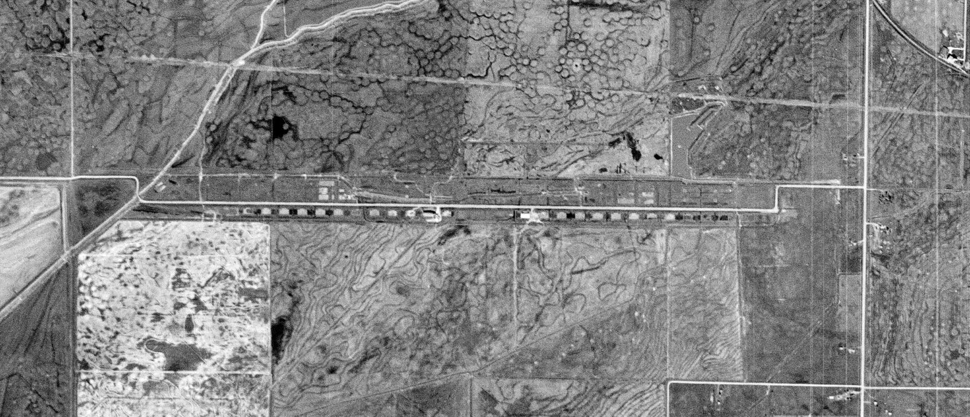
A 3/24/52 USGS aerial view showed the row of foundations of at least 20 hangars & numerous other buildings, along what is today Old Camp Road.
At least one hangar foundation still had a building on top of it, possibly a farm building added after the hangars had been removed.
A 1983 aerial view showed the last building remained standing on one of the Gerstner Field hangar foundations.
A 1998 aerial view showed the building had been removed from the Gerstner Field hangar foundation at some point between 1983-98.
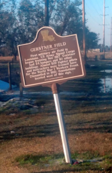
A 2/15/21 photo by Rex Ricks of the historical plaque commemorating Gerstner Field which sits askance.
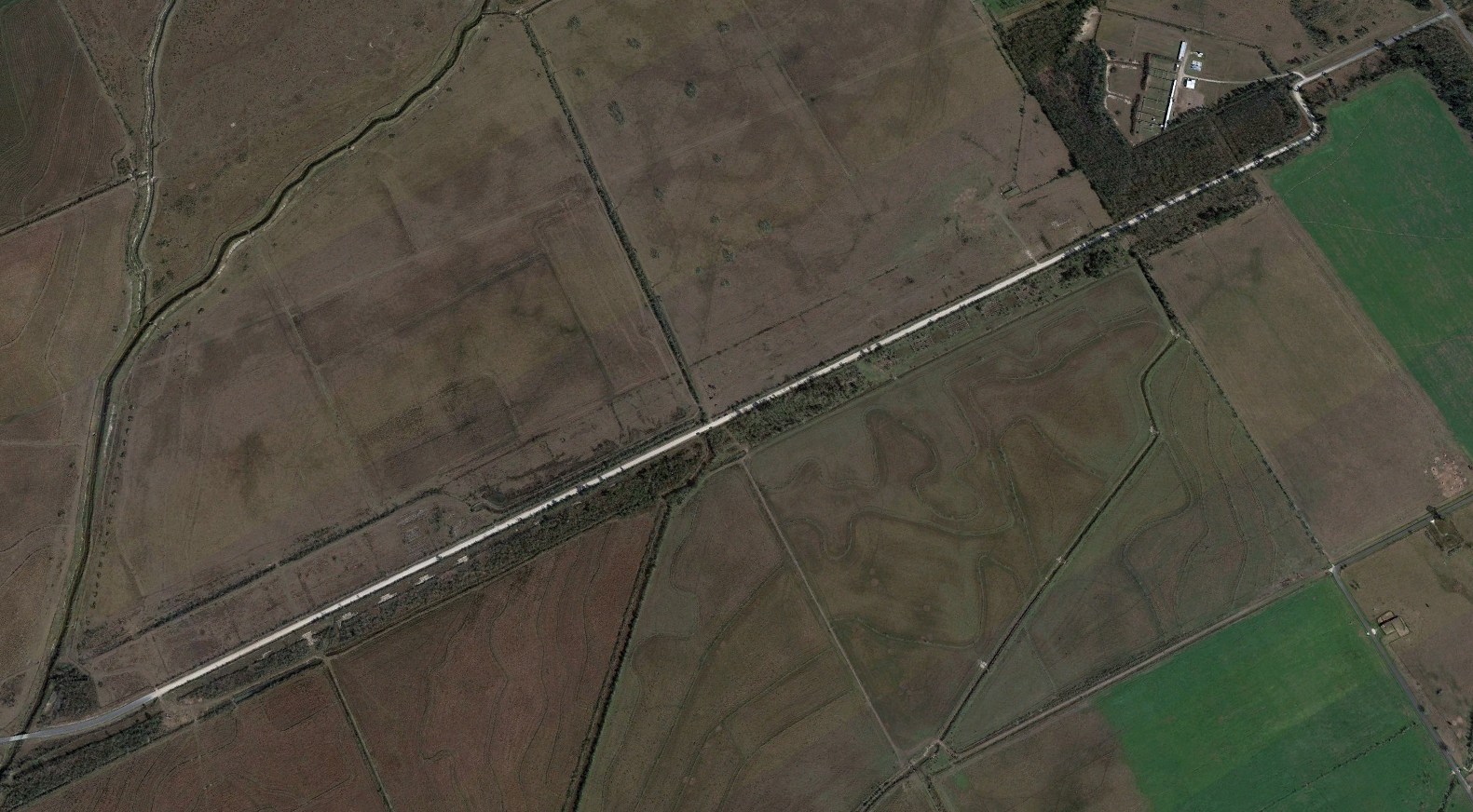
A 2022 aerial view looking northeast showing the row of Gerstner Field hangar foundations which remain along Old Camp Road.
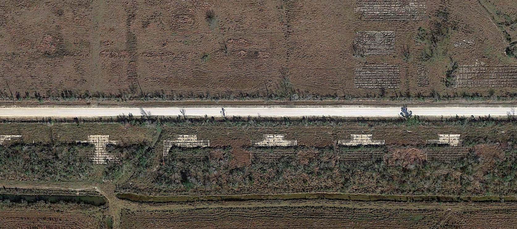
A 2022 aerial view of the row of Gerstner Field hangar foundations which remain along Old Camp Road, nearly a century since the airfield was abandoned.

A 2024 photo looking south at one of the century-old remains of Gerstner Field hangar foundations which remain along Old Camp Road.
Thanks to Rex Ricks for pointing out this airfield.
____________________________________________________
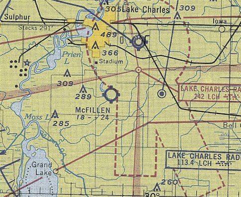
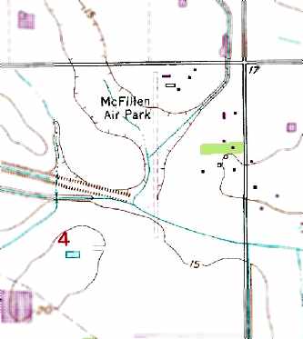
McFillen Airpark, Lake Charles, LA
30.138, -93.185 (West of New Orleans, LA)
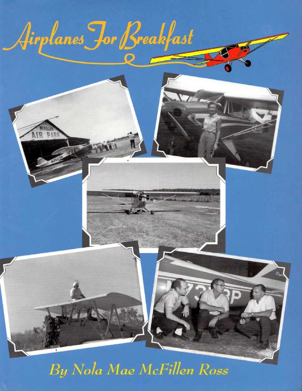
Scenes of McFillen Airpark on the cover of Nola Mae McFillen Ross's book “Airplanes For Breakfast”.
According to airport founder Nola Mae McFillen Ross's book “Airplanes For Breakfast”,
McFillen Airpark was built between 1943-45.
However, McFillen Airpark was not yet depicted on the August 1950 New Orleans Sectional Chart nor on the February 1955 Beaumont Sectional Chart.
The earliest topo map depiction which has been located of McFillen Airpark was on the 1955 USGS topo map.
It depicted McFillen as having 3 unpaved runways, the longest being an east/west strip along the northern boundary of the property,
and 4 small buildings on the northeast side.
The earliest aeronautical chart depiction which has been located of McFillen Airpark was on the September 1956 New Orleans Sectional Chart (courtesy of Ron Plante).
It depicted McFillen as having a 2,400' unpaved runway.
Joe Sasser recalled, “When I was 24 years old, I learned to fly in 1966 at the McFillen Airport.”
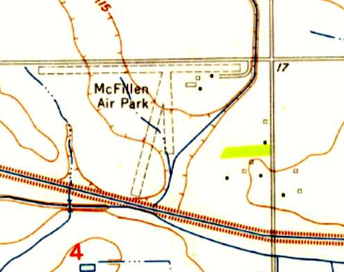
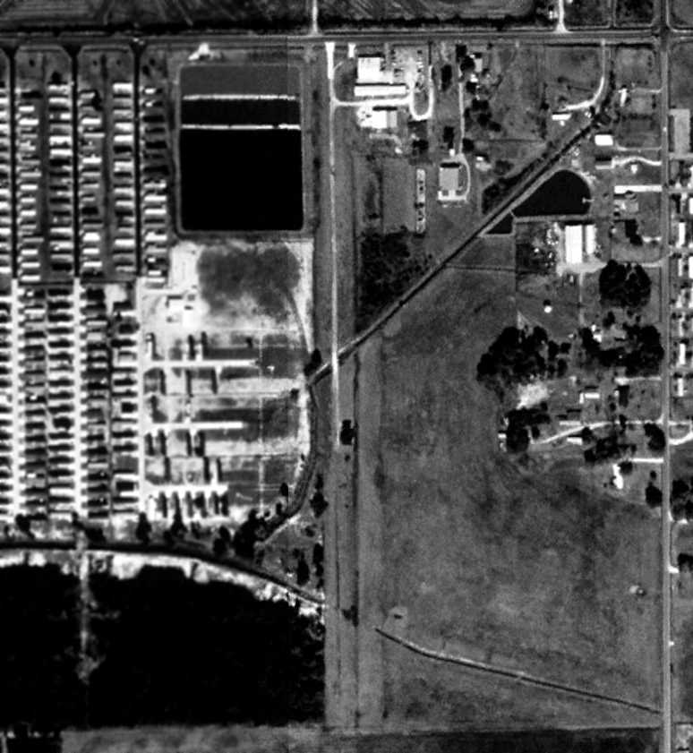
The earliest aerial photo which has been located of McFillen Airpark was an 11/25/67 USGS aerial view.
It depicted McFillen as having a very different runway configuration compared to the 1955 USGS topo map,
with the previous 3 runways replaced by one unpaved north/south strip.
Four light single-engine planes were visible near a few small buildings on the northeast side.
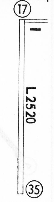
The 1968 Flight Guide (courtesy of Robert Levittan) depicted McFillen Air Park as having a single unpaved 2,520' Runway 17/35,
with 1 small building on the northeast corner of the field.
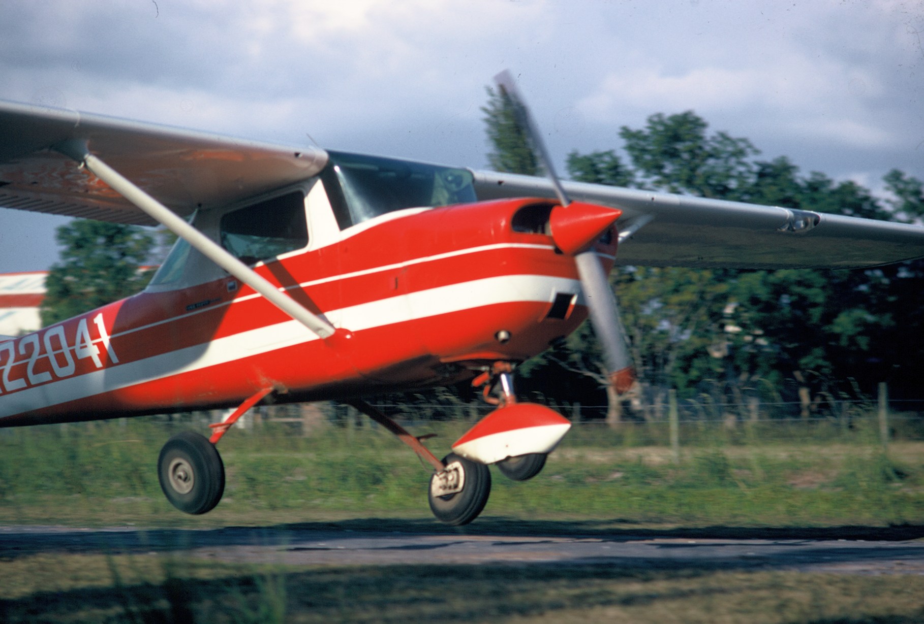
The last photos which have been located showing an aircraft at McFillen Airpark were a pair of 9/22/68 photos by Rick Craddock of a Cessna 150H making a practice landing.
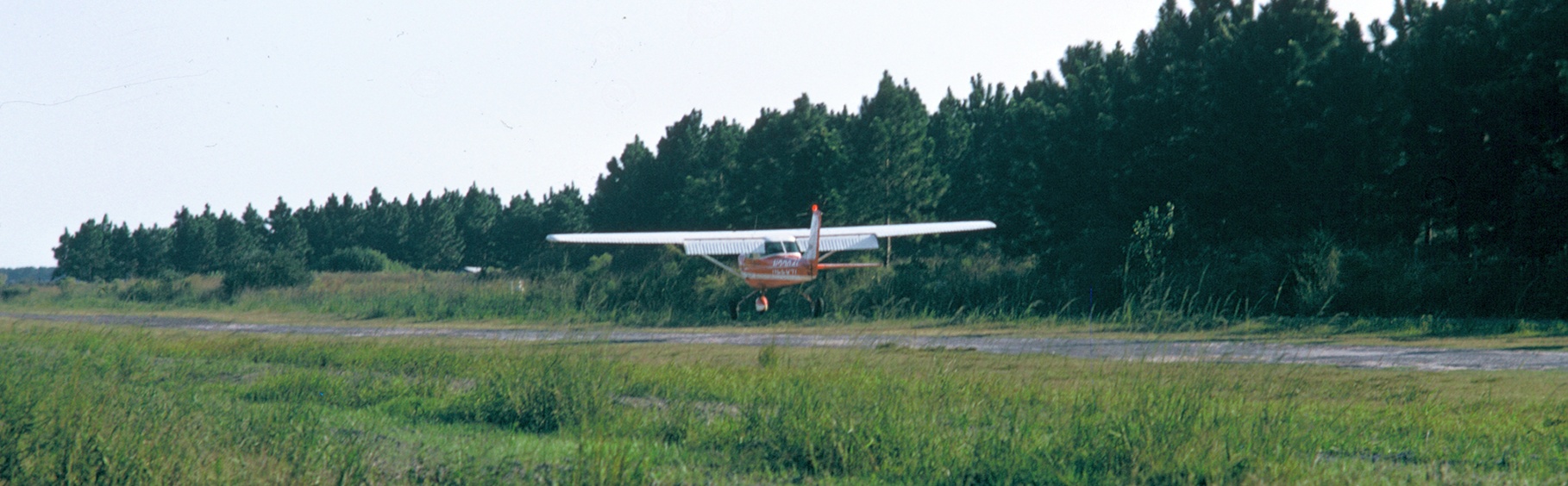
A 9/22/68 photo by Rick Craddock of a Cessna 150H making a practice landing at McFillen Airpark.
McFillen had evidently gained a paved runway at some point between 1968-75,
as the February 1975 Houston Sectional Chart depicted it as having a single 2,200' paved north/south runway.
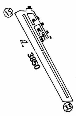
The 1980 USGS topo map still depicted McFillen as having 3 unpaved runways.
The last aeronautical chart depiction which has been located of McFillen Airpark was on the 1985 New Orleans Sectional Chart.
It depicted McFillen as having a single 2,600' paved north/south runway.
Nola Mae McFillen Ross wrote in her book “Airplanes For Breakfast”,
“Problems with product liability, followed by lawsuits became unbelievable.
The new breed of pilots seemed to have been educated in filing lawsuits.
We were among those at the wrong end of a lawsuit, though not our fault.
It contributed greatly toward our going out of business.
The bottom fell out of the business & at the same time I was discovering that Ross was rapidly rolling into an Alzheimer world.
So on 12/31/85 I closed the doors for the last time on a business that had grown
from a little J3 Cub to a million dollar Cheyenne & affected thousands of lives in Louisiana.”
The 1990 USGS topo map depicted McFillen Air Park as having a single unpaved north/south runway.
The 1996 USGS topo map depicted McFillen Air Park as having a single unpaved north/south runway,
with 5 small buildings on the northeast corner of the field.
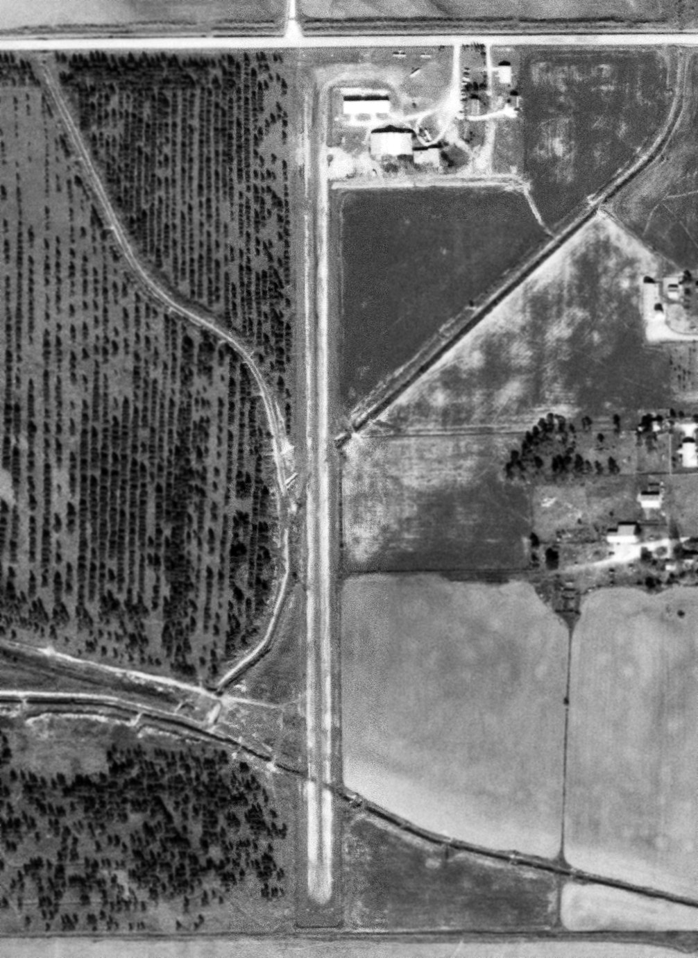
The 1998 USGS aerial view still showed the remains of the whole length of the McFillen runway,
and also showed the hangars remained standing, although commercial buildings had been added to the site.
The March 1999 Houston Sectional Chart (courtesy of Ron Plante) depicted McFillen Air Park as an abandoned airfield.
In 2000 Nola Mae McFillen Ross wrote in her book “Airplanes For Breakfast”,
“Today the old airport is the home of an automobile shop & an oilfield tool company.
One hangar, the first we ever built, still has the name McFillen Air Park written on the front, faded but still alive as if testifying to better days.”
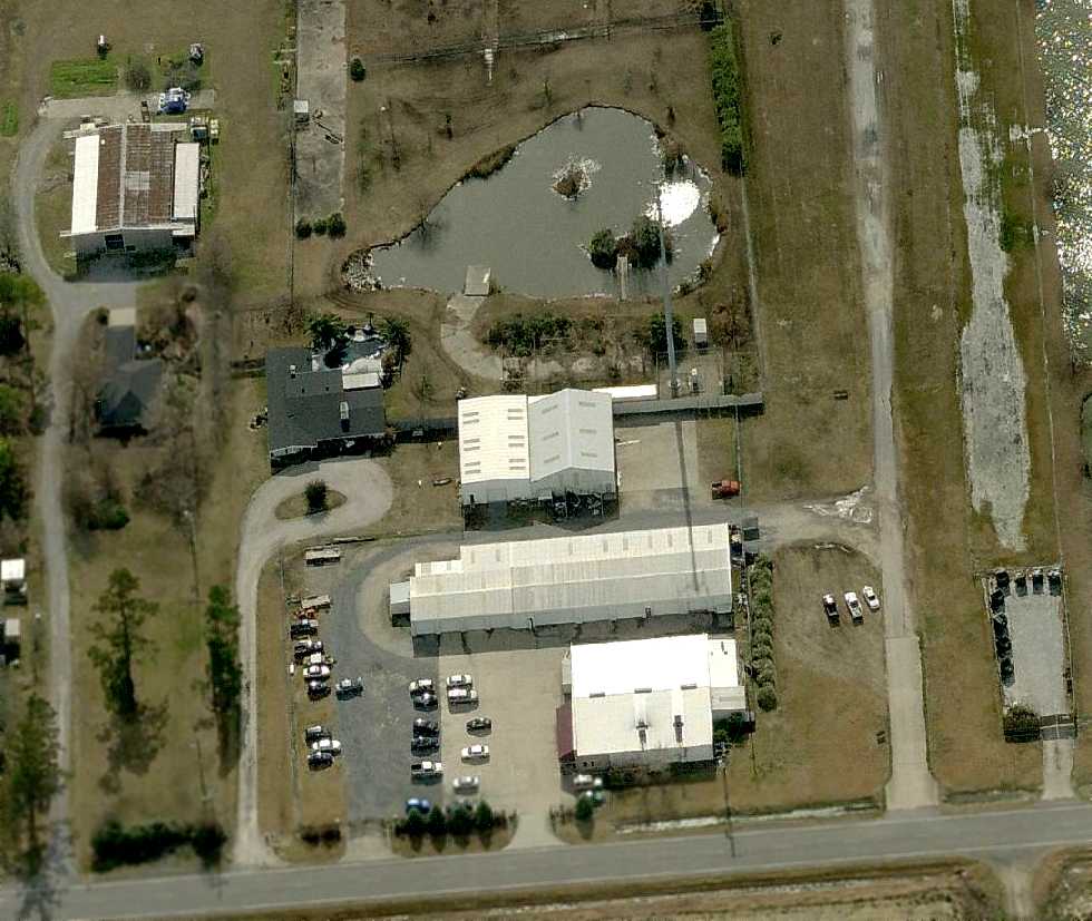
A circa 2010 aerial view looking south showed the remains of the McFillen runway, along with the hangars that remained standing.
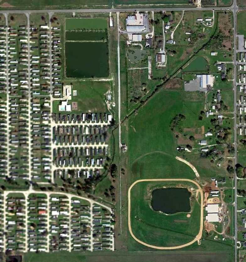
A 3/4/12 aerial view showed the remains of the McFillen runway, along with the hangars that remained standing.
A September 2020 photo looking south at the former McFillen Airpark hangars & runway.
The site of McFillen Airpark is located southwest of the intersection of Gauthier Road & Tom Hebert Road.
____________________________________________________
Lake Charles Airport / Louisiana Flyers Airport / East Lake Charles Airport (4R5), Lake Charles, LA
30.22, -93.14 (West of New Orleans, LA)
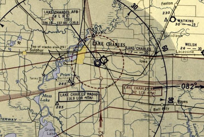
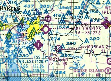
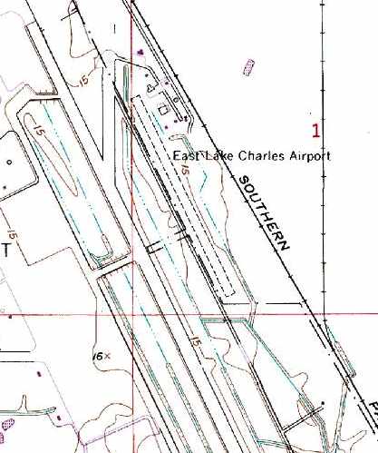
Lake Charles Airport, as depicted on the February 1953 Beaumont Sectional Chart.
This little grass airfield coexisted with the much-larger Lake Charles AFB / Chenault AFB
which was located directly adjacent to it to the west.
Various incarnations of a Lake Charles Airport & Lake Charles AAF existed to the west side of this property since the 1930s.
At some point after WW2, a single grass runway was constructed on the east side of the much-larger military field.
The little Lake Charles Airport to the east of Lake Charles AFB was not yet depicted on the August 1952 Beaumont Sectional Chart.
The earliest depiction which has been located of this airfield was on the February 1953 Beaumont Sectional Chart.
It depicted Lake Charles Airport as having a 3,000' unpaved runway.
The larger Lake Charles AFB was depicted adjacent to the west.
The 1953 Aviation Week Airport Directory (courtesy of David Brooks)
described the “Lake Charles Airport” as a municipal field with a 3,000' unpaved runway.
The remarks said “Use with caution when wet. If unusable use Lake Charles AFB with fee.”
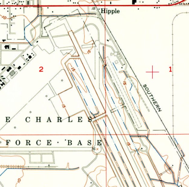
The 1955 USGS topo map depicted the single unpaved northwest/southeast runway of East Lake Charles Airport,
immediately adjacent to the northeast side of the Lake Charles AFB paved runway, but did not label it.
Lawrence Dugas recalled, “I learned to fly on the grass strip in Lake Charles in 1957.
I was stationed at Chennault AFB until 1960. There was a flying club there for the men in the Air Force.
Louisiana Flyers operated there & Ray Lambert had a maintenance shop there
and did work for McFillian who was the Piper dealer & operated a Fixed Base Operator at South Lake Charles.
I worked as a mechanic helper with Ray for about 3 years.”
The earliest photo which has been located showing aircraft at East Lake Charles Airport was a 1957 aerial photo,
which depicted 8 light aircraft parked near a cluster of hangars, with a single unpaved northwest/southeast runway adjacent to the Air Force Base runway.
Louisiana Flyers Airport was not depicted on the February 1960 Beaumont Sectional Chart
nor listed among active airfields in the 1963 AOPA Airport Directory (according to Chris Kennedy).
The adjacent Chennault AFB was closed in 1963.
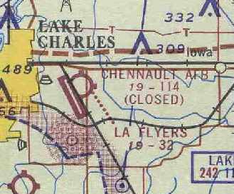
The Aerodromes table on the September 1964 Beaumont Sectional Chart (courtesy of Chris Kennedy)
described the Louisiana Flyers Airport as having a single 3,240' turf runway.
The adjacent Chenault AFB had been closed by that point.
It was apparently renamed "East Lake Charles" Airport at some point in the next 3 years,
as that is how it was listed in the 1967 AOPA Airport Directory (courtesy of Chris Kennedy).
It described the field as having a single 3,000' sod Runway 15/33,
and said that it was operated by Louisiana Flyers Inc. & Lambert Aircraft Service.
The field was said to offer charter, tiedowns, fuel, and repairs.
The only photo which is available showing aircraft at East Lake Charles Airport was a 12/3/67 USGS aerial photo,
which depicted one single-engine aircraft parked near the hangars.
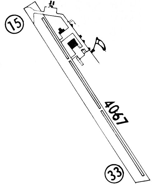
The 1968 Flight Guide (courtesy of Robert Levittan) depicted East Lake Charles as having a single unpaved 4,067' Runway 15/33.
A parallel taxiway on the east side led to a ramp at the northeast corner of the field with several small buildings.
Tim Bertrand recalled, “East Lake Charles Airport... I was a line boy there from 1972-78.
I learned to fly there & got my private, instrument, multi-engine & commercial ratings there.
It was named Louisiana Flyers flight school. There was also a crop-dusting company there which I also worked for named Louisiana Flyers.
The runway was actually 5,000' long'; I used to mow it. The south 2,000' were unusable a lot because it was low & stayed wet a lot.”
The February 1975 Houston Sectional Chart depicted East Lake Charles Airport having a 3,800' unpaved runway.
The runway at East Lake Charles has apparently been lengthened somewhat at some point within the next 12 years,
as the 1979 Flight Guide (courtesy of Chris Kennedy) depicted the field as having a single 3,850' Runway 15/33.
A parallel taxiway on the east side led to a ramp at the northeast corner of the field, with a total of 9 small buildings (hangars?).
Tim Bertrand recalled, “The businesses left there in approximately 1980-82.
The parish took it over but continued leasing hangar space to people with airplanes.”
East Lake Charles was still listed as an active airport in the 1982 AOPA Airport Directory (courtesy of Ed Drury).
The last aeronautical chart depiction of East Lake Charles Airport which has been located
was on the 1985 LA Aeronautical Chart (courtesy of Jed Keck).
It depicted East Lake Charles as having a 3,800' unpaved runway.
Tim Bertrand recalled, “I kept my airplane, Rans S7 there from 1995-98, for a $25/month charge.”
The 1996 USGS topo map still depicted East Lake Charles Airport, adjacent to the runway of the reopened Chenault Field,
but that does not necessarily indicate it was still open at that point.
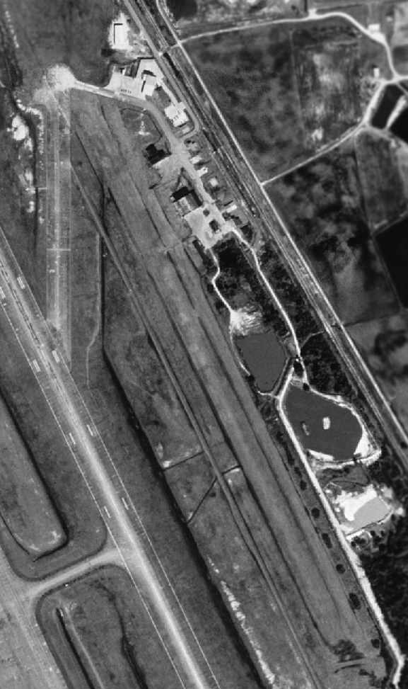
As seen in the 1998 USGS aerial photo, the grass runway of East Lake Charles Airport still remained intact,
as well as the group of small hangars at the northeast corner of the field.
But there was no indication that the field was still open at that point.
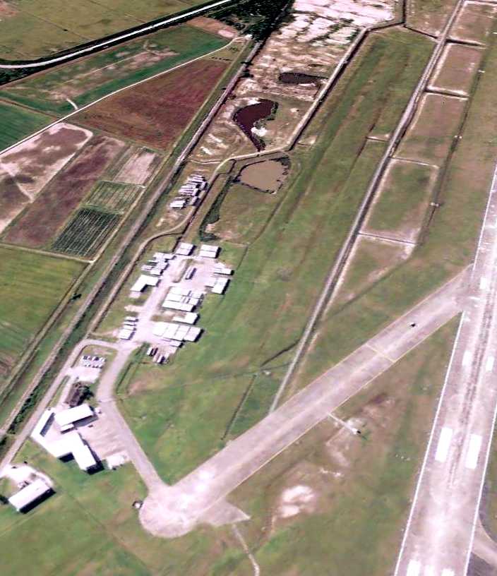
Tim Bertrand recalled, “After 1998 they slowly moved everyone out, demolished the hangars & later the runway, and used it for parish operations.
I literally cried when that happened - I had grew up at that little airport & it meant a lot to me.”
The March 1999 Houston Sectional Chart (courtesy of Ron Plante) no longer depicted East Lake Charles Airport.
The East Lake Charles Airport was no longer listed among active airfields in the 2000 AOPA Airport Directory.
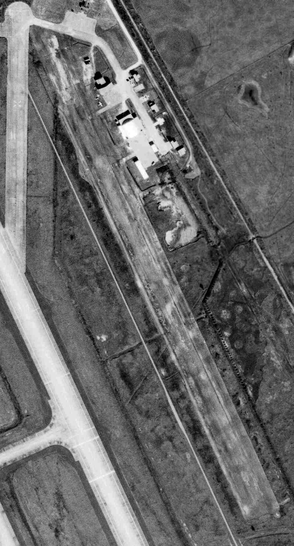
A 5/18/09 aerial view looking southeast showed the grass runway of East Lake Charles Airport still remained intact.
It appeared as if at least one of the former hangars remained standing, while others had been removed, with their locations used to store trailers.
The site of East Lake Charles Airport is located east of Chenault Field's main runway, and west of the Southern Pacific Railroad tracks.
____________________________________________________
Or if you prefer to contact me directly concerning a contribution (for a mailing address to send a check),
please contact me at: paulandterryfreeman@gmail.com
If you enjoy this web site, please support it with a financial contribution.
____________________________________________________
This site covers airfields in all 50 states.