Abandoned & Little-Known Airfields:
Louisiana: Baton Rouge area
© 2002, © 2023 by Paul Freeman. Revised 11/27/23.
This site covers airfields in all 50 states: Click here for the site's main menu.
____________________________________________________
Please consider a financial contribution to support the continued growth & operation of this site.
Babin Landing Strip (added 1/7/21) - Baton Rouge Municipal Airport / Downtown Airport (revised 11/27/23) - Iberia Parish Airport (added 3/18/17)
____________________________________________________
Babin Landing Strip, Gonzales, LA
30.279, -90.962 (Northwest of New Orleans, LA)
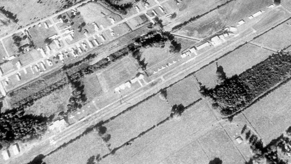
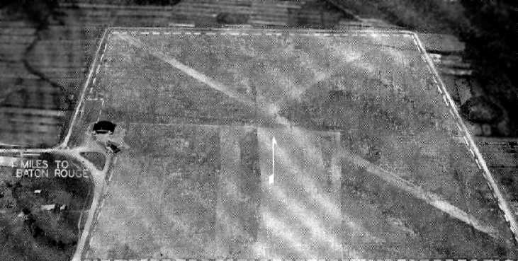
A 1989 aerial view looking northwest at Babin Landing Strip.
Yet another of America's many small grassroots airports swallowed by the never-ending demand for more suburban housing.
This small general aviation airport was evidently established at some point between 1971-81,
as it was not yet depicted on a 1962 aerial photo, the January 1971 New Orleans Sectional Chart (courtesy of Ron Plante), or the 1972 USGS topo map.
The 1981 USGS topo map depicted a single unpaved north/south road (what may have been an early depiction of the runway) with several small buildings along the west side,
but did not label the airfield.
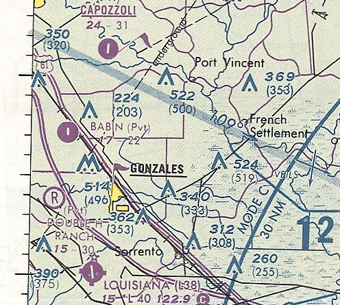
The earliest aeronautical chart depiction which has been located of Babin Landing Strip was on the December 1983 New Orleans Sectional Chart.
It depicted Babin as a private airfield having a 4,200' unpaved runway.
The earliest photo which has been located of Babin Landing Strip was a 1989 aerial view.
It depicted a single paved north/south runway, with a row of numerous small hangars & a dozen light single-engine aircraft on the west side.
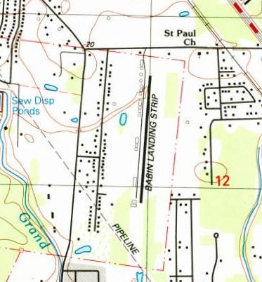
The earliest labeled depiction which has been located of Babin Landing Strip was on the 1991 USGS topo map.
It depicted Babin Landing Strip as having a single paved north/south runway, with a row of numerous small hangars on the west side.
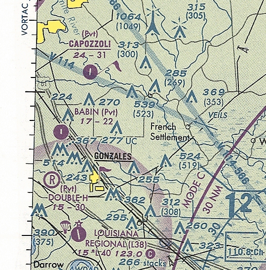
The earliest aeronautical chart depiction which is available of Babin Landing Strip was on the June 1993 New Orleans Sectional Chart (courtesy of Ron Plante).
It depicted Babin as a private airfield having a single paved north/south 2,200' runway.
Babin Landing Strip may have closed (for reasons unknown) by 1998,
as a 1998 aerial view showed the runway & hangars were still intact but the numerous aircraft seen parked outside on the 1989 photo were reduced to only a single aircraft.
The last aeronautical chart depiction which has been located of Babin Landing Strip was on the June 1999 New Orleans Sectional Chart (courtesy of Ron Plante).
It depicted Babin as a private airfield having a single paved north/south 2,200' runway.
Only 1 aircraft remained visible at Babin Landing Strip on a 2002 aerial photo.
A 2006 aerial photo showed that most of the Babin hangars had been removed, and there were no more aircraft on the field,
but the runway remained intact.
Babin Landing Strip was evidently by closed 2008, as it was no longer depicted on the June 2008 New Orleans Sectional Chart.
A 2008 aerial photo showed the Babin runway had been removed, a street (Caribbean Drive) had been built parallel to the west,
and a long pond had been built parallel to the east.
A 2007 photo showed houses had started to be built over the Babin Landing Strip site.
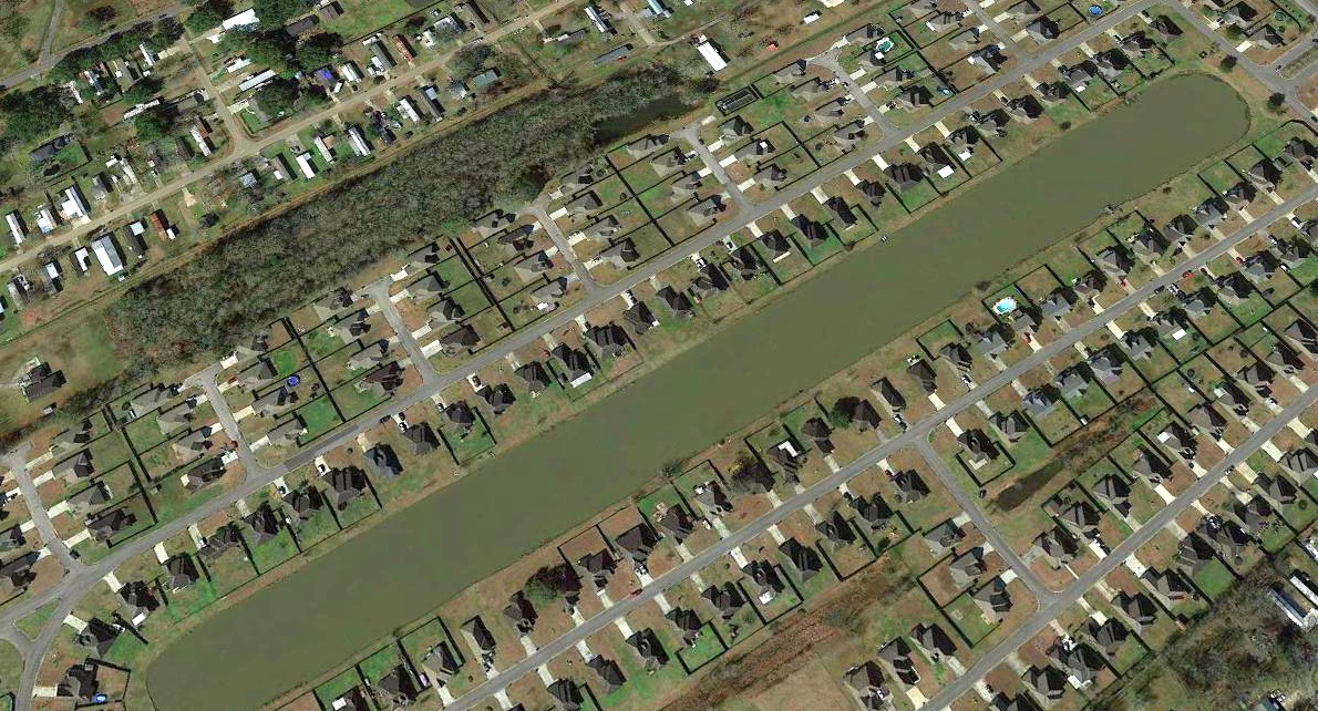
A 2019 aerial view looking northwest at the site of Babin Landing Strip, showing no trace remaining of the small airport.
Thanks to Lee Corbin for pointing out this airfield.
____________________________________________________
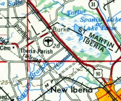
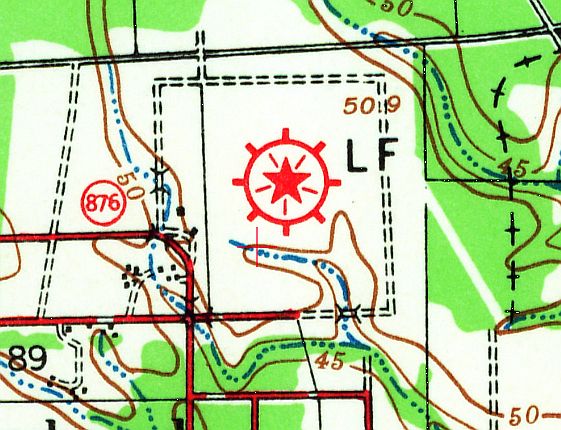
Iberia Parish Airport, New Iberia, LA
30.051, -91.882 (West of New Orleans, LA)

Iberia Parish Airport was depicted as an auxiliary airport on the 1944 New Orleans Sectional Chart.
Iberia Parish Airport was not yet depicted on the July 1942 New Orleans Sectional Chart.
According to the FAA, Iberia Parish Airport was activated in February 1944.
The earliest depiction which has been located of Iberia Parish Airport was on the 1944 New Orleans Sectional Chart,
which depicted it as an auxiliary airfield.
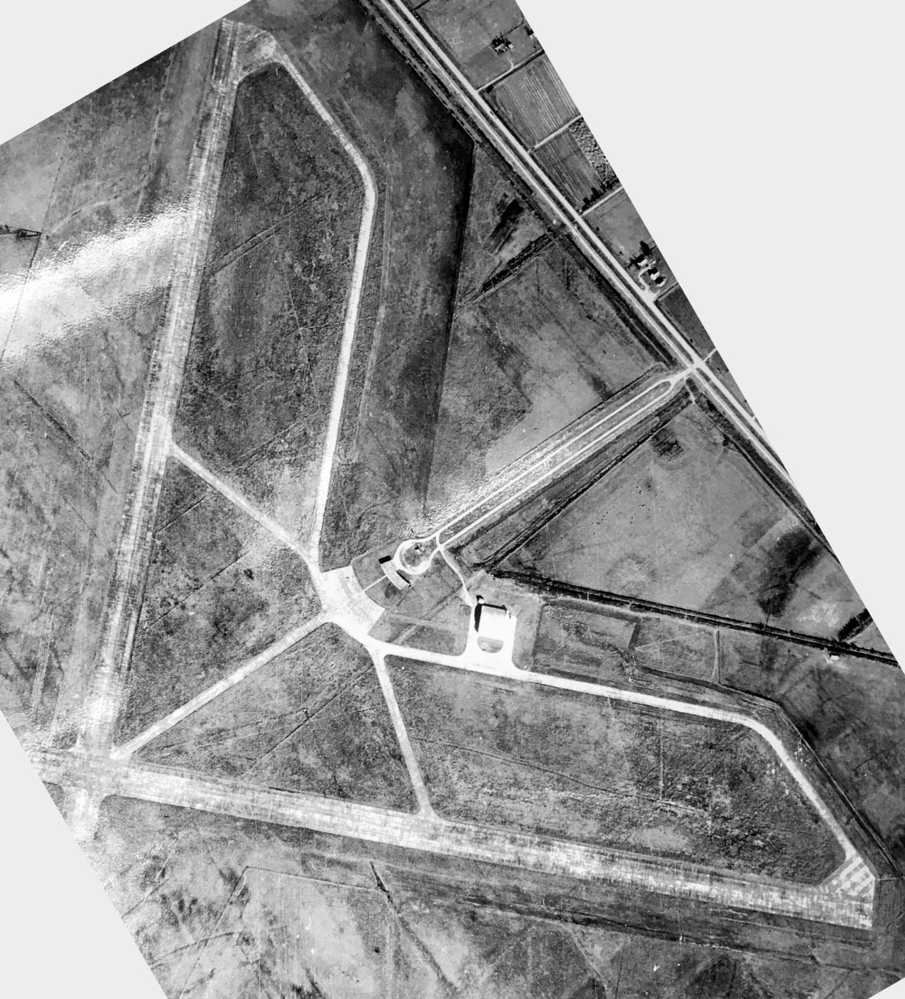
The earliest photo which has been located of Iberia Parish Airport was a 1/29/52 USGS aerial view.
It depicted Iberia Parish Airport as having 2 perpendicular paved runways, with a hangar & terminal building northeast of the runway interesection.
There were no aircraft visible on the field.
A 1955 aerial view of Iberia Parish Airport (photographed in 2017 by Thomas Marcotte in the Acadiana Regional Airport).
It depicted Iberia Parish Airport in the same fashion as the 1952 photo.
The last aeronautical chart depiction which has been located of Iberia Parish Airport was on the September 1956 New Orleans Sectional Chart,
which depicted Iberia Parish as having a 4,000' paved runway.
Iberia Parish Airport, as depicted on the 1956 USGS topo map.
According to Wikipedia, Naval Auxiliary Air Station New Iberia was established in 1960 adjacent to the south side of Iberia Parish Airport,
at which point the civilian airport presumably closed.
An 8,000' concrete runway was built for the NAAS, and the shorter runways of the civilian predecessor airport were evidently never reused as runways.
According to Thomas Marcotte, “The north end of the field was abandoned & used as roads & foundations.”
Iberia Parish Airport was no longer depicted on the October 1960 New Orleans Sectional Chart.
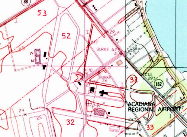
The abandoned runways of the former Iberia Parish Airport were still depicted on the 1983 USGS topo map.
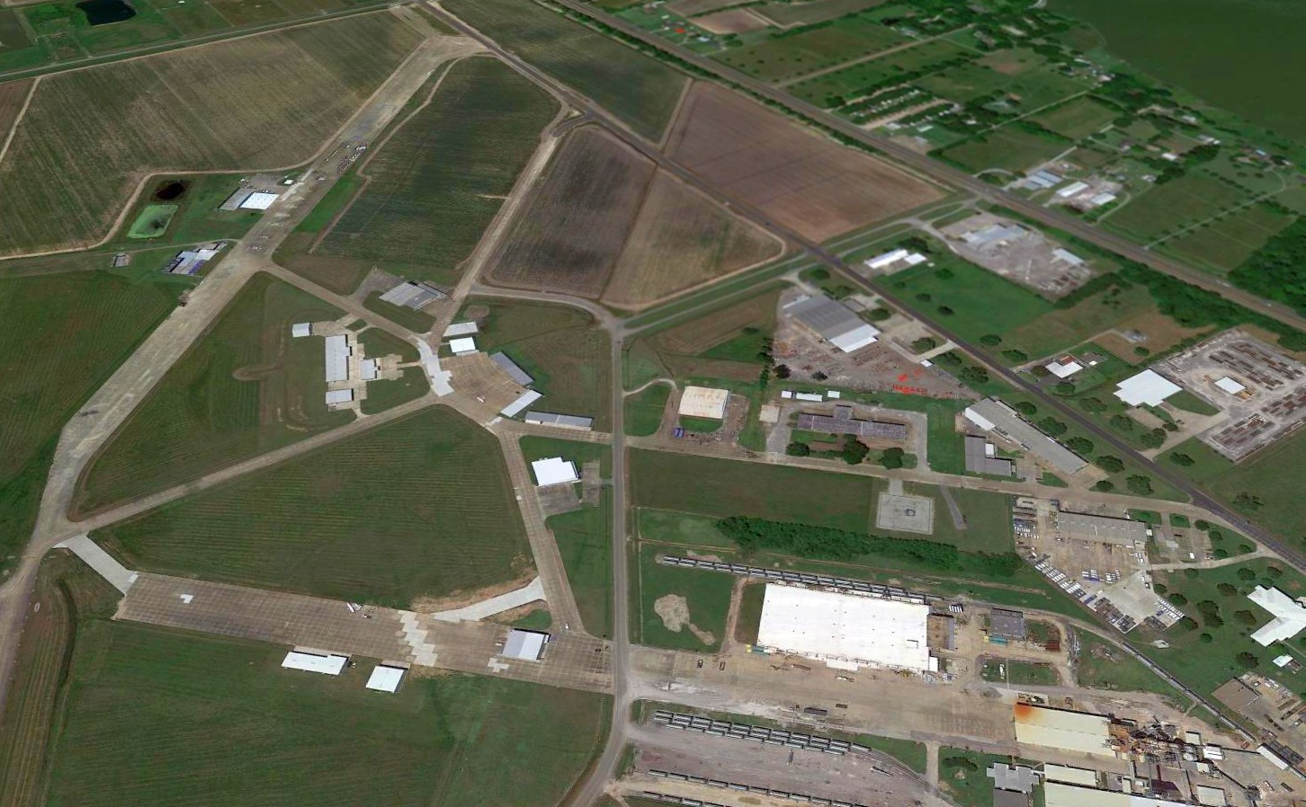
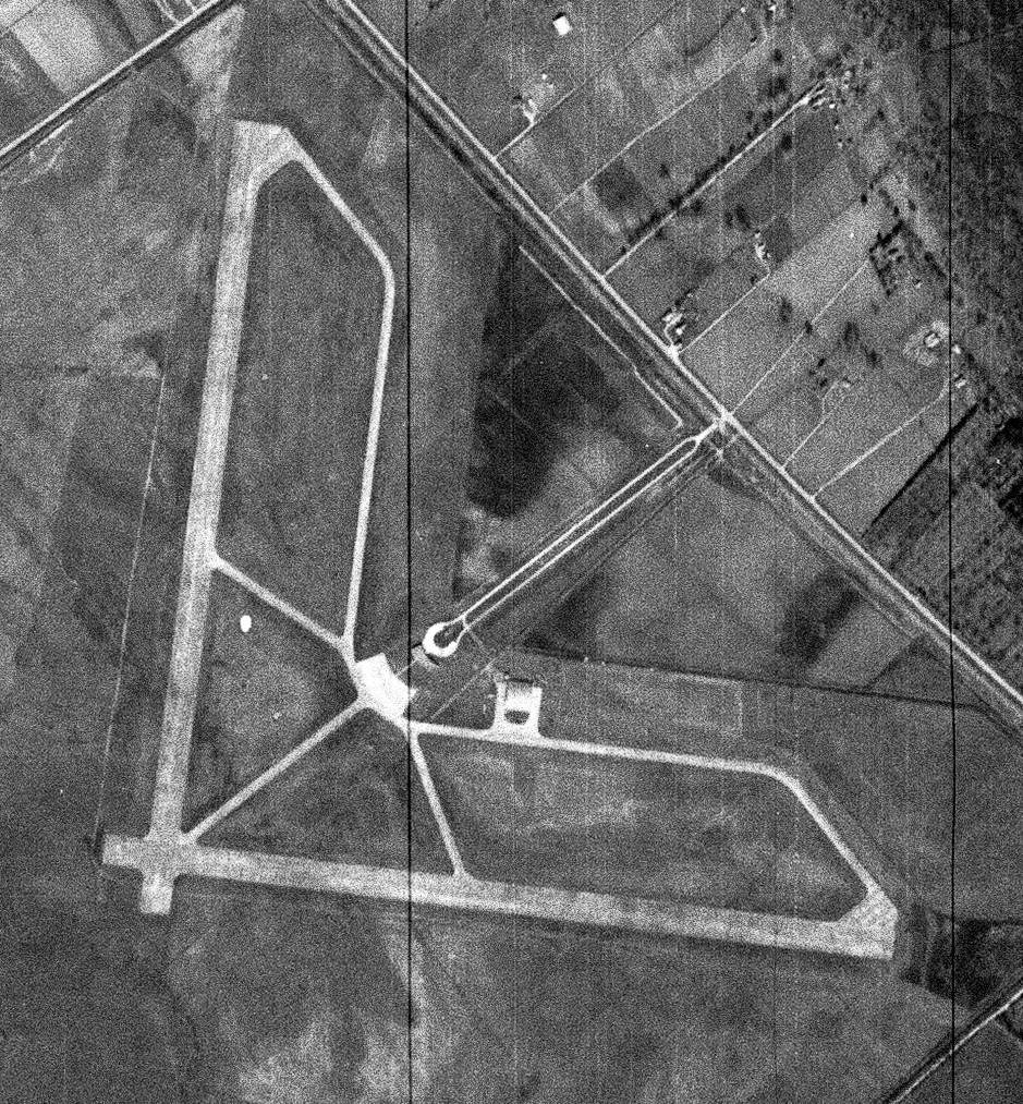
A 2016 aerial view looking north of the abandoned runways of the former Iberia Parish Airport, with several helicopters on the northeast/southwest runway,
a Cessna on the southeast/northwest runway, and another Cessna on the former ramp.
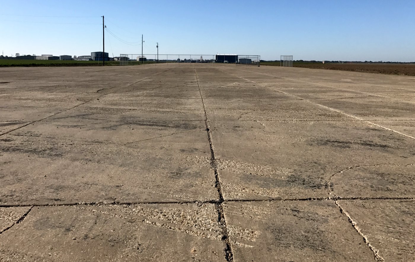
A 3/14/17 photo by Thomas Marcotte looking at “the northeast end of the old northeast runway. The concrete is still in good shape.”
The site of Iberia Parish Airport is located at the western terminus of Airport Boulevard, appropriately enough.
____________________________________________________
Baton Rouge Municipal Airport / Downtown Airport (EBR), Baton Rouge, LA
30.45, -91.11 (East of Downtown Baton Rouge, LA)
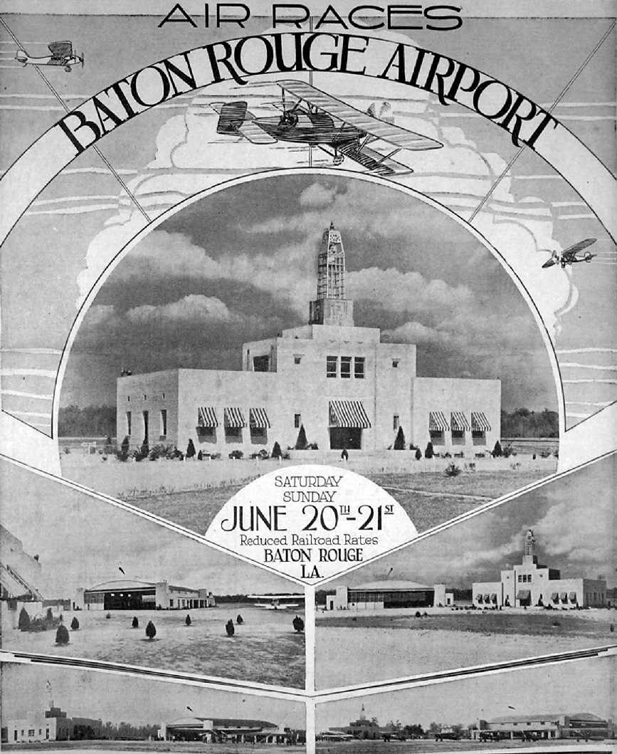
A program commemorating the Baton Rouge Airport's dedication
from the 6/17/31 issue of the Baton Rouge State Times (courtesy of Carl Hennigan).
The original airport for the town of Baton Rouge was located on the eastern side of the city.
An article in the 6/17/31 issue of the Baton Rouge State Times (courtesy of Carl Hennigan)
described the dedication ceremonies of the newly constructed $150,000 Baton Rouge Airport.
According to Carl Hennigan, “Thousands of spectators were expected to attend the 2-day event
featuring over 100 military & civilian planes.
The airport was advertised to be among the best in all the south
with one of the most elaborate lighting systems of any airport in the country.
It was said that the flood lights could illuminate all 200 acres of the field
to an intensity that a newspaper could be read on any portion of the airport.”
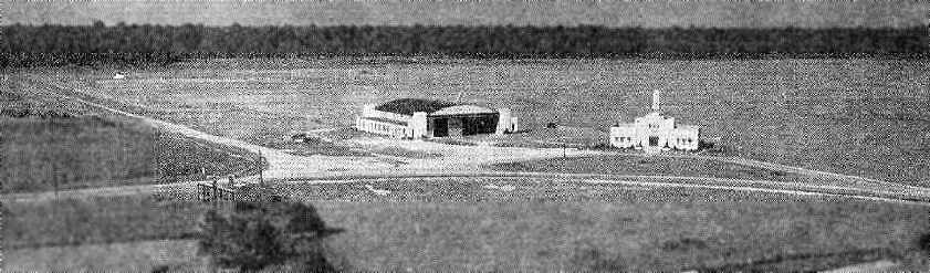
An aerial view looking northeast at the hangar & terminal building of Baton Rouge Municipal Airport,
from The Airport Directory Company's 1933 Airports Directory (courtesy of Chris Kennedy).
It described the original Baton Rouge Municipal Airport as consisting of a 56 acre square turf field.
The aerial photo in the directory depicted a single hangar & a two-story terminal building along the western side of the field.
The manager was listed as E. W. Kleinpeter,
and the operators were listed as American Airways Inc. (mail & passenger service)
and E. W. Kleinpeter (instruction, service, Monocoupe sales).
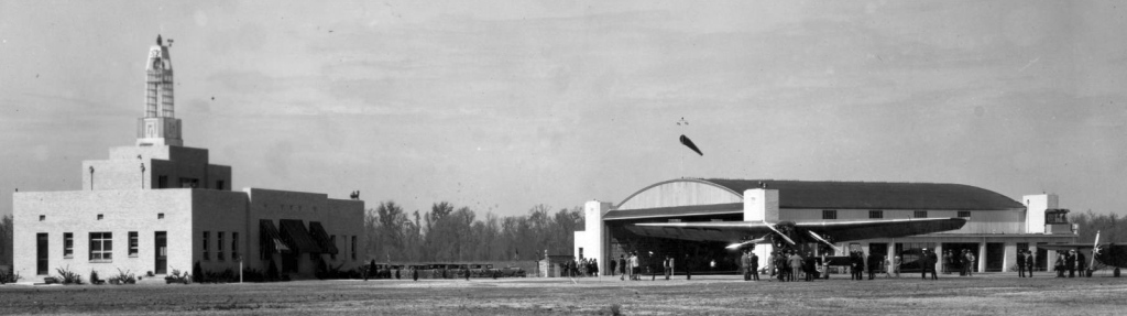
A circa 1930s photo of the terminal, hangar, and a Fokker Trimotor at Baton Rouge Municipal Airport.
The earliest chart depiction of the original Baton Rouge Municipal Airport which has been located
was on the December 1935 Beaumont Sectional Chart.
An aerial view looking north at the original Baton Rouge Municipal Airport,
from The Airport Directory Company's 1937 Airports Directory (courtesy of Bob Rambo).
The directory described the original Baton Rouge Municipal Airport as consisting of a rectangular sod field, measuring 3,000' x 2,900'.
The aerial photo in the directory depicted a single hangar along the western side of the field.
The 1939 USGS topo map depicted Baton Rouge Municipal Airport as a square-shaped field with a beacon in the center.
According to Cal Hennigan, “At some point it became known as the Baton Rouge Downtown Airport
and even the East Baton Rouge Airport, thus the identifier EBR.
Eastern Airlines flew commercial flights into the field but decided the field was too small for their new DC-3s.
Commercial & airmail flights were discontinued in 1939
until the newer & larger Harding Field was completed in 1941.”
An early 1940s aerial photo looking northeast at Baton Rouge Downtown Airport (courtesy of Carl Hennigan)
depicted the field as consisting of a square grass field,
with a single hangar & the terminal building along the west side.
Most of the adjacent land was rural & undeveloped.
Carl observed, “This was taken by Baton Rouge photographer & pilot Fonville Winans (looks like a Civil Air Patrol meeting).”
"Baton Rouge" was depicted as a municipal airport on the 1945 New Orleans Sectional Chart (courtesy of John Voss).
A 1951 aerial view looking northeast at the original Baton Rouge Municipal Airport (courtesy of Carl Hennisgan).
Carl observed, “You can see the beginning of the residential development around the airport. Commercial development would soon follow.”
A March 1959 aerial photo of Baton Rouge Downtown Airport (courtesy of Carl Hennigan)
showed that a row of unrelated buildings (retail) had been constructed along the north side of the field,
which otherwise appeared unchanged from its appearance in the January 1941 aerial photo.
By the time of the 1962 AOPA Airport Directory,
the much larger (former military) Ryan Field had become Baton Rouge's primary airport,
and the original airport had been renamed "Downtown" Airport.
It had also gained a paved runway, as the airfield was described as having a single 2,000' asphalt Runway 13/31.
The field was said to offer hangars, repairs, and charter.
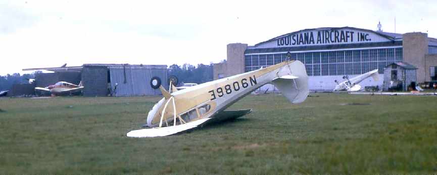
The operator was listed as Louisiana Aircraft, Inc., a Piper & Brantly dealer.
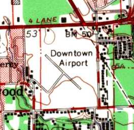
The 1963 USGS topo map depicted the Downtown Airport as having 2 paved runways & several buildings on the west side.
Jay Guillot recalled, “I took flying lessons there from the Aircraft Company
which was located at the south side of the Louisiana Aircraft Company housed in a portable building.
The owner was Jack Laws.”
A 1965 photo of damage at Baton Rouge Downtown Airport by Walter Hennigan (courtesy of Carl Hennigan).
Carl reported, “They were taken by my Dad in 1965 following the passage of Hurricane Betsy.”
The Aerodromes table on the 1965 New Orleans Sectional Chart (courtesy of John Voss)
described Downtown Airport as having 2 paved runways, with the longest being a 3,000' asphalt strip.
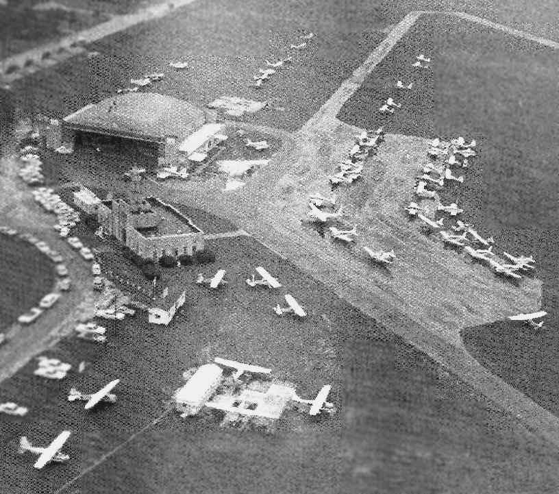
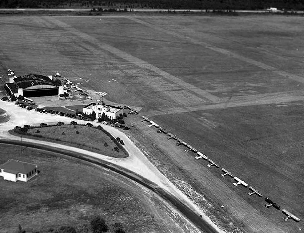
A 1967 aerial photo looking northwest at the Baton Rouge Downtown Airport hangar (courtesy of Carl Hennigan), showing dozens of light aircraft on the field.
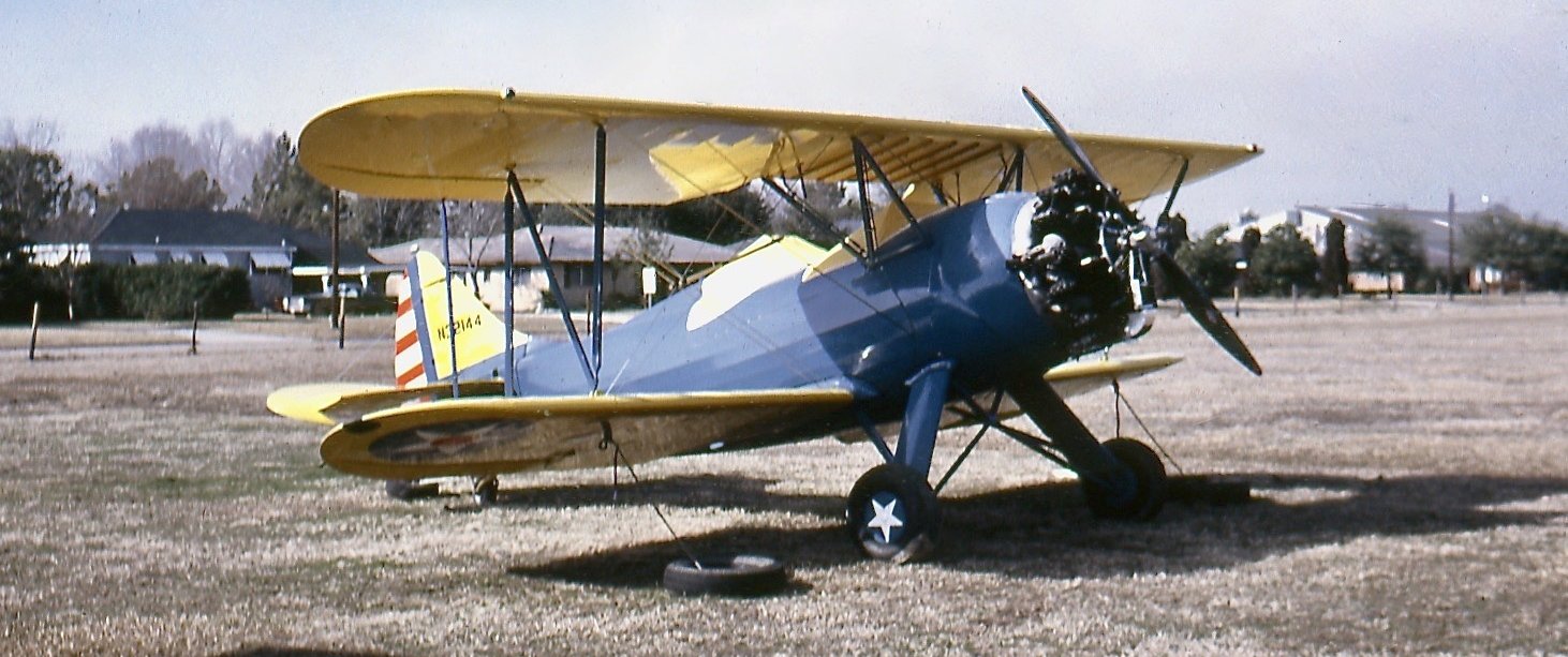
A 1/8/68 photo by Bob Thomas of Waco UPF-7 N32144 C/n 576 at Baton Rouge Downtown Airport.
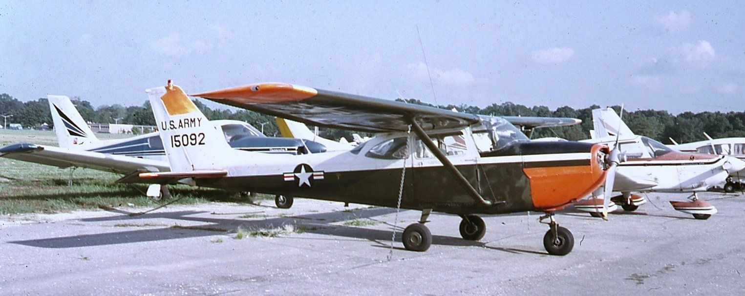
A 6/13/70 photo by Bob Thomas of Army Cessna T-41B Mescalero 67-15092 C/n R172093 at Baton Rouge Downtown Airport.
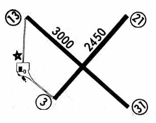
The 1972 Flight Guide (courtesy of Chris Kennedy) depicted Baton Rouge Downtown Airport
as having two paved runways (3,000' Runway 13/31 & 2,450' Runway 3/21),
and depicted a ramp on the west side of the field with three buildings.
Chuck recalled, “I learned to fly there in the early 1970s at Louisiana Aircraft,
and also with some associates, attempted to gain national register status for the old terminal building in order to keep it from being destroyed.
However, that process generally requires at least the token support of the owners of the property, which in this case was the City-Parish.
The then-mayor wanted to put a street extension right through where the terminal building was.
We went to the City Parish & made our presentation (to save the terminal building) but got absolutely nowhere.
It was a really cool art deco-ish brick facility, with wrought iron filligree on top, holding the rotating beacon.
Kinda reminds me of the old New Orleans Lakeshore Airport original terminal building.”
A January 1973 aerial photo of Baton Rouge Downtown Airport (courtesy of Carl Hennigan)
showed that a building for the Main East Baton Rouge Parish Library had been added along the south side of the field,
which was not shown in the March 1959 aerial photo.
The surrounding land had also become completely developed.
Lucien Cutrera recalled, “Moving to Baton Rouge in 1973, I remember the facility & flew from the airport on a local hop with a fellow student one clear, cool Saturday morning.
I’ll never forget his closing my door with a wire string & asking me to keep my feet on the brakes as he flipped the prop to start the plane.
What a Saturday morning that was - an introduction to a bird’s-eye perspective.”
According to Gavin McKemie, "It was a very popular airport right up to the point it was closed, because of residential encroachment.
The control tower was at the corner of Government Street & Lobdell.
I spent my summers down there & I used to go to the old airfield often."
Larry Lakin recalled, “I worked for Louisiana Aircraft at the Downtown Airport on line service
sunup to sundown every weekend from April 1973 until it closed.
While I was there it was an uncontrolled field owned by East Baton Rouge City-Parish.
The 1967 photo is pretty much as I remember it, but maybe twice as many aircraft.
I & about 5 of my friends started working line service in high school, and continued until we finished college.
My starting pay was $1.65 / hour. And the pilots - I don't think you could have collected a more colorful bunch of characters!
During the years I worked there I flew in about every type of piston aircraft there was -
if someone was passing though with an unusual aircraft I'd ask if they would take me up for a ride - and you know I was never turned down!
I don't know if there are airfields like that anymore, but it's nice to think there are.”
Larry Lakin continued, “Indeed it was urban growth that caused the closure of the airport.
In the early 1970s an upscale subdivision (Tara) was built at the end of Runway 13 (which was active runway 90% of the time),
and the well-connected residents started grumbling,
more & more newspaper articles & TV coverage for the residents' complaints until it culminated in an accident with 2 fatalities -
(inexperienced pilot - rental aircraft - stalled & crashed into pine trees at the end of Runway 13).”
Barrett Leibe, recalled, “Baton Rogue Downtown Airport... I had a Grumman-American dealership in New Orleans, Dixie Aviation, and put 2 planes in Baton Rogue to support the LSU flight class in 1974.
When the Bon Marche mall opened northeast across Florida Boulevard, we taxied across the field & under an overpass at night with police escort to have an exhibit at the mall.”
A 1974 photo of Carl Hennigan taking off from Baton Rouge Downtown Airport's Runway 3 in a Cessna 150.
Carl recalled, “Even though the runways were hard-surface, they were never improved with runway markings or runway lights.”
The last photo which has been located showing the Baton Rouge Downtown Airport while in operation
was a 1/20/75 USGS aerial view, showing a large number of light aircraft parked on the west side of the field.
The last aeronautical chart depiction which has been located showing the Baton Rouge Downtown Airport while in operation
was the March 1975 Houston Sectional Chart (courtesy of Jim Hackman).
It depicted Downtown Airport as having 2 paved runways, with the longest being 3,000'.
Larry Lakin recalled, “The accident in the fall of 1975 caused the Mayor to call for closure of the Downtown Airport.
The businesses (Louisiana Aircraft, Tigerland Aircraft, Baton Rouge Flight School, Duffard Flying Service)
moved to Ryan Field (used to be Harding Field) on the north side of town in May 1976.
In June 1976 the terminal building was demolished.
On 7/4/76 (the Bicentenial), the Downtown Airport was renamed Independence Park & was dedicated by Mayor W.W. Dumas.
The Mayor over the next few years gave about 1/3 the acreage (northwest corner) of the old field to the state
for the use of the Louisiana State Police.”
Chuck recalled, “At the time the decision was made to close Downtown,
it was promised that a new general aviation airport would be built to replace Downtown.
I think what contributed also to the purge of Downtown, and the slowness with ever coming up with a replacement
was the general funk of the General Aviation industry, which endured a major depression that started about this same time.
There was strong pressure from the owners of Bon Marche Mall across Florida Boulevard (under the approaches to Runway 13)
and the other business interests who figured this land would be sold off to private interests and 'developed'.”
Chuck continued, “The main general reason for the mayor wanting the airport closed
was because commercial interests were complaining (and wanted the land).
I am not aware of residential encroachment being a factor,
that area was completely developed 20 years before the airport was finally closed.
These were generally middle class ranch style homes, not mcMansions by any stretch of the imagination.
I am sure there were resident complaints, as there are with all airports
that people buy property near & then suddenly 'discover' after they move in.”
A local pilot observed, “The decision to close Downtown was not based upon anything other than political reality,
that land use decisions were made based on political needs,
and that the aviation community was gullible enough to believe false promises
that a new GA reliever airport would be made available in a timely manner.”
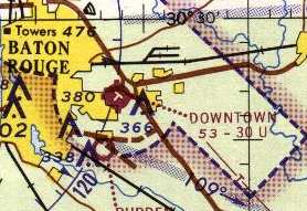
Baton Rouge Downtown Airport was depicted as an abandoned airport
on the December 1976 New Orleans Terminal Area Chart (courtesy of Chris Kennedy).
Gavin McKemie recalled, "In the early 1980s I had attended several meetings
that businessmen were holding to try to keep the place open.
I do not know who owned the field when it was turned over to the city, but the Parks & Recreation people have it now."
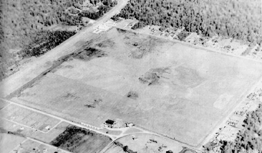
The former airport was no longer depicted on the 1984 USGS topo map.
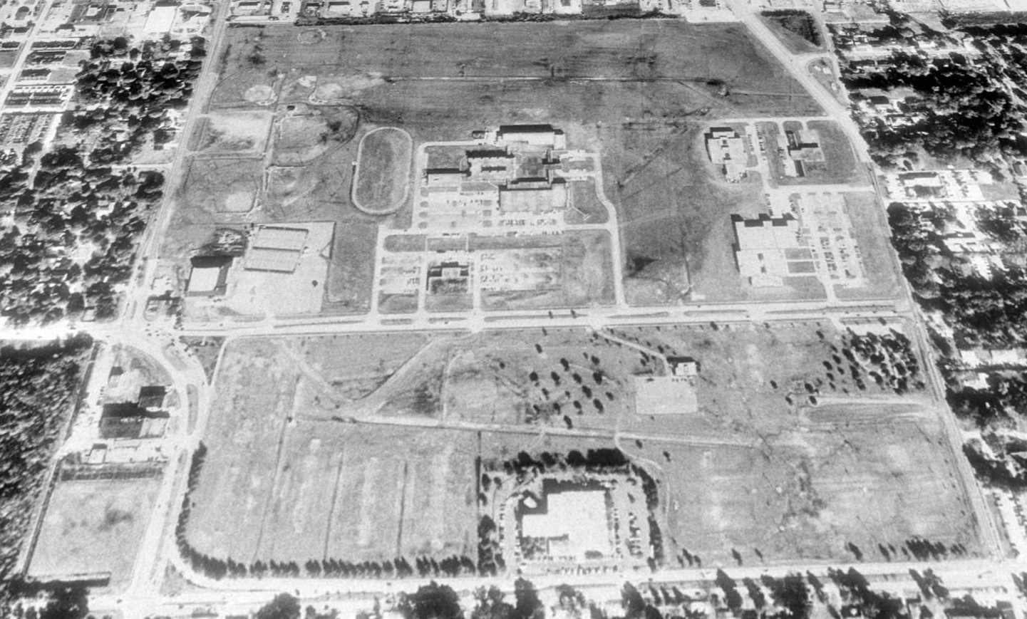
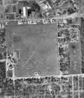
As seen in a 1989 USGS aerial view looking north, the area around the site of Baton Rouge Downtown Airport had been surrounded by dense development,
but the distinctive square area of the former airport remained quite recognizable, as it had become a complex of athletic fields.
Most remarkably, the outlines of one runway & 2 taxiways were still quite apparent in the midst of the athletic fields & newer buildings.
At least one former hangar also remained standing, on the western side of the field.
A concrete ring had been added to the northwest corner of the former airfield property, which was used by radio-controlled model aircraft pilots.
Gavin reported in 2003, "The control tower & a couple of hangars still exist, but the runways and aprons were covered over with athletic fields.
It was a shame that place was closed down."
The park encompassing the former airfield is known as Independence Park,
and it is described on the park web site as one of Baton Rouge's "most popular & busiest parks, because of the number of facilities available."
Ironically, one of the facilities at the park is "a model airplane field."
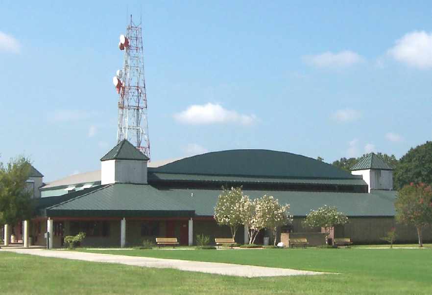
A 2005 photo by Tom Marcotte of the former hangar which remains at the southwest corner of the former Baton Rouge Downtown Airport.
According to Tom, “It is renovated & is used by the parks & recreation department. It looks excellent.”
Tom Marcotte reported in 2005, “I had opportunity to walk the grounds of the old Baton Rouge Downtown Airport today.
I walked the approach end of Runway 13 & found no evidence of asphalt.
They have done a good job of picking this up, and it's now covered with nice grass & oak trees.
There are a couple of windsocks on the field.
One seems to be vintage & the other new at the site of a state operated heliport on the northeast side.
No sign of runways or old terminal / tower building.”
Larry Lakin reported in 2006 that the Louisiana State Police facilities on the northwest corner of the property
“is now their headquarters, training facility and computer operations center.
The hangar is now the park office & indoor tennis courts.
The south half of the park is now soccer fields, a botanical garden, and the main library.”
Chuck reported in 2007, “Bon Marche Mall was ironically replaced by newer malls,
and the commercial property in the area went into decline from which it has not ever recovered.
The people who thought they were going to get ahold of the old downtown airport property
had to move on and do their evil deeds somewhere else.”
Chuck continued, “As with most of that part of Baton Rouge,
prime residential & commercial sites have now leapfrogged out into the surrounding parishes.
The old Bon Marche Mall property was either bought by the local government,
or was acquired through some sort of tax default, it has been an albatross around the city's neck every since.
They spent many more millions on that property than they ever invested in aviation.
As I recall, the skater Nancy Kerrigan's husband got a chunk of change from the state
to create a football TV network in part of that building, and after the state seed money was exhausted, they left town.
I think there is a call center or redemption operation there now,
but only because of heavy subsidy of the local government & strong tax incentives (strange how that works).”
Chuck continued, “The biggest gainer from this whole fiasco was the Louisiana State Police,
which relocated its training academy to the old airport site.
Some recreational opportunities were also created with sports facilities such as tennis courts.
However, it is not known as a particularly safe place to live or play except during daylight at this point.
There is serious blight on the other side of Florida Boulevard, which, unfortunately, has negatively impacted this area as well.”
Wes Carroll reported in 2014 that “the beacon that was atop the old terminal building at this airport...
I recently spotted it resting behind a maintenance shed at the Baton Rogue Metro Airport.”

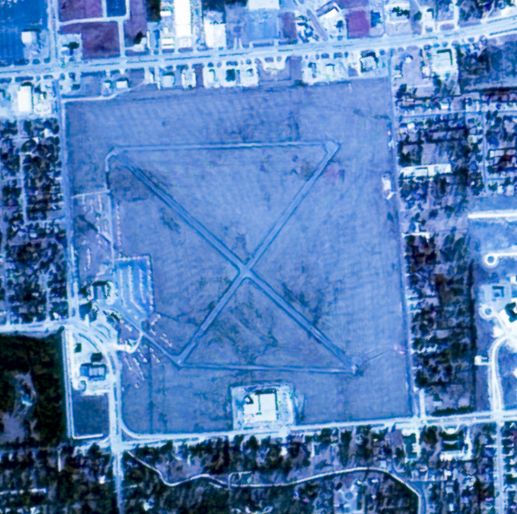
A 2015 aerial view looking north at the site of Baton Rouge Downtown Airport showed quite a bit has changed since the 1989 aerial photo.
The majority of the northern portion of the site had been covered with a large new development,
with buildings & parking lots covering the traces of the former runways which were still visible in the 1989 photo.
However, the hangar remains on the west side of the field.
A 2/9/21 photo by Buck Abbey of the southeast corner of the former hangar which remains at the southwest corner of the former Baton Rouge Downtown Airport.
According to Buck, “Baton Rogue Parks & Recreation is taking good care of the old airport site.
The hangar once owned by Louisiana Aircraft Inc is in fine shape of repair & serves the park well as an indoor tennis center. I expect that building to last much longer.”

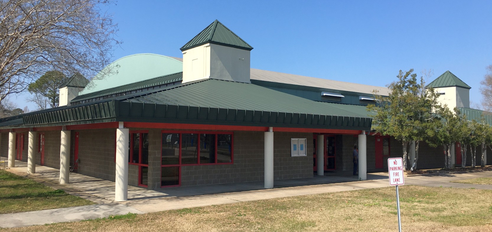
A 2/9/21 photo by Buck Abbey of the interior of the former Baton Rouge Downtown Airport hangar, reused as a tennis center.
 An
undated photo (posted in 2021) of the former Baton Rouge Downtown
Airport beacon, relocated to Baton Rouge Metro Ryan Field.
An
undated photo (posted in 2021) of the former Baton Rouge Downtown
Airport beacon, relocated to Baton Rouge Metro Ryan Field.
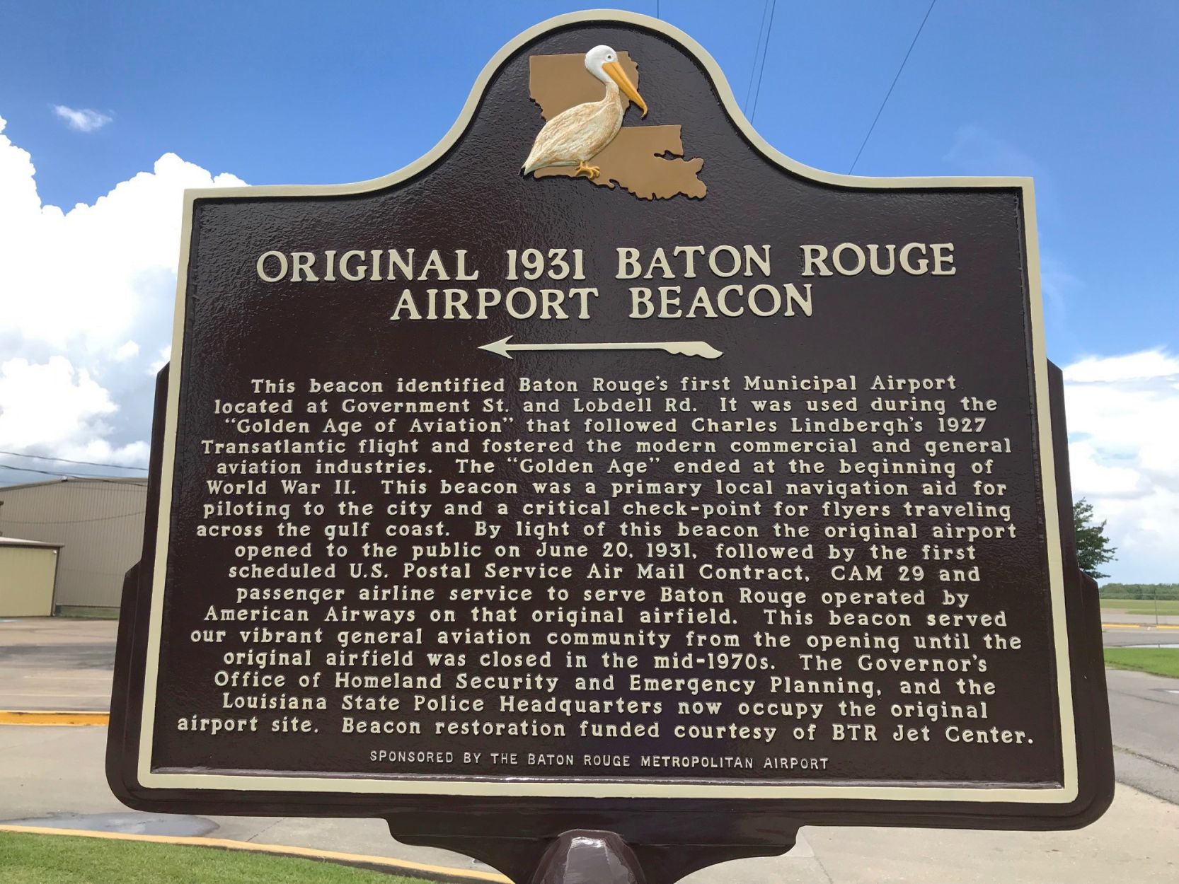
An undated photo (posted in 2021) of the historical marker commemorating the former Baton Rouge Downtown Airport beacon, relocated to Baton Rouge Metro Ryan Field.
Jim Weller reported in 2022 of the former Baton Rouge Downtown Airport beacon, “The beacon is mounted at the entrance to the BTR Jet Center FBO on the east ramp of Baton Rouge Metro Ryan Field.
There is also a state historical marker about it.”
The site of Baton Rogue Downtown Airport is located northeast of the intersection of Lobdell Avenue & Government Street.
____________________________________________________
Or if you prefer to contact me directly concerning a contribution (for a mailing address to send a check),
please contact me at: paulandterryfreeman@gmail.com
If you enjoy this web site, please support it with a financial contribution.
____________________________________________________
This site covers airfields in all 50 states.