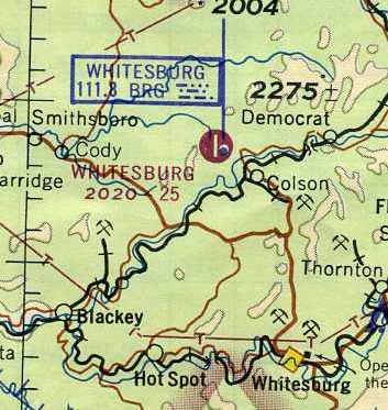
Abandoned & Little-Known Airfields:
Eastern Kentucky
© 2003, © 2026 by Paul Freeman. Revised 6/12/26.
This site covers airfields in all 50 states: Click here for the site's main menu.
____________________________________________________
Please consider a financial contribution to support the continued growth & operation of this site.
Burgess Field / Ashland Airport (added 11/17/20) - Butler State Park Airfield (added 6/12/26) - Calla Airfield (revised 5/17/21) – Codell Airport / Hazard Airport (revised 3/13/26)
Morehead Rowan County Airport (revised 3/14/26) - Olive Hill Airport / Sellers Field (revised 6/13/26) - Whitesburg Municipal Airport (revised 3/14/26)
____________________________________________________
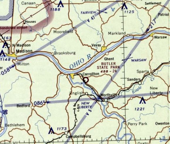
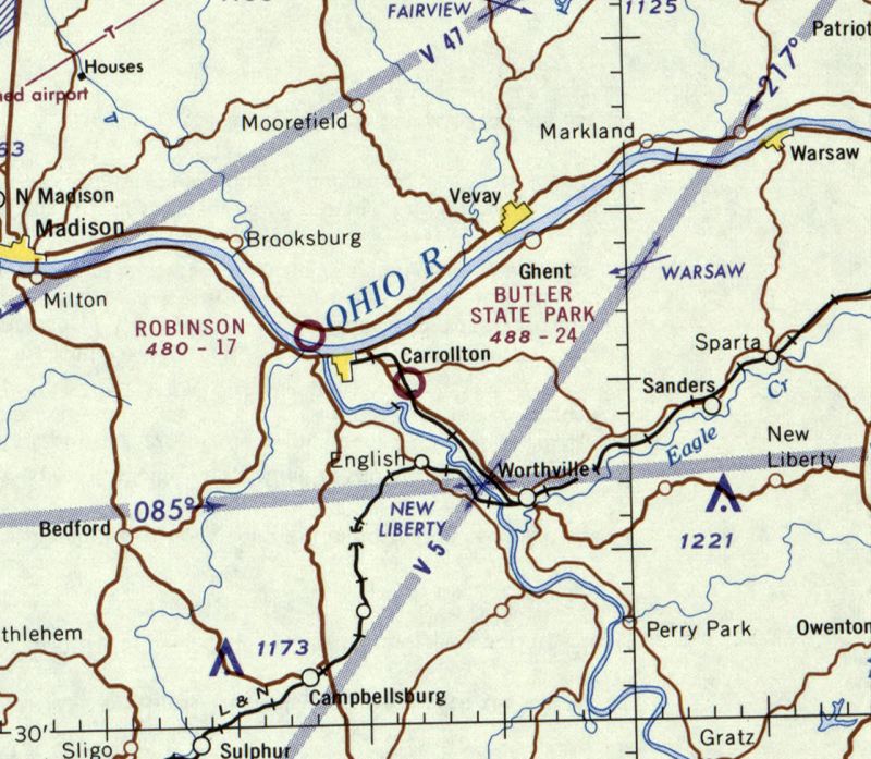
Butler State Park Airfield, Carrollton, KY
38.663, -85.136 (Northeast of Louisville, KY)
Butler State Parl Airfield, as it depicted on the August 1965 Cincinnati Sectional Chart.
Photo of the airport while in use not available.
This small airfield was evidently established at some point between 1955-57, as it was not yet depicted on a 1955 aerial photo.
The earliest depiction which has been located of Butler State Park Airfield was a 1957 aerial photo.
It depicted a single unpaved northwest/southeast runway, which appeared to be in the process of being cleared.
There were no hangars or aircraft seen on the field.
The airfield was evidently built to allow fly-in visitors to the adjacent Butler State Park, which included a small downhill ski resort.
Butler State Park Airfield was not yet depicted on the 1960 Cincinnati Sectional Chart.
The earliest aeronautical chart depiction which has been located of Butler State Park Airfield was on the August 1965 Cincinnati Sectional Chart.
It depicted Butler State Park Airfield as having a 2,400' unpaved runway.
Butler State Park Airfield was not yet depicted on the 1966 USGS topo map.
The only photo which has been located showing aircraft at Butler State Park Airfield was a 1967 aerial photo,
which depicted 2 light single-engine aircraft on the north end of the field.
The last aeronautical chart depiction which has been located of Butler State Park Airfield was on the February 1967 Cincinnati Sectional Chart.
It depicted Butler State Park Airfield as having a 2,400' unpaved runway.
Butler State Park Airfield evidently did not last long, being open no more than 9 years,
as it was no longer depicted on the August 1969 Cincinnati Sectional Chart.
The reason for the airfield's closure has not been determined.
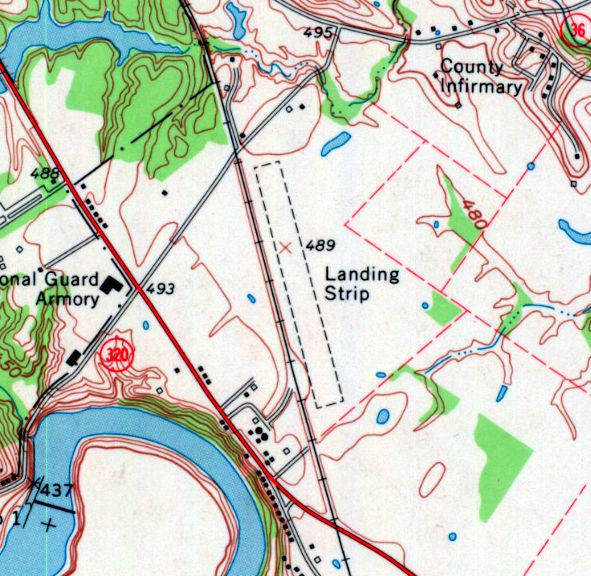
The earliest topo map depiction which has been located of Butler State Park Airfield was on the 1970 USGS topo map.
It depicted a single unpaved northwest/southeast runway, generically labeled as “Landing Strip”, with no buildings or other improvements.
A 1985 aerial photo showed a large industrial building had been built over the alignment of the former Butler State Park Airfield runway,
erasing any trace of the little airfield.
The 1994 USGS topo map continued to depicted a “Landing Strip” at this location, a decade after the airfield had ceased to exist.
The 2013 USGS topo map no longer depicted Butler State Park Airfield.
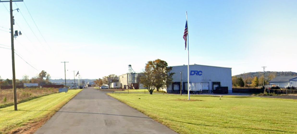
A 2024 photo looking south at the DRC industrial building which covers the site of Butler State Park Airfield.
A 2024 aerial view looking northwest showed the outline of the former Butler State Park Airfield runway remained recognizable.
David Blevins pointed out the last remaining clue of this former airfield's existence: the road just to the west is Airport Road.
Thanks to David Blevins for pointing out this airfield.
____________________________________________________
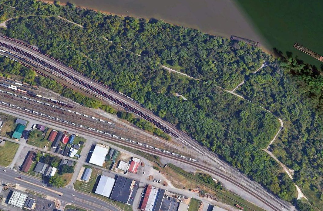
Burgess Field / Ashland Airport, Ashland, KY
38.471, -82.618 (Northeast of Lexington, KY)
Burgess Field, as it existed in the 1920s (courtesy of William Martin, via Richard Geist).
According to the 2017 book "Ashland Airport, Eastern Kentucky's Forgotten Field" by William Martin (courtesy of Richard Geist),
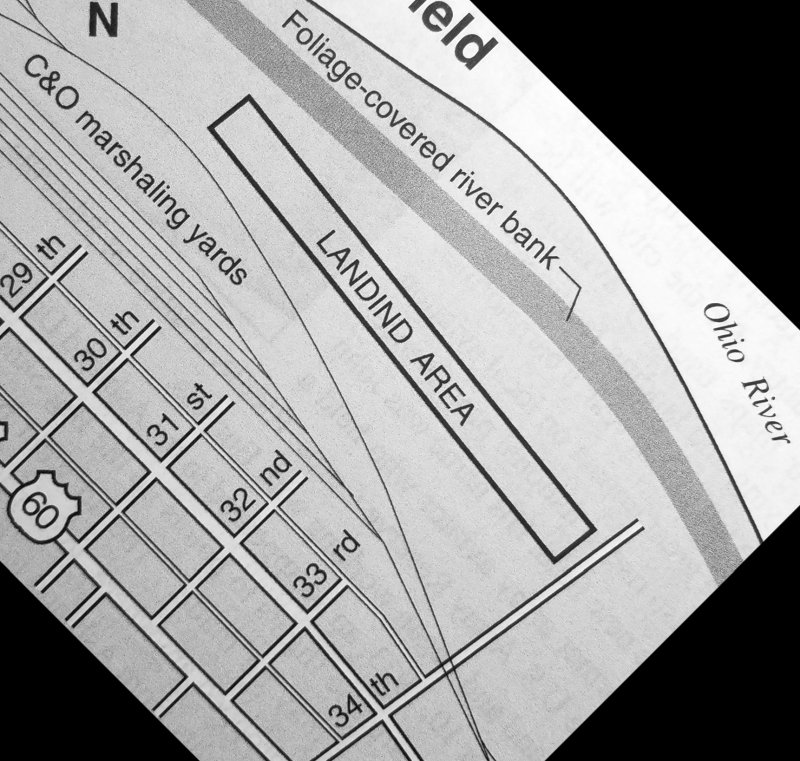
this airfield along the Ohio River was established as Burgess Field in 1923.
A diagram indicated Burgess Field had a single northwest/southeast runway, along a narrow patch of land between the C&O Railroad marshaling yards & the Ohio River,
from northeast of 29th Street to northeast of 34th Street.
Burgess Field was closed in 1930 (due to the Depression), then reopened in 1932 as Ashland Airport.
The earliest aeronautical chart depiction which has been located of Ashland Airport was on the February 1934 Huntington Sectional Chart.
It depicted Ashland Airport as an auxiliary airfield.
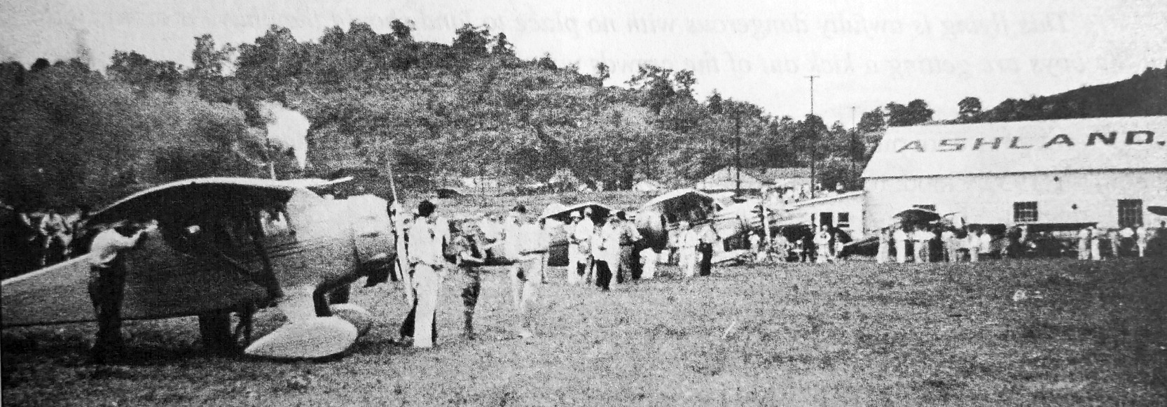
The earliest photo which has been located of Ashland Airpot was a late 1930s photo of a fly-in held to celebrate the new metal hangar
(from the book "Ashland Airport, Eastern Kentucky's Forgotten Field" by William Martin, courtesy of Richard Geist).
A late 1930s photo of a fly-in held to celebrate Ashland Airport's new metal hangar
(from the book "Ashland Airport, Eastern Kentucky's Forgotten Field" by William Martin, courtesy of Richard Geist).
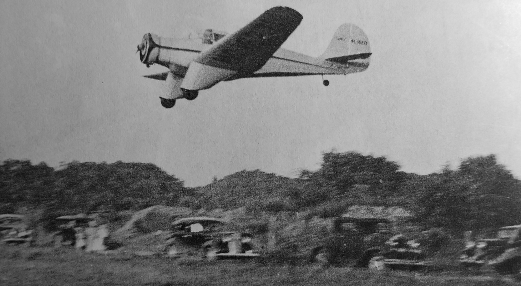
A circa 1930s/40s photo of an Aeronca LB landing at Ashland Airport
(from the book "Ashland Airport, Eastern Kentucky's Forgotten Field" by William Martin, courtesy of Richard Geist).
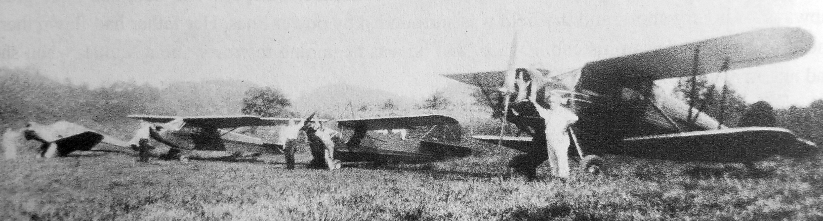
A circa 1930s/40s photo of 4 planes at Ashland Airport: an Aeronca LB, Taylor Cub J-2, Aeronca C-3, and Waco UEC
(from the book "Ashland Airport, Eastern Kentucky's Forgotten Field" by William Martin, courtesy of Richard Geist).
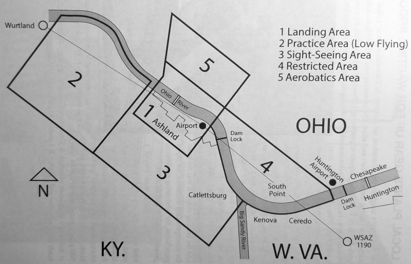
An October 1942 diagram of the Ashland Airport flight operation areas
(from the book "Ashland Airport, Eastern Kentucky's Forgotten Field" by William Martin, courtesy of Richard Geist).
A circa 1940s photo of a Stinson performing an airmail pickup at Ashland Airport, snagging the wire strung between 2 poles
(from the book "Ashland Airport, Eastern Kentucky's Forgotten Field" by William Martin, courtesy of Richard Geist).
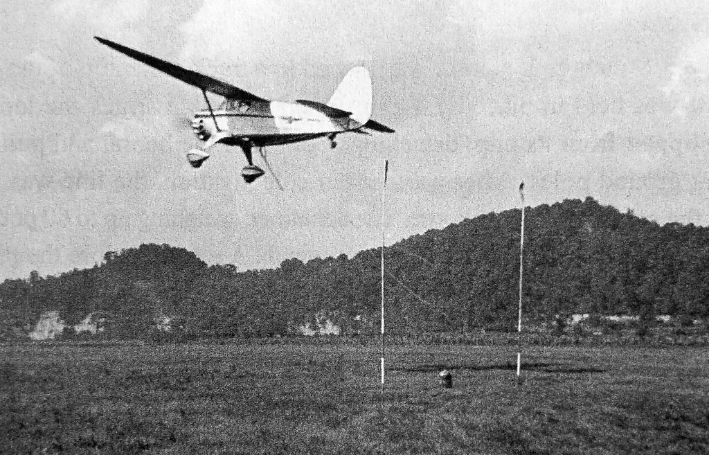
A circa 1940s aerial view looking north taken from Vanda Giovanelli's Waco UEC turning to final approach to Ashland Airport
(from the book "Ashland Airport, Eastern Kentucky's Forgotten Field" by William Martin, courtesy of Richard Geist).
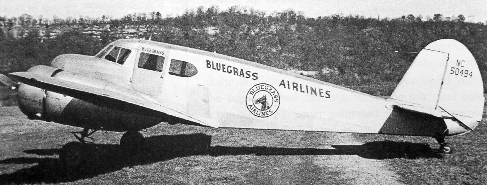
A circa 1940s photo of Bluegrass Airlines Cessna UV-78 Bobcat at Ashland Airport
(from the book "Ashland Airport, Eastern Kentucky's Forgotten Field" by William Martin, courtesy of Richard Geist).
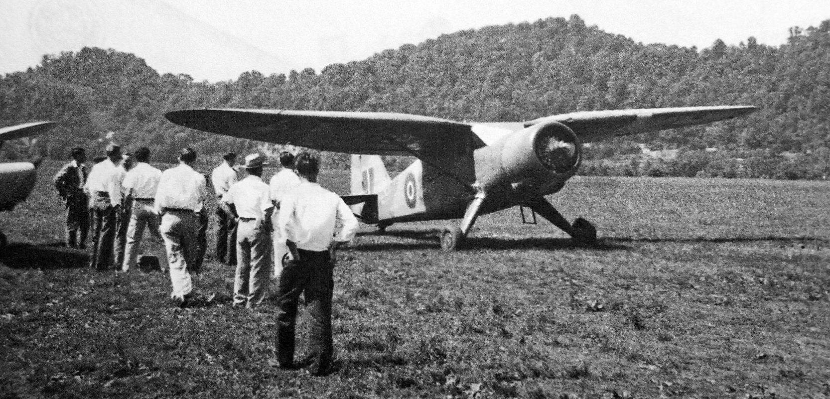
A circa 1940s photo of a war surplus Royal Navy V-77 Stinson which became a fixture at at Ashland Airport
(from the book "Ashland Airport, Eastern Kentucky's Forgotten Field" by William Martin, courtesy of Richard Geist).
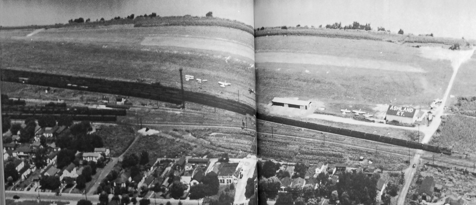
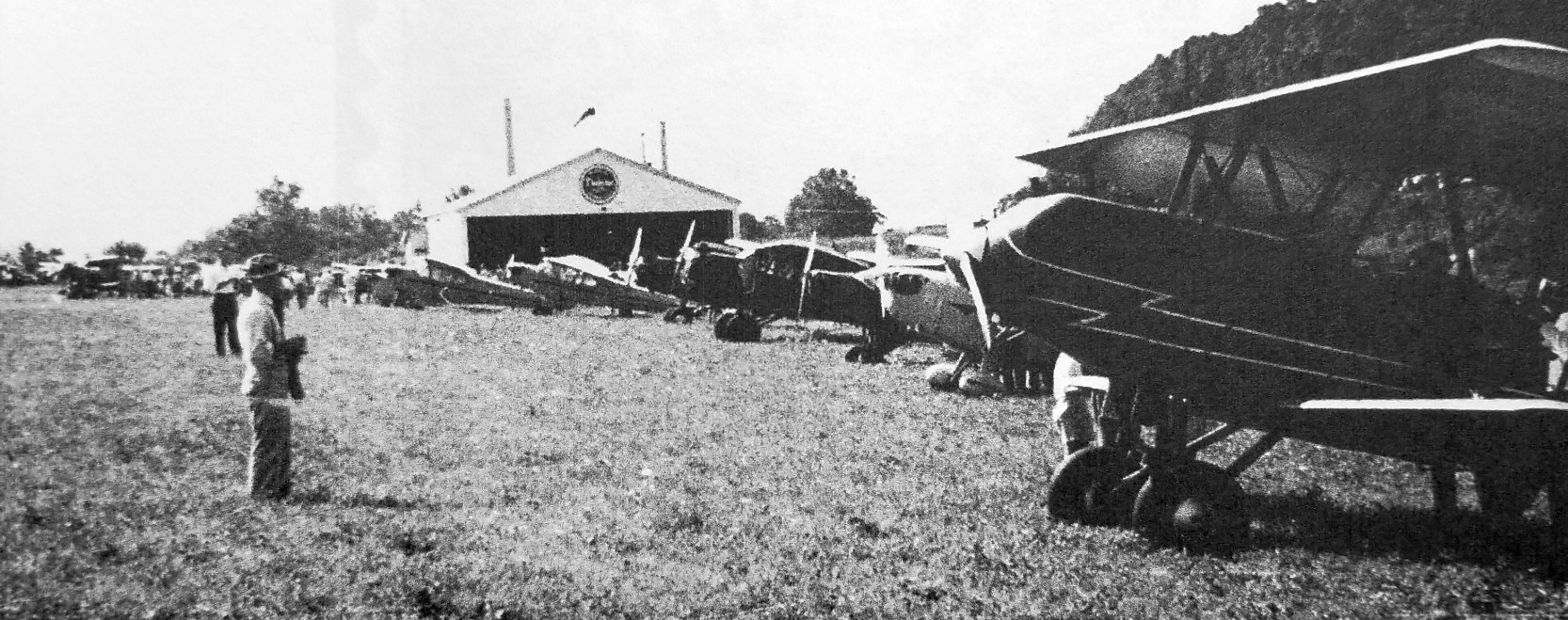
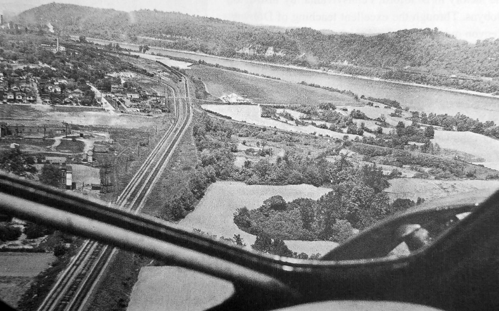
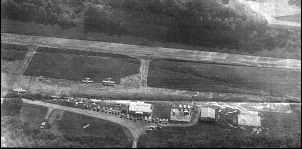
A early Fall 1947 aerial view looking northeast at Ashland Airport, showing the 2,400' grass runway, 2 hangars, and 9 light single-engine monoplanes & biplanes
(from the book "Ashland Airport, Eastern Kentucky's Forgotten Field" by William Martin, courtesy of Richard Geist).
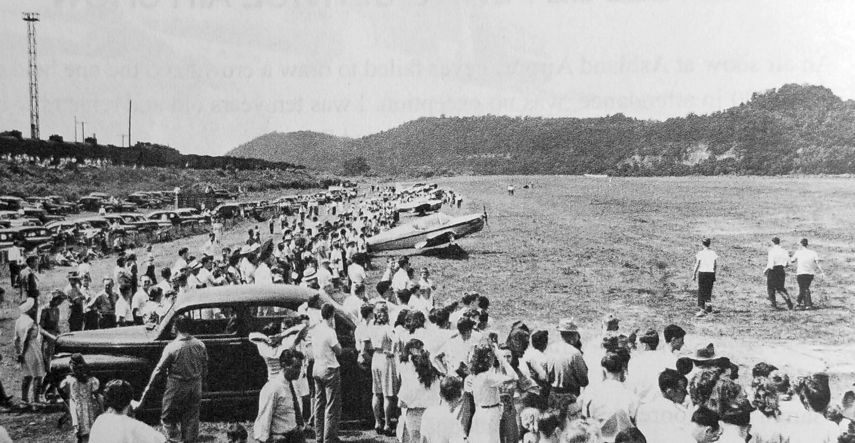
A photo of Ashland Airport's 7/27/47 Rutledge Air Show showed a Globe Swift & other light aircraft, along with a large number of spectactors
(from the book "Ashland Airport, Eastern Kentucky's Forgotten Field" by William Martin, courtesy of Richard Geist).
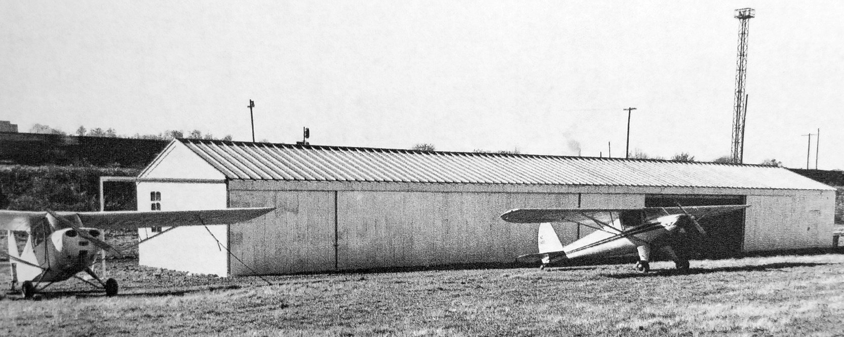
The last photo which has been located of Ashland Airport was a circa 1947-51 photo of 2 light planes in front of a Steelox T-hangar which had been temporarily erected at Ashland Airport in late 1947
(from the book "Ashland Airport, Eastern Kentucky's Forgotten Field" by William Martin, courtesy of Richard Geist).
The last aeronautical chart depiction which has been located of Ashland Airport was on the July 1951 Huntington Sectional Chart.
It depicted Ashland Airport as having a 2,200' unpaved runway.
According to “Ashland Airport, Eastern Kentucky's Forgotten Field", Ashland Airport was phased out by 1951.
Richard Geist recalled, “It probably flooded often. I was about 11-12 then & only vaguely remember an airfield there.”
Ashland Airport was closed by 1952, as it was no longer depicted on the January 1952 Huntington Sectional Chart.
A 1952 aerial photo depicted a single unpaved northwest/southeast runway & one small hangar at Ashland Airport,
but there were no aircraft visible on the field.
According to “Ashland Airport, Eastern Kentucky's Forgotten Field", Ashland Airport was last used in 1952 for a PR demo group.
Ashland Airport was not depicted at all on the 1955 USGS topo map.
According to “Ashland Airport, Eastern Kentucky's Forgotten Field", Ashland Airport was apparently not used again until 1960 briefly & unofficially with a J-3 in high weeds.
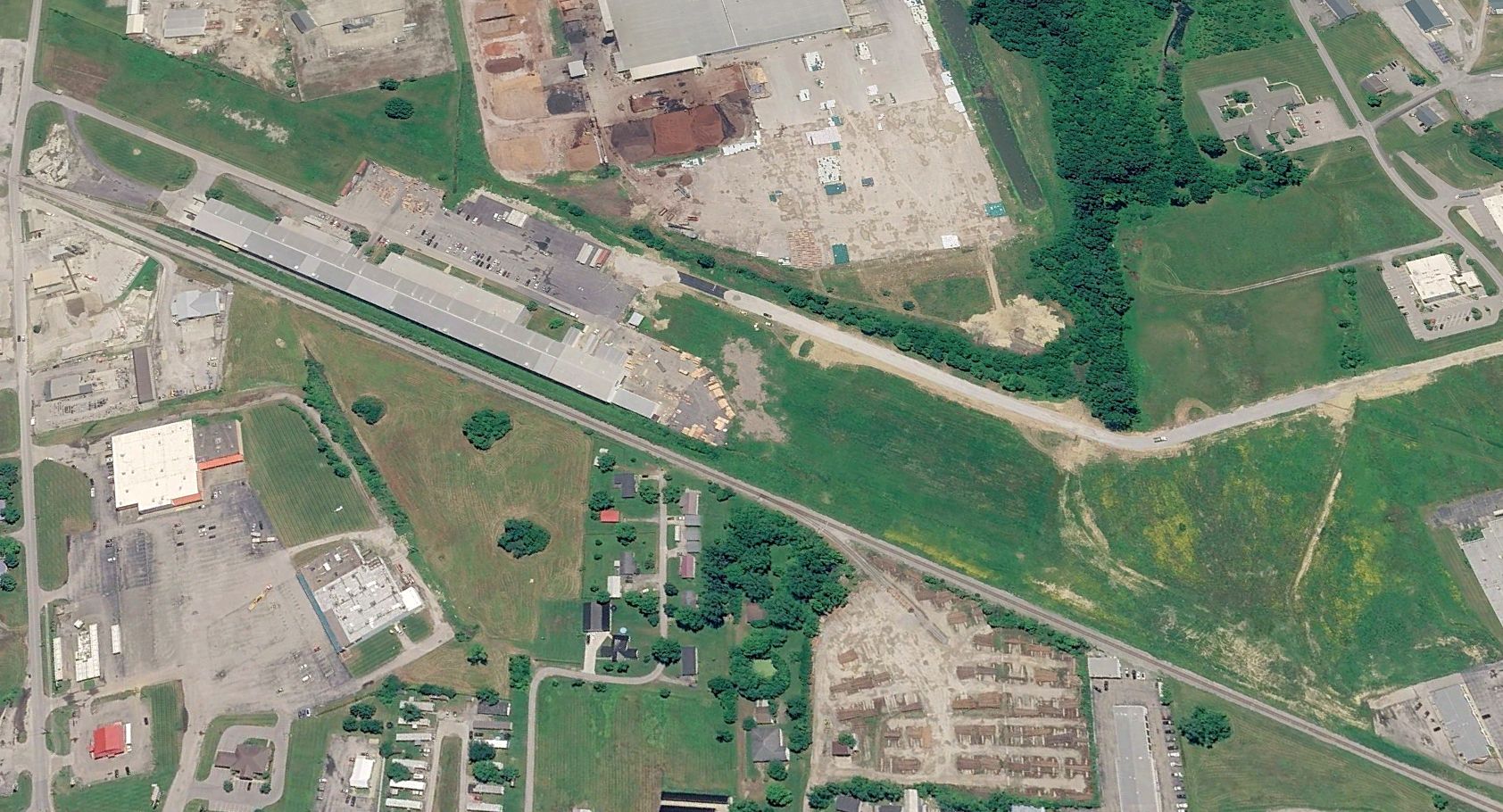
A 1967 aerial photo showed the unpaved northwest/southeast runway remained clear, and the hangar remained at the southeast corner of the Ashland Airport site.
A 1983 aerial photo showed former Ashland Airport hangar had been removed at some point between 1967-83.
A 2004 aerial view showed trees had covered the site of Ashland Airport.
A 2016 aerial view looking northeast showed no recognizable trace remaining of Ashland Airport, with trees covering the site.
Thanks to Richard Geist for pointing out this airfield.
____________________________________________________
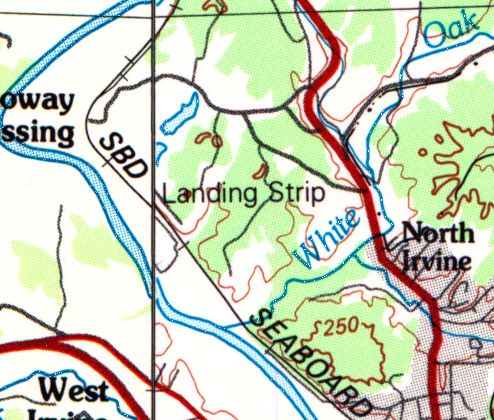
37.72, -84 (East of Lexington, KY)
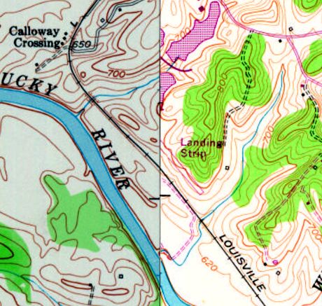
Calla Airfield was labeled as a “Landing Strip” on the 1978 USGS topo map.
Photo of the airfield while in use has not been located.
The Calla Airfield was evidently established at some point between 1966-78,
as it was not yet depicted on a 1957 aerial photo, the 1960 USGS topo map,
or on the January 1966 Nashville Sectional Chart (courtesy of David Stevenson).
The earliest depiction which has been located of Calla Airfield was on the 1978 USGS topo map,
which depicted a single northwest/southeast runway labeled simply as “Landing Strip”.
David Stone reported, “The airfield was named Calla. It was owned by a coal company which owned the property it is located on.
At that time they operated a coal wash there. Trains loaded with coal coming out of the Eastern KY mountains would pass through this facility
and the cars would pass through a washing station to remove debris & coal dust from the ore before it was shipped on to other locations.
After the 'coal wash' closed down a local doctor who owned a couple of small general aviation aircraft purchased the small airstrip for his own use.
Eventually the property came under legal troubles when two corporate entities began arguing as to who owned the rights to the property.”
The 1982 USGS topo map continued to depict Calla Airfield as a single northwest/southeast runway labeled simply as “Landing Strip”.
The earliest photo which has been located of Calla Airfield was a 1983 aerial view.
It depicted Calla as having a single paved northwest/southeast runway, with a ramp & hangar on the north end.
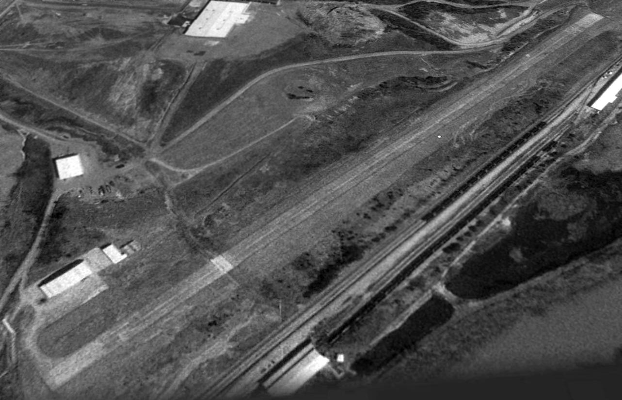
The earliest photo which is available of Calla Airfield was a 1995 USGS aerial view looking east.
It depicted Calla as having a single paved Runway 14/28, with a ramp & hangar on the north end.
The last photo which has been located showing Calla Airfield remaining intact was a 2013 aerial view looking east.
A 2014 aerial view looking east showed Calla Airfield considerably deteriorated in only a year.
Eric Karnes observed that “the western end is being eaten up by a coal strip mine (an industry that is the bane of Kentucky's economy & environment).”
The 2015 Sectional Chart depicted Calla as an abandoned airfield.
The site of Calla Airfield is located at the western terminus of Route 1840.
Thanks to Eric Karnes for pointing out this airfield.
____________________________________________________
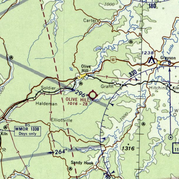
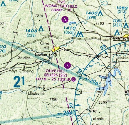
Olive Hill Airport / Sellers Field (2I2), Olive Hill, KY
38.25, -83.14 (Northeast of Lexington, KY)
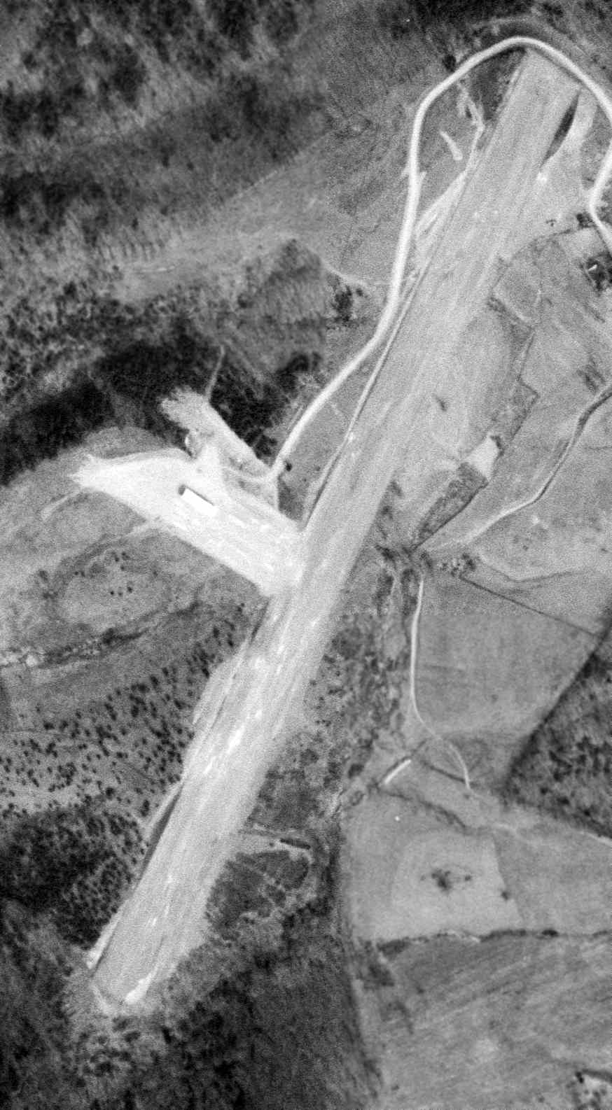
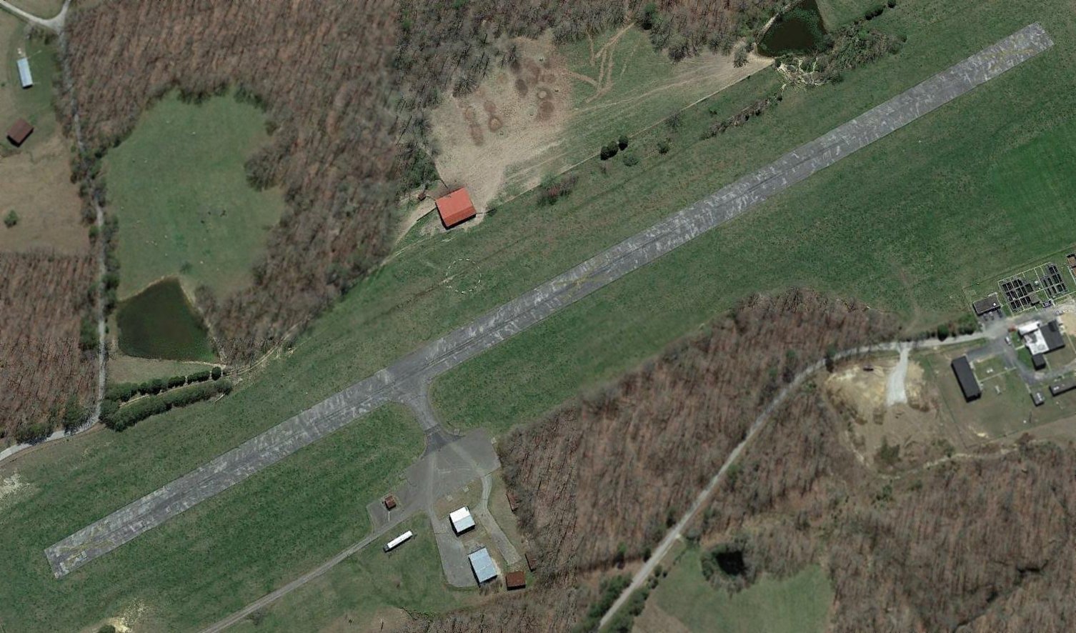
Olive Hill Airport, as depicted on a 3/29/61 USGS aerial photo.
Olive Hill Airport was not yet depicted on the January 1960 Huntington Sectional Chart.
According to its FAA Airport/Facility Directory data (courtesy of Richard Finley), Olive Hill Airport was activated on 11/1/60.
The earliest depiction which has been located of Olive Hill Airport was on a 3/29/61 USGS aerial photo,
which depicted it as having an unpaved northeast/southwest runway, with a hangar along the west side.
The 1962 USGS topo map depicted Olive Hill Airport as having an unpaved northeast/southwest runway, with a hangar along the west side.
The earliest aeronautical chart depiction which has been located of Olive Hill Airport was on the February 1965 Huntington Sectional Chart.
It depicted Olive Hill Airport as having a 2,800' unpaved runway.
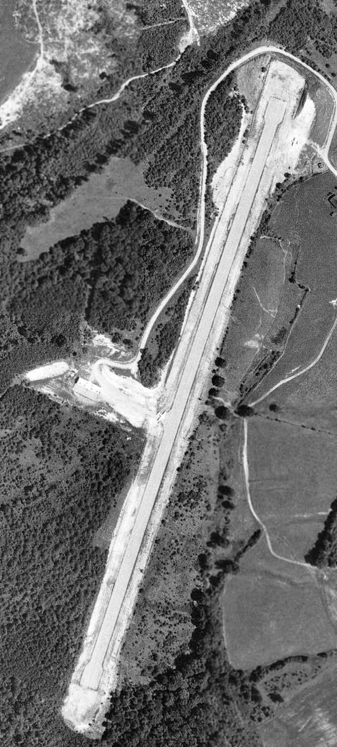
A 7/2/69 USGS aerial photo appeared to depict Olive Hill Airport with a newly-built paved ruway,
onto which one aircraft appeared to be entering at mid-field.
Oliver Hill Airport was renamed Sellers Field in 1974 to honor Matthew Sellers, an aviation pioneer & the first person to fly an airplane in Kentucky.
An undated aerial photo of Seller Field from the 1976 KY Airport Directory.
It described Seller Field as having a single 2,500' paved Runway 2/20.
The July 1999 Cincinnati Sectional Chart (courtesy of Richard Finley) depicted Olive Hill Sellers as having a 2,500' runway.
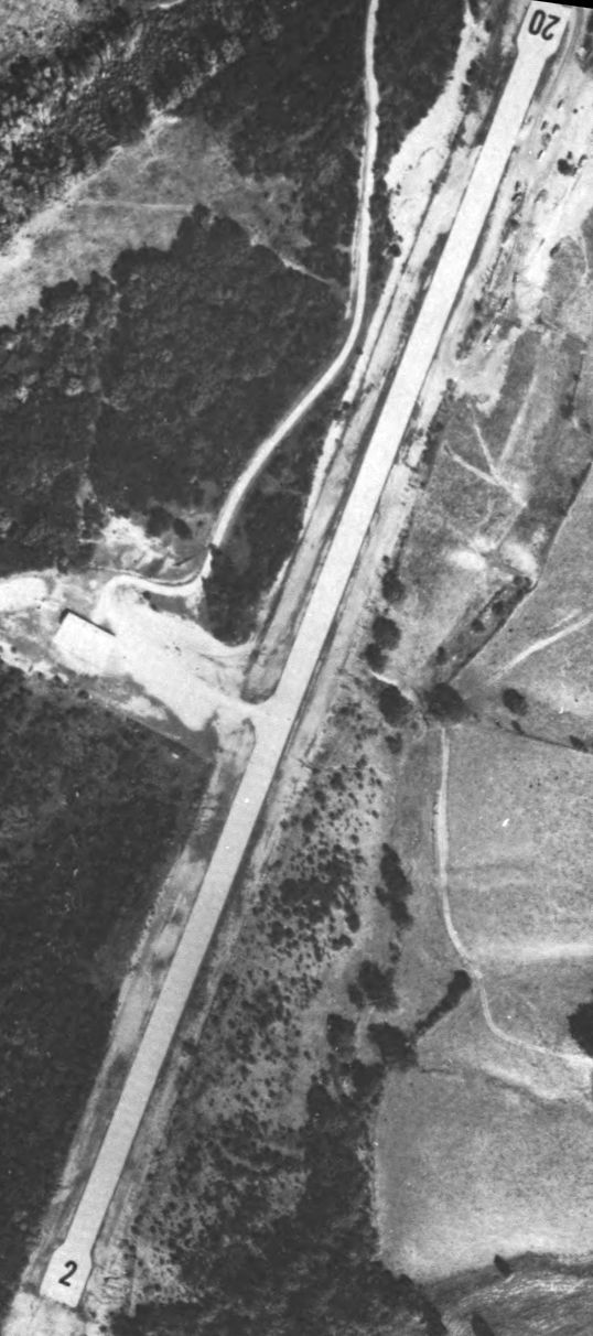
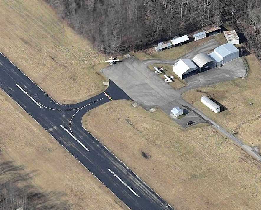
A 12/12/07 aerial view looking southwest showed Olive Hill's runway still marked as an active runway.
According to a city status document (courtesy of Richard Finley),
the town of Olive Hill suffered from severe flooding in May 2010, which put a great economic stress on the community.
Olive Hill Airport had a 2,900' runway, parking ramp and fueling facilities.
It serviced the construction industry, Carter Cave State Park visitors, business people and others.
But due to issues over lack of maintenance, the state closed it in early 2010.
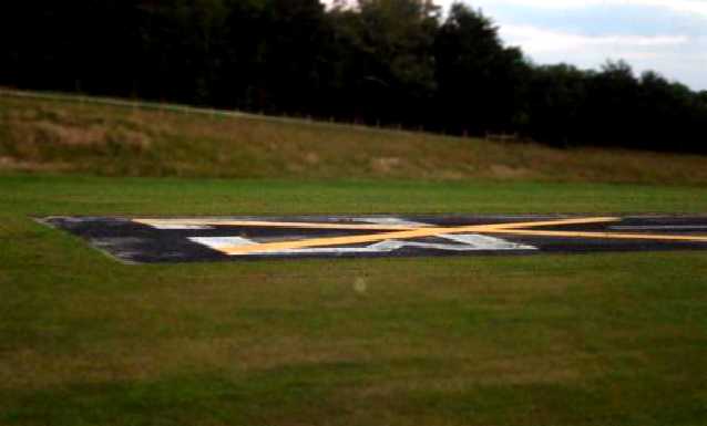
A 6/20/10 aerial photo showed Olive Hill's runway marked with closed-runway “X” symbols.
According to its FAA Airport/Facility Directory data (courtesy of Richard Finley),
for a 12-month period ending 9/27/10 Olive Hill Airport conducted 50 takeoffs or landings & had 3 single-engine aircraft based at the airport.
Olive Hill Airport consisted of 31 acres, with a 2,500' asphalt Runway 2/20.
An article entitled “Olive Hill Council Votes To Keep Airport” by Keith Kappes in the 7/25/12 Publisher Journal-Times (courtesy of Richard Finley)
reported that “a few months ago, Council declared the airport to be surplus property & ordered that it be sold.”
However, “Mayor Danny Sparks, who originally had recommended the sale, said Tuesday that he was wrong about the airport’s value to the city.
He then asked the Council members to reverse their earlier decision. They did so, 5-0.
The mayor said the 24-acre facility, no longer certified as an airport, can become a valuable tourism asset to the city as shown by the recent Heritage Trail Festival.”
State Sen. Robin Webb described the property as a “jewel” that the city should retain.
An article entitled “Olive Hill City Council Votes To Close Pool, Airport” by Joe Lewis in the 3/27/13 Journal-Times (courtesy of Richard Finley)
said, “Council also voted unanimously to empower the mayor to sign a document removing the old city airport from all piloting & FAA maps,
effectively closing the facility to further air traffic.”
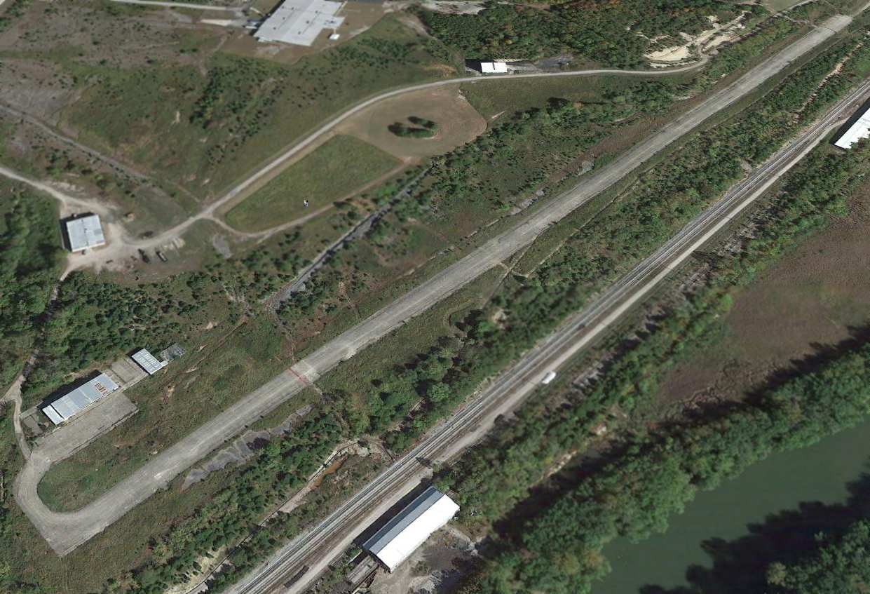
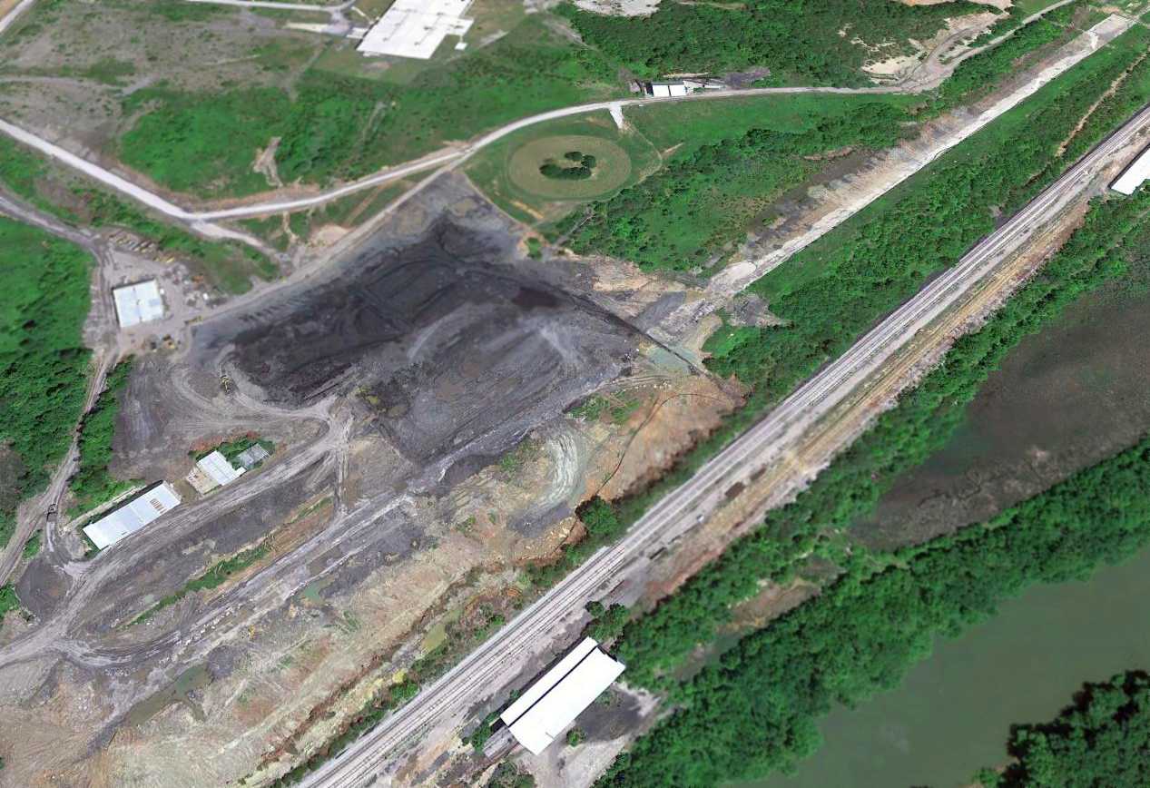
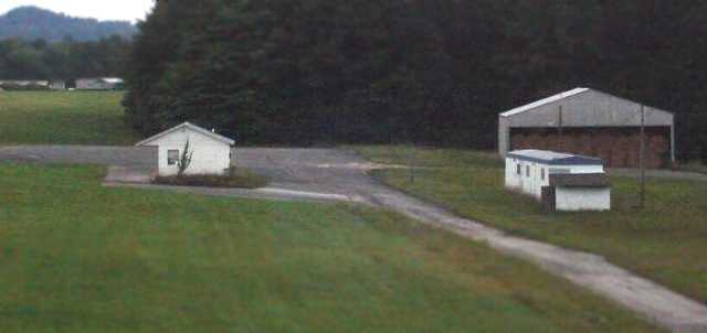
A 2026 aerial view looking southeast showed Olive Hill's runway remained intact though deteriorated.
Olive Hill Airport is located southeast of the intersection of Ben's Run Road & Airport Drive.
Thanks to Richard Finley for pointing out this airfield.
____________________________________________________
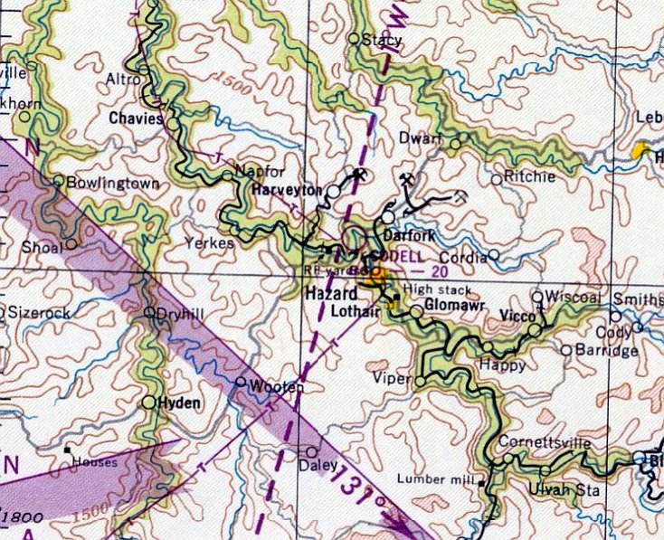
Codell Airport / Hazard Airport, Hazard, KY
37.28, -83.21 (Southeast of Lexington, KY)
Codell Airport, as depicted on the July 1949 Winston-Salem Sectional Chart.
This airfield northwest of the town of Hazard was not yet depicted on the March 1945 Winston-Salem Sectional Chart.
According to the Sunday Herald-Leader (courtesy of Mark Hess),
Hazard Airport was established sometime on or before 1947.
However, Hazard Airport was not yet depicted on the 1949 USGS topo map.
The earliest depiction which has been located of this airfield was on the July 1949 Winston-Salem Sectional Chart.
It depicted Codell Airport as having a 2,000' unpaved runway.
It was still depicted as Codell Airport on the 1951 Winston-Salem Sectional Chart.
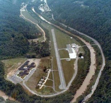
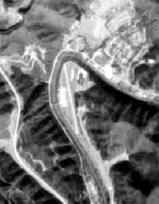
The 1954 USGS topo map depicted Hazard Airport as a northwest/southeast clearing along the east bank of the Kentucky River.
At some point between 1951-57, Codell Airport was renamed Hazard Airport,
as that is how it was depicted on the 1957 Winston-Salem Sectional Chart.
Jim recalled, “The old Hazard Airport... I learned to fly there & was in the Civil Air Patrol.
This was right up to the 1957 flood, which wiped out most of our airplanes.”
Allen McDavitt recalled, “The Hazard Airport was in Hazard, KY,
the same Hazard fictionally represented on the Dukes of Hazard TV show.
This airport was down in a deep valley surrounded by some good-sized mountains.
My ex-father-in-law owned a home close to the top of one of the overlooking mountains.
I remember many times sitting on the deck watching the airplanes flying up & down the valley below on their way to or from the airport.”
Taoist recalled, “I lived in Hazard from 1958-62.
My mother was a laboratory technician in the old Miners Memorial Hospital during that time.
There was a doctor at the hospital that was my hero & he used to fly for pleasure out of the Hazard Airport.
His name was Bill Leonard, and he had a old Stinson Voyager & we would go up every couple of months.
On a few occasions he even let me fly the Stinson as well as a Piper J2 Cub that he used to fly occasionally.
I don't think the Piper was his but belonged to a flying club at the airport.
We got to the airport by parking his car next to Highway 15 & walking across a swinging bridge over the river.
The airport runway was completely grass with very few buildings on site.
The airplanes were always lined up with their tails towards the river.”
David Stallsmith recalled, “Hazard... my dad flew his company's Cessna 182 in & out of there a number of times in the 1960s.
He described that airport as the craziest he had encountered; he had to sideslip to get into the valley.”
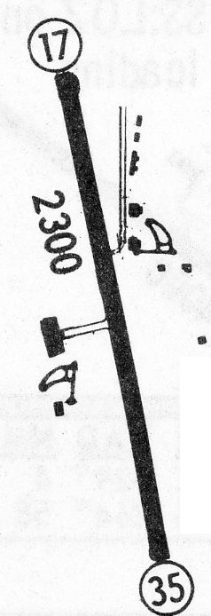
The 1968 Flight Guide (courtesy of Robert Levittan) depicted Hazard Airport
as having a single 2,300' paved Runway 17/35, with a few small buildings on the west & east sides.
Divadawg recalled, “I can remember landing at the old Hazard Airport in the summer of 1968.
Several members of Hazard's yearbook staff had gone to Athens, Ohio, for training & we had to fly home because of problems with land transportation.
That was the first & last flight I ever made into that airport & boy was it exciting!
I can remember thinking, 'I sure hope the brakes on this plane work cause if they don't we are all going to be in a world of hurt!'
Fortunately, all went well, but it sure took a person with nerves of steel to fly into or out of that airport!”
The last aeronautical chart depiction which has been located of Hazard Airport was on the April 1969 Winston-Salem Sectional Chart.
It depicted Hazard Airport as having a single 2,300' paved northwest/southeast runway.
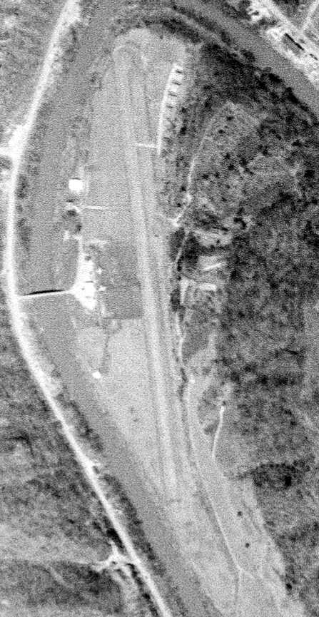
The earliest photo which has been located of the Hazard Airport was a 4/10/71 USGS aerial photo.
It depicted Hazard as having a single paved northwest/southeast runway.
A ramp with a few small buildings & 2 light planes was on the west side, and a cluster of small hangars was on the northeast side.
The 1972 USGS topo map depicted Hazard Airport as having a single paved northwest/southeast runway.
A ramp with a small buildings was on the west side, and a cluster of small hangars was on the northeast side.
A circa 1970s aerial view looking east at Hazard Airport (courtesy of James Henz)
showed a single paved runway, with taxiways leading to a ramp with several buildings & 8 single-engine aircraft.
A circa 1970s aerial view looking south at Hazard Airport (courtesy of Rick Harshbarger)
showed what appeared to be several light aircraft on the ramp.
Roger Dearnaley recalled, “When I was in high school in the 1970s, I worked at Kentucky Flying Service at Bowman Field.
The charter pilots often had to fly to Hazard, and told many stories about close calls there.
This was before the TV show, but they thought that the name Hazard was appropriate since it was quite 'hazardous'.”
The last photo which has been located showing aircraft at the Hazard Airport was an undated aerial photo from the 1976 KY Airport Directory.
It described Hazard Airport as having a single paved 2,300' Runway 17/35.
The last photo which has been located of the Hazard Airport was a 3/4/77 USGS aerial photo.
The 1979 USGS topo map still depicted the Hazard Airport.
Tim recalled, “I remember the day Tom Wopat of The Dukes of Hazard landed there.
It was a huge deal for the town. Hundreds came to see him. You'd think that Elvis was in town.”
Spanky recalled, “I remember going to the old airport with my grandfather. We'd sit there for hours.”
Mikey Bowling recalled, “I used to hang out there a lot with my dad.
He had a couple of business planes there for his company.
Alice Noble would take me in some of the planes & taxi me down the runway.
I also remember watching Jim Brewer do all sorts of trick in his plane. I loved that place.”
According to the 1/10/82 Sunday Herald-Leader (courtesy of Mark Hess),
actor Tom Wopat of television's “The Dukes of Hazard” flew into Hazard Airport to present a check to a local charity.
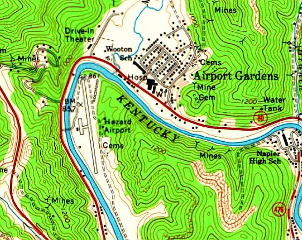
Hazard Airport was evidently closed at some point between 1982-92,
as the 1992 USGS topo map labeled the southern portion of the airport site as Gorman Park,
and depicted the Perry County Central High School on the northern portion.
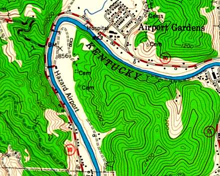
Allen McDavitt recalled, “About the best remaining evidence is a subdivision known as Airport Gardens
on the other side of the North Fork of the Kentucky River from the airport site.”
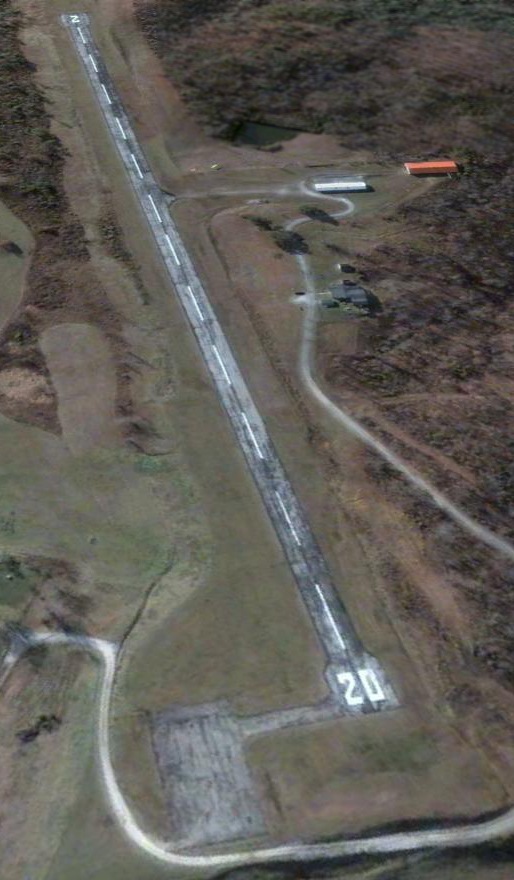
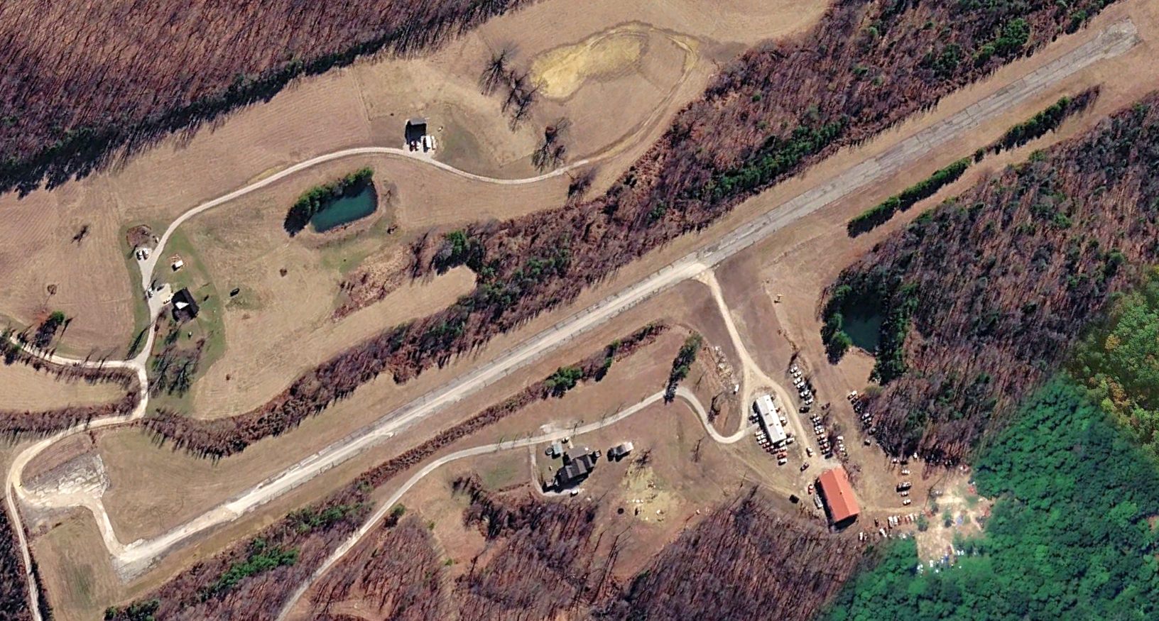
A 6/20/10 aerial photo did not show any remaining trace of Hazard Airport.
The site of Hazard Airport is located northeast of the intersection of Park Avenue & Perry Park Road.
Thanks to Allen McDavitt for pointing out this airfield.
____________________________________________________
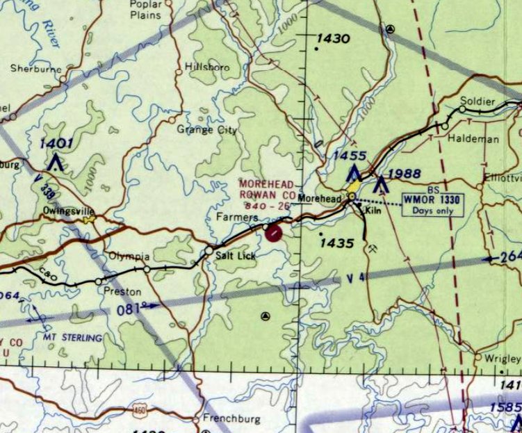
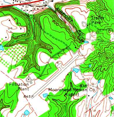
Morehead Rowan County Airport, Farmers, KY
38.13, -83.54 (East of Lexington, KY)
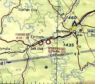
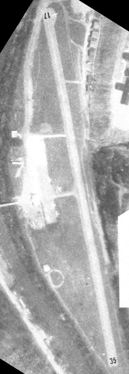
Morehead Rowan County Airport, as depicted on the February 1964 Huntington Sectional Chart (courtesy of Chris Kennedy).
Morehead Rowan County Airport was evidently established at some point between 1953-64,
as it was not yet depicted on the 1953 USGS topo map,
nor on the January 1963 Huntington Sectional Chart (according to Chris Kennedy).
The earliest depiction which has been located of the Morehead Rowan County Airport
was on the February 1964 Huntington Sectional Chart (courtesy of Chris Kennedy).
It depicted the field as having a 3,000' unpaved runway.
The Rowan County Airport evidently gained a paved runway within the next year,
as the August 1965 Huntington Sectional Chart ( courtesy of Chris Kennedy) depicted the field as having a single 2,600' paved runway.
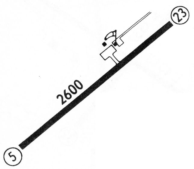
The 1968 Flight Guide (courtesy of Robert Levittan) depicted Morehead Rowan County Airport
as having a single paved 2,600' Runway 5/23, with a ramp & 2 small buildings on the north side.
The last aeronautical chart depiction which has been located of the Morehead Rowan County Airport was on the February 1969 Huntington Sectional Chart.
It depicted the field as having a single 2,600' paved northeast/southwest runway.
The 1970 USGS topo map depicted the Morehead Rowan County Airport as having a single paved northeast/southwest runway,
with a ramp with a single hangar on the north side.
The earliest photo which has been located of Morehead Rowan County Airport was an undated aerial view from the 1976 KY Airport Directory.
It described the field as having a single 2,600' paved Runway 5/23.
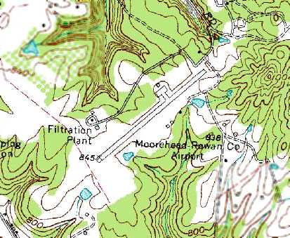
The 1983 USGS topo map depicted the Morehead Rowan County Airport as having a single paved northeast/southwest runway,
with a ramp with a single hangar on the north side.
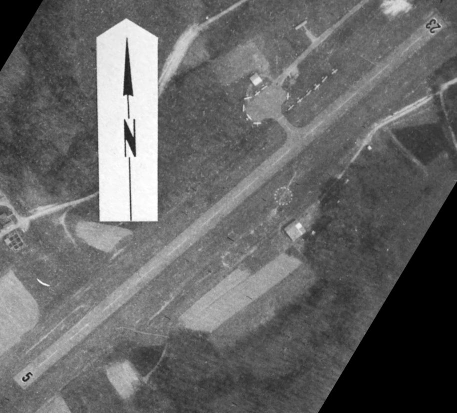
A 6/19/04 aerial photo showed Rowan County to have 4 single-engine planes parked on the ramp, around which were several small hangars.
Note another T-hangar next to the filtration plant adjacent to the southwest side of the airport.
A circa 2006 aerial view looking west showed 3 single-engine planes parked on the ramp, around which were several small hangars.
In July 2007 the new Morehead-Rowan County Clyde Thomas Regional Airport opened to the north,
at which point the original Morehead-Rowan County Airport presumably was closed.
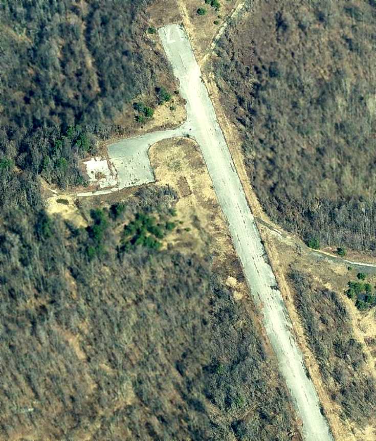
The Rowan County Airport was closed by 2008, as a 2008 photo by Nicki Sloan-Petronella showed large closed-runway “X” symbols painted over the runway.
A 2008 photo by Nicki Sloan-Petronella looking west at the Rowan County Airport ramp, showing the former office & one hangar.
Nicki noted, “Notice the hangar is full of hay, now!
I wish I could have gotten closer, but there is a gate blocking the drive. Makes me so sad!
The is the runway where I had my first airplane ride as a child and later, my first lesson.
The runway is nestled in the hills so that when you are at lower altitudes, especially when using Runway 23, it actually disappears behind the hills!”
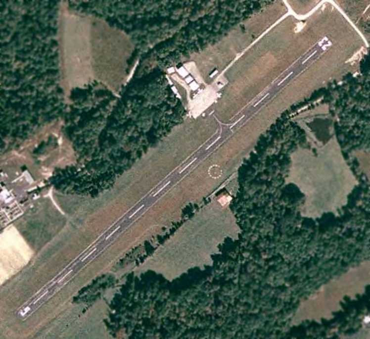
A 2016 aerial view looking southeast showed the former Rowan County Airport remains intact.
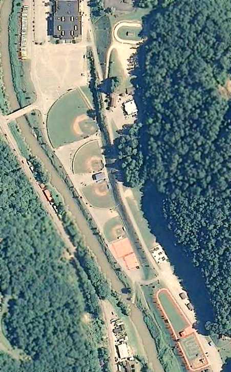
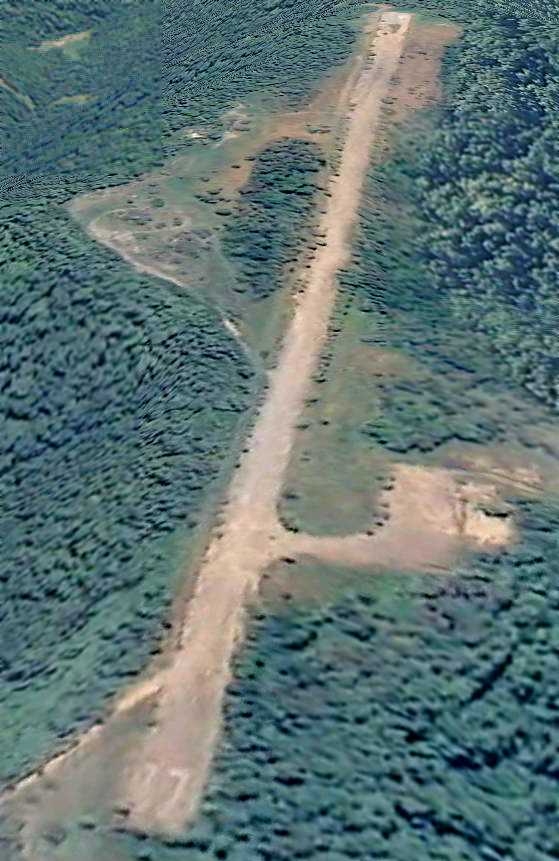
A 2024 aerial photo showed the southwest half of the Rowan County Airport had been redeveloped for a Rowan County Utility Plant.
The remaining portion was labeled “The Landing Strip Campground & Venue”.
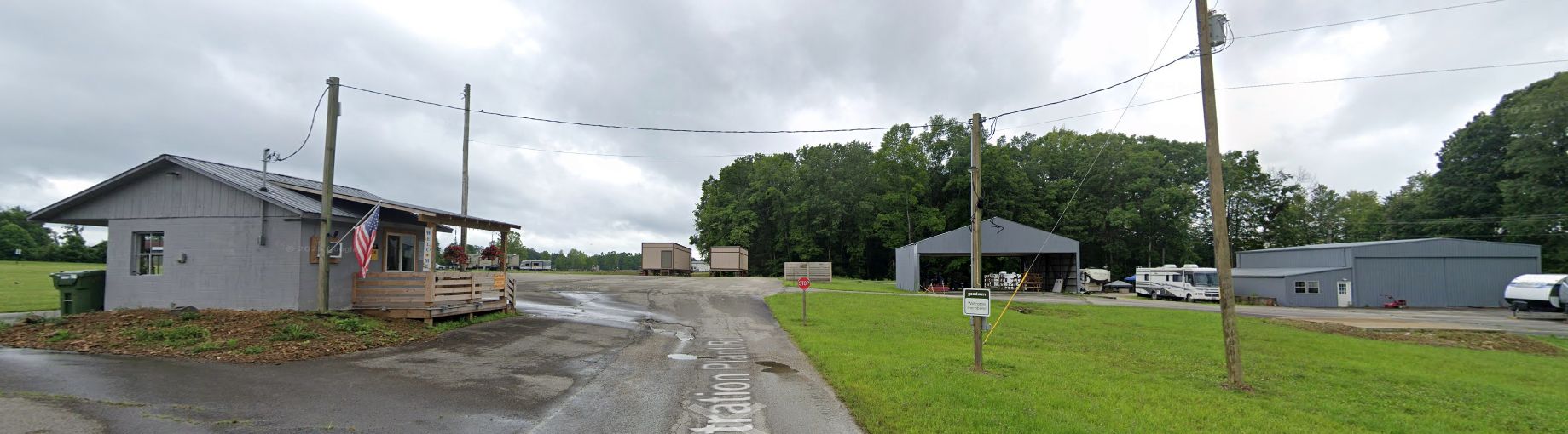
A 2025 photo looking southwest at the former Rowan County Airport office & hangars.
The site of the Rowan County Airport is located southwest of the intersection of Thompson Road & Airport Road, appropriately enough.
____________________________________________________
Whitesburg Municipal Airport, Whitesburg, KY
37.23, -82.87 (Northeast of Knoxville, TN)
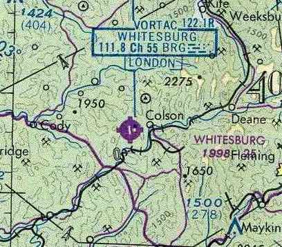
The Whitesburg Airport, as depicted on the March 1966 Winston-Salem Sectional Chart (courtesy of Chris Kennedy).
According to Mark Collins, this small general aviation airport also may have been known as Isom Airport.
Whitesburg Airport was evidently established at some point between 1964-66,
as it was not yet depicted on the April 1964 Winston-Salem Sectional Chart (according to Chris Kennedy).
The earliest depiction which has been located of the Whitesburg Airport
was on the March 1966 Winston-Salem Sectional Chart (courtesy of Chris Kennedy).
It depicted Whitesburg as having a single 2,500' paved north/south runway,
along with a VOR navigational beacon.
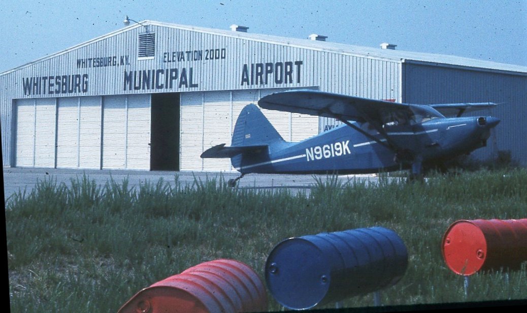
The earliest photos which have been located showing Whitesburg Municipal Airport in operation was a pair of 8/29/69 photos by Linc Reed-Nickerson,
this one showing his 1947 Stinson Voyager in front of the Whitesburg hangar.
Linc Reed-Nickerson recalled, “I planned Bluefield, WV but the fog hadn't lifted & another pilot on the FSS frequency suggested Whitesburg.
I was a relatively new Private Pilot with less than 100 hours, and this ridgetop airport was a challenge,
after a low pass to check for up- or down-drafts I came around again, and still wasn't quite comfortable, but on my 3rd approach I nailed it.
Once I turned off the runway & there was a welcoming committee of 'Good O'l Boys' who had been watching, and seemed disappointmed when I landed safely,
which made me the subject of some good-natured criticism, I purchased fuel, joined the boys for a soda & met Maynard Hogg, my goodness, right out of the Dukes of Hazard.
Now when I tell my story I have proof: yes, there really was a Maynard Hogg.”
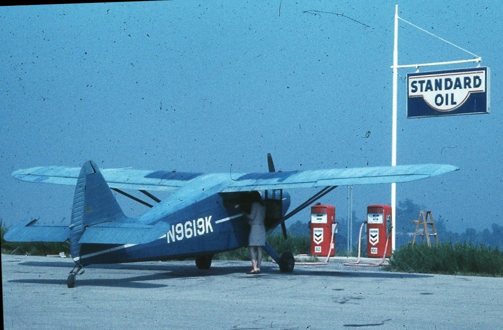
An 8/29/69 photo by Linc Reed-Nickerson of his wife Peg with their 1947 Stinson Voyager in front of the Whitesburg gas pumps.
James Wright recalled, “The Whitesburg Airport was built on the leveled-off top of a hill which had been strip-mined for coal.
As a just-licensed VFR pilot on a long cross country flight in a Cessna 150, I was caught in a snowstorm on 12/23/70,
and landed there to escape lowering conditions & high winds. At that time, it was operational, but unattended.
Fortunately for me, the Letcher County sheriff (with the unforgettable name of Maynard Hogg) was a pilot with a plane there,
and had heard me circling, so he drove up the steep road in a 4-wheel drive vehicle & took me into Whitesburg to a hotel.
The next morning, he delivered me back to my plane. I will always remember his kindness.”
An undated aerial view of Whitesburg Municipal Airport from the 1976 KY Airport Directory.
It described Whitesburg as having a single 2,550' paved Runway 17/35.
The last aeronautical chart depiction which has been located of the Whitesburg Airport
was on the August 1976 Cincinnati Sectional Chart (courtesy of Chris Kennedy).
It depicted Whitesburg as having a single 2,500' paved north/south runway.
The adjacent Whitesburg VOR navigation beacon had been upgraded
at some point between 1966-66 to a VORTAC (combination VOR & TACAN beacon).
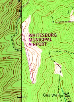
The 1978 USGS topo map depicted “Whitesburg Municipal Airport” as having a single paved runway.
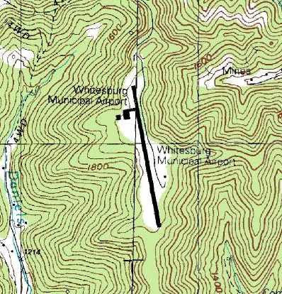
The 1992 USGS topo map depicted “Whitesburg Municipal Airport” as having a single paved runway
with a paved ramp & a single small building on the west side of the field.
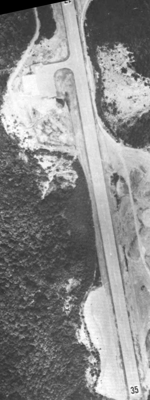
As seen in a 1995 USGS aerial view looking southeast, the runway at the former Whitesburg Airport
was still marked as an active runway (without any closed-runway symbols).
The former building on the ramp on the west side of the field appeared to have been removed.
What appears to have been the building housing the former Whitesburg VORTAC navigational beacon
remained in the clearing on the east side of the strip.
According to a report for the Letcher County Public Libraries,
the Whitesburg Airport was closed at some point between 1960-2000.
Neither the Whitesburg Airport nor the Whitesburg VORTAC
were depicted at all on the December 2003 Cincinnati Sectional Chart (according to Chris Kennedy).
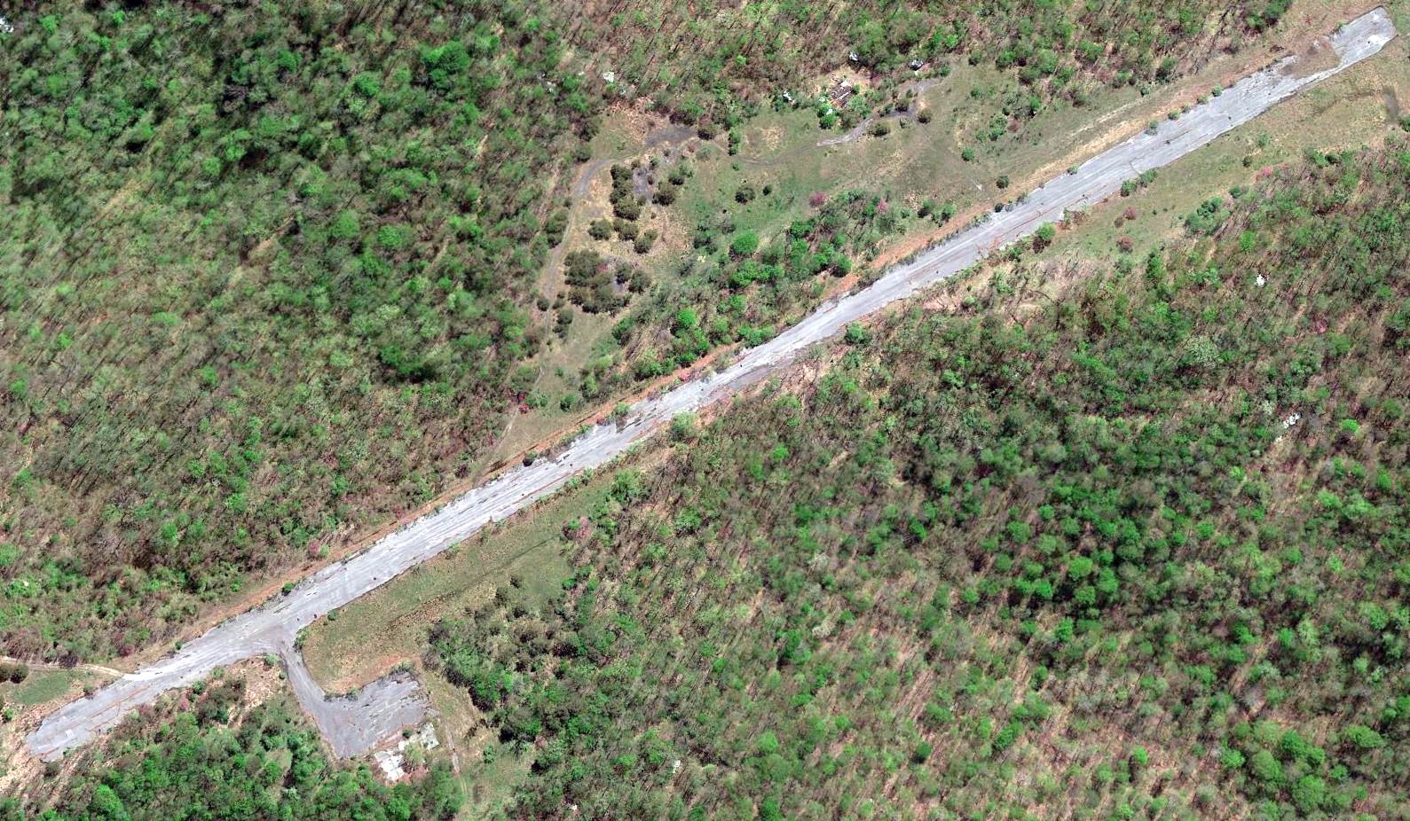
Mark Collins reported in 2005, “The landing strip is still there but is in rough shape.
It is only accessible with all-terrain vehicles or 4-wheel drive trucks.”
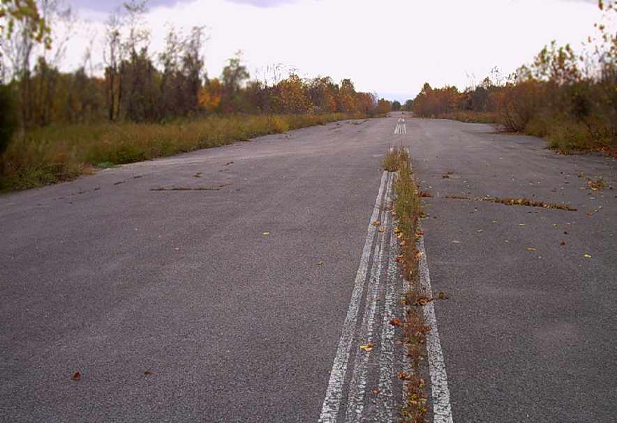
An October 2006 photo by Mark Collins of the abandoned runway at the site of the Whitesburg Airport.
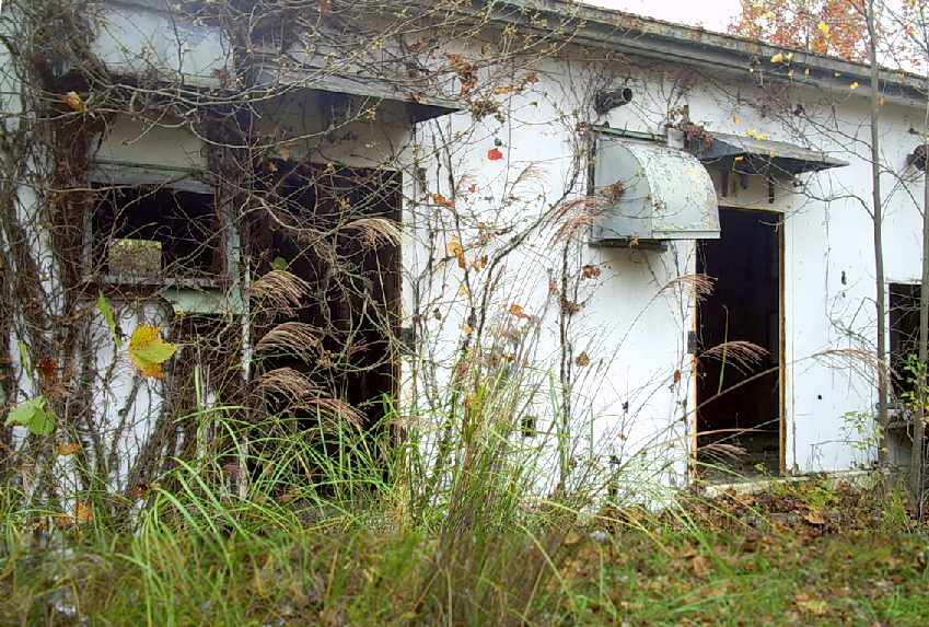
An October 2006 photo by Mark Collins of the building which remains standing at the site of the Whitesburg Airport.
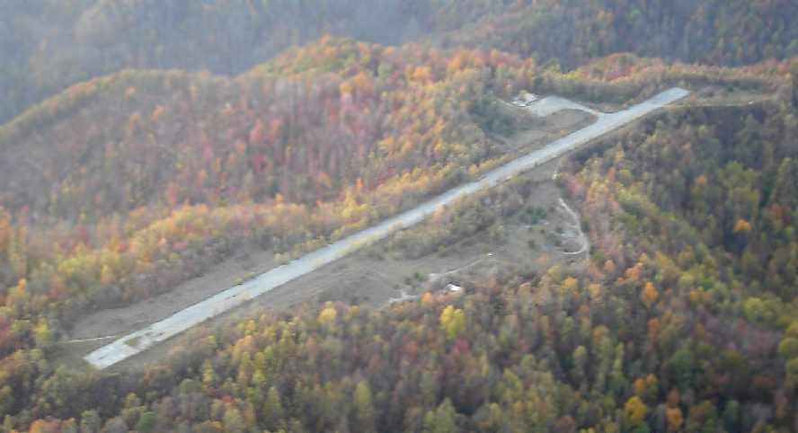
A 2007 photo by Brian Thompson looking northwest from a Cessna 180 at the Whitesburg Airport.
Brian reported, “The picture was shot at 1,500' AGL above the old airstrip & shows the fall foliage on this beautiful Kentucky afternoon.”
A circa 2006-2010 aerial view looking north at the remains of Whitesburg Airport.
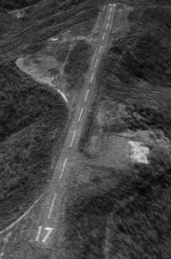
A 6/21/10 aerial view looking southeast showed that Whitesburg's Runway 17 markings were still barely recognizable.
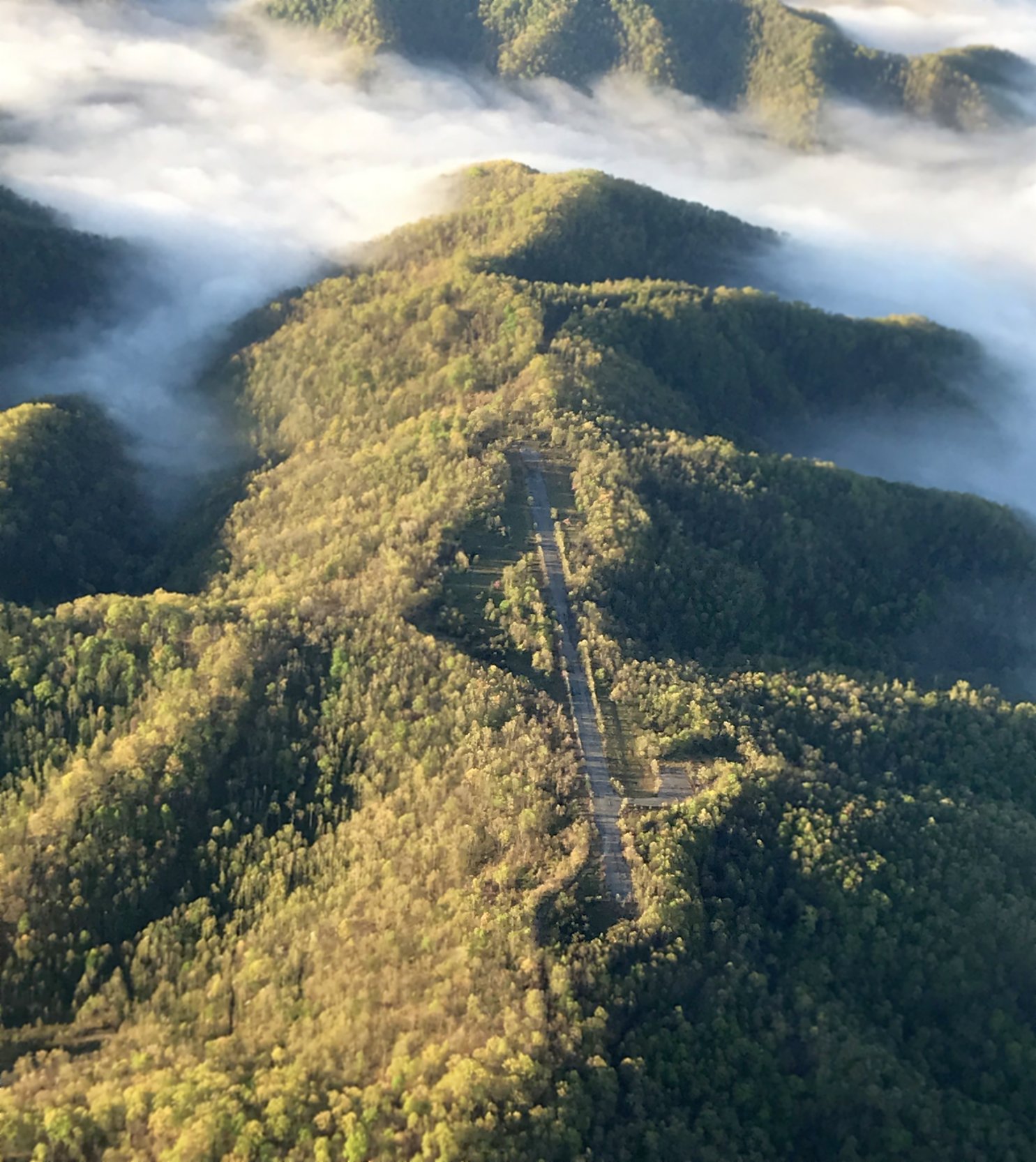
A 4/22/19 aerial view by George Kalbfleisch looking south from 300' AGL at the remains of Whitesburg Airport.
George observed, “What a slice of heaven that place would be. Trees right up next to the pavement.”
A 2019 aerial view looking east at the remains of Whitesburg Airport.
The site of the Whitesburg Airport is located at the southern terminus of Route 2547.
____________________________________________________
Or if you prefer to contact me directly concerning a contribution (for a mailing address to send a check),
please contact me at: paulandterryfreeman@gmail.com
If you enjoy this web site, please support it with a financial contribution.
____________________________________________________
This site covers airfields in all 50 states.