Abandoned & Little-Known Airfields:
Southeastern Georgia
© 2002, © 2026 by Paul Freeman. Revised 1/3/26.
This site covers airfields in all 50 states: Click here for the site's main menu.
____________________________________________________
Please consider a financial contribution to support the continued growth & operation of this site.
(Original) Brunswick Municipal Airport (revised 5/31/25) - Evans Army Heliport / Evans AAF (revised 12/30/25) - Glynco NAS (revised 12/22/25) - Harris Neck AAF (revised 11/14/24)
Harris Neck Intermediate Field Site #8 (revised 12/30/18) - Jaeck Army Stagefield / Jaeck Drop Zone AAF (revised 6/12/21) - Liberty County Airport (revised 1/3/26)
Little Neck Army Stagefield (revised 3/18/24) - Saffold Field (revised 4/26/20) - Savannah Wilmington Island Airport (revised 4/22/18) - Shellbine Airfield & Rocket Test Site (revised 5/28/17)
St Marys Airport (revised 11/28/23) - TAC-X Army Airfield (revised 6/12/21) - Townsend Airfield (added 11/18/25)
____________________________________________________
Townsend Airfield, Townsend, GA
31.543, -81.537 (Southwest of Savannah, GA)
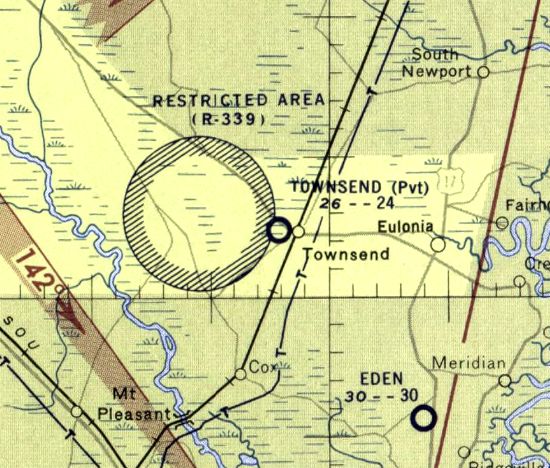
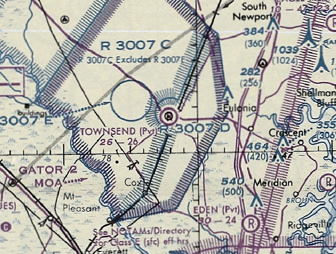
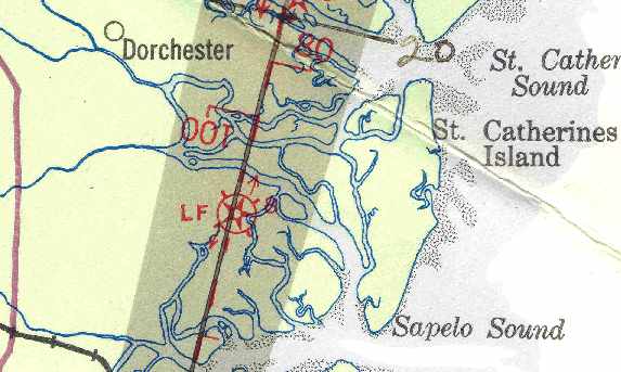
Townsend Airfield, as depicted on the January 1958 Jacksonville Sectional Chart.
Photo of the airfield while in use has not been located.
The date of establishment of this small rural private airfield has not been determined.
According to Roger Houston, Townsend Airfield “was in existence prior as auxiliary emergency landing strip for the Army Air Corps aircraft utilizing the WW2 version of the Townsend Bomb Target.
Townsend Bomb Range was originally an AAC facility for aircraft based at Harris Neck AAF, Hunter AAF and even Waycross AAF (P-40s, P-39s, A-24s) before it was passed over to the Navy at NAS Glynco after the war.”
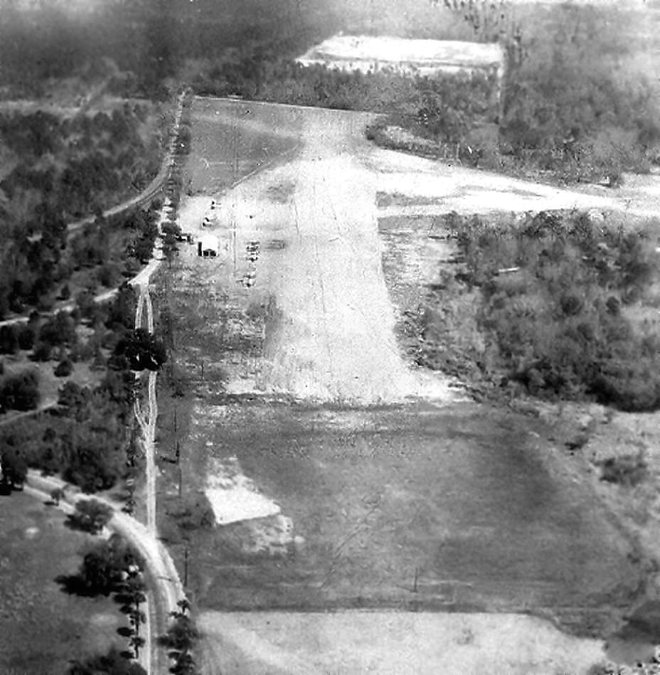
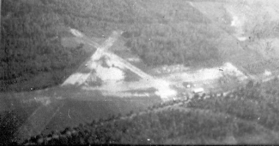
The earliest depiction which has been located of Townsend Airfield was on a 1951 aerial view,
which depicted a single unpaved northwest/southeast runway, with a few small buildings at the southeast end.
However, Townsend Airfield was not yet depicted on the July 1957 Jacksonville Sectional Chart.
The earliest aeronautical chart depiction which has been located of Townsend Airfield was on the January 1958 Jacksonville Sectional Chart.
It depicted Townsend as a private airfield having a 2,400' unpaved runway.
It also depicted the adjacent circular Restricted Area R-339 to the west, over the Townsend Bombing Range.
According to Roger Houston, Townsend Airfield “was a private field, but it also served as home base for the Georgia Forestry Commission fire observation aircraft that covered the coastal region of Georgia.
GFC kept a couple of Cessna 180s & other aircraft to fly fire patrols up & down wooded areas of South Georgia between the late 1960s & the mid 1980s.
They also had a fire suppression station where they housed fire ploughs , bulldozer tractors and brush trucks.
There was also a 200' tower that was manned during daylight hours to observe for woods fires.”
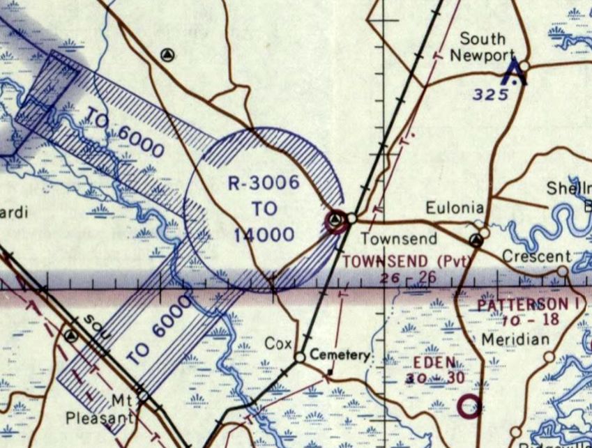
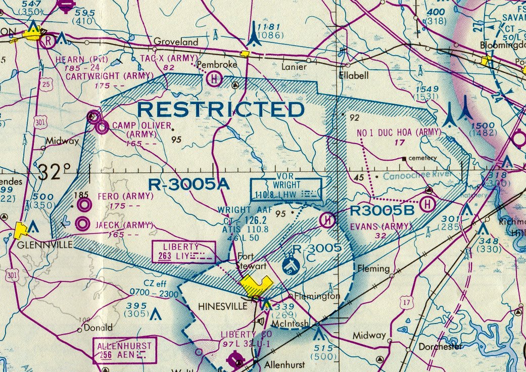
The April 1965 Jacksonville Sectional Chart (courtesy of Lee Corbin) depicted Townsend as a private airfield having a 2,600' unpaved runway, with adjacent circular Restricted Area R-3006 to the west.
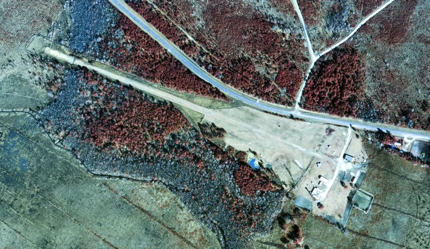
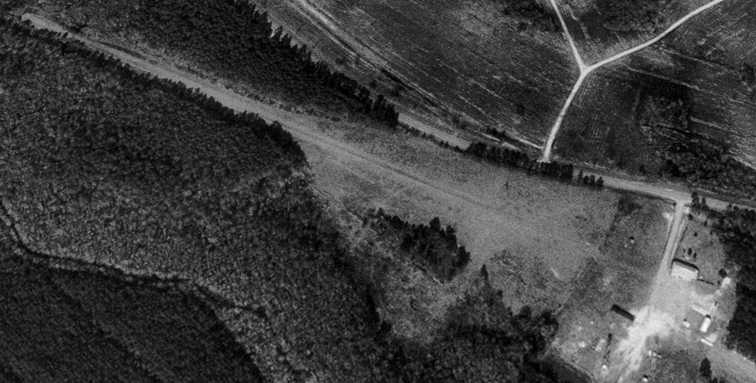
The earliest photo which is available of Townsend Airfield was on the 2/13/75 USGS aerial view (courtesy of Lee Corbin).
It showed the Townsend Airfield runway had been lengthened to the northwest at some point between 1951-75, and a T-hangar added to the southeast.

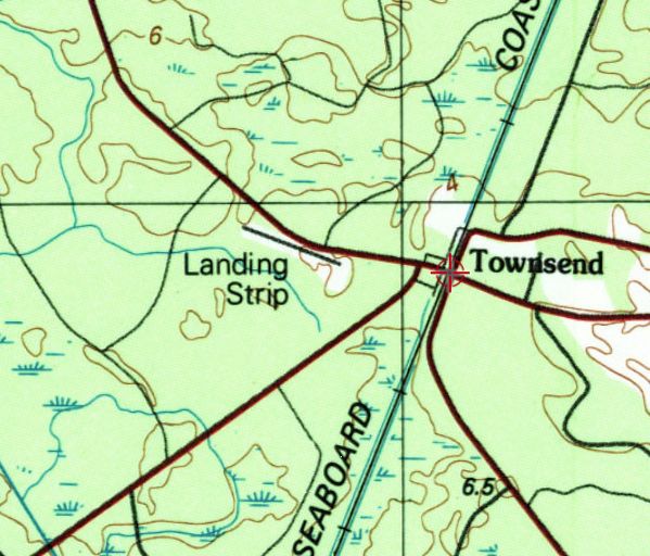
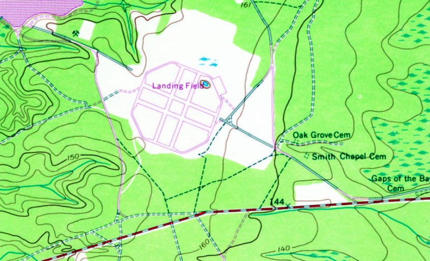
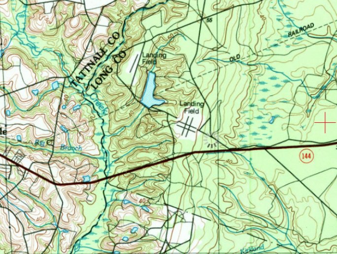
The earliest topo map depiction which has been located of Townsend Airfield was on the 1978 USGS topo map.
It depicted a single unpaved northwest/southeast runway, generically labeled “Landing Strip”, with several small buildings & a Lookout Tower to the southeast.
The last topo map depiction which has been located of Townsend Airfield was on the 1982 USGS topo map.
It depicted a single northwest/southeast runway, generically labeled “Landing Strip”.
According to Roger Houston, “When the current Townsend Bomb Range came on-line in the early 1980s under the operations by the Air Force & the Georgia Air National Guard,
the field was closed & GFC moved their assets to new locations in McIntosh County.
Their aircraft were re-based at the Liberty County Airport in Walthourville around 1982-83.
A large power transmission line running from the Vogtle nuclear plant down into Florida cut off the end of the runway strip & west approach so that the strip itself could never be utilized again.
This massive transmission line serves as the eastern boundary of the current Townsend Bomb range,which is now owned & operated by the MCAS Beaufort/31st MAG .”
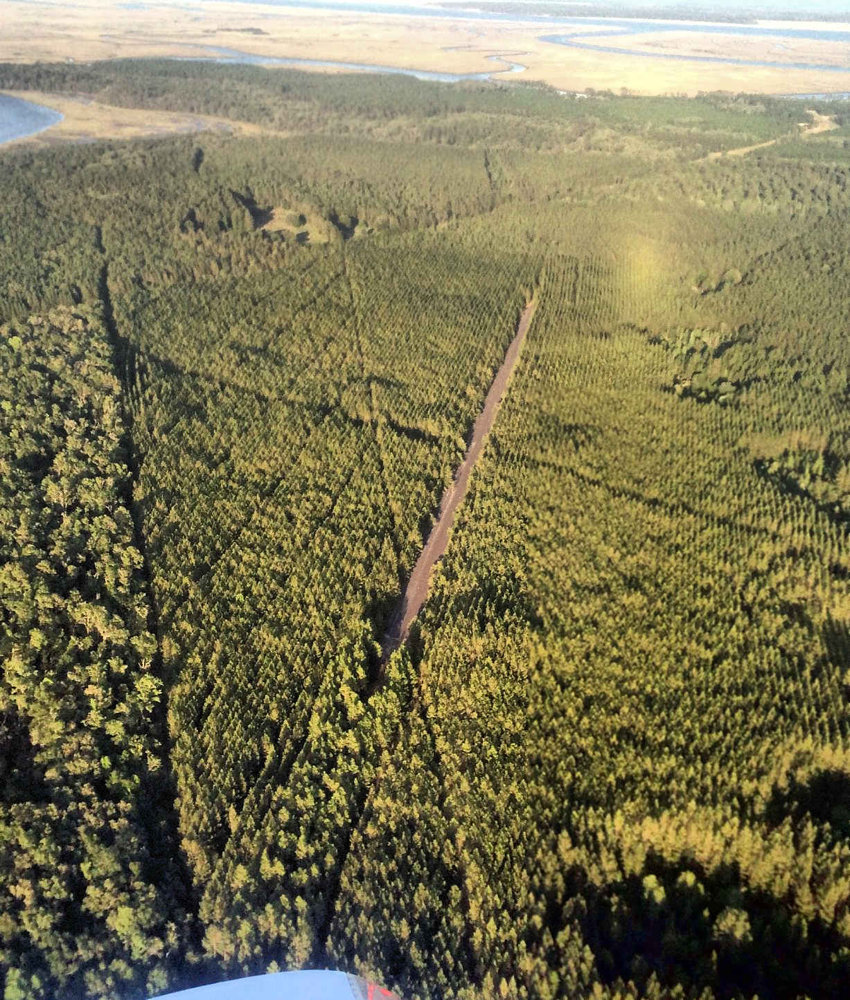
A 1993 USGS aerial view looking northwest depicted Townsend as having a single unpaved northwest/southeast runway, with several small buildings & a lookout tower to the southeast.
The last aeronautical chart depiction which has been located of Townsend Airfield was on the March 1994 Jacksonville Sectional Chart (courtesy of Ron Plante).
It depicted Townsend as a private airfield having a 2,600' unpaved runway, covered by Restricted Area R-3007D.
A 1999 aerial photo showed the Townsend Airfield runway remained clear.
Townsend Airfield was evidently closed (for reasons unknown) at some point between 1994-2004,
as a 2004 aerial photo showed trees had been planted on the center of the runway.
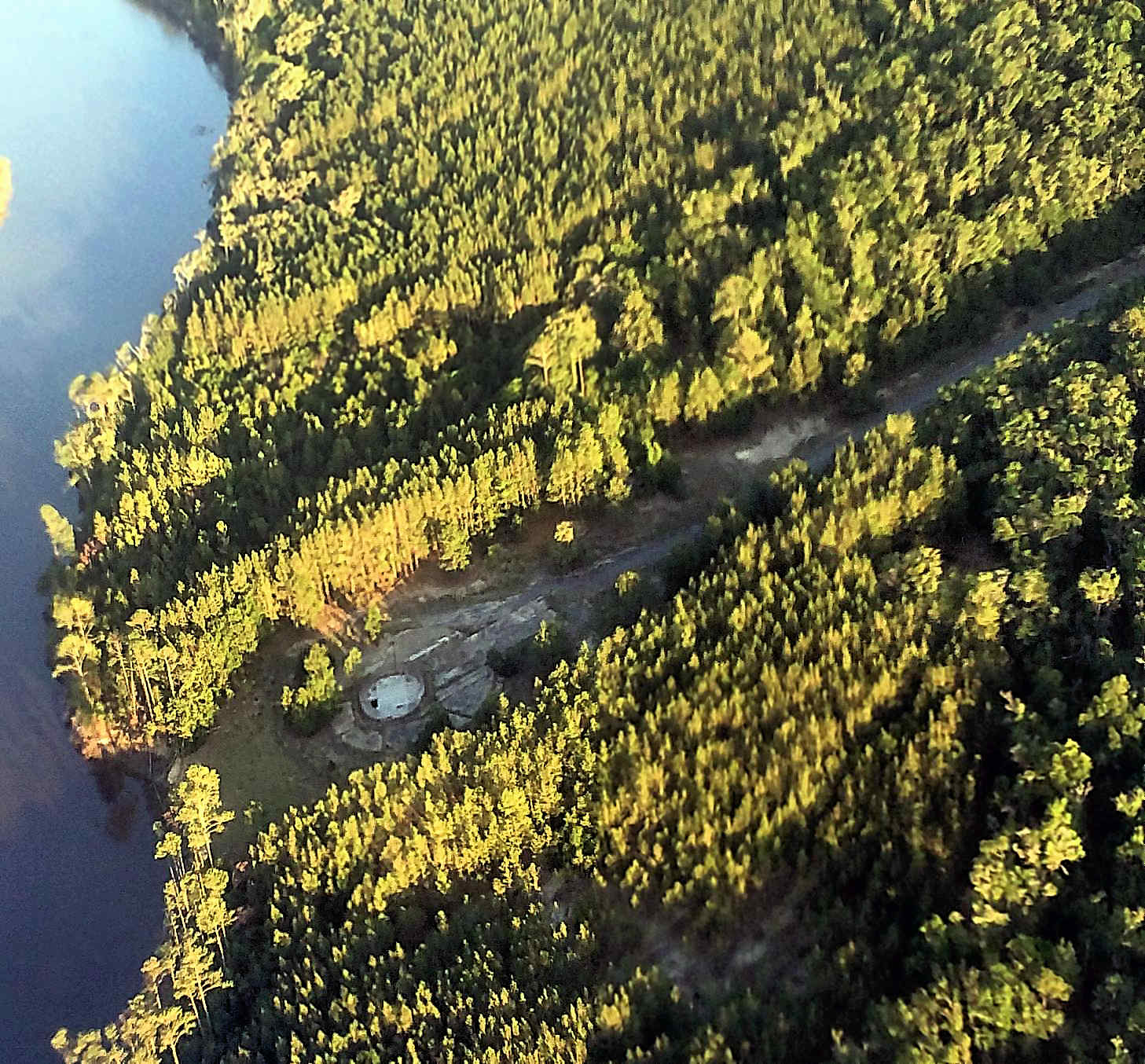
A 2012 aerial view showed a water tower had been built directly adjacent to the northeast side of the former Townsend Airfield runway at some point between 2010-2012.
Townsend Airfield was no longer depicted on the 2014 USGS topo map or August 2017 Jacksonville Sectional Chart.
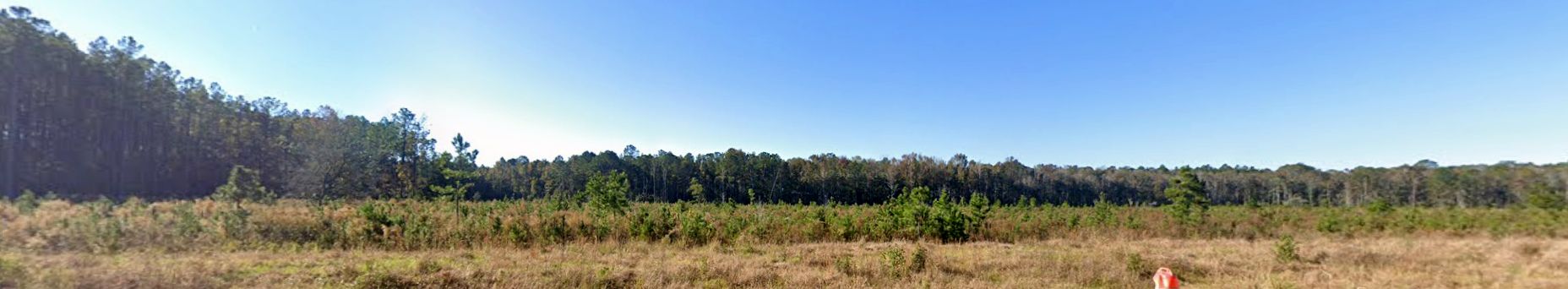
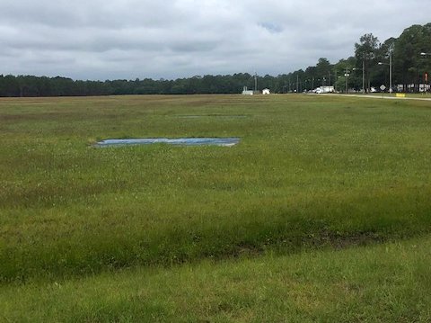
A 2024 photo looking south showed the site of Townsend Airfield remained clear.
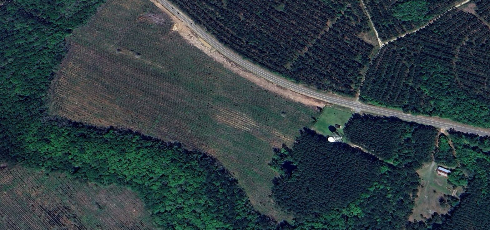
A 2024 aerial view looking northwest showed only the faintest traces remained of the former Townsend Airfield runway.
Thanks to Lee Corbin for pointing out this airfield.
____________________________________________________
Little Neck Army Stagefield, Savannah, GA
32.04, -81.287 (North of Jacksonville, FL)
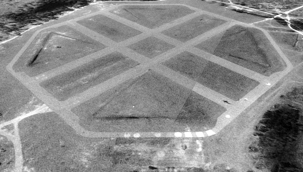
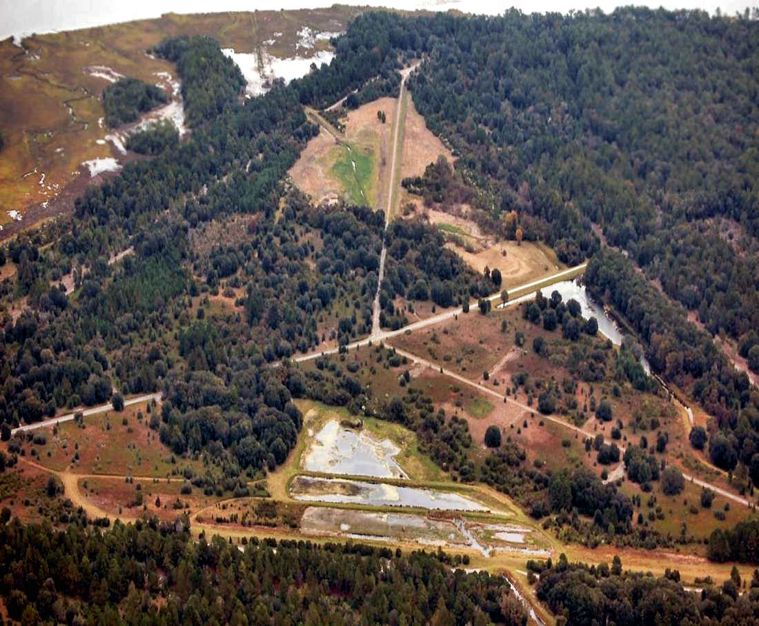
Little Neck Army Stagefield, as depicted on a 12/27/68 USGS aerial photo.
Photo of the airfield while in use has not been located.
Little Neck was one of 4 Army Stagefields built to support helicopter flight training operations at nearby Fort Stewart.
Roger Houston reported, “The working names for the facilities (from the Corps of Engineers - Savannah District Real Estate Division) were: Chatham County - Little Neck Stage Field,
North Bryan - Black Creek Stagefield, Effingham - Sand Hill Stagefield, South Bryan - Richmond Hill Stage field (on-base).
All 4 facilities were built in record time (less than 3months) in 1966-67.
All 4 Stagefields were identical to one another & all 4 had a permanent support shed for field equipment & a latrine building.
During their operational use by the aviation school , all 4 facilities were given Vietnamese names to train Army aviators how to clearly define locations for navigation flying in Southeast Asia.
My father, Thomas Houston, was the Post Engineer for Ft Stewart from 1965-1995. Most of the aviation facilities built for the School were of his design.
I saw Stewart develop from a backwater WW2 anti-aircraft gun training camp to the premier rapid deployment facility on the East Coast.
Much of that development was conceived & planned on our dining room table.”
No airfield was yet depicted at this location on a 1951 aerial photo, the November 1967 Jacksonville Sectional Chart, or the 1968 USGS topo map.
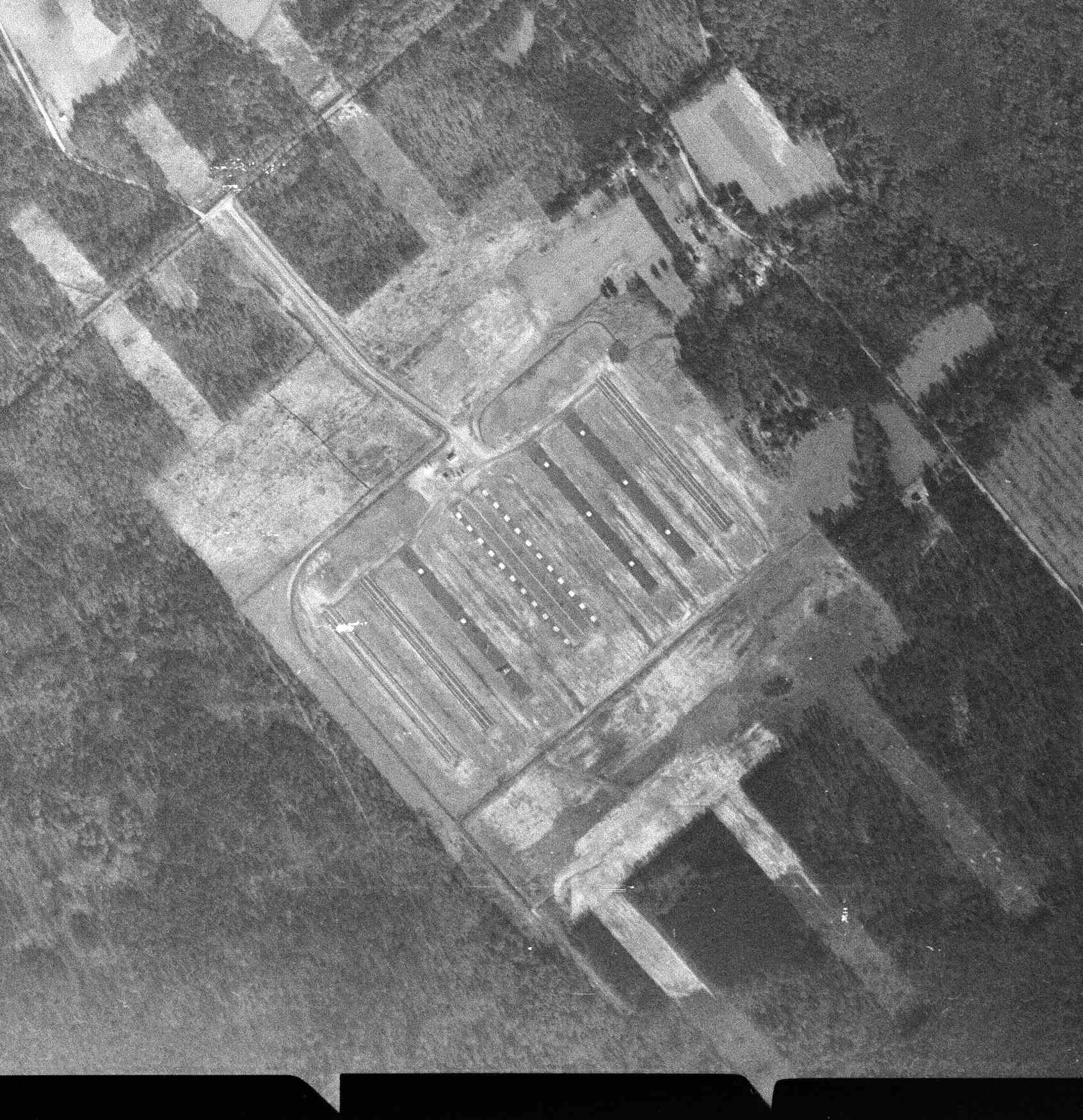
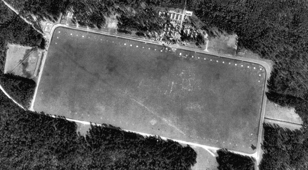
The earliest depiction which has been located of the Little Neck Army Stagefield was a 12/27/67 USGS aerial photo.
It depicted an unusual airfield configuration, not seen beyond the Ft. Stewart Stagefields.
The central portion of the airfield was a configuration typical of an Army helicopter Stagefield, with 7 paved 1,000' parallel northwest/southeast runways, each marked with up to 11 helicopter landing spots.
But the unusual aspect was that it also had 3 unpaved clearings extending beyond the paved airfield area, each a total length of 6,000'.
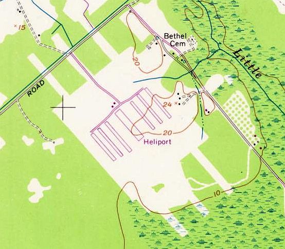
The earliest topo map depiction which has been located of the Little Neck Stagefield was on the 1971 USGS topo map.
It depicted 7 paved 1,000' parallel northwest/southeast runways, generically labeled “Heliport”.
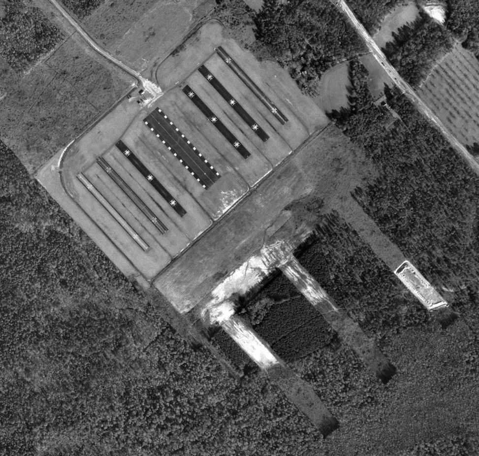
A 12/28/71 USGS aerial photo depicted the Little Neck Stagefield as remaining in very good condition,with the helicopter landing spots on the 7 paved runways remaining very distinct.
But there were no aircraft visible on the field.
A 1974 aerial view depicted the Little Neck Army Stagefield as remaining in the same configuration.
No airfield was still depicted at this location on the March 1976 Jacksonville Sectional Chart (courtesy of John Ferrara).
Chris Groshel recalled, “I flew out of Savannah starting in early 1976 & remember seeing some of those old Army fields associated with Fort Stewart at the edge of the Restricted airspace.
One place that I thought was associated with Stewart but out of its airspace (but closer to Hunter Army Airfield) was off of Little Neck Road, about 2 miles outside the current R-3005.
We never flew over it since it was close to the Restricted airspace & several tall towers (>1,500’) were raised nearby.”
According to Roger Houston, Little Neck Stagefield was “sold to the county & re-utilized.”
A 1981 aerial view showed the Little Neck Army Stagefield property had been reused as a park, with 8 tennis courts having been built over the central runway.
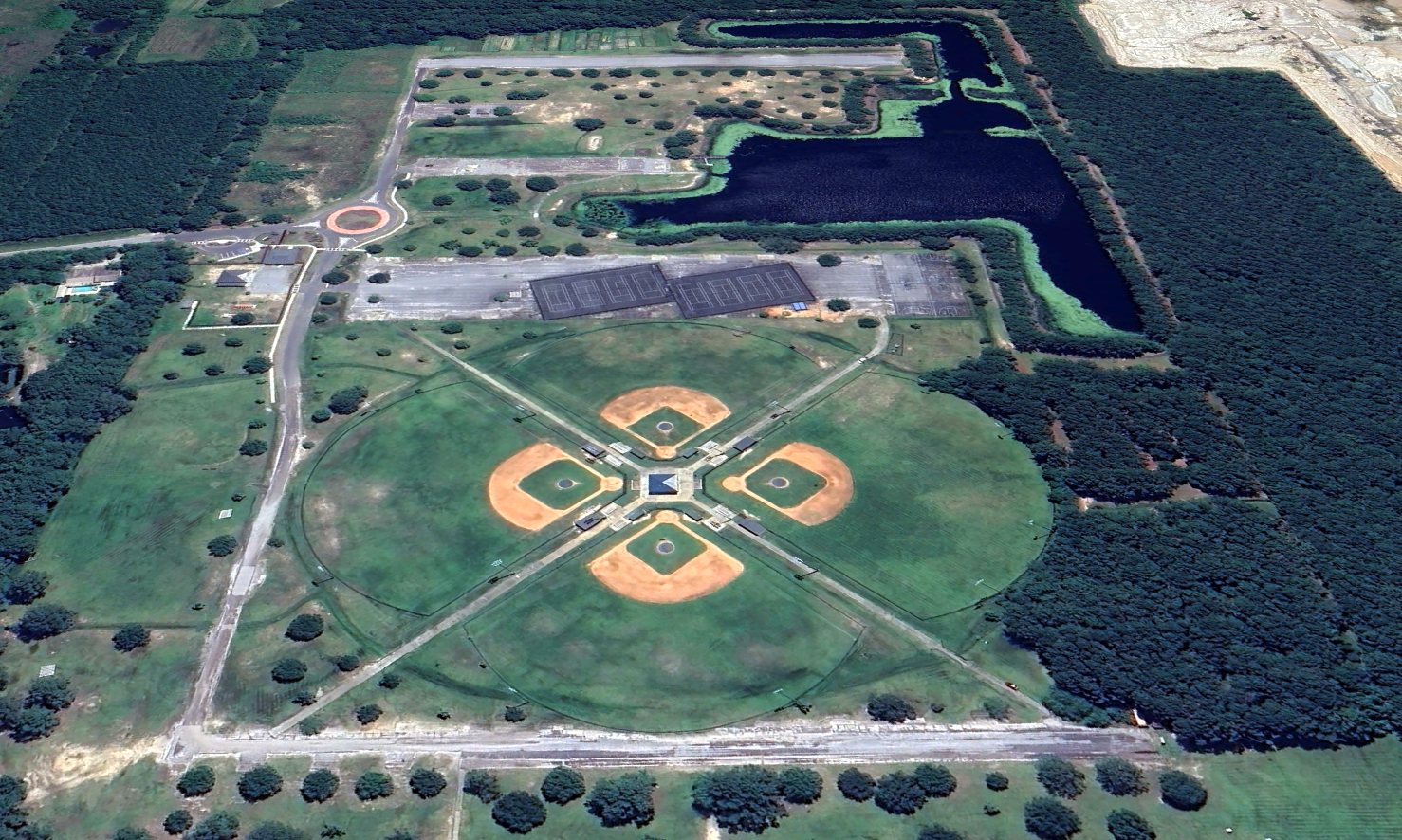
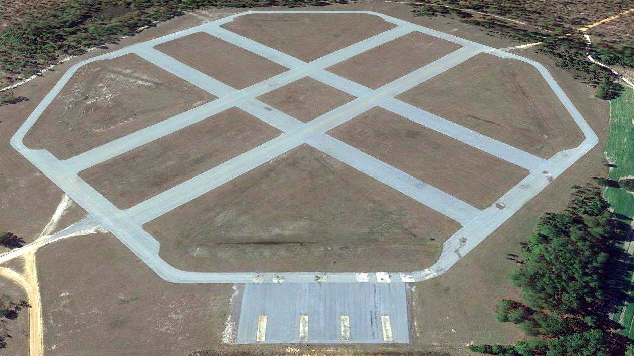
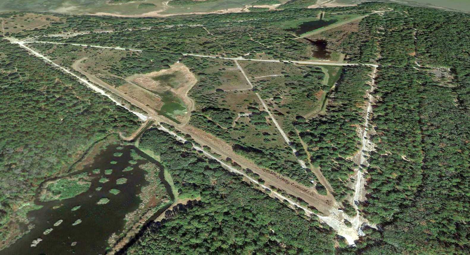
A 2023 aerial view looking northeast showed remains of 5 paved runways remained at the site of Little Neck Army Stagefield, which had been reused & progressively redeveloped as a park.
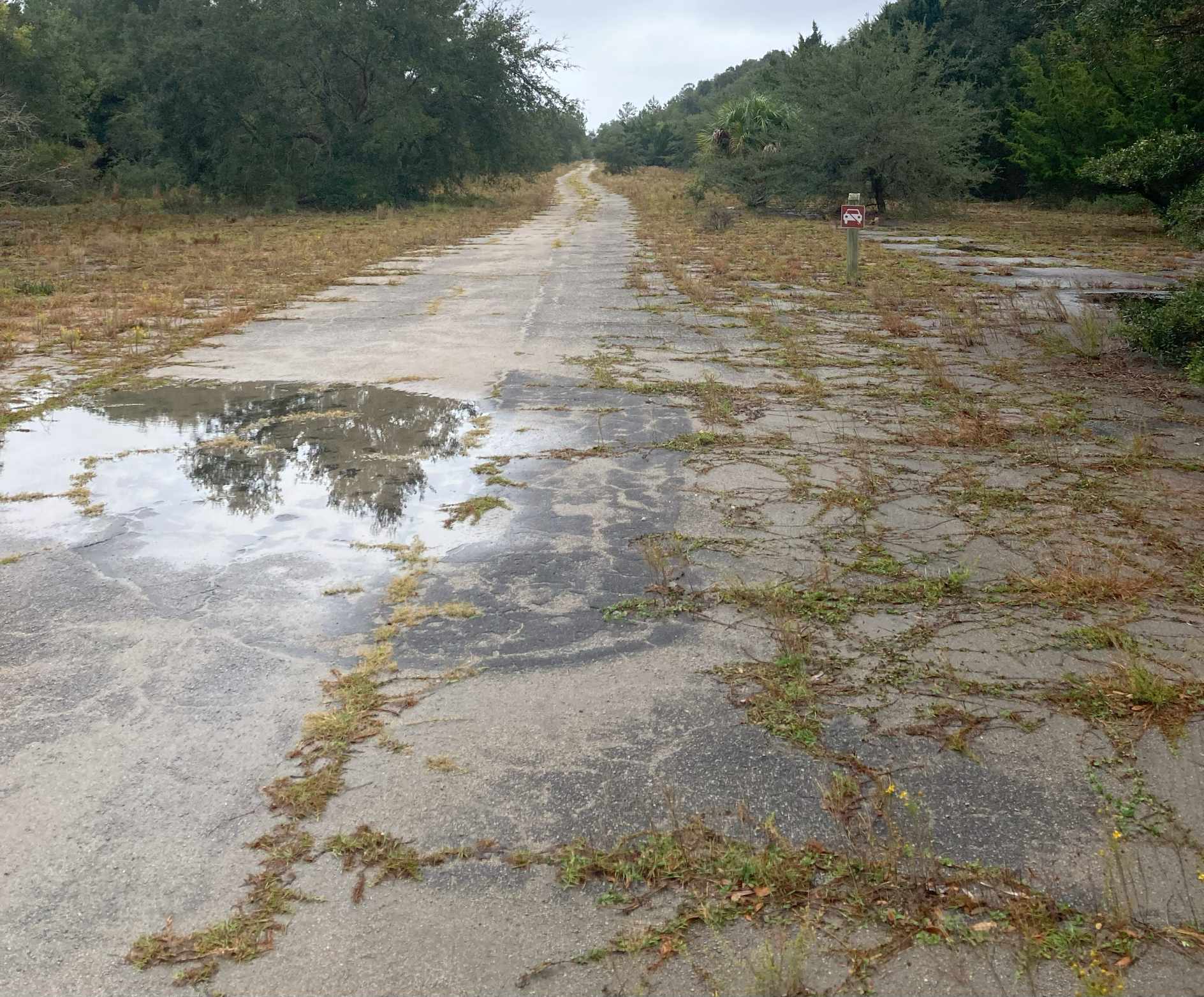
A 2023 photo looking northwest along the remains of the northeast-most former runway at the site of Little Neck Army Stagefield.
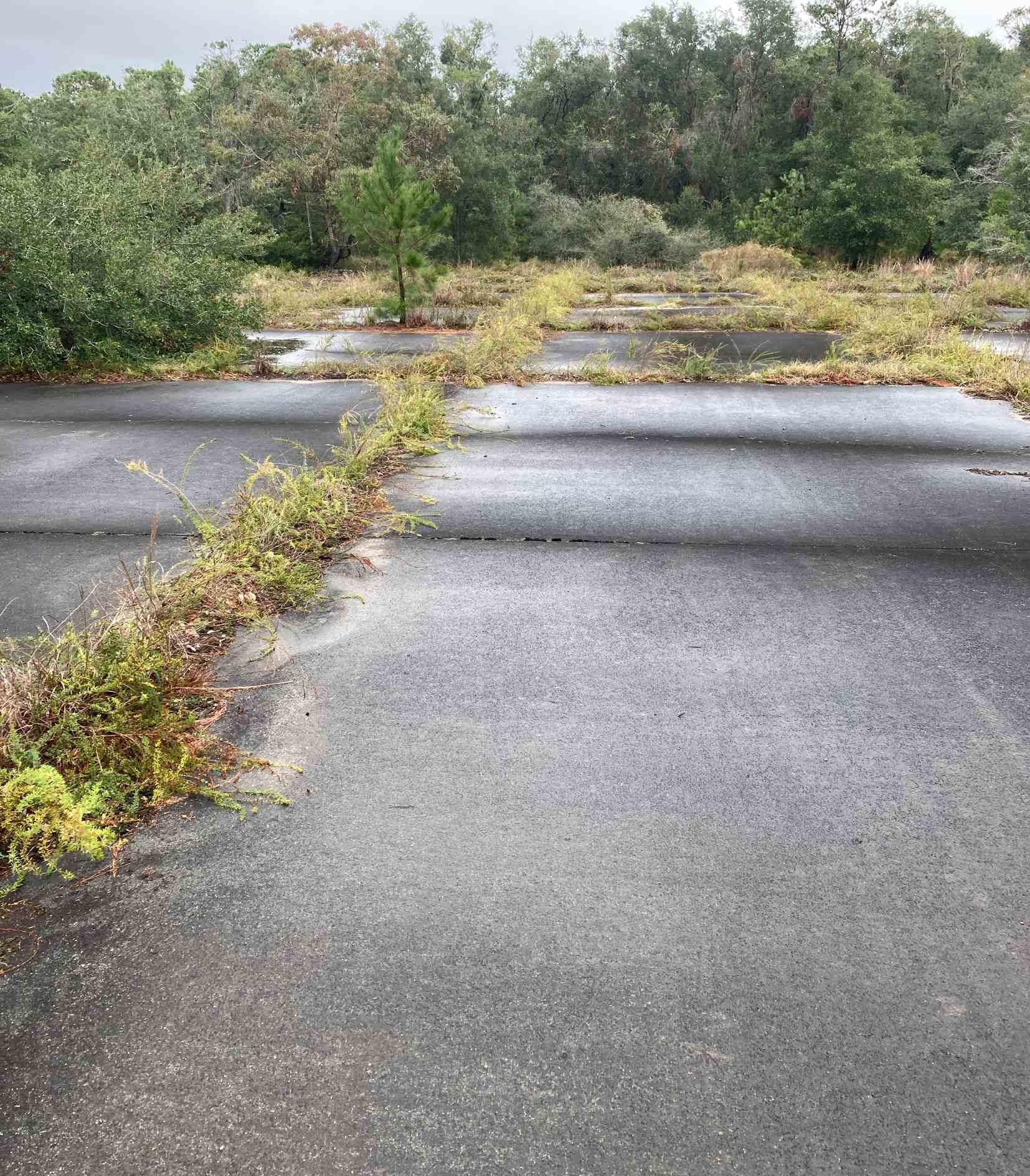
A 2023 photo looking southeast along the remains of the central former runway at the site of Little Neck Army Stagefield.
Roger Houston reported in 2024, “The shed & latrine are standing & still in use at the Little Neck site as part of the L Scott Stell Park.”
Thanks to Chris Groshel for pointing out this airfield.
____________________________________________________
Evans Army Heliport / Evans Army Airfield, Flemington, GA
31.94, -81.51 (North of Jacksonville, FL)
Evans Army Airfield was depicted on the 1973 USGS topo map, but completely unlabeled.
Photo of the airfield while in use has not been located.
Evans Army Airfield is within the property of Fort Stewart.
Roger Houston recalled, “My father, Thomas Houston, was the civilian post engineer for Fort Stewart & Hunter for many many years until his retirement in 1995.
Most all the aviation facilities on Fort Stewart were his design as part of the Aviation School mission there from 1966-73.
The main base field for that course was Evans Army Heliport (now known as Evans Army Airfield).
Evans was designed & built in about a 9 month period being completed in early 1967.
Evans was a great facility & was built & designed for the sole purpose as a helicopter base field.
Evans was designed as a miniature version of Hanchey Army Airfield/Basefield over at Rucker.
It could support up to 120 UH-1 helicopters & served as the primary beddown, classroom & maintenance activity for the Huey training portion of the school.
Evans had an operations/classroom & tower combined into one building along with a crash station & a separate maintenance hangar.
Evans had a separate GCA radar & night beacon for night training & low-visibility weather conditions.
The main parking area consisted of 6 parallel 'runways' separated by linear aircraft parking areas & hardstands (about 30 per line).
It was a pretty much self-contained area, having a fuel tank farm up by GA Highway 144, mess hall, administration building, wastewater treatment plant, and a separate water service with water tank.
It based as many as 120 'Orange Door' Huey helicopters.
On a typical training day, these aircraft would scatter out to train at the on- & off-post stage fields, TAC-X,
or out doing cross country VFR & IFR navigation training among the many GCA sites scattered throughout the area.
Also, there were several pinnacle sites built in the Ft Stewart / Savannah area for pinnacle landing training for UH-1s.
All of these facilities had official Vietnamese names.”
Ed Brock recalled, “Charley Evans & I were among the first Cobra instructors assigned to Hunter AAF.
I was there when he crashed & died in August, 1967. He was conducting an orientation flight that originated at Hunter with an aviator that was to be qualified in the Cobra.
They crashed in a marsh south of Savannah after failing to pull out of a high speed dive.
Evans Army Airfield was named after Charlie sometime subsequent to that tragedy.”
Evans Army Airfield was not yet depicted on the October 1968 Jacksonville Sectional Chart (courtesy of Ron Plante).
The earliest depiction which has been located of Evans Army Airfield was on the 1973 USGS topo map.
It depicted the clearing of the airfield area & several buildings along the southeast side, but it was not labeled.
Roger Houston recalled, “In 1973, when the aviation training consolidated at Rucker, Evans was 'mothballed' from inactivity.
In 1975, when the 24th Infantry Division reactivated, the plan was for the Division Air Cavalry Squadron was to billet there at Evans,
but due to its close proximity to key artillery firing points & the artillery impact area, no further helicopter flight use or training occurred at Evans.”
The earliest aeronautical chart depiction which has been located of the Evans Army Airfield was on the March 1975 Jacksonville Sectional Chart (courtesy of John Ferrara).
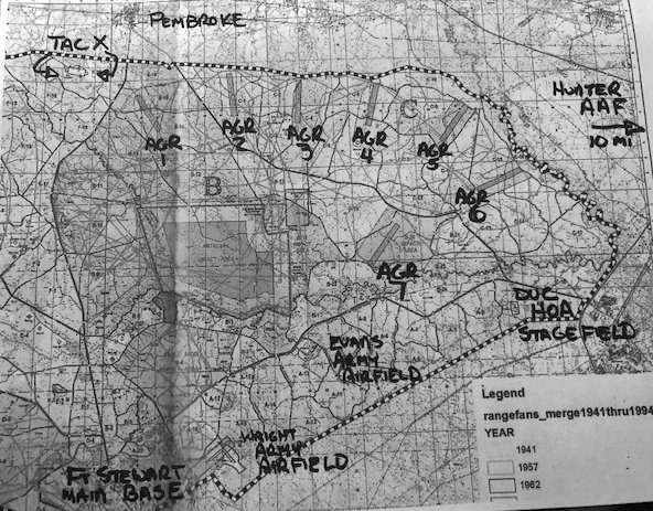
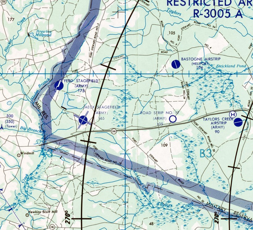
A 1970s Ft. Stewart range safety fan map (courtesy of Roger Houston) depicted Evans Army Airfield.
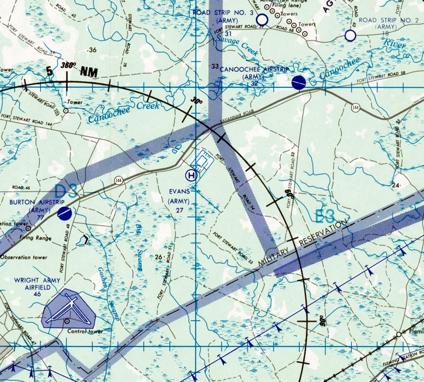
A 1978 DMA Wright AAF Search & Rescue Map (courtesy of Roger Houston) depicted Evans Army Heliport.
The last aeronautical chart depiction which has been located of the Evans Army Airfield was on the March 1979 Jacksonville Sectional Chart (courtesy of Jonathan Westerling).
Roger Houston recalled, “In 1980, the facilities at Evans were used for indoor command post exercises & for computer-simulated warfighter exercises.
New buildings & facilities were built to allow the Division to conduct joint computer simulation war games using the entire Division & Brigade staffs
tied to Corps & Field Army run from multiple installation locations here & overseas.
The old runways & pads were used for tactical vehicle parking as part of the simulation.”
The earliest photo which has been located of Evans Army Airfield was a 1981 aerial view.
The airfield area was being used for storage (vehicles or other objects), apparently not for aviation.
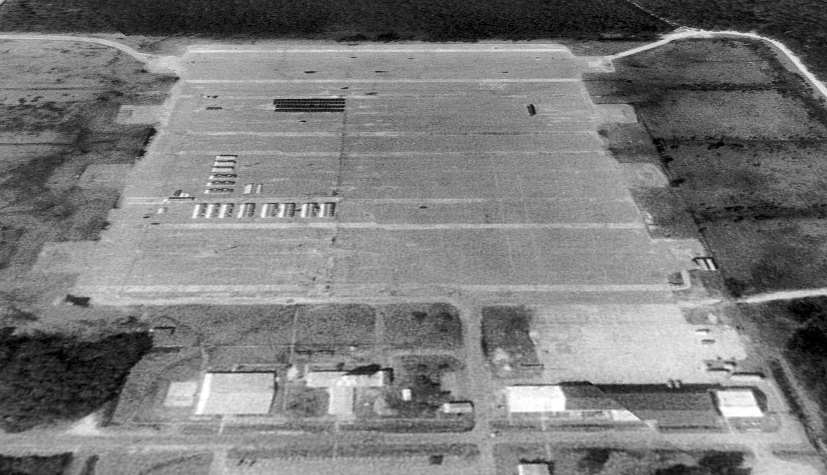
The earliest photo which is available of Evans Army Airfield was a 1993 aerial view looking northeast.
It depicted a stagefield with several parallel paved runways, with several buildings along the southeast side.
There were non-aviation objects stored on a portion of the airfield, and no indication of recent aviation use.
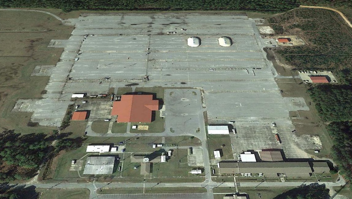
A 2015 aerial view looking northeast at Evans Army Airfield showed a building had been constructed over the southeast runway at some point between 1993-2015,
and 2 tent shelters had been situated along the middle of the airfield, presumably to support National Guard unmanned aircraft operations.
Roger Houston recalled, “In 2018, Evans became an Army Airfield once again
when the GA National Guard built a operations facility for its Shadow UAV Platoon assigned to the 48th Infantry Brigade Combat Team.
One of the old helicopter runways was rehabilitated for the launching & landing of these aircraft
and big multi-million dollar maintenance & operations building was constructed directly across from the original Evans facilities.
Luckily, the Army figured out a new use for it & it even came full circle back as a basefield for the new UAVs that are gradually taking over the jobs of the old manned rotary-wing & fixed-wing aircraft.”
Thanks to Roger Houston for pointing out this airfield.
____________________________________________________
TAC-X Army Airfield, Pembroke, GA
32.101, -81.659 (North of Jacksonville, FL)
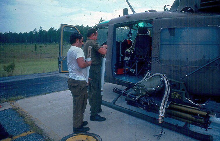
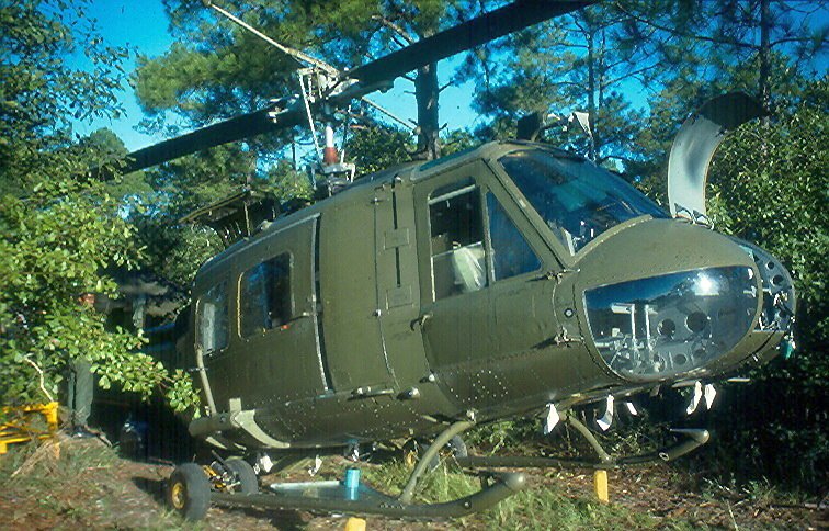
A 1973 photo (courtesy of Roger Houston) of a SC Army National Guard UH-1M Huey Gunship being loaded with 70mm rockets for a live fire training mission at the TAC-X Army Airfield.
The TAC-X Army Airfield is within the property of Fort Stewart.
Roger Houston recalled, “TAC-X served as a field training area for the advanced rotary wing training course
as part of the US Army Aviation School & Center Element held at Fort Stewart from 1966-73.
The facility was built to give army rotary-wing pilot trainees the opportunity to spend part of their training in an unimproved field environment like what they would encounter when they got to Vietnam.
A large grassed field was cleared & concrete pads were placed around its perimeter for the bedding of over 60+ UH-1 helicopters.
Simple 1-story barracks, mess halls, and classrooms were located north of the field for billeting & training the aviators.
A 1-bay fire crash station & a simple wooden control tower was also there to support flight operations.
The Aviation School had a resident infantry company assigned to Fort Stewart as part of the aviation mission
and these troops were often placed at TAC-X with the aviators to intensify the Vietnam feel.
My father, Thomas Houston, was the civilian post engineer for Fort Stewart & Hunter for many many years until his retirement in 1995.
Most all the aviation facilities on Fort Stewart were his design as part of the Aviation School mission there from 1966-73.”
Roger continued, “TAC-X was essentially a training mockup of a Vietnam base like An Khe or Pleiku where aviation & ground forces were bedded down in a field environment.
Training operations there included multi-ship air assaults, loadouts, cross country maneuver in daylight & nighttime,
formation flying using VFR & instruments as well as aircraft staging & FFARP for the nearby aerial gunnery ranges just to the east of TAC-X.”
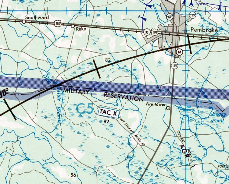
The TAC-X airfield was not yet depicted on the 1967 USGS topo map
or the October 1968 Jacksonville Sectional Chart (courtesy of Ron Plante).
The earliest depiction which has been located of the TAC-X Army Airfield was a series of 1973 photos (courtesy of Roger Houston)
of SC Army National Guard UH-1M Huey Gunships being loaded with 70mm rockets for a live fire training mission at the TAC-X Army Airfield.
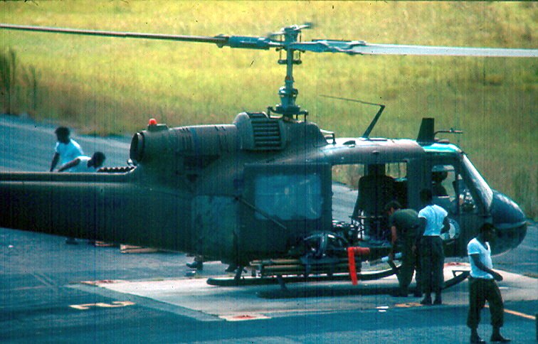
A 1973 photo (courtesy of Roger Houston) of a SC Army National Guard UH-1M Huey Gunship being loaded with 70mm rockets for a live fire training mission at the TAC-X Army Airfield.
Roger continued, “After 1973, TAC-X was used regularly as a bed-down area for National Guard aviation units of company size for their weekend & annual training at Ft. Stewart.”
The only aeronautical chart depiction which has been located of the TAC-X heliport was on the March 1975 Jacksonville Sectional Chart (courtesy of John Ferrara).
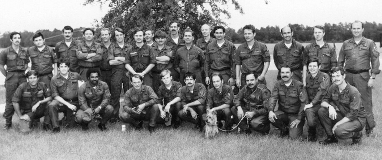
A 1976 photo (courtesy of Roger Houston) of the SC Army National Guard 51st Assault Helicopter Company at their summer camp at the TAC-X Army Airfield, with their fierce-looking mascot.
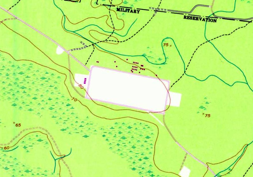
The earliest topo map depiction which has been located of TAC-X Army Airfield was on the 1976 USGS topo map.
It depicted an unlabeled rectangular clearing, with clusters of small buildings on the west & north sides.
A 1970s Ft. Stewart range safety fan map (courtesy of Roger Houston) showing the TAC-X Army Airfield at the top-left.
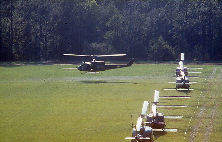
A 1978 photo (courtesy of Roger Houston) of SC Army National Guard D Troop 1/101st Cavalry UH-1 Hueys at the TAC-X Army Airfield.
A 1978 photo (courtesy of Roger Houston) of a SC Army National Guard D Troop 1/101st Cavalry UH-1 Huey at the TAC-X Army Airfield.
Roger Houston recalled, “In 1978, [TAC-X] became the 24th Infantry Division NCO Academy.”
A 1978 DMA Wright AAF Search & Rescue Map (courtesy of Roger Houston) depicted TAC-X as a rectangular outline.
The earliest photo which has been located of TAC-X Army Airfield was a 1993 USGS aerial view.
It depicted a rectangular clearing, with a large number of paved helicopter landing pads along the north & south sides,
and a clusters of small buildings on the north side.
TAC-X Army Airfield was not depicted at all on the March 1994 Jacksonville Sectional Chart (courtesy of Ron Plante).
Roger Houston recalled, “Half of it was planted in pine trees in order to save the post some money in having to mow the whole field.
The rest was left as-is & serves as parade field, tactical training, and PT area for the NCO Academy.”
A 2007 aerial photo showed the southern half of the TAC-X airfield covered in the newly-planted pine trees.
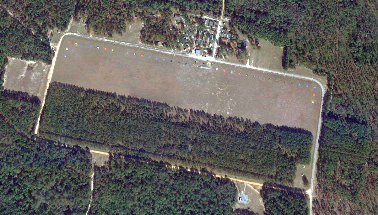
A 2015 aerial view shows the TAC-X Army Airfield remains recognizable, but the southern half of the clearing is mostly covered by the pines trees planted to lower maintenance.
The large number of paved helicopter landing pads along the north side are each painted with different primary colors or rank insignia.
Roger Houston reported, “The NCO Academy painted all the pads in the primary colors of each of the combat arms & combat support arms. When they were used as helicopter pads, they were plain concrete.”
A 2020 photo by Roger Houston, “Looking west from the northeast corner of the field [TAC-X] at the line of helicopter landing pads lining the north side of the field.
These pads were used to bed down the Hueys while based at TAC-X.
They were also troops would board the Hueys for practice air assaults as part of the aviation training there.”
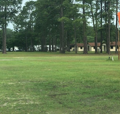
A 2020 photo by Roger Houston, “Some of the barracks, classrooms, and admin buildings still in use for the NCO Academy there at the TAC-X facility.
The windsock pole is the same one used at TAC-X as it was in 1966 when it was installed.”
Roger Houston reported in 2021, “TAC-X still serves as the 24th Infantry Division NCO Academy.
The helicopter field & pads remain but are not used for helicopter training anymore.
The field was named 'Dean Field' in memory of General Dean who commanded the 24th Infantry Division in Korea & died in action there in 1950.
An occasional helicopter lands there from time to time as part of a VIP visit to the Academy facility from the main post or from Hunter AAF.”
Thanks to Roger Houston for pointing out this airfield.
____________________________________________________
Jaeck Army Stagefield / Jaeck Drop Zone Army Airfield, Glenvville, GA
31.939, -81.856 (North of Jacksonville, FL)
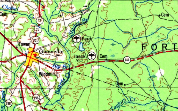
Jaeck Drop Zone Airfield was labeled generically “Landing Field” on the 1973 USGS topo map.
Photo of the airfield while in use has not been located.
The Jaeck Drop Zone Airfield is within the property of Fort Stewart.
Jaeck Drop Zone Airfield was not yet depicted on the 1961 USGS topo map.
Roger Houston recalled, “Jaeck was named for CW2 Robert Jaeck, who was killed in action in South Vietnam when his O-1 Bird Dog came under enemy fire & crashed in 1966.
Jaeck Stagefield was designed & built in a very short timeframe when it was announced that the primary fixed-wing flight training would be conducted at Fort Stewart in 1966.
The announcement came of the move in February 1966, and by November 1966, Jaeck was ready for use.
The design followed a similar design for an aviation facility that had been built at Ft Rucker.
Skelly Stagefield at Rucker was the model for multiple runway touch & go pattern training for the initial fixed-wing course
to allow trainees to experience cross- & tailwind approach & departure for the T-41 & O-1 light aircraft.
My father, Thomas Houston, was the civilian post engineer for Fort Stewart & Hunter for many many years until his retirement in 1995.
Most all the aviation facilities on Fort Stewart were his design as part of the Aviation School mission there from 1966-73.”
Jaeck Drop Zone Airfield was not yet depicted on the October 1968 Jacksonville Sectional Chart (courtesy of Ron Plante).
The earliest depiction which has been located of Jaeck Drop Zone Airfield was on the 1973 USGS topo map.
It depicted 4 paved 2,000' runways, with a paved track running around their periphery, and a paved ramp on the northeast side.
The airfield was labeled generically “Landing Field”.
The only aeronautical chart depiction which has been located of the Jaeck Drop Zone Airfield was on the March 1975 Jacksonville Sectional Chart (courtesy of John Ferrara).
Although depicted as an airfield not a heliport, no runway length was depicted.
The earliest depiction which has been located which labeled Jaeck Drop Zone Airfield was on the 1977 USGS topo map.
A 1978 DMA Wright AAF Search & Rescue Map (courtesy of Roger Houston) depicted “Jaeck Stagefield (Army)” as having 4 paved runways.
The 1981 USGS topo map depicted Jaeck Drop Zone Airfield as 4 paved runways, labeled generically “Landing Field”.
The earliest photo which has been located of Jaeck Drop Zone Airfield was a 1993 USGS aerial view looking southwest
It depicted 4 paved runways, with a paved track running around their periphery, and a paved ramp on the northeast side.
Jaeck Drop Zone Airfield was not depicted at all on the March 1994 Jacksonville Sectional Chart (courtesy of Ron Plante).
The only civilian aviation use which has been located of the Jaeck Drop Zone Airfield came in 2007,
as reported in an article entitled “Plane makes emergency landing on post Tuesday” in the 6/14/07 Coastal Courier:
“A civilian airplane made an emergency landing in the Fort Stewart training area Tuesday.
The Piper PA-31 safely made an emergency landing at Jaeck drop zone according to installation aviation safety.
Jaeck drop zone is in the western part of the Fort Stewart training area off of Highway 144 near Glennville.
The plane will remain on the ground until it is refueled.”
A 2015 aerial view looking southwest depicted Jaeck Drop Zone Airfield as having 4 paved runways, with a paved track running around their periphery, and a paved ramp on the northeast side.
Roger Houston reported in 2021, “The facility is still in active use by Army aircraft today.
It’s primary use is as a field forward arming & refueling point for the AH-64 Apache & UH-60 Blackhawk helicopters supporting ground maneuver & for aerial live fire on the Fort Stewart complex.
In addition, Jaeck is frequently used as a field launch & landing point for the new Grey Eagle UAV used by the Combat Aviation Brigade for aerial battlefield reconnaissance.
In my 50+ years of living here, Jaeck has not been used very much as a Drop Zone for parachute drops in the post-Aviation School era at Ft Stewart.
As of right now, Jaeck is no longer certified by Air Mobility Command to be used as a drop zone.”
Thanks to Chris Levdahl for pointing out this airfield.
____________________________________________________
St Marys Airport (4J6), St Marys, GA
30.753, -81.558 (North of Jacksonville, FL)
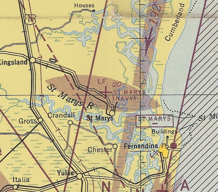
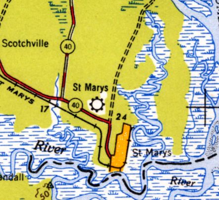
St Marys Airport, as depicted on the February 1945 Jacksonville Sectional Chart (courtesy of Ron Plante).
According to its FAA Airport/Facility Directory data, this general aviation airport was activated in May 1941.
According to Brian Rehwinkel, “NAS Jacksonville began using the field [St Marys Airport] apparently in early 1942, before the paved runways were added in 1943.
The Navy leased the field from the City of Saint Marys for $1/year.
The Civil Aeronautics Administration (CAA) improved the field by adding the three 5,000’ runways.
This was a common practice, and the Navy used many fields that were improved by the CAA (including the nearby Fernandina Beach, FL Airport).”
The earliest depiction which has been located of St Marys Airport was on the February 1945 Jacksonville Sectional Chart (courtesy of Ron Plante).
It depicted “St Marys (Navy)” as an auxiliary airfield.
The earliest photo which has been located of St Marys Airport was a 6/29/45 USN aerial view looking south (courtesy of Brian Rehwinkel),
showing the field while it was being used as a Navy Outlying Field.
It showed St Marys to have 4 paved runways & a parallel taxiway, but no ramps, hangars, or other improvements.
According to Brian Rehwinkel, “The lease was apparently canceled sometime in late 1945 or early 1946 & the 462 acre airfield was returned the City of Saint Marys.
These type arrangements were beneficial to the cities (who had to provide the land) & the military as well.”
The earliest topo map depiction which has been located of St Marys Airport was on the 1948 USGS topo map.
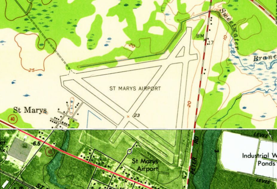
The 1958 USGS topo map depicted St Marys Airport as having the layout of 4 paved runways which was characteristic of many US airfields built during WW2.
A taxiway led to 2 small buildings on the south side of the airfield.
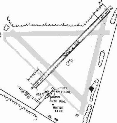
The 1985 GA Airport Directory (courtesy of Charlie Evans) depicted St. Marys Airport as having a single 5,000' Runway 4/21, along with 2 closed runways.
The administration building & 2 hangars were depicted on the southeast side.

A 1988 USGS aerial view looking north at St Marys Airport showed that 3 of the runways had been abandoned at some point between 1958-88, leaving only Runway 4/22.
A half-dozen light single-engine aircraft were visible parked on the south side of the airfield, along with a few small hangars.
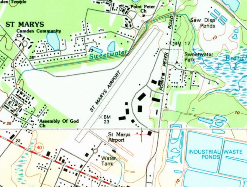
The 1994 USGS topo map showed St Marys Airport having a considerably smaller configuration than was depicted on previous topo maps,
with only a single northeast/southwest runway.
According to Wikipedia, “The airport was closed for 3 months following the 9/11/01 terrorist attacks,
as a result of its position approximately 1 mile south of Naval Submarine Base Kings Bay.
The Federal Aviation Administration created a Temporary Flight Restriction below 5,000' & a radius of 5 miles from the base, effectively eliminating all [air] traffic.
Aircraft based at that field were eventually allowed to leave under special permission of air traffic control, but the existing Fixed-Base Operator suffered substantial financial difficulties during this time.
The airport was reopened on 12/3/01, with the creation of a smaller Temporary Flight Restriction located approximately ½ mile from the departure end of Runway 4.
That restriction became permanent on 2/16/06, with the creation of Prohibited Airspace P-50,
an airspace encompassing all airspace below 3,000' within a 3-mile radius of the submarine base's waterfront operations.”
According to Wikipedia, “Almost immediately after the 9/11/01 Temporary Flight Restriction was created,
the Navy pressed for a permanent closure of the airport for national security reasons.
As a result, in April 2004 the city received a grant of $236,538 from the Department of Transportation for an airport relocation study.
Nine possible sites were studied by Reynolds, Smith and Hills, a contracted consultant, with a final site approved on 2/17/05.
The new airport location will be south of Woodbine, GA.
The anticipated cost is $29 million, with 90% of the construction costs paid by the Department of Transportation.
The approval for the airport was not without controversy.
In February 2007, the St. Marys City Council & the St. Marys Airport Authority entered disputes over both airport ownership & whether the airport should even be moved.
This eventually led to litigation. On 10/2/08, the court ruled that the city & not the airport authority had legal control over the property, allowing the move to proceed.
The current estimated costs are now over $40 million.
There had been no written document from the Navy (or any other official governmental body) that requested either the closure or relocation of St. Marys Airport until September 2012.
This was due to concerns involving skydivers accidentally landing on Naval Submarine Base Kings Bay.
The skydiving company ceased operations at St. Marys Airport.”
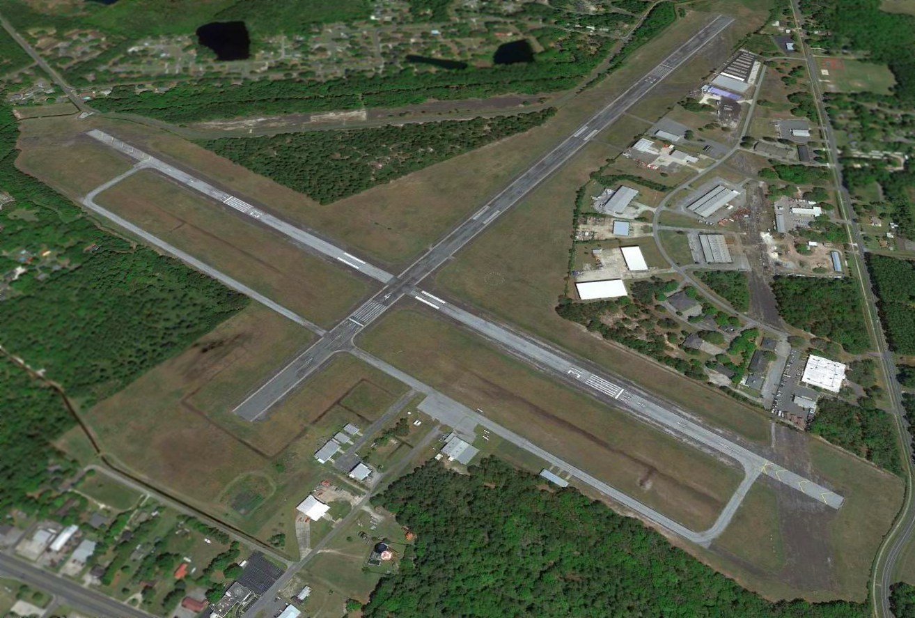
A 2016 aerial view looking north showed that St Marys Airport regained a 2nd runway (Runway 13/31) at some point between 1994-2016.
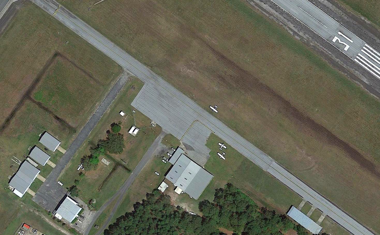
A 2016 aerial view showed 4 light single-engine aircraft parked near some small hangars on the south side of St Marys Airport.
The FAA Airport/Facility Directory said St Marys Airport conducted an average of 77 takeoffs or landings per week in 2014.
As of 2017, the FAA Airport/Facility Directory described St Marys Airport as being owned by the City of St Marys, with the Manager listed as John Holman.
It was said to have 2 asphalt runways: 5,021' Runway 4/22 & 4,001' Runway 13/31.
It was said to have 26 based aircraft, including 1 multi-engine.
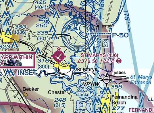
The February 2017 Jacksonville Sectional Chart depicted St Marys Airport as having 2 perpendicular paved runways,
one of which was pointed directly at King's Bay Submarine Base's Prohibited Area P-50, the eventual reason for the airport's demise.
According to Wikipedia, “As of 2/16/17, the airport is scheduled to close permanently on 7/14/17 with all airplanes to vacate the airport by July 1.”
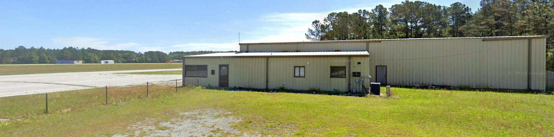
A 2023 photo looking east at the airport office, hangar, and ramp on the southeast side of St Marys Airport.
A 2023 photo looking west at former hangars on the south side of St Marys Airport.
St Marys Airport is located north of the intersection of Osborne Street & North Dandy Street.
Thanks to Ron Plante for pointing out the closure of this airport.
____________________________________________________
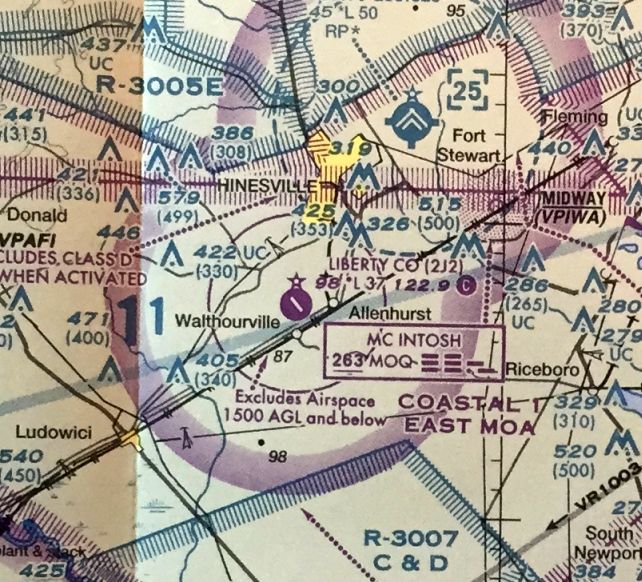
Liberty County Airport (2J2), Walthoursville, GA
31.785, -81.64 (North of Jacksonville, FL)
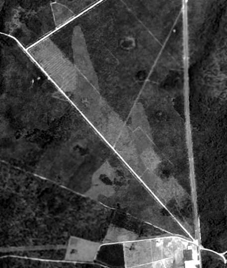
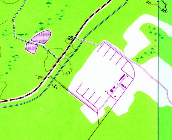
Liberty County Airport, as depicted on a 5/1/68 USGS aerial photo (courtesy of Oliver Dallam-Lee).
This general aviation airport may have been established at some point in 1968,
as it was not yet depicted on the October 1968 Jacksonville Sectional Chart.
The earliest depiction which has been located of the Liberty County Airport
was on a 5/1/68 USGS aerial photo (courtesy of Oliver Dallam-Lee).
It may have depicted the field while still under construction,
as it showed a northwest/southeast clearing on the eventual runway alignment,
but not other specific airfield features.
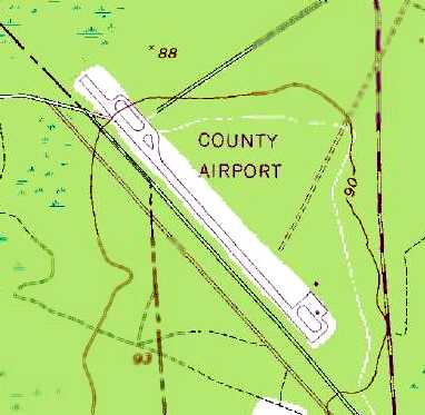
The 1973 USGS topo map depicted the “County Airport” as having a single paved northwest/southeast runway,
with a small ramp with 2 small buildings on the southeast side.
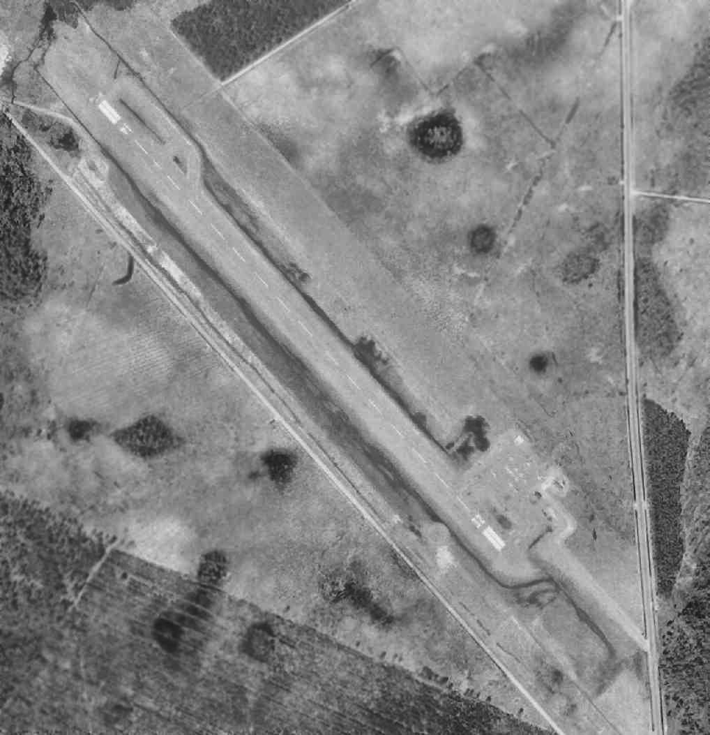
A 3/3/73 USGS aerial photo (courtesy of Oliver Dallam-Lee) depicted Liberty County Airport
as having a single paved northwest/southeast runway.
The earliest aeronautical chart depiction which has been located of the Liberty County Airport was on the 1978-79 GA Aeronautical Chart (courtesy of David Stevenson).
It depicted Liberty County as having a single 3,200' paved runway.
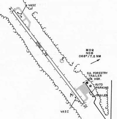
The 1985 GA Airport Directory (courtesy of Charlie Evans) depicted Liberty County Airport as having a single 3,700' Runway 14/32,
with a small ramp with 2 small buildings on the southeast side.
A 3/5/87 USGS aerial photo (courtesy of Oliver Dallam-Lee) depicted a dozen light aircraft on the Liberty County ramp.
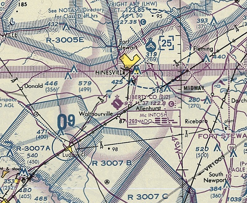
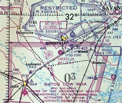
The March 1994 Jacksonville Sectional Chart (courtesy of Ron Plante) depicted Liberty County as having a 3,700' paved northwest/southeast runway.
The last photo which has been located showing Liberty County Airport in operation was a 6/24/07 aerial view looking west,
which depicted a total of 9 light aircraft parked on its ramp.
In 2008, Liberty County Airport's last year of operation, the FAA Airport/Facility Directory statistics
described the field as having a single 3,698' asphalt Runway 14/32, in “fair” condition.
The field was owned by Liberty County, and the manager was Joseph Brown.
The field was said to have a total of 9 based aircraft,
and it was listed as conducting a total of 77 takeoffs or landings per week.
Liberty County Airport was closed in 2008 after the nearby Wright Army Airfield was opened to civilian operations,
becoming known as the Midcoast Regional Airport.
![]()
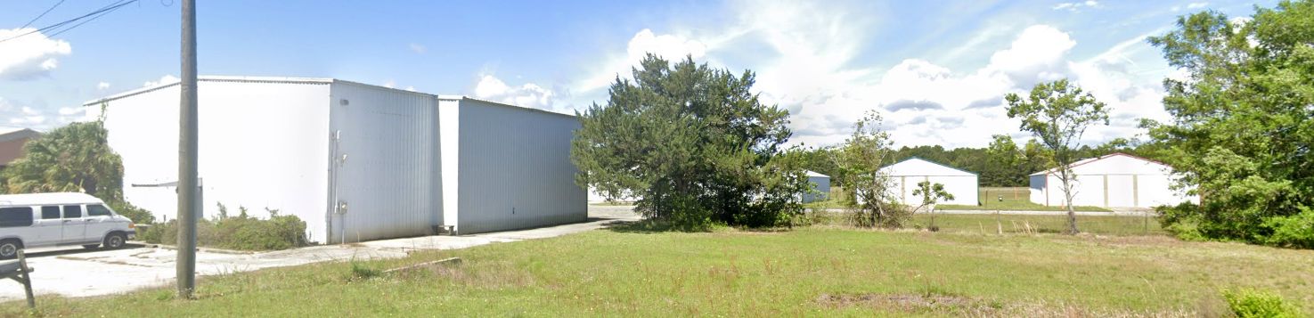
A 2008 photo by Thomas Wahl of a hangar foundation & the airport beacon.
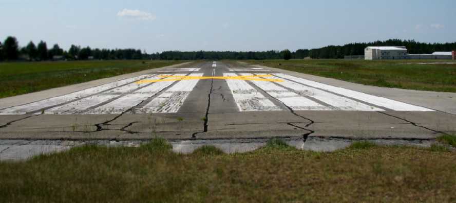
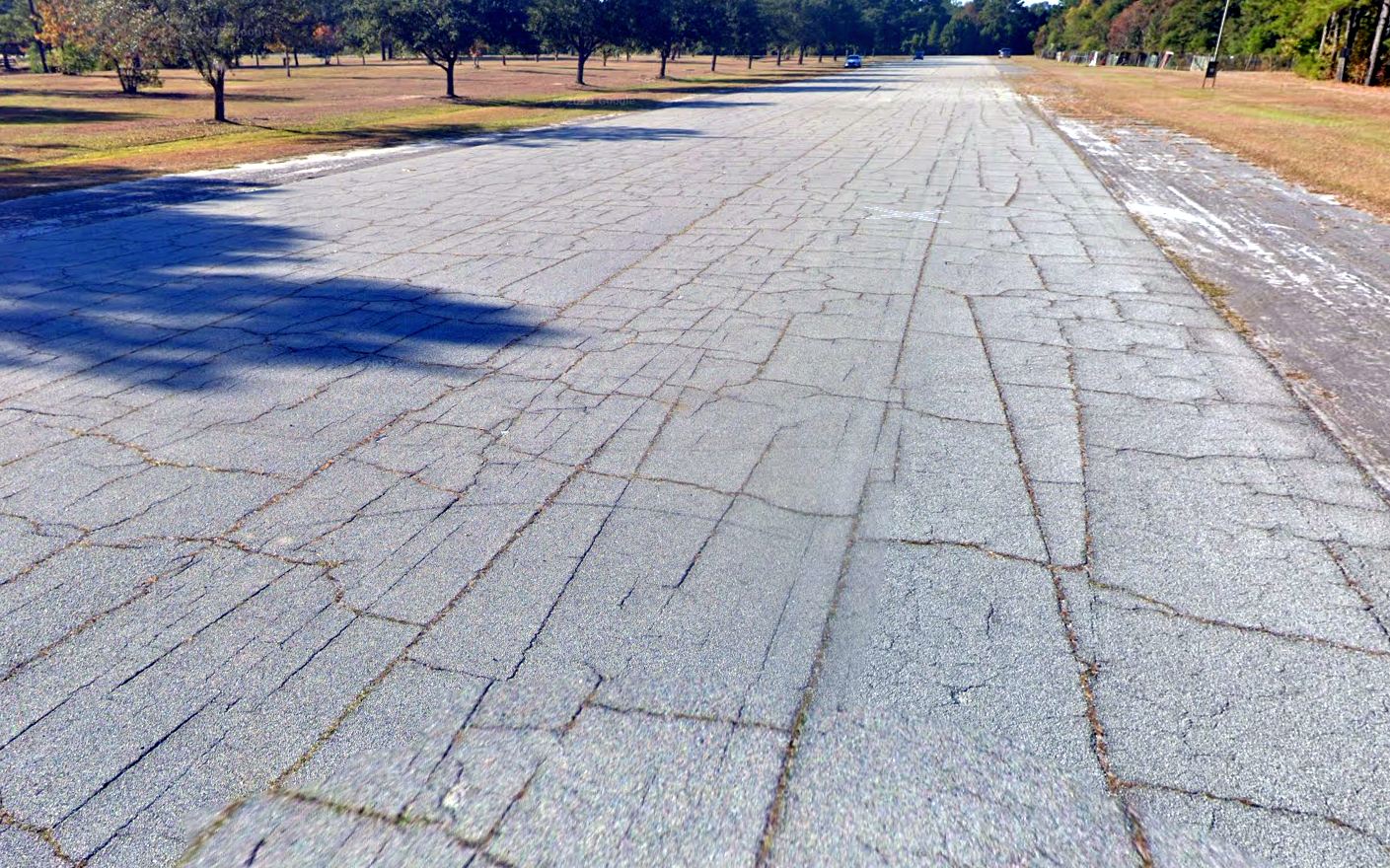
A 2008 photo by Thomas Wahl looking northwest along the closed Runway 32.
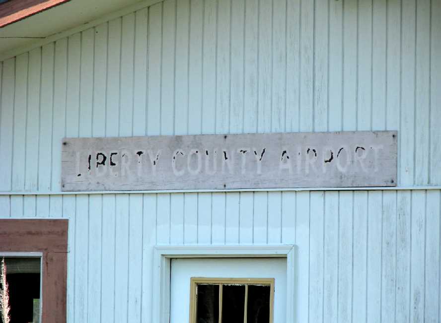
A 2008 photo by Thomas Wahl of a “Liberty County Airport” sign on the FBO building.
A 2008 photo by Thomas Wahl of the former FBO building.
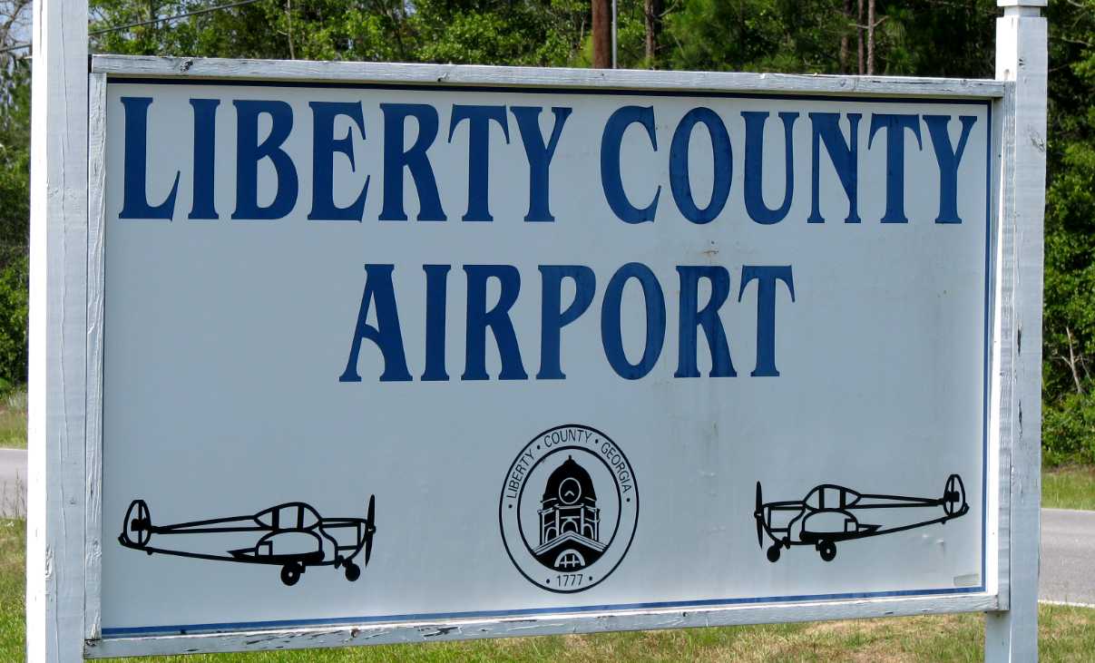
A 2008 photo by Thomas Wahl of a sign for the Liberty County Airport.
According to Thomas Wahl, “The airport property will be used for continued expansion of the County Jail facility,
a truck driving school, a new county Animal Control facility, an emergency communications antenna site and a new school site.”
Even though it had been closed the year before, Liberty County Airport was still depicted on the 2009 Jacksonville Sectional Chart.
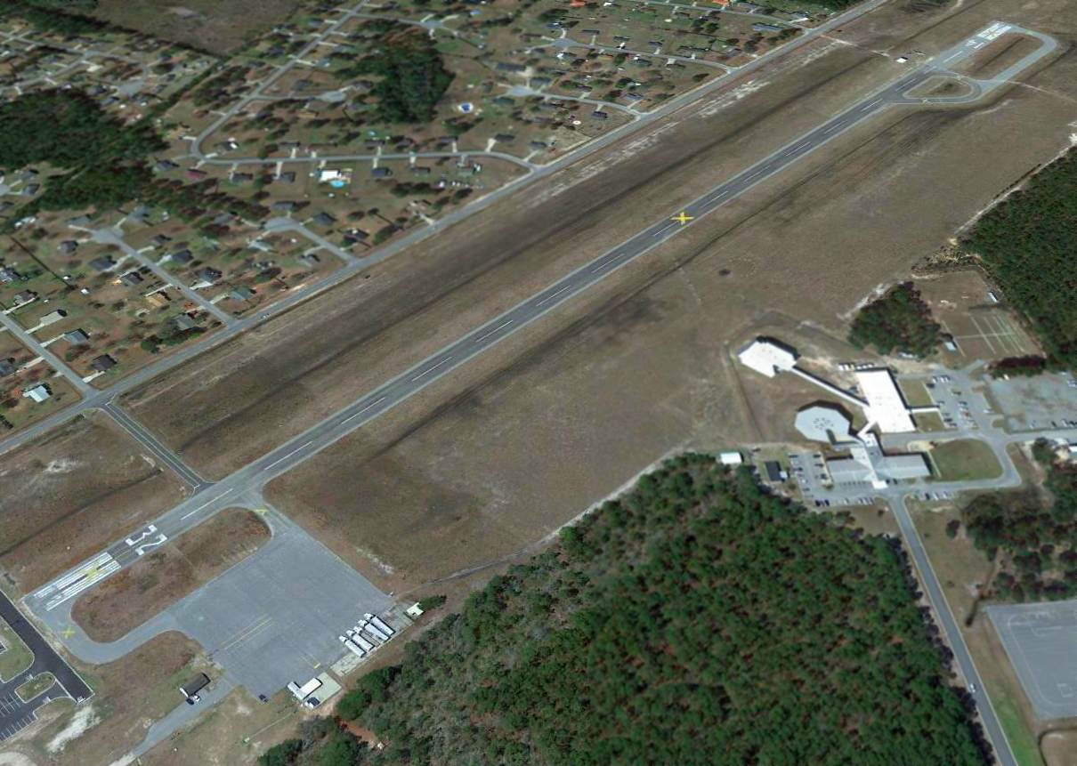
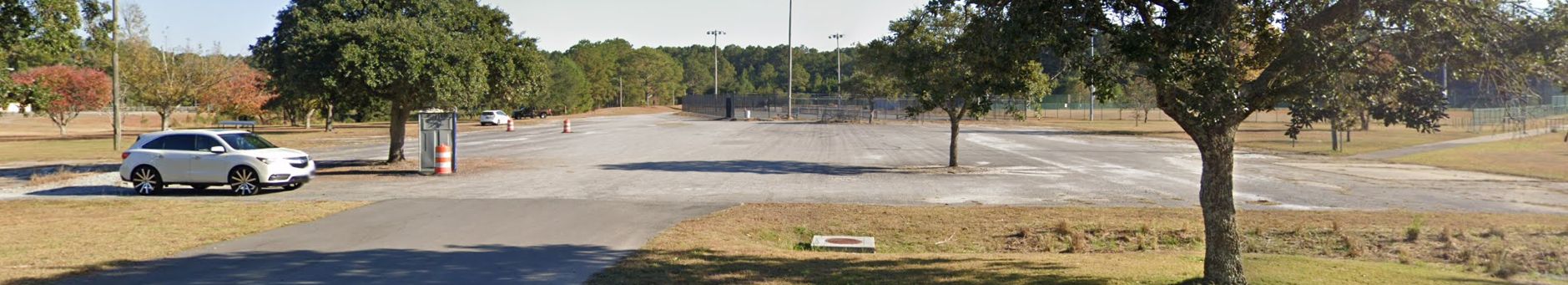
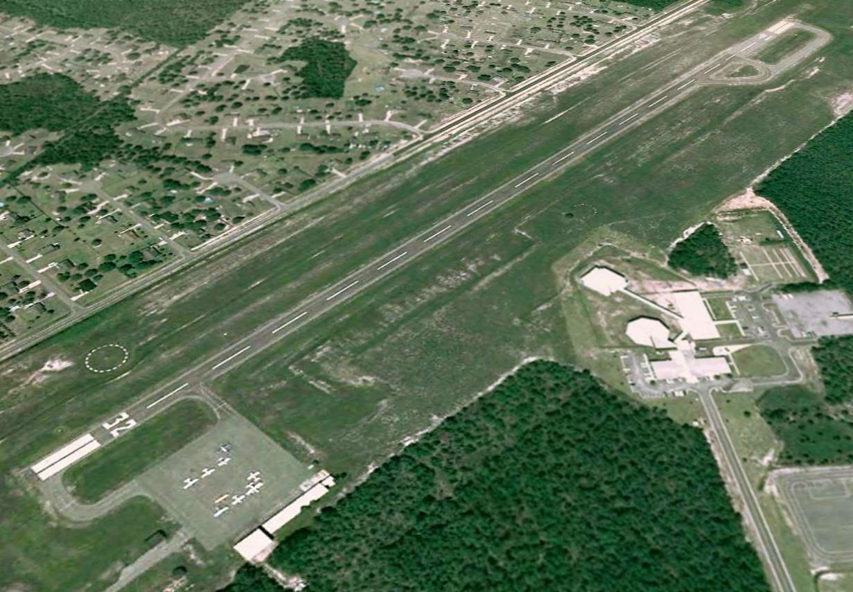
A 2013 aerial view looking west at the site of Liberty County Airport showed the runway & ramp remained intact, but the hangars had been removed.
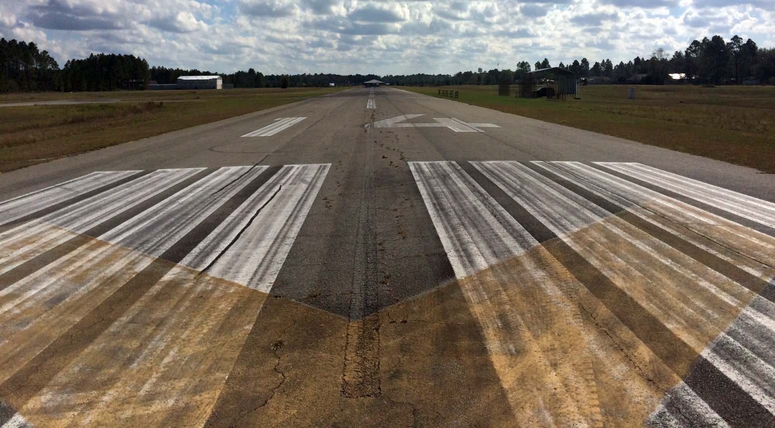
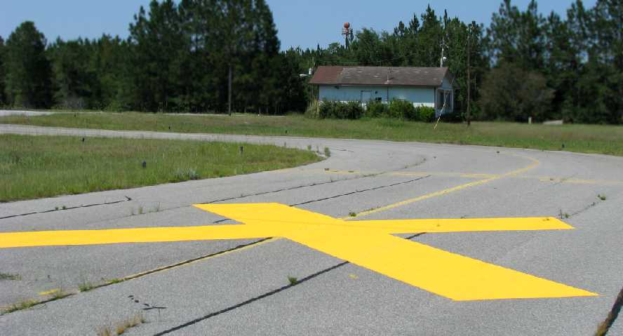
An 11/18/17 photo by Matt Franklin looking southeast along the former Liberty County Airport Runway 14.
Matt reported, “The runway is in great condition, and is being used by the Savannah Technical College for truck driver training
and a local radio-controlled model
aircraft club has erected some stands & uses the Runway 14 end
for flying.
A big radio tower has been put just shy of the end
of Runway 14 so I don't think any full-sized planes will be coming
back here.”
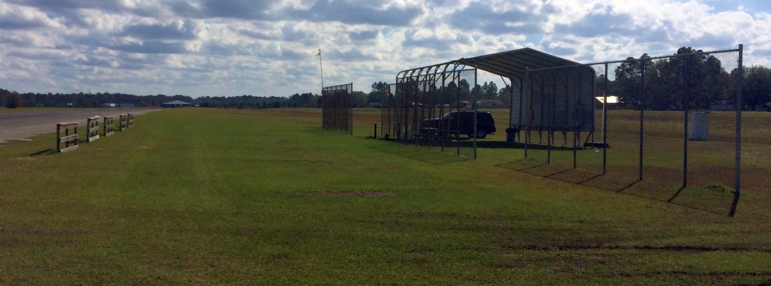
An 11/18/17 photo by Matt Franklin looking southeast at the radio-controlled model aircraft shelter next to the former Liberty County Airport runway.
Matt reported, “Great news, Liberty County Airport is open for aircraft - except they have to be scale radio-controlled models.”
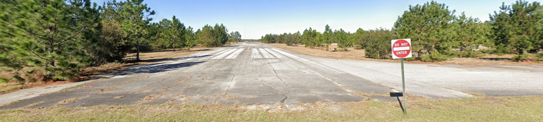
A 2024 photo looking northwest along the former Liberty County Airport Runway 32.
The site of Liberty County Airport is located northwest of the intersection of Dorsey Road & Slaten Drive.
____________________________________________________
Brunswick Municipal Airport (original location), Brunswick, GA
31.185, -81.48 (North of Jacksonville, FL)
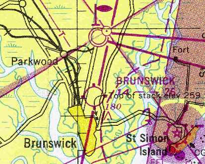
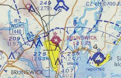
The original Brunswick Airport, as depicted on the February 1949 Jacksonville Sectional Chart (courtesy of Chris Kennedy).
The original airport for the town of Brunswick was a small field located adjacent to the north side of the town.
The original Brunswick airport was evidently established at some point between 1946-49,
as it was not yet depicted on the August 1946 Jacksonville Sectional Chart.
The earliest depiction which has been located of Brunswick Airport
was on the February 1949 Jacksonville Sectional Chart (courtesy of Chris Kennedy).
It depicted the field as having a 2,600' unpaved runway.
Brunswick Municipal Airport evidently gained paved runways at some point between 1949-51,
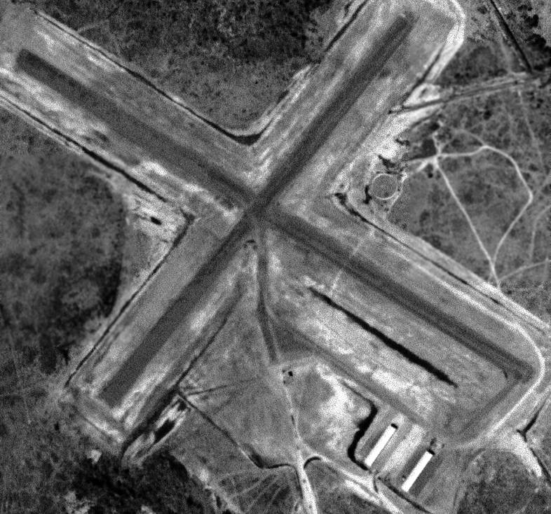
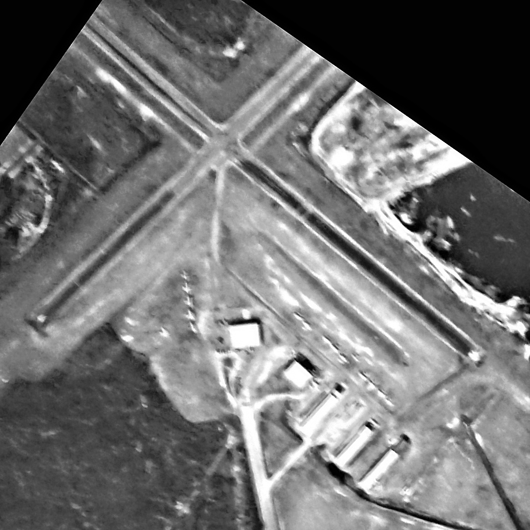
as a 1951 USGS aerial photo (courtesy of David Henderson) depicted the field as having 2 perpendicular paved runways,
with a taxiway leading to 2 hangars on the southeast side.
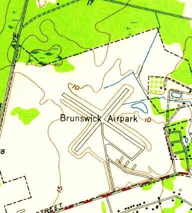
The 1956 USGS topo map depicted Brunswick Municipal Airport as having 2 perpendicular paved runways,
with a taxiway leading to 3 hangars on the southeast side.
The 1962 AOPA Airport Directory described Brunswick Municipal Airport as having 2 asphalt runways:
2,400' Runway 13/31 & 2,000' Runway 4/22.
The field was described as offering major repairs, fuel, hangars, tiedowns, and charter.
The operator was listed as Baker Flying Service.
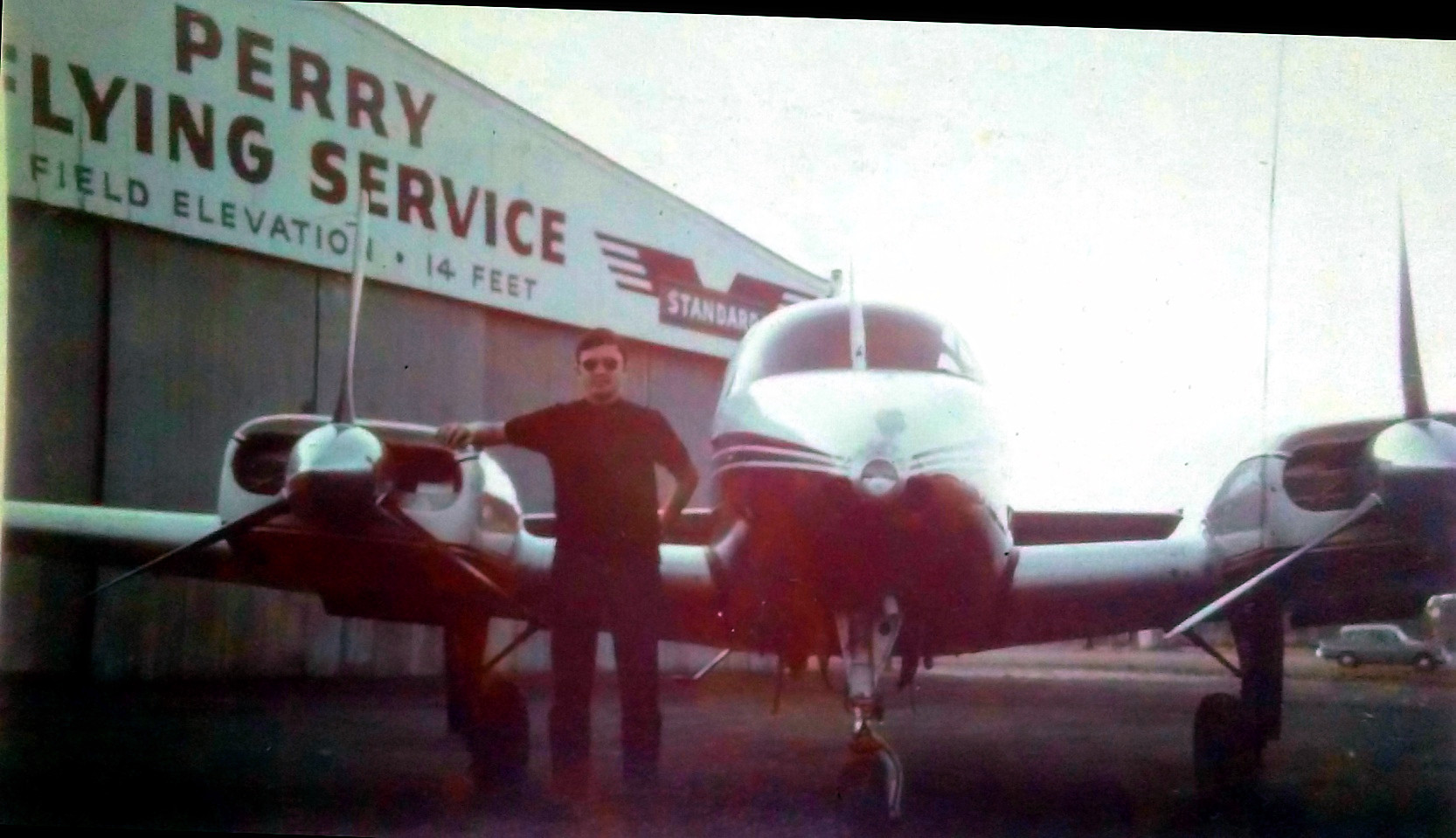
David Savage recalled, “Brunswick Municipal Airport... I dropped into George Perry’s place on 3/23/62
and he checked me out in his 7AC Champ & then let me fly anything that I felt like trying out.
I flew the following aircraft there from 3/23/62 through 7/27/62:
Aeronca 7AC ($6/hr), Piper Colt, Piper Tri Pacer, Piper J-3, Aeronca L16A (about $ 1.50/hr, only the cost of fuel as a member of CAP).
Talk about being in the right place at the right time.
But since, as a Marine PFC making about $86/month, this was still a lot of money.
George Perry also took me for a couple of rides in his Twin Bonanza.
I believe it is the furthest aircraft to the left in that picture of 5 twins.
He also took me over to St. Simons Island for an open house & small airshow.
Even when I couldn’t afford to go flying, I hung around Perry Aviation & had a great time.”
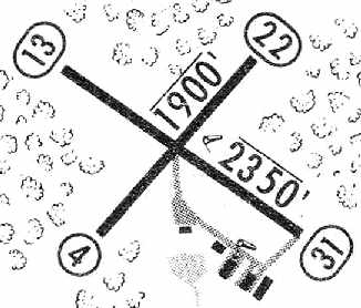
The 1965 Jeppesen Airway Manual (courtesy of Chris Kennedy)
depicted the Brunswick Airport as having 2 paved runways: 2,350 Runway 13/31 & 1,900' Runway 4/22.
The manager was listed as F.A. Baker.
The 1968 Flight Guide (courtesy of Robert Levitttan) depicted the Brunswick Airport as having 2 paved runways: 2,350 Runway 13/31 & 1,900' Runway 4/22.
Alan Miller recalled, “Perry Flying Service is where my dad learned to fly. George Perry was a character”
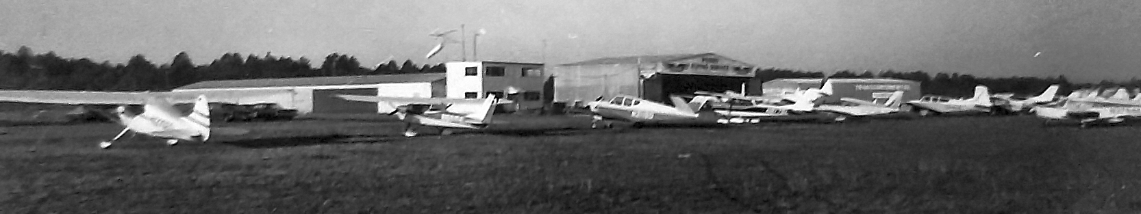
A circa 1960s photo by Jimmy Hamilton of a variety of general aviation planes in front of the hangar of Perry Flying Service at Brunswick Airport.
Jimmy recalled, “Like a lot of young fellas I worked for Mr. Perry.”
A circa 1960s aerial view of Brunswick Airport (courtesy of Jimmy Hamilton) showing 5 hangars & a number of light general aviation aircraft.
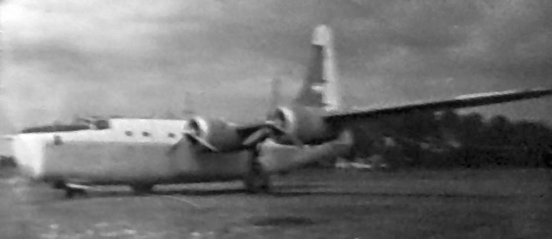
A circa 1960s photo by Jimmy Hamilton of a Consolidated PB4Y-2 Privateer (in civilian use?) at Brunswick Airport.
Sherman Swofford recalled, “I Glynco veteran (1968-69) that learned to fly from George Perry at the Brunswick Airport.
I agree that George was a delightful man to talk to & I especially remember his son 'Daisy'.”
Mike Brzowski recalled, “Brunswick Airpark... I learned to fly there
and also worked for George Perry, owner of Perry Flying Service, from 1969-75.
A gracious & caring man to say the least.
George owned a fleet of 25 aircraft for rent or charter which stayed on the go constantly up until his death in 1974.”
A circa 1972 photo of Jimmy Hamilton & a Beech Baron in front of the hangar of Perry Flying Service at Brunswick Airport.
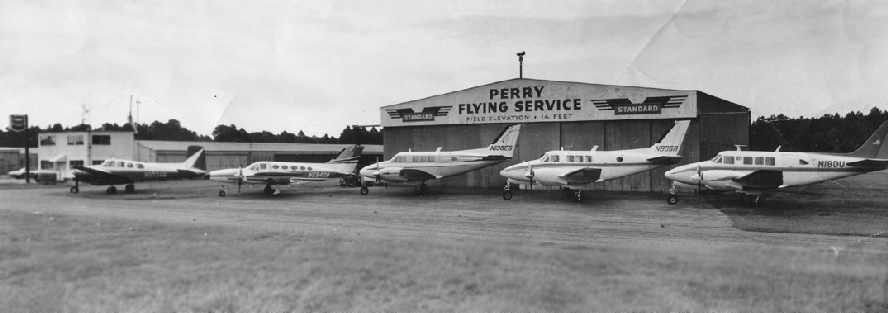
A 1973 photo by John Caples (courtesy of Mike Brzowski)
of 5 twin-engine planes in front of the hangar & office of Perry Flying Service at the Brunswick Airpark.
The last photo which has been located of the original Brunswick Airport was a 1974 USGS aerial photo (courtesy of David Henderson).
It showed over a dozen light aircraft parked outside.
The last aeronautical chart depiction which has been located of the original Brunswick Airport
was on the March 1974 Jacksonville Sectional Chart (courtesy of Chris Kennedy).
It depicted Brunswick as having 2 paved runways, with the longest being 2,300'.
The Brunswick Municipal Airport was evidently closed at some point between 1974-75,
as it was no longer depicted at all on the January 1976 CH-25 World Aeronautical Chart (according to Chris Kennedy).
It had evidently been replaced by the much larger Glynco airfield just to the north,
which had been closed by the Navy & relinquished for use as a civilian airport.
The 1995 USGS topo map no longer depicted any runways or any other airfield infrastructure,
but labeled the buildings along the west side of the former airport site as “Brunswick Junior College”.
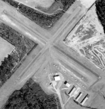
In the 1995 USGS aerial photo,
traces of the orientation of the 2 former runways at the site of the Brunswick Airport were still recognizable,
even though all of their pavement had been removed.
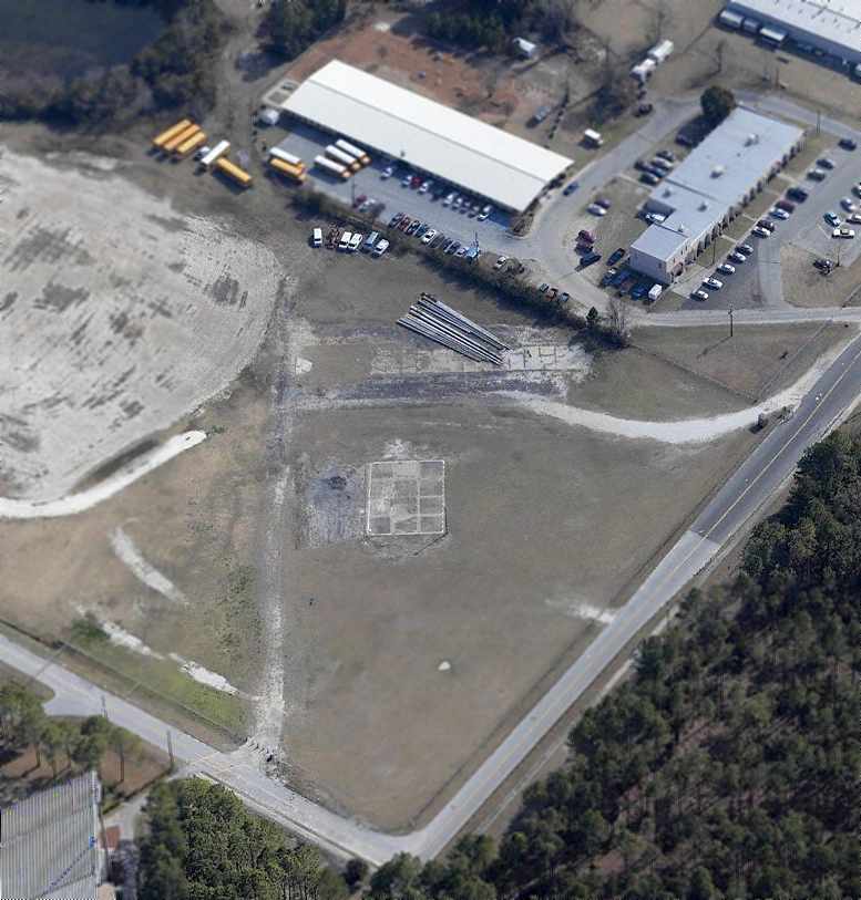
A circa 2006 aerial view looking southeast at what appears to be the last remnant of the former Brunswick Airport:
a short section of taxiway pavement, along with a foundation & a paved ramp.
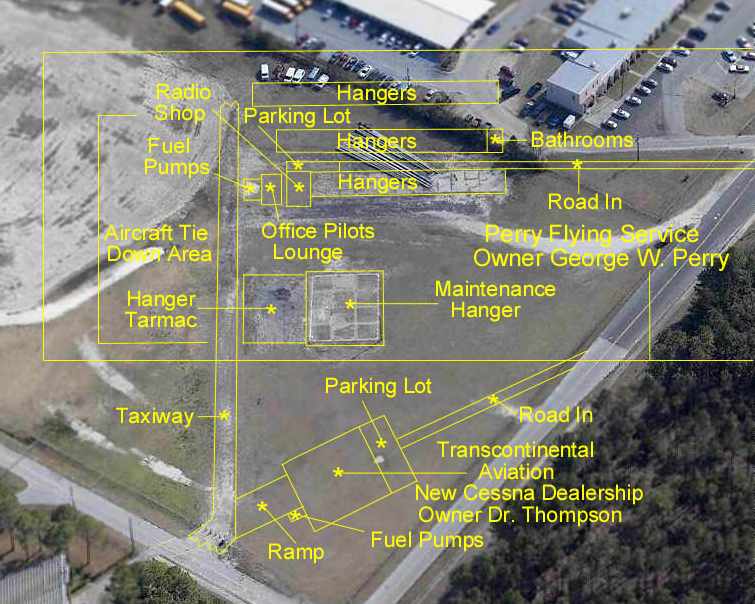
The circa 2006 aerial has been annotated by Mike Brzowski to show where the former Brunswick Airpark structures were located.
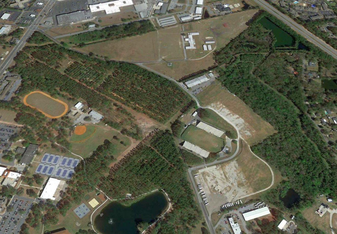
A 2017 aerial view looking north showed traces of the orientation of the 2 former runways at the site of Brunswick Airport were still recognizable,
along with some of the hangar foundations on the south side.

A 5/15/25 aerial view by Alan Miller looking northeast at the Brunswick Airport site, taken from the CAF red-tail P-51C Mustang.
Alan observed, “You are looking roughly 040 heading along the wing. Runway 31 ran from the right of the grass clearing to & beyond roughly the bleachers in the bottom of the picture.
The intersection of Runway 4/22 was just left of the ball field.”

A 5/15/25 photo by Alan Miller of the hangar track for the doors of Perry Flying service at the Brunswick Airport site.
Alan observed, “Nothing is left other than the concrete & the hangar door tracks of that hangar. This picture is taken looking roughly 130 heading.”
The site of the original Brunswick Airport is located north of the intersection of 4th Street & Old Airpark Road, appropriately enough.
____________________________________________________
Savannah Wilmington Island Airport / Hobbs Field, Wilmington Island, GA
32.014, -80.98 (Southeast of Savannah, GA)
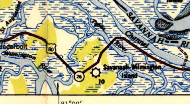
Savannah - Wilmington Island Airport, as depicted on the April 1945 Savannah Sectional Chart (courtesy of Chris Kennedy).
The date of construction of this airport has not been determined.
It may have been established in 1942, as, according to the History of the Civil Air Patrol in Savannah,
"The Savannah Squadron of Civil Air Patrol was organized in June of 1942
under the command of Captain S. E. Perkins and was based at the old Wilmington Island Airport.
During the war years, this airfield was known as CAP Field, Savannah.
The land was donated by Mr. H. M. Carter & the labor was performed by members of the old CAP squadron."
Robert Wilson recalled, “I learned to fly at this airport. It never had 5 runways. When I started there it had only 2.
One of which was very short with an approach over some power lines at one end.
We, CAP members, did clear & build a 3rd runway that was too short to safely use.
I began to take flying lessons sometime in late 1943 or early 1944. I was a 14 year old CAP Cadet at the time.”
However, no airfield in the Wilmington Island area was depicted on the September 1943 or March 1944 Savannah Sectional Charts (according to Chris Kennedy)
nor listed in the April 1944 US Army/Navy Directory of Airfields (courtesy of Ken Mercer).
Frank Coleman recalled, “While still in Savannah High School I caught the aviation bug
and went out to the Wilmington Island Airport for flying lessons.
My Instructor was Bill Hobbs of Hobbs-Waller Avbia Service.
I wish I had a photo of Hobb’s Field as it was affectionately known in the early days.
My 1st flight with Bill Hobbs was on 9/11/44 in a Cub J-5 & my solo took place on 11/9/44.
I subsequently flew a garden variety of light aircraft out of this field.
Aside from the Aeroncas, Luscombes Taylorcraft, more Cubs etc,
I took lessons in the Stearman PT-17 & had some wonderful acrobatic hops in that venerable/tough aircraft.
I eventually owned it outright & flew it with enthusiasm.
The stacks were blowing off & CAA advised me to recover the wings, replace stacks, and required other fixes.
It became cost prohibitive later so I sold it. $300. Wow!”
The earliest depiction of this airfield which has been located
was on the April 1945 Savannah Sectional Chart (courtesy of Chris Kennedy),
which depicted "Savannah Wilmington Island" as a commercial or municipal airport.
A circa 1943-45 aerial view by Robert Wilson looking east along Wilmington Island's primary runway,
with old Tybee Road at the left.
The field had a small building on the north side, with several light aircraft parked.
A circa 1943-45 aerial view by Robert Wilson looking south from the downwind leg to Wilmington Island,
with old Tybee Road at the bottom.
The field consisted of 3 unpaved runways.
A 1945 photo of Robert Wilson in front of a Piper Cub at Wilmington Island Airport.
Robert recalled, “Because of my age I did not solo until 9/11/45.”
The Haire Publishing Company's 1945 Airport Directory (courtesy of Chris Kennedy)
described the "CAP - Wilmington Island Airport" as a "class 2" airport owned by H. M. Carter, and operated by Hobbs & Waller Aviation Service.
The field was described as having no less than 5 soil runways, with the longest being the 3,000' north/south & east/west runways.
The field was described as having hangars under construction, and offering tie-downs, repairs, training, charter, and fuel.
Wilmington Island Airport was not depicted on the 1945 USGS topo map.
Amy Chancey reported that her mother, Myrtice Walker, learned to fly at Hobbs Field:
“Per Mom’s logbook, she soloed 10/23/46 in a Piper J-3 N38756, with 9 hours on the book, by W. Hobbs.
She did a final check flight on 12/7/46 on Piper J-3 N38756, also signed off by W. Hobbs.
There were 3 planes in her logbook for Hobbs: N33125, N38756, and N92361.”
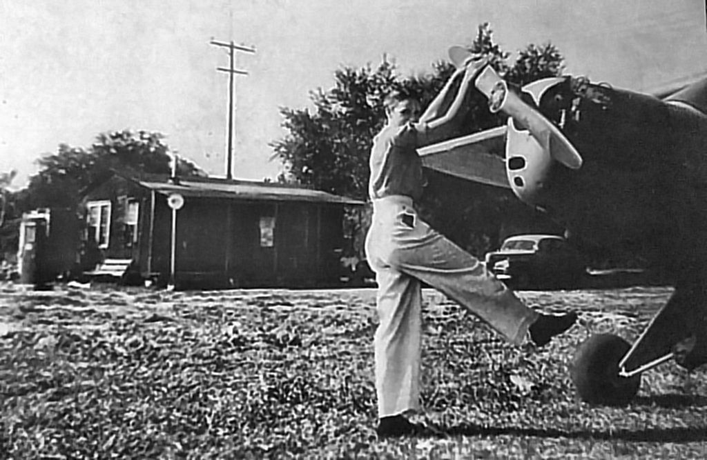
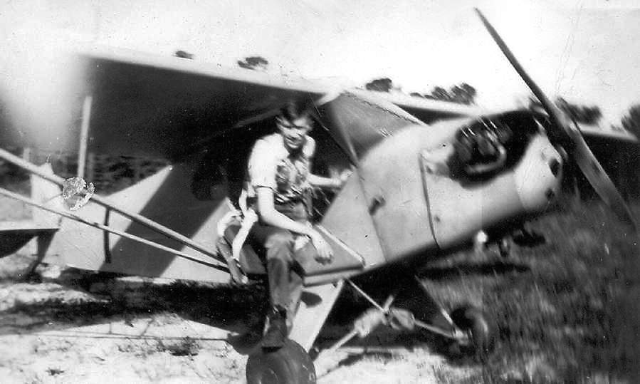
The last photo which has been located showing an aircraft at Hobbs Field was a 1/3/47 photo of Myrtice Walker
propping a Piper J-3 Cub in which she was getting her Private Pilot checkride (courtesy of her daughter Amy Chancey).
Savannah-Wilmington Island Airport was depicted on the 1948 USGS topo map as a commercial/municipal airport.
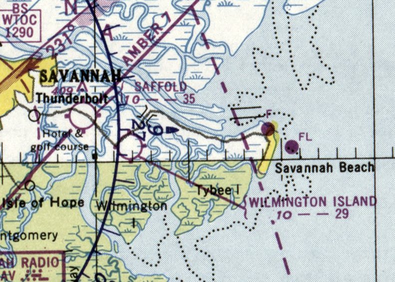
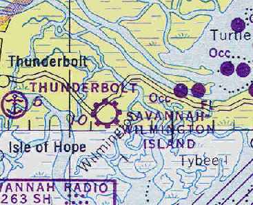
The last aeronautical chart depiction which has been located of Wilmington Island Airport was on the February 1950 Jacksonville Sectional Chart.
It depicted Wilmington Island Airport as having a 2,900' unpaved runway.
According to longtime Wilmington Island resident Eva Thompson, “It was known by the people who worked there
and used it frequently as Hobbs Field, according to my father-in-law, since Bill Hobbs ran all the operations.”
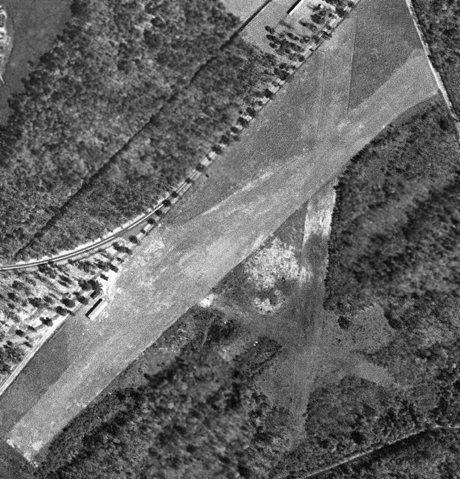
A 1951 USGS aerial photo (courtesy of David Henderson) may have showed the field after its closure.
Only the northeast/southwest runway appeared to have been recently cleared,
with the other 2 runways still being recognizable but deteriorated.
One small building was located on the northwest side, but no aircraft were visible on the field.
The Wilmington Island Airport was evidently closed at some point between 1949-53,
as it was no longer depicted on the January 1953 Savannah Sectional Chart (courtesy of Ron Plante)
or the 1955 USGS topo map.
According to Eva Thompson, the reason for the airfield's closure
was that the Air Force had relinquished what is now Hunter Army Airfield
to the City of Savannah for use as a municipal airport.
Shortly after that, Hobbs moved his operations to the new airport.
“My father-in-law worked as an aircraft mechanic for Bill Hobbs, and left after the operation moved to the new airport.”
Eva continued, “Sometime during the 1960s, an episode of the television series 'Route 66'
was filmed at night at the site of the old Hobbs airfield.
Everybody on the island showed up to watch, including me.
At the time there was not much left of the old airfield, pine trees and undergrowth having taken it over.
Shortly after that, development began to crop up.”
Harry M. Carter III reported, “My grandfather is the H.M. Carter
mentioned as having donated or owning the land on which this field was established.
I still have his C.A.P. hat, uniform and pins.
I also have a few memories of the field, mostly second hand through my father.
One though is first hand although I was very young at the time.
My father woke me at nearly midnight one night. I was around 6 years old.
I was told to put on my robe & slippers because there was something he wanted to take me to see.
We drove across the island & stopped on the shoulder of the road which runs roughly parallel to the East west runway.
He handed me a flashlight & instructed me to walk straight into the bushes & tell him what I saw.
What I saw made me burst into excitement & immediately ask if we were going to take it home.
It was the entire fuselage of a Piper Cub or similar aircraft.
The wing & stabilizer were removed & laid alongside the main fuselage, but at 6 years I was sure we could get it running in no time.
Well, we didn't take it home but it was still an interesting experience.
My father told me to watch what was happening here when I passed over the next few days.
I noticed the plane had been reassembled & a crew of men were working in the general area.
Next I saw the plane, appearing brand new, but leaning at about 45 degrees with tail in the air & nose in the dirt.
That night he took me back down to see the crew with lightning machine in full flame & told me this would be on television very soon.
So, I [can] reconfirm the account of the 'Route 66' episode. The lightning was much more convincing on TV as was the crash.
We had a barn across from our home on Wilmington
which still had 2 large German-made 'Klieg' lights which my father told me were from the airfield.”
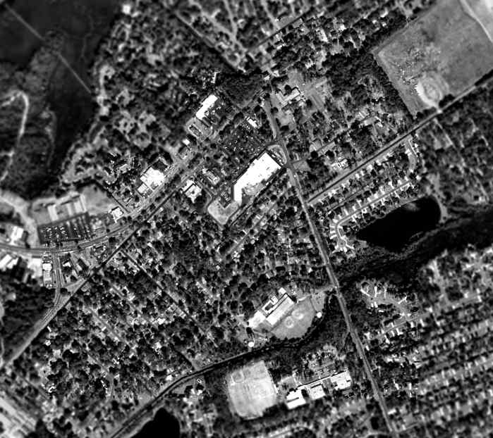
As seen in the 1995 USGS aerial photo, not a trace of the former Wilmington Island Airport appeared to remain -
the area had been densely redeveloped with housing.
Eva Thompson reported in 2005, “There is now a Kroger grocery store, a shopping center,
a private school & several subdivisions covering what used to be the old airfield runways.
All traces are completely gone. Most people who live on the island now have no idea that there was ever an airfield here.
How well it's remembered depends on how many gray hairs you have, I suppose.”
The site of the Wilmington Island Airport is located south of the intersection of Johnny Mercer Boulevard & Penn Waller Road.
____________________________________________________
Saffold Field (GA40), Wilmington Island, GA
32.04, -81.008 (Southeast of Savannah, GA)
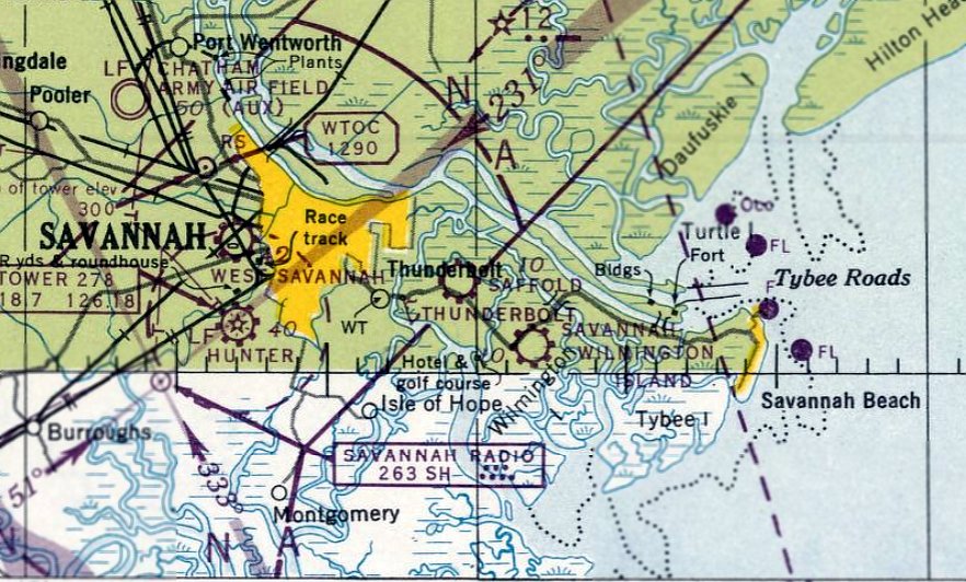
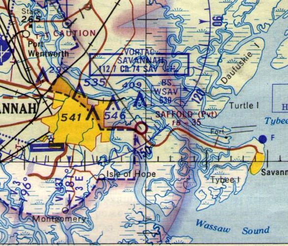
Saffold Field, as depicted on the April 1947 Savannah Sectional Chart.
This general aviation airport was evidently established at some point between 1946-47,
as it was not yet depicted on the October 1946 Savannah Sectional Chart.
The earliest depiction which has been located of Saffold Field was on the April 1947 Savannah Sectional Chart.
The February 1949 Savannah Sectional Chart (courtesy of Chris Kennedy) depicted Saffold as having a 3,500' unpaved runway.
The February 1950 Jacksonville Sectional Chart depicted Saffold Field as having a 3,500' unpaved runway.
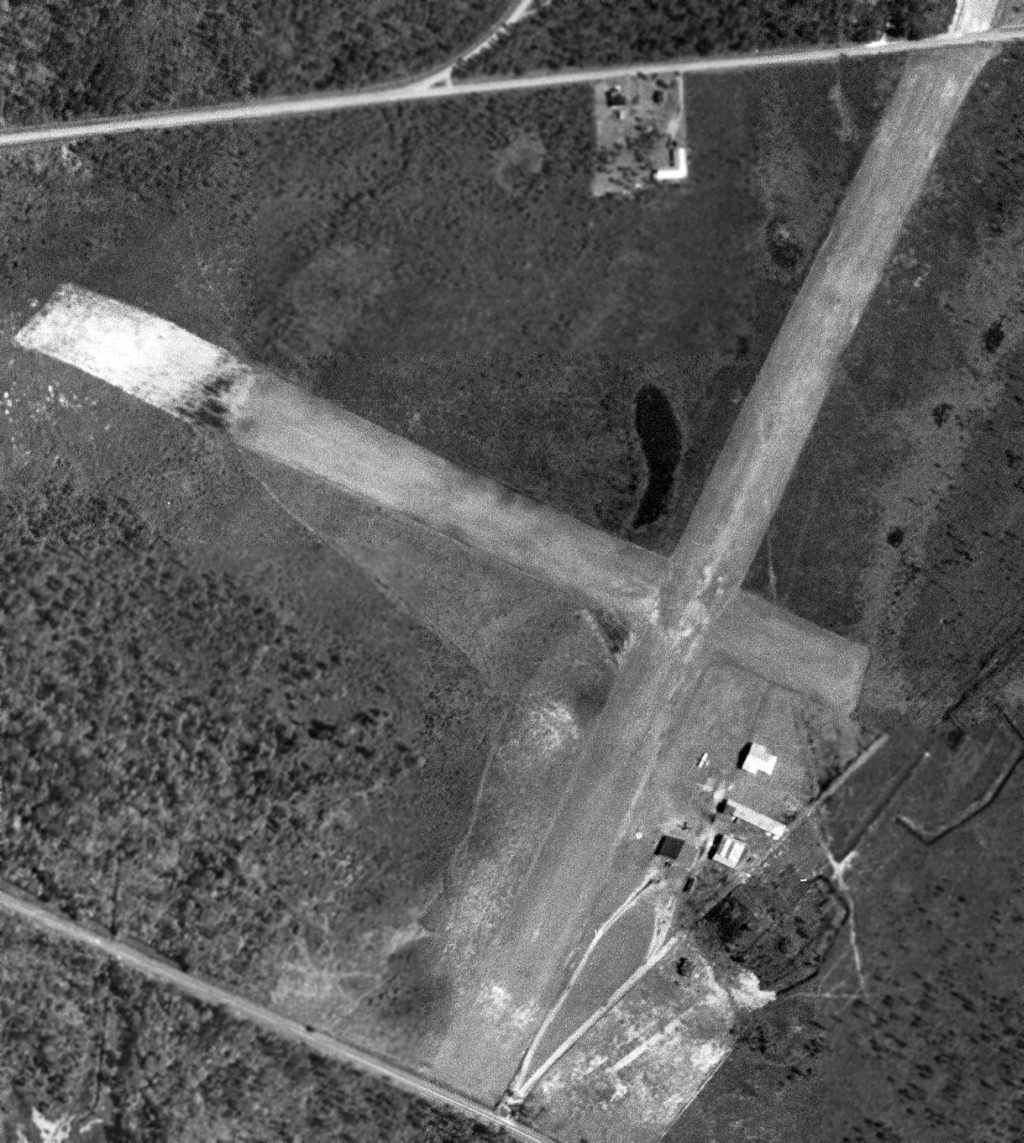
The only aerial view which has been located of Saffold Field was a 3/22/51 USGS aerial photo (courtesy of David Henderson).
It depicted Saffold Field with having 2 grass runways,
with one single-engine aircraft & several small buildings on the southeast side.
The 1955 USGS topo map depicted Saffold Field as having two 3,500' unpaved runways, with several small buildings on the south side.
Don Imbody recalled, “I flew out of Saffold Field in 1959 as a student pilot while I was stationed at Hunter AFB.
Saffold Field had trees on 3 ends of the runways & power lines on the 4th end of the runway.
It was a great airfield from which to take primary instruction!!”
The 1962 AOPA Airport Directory described Saffold Field
as having 2 sod runways: a 3,800' Runway 3/21 & a 2,500' Runway 12/30.
The field was said to offer fuel, repairs, hangars, tiedowns, and charter,
and the operator was listed as Flight Service Inc.
The Aerodromes table on the 1964 Savannah Sectional Chart (courtesy of John Voss)
described Saffold as having 2 runways, with the longest being a 3,500' turf strip.
Longtime Wilmington Island resident Eva Thompson recalled, “During the Vietnam War,
Saffold Field was used as a helicopter training field by the Army.
All the signage was replaced by signs in Vietnamese, which was a little disconcerting to local residents.
It appeared that the Army wanted to create a realistic landing zone atmosphere at the field.
I don't recall any fixed-wing landings at Saffold after the Army used it in the 1960s for the LZ training.”
Al Fitzgerald recalled, “Saffold Field was used by the Army in the mid-late 1960s as a site to practice Ground Controlled Approaches (GCA).
I was teaching instruments in those days & there was a portable GCA radar set up at Saffold.
Can remember landing & taking a break there, not a whole lot going on, but remember a small hangar & office.”
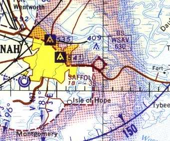
The last aeronautical chart depiction which has been located of Saffold Field was on the 1966 Savannah Sectional Chart.
The airfield's status had apparently changed at some point between 1964-66 to a private airfield.
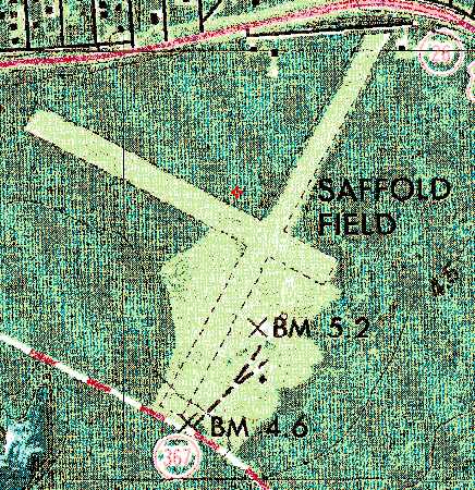
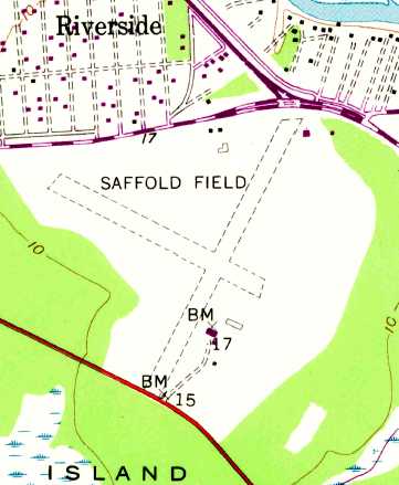
The 1978 USGS topo map showed Saffold Field as having two 3,500' unpaved runways.
Only a single building was depicted on the field - a small building, just south of the runway intersection.
Saffold Field was no longer depicted at all on the 1978-79 GA Aeronautical Chart (courtesy of David Stevenson).
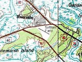
Saffold Field was still depicted on the 1981 USGS topo map,
but with only one runway (the northwest/southeast strip).
Saffold Field was still listed in the 1982 AOPA Airports USA directory (courtesy of Ed Drury),
although the field's status was described as "Private. Closed to Public."
The airfield configuration had been reduced to a single 2,640' turf Runway 12/30.
Saffold Field was apparently closed at some point between 1982-95.
According to Wilmington Island resident Eva Thompson, “Saffold Field was taken by eminent domain from the Saffold family
in order to build what was supposed to have been elementary, middle, and high school campuses.
Two elementary schools & one middle school were eventually built,
and parts of the Saffold property were also used for the development of the Battery Point subdivision adjacent to the schools,
as well as a Wal-Mart & other stores along the new U.S, Highway 80.”
The 1995 USGS aerial photo showed that the site of the former Saffold Field
had been reused for 2 elementary schools & a middle school.
However, the rectangular outline of the northwest & southwest halves of 2 of the former runways were still quite apparent.
Jon Stark recalled in 2003, “Staffold Field... For as long as I can remember driving by there (since 1776)
it was mowed but I think I only ever saw one aircraft there.
There was something about it having to be maintained as an airfield to remain in the family.
It is prime development real estate.”
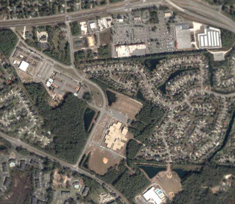
A 2003 USGS aerial view of the site of Saffold Field showed the rectangular outline of the northwest & southwest halves of 2 of the former runways were still quite apparent.
The site of Saffold Field is located south of the intersection of Saffold Road & Whitemarsh Island Road.
____________________________________________________
Shellbine Airfield & Rocket Test Site, Shellbine, GA
30.945, -81.53 (North of Jacksonville, FL)
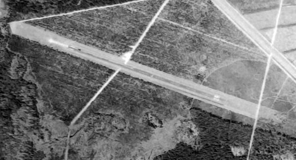
A 1974 USGS aerial photo (courtesy of David Henderson) of the Shellbine runway.
Nothing was yet depicted at this location on a 1958 USGS topo map.
An article in the 4/19/63 issue of the Camden County Tribune reported that "Thiokol Chemical Corporation
was awarded Tuesday long-anticipated contracts for construction
of the largest & most powerful rocket motors ever built in the United States.
Thiokol received 3 parts of a 4-part contract by the NASA acting in conjunction with the Air Force.
The 2 contracts affecting Camden County include one for demonstration firings of 260-inch solid fuel motors
and another for demonstration firings of a 156 inch motor with a 3-million pound thrust
both to be assembled and tested at the new Thiokol plant in Camden now under construction.
This contract marks the 1st time that NASA has participated in a demonstration program
looking toward the use of solid propellants for space vehicles."
According to Gene Greneker, the Georgia plant was previously described on Thiokol's web site.
"There was a small photo at the previous web site of the casting pit being built.
It discussed the facilities saying it 'was a reinforced concrete pit more than 260 inches in diameter
and more than 100 feet deep that was intended to serve as a combination casting pit & curing oven.
The old timers tell me that one engine was tested in the casting pit with the blast going straight up.
It seems that it was heard over a large radius around the area."
At some point a single runway was constructed,
on the north side of the complex, just to the south of the Schooner Landing rocket test site.
According to Clifton Cox, “The landing strip was built so NASA had a place to land at the site.
It was a long drive from Jacksonville or Brunswick.”
According to Gene Greneker, "The entire business failed when they built an engine for NASA and the housing failed
during a hydrostatic pressure test at 50% rated strength.
It seems that NASA & Thiokol did not have the instrumentation to detect the type flaws that caused the failure at that time.
The program was killed.
A small crew stayed at the Georgia Plant trying to find a use for the facility."
After failing as a rocket booster plant, the facility was reconfigured for a U.S. Army contract
to manufacture trip flares (flares that are ignited by an external trigger,
normally an enemy soldier approaching a camp's perimeter).
Bill Boles recalled, “I was Chief of Quality Control for Thiokol from 1969 until 3 months after the explosion on 2/2/71.
I flew a Cessna 140 (N77151) to that field from SSI (almost) daily for a year before the accident.”
On 2/2/71, an explosion at the Thiokol plant killed 34 people and injured 150.
That ended the use of the facility to manufacture flares.
According to Clifton Cox, “In 1971 when the accident at the plant there
most of the injured were flown by Perry Flying Service Aircraft into Brunswick with a few to Jacksonville.
George Perry would not accept an payment for the many flights his aircraft made that day.
If my memory is correct George had a contract with Norton Thiokol
to fly their upper management members to & from Jacksonville on their visits to the plant.
I worked for George Perry from 1966-72
and lived across the street from the road leading to the airfield 2 doors down from the Perrys.”
Gene Greneker recalled, "In the 1970s the Georgia Facility was sold to Union Carbide.
Now it is an insecticide plant.
You can still see the rocket fuel storage bunkers from the sat photos around the oval access road."
The earliest depiction which has been located of the Shellbine Airfield was a 1974 USGS aerial photo (courtesy of David Henderson).
It depicted the field as consisting of a single asphalt Runway 11/29, with no buildings or other improvements.
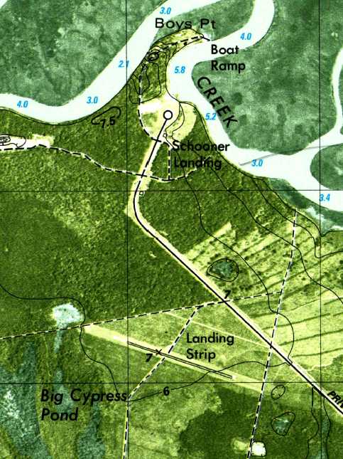
The 1979 USGS topo map depicted a single northwest/southeast runway, labeled simply as “Landing Strip”.
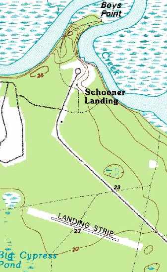
The 1995 USGS topo map depicted a single 2,300' runway, labeled simply as “Landing Strip".
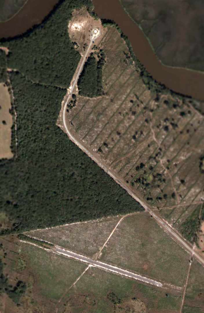
The rocket test site (at the top), and the abandoned runway (at the bottom),
as depicted on the 2003 USGS aerial photo.
The Shellbine airfield was not depicted at all (not even as an abandoned airfield) on 2003 Sectional Aeronautical Charts,
but the site was depicted as "plant".
A 5/28/17 aerial view by James Kleen looking north at the former Shellbine runway (on the left).
James reported, “The pine trees have pretty well taken over the area of the runway.”
A 5/28/17 aerial view by James Kleen looking east at the former Shellbine rocket test pad.
James reported, “Interesting in that there isn’t really anything out there any more...
lots of old foundations, but there was clearly a gate blocking access from the road,
and there were a couple of vehicles at what I presume is the old ‘main gate’,
as if there is a security presence still. Probably to keep people like me out.”
The Shellbine airfield is located at the eastern terminus of Union Carbide Road,
three miles northwest of Shellbine, GA.
____________________________________________________
Harris Neck Intermediate Field Site #8, Harris Neck, GA
31.62, -81.27 (South of Savannah)
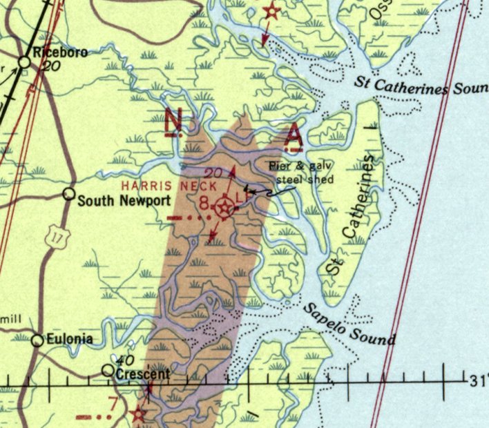
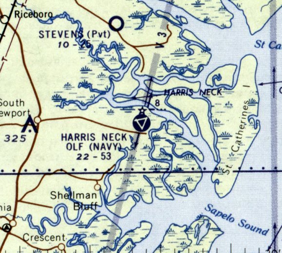
The Harris Neck Intermediate Field, as depicted on the 1935 U.S. Navy Aviation Chart (courtesy of Chris Kennedy).
Photo of the airfield while open has not been located.
The 1st airfield in Harris Neck was one of the Department of Commerce's network of Intermediate Fields,
established for the emergency use of commercial aircraft flying on airways between major cities.
Harris Neck Intermediate Field Site #8 was evidently established at some point between 1929-32,
as it was not yet depicted on the 1929 Rand-McNally Air Tails Map of GA (according to Chris Kennedy).
The earliest reference to the airfield which has been located
was in The Airport Directory Company's 1933 Airport Directory (courtesy of Chris Kennedy).
It described the Harris Neck Intermediate Field as the Department of Commerce's Site #8 along the Jacksonville – Richmond Airway.
The field was said to be located “west of Gould's Landing”,
and to consist of an irregularly-shaped 93 acre sod parcel, measuring 2,600' x 2,550'.
The field was said to be illuminated, but to offer no services.
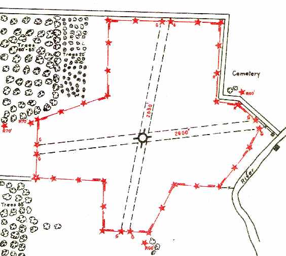
The 1935 U.S. Navy Aviation Chart (courtesy of Chris Kennedy)
depicted the Harris Neck Intermediate Field as having 2 unpaved runways:
2,600' east/west & 2,550' north/south.
It described the field as being the Department of Commerce's Site #8 along the Jacksonville – Richmond Airway.
The field was said to be illuminated, but to offer no services.
The Airport Directory Company's 1941 Airport Directory (courtesy of Chris Kennedy)
described the Harris Neck Intermediate Field as the Civil Aeronautics Administration's
Site #8 along the Jacksonville – Richmond Airway.
The field was said to be located “west of Gould's Landing”,
and to consist of an irregularly-shaped 93 acre sod parcel, measuring 2,600' x 2,550'.
The field was said to be illuminated, but to offer no services.
The last aeronautical chart depiction which has been located of the Harris Neck Intermediate Field
was on the August 1941 Jacksonville Sectional Chart.
A circa early 1943 aerial photo (National Archives, courtesy of Brian Rehwinkel) showed the proximity of the Harris Neck Intermediate Field (bottom of photo)
to the newly-built Harris Neck Army Airfield (top of photo).
The Harris Neck Intermediate Field was evidently abandoned by 1944,
as only the much larger Harris Neck Army Airfield was depicted on the January 1944 Jacksonville Sectional Chart (according to Chris Kennedy).
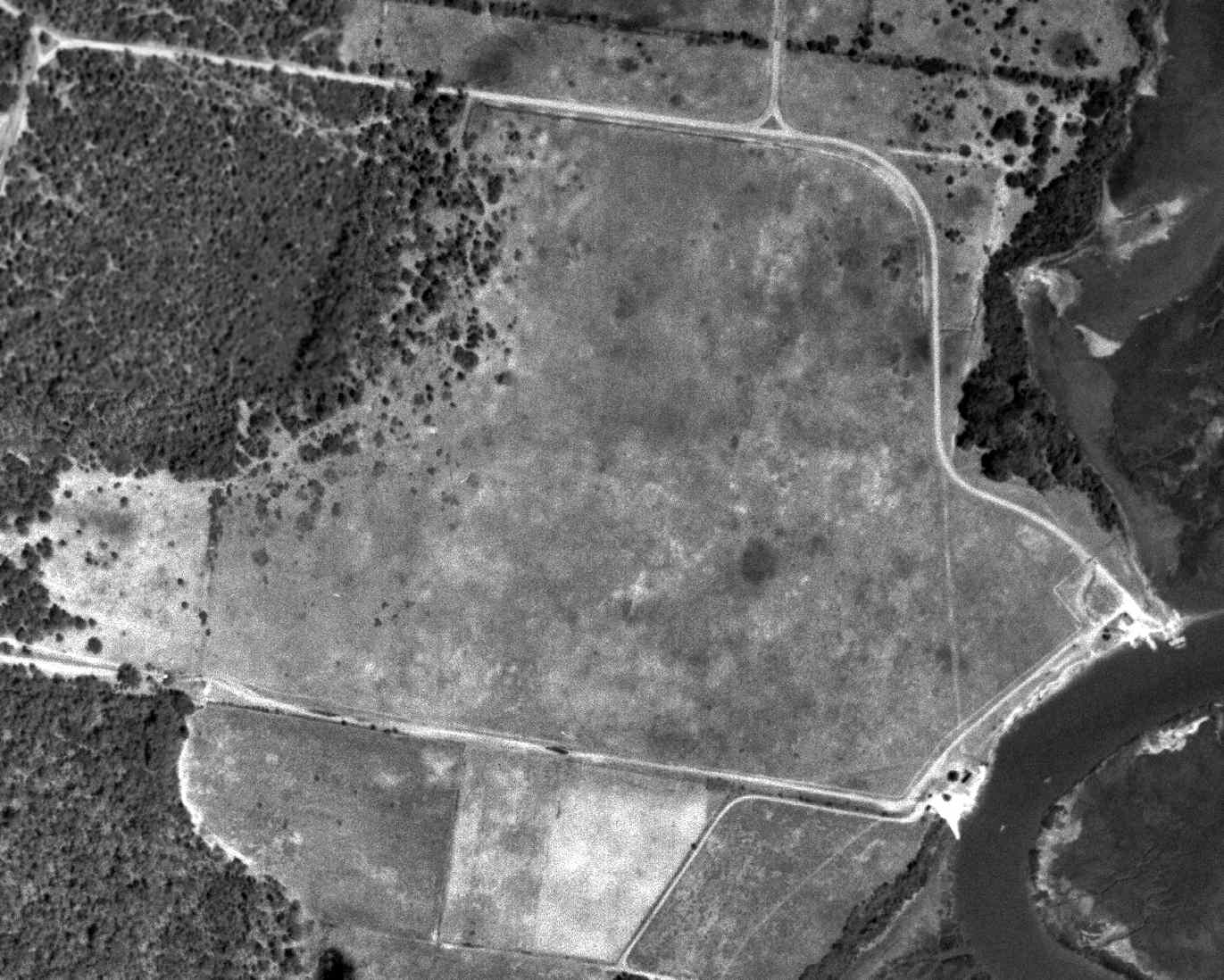
A 3/21/51 USGS aerial photo did not depict any recognizable trace of an airfield, just an open grass field.
The 1959 USGS topo map still depicted a “rotating light” on the south edge of the airfield site, no doubt a remaining airway beacon.
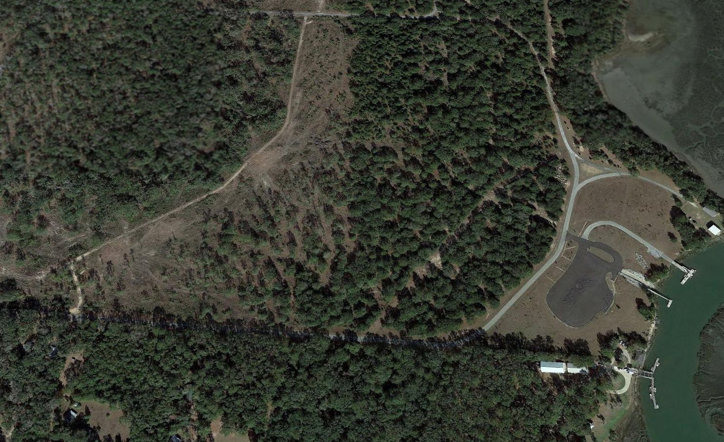
A 2016 aerial view looking north showed not a trace appears to remain of the former Harris Neck Intermediate Field.
Brian Rehwinkel reported in 2016, “The former intermediate field supports a nice stand of tall pines.”
The site of Harris Neck Intermediate Field is located northwest of the intersection of Route 29 & Harris Neck Road.
____________________________________________________
Harris Neck Army Airfield / Harris Neck Outlying Field, Harris Neck, GA
31.64, -81.27 (South of Savannah)
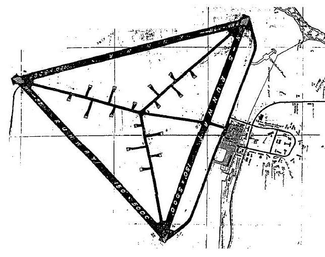
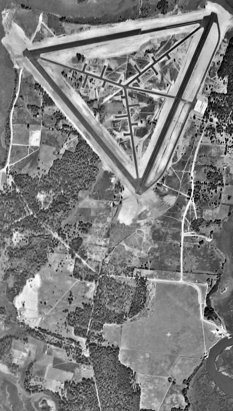
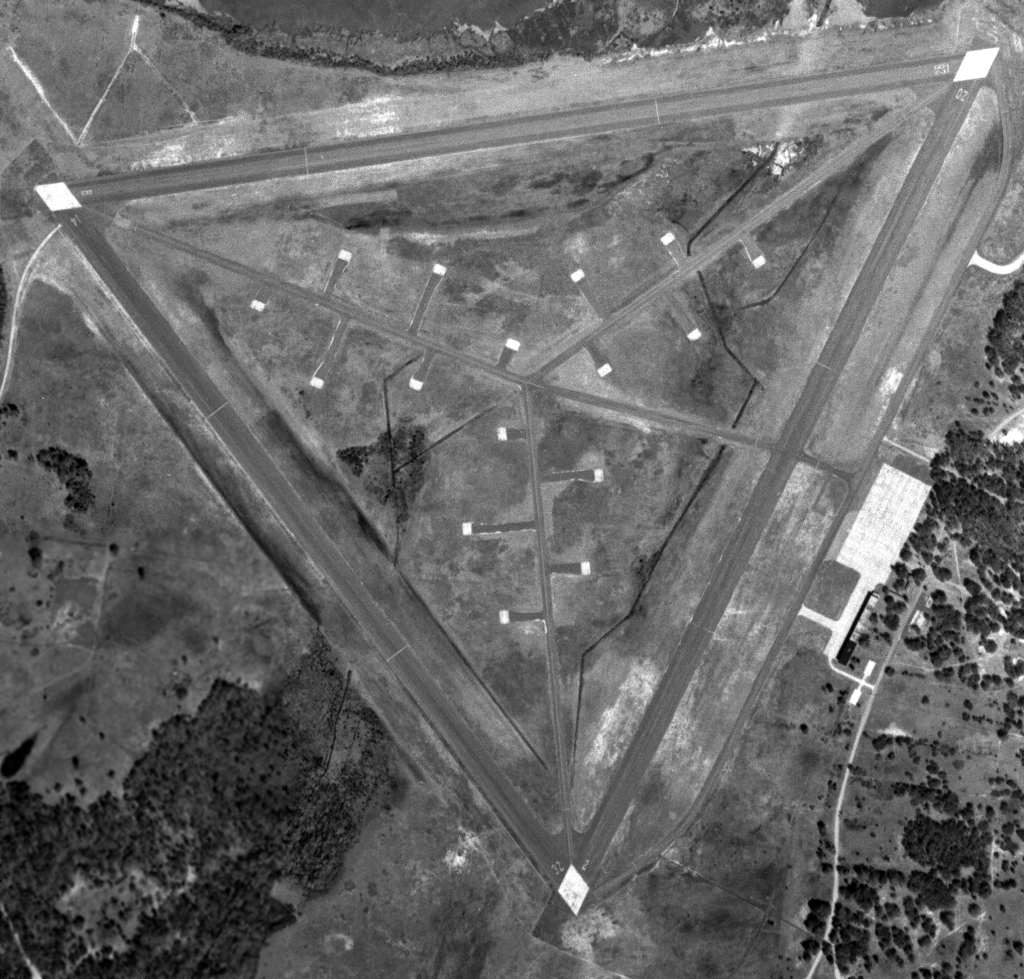
A 1942 Army map of Harris Neck AAF.
Harris Neck Army Airfield was not yet depicted on the September 1942 Jacksonville Sectional Chart.
This airfield is located on an island along the Atlantic coast, barely a few feet above sea level.
It was built during WW2 as a satellite field for Dale Mabry AAF, in Tallahassee, FL,
which was a combat command base primarily for fighter planes.
P-39 & P-40 fighters operated from Harris Neck.
According to Brian Rehwinkel, “I believe most of the construction took place in the latter part of 1942.”
The earliest depiction which has been located of Harris Neck Army Airfield was on a 1942 Army map.
The airfield consisted of three 3,500' paved runways, taxiways, and a large quantity of dispersal pads.
The military property was a total of 1,200 acres.
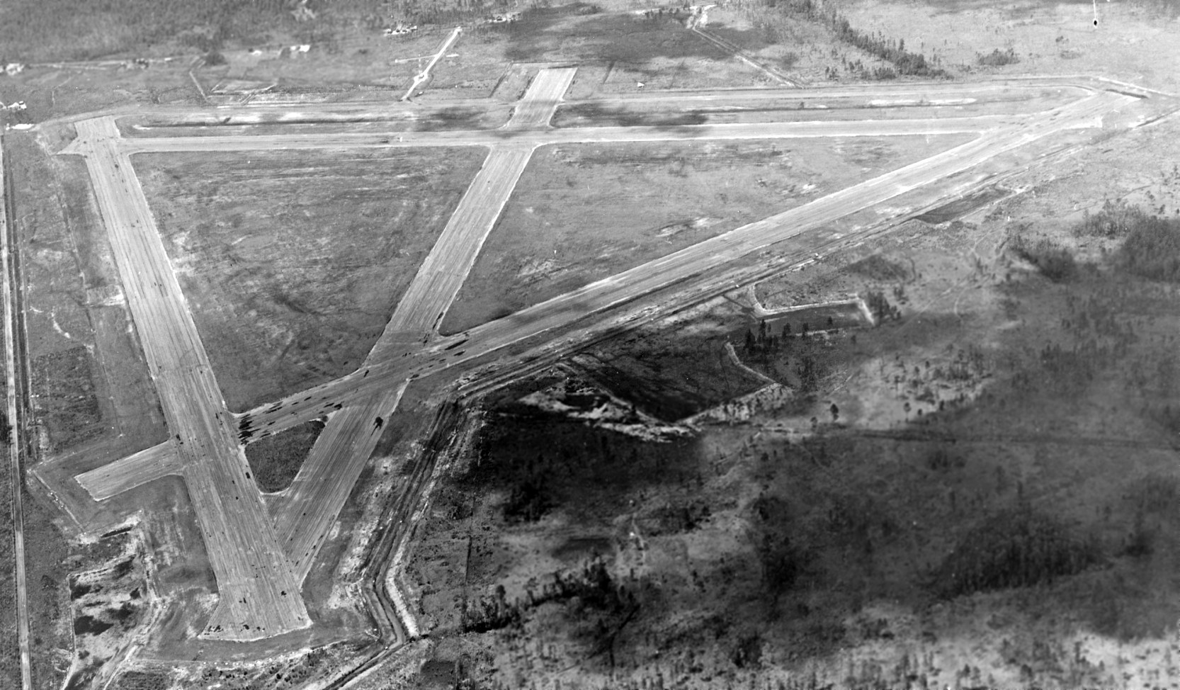
The earliest photo which has been located of Harris Neck Army Airfield was a circa early 1943 aerial view (National Archives, courtesy of Brian Rehwinkel).
Brian Rehwinkel noted, “The photo shows the field before all of the runway paving has been completed.
According to the Base History of the airfield (from the Air Force Historical Research Agency, via Brian Rehwinkel),
the first group of buildings were accepted by the Army on 1/28/43.
The earliest aeronautical chart depiction of Harris Neck AAF which has been located
was on the January 1944 Jacksonville Sectional Chart.
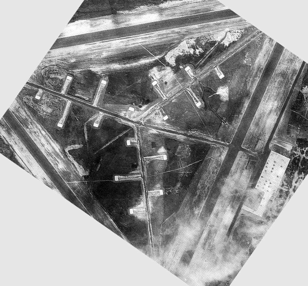
The only photo which has been located showing Harris Neck AAF in use was a 1944 USAAF aerial view (courtesy of David Henderson),
showing about 20 planes on the parking ramp, and 16 dispersal hardstands.
According to Joe Benson, a 1944 Directory of AAF Stations & Activities
listed Harris Neck as being accountable to Waycross AAF,
while a 1945 AAF Installations Directory listed it as a sub base of Statesboro AAF, GA.
Harris Neck AAF was deactivated in 1944.
After WW2, the property was given to McIntosh County for use as a municipal airport.
It was depicted as a civil airfield, "Harris Neck", on the 1949 Jacksonville Sectional Chart (according to Chris Kennedy),
and described as having a 5,400' hard-surface runway.
Due to county mismanagement of the land resources,
Harris Neck was transferred at some point to the Federal Aviation Administration.
A 3/2/51 USGS aerial view (courtesy of David Henderson) still showed the Harris Neck runways marked as active runways,
and the field remained in fine condition, but there were no aircraft visible on the field.
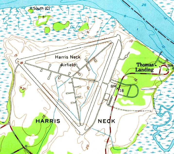
The 1954 USGS topo map depicted "Harris Neck Airfield" as having 3 paved runways,
with paved taxiways leading to a network of 16 parking revetments in the center of the field, and a ramp with one building on the east side.
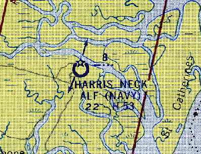
The Harris Neck airfield apparently then also was used by the Navy,
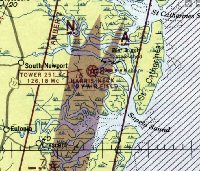
as it was depicted as "Harris Neck ALF (Navy)" on the February 1956 Jacksonville Sectional Chart (courtesy of Chris Kennedy),
and the remarks in the Aerodromes table said "ALF to NAS Glynco. Closed to all traffic except on prior approval. CAA Site 8 on field."
Richard Legg recalled, “While an aircrewman with ZP-2 [NAS Glynco 1957-59] we often flew to Harris Neck ALF to conduct touch and go landings.
The field was used to graze cattle & we had to buzz the field first to scatter the beasts.
While at the CIC School we were issued Geneva Convention Cards
that in case of a nuclear attack in which we could not return to NAS Glynco we were directed to proceed to Harris Neck.
It was an investigation conducted during this period that the government learned that the County Commissioners of McIntosh County
had removed & sold all wooden structures from Harris Neck & sold them for profit.
The only structure remaining was a masonry building that was once the officer's club. At one time this was used as a nightclub.”
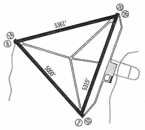
"Harris Neck OLF" was still depicted in the 1960 Jeppesen Airway Manual (courtesy of Chris Kennedy),
but the field was said to be "Closed to all traffic except on prior approval."
The field was depicted as having 3 paved runways, with the longest being the 5,361' Runway 8/26.
A single building was depicted on the ramp on the east side of the field,
but it did not appear to have been big enough to be a hangar.
The last aeronautical chart depiction which has been located of Harris Neck
was on the August 1960 Jacksonville Sectional Chart.
It depicted "Harris Neck OLF (Navy)" as having 3 paved runways, with the longest being 5,300'.
In 1962, the US Bureau of Sport Fisheries & Wildlife (forerunner of the USFWS)
acquired the Harris Neck property & established the area as a migratory bird refuge.
That is presumably when the airfield was closed.
Harris Neck was depicted as an abandoned airfield on the March 1964 Jacksonville Sectional Chart (courtesy of Ron Plante).
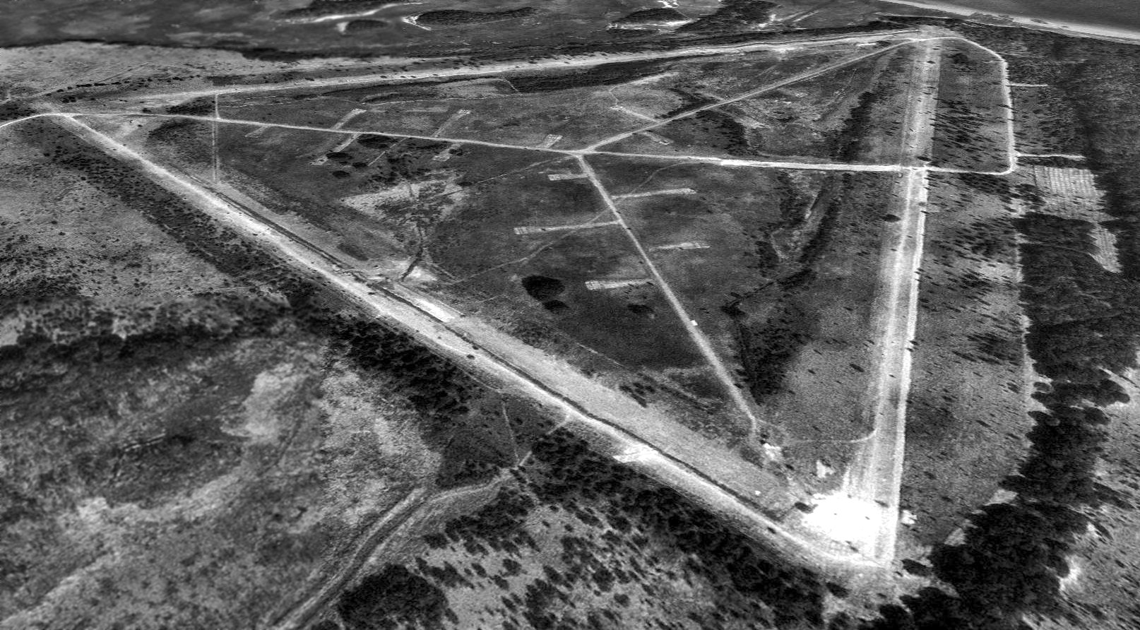
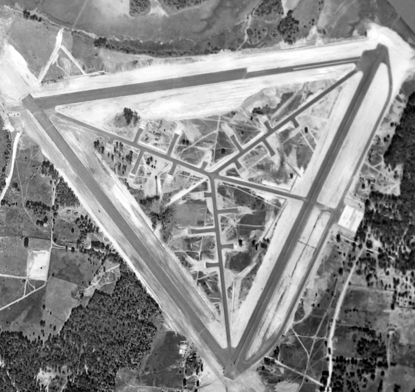
A 1993 USGS aerial view looking north showed the remains of Harris Neck's 3 paved runways still existed in quite good condition,
along with its network of taxiways & dispersal pads.
As of 2002, the property is still operated as the Harris Neck National Wildlife Refuge.
Harris Neck was still depicted as an abandoned airfield on 2002 aeronautical charts.
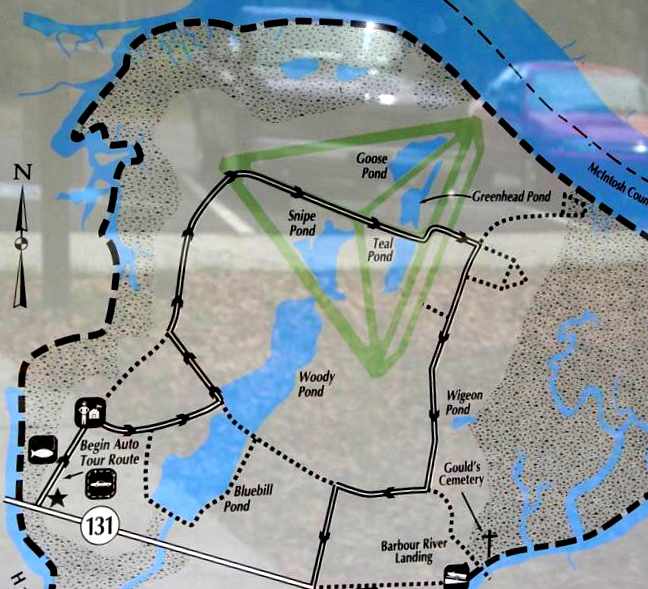
A 2004 photo by Les Parker of the map of the Harris Neck National Wildlife Refuge.
Les Parker reported in 2004, "On a recent trip to Georgia, we happened to visit Harris Neck NWR,
only to discover that it had once been an airfield.
Other than the runways & taxiways there is very little left to show what this area once was.
The area is very overgrown & travel is limited by 'keep out' signs.
It's my feeling that the wildlife folks want the area returned to nature as rapidly as possible.
A new asphalt road has been laid over the broken runway
so it is possible to drive where the wildlife service wants you to drive.
I would strongly recommend very good snake boots if any off road exploring is planned.
We saw the largest copperhead we've ever seen sunning on a section of the old runway.
The surrounding woods are full of roads but they don't show up on your map."
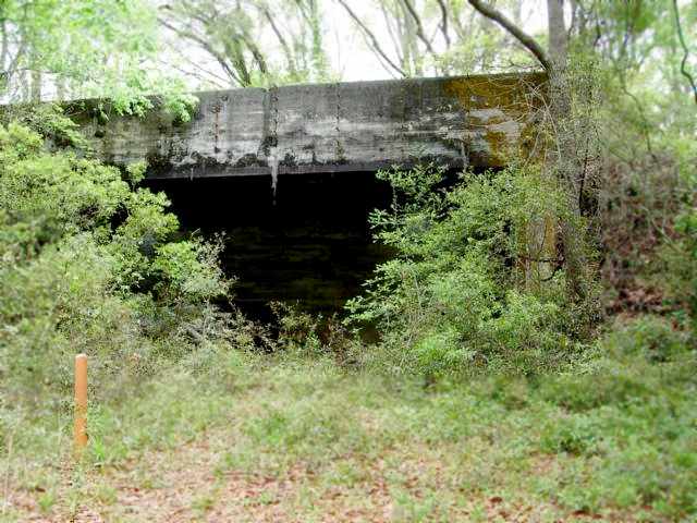
Les Parker reported in 2004, "Your map shows a short road near the upper right hand corner leading to some kind of bunker.
It is still standing and is the only building we saw anywhere."
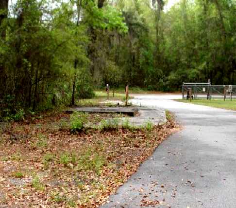
A 2004 photo by Les Parker of the foundation of the former guard shack for Harris Neck AAF.
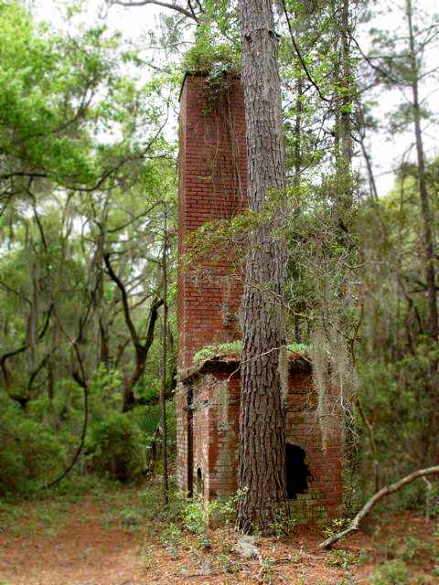
A 2004 photo by Les Parker of the remains of the Harris Neck trash incinerator.
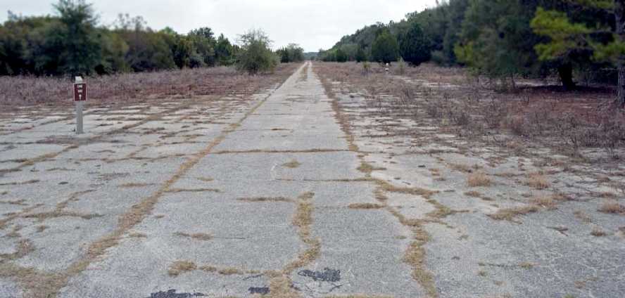
A 2009 photo by Joe Burke looking along a former Harris Neck runway.
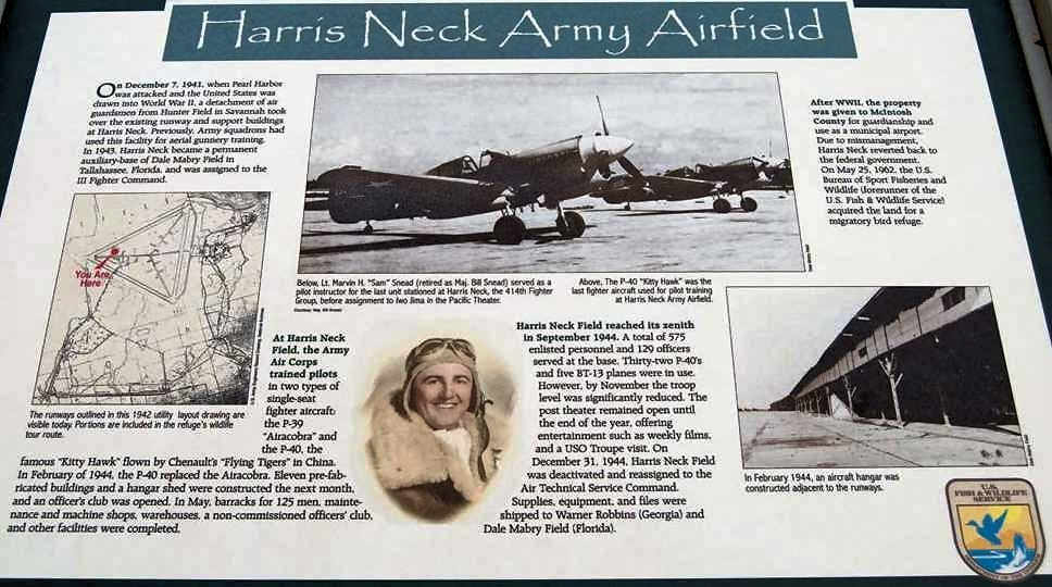
A 2009 photo by Joe Burke of a historical plaque at the site of Harris Neck AAF.
An 11/8/14 aerial view by Dean Baker looking northeast at the remains of the Harris Neck AAF runways.
Brian Rehwinkel reported in 2016, “The former [Harris Neck] AAF is a great place to visit.
There is a loop road for driving around the refuge. It goes through the middle of the airfield & is about 3-4 miles in length.
There are also numerous walking trails. Most of the pavement is still in existence, but trees, bushes, and other plants have grown up through some of pavement.””
A 2016 aerial view looking north showed that Harris Neck's former runways, taxiways & dispersal pads still remained remarkably intact.
An 11/13/24 photo by Robert Lipske from the west point looking east along a former Harris Neck runway.
An 11/13/24 photo by Robert Lipske of former Harris Neck airfield pavement.
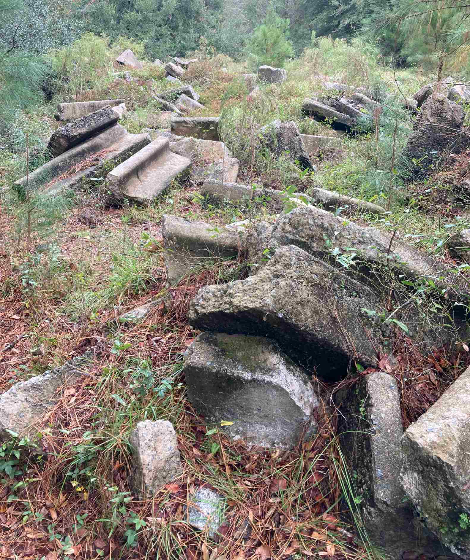
An 11/13/24 photo by Robert Lipske of unidentified rubble at the Harris Neck airfield site.
The Harris Neck Army Airfield is located north of the intersection of Route 131 & Harris Neck Airport Road, appropriately enough.
See also: http://harrisneck.fws.gov/historyx.html
____________________________________________________
Glynco NAS (BQK), Brunswick, GA
31.245, -81.474 (North of Jacksonville, FL)

A circa 1942 aerial view looking north at Glynco's Hangar 1 under construction, with one blimp on the large circular blimp field.
Naval Air Station Glynco was built in 1942 as Navy antisubmarine blimp base.
The wooden trusses for Glynco's 2 massive blimp hangars were cut in Oregon & Washington,
fabricated & numbered, and shipped to Glynco on rail cars.
NAS Glynco was not yet depicted on the September 1942 Jacksonville Sectional Chart.
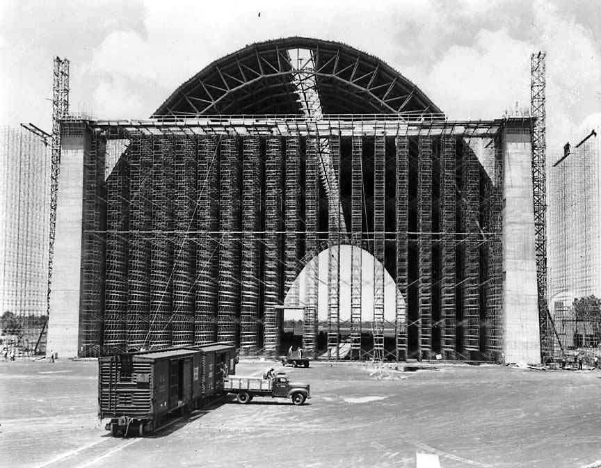
A circa 1942 photo showing Glynco's massive Hangar 1 nearing completion.
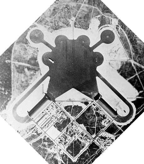
A 1942 aerial view of NAS Glynco (from the Vanishing Georgia Collection of the Georgia Archives).
NAS Glynco was was fully operational by 1943, with two 960' long wooden blimp hangars, 2 mooring circles,
an operational complement of 12 blimps, and a helium plant.
The number of buildings constructed during the WW2 period was approximately 500.
The number of circular blimp mooring pads was eventually expanded to a large number
(their remains are visible southwest of the current runway as a cluster of circular clearings).
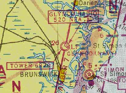
The earliest chart depiction which has been located of NAS Glynco
was on the August 1943 17M Regional Aeronautical Chart (courtesy of Chris Kennedy).
It depicted “Glynco (Navy)” as a military airfield with a control tower.
The January 1944 Jacksonville Sectional Chart (courtesy of Chris Kennedy)
also depicted “Glynco (Navy)” as having a blimp mooring mast.
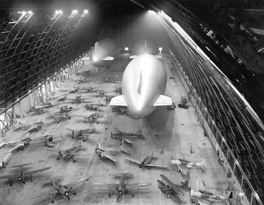
A 1944 photo of an amazing variety of Navy fixed-wing planes & 3 airships inside a Glynco hangar.
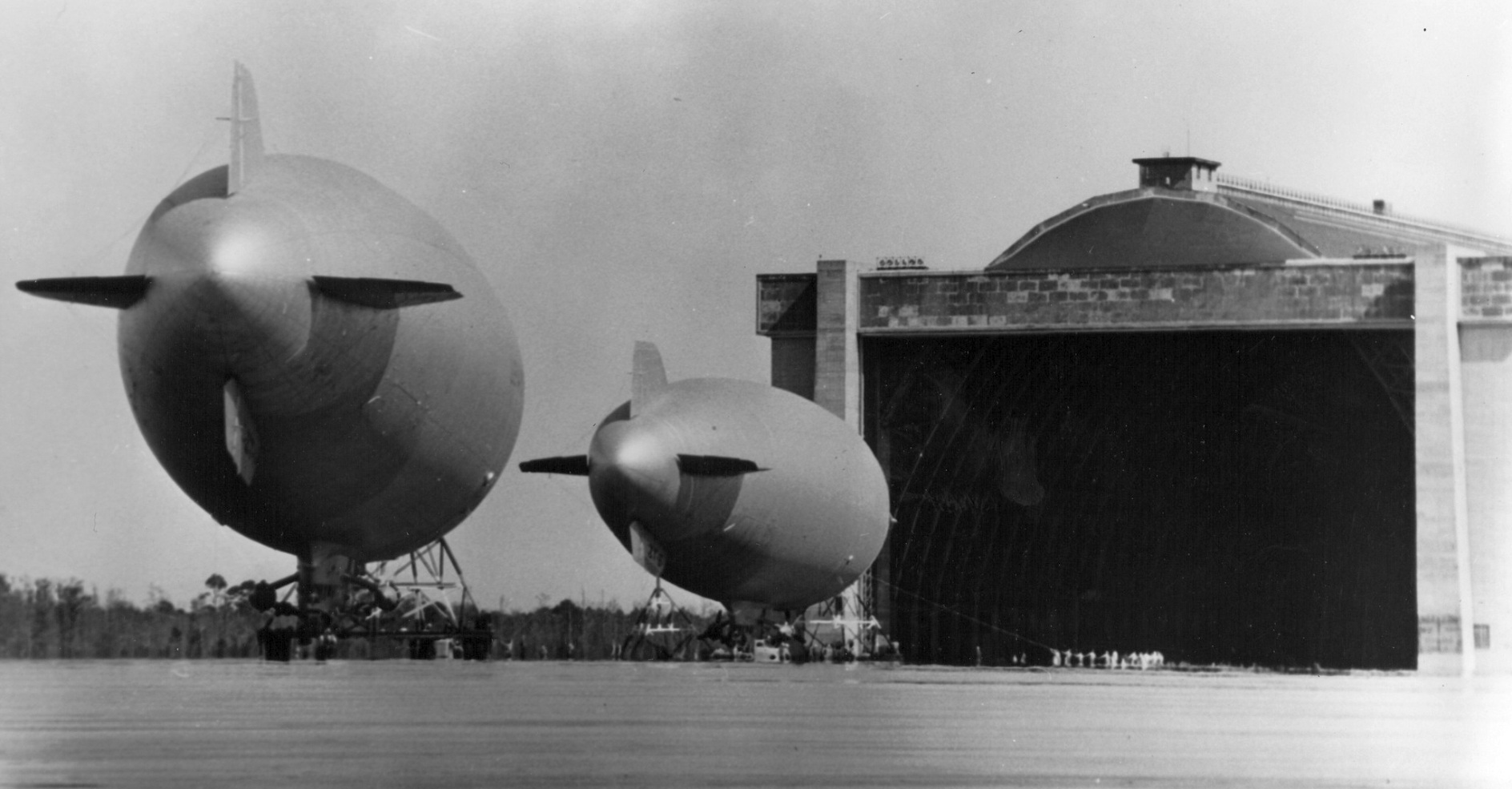
An undated photo of 2 unidentified Navy blimps in front of a Glynco hangar.
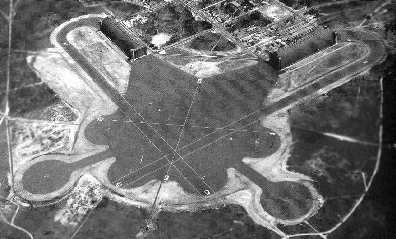
A WW2-era view of Glynco, looking south. National Archives photo.
In 1945 the station was reduced to an air facility,
and it became a storage & salvage yard for some 800 Navy aircraft.
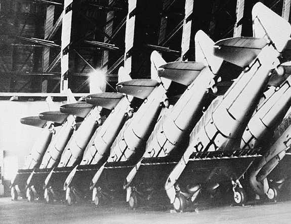
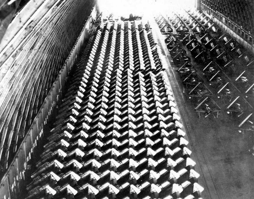
A post-1946 view of SNJ trainers stored inside one of the Glynco's blimp hangars
(from the Vanishing Georgia Collection of the Georgia Archives).
"NAF Glynco (LTA)" was depicted on the 1949 Jacksonville Sectional Chart (according to Chris Kennedy),
along with the mooring mast symbol.
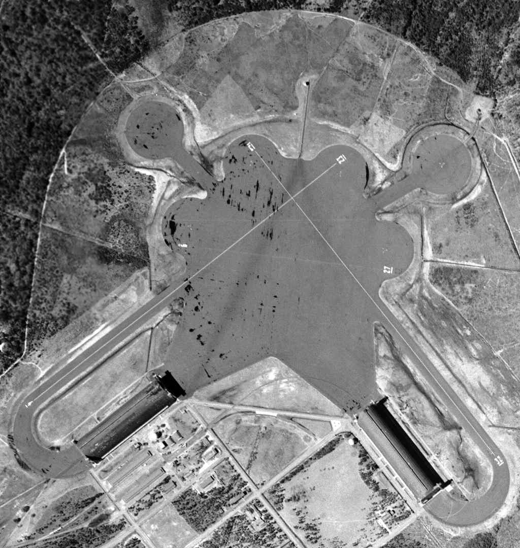
A 1951 aerial view (courtesy of David Henderson) depicted NAS Glynco's massive blimp hangars, and 2 fixed-wing aircraft runways were marked out as well on the large paved landing mat.
In 1952, Glynco underwent a significant expansion, and an 8,000' runway was built for jet aircraft operations to the north of the WW2 blimp facility.
The base eventually totaled over 4,434 acres.
At one time, the base could boast of being the only air station operating every type of aircraft: blimps, propeller aircraft, jets & helicopters.
These included the P2V Neptune, E-2B Hawkeye, T-33, T-39 & A-4.
The newer aircraft were required to support advanced pilot training & the Naval Air Technical Training Command (NATTC).
NATTC provided advanced & specialized training for the Combat Information Center, air traffic control & associated equipment maintenance.

A 1955 or later photo of a ZS2G-1 (5-K) airship moored to a mobile mooring mast in front of a Glynco hangar.
According to Richard Legg, the first ZS2G-1 “was not delivered to the US Navy until 1955”, thus dating the photo to 1955 or after.
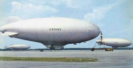
A circa 1950s view of several Navy blimps at Glynco (courtesy of Steve Cruse).
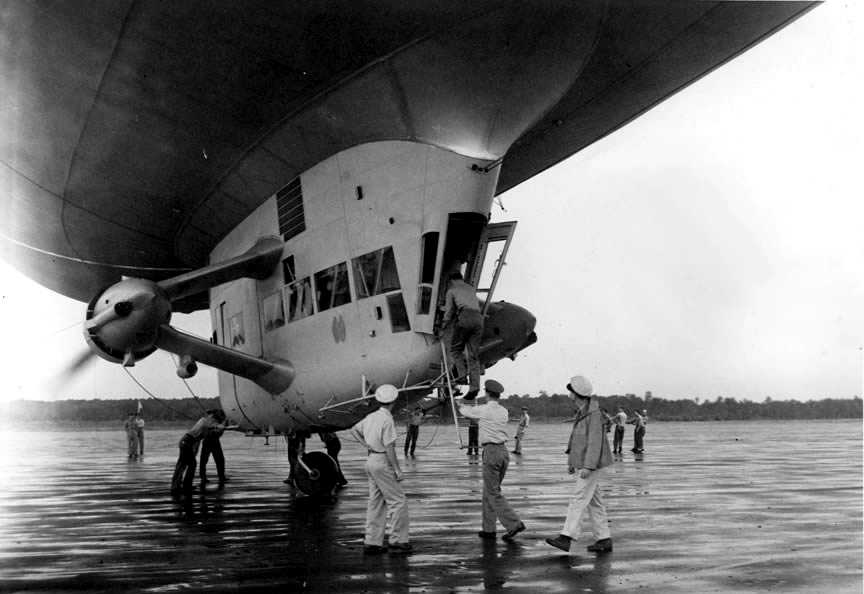
A circa 1950s photo of the crew boarding a K-type airship at Glynco.
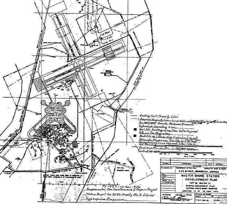
A curious footnote in the history of the Navy's use of Glynco is its 1956 "Master Shore Development Plan".
whereas only one runway was ever built for jet aircraft.
This was apparently a proposal to upgrade Glynco as one of the Navy's "Master Jet Bases",
which was eventually carried out at Oceana NAS & Cecil Field NAS instead.
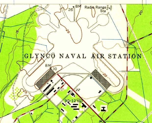
The 1956 USGS topo map depicted Glynco NAS as having 2 blimp hangars & the large paved blimp apron area & mooring pads.
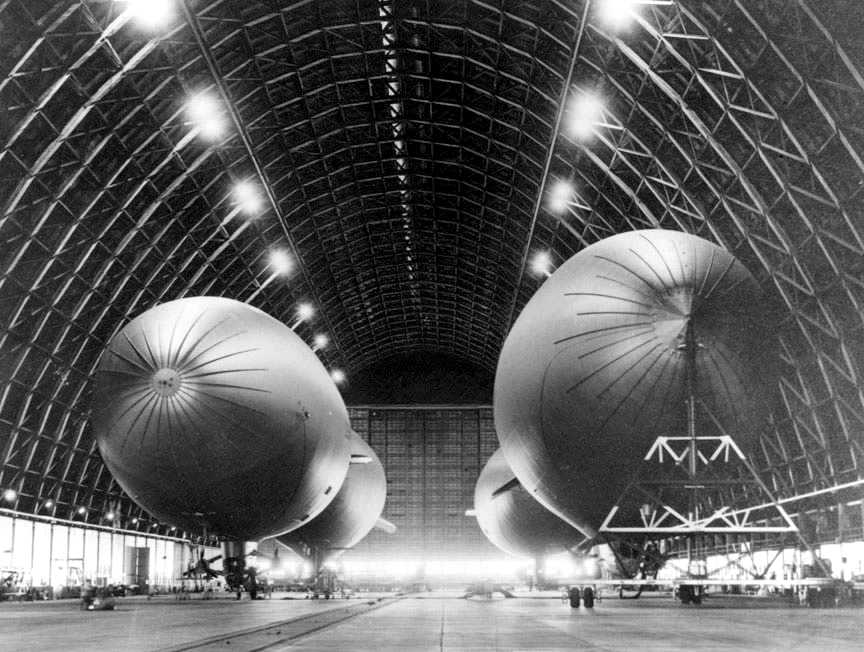
A circa 1956 photo of 4 blimps of Squadron ZP-2 inside Glynco's massive Hangar 1.
According to Richard Legg, the photo is “circa 1956 when ZP-2 was replacing the ZSG-3 (3-K) airships with the newer ZS2G-1 (5-K) airships.
Note that there are 2 of each type airship in the photo: the ZS2G-1 airships have 3 tail fins while all previous model K-ships have the standard 4 fins.”
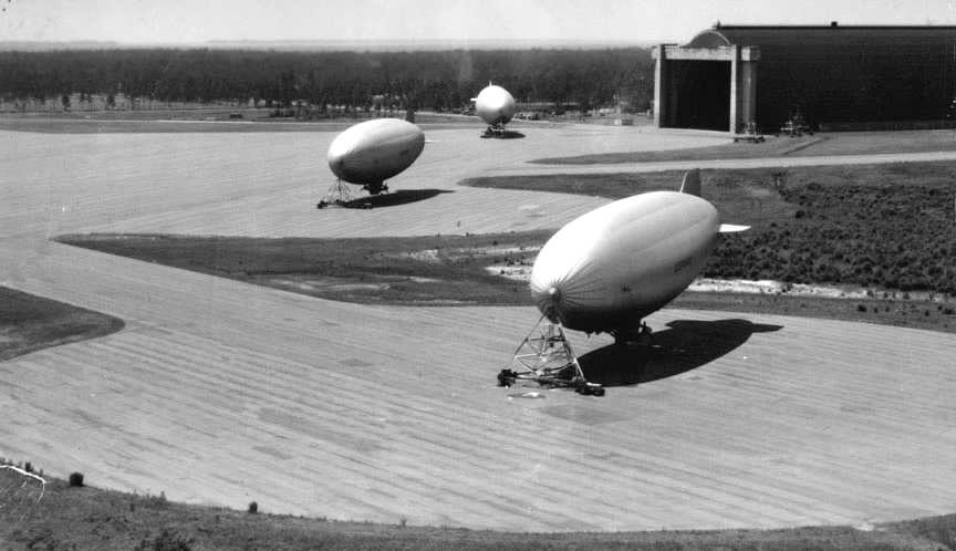
An undated photo of 3 Navy blimps moored to portable mooring masts at Glynco.
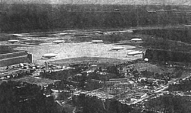
An amazing 1957 aerial view of no less than 7 blimps at Glynco.
According to Richard Legg, “I reported to ZP-2 in August 1957
and jet hangar maintenance was still being performed beneath the airships in Hangar 1.
In 1957 I transferred to ZP-2 at NAS Glynco where I was stationed until February 1959.
During my years with ZP-2 the squadron was assigned 6 ZS2G-1 (5K) airships & 3 SNB aircraft.
Airship pilots were required to be qualified in both LTA (Lighter-Than-Air) & HTA (Heavier-Than-Air) aircraft.
The SNB were used for travel to commands located at other locations.
NAS Glynco was also the site of the only airship training command.
It was at various times identified as ZTG (Airship Training Group) & ZTU (Airship Training Unit).
This squadron operated 6 ZSG-4 (4-K) airships during the years that I was there.
Basic airship training was provided young airmen after they received their wings as well as other pilots that did not have airship experience.
They operated out of Hangar 2. The old diehard LTA officers always referred to them as Dock 1 & Dock 2 vice hangars.
While an aircrewman with ZP-2 we often flew to Harris Neck ALF to conduct touch & go landings.
While at the CIC School we were issued Geneva Convention Cards that in case of a nuclear attack in which we could not return to NAS Glynco
we were directed to proceed to Harris Neck.”
Richard continued, “ZX-11, which was based at NAS Key West, FL, maintained a permanent detachment at NAS Glynco.
The detachment was housed in Hangar 1 & all personnel were permanently assigned.
ZX-11 operated the much larger ZPGN (Nan) ships & only brought the ships to Glynco for major inspections
or maintenance requiring hangaring since no airship facilities were available at NAS Key West.”
Richard Legg recalled, in February 1959, “At that time my sea tour was ended & I crossed the field and was stationed with the Naval CIC School until February 1962.
The US Naval Combat Information Center (CIC) School was located at NAS Glynco during the late 1950s & early 1960s.
It was a major command that had more than 1,000 enlisted & officers assigned.
The command consisted of a large masonry building, known as the 'T' Building, located in the pine forest well to the north of the other buildings
and 2 hangars located alongside the single 8,000’ runway.
The 'T' Building housed all non-aviation components of the CIC School command.
This included all administrative offices as well as the Training Department including classrooms
and full size Combat Information Centers like those found on board major Navy surface ships.”
Richard continued, “The second component was the Operations Department that was located alongside the 8,000' runway & next to the base control tower.
The Operations Department was housed in 2 hangars, one being a nose hangar containing shop & maintenance spaces
and one standard hangar containing shop, maintenance, and office spaces.
The Operations Department was divided into 2 completely separate maintenance sections,
one performing maintenance on the assigned propeller-powered aircraft
and the other performing maintenance on the assigned jet powered aircraft.
The fact that maintenance was assigned to the Operations Department was definitely a non-standard arrangement.
The propeller section of the maintenance division was completely independent from the jet division.
Each had their own Maintenance Officer, CPO and assigned personnel.”
Richard continued, “The propeller section maintained four WV-2 Super Constellation early warning type aircraft.
The WV-2 aircraft were maintained in the nose hangar that permitted the forward section to be indoors out of the weather
but leaving the remainder of the aircraft exposed to the elements.
The WV-2 aircraft were utilized as in-flight classrooms where Air Traffic Control students were trained in the operation of the radar equipment.
Upon successful completion of the course the students would be designated as Air Traffic Controllers (AC) (W).
The controllers were trained to detect aircraft on their radar screens & vector interceptor aircraft
while feeding this same information back to the CIC units in the 'T' Building.
The jet section maintained around 90 aircraft.
Initially the assigned aircraft consisted mostly of several versions of the F-2H dual-engine Banshees.
Around 1960 the older & slower F-2H Banshees were replaced by the newer & more up-to-date FJ-4 Fury.
Also a few other aircraft such as T2V & F3D were assigned in limited numbers.
The jet aircraft were utilized as both bogies & interceptor aircraft & were flown both day & night.”
Richard continued, “The CIC jet hangar was probably completed & occupied in late 1957 or early 1958.
All maintenance personnel assigned to the Operations Department of the CIC School were reassigned to NAS Glynco in November 1961.
The reason for this change is not known.”
Richard continued, “During my years in the CIC School I recall that the station had at least one R4D, one UF & some helicopters.
I recall an instance when a pilot assigned to the CIC School flew a jet, prop driven aircraft, seaplane, airship and helicopter in the same day.
His name was Lt. Straughn and he was an ex AP (enlisted pilot).”
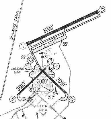
The 1959 Jeppesen Airway Manual (courtesy of Chris Kennedy)
shows the configuration of the jet airfield which was constructed at Glynco:
a single 8,000' paved Runway 7/25,
along with the much smaller 3,800' Runways 5/23 & 13/31, from the original WW2-era airfield.
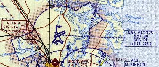
NAS Glynco, as depicted on the 1964 Jacksonville Sectional Chart (courtesy of John Voss).
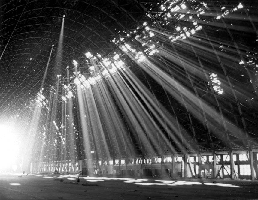
An undated photo showing sunlight poring through several holes in one of Glynco's blimp hangars.
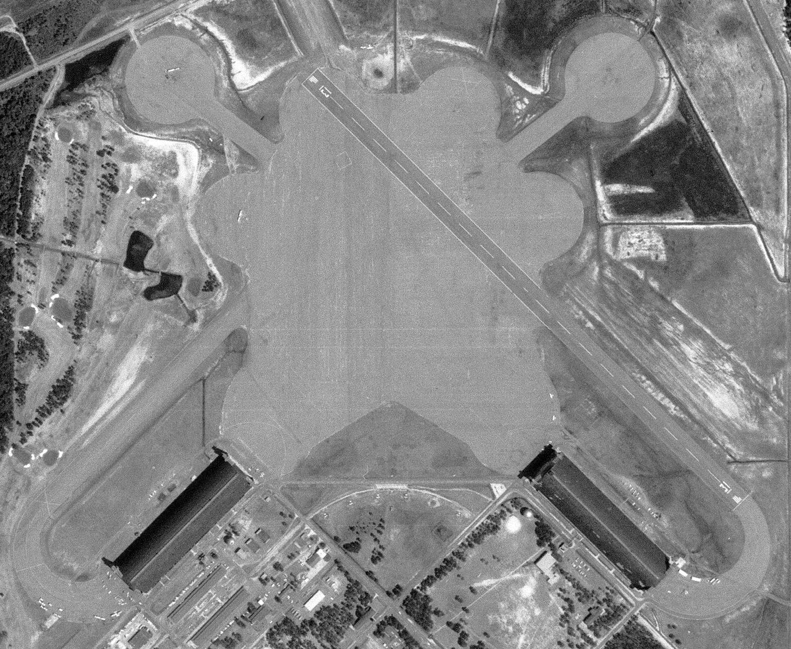
The last aerial photo which has been located showing NAS Glynco in its original WW2 configuration was a 5/1/68 USGS aerial view.
Both massive blimp hangars remained, and Runway 13/31 still remained marked over the former blimp mooring mat.
Former Runway 5/23 had evidently been abandoned at some point between 1959-68.
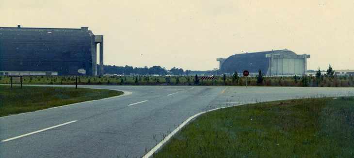
A 1970 photo by Dan Davis of the 2 hangars at Glynco.
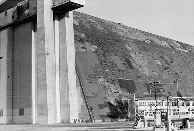
A 1970 close-up by Dan Davis of one of the blimp hangars at Glynco.
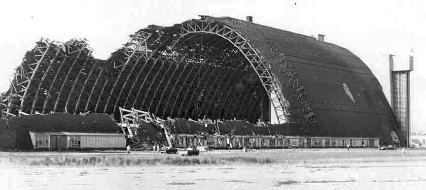
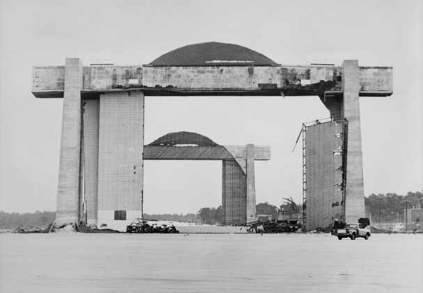
A 1971 photo of the remains of one of Glynco's massive blimp hangars,
taken during its demolition (from the Vanishing Georgia Collection of the Georgia Archives).
Both blimp hangars were demolished in 1971.
The Navy was in the process of constructing new quarters & upgrading the facilities of the base
when they were directed to disestablish the Naval Air Station in 1974.
In 1977, the US conveyed the northern half of the base (the runway area, consisting of a total of over 2,300 acres)
to the County of Glynn to establish a civil airport.
The southern part of the base (the blimp operating area, a total of over 1,524 acres)
became the Federal Law Enforcement Training Center,
with driver training tracks being built over many of the former blimp mooring pads.
Christopher Ness reported in 2003, “I did try to get a good view of the old blimp facility with minimal success.
It was neat to see about 30 police cars with lights flashing run the course."
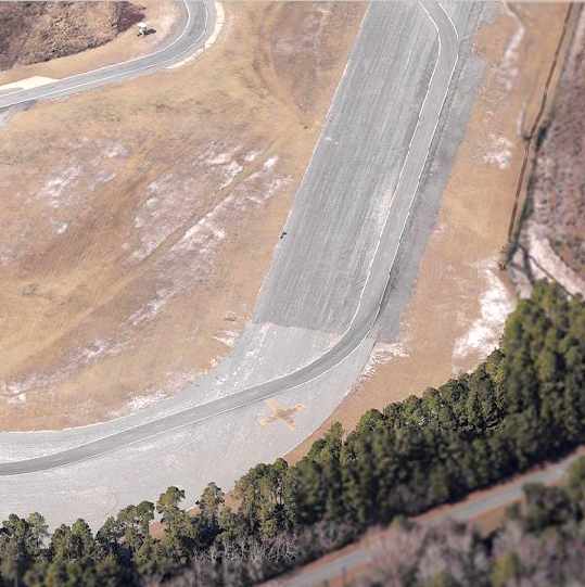
In a circa 2002-2005 aerial view looking west, a yellow closed-runway “X” symbol was still visible on the southeast end of the former southeast/northwest Navy runway at Glynco.
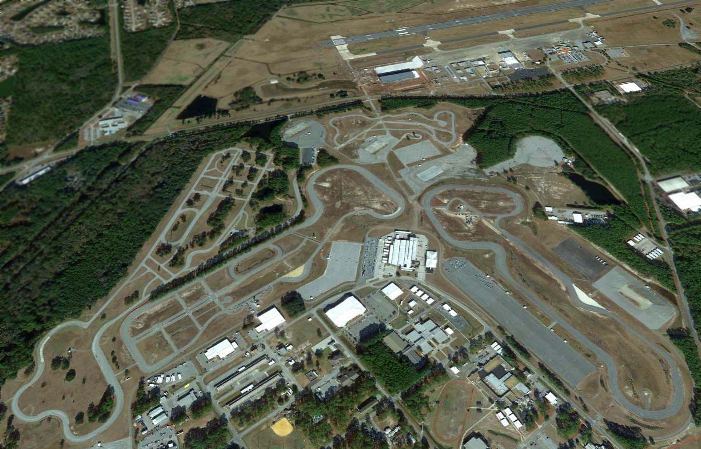
A 2014 aerial view looking northwest at the remains of the Glynco blimp field, with the runway of Glynco Jetport in the background.
A 1999 Army Corps of Engineers report gives further details of Glynco.
____________________________________________________
Or if you prefer to contact me directly concerning a contribution (for a mailing address to send a check),
please contact me at: paulandterryfreeman@gmail.com
If you enjoy this web site, please support it with a financial contribution.
____________________________________________________
This site covers airfields in all 50 states.
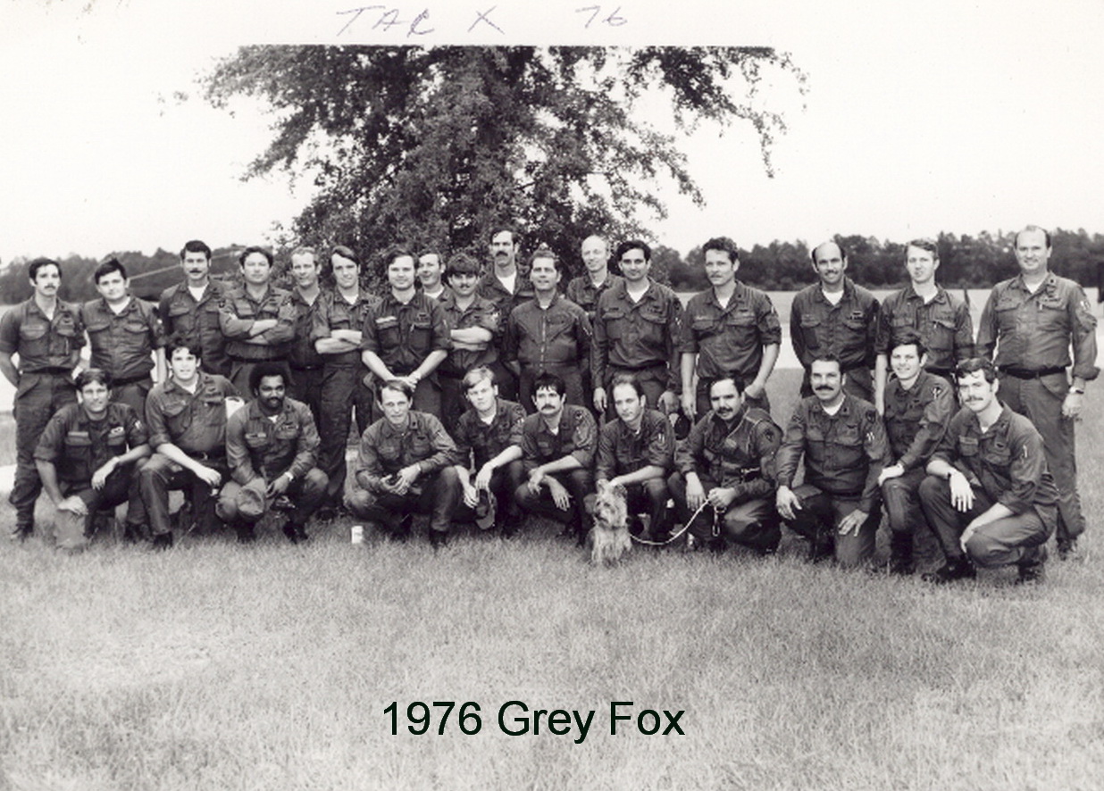