
Abandoned & Little-Known Airfields:
California: San Luis Obispo area
© 2002, © 2024 by Paul Freeman. Revised 8/27/24.
This site covers airfields in all 50 states: Click here for the site's main menu.
For a 9th year, the CA pages of this website are sponsored by the California Pilots Association:

____________________________________________________
Please consider a financial contribution to support the continued growth & operation of this site.
Alamo Airstrip (revised 7/10/22) - California State Polytechnic Airport (revised 11/15/18) - Cambria Pines Airport (revised 6/8/21) - Camp Roberts Main AAF (revised 4/6/21)
Camp Roberts AAF (original location) (added 4/6/21) - Camp San Luis Obispo Army Airfield (revised 11/19/13) - Clark Field (revised 7/5/20) - Sinclair Field / Flying R Ranch Airfield (revised 4/13/16)
Hearst Ranch Airport (1st location) (revised 3/31/23) – W.R. Hearst Airport (2nd location) (revised 6/7/21) - Hearst Airport (3rd location) (revised 8/26/18)
Jolon Airfield / Hearst Hacienda Airfield / Hunter Liggett Airfield (revised 7/10/22) - Nipomo Airfield (revised 10/21/14) - Northside Airpark (revised 3/19/21)
O'Sullivan Army Airfield (revised 3/27/17) – Souza Airfield (revised 8/27/24) - Sherwood Field / (Original) Paso Robles Airport (revised 4/23/23)
Schoonover Tactical Airstrip (revised 3/19/21) - Sky Lawn Airport (revised 4/6/21) - Weir Airfield (revised 5/10/24)
____________________________________________________
Souza Airfield, Santa Margarita, CA
35.39, -120.63 (Southeast of San Francisco, CA)
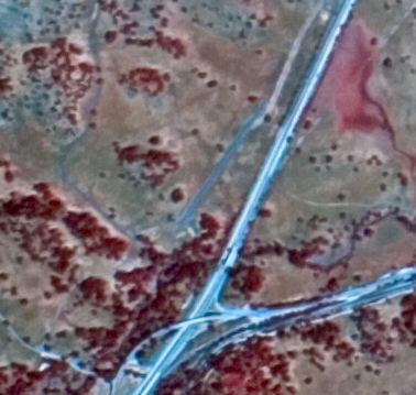
A 5/24/02 aerial view of Souza Airfield (courtesy of Dallam Oliver-Lee).
This airfield was not yet depicted on a 1994 aerial photo.
Santa Margarita resident Cal Gunther reported, this airfield was “a late 1990s / early 2000s graded weekend project by Steve Souza, a local road & building contractor.
The 'runway' was never used & construction was shut down immediately the following week after an attempt to bypass local permit requirements.
The FAA got involved with the arrival & departure track in relationship to Highway 101.”
According to Dallam Oliver-Lee, this airfield “opened sometime between 1994-2003.
I have only seen 2 airplanes land [on it] in 2007-2008. [It was] abandoned sometime between 2007-2009.
[Closed-runway symbol] Xs on the runway were first visible in 2009.”
The Souza Airfield was not depicted at all on 1994/2000/2013 USGS topo maps.
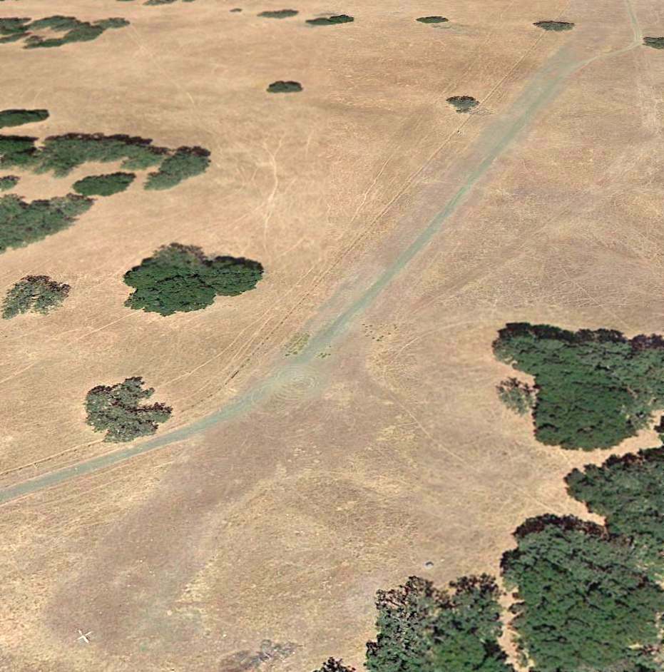
An 8/23/13 aerial view looking northeast at the remains of the runway of the Souza Airfield, showing the closed-runway “X” markings.
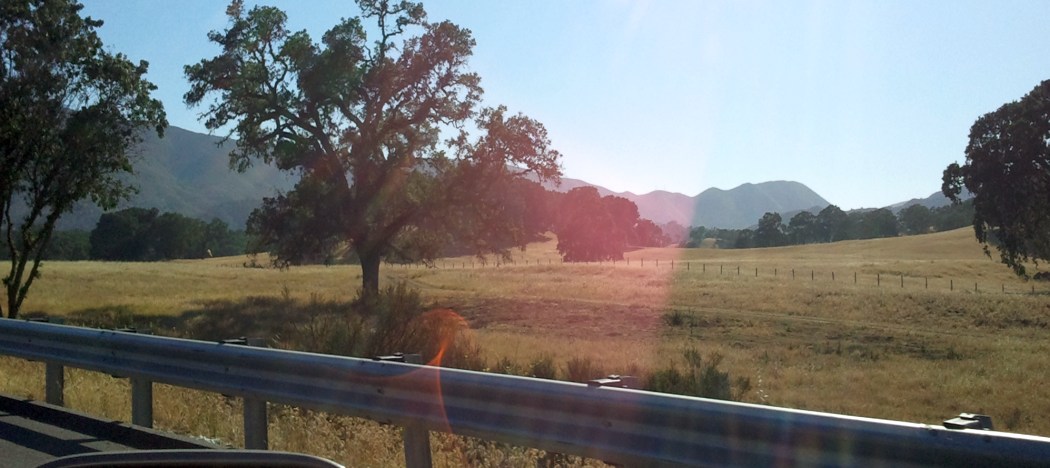
A 5/23/13 photo by Dallam Oliver-Lee of the site of the Souza Airfield.
Dallam Oliver-Lee reported in 2014, a “directional wind cone is still visible from Highway 101 & has been neglected.”
The site of Souza Airfield is located northwest of the intersection of US Route 101 & Route 58.
____________________________________________________
Clark Field, San Luis Obispo, CA
35.25, -120.66 (Southeast of San Francisco, CA)
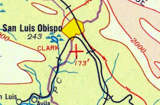
Clark Field, as depicted on a 1933 aeronautical chart (courtesy of Dallam Oliver-Lee).
According to Dallam Oliver-Lee, “Other books & other documents showed Clark Field in use from 1910.”
According to www.aerofiles.com, Clark Field was established circa 1926.
The earliest dated reference which has been located to Clark Field
was on a January 1928 Standard Oil advertisement (according to www.aerofiles.com).
The earliest depiction which has been located of Clark Field was on a 1933 aeronautical chart (courtesy of Dallam Oliver-Lee),
which depicted Clark as an auxiliary airfield.
According to www.aerofiles.com, as of 1936 Clark Field was described as being located 1.5 mi south of town, at the end of Prado Road,
and it measured 2,000' x 1,430'.
According to Dallam Oliver-Lee, “Amelia Earhart landed at this airport while visiting Cal Poly & San Luis Obispo.”
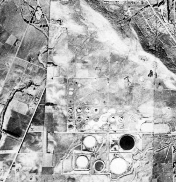
The earliest photo which has been located of Clark Field was a 1937 War Department aerial view (courtesy of Dallam Oliver-Lee),
which showed the airfield adjacent to the north of a tank farm.
The 1938 "Descriptions of Airports & Landing Fields in the United States, Volume 23"
published by the U.S. Government Printing Office (courtesy of Dallam Oliver-Lee)
described Clark Field as an auxiliary airfield having one 1,000' clay runway, with a hangar on the north side.
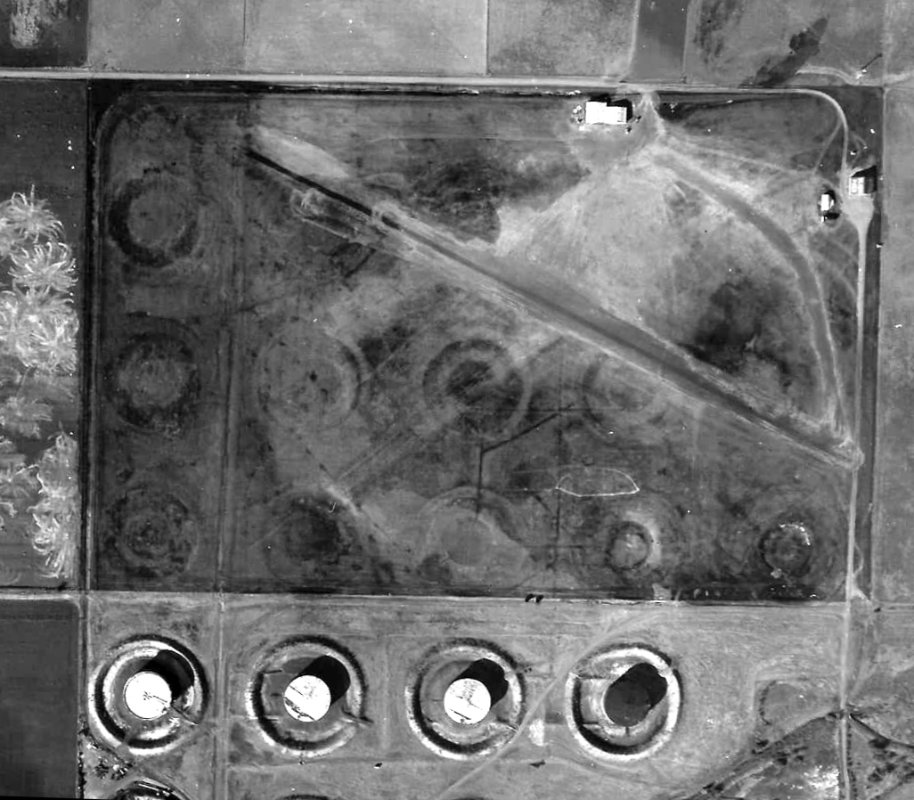
The last photo which has been located showing Clark Field was a 1938 CA National Guard aerial view (courtesy of Dallam Oliver-Lee),
which showed hangars on the north & east sides, a paved (or oiled) northwest/southeast runway, and an unpaved northeast/southwest runway.
According to the 1939 “The Blue Book of American Aviation; Who's who in the Industry” by Robert Dowling (according to Dallam Oliver-Lee),
Fred Philbrick was the Clark Field manager.
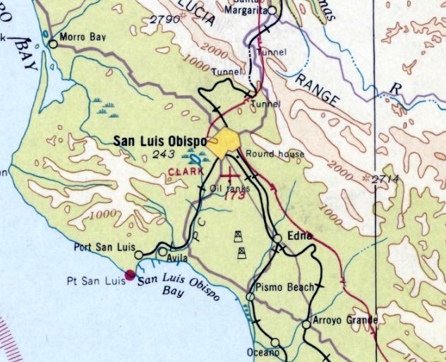
The last aeronautical chart depiction which has been located of Clark Field was on the February 1939 San Francisco Sectional chart,
which depicted Clark as an auxiliary airfield.
According to www.aerofiles.com, Clark Field was replaced circa 1939 by the new San Luis Obispo Airport, located nearby to the east.
Clark Field was no longer depicted on the April 1941 San Francisco Sectional Chart.
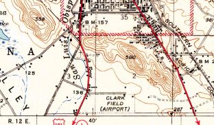
The 1942 USGS topo map (courtesy of Dallam Oliver-Lee) continued to depict Clark Field,
even though it evidently had already been closed for several years by that point.
Perhaps that was an example of wartime deception by the mapmakers?
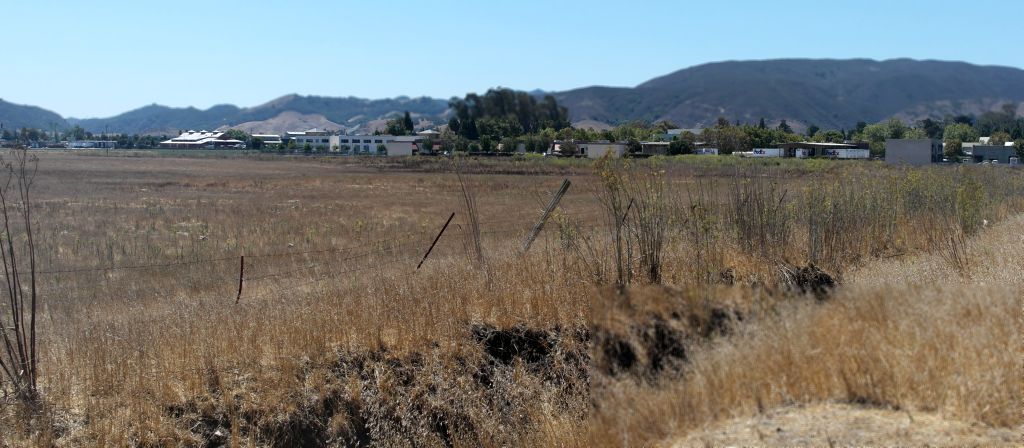
An 8/30/13 photo by Dallam Oliver-Lee of the site of Clark Field.
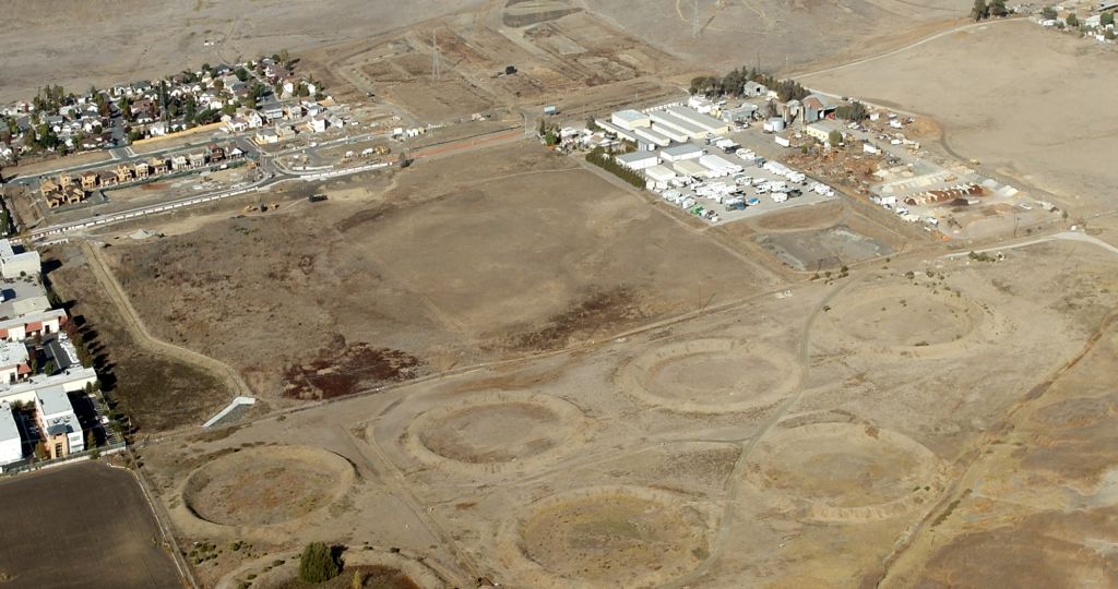
An 11/17/13 aerial view by Dallam Oliver-Lee looking northeast at the site of Clark Field.
The site of Clark Field is located south of the eastern terminus of Prado Road.
____________________________________________________
Sky Lawn Airport, Morro Bay, CA
35.185, -120.59 (Southeast of San Francisco, CA)
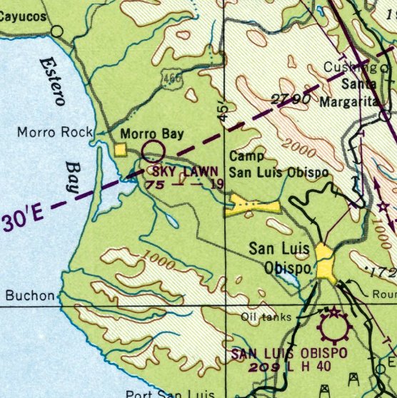
Sky Lawn Airport, as depicted on the August 1948 San Francisco Sectional Chart.
Sky Lawn Airport was reportedly opened in the 1930s,
It was a private airport, primarily used for crop dusting, with a dirt runway & a few small hangars.
However, Sky Lawn Airport was not depicted on 1933, 1937, or 1939 San Francisco Sectional Charts,
and Jonathan Westerling observed, “Judging from the 1937 picture, I don't think there was anything more than an open field.
I would say the airport opened in 1945 as indicated in the Airman's Guide.”
The May 1945 Airman's Guide (courtesy of Jonathan Westerling) described Sky Lawn as a new airport.
The August 1948 Airman's Guide (courtesy of Jonathan Westerling) described Sky Lawn Airport as having a 1,900' runway.
In the book "Morro Bay Remembered", author Mary Moses interviewed Carrie Haggberg, who recalled the airport.
"Everyone knew the Airport Cafe, too”, she said.
Her father taught aeronautical engineering at Cal Poly & often landed at Morro Bay on that strip.
A Fixed Base Operator building was built in the 1940s.
The 1948 Haire Airport Directory (courtesy of Jonathan Westerling) described Sky Lawn Airport as having a 2,400' unpaved east/west runway,
and listed the manager as Louis Domenghini.
Sky Lawn Airport was not depicted on the February 1948 San Francisco Sectional Chart.
The earliest depiction which has been located of Sky Lawn Airport was on the August 1948 San Francisco Sectional Chart.
It depicted Sky Lawn as having a mere 1,900' unpaved runway.
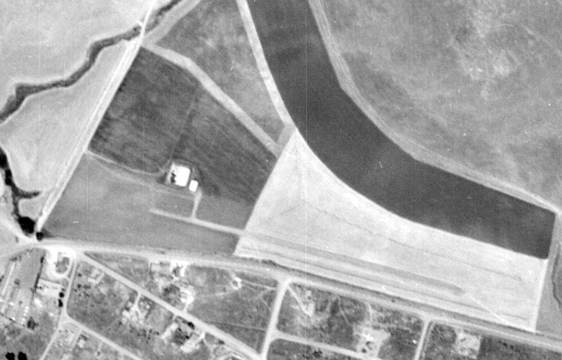
The earliest photo which has been located of Sky Lawn Airport was a 8/2/49 aerial view (from the UCSB Library, courtesy of Dallam Oliver-Lee).
It depicted Sky Lawn as having a single northwest/southeast runway, with 2 small buildings on the northwest side.
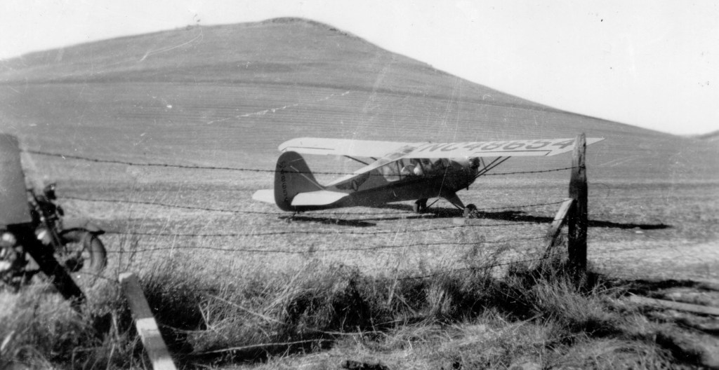
A circa 1940s photo of an Aeronca at Sky Lawn Airport (courtesy of Courtesy of Betty Domenghini & Historical Society of Morro Bay, via Dallam Oliver-Lee).
Dallam Oliver-Lee observed, it “shows just the south end of the 'runway' which was always just a dirt strip.
The airfield & the adjacent dairy farm was/is owned by the Domenghini family. The farm is to the right off the first off-ramp into Morro.”
The Airport Cafe was built across the street from the airport on Quintana Road (old Highway 1).
Doug Edick recalled, “My dad told me of an airport that used to be in Morro Bay.
From what my dad says, the airport should have still been active in the early- to middle-1950s.”
Roger Castle of the Historical Society of Morro Bay recalled, “The airstrip was located on land that is now just south of the 1st Main Street off-ramp directly on what is now Highway 101.
I grew up just over the hill north of the strip.
As a child I would often see the crop dusters sail up over the hill & settle down on to the fields in the Morro Creek Valley.”
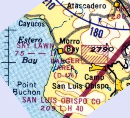
A 1952 aeronautical chart (courtesy of Dallam Oliver-Lee) depicted Sky Lawn as having a 1,700' unpaved runway.
Sky Lawn Airport was reportedly closed in 1953 when the Domenghini family sold the property to the State of California for the Highway 1 Freeway.
However it continued to be depicted on aeronautical charts & listed in airport directories for a few more years.
The 1954 Airport & Business Flying Directory (courtesy of Jonathan Westerling) described Sky Lawn Airport as having a 1,700' unpaved rough, rolling runway.
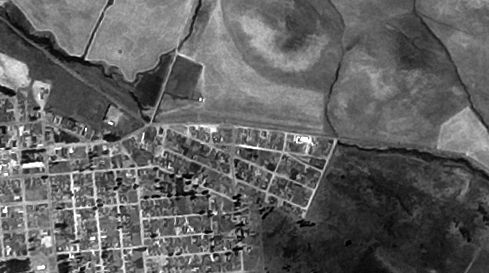
The last photo which has been located of Sky Lawn Airport was on a 6/27/56 aerial photo (courtesy of Dallam Oliver-Lee).
The airport still appeared completely intact.
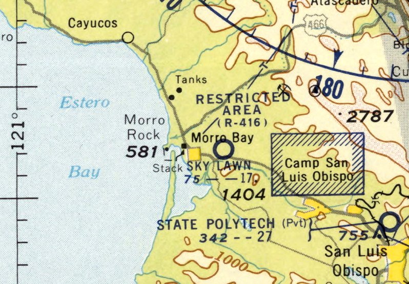
The last aeronautical chart depiction which has been located of Sky Lawn Airport was on the September 1957 San Francisco Sectional Chart (courtesy of Jonathan Westerling).
It depicted Sky Lawn as having a 1,700' unpaved runway.
Sky Lawn Airport was evidently closed at some point between 1957-58,
as it was no longer depicted on the April 1958 San Francisco Sectional Chart.
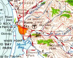
The last depiction which has been located of Sky Lawn Airport was on the 1958 USGS topo map (courtesy of Dallam Oliver-Lee).
A 1959 aerial photo (courtesy of Jonathan Westerling) showed that the highway had been expanded over the former location of the Sky Lawn runway,
and the hangar on the west side had been removed.
According to Dallam Oliver-Lee, “the Airport Cafe was an operating cafe well into the 1950s.
Its fate was sealed with the advent of the highway in the early 1960s.”
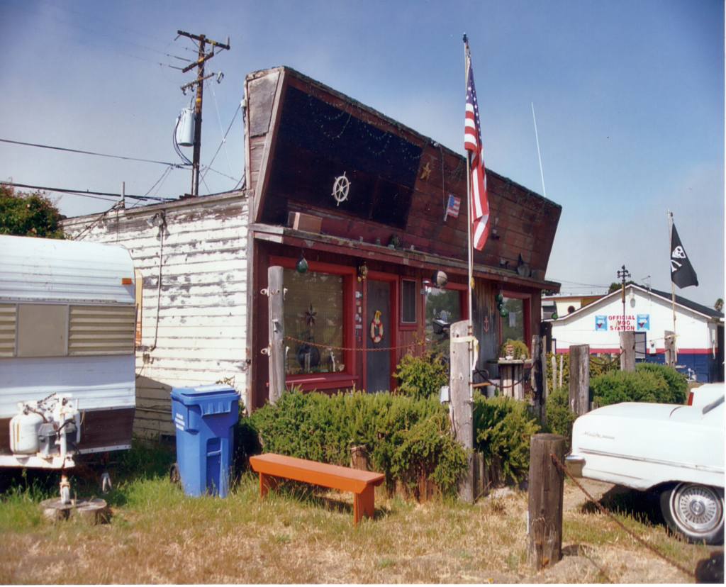
A circa 1990s photo of the building that housed the Airport Cafe across the street from Sky Lawn Airport (courtesy of Thom Ream & Historical Society of Morro Bay, via Dallam Oliver-Lee).
Dallam Oliver-Lee observed, this “is the rundown Airport Cafe in its last days as a private residence.”
Roger Castle of the Historical Society of Morro Bay recalled in 2013, “The Airport Cafe...
The commercial project it was demolished for a few years ago has yet to be completed.”
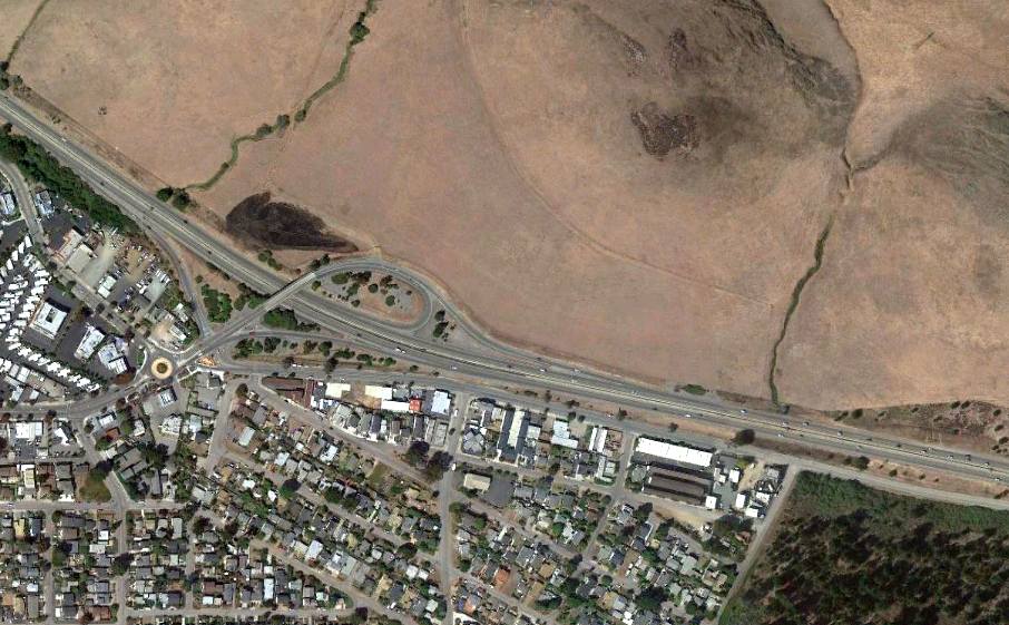
A 9/17/11 aerial view showed no trace remaining of Sky Lawn Airport.
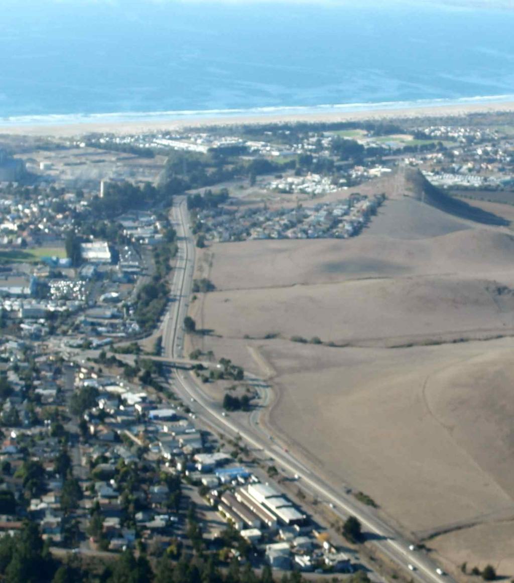
A 11/17/13 aerial view by Dallam Oliver-Lee looking northwest at the site of Sky Lawn Airport.
The site of Sky Lawn Airport is located at the intersection of Highway 1 & Morro Bay Boulevard.
____________________________________________________
Weir Airfield, San Luis Obispo, CA
35.18, -120.59 (Southeast of San Francisco, CA)

Weir Airfield, as seen in a 1949 USDA aerial photo (courtesy of Jonathan Westerling).
David Weir reported, “Weir Airfield was on a ranch owned by my family starting around 1905.
My uncle Casper Weir built the airstrip just after WW2, with an adjacent hangar & machine shop.
He converted a WW2 glider into a Taylorcraft Cub & kept it at the Ranch.
He had various antiques including a WW1 Rhone rotary motor & a complete original Link trainer (ex Civil Air Patrol). His wife Rosalind Weir was pioneer lady aviator.”
The earliest depiction which has been located of the Weir Airfield was a 1949 USDA aerial photo (courtesy of Jonathan Westerling).
It depicted Weir as having a single southeast/northwest runway, with a parking area on the southeast side.
According to David Weir, “The photo shows the Weir Airfield when it was first built.”
The earliest airfield directory listing which has been located of Weir Airfield was in the December 1950 Airman's Guide (courtesy of Jonathan Westerling).
It listed Weir's Field as a new airfield having a 1,600' unpaved runway.
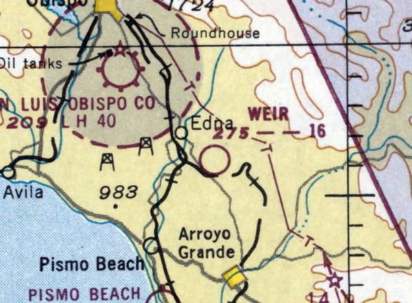
The earliest aeronautical chart depiction which has been located of the Weir Airfield was on the May 1951 San Francisco Sectional Chart (courtesy of Jonathan Westerling).
It depicted Weir as having a 1,600' unpaved runway.
David Weir recalled, “I spent summers at the ranch when I was in high school in the 1950s.
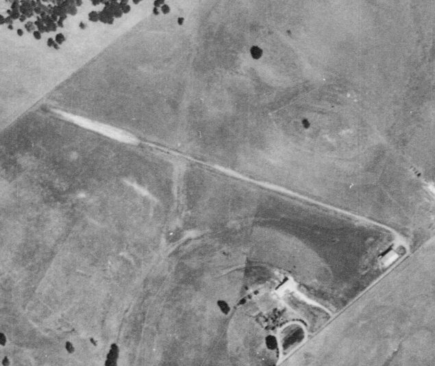
A 1956 USDA aerial photo (courtesy of Jonathan Westerling) depicted Weir Airfield as having a single southeast/northwest runway, with a hangar on the southeast side.
There were no aircraft visible on the field.
The 1959 San Francisco Sectional Chart (courtesy of Jonathan Westerling) listed Weir as a private airfield having a 1,600' bare runway.
The 1967 AOPA Airport's USA directory (courtesy of Jonathan Westerling) listed Weir as a private airfield having an 1,800' dirt Runway 9/27.
The 1969 San Francisco Sectional Chart (courtesy of Jonathan Westerling) depicted Weir as a public-use airfield having a 1,600' unpaved runway.
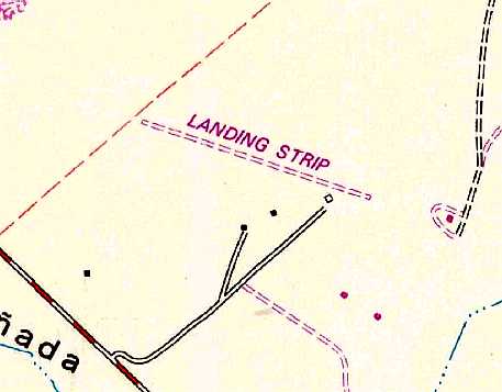
The 1978 USGS topo map depicted a single southeast/northwest unpaved runway, labeled simply as “Landing Strip”.
David Weir recalled, “In the 1980s I flew my Mooney in there several times, landing on the dirt strip.”
It was owned by my family until the 1980s when the County took it over to expand an adjacent dump & landfill.”

The last aeronautical chart depiction which has been located of the Weir Airfield was on the January 1994 San Francisco Sectional Chart (courtesy of Ron Plante).
It depicted Weir as a private airfield having a 2,000' unpaved runway.
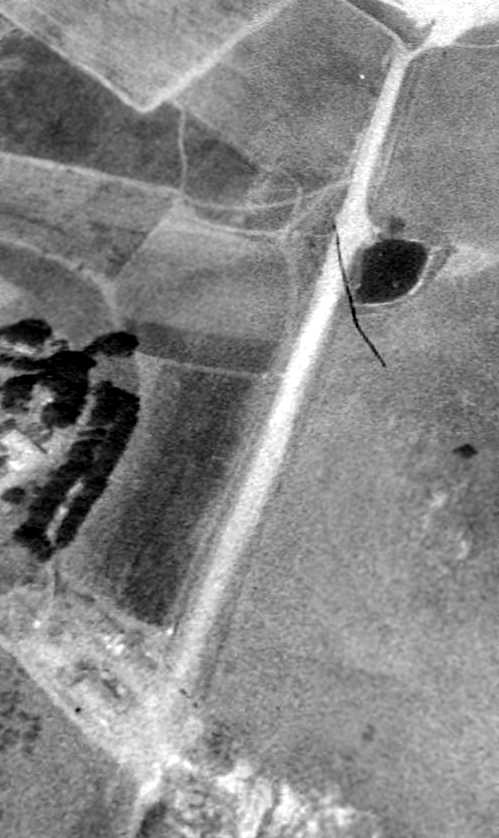
A 1994 USGS aerial view looking west showed Weir to have a single unpaved runway.
Weir Airfield was evidently closed (for reasons unknown) at some point between 1994-96,
as it was no longer depicted on the January 1996 San Francisco Sectional Chart (courtesy of Ron Plante).
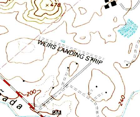
The 2000 USGS topo map depicted “Weirs Landing Strip” as having a single southeast/northwest unpaved runway.
A 2002 USGS aerial photo (courtesy of Dallam Oliver-Lee) showed that a large industrial building had been constructed over the eastern portion of the Weir Airfield.
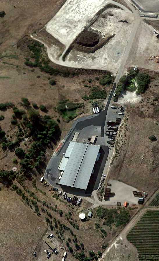
A 9/17/11 aerial view looking west at the site of Weir Airfield.
According to David Weir, “The main diagonal access road is on the airstrip, and the large maintenance building is on the site of the old hangar & machine shop.”
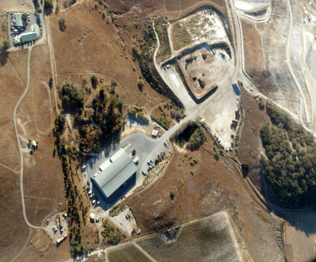
A 10/18/14 aerial view by Dallam Oliver-Lee looking south at the site of Weir Airfield.
David Weir reported in 2019, “Although it was once surrounded by depleted farms & pasture, the area is now part of the well-known wine region south of San Luis Obispo.
Aside from the landfill support buildings, the area is still scenic & pastoral and off the beaten track.”
The site of Weir Airfield is located north of the intersection of Carpenter Canyon Road & Patchett Road.
____________________________________________________
35.06, -120.52 (Southeast of San Francisco, CA)
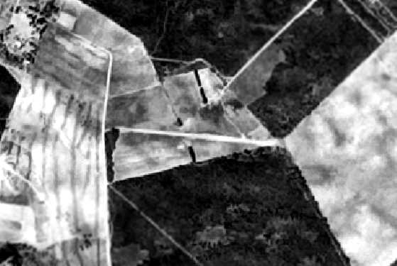
Nipomo Airfield, as seen in a 4/1/60 USAF aerial photo (courtesy of Dallam Oliver-Lee).
Not much is known about this small airfield, including its name.
This airfield was evidently established at some point between 1957-60,
as it was not yet depicted on a 9/19/57 USDA aerial photo (courtesy of Dallam Oliver-Lee).
The earliest photo which has been located of the airfield in Nipomo was on a 4/1/60 USAF aerial photo (courtesy of Dallam Oliver-Lee).
It depicted the field as having a single east/west runway.
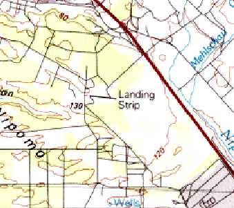
The 1981 USGS topo map (courtesy of Dallam Oliver-Lee) depicted a single east/west runway, labeled simply as “Landing Strip”.
John Langdon recalled of the Nipomo Airfield, “My school bus used to stop right there on Pomeroy or Los Berros in the 1980s.
I never saw any planes but as an aerophile, I knew what it was.
I got my kicks flying screaming slope soarers at the edge of the mesa.”
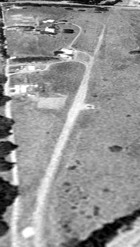
A 1994 USGS aerial photo depicted the Nipomo runway.
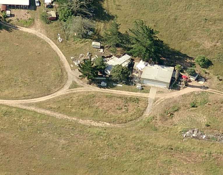
A circa 2011 aerial view looking south at the Nipomo hangar.
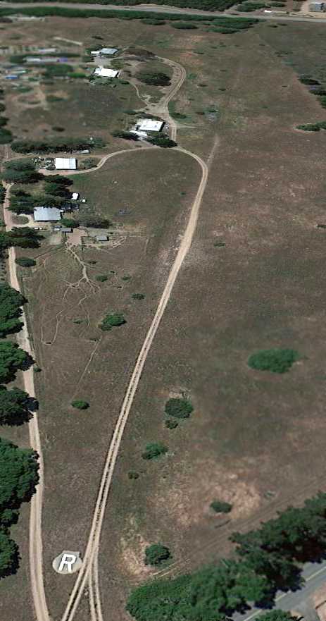
Interestingly, a 4/18/13 aerial view looking west at Nipomo depicted a private runway “R” seemingly recently painted on what appeared to be a paved turnaround that would be found on a runway end,
but without any other runway pavement.
The alignment of the former runway was replaced with a driveway.
John Langdon recalled of the Nipomo Airfield, “ I was just back there last winter [2012]
and was gratified to see a windsock & evidence that the site is still seeing use.”
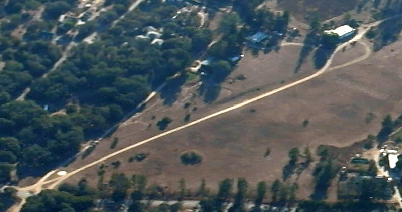
A 10/18/14 aerial view by Dallam Oliver-Lee looking southwest at the remains of the Nipomo Airfield runway.
The site of Nipomo Airfield is located southwest of the intersection of Hetrick Avenue & Summit Station Road.
____________________________________________________
Northside Airpark (0CA1), Santa Maria, CA
34.99, -120.45 (Southeast of San Francisco, CA)
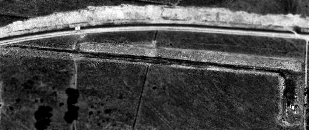
Northside Airpark, as seen in a 6/27/63 aerial photo (courtesy of Dallam Oliver-Lee).
This small general aviation airport was evidently established at some point between 1961-63,
as it was not yet depicted on a 1960 aerial photo (according to Dallam Oliver-Lee) or the March 1961 San Francisco Sectional Chart.
The earliest photo which has been located of Northside Airpark was on a 1963 aerial photo (courtesy of Dallam Oliver-Lee).
It depicted the field as having a single 2,481' asphalt Runway 8/26,
with a ramp & a few small buildings on the southeast side, around which were parked at least 9 single-engine aircraft.
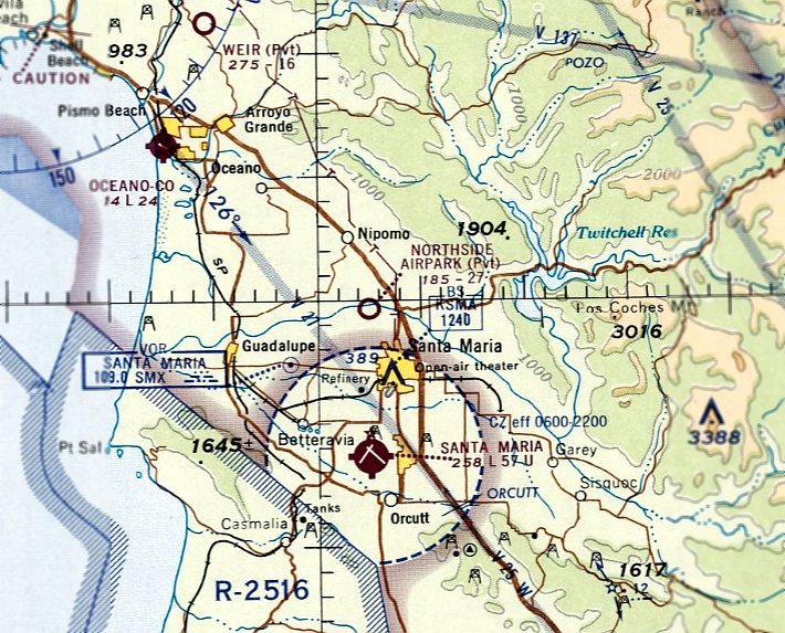
The earliest aeronautical chart depiction which has been located of Northside Airpark was on the June 1965 San Francisco Sectional Chart.
It depicted Northside as having a 2,700' unpaved runway.
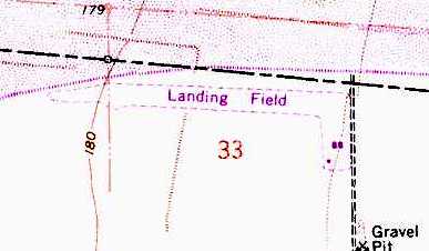
The 1968 USGS topo map depicted Northside Airpark as a single unpaved east/west runway, labeled simply as “Landing Field”.
An unpaved ramp on the southeast side had 3 small buildings.
On 5/21/82 a Bell 47G2 helicopter had an accident at Northside Airpark.
The accident reported noted, “The helicopter contacted the platform with a landing skid & rolled over during an attempted takeoff.
As the helicopter lifted off of a truck-mounted platform a skid became fouled by the truck & a dynamic roll-over occurred.”
On 6/18/83 a student pilot without a license had an “uncontrolled collision with ground” in a Bensen B8M autogiro at Northside Airpark.
The 1985 USGS topo map continued to depict the airfield in an unchanged manner.
The FAA Airport/Directory data for Northside Airpark described it as having a single 2,481 asphalt Runway 8/26.
The 1994 USGS aerial photo shows that the asphalt runway was removed (for reasons unknown) at some point between 1963-94.
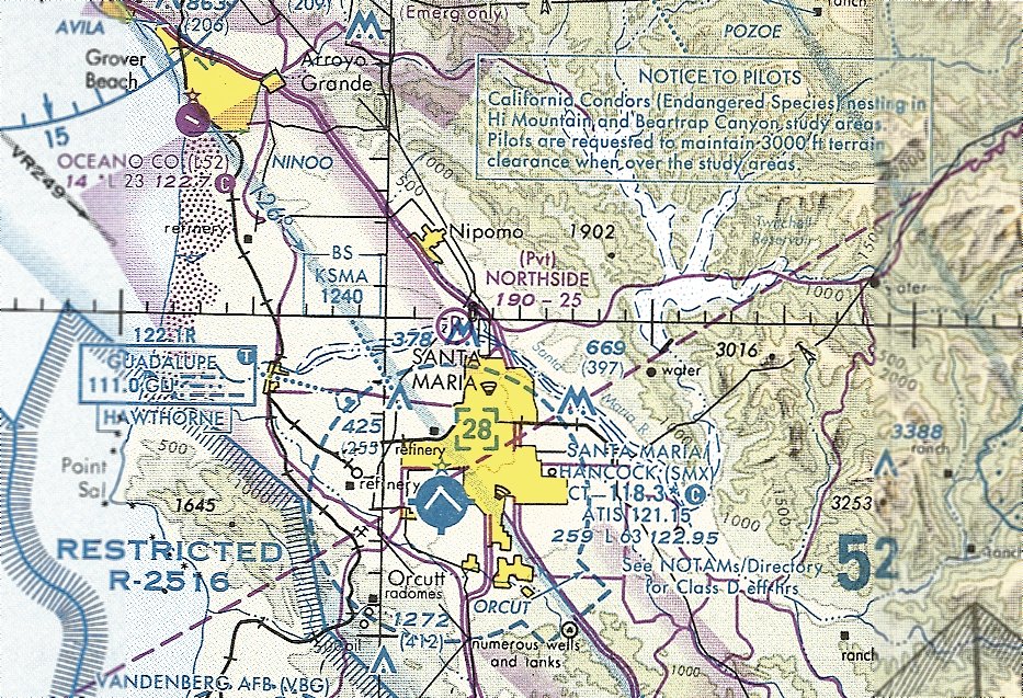
The last aeronautical chart depiction which has been located of Northside Airpark was on the January 1998 LA Sectional Chart (courtesy of Ron Plante).
It depicted Northside as a private airfield having a 2,500' unpaved runway.
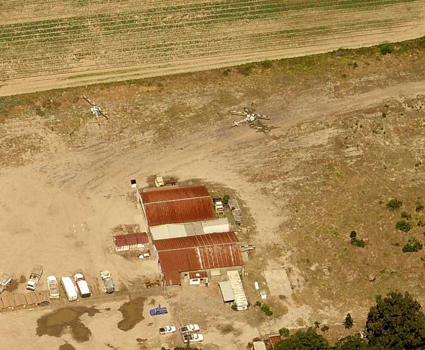
Evidently there was still some aviation use of the Northside Airpark property in circa 2011,
as a circa 2011 aerial view looking west showed what appeared to be 2 Bell 47 helicopters, along with the tailboom of a 3rd sticking out of the hangar.
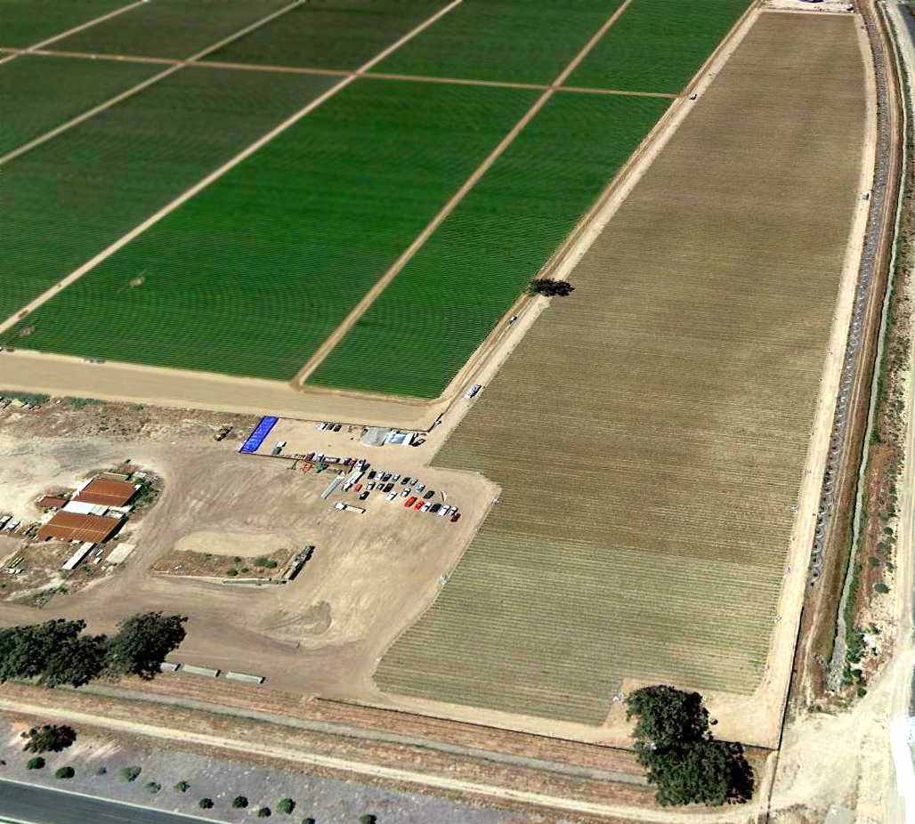
A 4/18/13 aerial view looking southwest showed the runway area of Northside Airpark had been reused for farming,
but the former airport buildings on the southeast still remained standing.
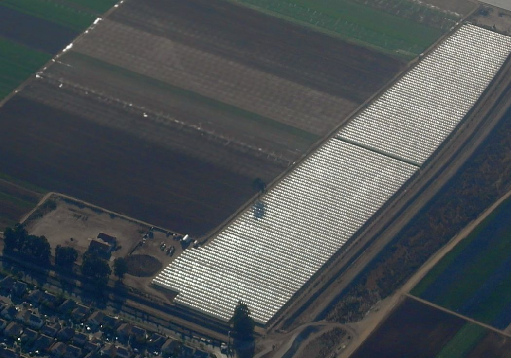
A 10/18/14 aerial view by Dallam Oliver-Lee looking southwest at the site of Northside Airpark.
Northside Airpark was no longer depicted on the June 2016 LA Sectional Chart.
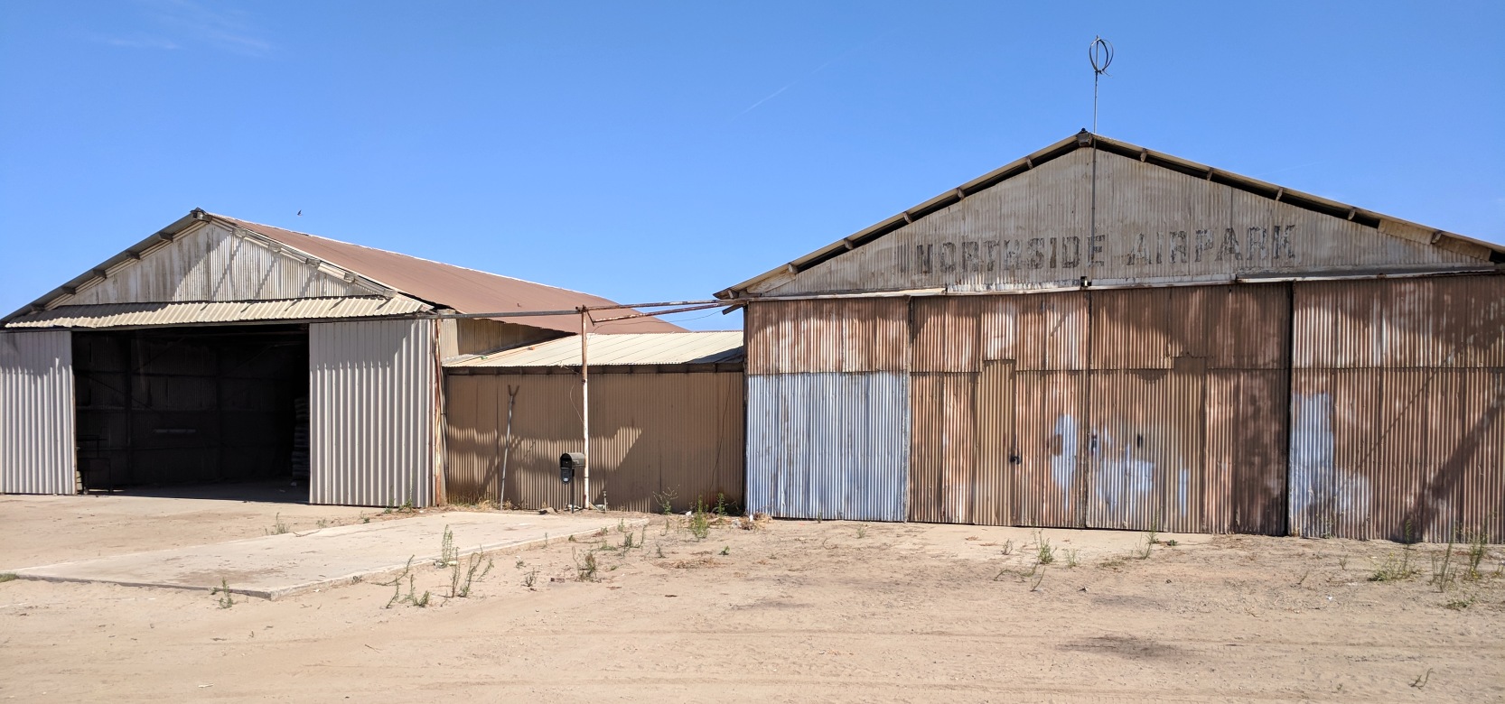
A 7/23/18 photo by Joe Hugh of the hangars which remain at the site of Northside Airpark, one of which still has a windsock frame & “Northside Airpark” markings.
The site of Northside Airpark is located northwest of the intersection of Atlantic Place & North Blosser Road.
____________________________________________________
California State Polytechnic Airport, San Luis Obispo, CA
35.31, -120.67 (Southeast of San Francisco, CA)
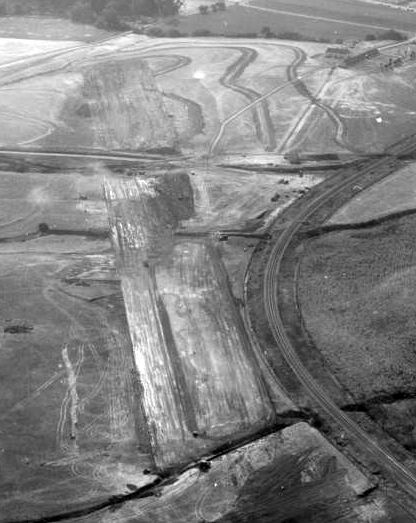
A 1945 aerial view looking southeast along the Cal Poly runway while still under construction (courtesy of Dallam Oliver-Lee).
California State Polytechnic College in San Luis Obispo had its own airport on the northwest side of campus.
The date of establishment of Cal Poly Airport has not been determined,
and there are several conflicting accounts of when it was built.
According to the Cal Poly Timeline, “The Cal Poly airstrip is constructed by the Army Corps of Engineers” in 1936.
According to Bob Schremp, “During World War II, the campus was the site of a naval flight preparatory school.
This field was built to train pilots during the war.”
The 1944 San Francisco Sectional Chart (courtesy of Jonathan Westerling) did not yet depict the Cal Poly Airfield.
According to a history of the Cal Poly Aero Department, “In 1945, the Cal Poly airstrip was constructed by the U.S. Army Corp of Engineers.”
The earliest depiction which has been located of the Cal Poly San Luis Obispo Airfield
was a 1945 aerial view showing the runway while still under construction (courtesy of Dallam Oliver-Lee).
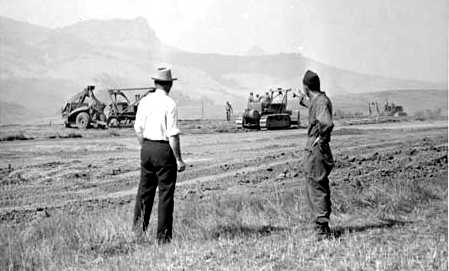
A circa 1940s photo of construction of the Cal Poly airstrip by the Army Corps of Engineers (courtesy of University Archives, California Polytechnic State University).

An undated photo of the Cal Poly Airfield while under construction, from the 1946 yearbook “El Rodeo” (courtesy of Juan Slayton).
The caption included, “The construction work was done by an Engineering battalion at Camp San Luis Obispo
in exchange for instruction for their men provided by teachers at Cal Poly.
Cal Poly now boast a new airstrip, 3,000' feet long by 200' wide,
which will enable the aero department to fly in ships for repairs & to take off on test hops.
During Poly Royal the flight strip was used to display several models of light airplanes flown in by manufacturers.”
According to a history of the Cal Poly Aero Department, “The adjoining hangar was constructed in 1947
in order to provide more adequate facilities for the Aeronautical Engineering Department.”
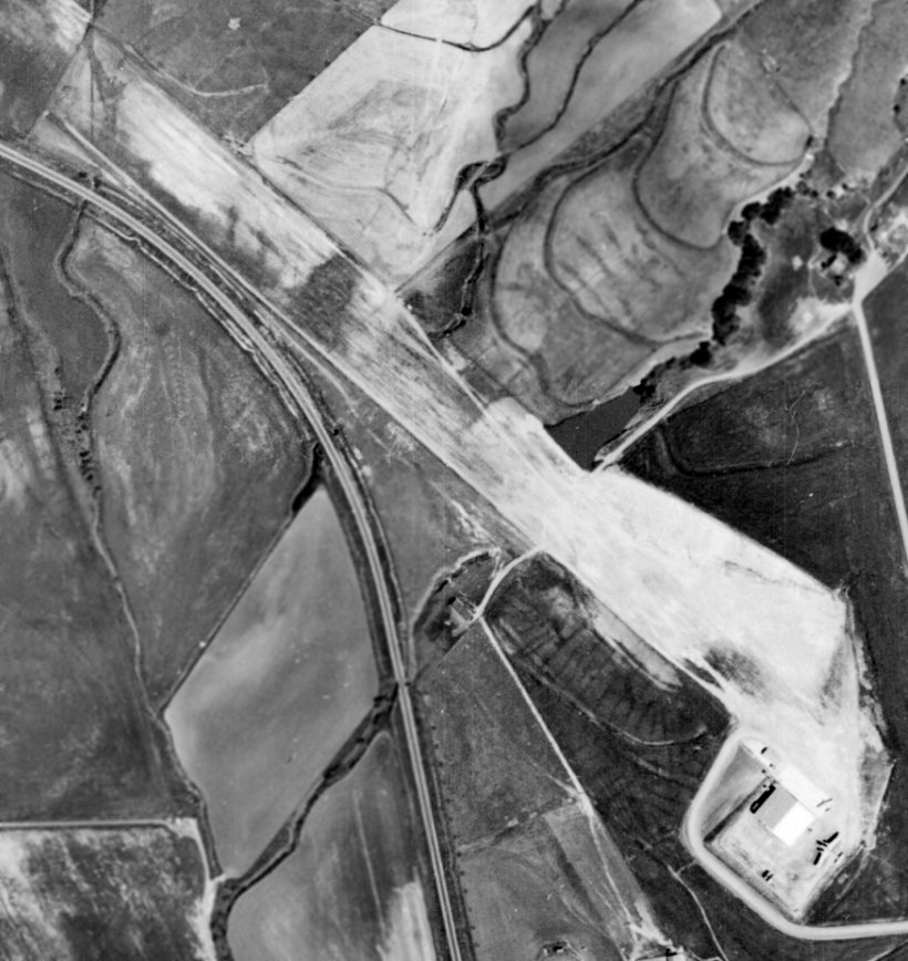
The earliest depiction which has been located showing Cal Poly Airport in operation was a 1949 aerial photo (from the UCSB Library, courtesy of Jonathan Westerling).
It depicted Cal Poly Airport as having a single unpaved northwest/southeast runway.
A hangar was located at the south end, with 1 light single-engine aircraft & 1 bigger twin-engine aircraft.
The Cal Poly Airport was not yet depicted on the March 1950 San Francisco Sectional Chart.
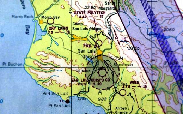
The earliest aeronautical chart depiction which has been located of the Cal Poly Airport
was on the 1951 San Francisco Sectional Chart (courtesy of Jonathan Westerling).
It depicted “State Polytech” as having a 2,700' unpaved runway.
According to Jonathan Westerling, “The 1951 Airman’s Guide lists State Polytech in a section of 'New Facilities' & noted a 2,700' runway.
It remained a public airfield for about a decade.”
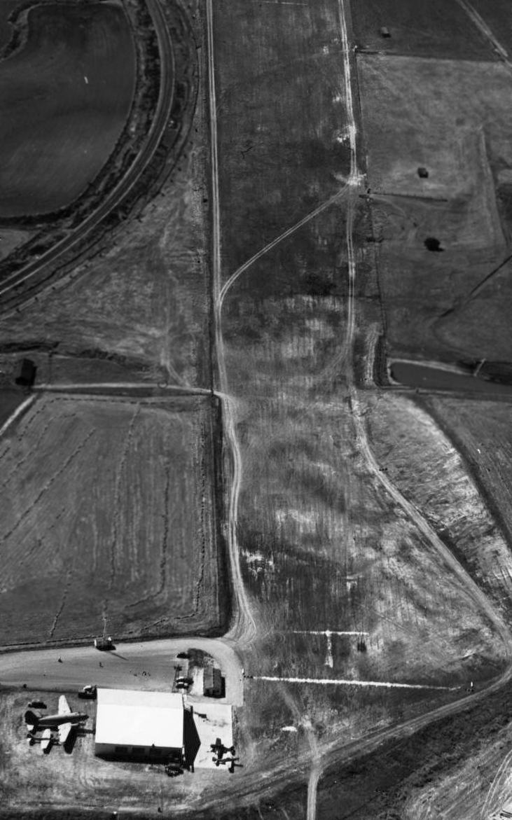
A circa 1950s aerial view looking northwest at the Cal Poly airfield (courtesy of Dallam Oliver-Lee)
showed 4 aircraft parked around the hangar, including what appeared to be a Curtiss C-46 Commando.
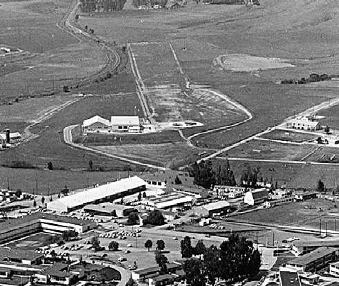
A 1960 aerial view looking northwest along Cal Poly's unpaved runway showed the 2 hangars on the south side (courtesy of Juan Slayton).
Dean Billing recalled, “I attended Cal Poly from 1962-67 & the airstrip was open to the public.
The Cal Poly Aero Department had a very large hangar on the site.”
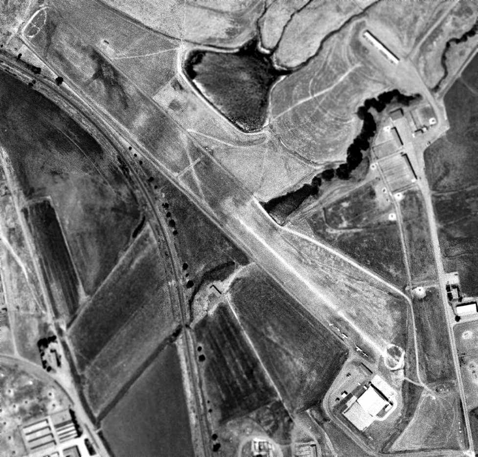
A 6/27/63 aerial view (courtesy of Dallam Oliver-Lee) depicted 4 single-engine aircraft parked near the Cal Poly hangar.
Perhaps the most famous alumnus of the Cal Poly Aero Department is Burt Rutan,
who graduated from Cal Poly in 1965 with a bachelor's degree in Aeronautical Engineering.
According to the University’s website, other notable students who trained at Cal Poly include:
Dean Borgman, President of McDonnell-Douglas Helicopter Systems, Michael Evans, Vice President, Lockheed Martin Skunk Works,
Robert Gibson, NASA Astronaut, Robert Lang, President, International Aerospace Services,
Paul Martin, Vice President, Lockheed Martin Skunk Works, Rodney Philbrick, President, Hangar One Aeroservice,
James Phillips, Vice President, McDonnell-Douglas, Gary Riley, Vice President, Lockheed Martin, Aeronautical Systems,
and Robert Wulf, Vice President of Northrop Grumman Corporation.
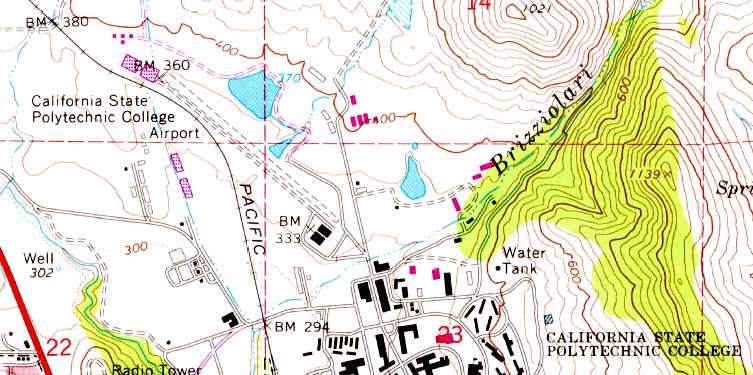
The 1965 USGS topo map depicted the “California State Polytechnic College Airport” as having a single unpaved northwest/southeast runway,
with 2 buildings (hangars?) on the southeast side.
The 1966 San Francisco Sectional Chart (courtesy of Chris Kennedy) depicted “State Polytech” as a private airfield having a 2,700' unpaved runway.
According to Jonathan Westerling, “According to the 1964 Sectional, the airfield was reclassified as a private airport.”
According to Jonathan Westerling, “The 1967 AOPA Airports USA guide lists State Polytech airfield
as having Runway 12/30, 2,700' in length with the caution 'Livestock on field' (Cal Poly has always had an active animal studies program).”
According to www.aerofiles.com, as of 1968 the Cal Poly San Luis Obispo Airport consisted of a 2,700' turf northwest/southeast runway,
adjacent to the school's Aeronautical Engineering Department.
Mark Oberman recalled, “The Cal Poly Airport in San Luis Obispo... When I went to school there in the late 1960s, I used to fly my Cessna 170B to school.”
Dean Billing recalled, “An aircraft crash which happened during the Poly Royal open house event on 4/27/68, killing 4 persons, pretty much doomed the airstrip.
I was standing on the airstrip when it happened & saw it.”
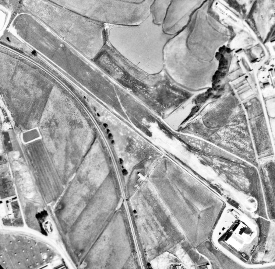
A 1969 aerial photo (from the UCSB Library, courtesy of Jonathan Westerling) depicted 1 light single-engine aircraft parked near the Cal Poly Airport hangar.
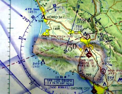
The last aeronautical chart depiction which has been located of the Cal Poly Airport
was on the 1970 San Francisco Sectional Chart (courtesy of Jonathan Westerling.
It depicted “State Polytech” as a private airfield having a 2,700' unpaved runway.
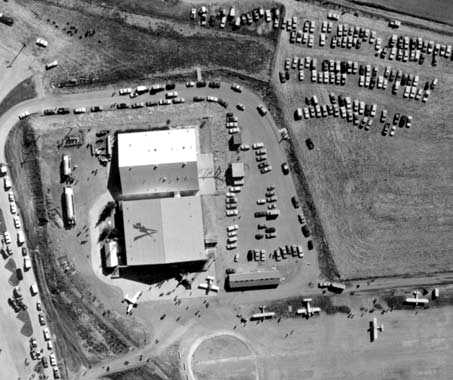
A 1970 aerial view of the Cal Poly hangar showed a total of 7 light aircraft on the field (courtesy of University Archives, California Polytechnic State University).
Greg Magnuson recalled, “I believe the airstrip was used more extensively in the 1970s.”
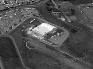
The last photo which has been located showing an aircraft at the Cal Poly airfield was a 1975 aerial view looking south (courtesy of Dallam Oliver-Lee).
It appeared to show one aircraft parked to the left (south side) of the hangar.
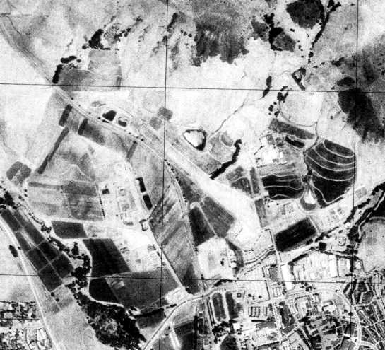
A 1976 USGS aerial photo showed the Cal Poly runway remained intact.
According to Jonathan Westerling, “The State Polytech airfield was not listed in the 1976 AOPA Airports USA [directory].”
Bruce Johnson recalled, “I attended Cal Poly from 1977-81. The field was closed, or at least restricted, in the 1970s.”
Bob Schremp recalled, “When I first moved here in 1979 the airfield was still in use very little use but still used.
In 1979 the field was still the shape of an old aircraft carrier.“
The Cal Poly Airport was no longer depicted on the August 1979 LA Sectional Chart.
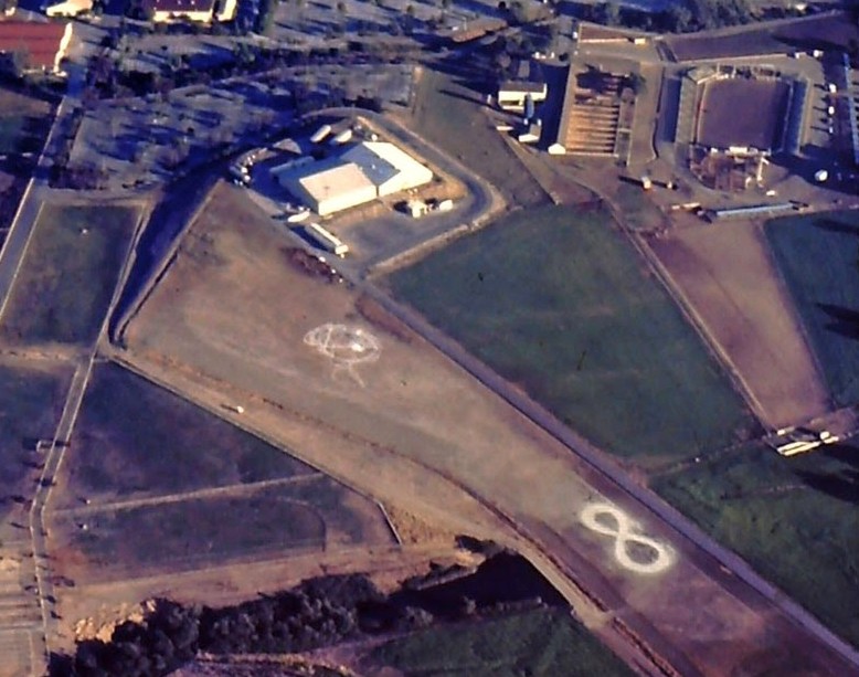
A July 1980 aerial photo (courtesy of Bruce Johnson) looking southeast at the Cal Poly runway & hangar, “showing the field marked with an ∞ symbol.”
Greg Magnuson recalled, “A Sectional [Chart] from the mid-1980s showed the field as 'Restricted'.
The only time I saw an airplane there (a Piper Malibu) was during a college open house in 1986.
I was surprised at the time that a high performance aircraft could actually land within the restricted space.
I doubt the airstrip was longer than 2,500'.”
According to www.aerofiles.com, the Cal Poly San Luis Obispo Airport was closed circa 1985.
According to Jonathan Westerling, “The aviation department at State Polytech was transferred to a sister campus, Cal Poly Pomona.
Presumably the use of the airfield was discontinued at this time.”
According to Cal Poly student Bruce Johnson, “By the late 1980s, [the airfield] was definitely closed & a horse track had been built around the perimeter of the old strip.””
The 1995 USGS topo map depicted a clearing with the same orientation as the former runway.
Bob Schremp reported in 2003, “The area no longer even looks like an airfield.
The area was graded & a horse training track installed, at that time the center of the track could still be used as an airfield.
Since then a sports complex has been developed in that location. The hangars still exists.”
Dean Billing reported in 2007, “The hangar... is still there, but the strip is obliterated mainly by a new baseball stadium.”
Greg Magnuson reported in 2007, “It was located next to several Aeronautical Engineering buildings (old sheet metal hangars).”
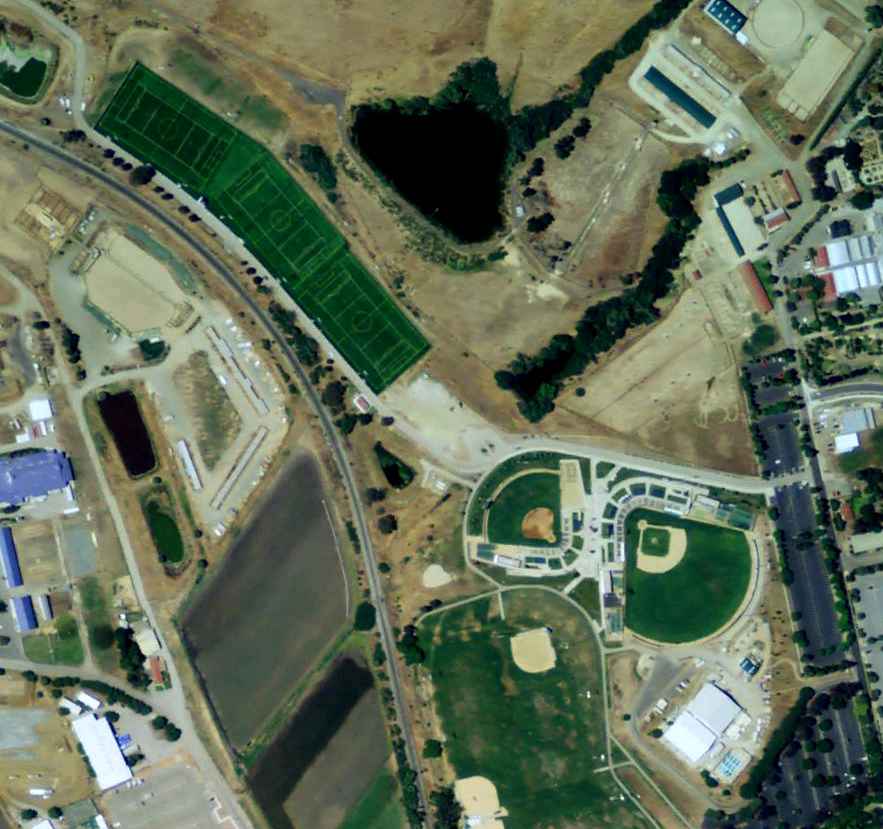
A 5/25/09 aerial view shows 3 soccer fields & 2 baseball fields occupying the site of Cal Poly runway,
but amazingly the 2 hangars remain standing at the southeast corner.
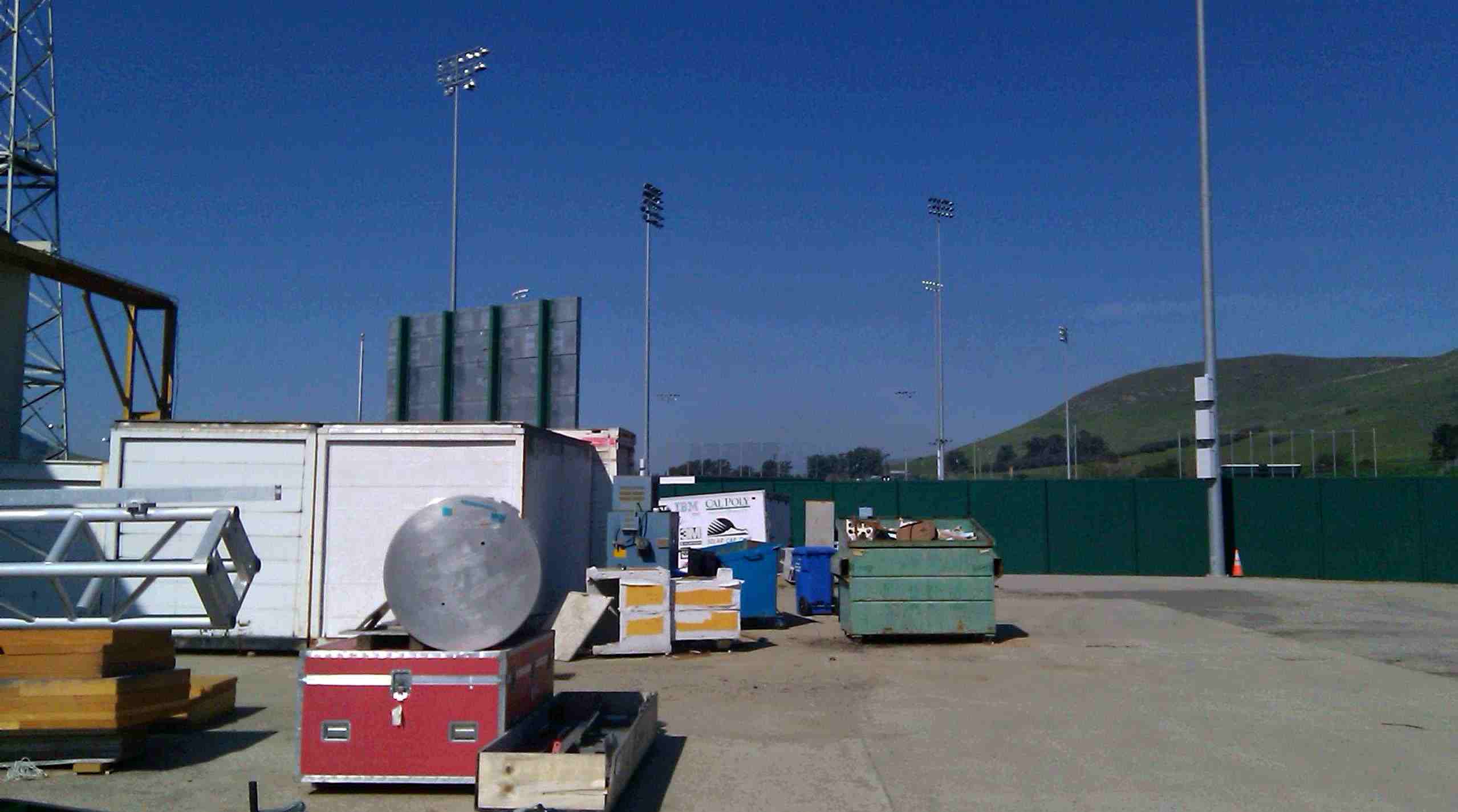
A 2010 photo by Dan Tartre “looking northwest along axis of former runway, now covered by playing fields.”
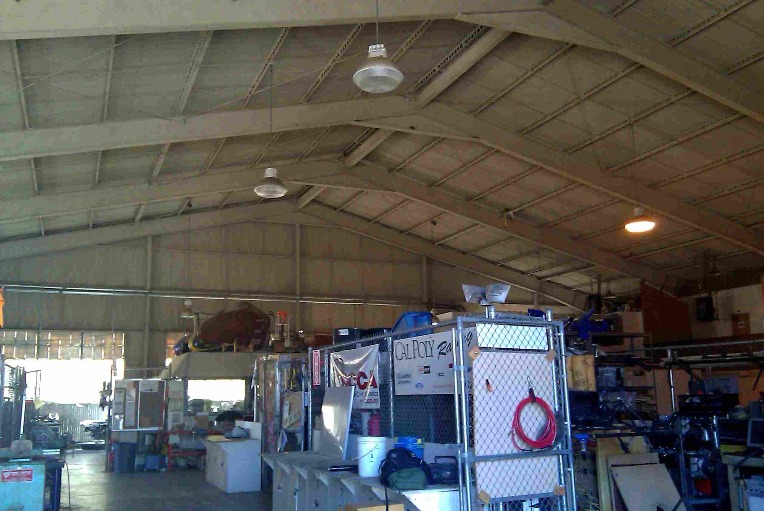
A 2010 photo by Dan Tartre of the “interior of the hangar, now used for student lab projects. The hangar remains as Research Development Building 4.”
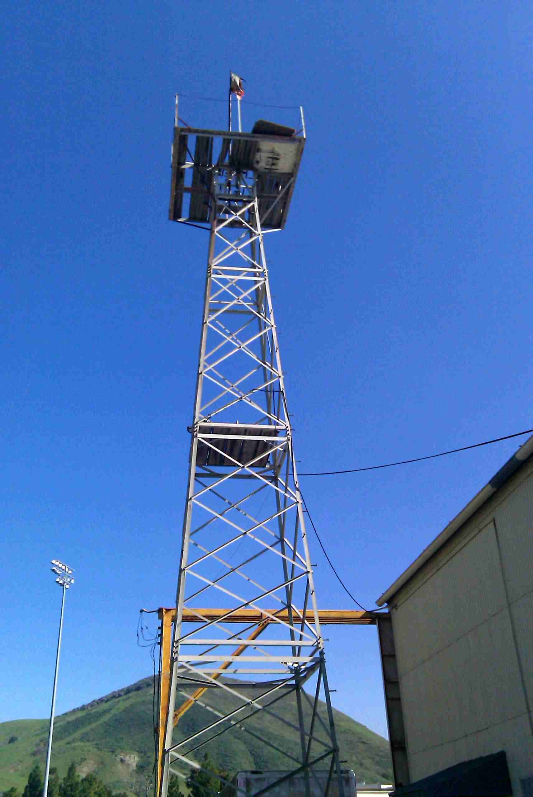
A 2010 photo by Dan Tartre of the Cal Poly beacon tower, “with the remains of a windsock.”

A 2010 panoramic photo by Jonathan Westerling looking east across the railroad tracks at the former site of the State Polytech Airfield.
The site of Cal Poly Airport is located northwest of the intersection of Pinnacles Road & Via Carta.
____________________________________________________
Camp San Luis Obispo Army Airfield, San Luis Obispo, CA
35.33, -120.75 (Southeast of San Francisco, CA)
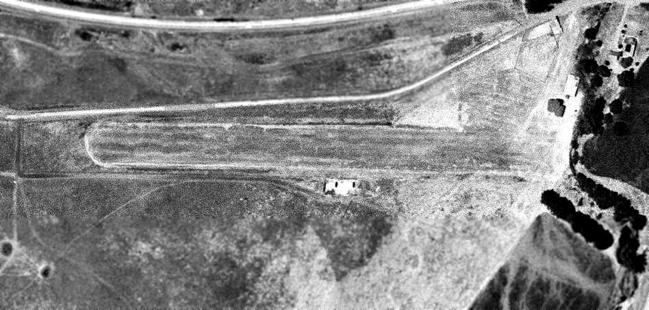
The Camp San Luis Obispo Army Airfield, as depicted on a 1963 aerial photo (courtesy of Dallam Oliver-Lee).
The original airfield for Camp San Luis Obispo was located adjacent to the south side of Route 1, to the northwest of the camp.
Camp San Luis Obispo Army Airfield was evidently established at some point between 1945-63,
as it was not yet listed among active airfields in the 1945 AAF Airfield Directory (courtesy of Scott Murdock).
The earliest depiction which has been located of Camp San Luis Obispo Army Airfield was on a 1963 aerial photo (courtesy of Dallam Oliver-Lee).
It depicted the field as having a single unpaved east/west runway, with a single small building on the northeast side.
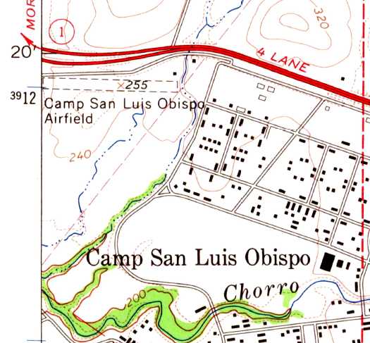
The 1965 USGS topo map depicted “Camp San Luis Obispo Airfield” as a single unpaved east/west runway, with a single small building on the northeast side.
The June 1965 San Francisco Sectional Chart did not depict Camp San Luis Obispo Army Airfield.
According to Jonathan Westerling, “When the Army returned [Camp San Luis Obispo] to State control in July 1965,
the California National Guard upgraded many of the facilities here.”
At some point between 1969-72, an replacement airfield was constructed to the southeast (O'Sullivan Army Airfield),
and Camp San Luis Obispo's original airfield was presumably closed.
The original Camp San Luis Obispo Army Airfield was not depicted on the 1979 USGS topo map (according to Dallam Oliver-Lee).
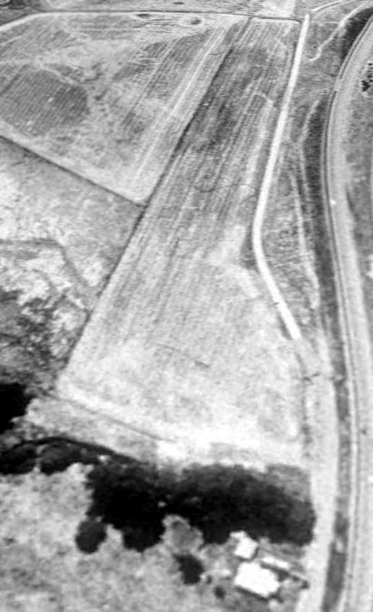
A 6/18/89 USGS aerial view looking southwest depicted the Camp San Luis Obispo Army Airfield as having a single unpaved east/west runway.
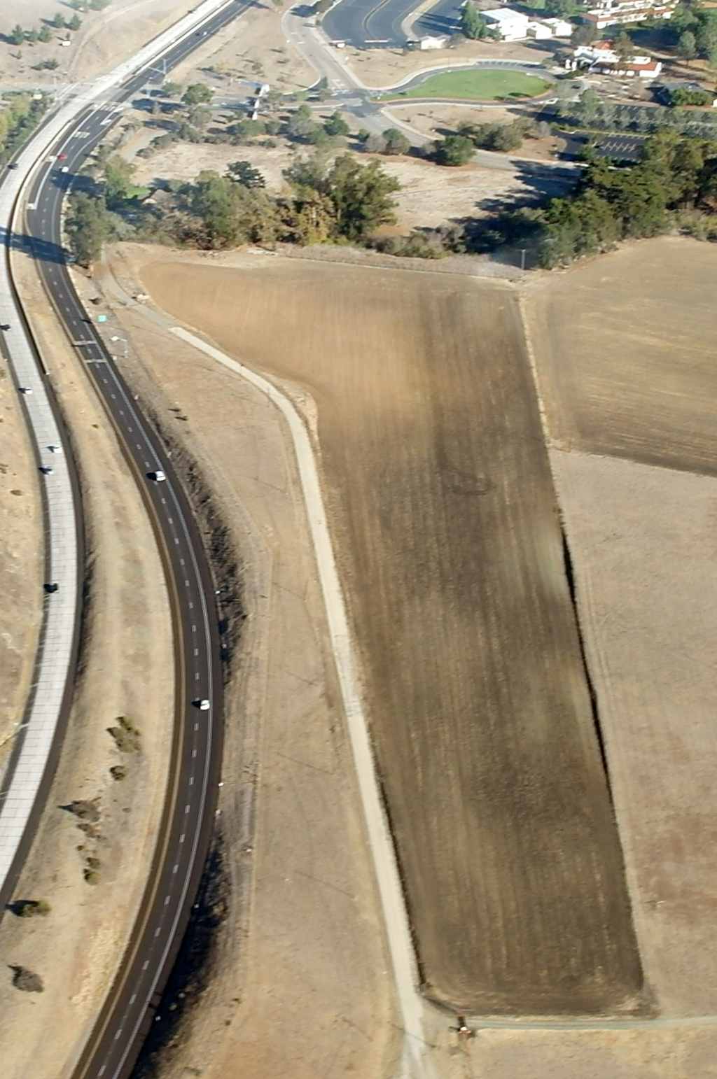
An 11/17/13 aerial view by Dallam Oliver-Lee looking east showed the outline of the Camp San Luis Obispo runway remains very recognizable.
The site of Camp San Luis Obispo Army Airfield is located southwest of the intersection of Route 1 & Cuesta College Road.
Thanks to Dallam Oliver-Lee for pointing out this airfield.
____________________________________________________
O'Sullivan Army Airfield, San Luis Obispo, CA
35.326, -120.74 (Southeast of San Francisco, CA)
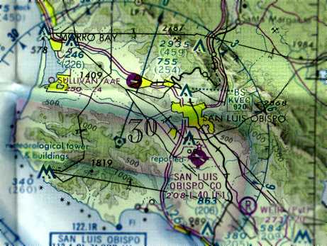
O'Sullivan Army Airfield, as depicted on the 1976 San Francisco Sectional Chart (courtesy of Jonathan Westerling).
Jonathan Westerling reported, ”The airport at Camp San Luis Obispo has the distinction of being one of the shortest-lived military airports in California.
'Camp SLO', as it is called, remains one of the oldest military training installations in the state of California, founded in 1928.
When the Army returned it to State control in July 1965, the California National Guard upgraded many of the facilities here.”
A 1969 USGS aerial photo did not yet show any signs of an airfield at Camp SLO.
At some point between 1969-72, an airfield was constructed.
According to Jonathan Westerling, “An airstrip was constructed on 100 acres of land west of the installation.
The airstrip was named after Major General Curtis O’Sullivan, Commanding General of the 49th Infantry Division & a founder of the California Military Academy.
It was 2,430' long by 125' wide. Several small buildings were built as part of the project on the south side of the runway.”
According to Lieutenant Dave Andrews of the Civil Air Patrol, in 1972 an Army airman flipped his aircraft at the east end of the runway.
According to an article in the Modesto Bee, the plane involved was a Beaver U-6A.
An article in the October 2009 Camp SLO newsletter interviewed National Guard Major John Noble,
who was working that day at a building close to the runway when he heard the crash.
“The crash was investigated & determined to be 100% pilot error.
Normal approach for the airfield was over the Post Headquarters & into the wind,
however the pilot came in the wrong direction, and couldn't get on the ground fast enough.”
According to Jonathan Westerling, “An identical DeHavilland Beaver aircraft is currently on display at the Aircraft Museum at Camp San Luis Obispo.”
Jonathan Westerling reported, ”For reasons unknown, the State completely closed the airfield as a result of this single pilot-caused crash.
No other reasons for closing the airfield were published. The freshly-built runway then lay unused for 22 years.”
The earliest depiction which has been located of O'Sullivan AAF was on the 1976 San Francisco Sectional Chart (courtesy of Jonathan Westerling).
It depicted O’Sullivan AAF as having a single 2,400' paved WNW/ESE runway, though it was closed to fixed wing operations at the time.
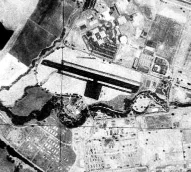
The earliest photo which has been located of O'Sullivan AAF was a 6/28/76 USGS aerial view.
It depicted O’Sullivan AAF as having a single asphalt WNW/ESE runway with parallel taxiways & a ramp.
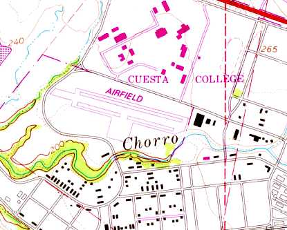
The 1979 USGS topo map depicted a single paved northwest/southeast runway with parallel taxiways & a ramp, labeled simply “Airfield”.
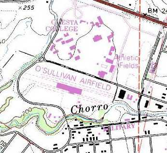
The 1988 USGS topo map depicted “O'Sullivan Airfield” as having a paved helicopter ramp with an unpaved runway extending to the northwest & southeast.
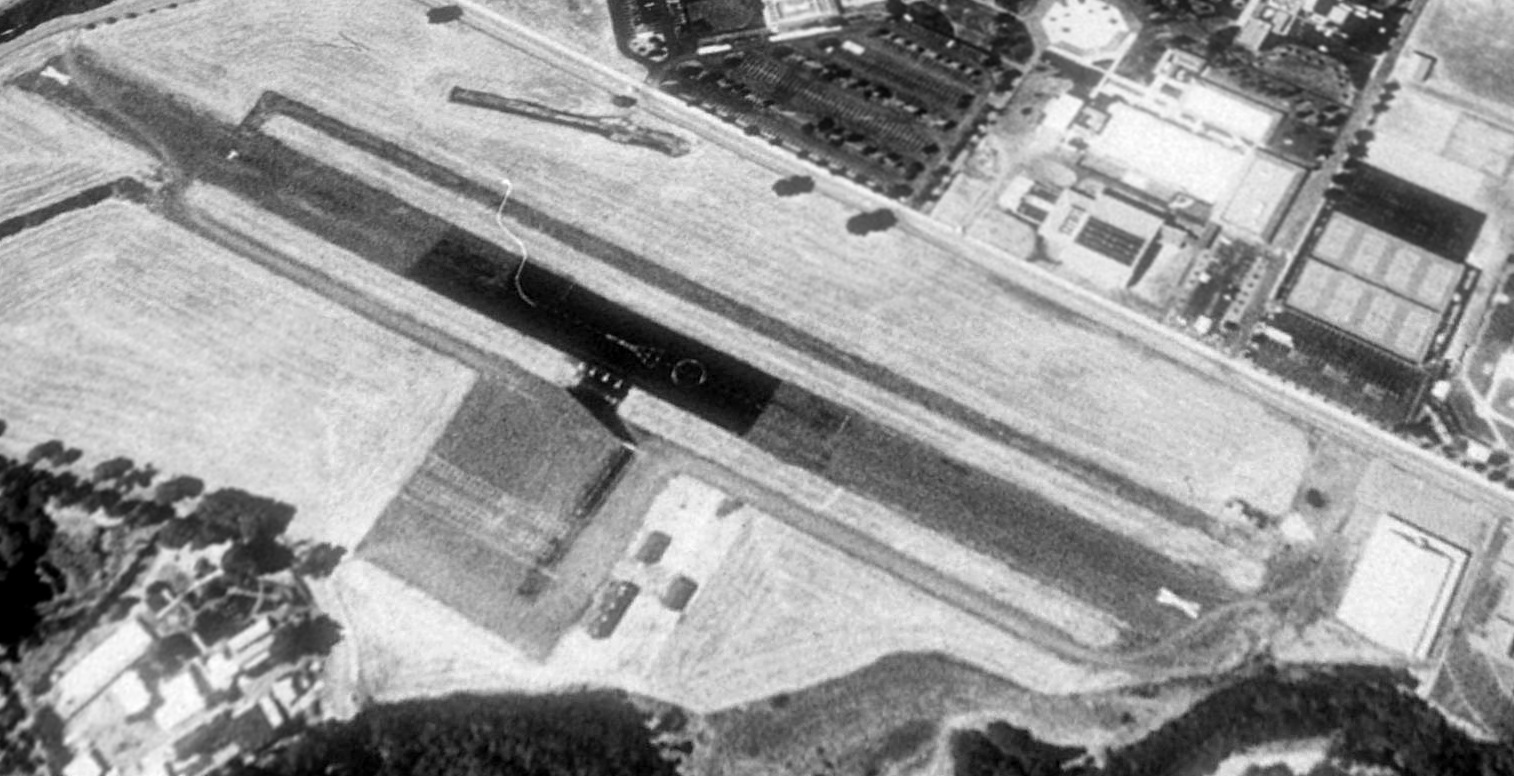
A 1989 USGS aerial view looking northwest showed showed closed-runway X symbols painted on each end of the O'Sullivan Army Airfield runway.
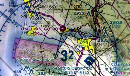
The 1990 San Francisco Sectional Chart (courtesy of Jonathan Westerling)
still depicted O'Sullivan Army Airfield as having a 2,400' paved runway, even thought it had been closed to fixed-wing operations for 18 years.
An aerial view taken in 1994 only 6 months after the preceding photo showed the runway had been removed, only 22 years after having been built.
Jonathan Westerling reported, ”Later the field was reopened as a heliport-only facility.
In 1998 a proposal to build 600 single-family homes on the site of the former airfield was abandoned due to water constraints in the valley.”
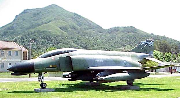
A pre-2010 photo by Wayne Nicholls of a McDonnell Douglas F-4 Phantom fighter serial # 64-0827 on static display at the O’Sullivan Army Airfield.
A Phantom being displayed here would seem to be an odd choice, given that the O’Sullivan runway was far too short to ever operate an F-4.
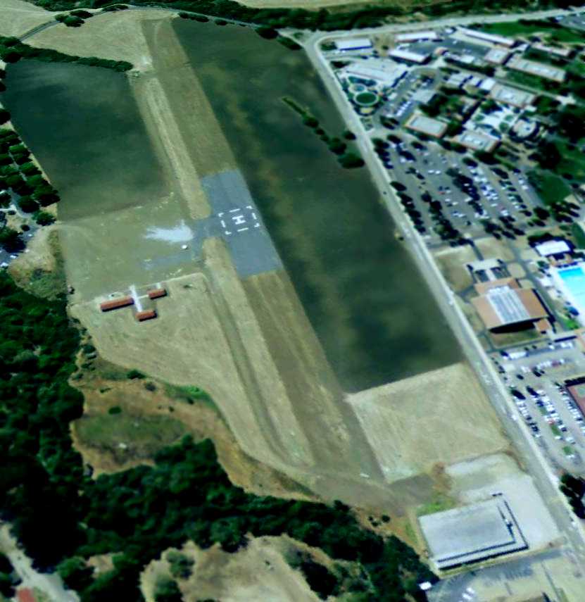
A 5/25/09 aerial view looking northwest along the remains of the fixed-wing runway at O'Sullivan.
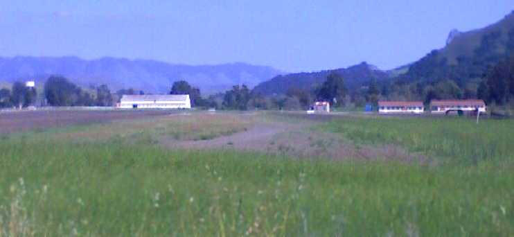
A Spring 2010 photo by Jonathan Westerling “looking east along the orientation of the former runway at Camp San Luis Obispo”.
According to Capt. Rich Bingham, the pavement for the runway was broken up though the land is kept mowed by a local farmer [as of 2010].”
Jonathan Westerling reported in 2010, ”Interestingly, the published FAA information for Camp SLO
lists its helipad as 2,430' x 75' (the dimensions of the old runway) even though modern photographs
show that only a small asphalt area is maintained for the helicopter landings.”
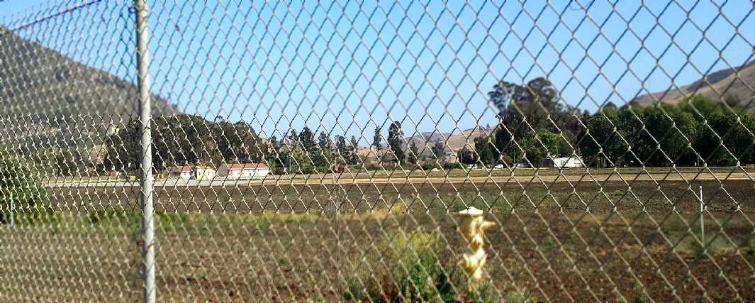
A 5/23/13 photo by Dallam Oliver-Lee looking through the fence at the runway at & buildings of the former O’Sullivan Army Airfield.
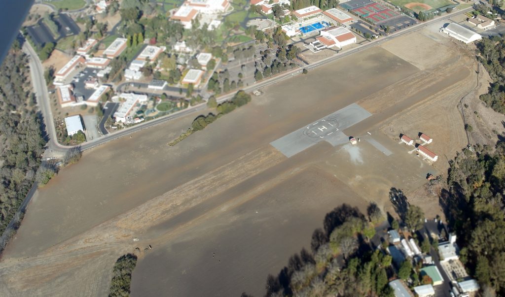
An 11/17/13 aerial view by Dallam Oliver-Lee looking east showed the helipad built over the O’Sullivan Army Airfield runway.
The site of O'Sullivan AAF is located southeast of the intersection of Chorro Valley Road & Cuesta College Road.
____________________________________________________
Cambria Pines Airport, Cambria, CA
35.55, -121.08 (Northwest of Los Angeles, CA)
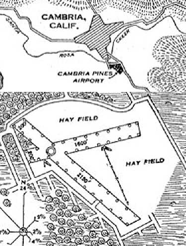
The location & layout of the Cambria Pines Airport,
as depicted on the 10/29/30 Commerce Department Airway Bulletin (courtesy of Jonathan Westerling).
According to Jonathan Westerling, “The Cambria Pines airport dates back to the early days of aviation.
According to the Cambria Historical Society, this company [the Cambria Development Company] had bought land in Cambria in the mid-1920s.
It is assumed that they established the airport to ferry prospective buyers to the property.”
The earliest depiction which has been located of the Cambria Pines Airport
was on the on the 10/29/30 Commerce Department Airway Bulletin (courtesy of Jonathan Westerling).
It depicted the field as having 2 grass runways, measuring 2,150' & 1,600'.
The field was said to be owned by the Cambria Development Company of Hollywood.
The 1931 Pilot's Handbook (courtesy of Jonathan Westerling) described Cambria Pines Airport as measuring 2,150' x 1,600'.
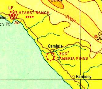
The earliest aeronautical chart depiction which has been located of the Cambria Pines Airport
was on a 1933 aeronautical chart (courtesy of Dallam Oliver-Lee).
It depicted Cambria Pines as a commercial/municipal airport.
The 1936 Department of Commerce Directory of Airfields (according to Jonathan Westerling)
listed Cambria as a day-only auxiliary airfield, largely unchanged from the 1930 Bulletin.
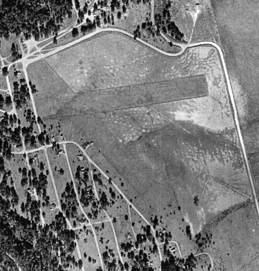
The earliest photo which has been located of the Cambria Pines Airport
was a 1937 aerial view (from the Alexandria Digital Library @ UC Santa Barbara, courtesy of Jonathan Westerling).
It depicted the field as having 2 unpaved runways.
Jonathan noted the “photo shows the airfield with pine trees (appropriately enough) surrounding the field on the west & north sides.”
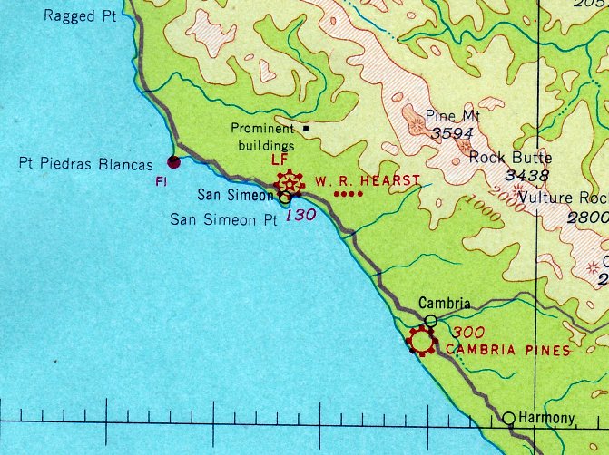
The April 1941 San Francisco Sectional Chart (courtesy of Paul Columbus) depicted Cambria Pines as a commercial/municipal airport.
The 1941 Airport Directory Company Airport Directory (courtesy of Jonathan Westerling) described Cambria Pines Airport as an irregularly-shaped 60 acre turf field
having 2 runways measuring 2,150' northwest/southeast & 1,600' east/west.
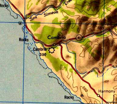
The earliest topo map depiction which has been located of the Cambria Airport was on the 1947 USGS topo map.
The 1948 Haire Airport Directory (courtesy of Jonathan Westerling) described Cambria Airport as having 2 unpaved runways measuring 1,850' northwest/southeast & 1,600' east/west,
and listed the manager as E.E. Waller.
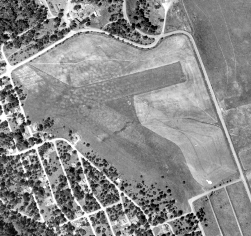
The last photo which has been located which shows the Cambria Pines Airport while still intact
was a 1949 aerial view (from the Alexandria Digital Library @ UC Santa Barbara, courtesy of Jonathan Westerling).
It depicted the field in basically the same configuration as seen in 1937.
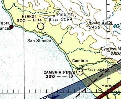
The last aeronautical chart depiction which is available of the Cambria Pines Airport
was on 1951 San Francisco Sectional Chart (courtesy of Jonathan Westerling).
It depicted Cambria Pines as having a 1,900' unpaved runway.
The 1952 Airman's Guide (courtesy of Jonathan Westerling) described Cambria Pines Airport as having 2 runways, with the longest being 1,900'.
The last aeronautical chart depiction which has been located of the Cambria Pines Airport
was on November 1952 San Francisco Sectional Chart (according to Jonathan Westerling).
Cambria Pines Airport was evidently closed (for reasons unknown) at some point between 1952-53,
as it was no longer listed in the 1953 Airman's Guide (according to Jonathan Westerling).
It would be at least 3 years before Route 1 & houses were built over the airport site.
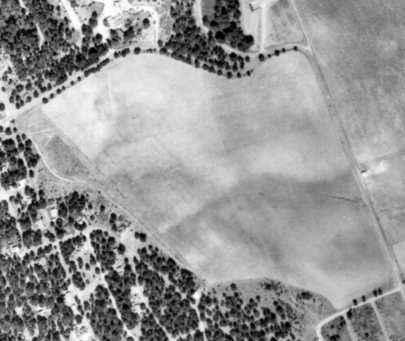
A 1956 aerial view (from the Alexandria Digital Library @ UC Santa Barbara, courtesy of Jonathan Westerling) showed the site of Cambria Pines Airport still clear, but after the airport had closed.
A 3/29/60 USAF aerial photo (courtesy of Dallam Oliver-Lee) showed new streets covering the Cambria Pines Airport site.
Cambria Pines Airport was no longer depicted on the 1966 San Francisco Sectional Chart (courtesy of Chris Kennedy).
A 1969 aerial view (from the Alexandria Digital Library @ UC Santa Barbara, courtesy of Jonathan Westerling)
showed that Route 1 had been built right through the southern portion of the airfield,
but traces of the 2 runways were still visible on the northern half of the property.
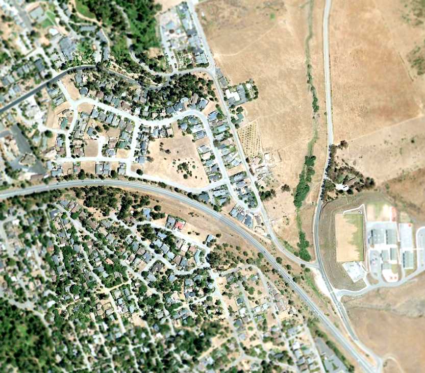
As seen in a 2007 aerial photo, there did not seem to be any remaining trace of the Cambria Pines Airport.
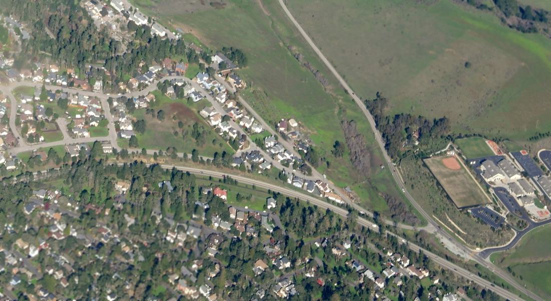
A 12/27/14 aerial view by Dallam Oliver-Lee looking northeast at the site of Cambria Pines Airport.
The site of the Cambria Pines Airport is located northwest of the intersection of Route 1 & Main Street.
Thanks to Jonathan Westerling for pointing out this airfield.
____________________________________________________
Sherwood Field / (Original) Paso Robles Airport, Paso Robles, CA
35.61, -120.66 (Northwest of Los Angeles, CA)
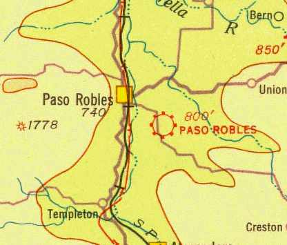
The original Paso Robles Airport, as depicted on the 1933 San Francisco Airway Map (courtesy of Chris Kennedy).
Sherwood Field was began in the late 1920s as a private airport owned by T A Osborne.
It had 2 dirt strips with a few locally-owned aircraft.
In those days it was quite an event to have "barnstormers" visit Paso Robles, and when they did, the whole city turned out to see them.
Rides were offered for only $1.
At some point, the field became known as Paso Robles Airport.
The Standard Oil Company's 1929 "Airplane Landing Fields of the Pacific West" (courtesy of Chris Kennedy)
described Paso Robles as a commercial airport operated by Perry Tucker.
The airfield configuration was said to consist of a 2,000' northeast/southwest runway,
along with auxiliary runways on the north & east.
A small hangar was said to be on the northeast corner of the field.
The earliest depiction of the Paso Robles Airport which has been located
was on the 1933 San Francisco Airway Map (courtesy of Chris Kennedy).
It depicted Paso Robles as a commercial/municipal airfield.
Paso Robles was also used as a stopover for Goodyear blimps traveling up & down the coast in the 1930s.
The Airport Directory Company's 1937 Airports Directory (courtesy of Bob Rambo)
described Paso Robles Municipal Airport as having three dirt runways,
with the longest being a 3,300' northeast/southwest strip.
In 1940, a flying club, in joint ownership with the Paso Robles airport, was planned.
The committee anticipated a $10,000 improvement program tentatively promised by the CAA.
A field survey by the CAA was completed with the team recommending a beacon, radio signal tower, and weather station.
The runways at Sherwood were then 3,400' & 1,600' long.
In late 1940, the City of Paso Robles & the War Department came to an agreement
to have the City lease the Paso Robles Airport to the military for $1 / year.
One week later the private planes were moved to other cities, most went to San Luis Obispo.
Ground was broken for the first buildings of an estimated $300,000 construction project.
More than 5,000' of concrete drain tile & corrugated iron culverts lined both sides of the 2 main runways.
The first unit to move into the new government-run airport
was the 115th Observation Squadron of the California National Guard.
The unit was attached to the 40th Division, at the time stationed at Camp San Luis Obispo.
Early in 1941, the government appropriated an additional $254,346 for the construction
of a new 4,200' east-west runway, for which the City of Paso Robles purchased 20 additional acres.
The runway was of sufficient size to accommodate any type of landplane then in use.
All runways were hard-surfaced with a concrete apron.
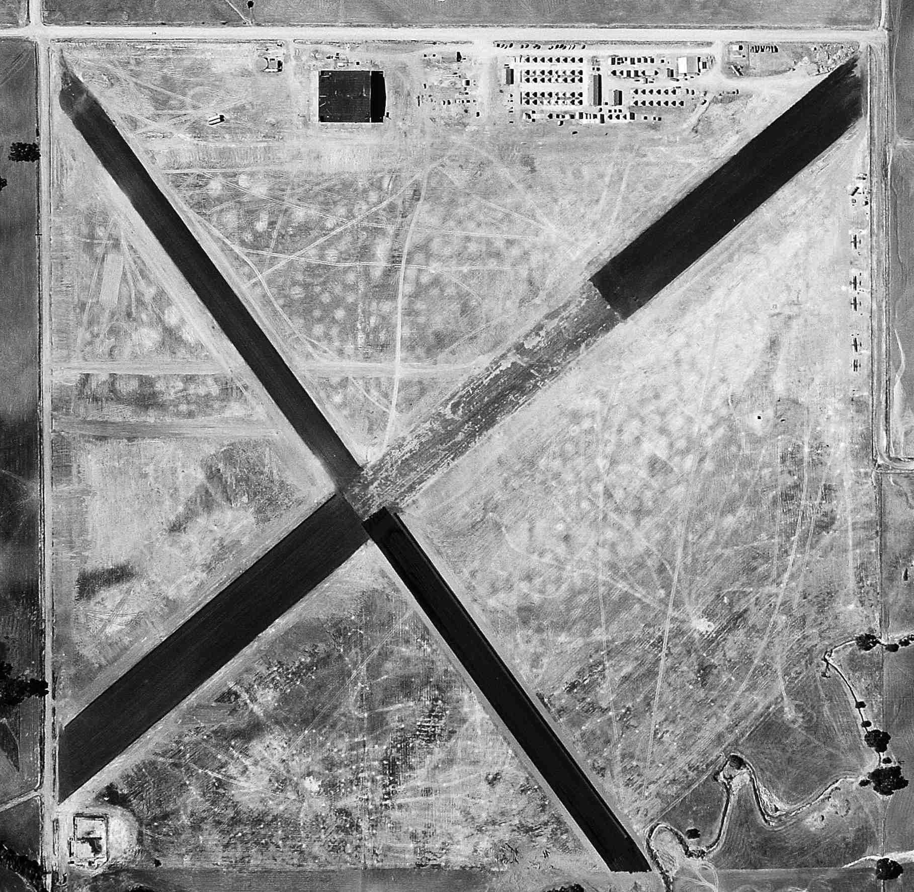
The earliest photo which has been located of Sherwood Field was a 6/29/41 aerial view (from the UCSB archives).
It depicted Sherwood Field as having 2 runways which were being newly-paved with asphalt, along with a newly-built hangar on the north, and 5 single-engine planes on the east side.
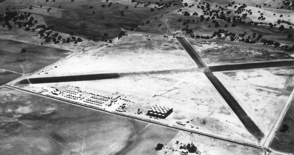
An 8/12/41 aerial view looking southeast depicted Sherwood Field as having 2 asphalt runways,
with a checkerboard-roofed hangar along the north side.
Later in 1941, the Air Corps turned Sherwood Field over to the Navy,
who used it only as an emergency field - a full complement was never stationed there.
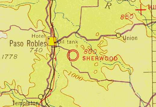
The December 1941 San Francisco Sectional Chart (courtesy of Chris Kennedy) depicted Sherwood Field as a military airfield.
A motion picture, with actor Robert Taylor in the role of an Air Corps cadet, was made early in WW2, and part of it was filmed at Sherwood Field.
Legendary stunt pilot Paul Mantz flew the air scenes in place of Taylor (who actually later was a Navy pilot in the Pacific theater).
One morning all airplanes were moved out of the hangar, both doors slid open,
then Mantz took off, circled the field once, dove, and flew through one door & out the other.
Hundreds of townspeople had heard about the planned scene, and were there to watch the action being filmed - Paso Robles' first air show!
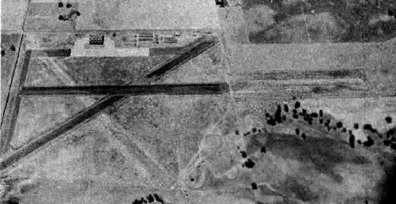
A 7/23/43 aerial view looking north at “Paso Robles Municipal Airport (Sherwood Field)” from the 1945 AAF Airfield Directory (courtesy of Scott Murdock).
The field was pictured as having 2 paved runways, with indications of a 3rd unpaved runway.
A paved ramp on the north side had several hangars.
Sherwood Field was not depicted on the 1943 USGS topo map (courtesy of Dallam Oliver-Lee).
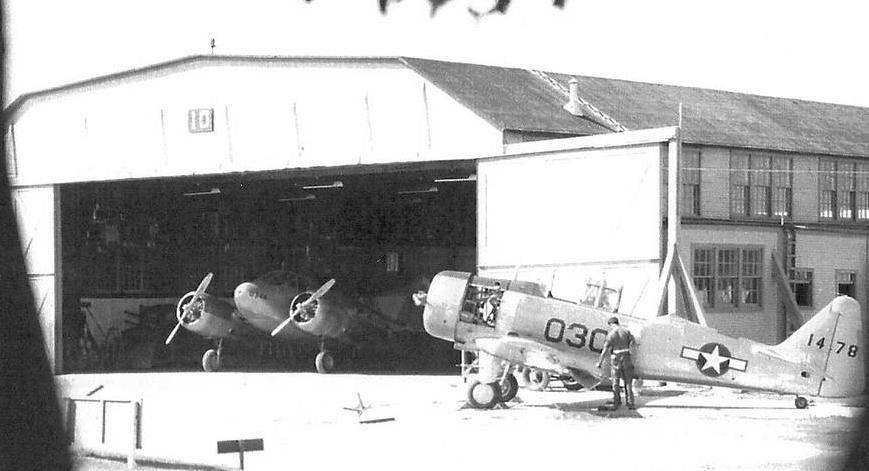
A WW2 photo of an AT-11 & an AT-6 in front of a Sherwoood Field hangar.
"Paso Robles" Airport was described by the 1944 US Army/Navy Directory of Airfields (courtesy of Ken Mercer)
as having a 3,300' hard-surface runway.
In 1945, the Navy returned the field to the City of Paso Robles.
The airport fell into general disrepair after the war, since most aviation activity had shifted to Estrella -
by then the official Paso Robles airport - and housing was fast encroaching.
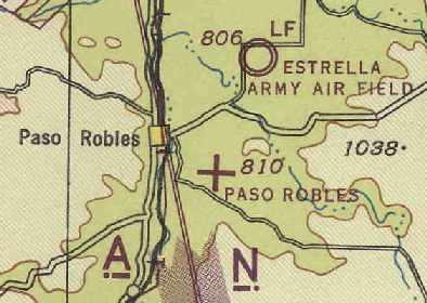
"Paso Robles" was depicted as an auxiliary airfield on the March 1945 San Francisco Sectional Chart (courtesy of Chris Kennedy).
The 1945 AAF Airfield Directory (courtesy of Scott Murdock) described “Paso Robles Municipal Airport (Sherwood Field)”
as a 180 acre field within which were 2 asphaltic concrete runways, measuring 3,300' northeast/southwest & 2,500' east/west.
The field was said to have 2 hangars, the largest being a 160' x 120' metal structure.
The airport was described as being owned by the City of Paso Robles, but “Not in operation.”
Roland Sinclair recalled, “To build our hours we often flew to Sherwood Field in Paso Robles.
There, was Walt Fell, Airport Manager & Larry Anderson, Flight Instructor, who gave us our flight tests for our Private Licenses.
I remember well the DC-3 of William Randolf Hearst parked at times in the huge hangar there.”
The January 1948 San Francisco Sectional Chart (according to Dean Billing) depicted Paso Robes as having a 3,500' hard-surface runway.
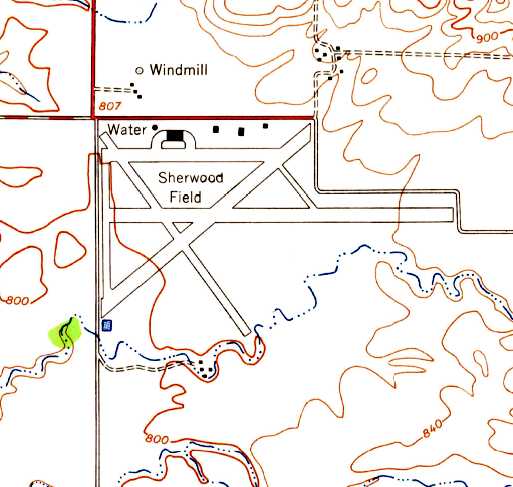
The earliest topo map depiction which has been located of Sherwood Field was on the 1948 USGS topo map.
It depicted Sherwood as having 4 paved runways, a ramp, and several buildings on the north side.
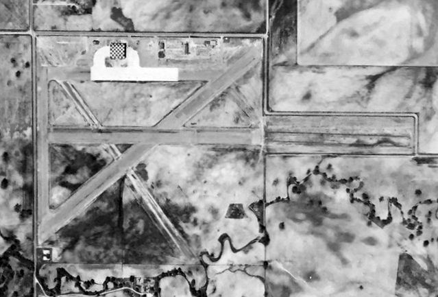
The last photo which has been located showing Sherwood Field still in operation was a 3/31/49 aerial view (courtesy of Kevin Walsh).
It depicted Sherwood as having 3 paved runways. A paved ramp on the north side had several hangars, including one with a checkerboard-painted roof.
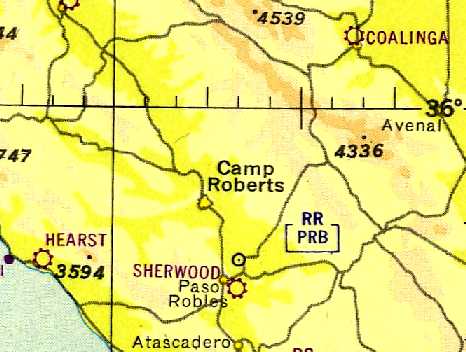
The last aeronautical chart depiction of Paso Robes as an active airfield which has been located
was on a 1950 aeronautical chart (courtesy of Dallam Oliver-Lee).
It depicted Sherwood as a municipal/commercial airfield.
According to the 12/30/76 San Luis Obispo Telegram-Tribune, Sherwood Field was the site of the Paso Robles airport until 1951
when the city moved operations to the current location north of Highway 46, a former WW2 military airfield.
Bob Cannon recalled, "On a cross-country to Gilroy in 1954 in my Champ,
I was depending upon getting gas at Sherwood, but I never could find it; maybe it was gone by then?"
Sherwood Field was no longer depicted on the 1955 San Francisco Sectional Chart (according to Chris Kennedy).
In the mid-1950s, a housing tract was constructed on the Sherwood Field property,
where some residents trying to plant trees in their yard hit the old runway & parking ramps.
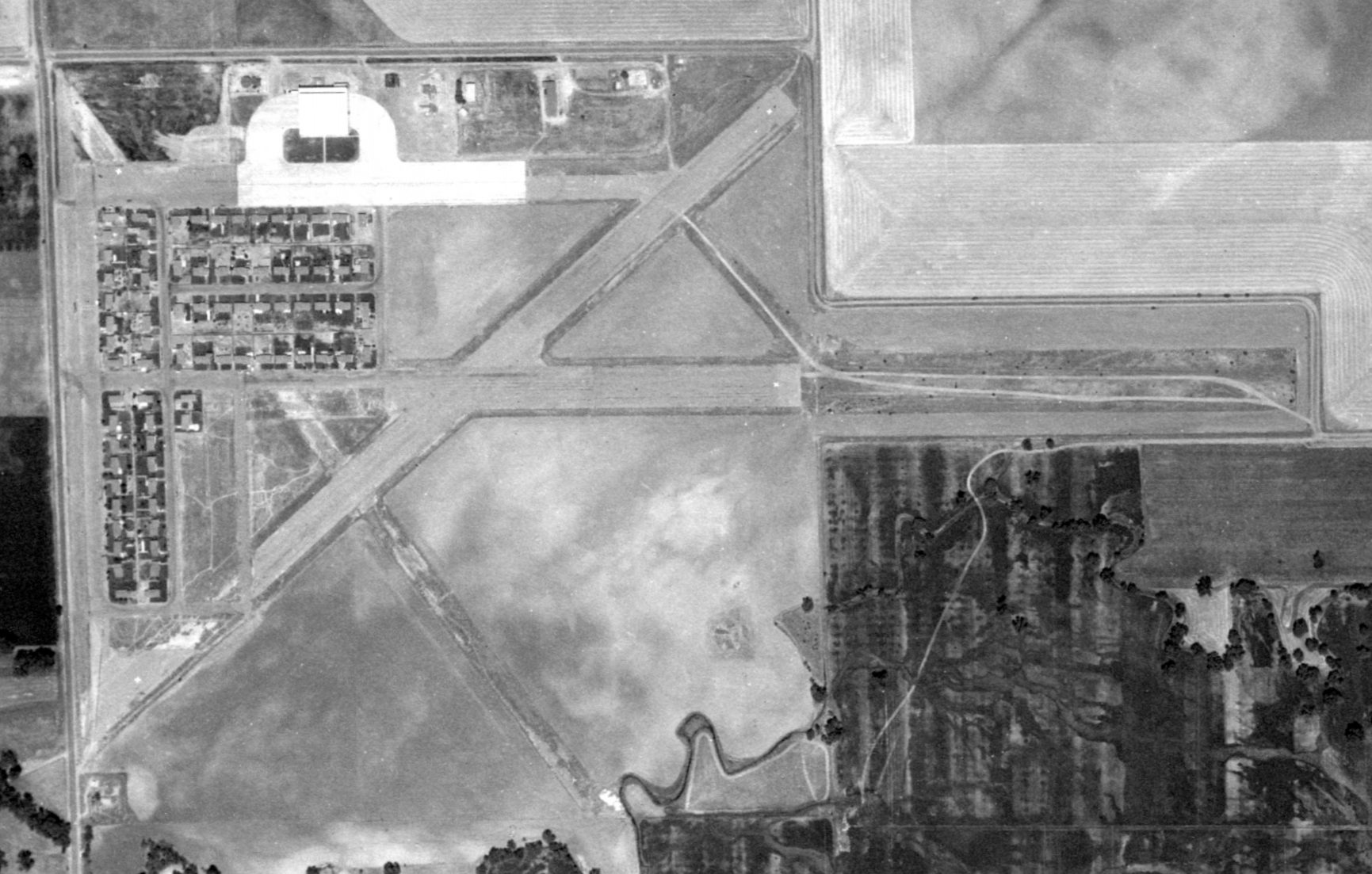
An 8/8/57 USGS aerial view (from the UCSB archive) showed housing starting to cover the west side of Sherwood Field.
Most of the 4 runways still remained, as well as the ramp & hangars along the north side of the field.
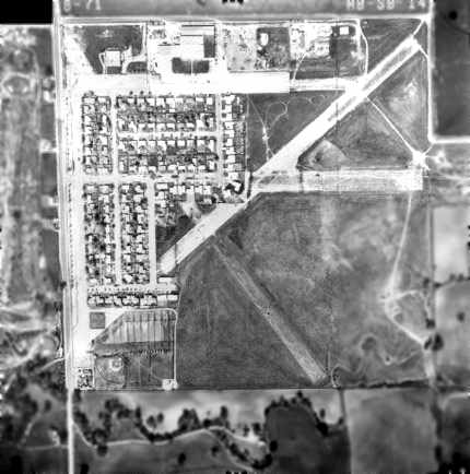
A 1971 aerial view of the site of Sherwood Field (from the Alexandria Digital Library @ UC Santa Barbara, courtesy of Jonathan Westerling),
showing the still-extant remains of 4 runways, as well as the hangars along the north side of the field.
According to the 12/30/76 San Luis Obispo Telegram-Tribune, the last time an airplane landed at Sherwood Field was likely during late December 1976.
Unfortunately, the airfield had been closed for more than 2 decades.
The pilot mistook the old airfield for the active Paso Robles Municipal Airport runway less than 4 miles away.
The remains of the 1,000' runway were overgrown with weeds & cut with ditches but the runway paint with warning crosses had faded, failing to alert pilots that the field was closed.
The out-of-town pilot somehow missed the larger active field nearby & aimed for Sherwood instead. The aircraft ended up in a backyard but no one was injured.
The 1979 USGS topo map still depicted the paved east/west ramp, as well as the hangar on its north side,
and the paved north/south runway.
In a 1994 USGS aerial view of the site of Sherwood Field, the former ramp was still visible in the center, with the hangar to the north of it.
A pre-2001 aerial view looking west at what remains of Sherwood Field.
The outline of the former main runway runs diagonally across the picture, with the small portion that is still visible highlighted by the arrow.
The rest of the runway lies buried under houses & commercial buildings. The still-extant ramp & hangars are on the right side of the picture.
Sherwood Field is still with us today in visible reminders.
The old Officers Mess is in use by the Paso Robles Shriners, and the big hangar remains, now occupied by Ennis Co,
as does the original apron where the planes were tied down.
The hangar & ramp can be viewed from Santa Fe Avenue, off Creston Road,
where the apron is bisected by a chain-like fence from Ennis Co property.
The concrete was just too much trouble to break up & remove, so it remains as a reminder of bygone days when the sounds of aircraft engines chattered
in the soft, clear air over what was then open pasture land.
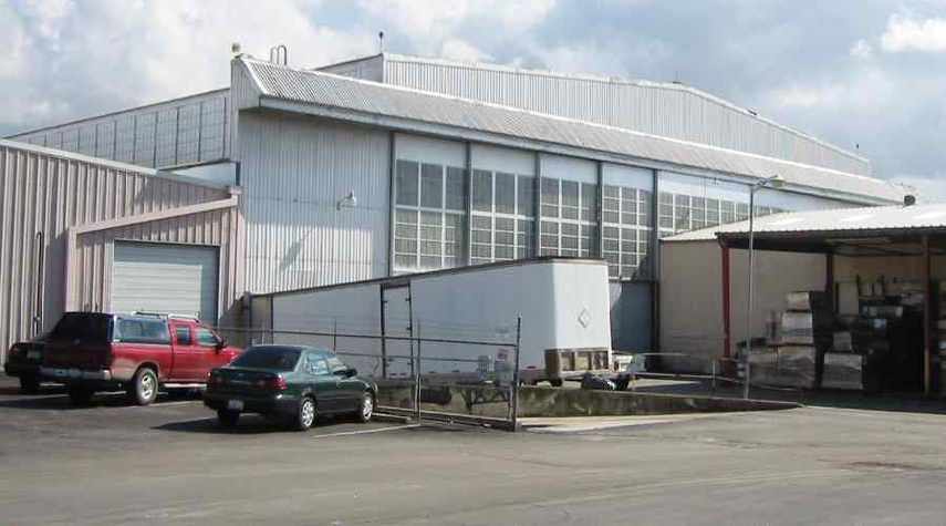
A 2006 photo by Jonathan Westerling, looking at the front of the impressive hangar which remains at the site of Sherwood Field.
Jonathan Westerling reported, “As of 2006, Sherwood field is still very much in evidence & accessible for viewing.
One half of the shorter east/west runway (divided longways!) is legally drivable as part of Santa Fe Road.
The other half is used for parking by nearby businesses. A fence runs the length of this remaining runway.
By far the most interesting aspect of the airfield that remains is the huge hangar building, now reused as part of the Ennis Printing Company.
The 10 panels of its monstrous doors have been fairly well maintained & dwarf all other buildings in the vicinity.
Large red globe lights still mark each corner of the building
and its architecture is a perfect example of a WWII hangar structure.
Unfortunately, the end of the remaining portion of the diagonal runway evidenced in the aerial photo [several paragraphs above]
has been removed in favor of another industrial building.”

A 2006 photo by Jonathan Westerling, a “120 degree panoramic view looking northwest from the eastern part of the remaining runway at Sherwood Field.
The large blue building was the airport hangar. The remains of the concrete runway have been divided lengthwise by a fence to be used for parking.”
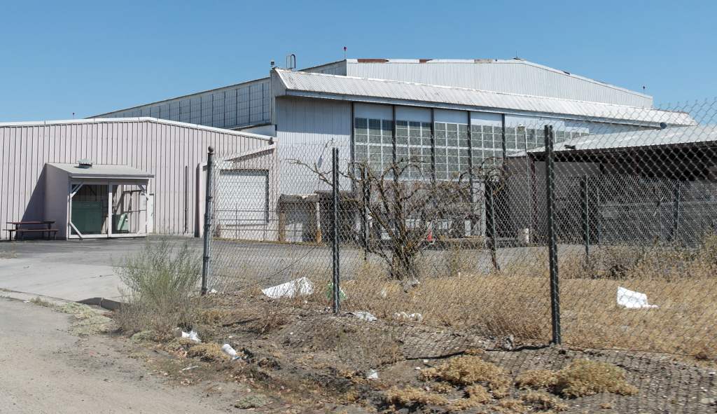
An 8/30/13 photo by Dallam Oliver-Lee of the hangar which remains at the site of Sherwood Field.
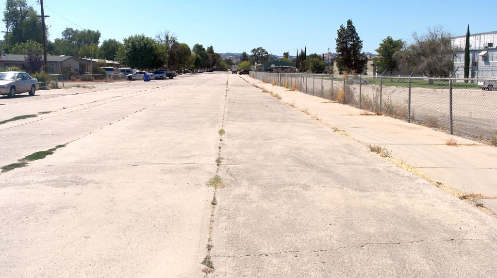
An 8/30/13 photo by Dallam Oliver-Lee of the remains of the Sherwood Field ramp.
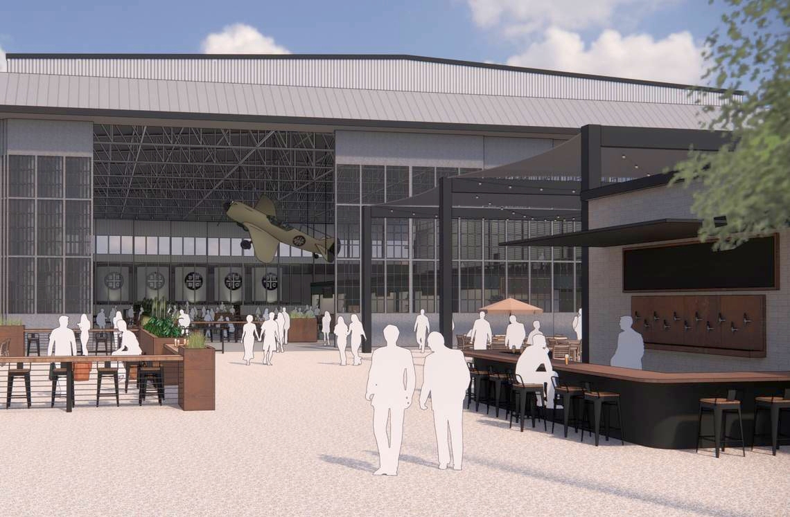
A 2023 artist's conception of “The Hangar”, BarrelHouse Brewing Company’s production facility & taproom, which is planned to occupy a former Sherwood Field hangar.
According to the article “Old Paso Robles airplane hangar will soon house brewery”, in the 4/22/23 San Luis Obispo Tribune,
“Now most of the Sherwood area is developed and the former runway can no longer be seen from the air.
Popular Paso Robles craft brewery BarrelHouse Brewing Company recently announced that it will be opening a new production facility & taproom in a former Sherwood Field hangar.”
The site of Sherwood Field is bordered by Creston Road on the West, Sherwood Road on the North, Fontana Road on the East, and Scott Street on the South.
See also: http://ewarbirds.org/sherwood.html
____________________________________________________
Sinclair Field / Flying R Ranch Airfield, San Miguel, CA
35.761, -120.687 (Southwest of Fresno, CA)
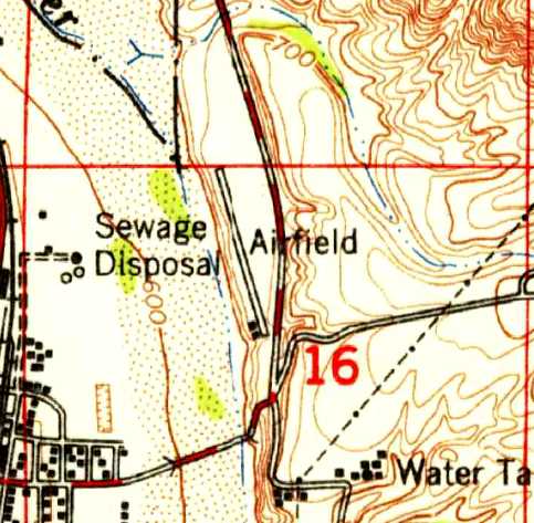
The 1947 USGS topo map depicted Sinclair Field as having a single northwest/southeast runway, with 2 small buildings on the southwest side.
Photo of the airfield while in use has not been located.
Roland Sinclair recalled, “That strip was built by my Dad, Ed Sinclair, on a portion of his ranch. Probably 1945 or 1946.
As I recall, the construction consisted mostly of dragging a length of railroad rail behind a farm truck with chains.
The old hangar, a T-shaped structure, was built by my Dad at the same time, for his new Taylorcraft, in which we both learned to fly.
In the early years there was a cross fence to the north, separating the adjoining property.
At some later date this fence was removed & the runway extended.
I know of at least one other who learned to fly there & several local pilots parked their aircraft there shortly after WW2.
Our Instructor was Hollis Green. To build our hours we often flew to Sherwood Field in Paso Robles.”
The earliest depiction which has been located of Sinclair Field was on the 1947 USGS topo map.
It depicted a single northwest/southeast runway, with 2 small buildings on the southwest side, labeled simply as “Airfield”.
Sinclair Field was not depicted at all on the 1966 San Francisco Sectional Chart (courtesy of John Voss).
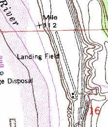
The 1979 USGS topo map depicted a single 1,900' runway, labeled simply as "Landing Field".
According to Roland Sinclair, “I know the old San Miguel strip was improved & used in later years as a crop dusting base.”
No airfield at this location was listed here in the 1982 AOPA Airport Directory (courtesy of Ed Drury).
It was also still depicted on the 1989 USGS topo map, but once again simply labeled as "Landing Strip".
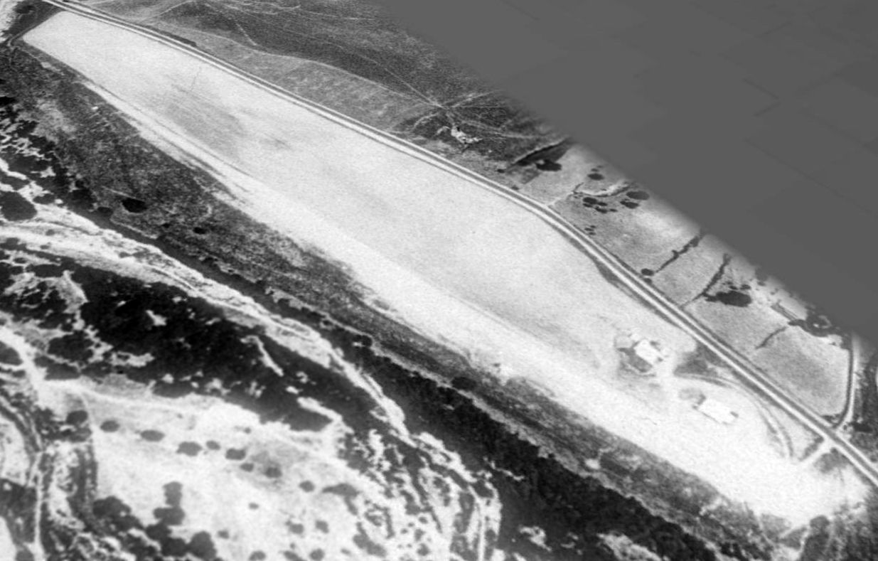
The earliest photo which has been located of Sinclair Field was a 1989 aerial view looking northeast.
It depicted Sinclair Field as having a single unpaved northwest/southeast runway, with 2 small buildings on the southeast side & a T-hangar on the southwest side.
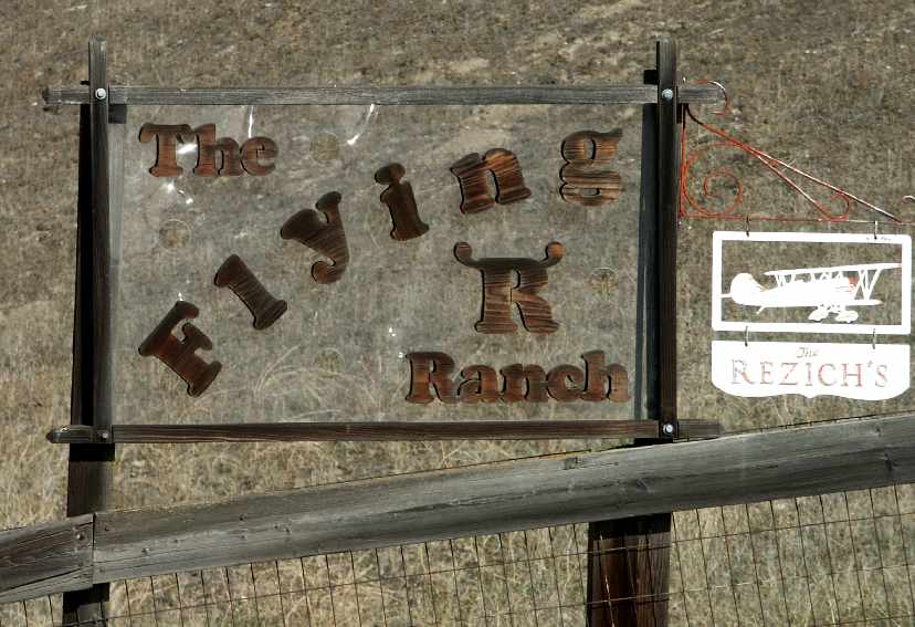
A 2003 photo by Tim Tyler, of the sign in front of a house on a bluff overlooking the airfield on the opposite side of Indian Valley Road.
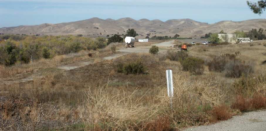
A 2003 photo by Tim Tyler of the remains of the runway & hangar.
Tim reported that the airfield consisted of one "Old gravel runway, with remains of one old, and one newer hangar,
plus a partially demolished trailer home.
Both hangars have remains of windsocks on their roofs.
The newer hangar is Butler type building & looks like it is now used to do mechanical work on machinery.
The older, smaller open-faced hangar looks like it was most recently used as an animal pen.
The runway isn’t flight-ready."
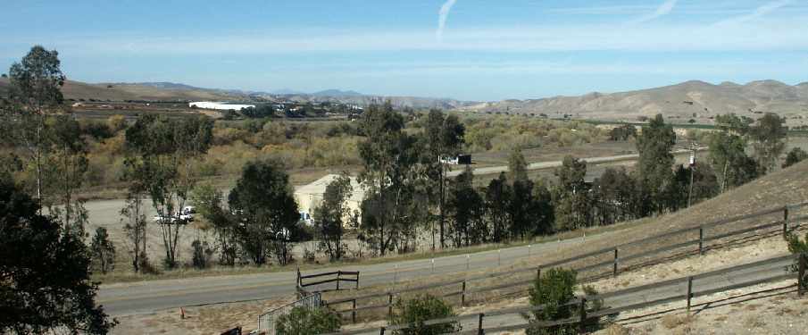
A 2003 photo by Tim Tyler of the airfield, from the hillside on the opposite side of the road.

A 2003 photo by Tim Tyler of the newer of the 2 hangars at the airfield.
Note the windsock frame atop the hangar.
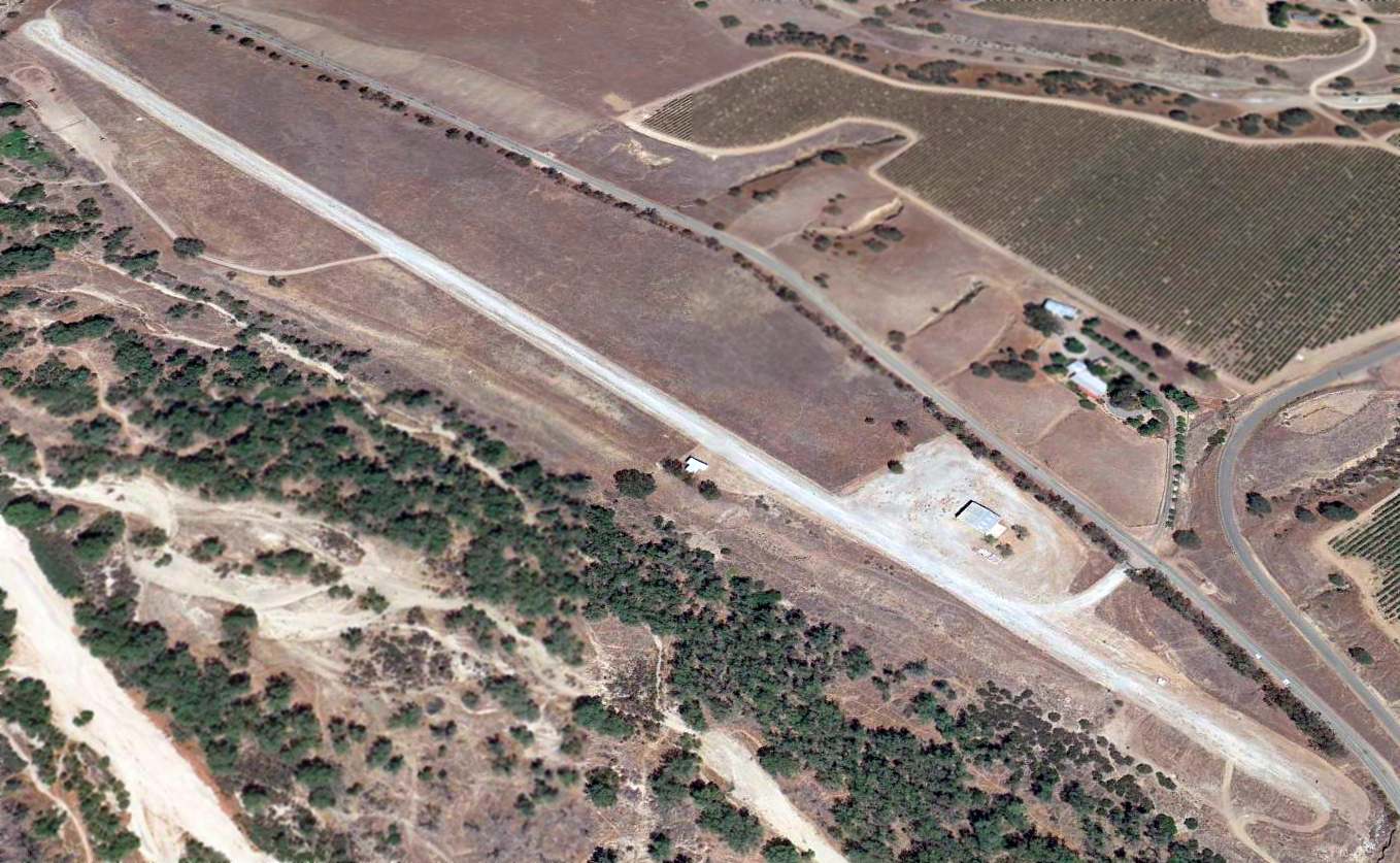
A 2013 aerial view looking northeast at Sinclair Field / Flying R Ranch Airfield.
The Flying R Ranch Airfield is located northwest of the intersection of Indian Valley Road & River Road.
____________________________________________________
Camp Roberts Army Airfield (original location), Camp Roberts, CA
35.785, -120.721 (Southwest of Fresno, CA)
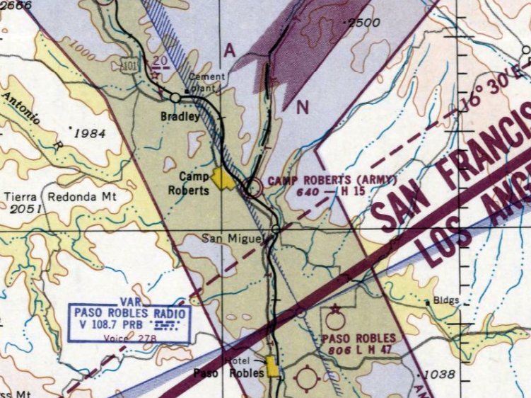
The original Camp Roberts Army Airfield, as depicted on the March 1951 San Francisco Sectional Chart.
Camp Roberts' original airfield was located on the southeast side of the base, and was evidently established at some point between 1951-51,
as it was not yet depicted on the 1948 USGS topo map or the September 1950 San Francisco Sectional Chart.
The earliest depiction which has been located of Camp Roberts Army Airfield was on the March 1951 San Francisco Sectional Chart.
It depicted the field as located on the southeast side of Camp Roberts, with a 1,500' paved runway.
Bob Cannon recalled, "On the Camp Roberts airstrips: I flew out of both of them in 1952-58 with the CA National Guard.
I was in the 111th Armored Cavalry Regiment.
The main strip was used mainly for parades or for the 'biggies' like Goodwin Knight,
and the short strip across the road was used for air traffic,
except the doggy L-17 Navions were limited to 3 persons on board due to the short strip."
Camp Roberts original airfield was still not depicted on the 1951/52/55 USGS topo maps.
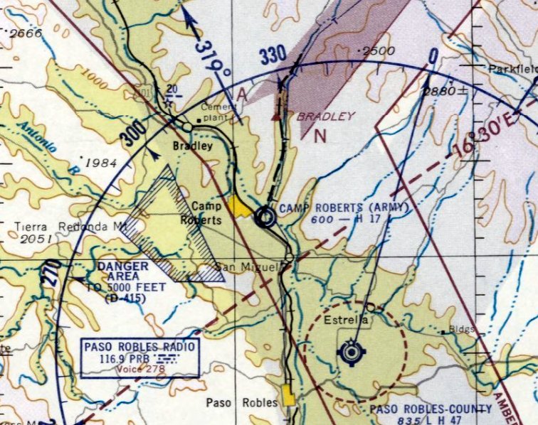
The last depiction which has been located of the original Camp Roberts Army Airfield (on the southeast side of the base)
was on the March 1953 San Francisco Sectional Chart.
It depicted “Camp Roberts (Army)” as having a 1,700' paved runway.
At some point between 1953-54 the original Camp Roberts Army Airfield (on the southeast side of the base)
was replaced by a field to the north of the base (later known as Camp Roberts “Main” Airfield),
as that is where “Roberts AAF” was depicted on the September 1954 San Francisco Sectional Chart.
No trace of the original Camp Roberts Army Airfield was discernible on a 1981 aerial photo.
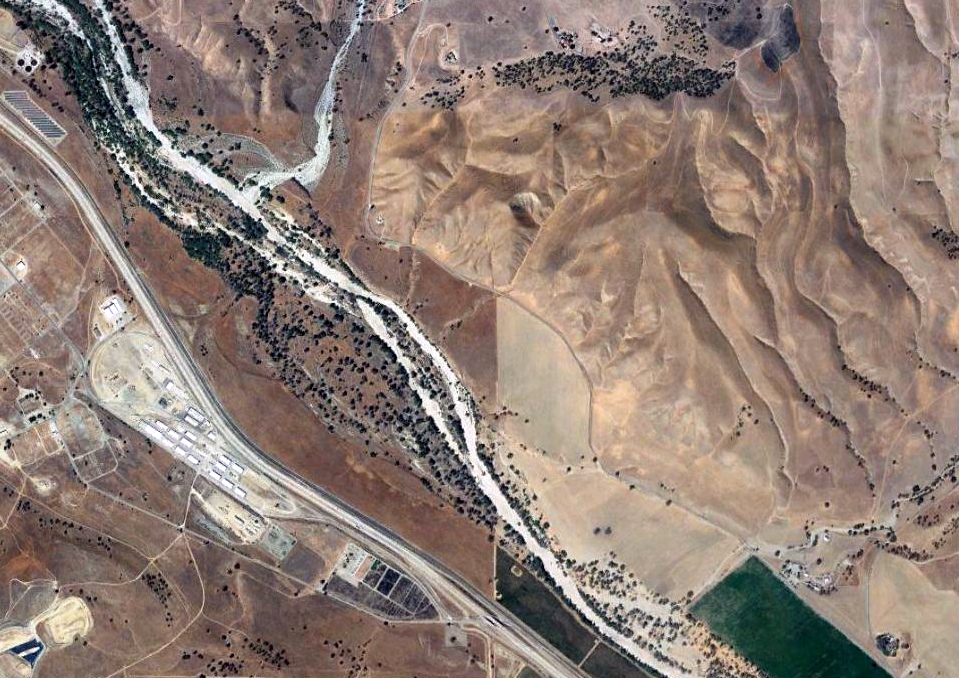
A 2018 aerial view did not show any recognizable trace of the original Camp Roberts Army Airfield.
____________________________________________________
Camp Roberts (Main) Army Airfield, Camp Roberts, CA
35.79, -120.74 (Southwest of Fresno, CA)
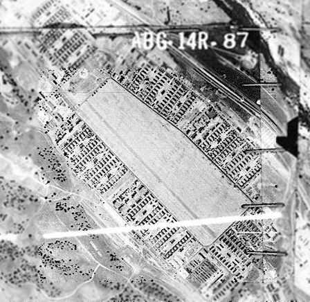
The earliest photo which has been located of the Camp Robert Main Airfield was a 1956 aerial view
from the Alexandria Digital Library @ UC Santa Barbara (courtesy of Jonathan Westerling).
It depicted the field as a single (very wide) northwest/southeast runway.
Camp Roberts Main Airfield (immediately adjacent to the northwest side of the base) was not yet depicted on the 1948 USGS topo map.
The earliest photo which has been located of the Camp Robert Main Airfield was a 1956 aerial view
from the Alexandria Digital Library @ UC Santa Barbara (courtesy of Jonathan Westerling).
It depicted the field as a single (very wide) northwest/southeast runway, originally the camp's parade grounds.
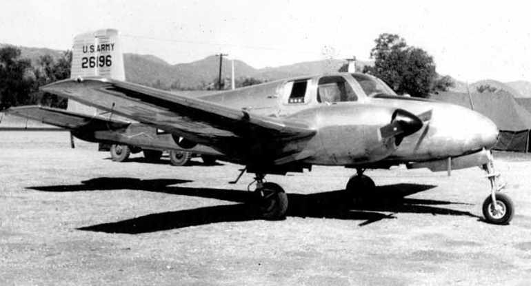
A circa 1950s photo of a General's L-23 at the Camp Roberts Main Airfield (courtesy of Bob Cannon).
Dick Landgraff recalled, "My National Guard unit spent a couple of summers up there in the late 1950s.
Since my unit was the 111th Armored Reconnaissance Battalion
we naturally had a couple of Pipers as part of our Recon equipment.
But whether they used the East or West Fields, I don't know."
"But I believe the (Main) Field was the longest of the two.
I think it's runway was over a mile long because the 160th Armored Infantry Battalion
needed a flat piece of asphalt or concrete with a measured mile on it.
They stripped the governor off the engine of an M-41 Walker Bulldog tank & clocked it at high speed.
They did it twice to make sure their stopwatches & math was correct.
They had a crackerjack driver zip that 25 ton tank down the airstrip at 72 mph.
At least that was ONE use for the air strip."
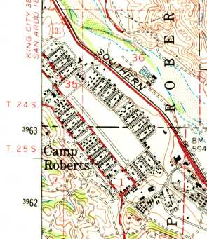
The 1961 USGS topo map depicted a single runway running along the southeast side of the Camp Roberts parade ground,
although it did not label the airfield as such.
Camp Roberts Main Airfield was not yet depicted on the March 1961 San Francisco Sectional Chart.
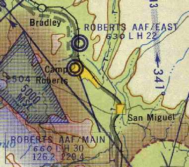
The earliest depiction which has been located of Camp Roberts Main Airfield was on the June 1963 San Francisco Sectional Chart (courtesy of Chris Kennedy).
It depicted Roberts AAF Main as having a 3,000' paved runway & a control tower.
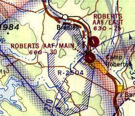
The 2 Camp Roberts airfields, as depicted on the 1966 San Francisco Sectional Chart (courtesy of John Voss).
The 1966 San Francisco Sectional chart (courtesy of John Voss)
depicted Roberts AAF Main as having a single 3,000' paved runway,
and depicted Roberts AAF East as having a single 2,500' paved runway.
Strangely enough, the Aerodromes table on the reverse side of the 1966 Sectional Chart
included the following remark for both Camp Roberts fields: "Closed until further notice."
John Christie was stationed at Camp Roberts from 1980-2000.
Of the Camp Roberts Main Airfield, he recalled,
"In my years of training there it was primarily used as a helipad, and mostly for medevac.
If you look on your aerial photo, there is, at center of the lower long side some buildings,
that was the dispensary, next to which they parked said helicopters.
On the lower short side is a recently constructed (1996? or so) fuel point (Vehicle, wheeled).
In fact I never saw a fixed wing aircraft use it in the years between 1980 & 2000."
The Camp Roberts Main Airfield was closed at an unknown date, apparently between 1987-91.
Both the East & Main Airfields were depicted on the 1987 CA Aeronautical Chart (courtesy of John Voss),
but only the East Airfield was still depicted on the 1991 Tactical Pilotage Chart (courtesy of Robin Ziegler).
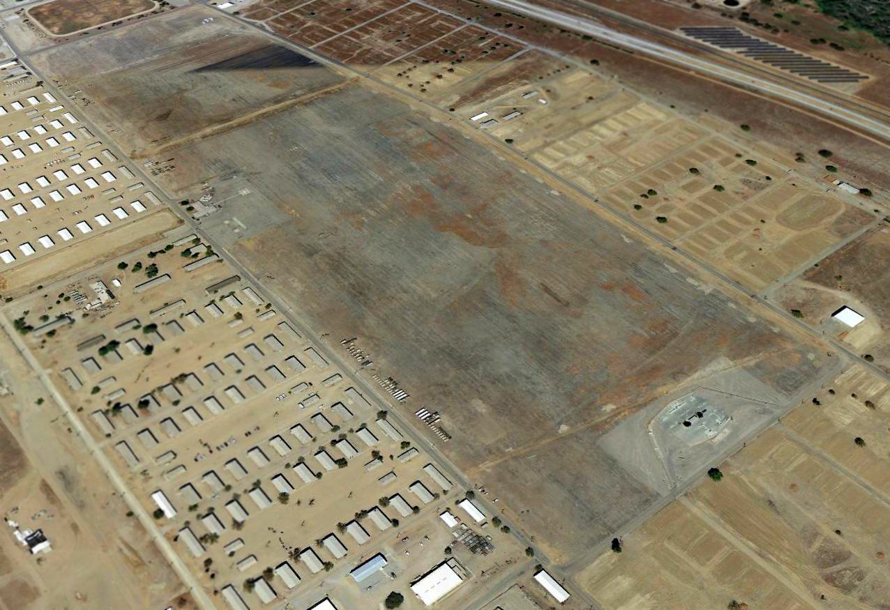
A 2013 aerial view looking north at the Camp Roberts Main Airfield.
The Camp Roberts Main Airfield is located south of the intersection of Montana Boulevard & California Boulevard, a quarter-mile west of US Route 101.
____________________________________________________
Hearst Ranch Airport (1st location), San Simeon, CA
35.65, -121.19 (Northwest of Los Angeles, CA)
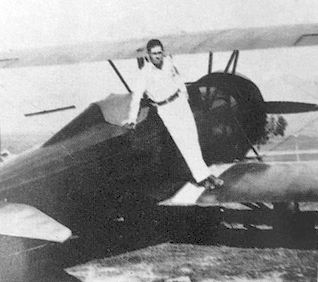
A 1928 photo of household staff member Joseph Reilly posing on the biplane (model unidentified)
which had been flown into Hearst Airfield by millionaire Howard Hughes (courtesy of Kevin Walsh).
William Randolph Hearst first constructed a private airstrip at an unknown date on the property of his Hearst Castle.
In addition to the stars, politicians & other influential members of society
that were continually being flown in for extravagant parties,
Mr. Hearst used the airstrip to have every one of his newspapers delivered to him for his review & critique.
The earliest photo which has been located of the Hearst Airfield was a 1928 photo of household staff member Joseph Reilly posing on the biplane (model unidentified)
which had been flown into Hearst Airfield by millionaire Howard Hughes (courtesy of Kevin Walsh).
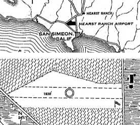
The earliest map depiction which has been located of the Hearst Ranch Airfield
was on the 4/20/29 Department of Commerce Airway Bulletin (courtesy of Jonathan Westerling).
It depicted the Hearst Ranch Airfield as having a single 1,930' east/west unpaved runway,
located directly along the east side of Pacific Coast Highway.
The airfield property was described as 26 acres in size, but did not have any hangars.
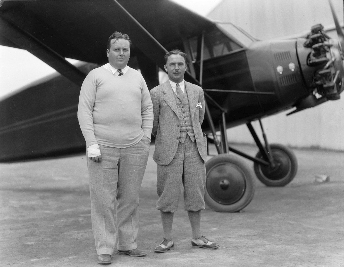
The last photo which has been located of the original location of Hearst Airfield was a circa 1930 photo by Julian Graham of George Hearst & Fred McKinley in front of a high-wing monoplane (model unidentified).
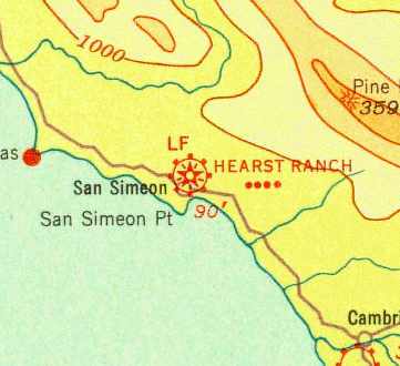
The 1933 San Francisco Airway Map (courtesy of Chris Kennedy) depicted “Hearst Ranch” as a commercial airfield.
It continued to be depicted as the “Hearst Ranch” Airport on the November 1936 San Francisco Sectional Chart.
At some point between 1936-37, the original Hearst Ranch Airport (directly adjacent to Route 1)
was evidently replaced by a 2-runway W.R. Hearst Airport just to the east.
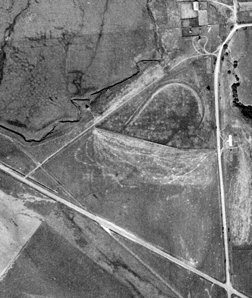
A 1937 USDA aerial photo (courtesy of Jonathan Westerling) did not show any recognizable trace of the 1st location of the Hearst Airfield.
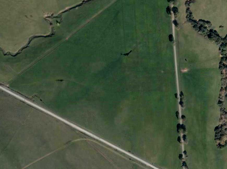
As seen in a 2003 aerial view, there doesn't not appear to be any trace remaining of the single runway
at the site of the original Hearst Ranch Airfield.
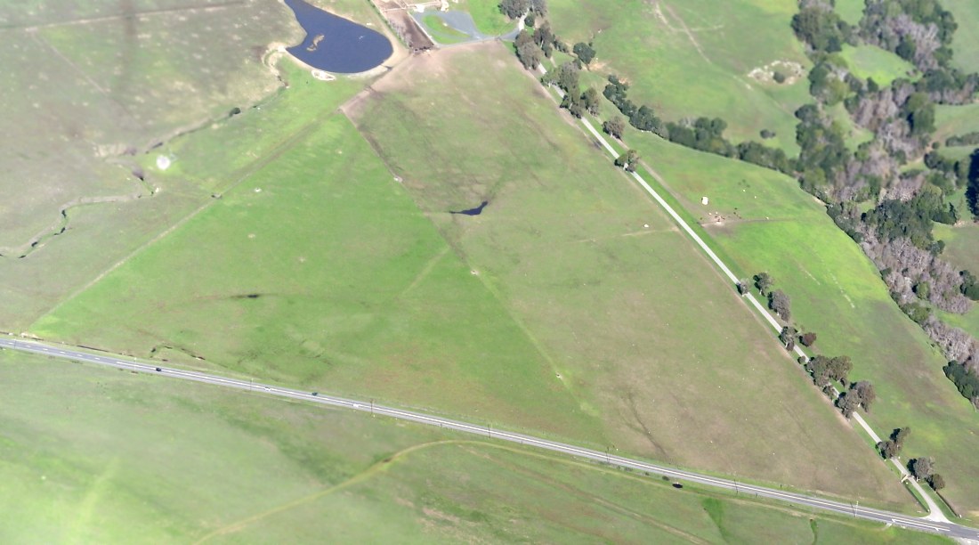
A 12/27/14 aerial view by Dallam Oliver-Lee looking northeast at the site of the original Hearst Ranch Airfield.
____________________________________________________
W.R. Hearst Airport (2nd location), San Simeon, CA
35.65, -121.19 (Northwest of Los Angeles, CA)
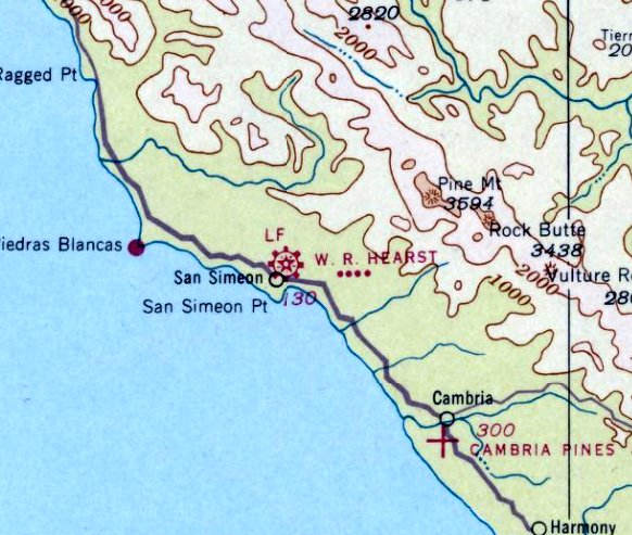
The earliest depiction which has been located of the 2nd location of the Hearst Airfield was on the October 1937 San Francisco Sectional Chart.
It depicted “W. R. Hearst (Aux)” as a commercial/municipal airport.
At some point between 1936-37, the original Hearst Ranch Airport (directly adjacent to Route 1)
was evidently replaced by a 2-runway W.R. Hearst Airport just to the east.
The earliest depiction which has been located of W.R. Hearst Airport was on the October 1937 San Francisco Sectional Chart.
It depicted “W. R. Hearst (Aux)” as a commercial/municipal airport.
The Airport Directory Company's 1937 Airports Directory (courtesy of Bob Rambo)
described Hearst Airfield as having 2 sod runways, with the longest being a 2,350' north/south strip.
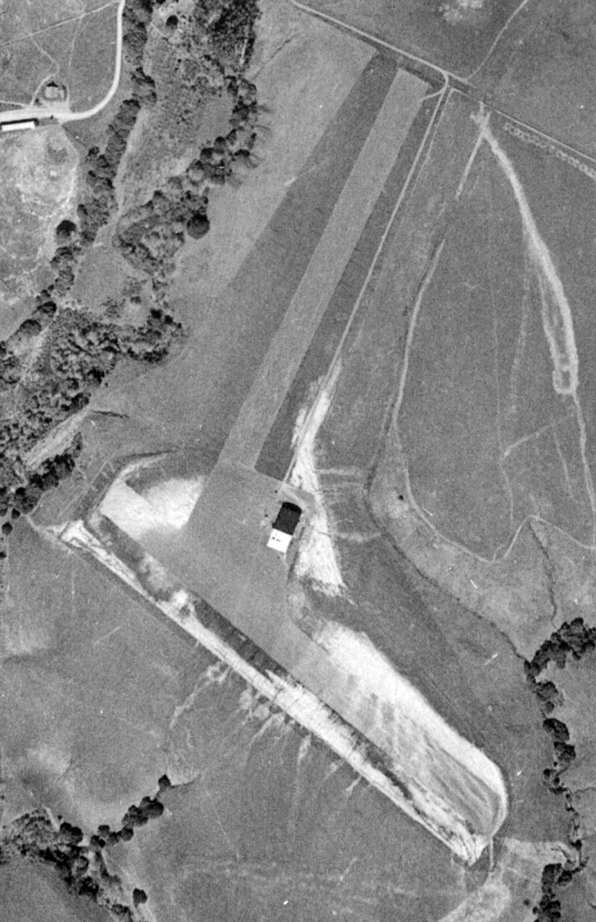
The earliest photo which has been located of W.R. Hearst Airport was a 1937 USDA aerial photo (courtesy of Jonathan Westerling).
It depicted the Hearst Airport as having 2 unpaved runways, with a building to the east of the runway intersection.
Mr. Hearst's airstrip was one of the first in the state to facilitate instrument landings.
Famous aviators that visited Hearst's ranch included Howard Hughes, Amelia Earhart & Charles Lindbergh.
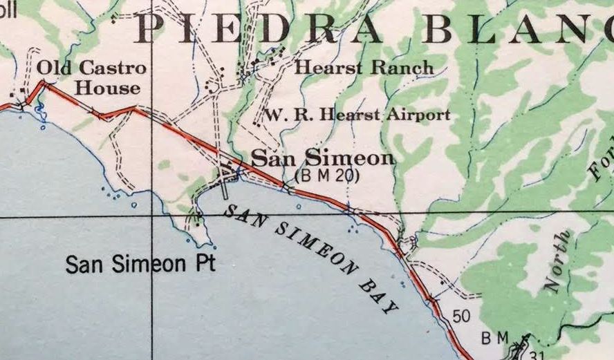
The 2nd location of the Hearst Airfield, as depicted on a 1937 Army Corps of Engineers map (courtesy of Kevin Walsh).

The April 1941 San Francisco Sectional Chart (courtesy of Paul Columbus)
depicted “W. R. Hearst (Aux)” as a commercial/municipal airport.
The Hearst hangar was reportedly in the 1942 movie Casablanca.
William Randolph Hearst owned a DC-3 which he stored in the hangar.
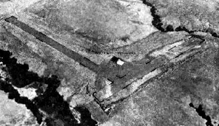
A 7/23/43 aerial view looking east at “William R. Hearst Airport” from the 1945 AAF Airfield Directory (courtesy of Scott Murdock)
depicted the field as having 2 runways with a single hangar to the east of the runway intersection.
The 1945 AAF Airfield Directory (courtesy of Scott Murdock) described “William R. Hearst Airport”
as a 70 acre field within which were 2 oiled runways, measuring 2,300' north/south & 2,200 east/west.
The field was said to have a single 100' x 80' wood & metal hangar.
The airport was said to be privately owned, but “Not in operation”.
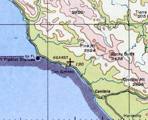
The last depiction which has been located of the Hearst Airport in its 2nd location was on the February 1946 San Francisco Sectional Chart.
It depicted Hearst as an auxiliary airfield.
In 1946, a replacement Hearst Airfield was constructed one mile north, and the original airfield was presumably abandoned.
The August 1946 San Francisco Sectional Chart did not depict any Hearst airfields (presumably while construction was underway).
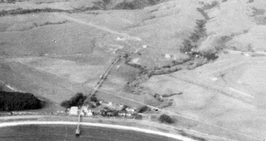
A 1/8/48 aerial photo looking north (courtesy of Dallam Oliver-Lee) showed the 2nd location of the Hearst Airfield (bottom-right),
as well as the 3rd location of the airfield (top-left side).
The February 1948 San Francisco Sectional Chart did not depict any Hearst airfields (presumably while construction was underway).
The August 1948 San Francisco Sectional Chart no longer depicted the 2nd Hearst Airfield, but instead depicted the 3rd location of the Hearst Airfield to the northwest.
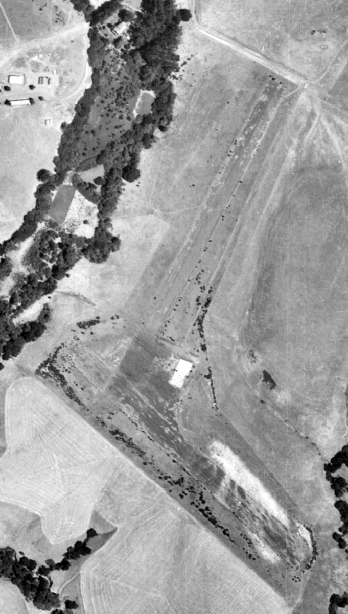
An 8/2/49 USDA aerial photo (courtesy of Dallam Oliver-Lee) showed the remains of the 2nd location of the Hearst Airfield.
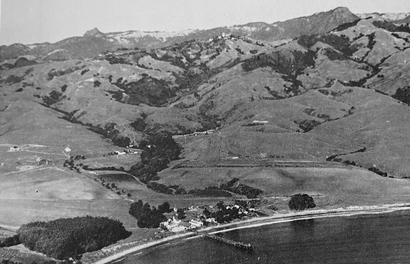
A circa 1946-56 aerial photo looking east (courtesy of Kevin Walsh) showed the 1st location of the Hearst Airfield (left side),
as well as the 2nd location of the airfield (right side).
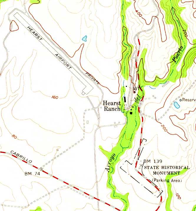
The 1958 USGS topo map continued to depict the outline of 2 runways at the 2nd location of the Hearst Airfield
(the outline labeled “State Historical Monument” at the southeast corner),
in addition to the 3rd Hearst Airfield (at the northwest corner).
A 1960 aerial view (courtesy of Dallam Oliver-Lee) showed a parking lot for the visitors' center
starting to cover the area of the northwest/southeast runway of the 2nd location of the Hearst Airfield.
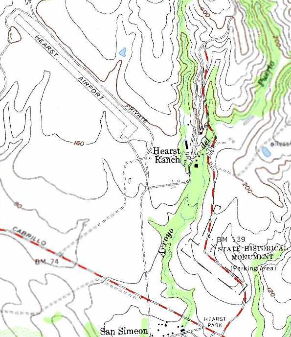
Amazingly, the 1989 USGS topo map appears to continue to depict the outline of 2 runways at the 2nd location of the Hearst Airfield
(the outline labeled “State Historical Monument” at the southeast corner),
in addition to the 3rd Hearst Airfield (at the northwest corner).
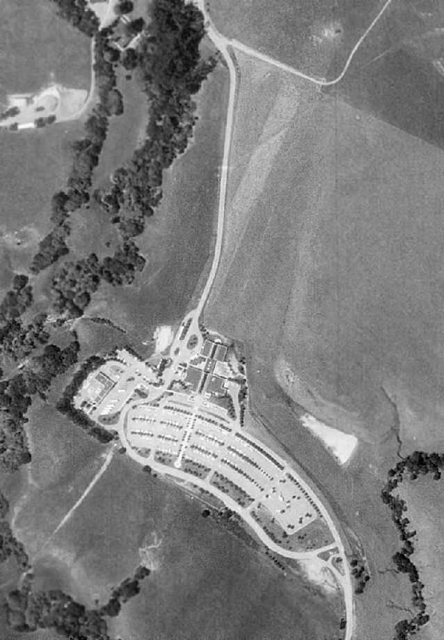
In the 1994 USGS aerial photo, the outline of the 2nd Hearst Airfield's former north/south runway was still quite recognizable,
while much of the former east/west runway had been covered by the Visitor Center & its parking lots.
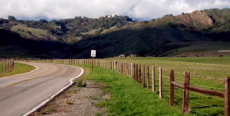
A 2006 photo by Jonathan Westerling, looking north
along the location of the former north/south runway of the 2nd Hearst airfield.
Jonathan observed, “The runway (which was much wider than the road visible here)
remains a flat, raised area that extends well past either side of the road.
Hearst Castle sits at the top of the mountain in the background.”
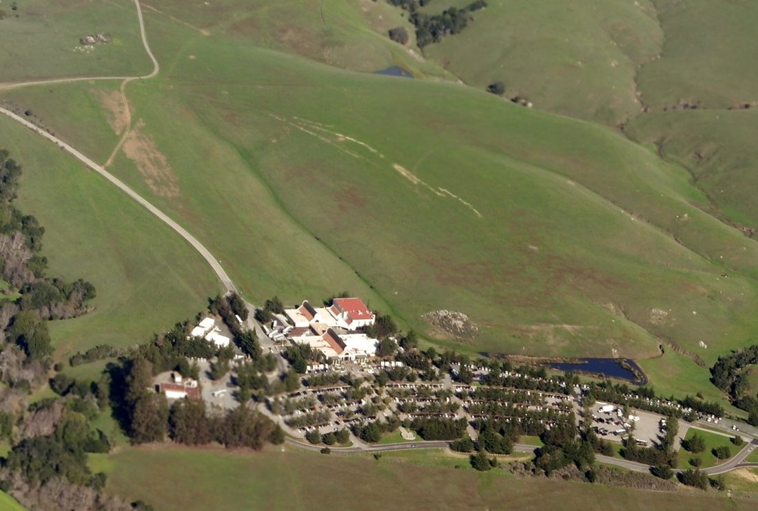
A 12/27/14 aerial view by Dallam Oliver-Lee looking northeast at the site of the 2nd location of the Hearst Ranch Airfield.
Thanks to Mike Perry & Christopher Baker for information about Hearst Airfield.
See also: http://www.hearstcastle.org/history/airport.shtml
____________________________________________________
Hearst Airport (3rd location), San Simeon, CA
35.66, -121.2 (Northwest of Los Angeles, CA)

A 1/8/48 aerial photo looking north (courtesy of Dallam Oliver-Lee) showed the 2nd location of the Hearst Airfield (bottom-right),
as well as the 3rd location of the airfield (top-left side).
In 1946, the 2nd location of the Hearst Ranch Airfield on the property of the Hearst Castle was replaced
by a newly constructed airfield, one mile to the north.
The earliest depiction which has been located of the 3rd location of the Hearst Airfield was a 1/8/48 aerial view (courtesy of Dallam Oliver-Lee).
It depicted a single paved northwest/southeast runway, with a ramp & hangar at the southeast end.
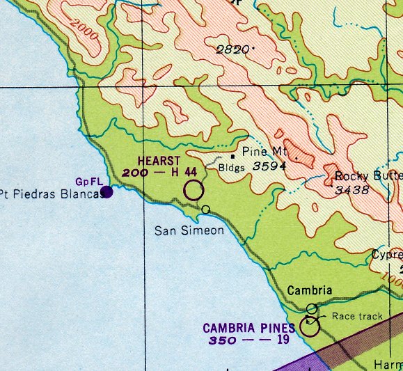
The earliest aeronautical chart depiction which has been located of the 3rd location of the Hearst Airfield was on the August 1948 San Francisco Sectional Chart.
It depicted Hearst as having a 4,400' paved runway.
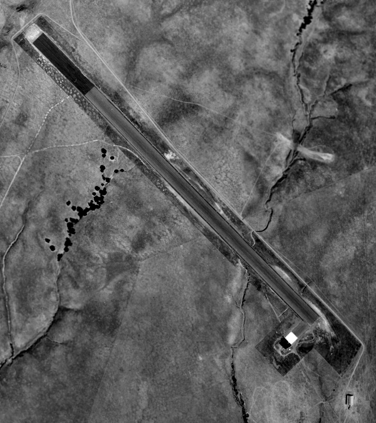
An 8/1/49 aerial photo (from the UCSB Library) depicted the 3rd location of the Hearst Airfield as having an asphalt northwest/southeast runway,
with a hangar on the south side.

The 1958 USGS topo map depicted the 3rd Hearst Airfield (at the northwest corner).
The 1962 AOPA Airport Directory described Hearst as having a 4,400' paved runway.
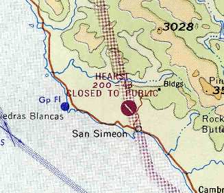
The 1965 San Francisco Sectional Chart (courtesy of Chris Kennedy)
depicted the field as having a single 4,300' paved northwest/southeast runway,
which was labeled as being "Closed to public."
According to a California State Government document,
the Hearst Ranch Airfield may have been used to support the operations of the nearby Cambria Air Force Station
(a radar installation which was operational from 1951 through the mid-1980s).
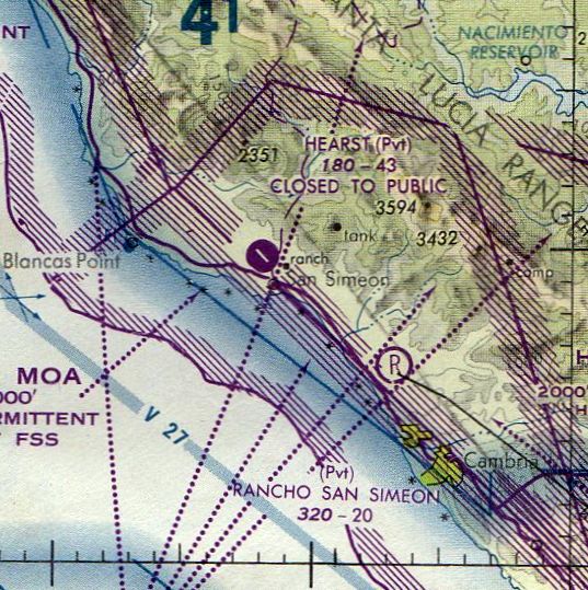
The last aeronautical chart depiction which has been located of the Hearst Airfield
was on the August 1979 LA Sectional Chart (courtesy of Mitchell Hymowitz).
It depicted Hearst as as private airfield having a single 4,300' paved northwest/southeast runway.
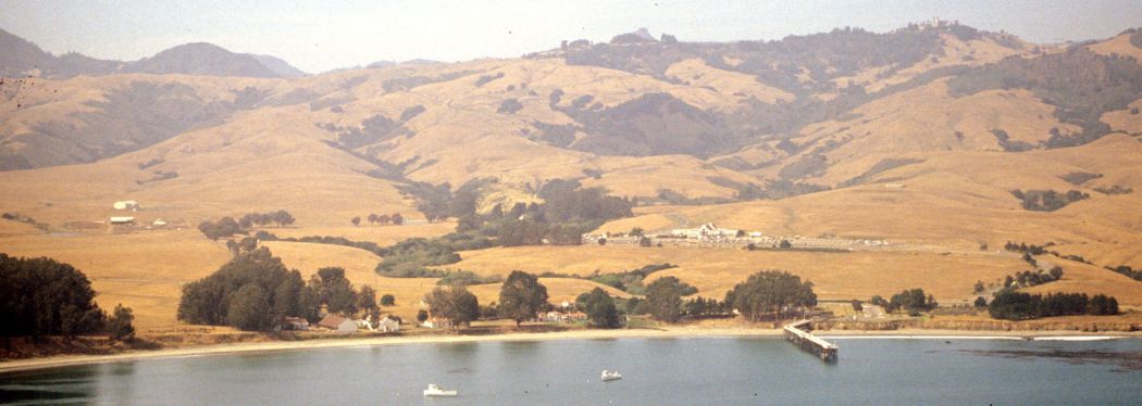
A 1987 aerial photo looking east (courtesy of Dallam Oliver-Lee) of the 3rd location of the Hearst Airfield.

The 1989 USGS topo map depicted the single runway & parking ramp of Hearst Airport.
The 2000 USGS aerial photo depicted the field as consisting of a single 4,400' paved runway,
with a single hangar at the southeast end.
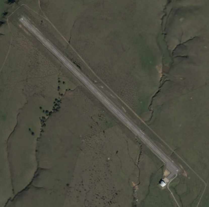
As seen in a 2004 aerial photo, the airfield consisted of a single 4,400' paved runway,
marked with a "P" at each end (indicating it to be private), with a single hangar at the southeast end.
Today, the airstrip is still used by the Hearst Corporation & family but is not open to public air traffic.
Small propeller & jet aircraft are the norm.
However, the largest aircraft to land at the airstrip was a 727 owned by Malcolm Forbes
that visited over a 4th of July weekend several years ago.
Local commercial pilots have flown charters in & out of the airfield,
even though the LA Sectional depicts it as an abandoned airfield,
and it is not listed at all among active airfields in the Airport Facilities Directory.
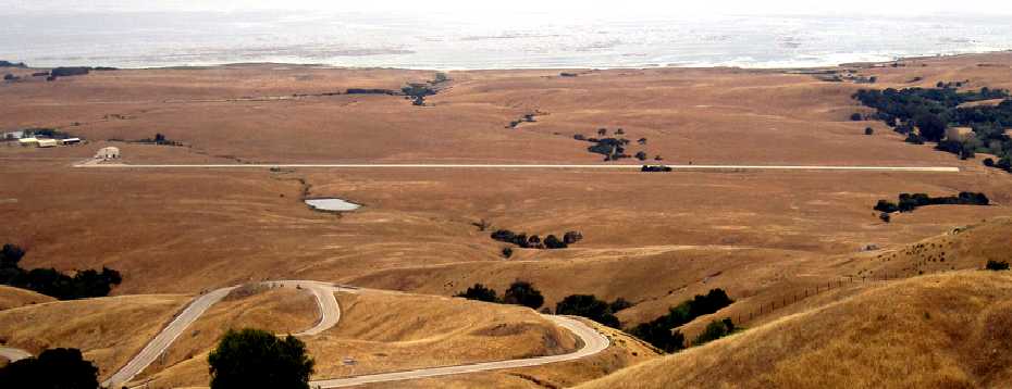
A 6/15/09 photo looking southwest at the Hearst Airfield.
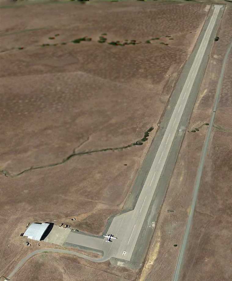
A 9/17/13 aerial view looking northwest at a Beech King Air on the Hearst Airfield ramp.
This is the only photo which has been located showing an aircraft at the Hearst Airfield,
showing that it continues to be used, in spite of not appearing in the 2013 FAA Airport/Facility Directory data.
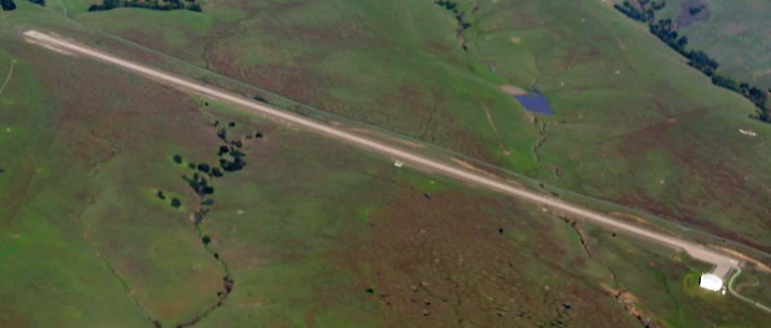
A 12/27/14 aerial view by Dallam Oliver-Lee looking northeast at the Hearst Castle Airfield.
Thanks to Mike Perry & Christopher Baker for information about Hearst Airfield.
See also: http://www.hearstcastle.org/history/airport.shtml
____________________________________________________
Jolon Airfield / Hearst Hacienda Airfield / Hunter Liggett Airfield, Jolon, CA
36, -121.23 (Northwest of Los Angeles, CA)
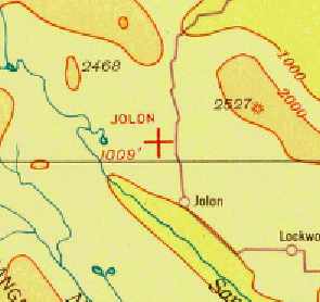
Jolon Airfield, as depicted on the 1935 San Francisco Airway Map.
According to the Fort Hunter Liggett website, William Randolph Hearst's Milpitas Ranch (also known as “The Hacienda”) was constructed in Jolon in 1929/30.
Ground travel was tedious between Hearst’s nearby Castle at San Simeon & his new Hacienda,
so a landing strip was built down slope & slightly to the left of the Hacienda, from which Hearst could fly between his 2 properties.
Hearst often flew a Stinson Tri-motor & in and out of the Hacienda airstrip.
According to “Hearst’s Dream” by Taylor Coffman, “While the Jolon airstrip was primarily for ranch operations at Milpitas,
Hearst is known to have flown guests back to La Cuesta Encantada from Jolon on occasion after riding to Milpitas for picnics.
One time, Hearst flew to Jolon during the renovations of the San Simeon airstrip in the early 1930s.”
The earliest depiction which has been located of the Jolon Airfield was on the 1935 San Francisco Airway Map.
It depicted Jolon as an auxiliary airfield.
The 1936 Federal Airport Information Manual described the Hearst Jolon Airfield as an auxiliary airfield,
located 2 miles southeast of Hearst’s Hacienda.
The runway was listed as being 2,500' adobe & sod, with aviation fuel on-site.
On 12/12/40, the Hearst era at Jolon ended when the 158,000-acre ranch was sold to the government.
In 1941 the property was used to establish the Hunter Liggett Military Reservation.
Hearst’s Hacienda airfield was no longer depicted at all on the December 1941 San Francisco Sectional Chart (according to Chris Kennedy),
the 1948 San Francisco Sectional Chart (according to Jonathan Westerling),
or the February 1949 San Francisco Sectional Chart (according to Chris Kennedy).
The Army later resurfaced Hearst’s airfield for its own use.
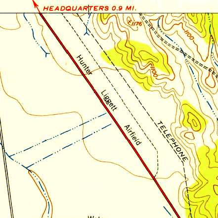
The earliest topo map depiction which has been located of Hunter Liggett Airfield was on the 1949 USGS topo map,
which depicted a single unpaved northwest/southeast runway.
No buildings were depicted at the airfield.
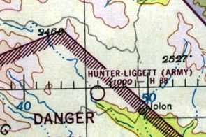
“Hunter-Liggett (Army)” heliport was listed on the 1951 San Francisco Sectional (courtesy of Jonathan Westerling)
as having a 3,800' hard-surface runway.

The earliest photo which has been located of the Hunter Liggett Airfield was an 8/24/56 USDA aerial view (from the USCB Library, courtesy of Jonathan Westerling).
It depicted a single unpaved northwest/southeast runway, with 1 or 2 light single-engine aircraft parked on the northwest side.
The 1966 San Francisco Sectional Chart (courtesy of John Voss)
depicted “Hunter-Liggett AAF” as having a single 3,800' hard-surface northwest/southeast runway.
An 8/30/67 USAF aerial view (courtesy of Dallam Oliver-Lee) depicted Hunter-Liggett as having a single asphalt Runway 13/30.
According to Dale Knutsen, “The Hunter Liggett AAF by the late 1960s had evolved to a 3,700' or 3,800' foot paved strip.
During the late 1960s, Hunter-Liggett AAF was the site of some noteworthy experimental test flights.
The Defense Technology Laboratories division of FMC Corporation, Santa Clara, CA,
made use of the facility on several occasions for test operations associated with experimental devices being developed under USAF contracts.
The test aircraft was a P-51D Mustang (N7722C) that was owned & operated by Robert Bixler of San Jose, CA.
Most of the test operations were at relatively low altitude (sometimes VERY low)
and were conducted a short distance to the west or south of the airfield.
On at least one occasion, the FMC corporate jet, a Sabreliner, used the short strip
to bring in & retrieve an Air Force project officer who was observing the tests.”
Dale continued, “The Army & Lockheed also used the out-of-the-way airfield
to conduct initial flight tests & sound measurement tests of the QT-2 experimental powered glider.
This machine, which evolved into the YO-3A 'Quiet Star',
was intended for nighttime low altitude surveillance operations in Vietnam & was virtually silent in flight.
The Army also conducted parallel experiments at Hunter-Liggett
with highly modified L-19 aircraft that had greatly reduced sound signatures, but not nearly to the level achieved by the YO-3A.
I was working for FMC Corporation at the time & witnessed the above events.”
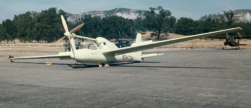
A September 1967 photo by Dale Stith of a Lockheed QT-2 being evaluated at Hunter Liggett.
Dale recalled, “The Experimental Lockheed Quiet Thruster QT-2 N2472W was evaluated at Hunter Liggett Military Reservation in September 1967.
Compared to other 'quietened' aircraft (including the L-19 behind & right of N2472W).
Randomly selected Army observers, stationed at specific location over one acre, were employed as aural/visual detectors.
The observers activated their annunciators if/ when they detected aircraft, flying by at low altitudes.
The quieter aircraft, if heard, were detected only at shorter slant ranges than others. The QT-2 overwhelmed the competition.
YO-3A 69-18009, a follow-on Full-Scale-Development Quiet Aircraft, was also evaluated at HLMR in mid 1969.
See prizecrew.org, quietaircraft.org, and YO-3A.com for more information."
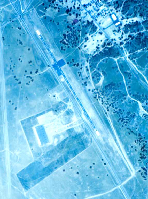
An 8/27/71 USGS aerial view (courtesy of Dallam Oliver-Lee) depicted Hunter-Liggett as having a single asphalt Runway 13/30.
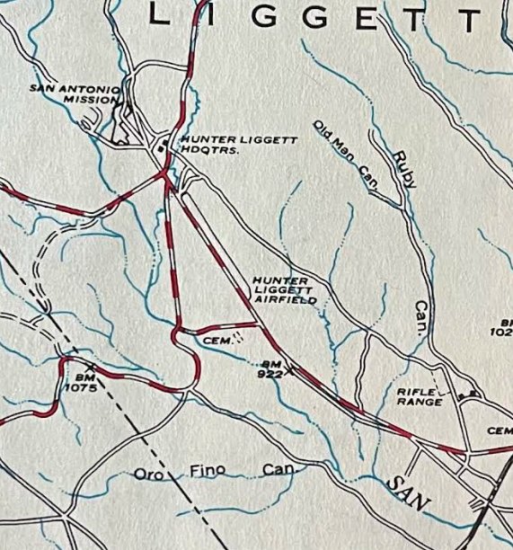
A 1972 National Forrest Service map (courtesy of Kevin Walsh) depicted “Hunter Liggett Airfield” as having a single northwest/southeast runway.
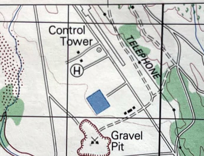
The 1976 USGS topo map (courtesy of Kevin Walsh) depicted Hunter Liggett Airfield as having a single northwest/southeast runway, with a control tower & helipad on the opposite (west) side of the road.
The 1981 World Aeronautical Chart (courtesy of Jonathan Westerling) no longer depicted the Hunter-Liggett Airfield,
but instead depicted the “Hunter-Liggett (AHP)” heliport.
Between 1981-89 the Army constructed 2 new airfield facilities which eventually replaced the former Hearst Airfield:
the Schoonover Airstrip 3 miles to the southeast to support fixed-wing operations,
and the Tusi Army Heliport just across Mission Road from the old Hearst Airfield.
The use of the Hunter-Liggett runway had apparently ended by 1989,
as a 6/14/89 USGS aerial view (courtesy of Dallam Oliver-Lee) depicted several structures as having been built over the northwest end of the Hunter-Liggett runway.
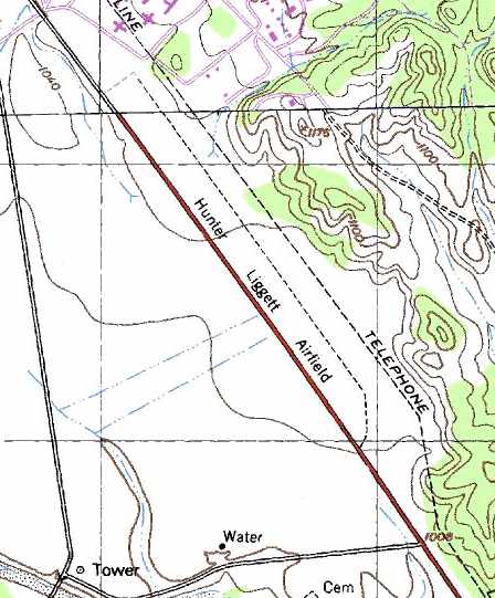
The 1991 USGS topo map (courtesy of Jonathan Westerling)
depicted “Hunter Liggett Airfield” as having a single 4,500' unpaved northwest/southeast runway.
No buildings were depicted at the airfield.
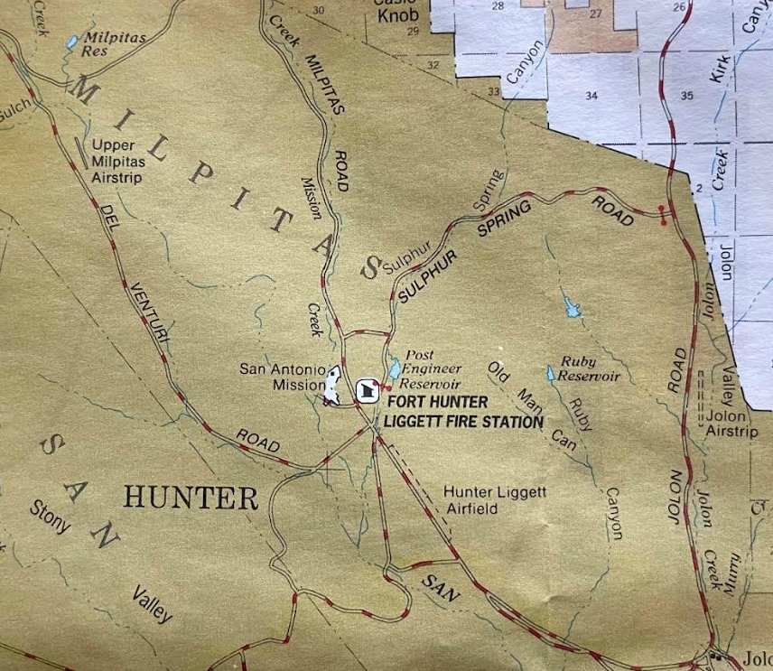
A 1996 National Forrest Service map (courtesy of Kevin Walsh) depicted Hunter Liggett Airfield as having a single northwest/southeast runway.
Note that it also depicted a “Upper Milpitas Airstrip” to the northwest, and a “Jolon Airstrip” to the northeast.
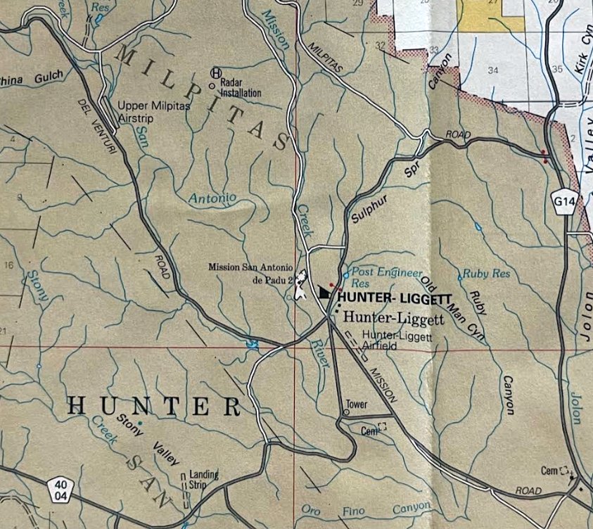
A 2005 National Forrest Service map (courtesy of Kevin Walsh) depicted Hunter Liggett Airfield as having a single northwest/southeast runway.
Note that it also depicted a “Upper Milpitas Airstrip” to the northwest, and an unlabeled airfield with a single unpaved northwest/southeast runway to the southwest in Stony Valley.
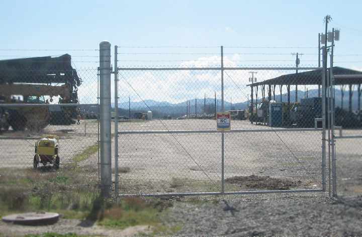
A 2006 photo by Jonathan Westerling, looking south down the old runway at Fort Hunter Liggett.
Jonathan Westerling reported in 2006, “Today the Hacienda is open to the public as a Bed & Breakfast
even though its on the grounds of one of the largest Army training facilities in California.
The old Hacienda Airfield is now fenced off as equipment storage for a large number of Army training vehicles.
It’s plainly viewable just off the access road to the Fort, though the runway markings have faded.”
A 2006 approach procedure for the adjacent Tutsi AHP (courtesy of Dallam Oliver-Lee)
depicted the Hunter-Liggett runway, but marked with closed-runway “X” symbols.
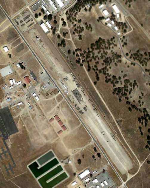
A 9/17/11 aerial photo (courtesy of Dallam Oliver-Lee) showed the remains of the Hearst / Army runway.
The site of the Hacienda Airfield is located east of the intersection of Mission Road & Del Venturi Road.
Thanks to Jonathan Westerling for pointing out this airfield.
____________________________________________________
Schoonover Tactical Airstrip, Jolon, CA
35.96, -121.2 (Northwest of Los Angeles, CA)

A 6/14/89 USGS aerial photo of Schoonover Tactical Airstrip (courtesy of Dallam Oliver-Lee).
This military airfield is located on the grounds of the Army's Fort Hunter Liggett.
The Schoonover Tactical Airstrip was constructed to serve as a replacement for fixed-wing operations
previously conducted at the original Hunter Liggett Army Airfield.
Schoonover Tactical Airstrip was evidently constructed at some point between 1981-89,
as it was not yet depicted at all on the 1987 USGS topo map (courtesy of Jonathan Westerling)
nor on a 8/2/81 USGS aerial photo (courtesy of Dallam Oliver-Lee).
The earliest depiction of the Schoonover airfield which has been located was a 6/14/89 USGS aerial photo (courtesy of Dallam Oliver-Lee).
It depicted the field as consisting of a single 5,000' northeast/southwest runway
with a parking ramp on the north side of the field.
Inexplicably, the Schoonover airfield was not depicted at all on the 1998 World Aeronautical Chart (courtesy of Jonathan Westerling).
A 1/6/03 aerial photo (courtesy of Dallam Oliver-Lee) depicted Schoonover in its original configuration.
A 12/31/04 aerial photo (courtesy of Dallam Oliver-Lee) showed that the Schoonover runway had been somewhat widened.
GlobalSecurity.org described Schoonover Tactical Airstrip in 2005 as capable of handling C-130 & C-12 aircraft.
“Shoonver is 5,000' with a compacted dirt / rock surface.
Refueling operations are available.”
The Fort Hunter Liggett website described Schoonover Tactical Airstrip in 2005
as consisting of a 4,100' tactical assault (compacted dirt/crushed rock) airstrip,
used for training, emergency, and other special takeoff & landing operations.
“It can also accommodate rotary-wing aircraft. It is primarily used for C-130 assault operations.
Crash, fire and rescue assets (FHL Fire Department) are available.”
Strangely, as of 2005 the Schoonover airfield was not listed at all as an active airfield in the FAA Airport/Facility Directory data.
However, the Airport/Facility Directory data for Hunter Liggett's Tusi Army Heliport
included the following remarks about Schoonover: “Tactical forward airstrip (Schoonover LZ)
available for C-130 & OV-10 military fixed-wing aircraft only. Fuel unavailable at Schoonover LZ.”

A 2006 panoramic photo by Jonathan Westerling “of the Schoonover Tactical Airstrip taken from the northwestern end of the field.
The airstrip extends along the the far side of the clearing.
Just this side of it is the parking area. A steamroller sits idly along one edge of the taxiway.”
According to John Miller “Schoonover Tactical Airstrip was expanded in 2006 to to be used by C-17s.”
He reported that this panoramic photo was taken when the airfield upgrades were almost finished.
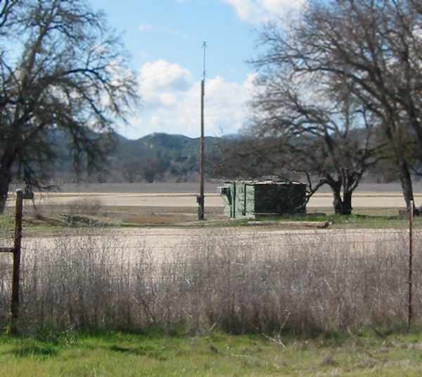
A 2006 photo by Jonathan Westerling “of the equipment at Schoonover consisting of an air conditioned metal trailer & antenna pole.”
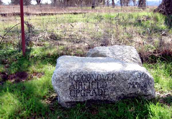
A 2006 photo by Jonathan Westerling.
“The only signage for the Schoonover airstrip is this small hand-painted rock by the gated dirt road to the airstrip.”
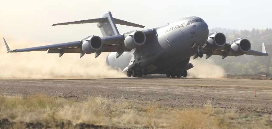
A C-17 Globemaster III takes off from Schoonover Tactical Airstrip on 9/23/06 (photo by Bobbi Zapka, courtesy of John Miller).
The C-17 was performing takeoff & landing testing on semi-prepared runways.
The 1st of 4 test phases was conducted at Schoonover Tactical Airstrip
to validate the ability of the aircraft to bring a large force into a wet or dry dirt airfield without making runway condition corrections.
A 7/29/07 aerial photo (courtesy of Dallam Oliver-Lee) showed that the Schoonover runway had been lengthened & widened compared to the 2004 photo.
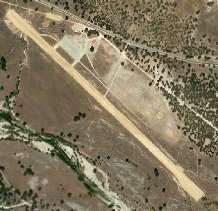
A 9/17/11 aerial view (courtesy of Dallam Oliver-Lee) of Schoonover Tactical Airstrip.
Schoonover Airstrip was not depicted at all on the 2012 USGS topo map.
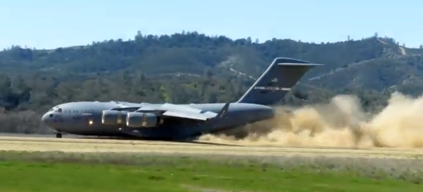
An image from a 3/18/19 US Army video by Cynthia McIntyre of a Boeing C-17 Globemaster III from Travis AFB's 21st Airlift Squadron landing at Schoonover Army Airfield.
The video was captioned, “C-17 Globemaster III & C-130 Hercules aircraft from several installations across the country gave Schoonover Army Airfield a workout the week of 3/18/19.
Schoonover's dirt airfield is one of only a few in the country that allows Air Force & Marine pilots to keep up their flight certifications for landing & taking off from the dirt airstrip.
A ground crew inspects the runway after each turnaround & keeps the pilots apprised of wind speed & direction.”
The Schoonover Tactical Airstrip is located southwest of the intersection of Mission Road & Jolon Road.
Thanks to Jonathan Westerling for pointing out this airfield.
____________________________________________________
35.97, -121.18 (Northwest of Los Angeles, CA)
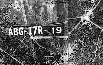
“Alamo Airstrip”, as depicted on an 8/24/56 USDA aerial photo (courtesy of Dallam Oliver-Lee).
This former airfield is currently located on the grounds of the Army's Fort Hunter Liggett,
adjacent to the west side of the tiny town of Jolon.
According to Jonathan Westerling, “The history behind this little airstrip remains shrouded in mystery
much like the city of Jolon itself which was a bustling gold rush town back in the 1920’s.
The entire town burned down at the beginning of the Great Depression.”
It is not known if this airfield was originally established as a military or civilian airfield.
The earliest depiction of the field which has been located was on an 8/24/56 USDA aerial photo (courtesy of Dallam Oliver-Lee).
It depicted a single unpaved east/west runway.
No airfield at this location was depicted on the 1974 USGS topo map.
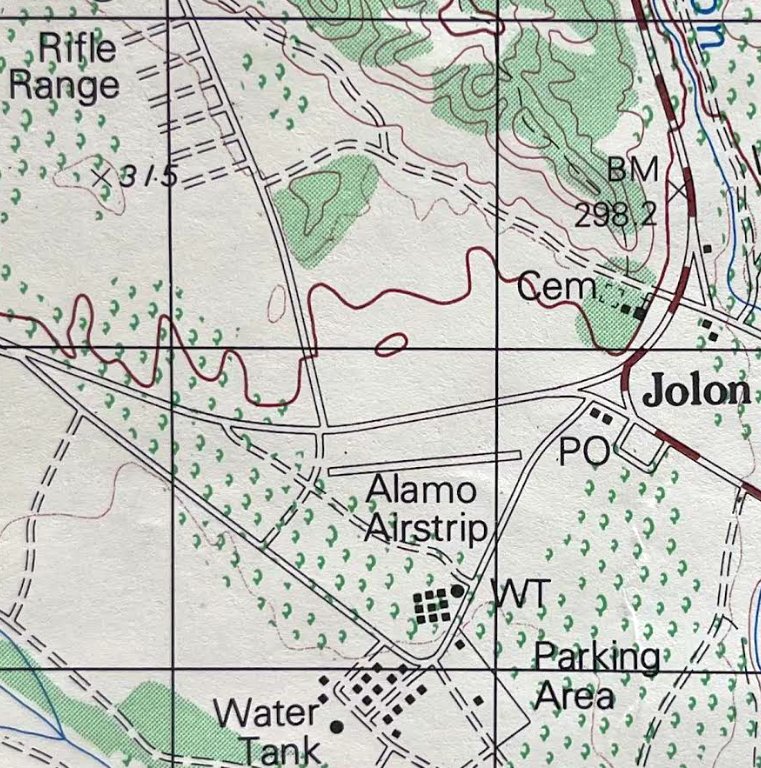
The earliest map depiction which has been located of the Alamo Airstrip was on the 1976 USGS topo map (courtesy of Kevin Walsh).
It depicted a single east/west paved runway.
No airfield was depicted at this location on the 1976 or 1981 LA Sectional Charts (according to Chris Kennedy).
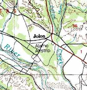
The 1987 USGS topo map depicted Alamo Airstrip as a single 1,800' east/west runway.
No airfield at this location was depicted on the 1989 LA Sectional Chart (according to Chris Kennedy) or the 1991 USGS topo map (courtesy of Jonathan Westerling).
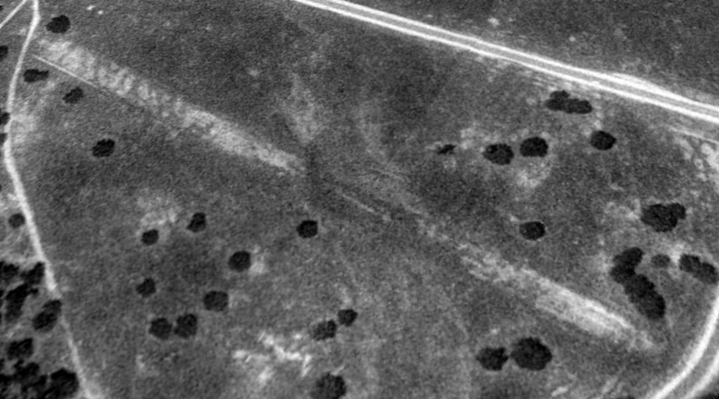
A 1994 aerial view looking northwest showed the remains of the Alamo Airstrip to consist of a single east/west strip.
No airfield at this location was listed as of 2005 in the FAA Airport/Facility Directory data.
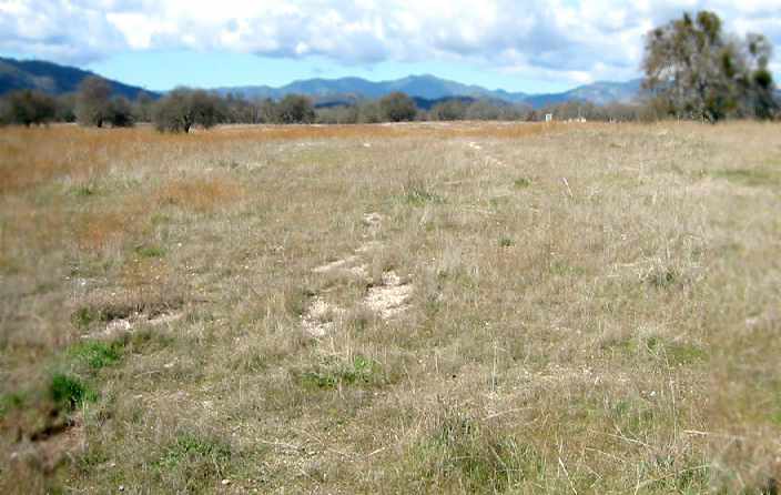
A 2006 photo by Jonathan Westerling, looking west along the remains of the Alamo Airstrip.
Jonathan reported, “The airstrip consisted of white gravel laid along a clearing in the oak trees which surround the site.”
Jonathan Westerling reported in 2006, “It is unlikely the strip dates back that far [the 1930s] since little vegetation has sprung up on the runway.
There is an extensive camping & hunting operation just inside the gate of Fort Hunter Liggett. Perhaps the strip was installed as part of that facility?”
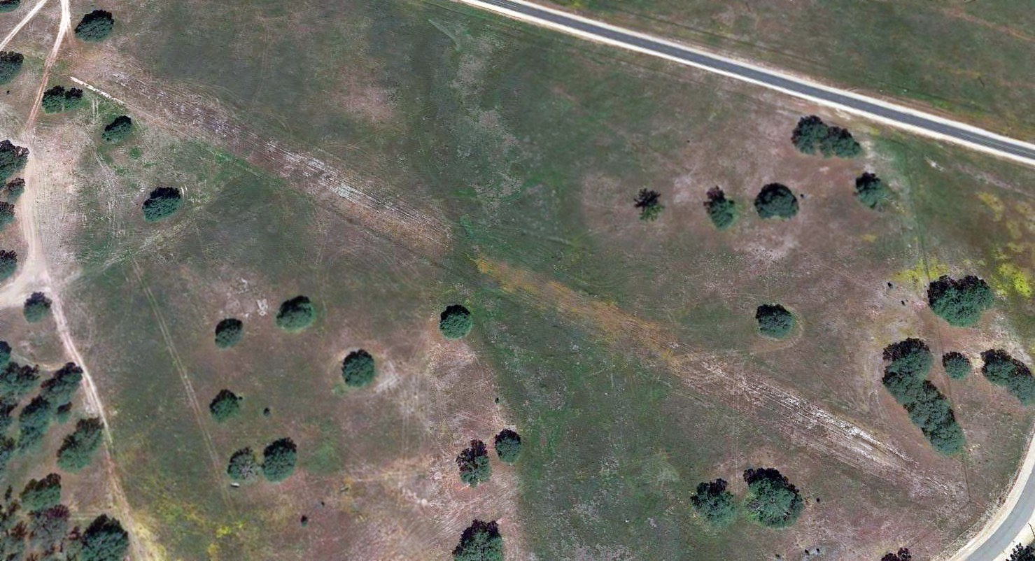
A 2015 aerial view looking northwest showed the remains of the Alamo Airstrip to consist of a single 1,800' east/west runway, which appeared to have been paved at some point.
There were no signs of any buildings at the field, nor any other indication of recent aviation usage.
The Alamo Airstrip is located southwest of the intersection of Mission Road & Jolon Road.
Thanks to Jonathan Westerling for pointing out this airfield.
____________________________________________________
____________________________________________________
This site covers airfields in all 50 states.