
Abandoned & Little-Known Airfields:
California: Northeastern San Bernardino County
© 2002, © 2026 by Paul Freeman. Revised 4/2/26.
This site covers airfields in all 50 states: Click here for the site's main menu.
For a 10th year, the CA pages of this website are sponsored by the California Pilots Association:
____________________________________________________
Please consider a financial contribution to support the continued growth & operation of this site.
Baker Intermediate Field (revised 10/17/19) - Camp Ibis Army Airfield (revised 4/2/26) - Kelso Airfield (revised 4/2/26) - Rasor Airfield (added 9/29/24) - Silver Lake Intermediate Field (revised 9/10/23)
____________________________________________________
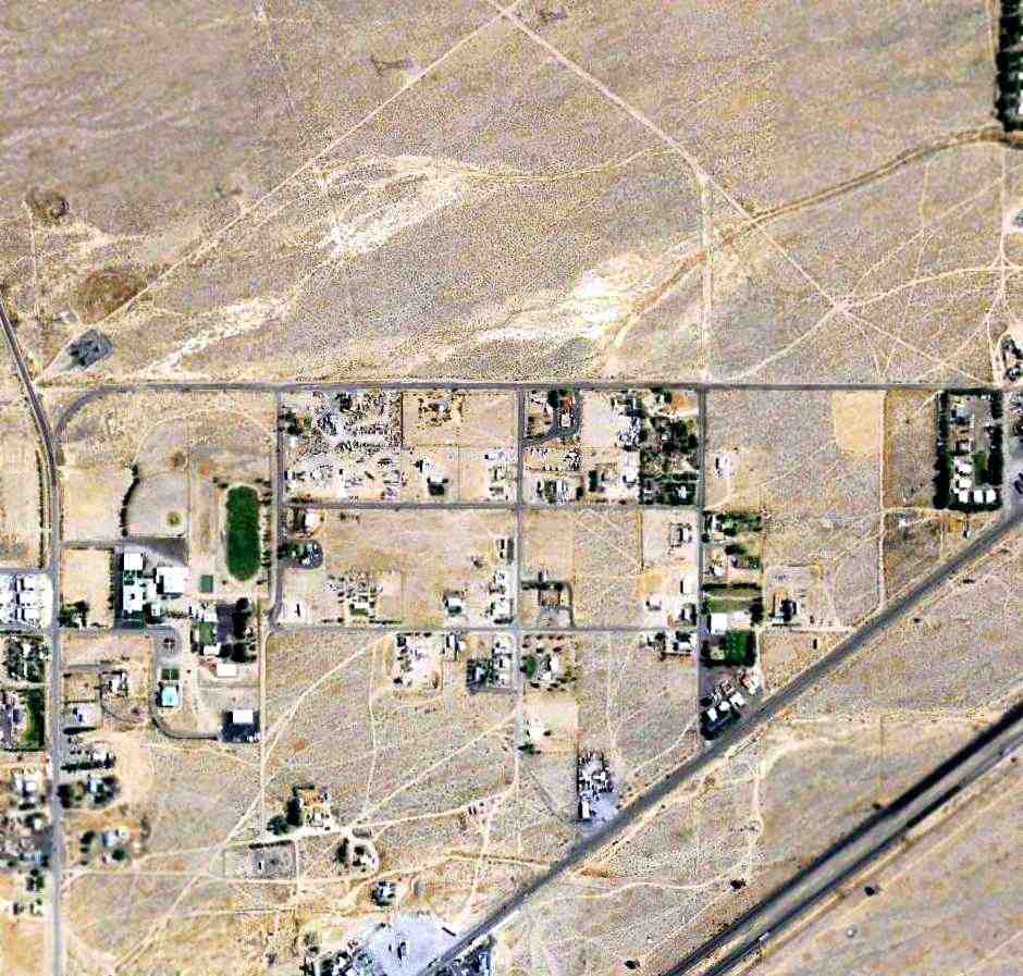
35.131, -116.21 (Northeast of Los Angeles, CA)

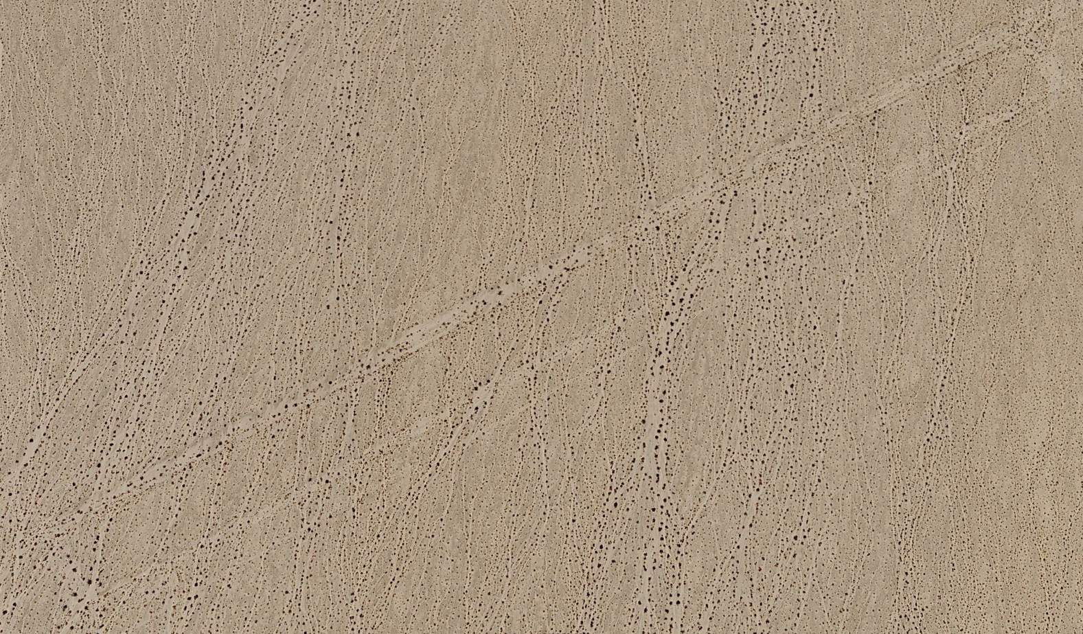
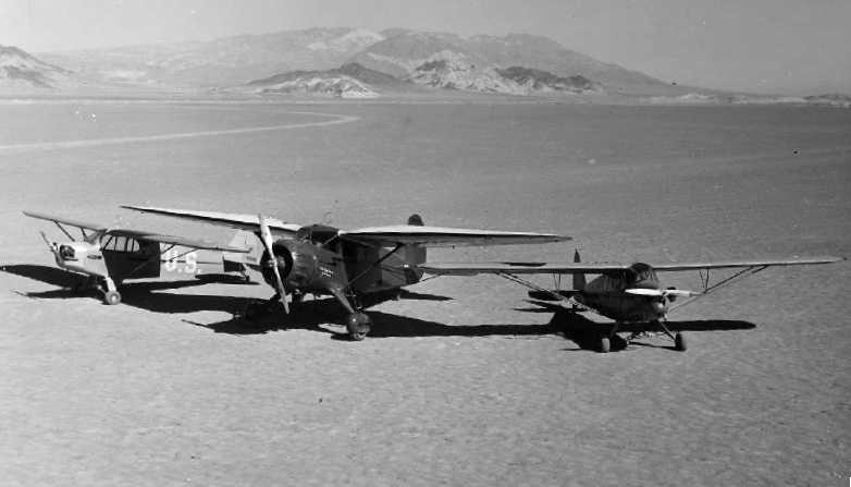
A 1994 aerial view looking southeast depicted the Rasor Arifield as having a single northeast/southwest unpaved runway & 1 light single-engine plane.
This rural desert airfield was was not yet depicted on a 1983 aerial photo or the 1983 USGS topo map.
Chuck Heald recalled, “Rasor Airfield was constructed in the mid-1980s by the Rasor gas station owner Terry Young
after sitting around listening to me & my flying friends talking about our exploits out at Junior Penfold's cabin 8 miles away on the Mojave Road.
Terry & his brothers wanted to learn to fly & purchased a Piper Cherokee 140 & hired an instructor & constructed the airstrip behind the gas station.
The only runway at that time was parallel to the freeway. The east end was 50-75' higher than the west end. I flew into this strip many times in my Cessna 206 & in a friend's Bellanca Decathlon.
I gave the brothers' instructor an aerobatic ride from this strip after he told the brothers we were likely exaggerating our exploits. I had been a competitive aerobatic pilot when younger.
That instructor was inverted going down the runway shortly after liftoff. Good times.”
The earliest depiction which has been located of this airfield was a 1995 aerial photo, which showed a northeast/southwest unpaved runway next to a gas station on the side of Interstate 75.
One light single-engine plane was parked next to the runway.
No airfield was depicted at this location on the 1998 LA Sectional Chart.
Chuck Heald recalled, “Years later, Terry Young built a Vans RV-6 & asked that I perform the first flight. The first flight was done on the Rasor airstrip.
I lost touch with Terry some time around the early 2000s & believe the Rasor station was sold.”
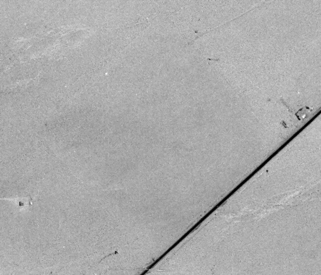
A 2009 aerial photo showed a crosswind unpaved runway was added at some point between 2005-09.

A 2023 photo looking south along the Rasor north/south runway.

A 2023 aerial view looking southeast showed the 2 Rasor Airfield runways to have been oiled, but had numerous trailers stored on them, and did not show any sign of recent aviation use.

A 2024 aerial view looking east along the Rasor east/west runway showed 3 tanks placed in-line at the end of the runway, presumably to preclude landings, one of which was painted “Rocket Fuel”.

The 2024 LA Sectional Chart depicted the Rasor Airfield as “Unverified”.
As of 2024, the FAA did not list any airfield registered at this location.
Thanks to John Acosta for pointing out this airfield.
____________________________________________________
Camp Ibis Army Airfield, Ibis, CA
34.97, -114.84 (Northeast of Los Angeles, CA)
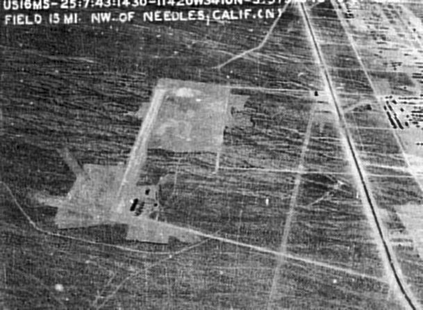
A 1943 aerial view looking north at the Camp Ibis AAF (courtesy San Bernardino County Library, via Rick Jackson).
Camp Ibis was established in 1942, as one of 10 major Army training camps in the desert
which were constructed to train the forces of General George Patton, as part of the 12 million acre Desert Training Center.
The airfield at Camp Ibis was built adjacent to the west side of the camp.
According to Keith Wood, the Camp Ibis Airfield was built by the orders of General Patton (who was himself a pilot),
who was experimenting with the use of liaison aircraft to coordinate armored forces & motorized infantry.
The Camp Ibis Airfield was not depicted at all on LA Sectional Charts from 1942/44/45/46.
The date of construction the Camp Ibis airfield has not been determined.
The earliest depiction which has been located of the Camp Ibis Airfield was a 1943 aerial view looking north (courtesy San Bernardino County Library, via Rick Jackson).
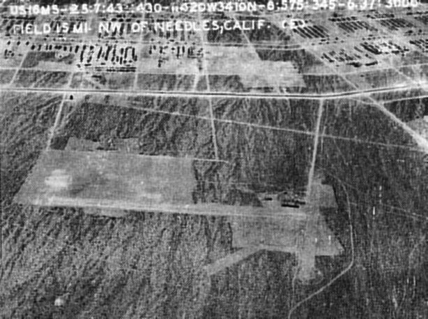
A 1943 aerial view looking east at the Camp Ibis AAF (courtesy San Bernardino County Library, via Rick Jackson).
The Army Corps of Engineers history of Camp Ibis included no mention of its airfield.
The Desert Training Center was renamed the California Arizona Maneuver Area in 1943, and was declared surplus in 1944.
The Camp Ibis airfield depicted on a 4/2/53 USGS aerial view as a single unpaved north/south runway.
The Camp Ibis airfield was not depicted at all on the 1956 or 1961 USGS topo maps.
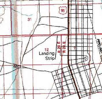
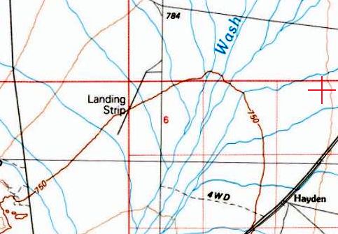
The Camp Ibis airfield depicted on the 1980 USGS topo map as a single 4,500' north/south runway, generically labeled “Landing Strip”.
The Camp Ibis airfield was not depicted at all on the 1984 USGS topo map.
A historical plaque commemorating Camp Ibis was installed on 5/1/87.
Esther Miller visited Camp Ibis in 1997 & reported, "Most of Camp Ibis is on the east side of 95 but the airstrip was on the west side, parallel to the highway.
It's another of those unpaved runways, with only slightly fewer plants than the surrounding area."
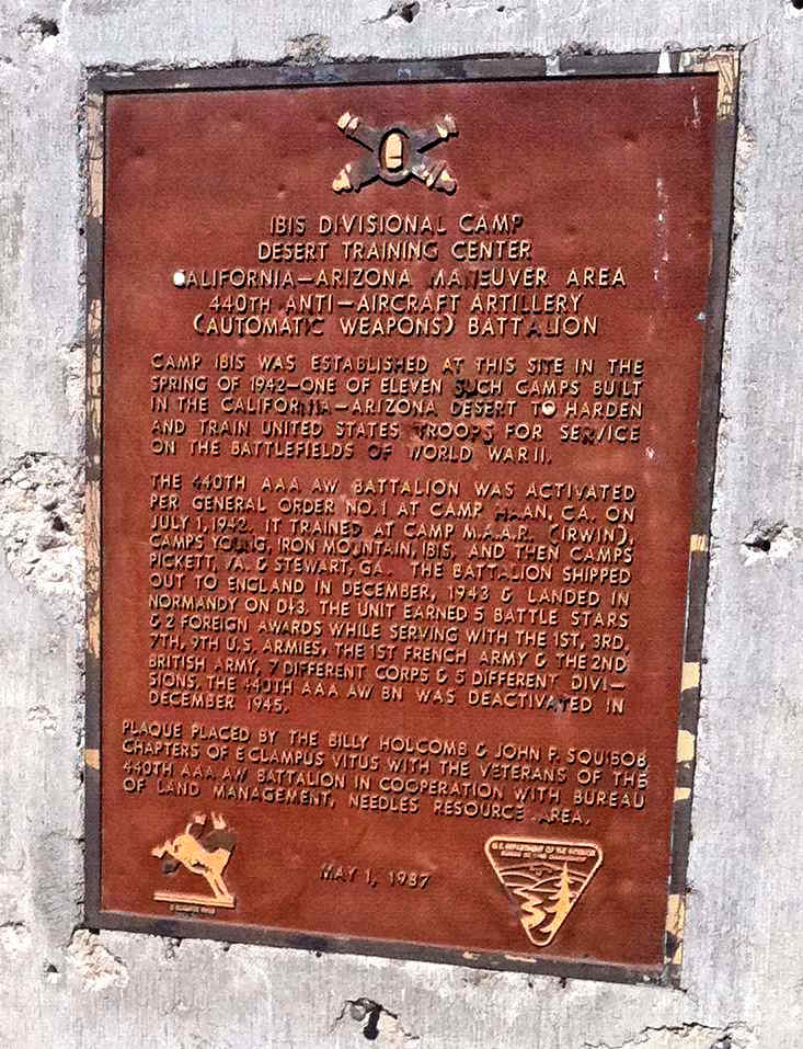
A 2011 photo of a historical plaque erected on 5/1/87 commemorating Camp Ibis.
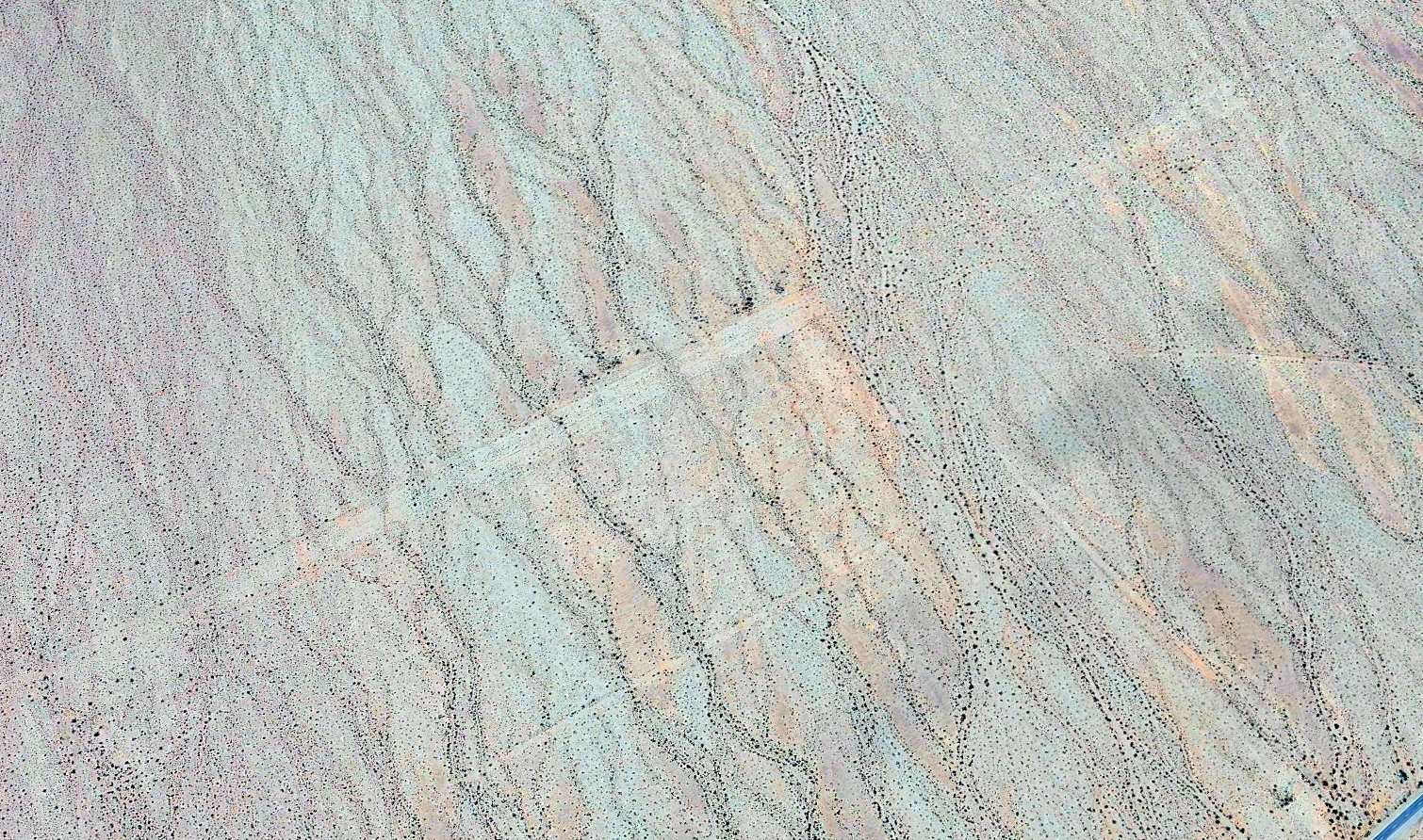
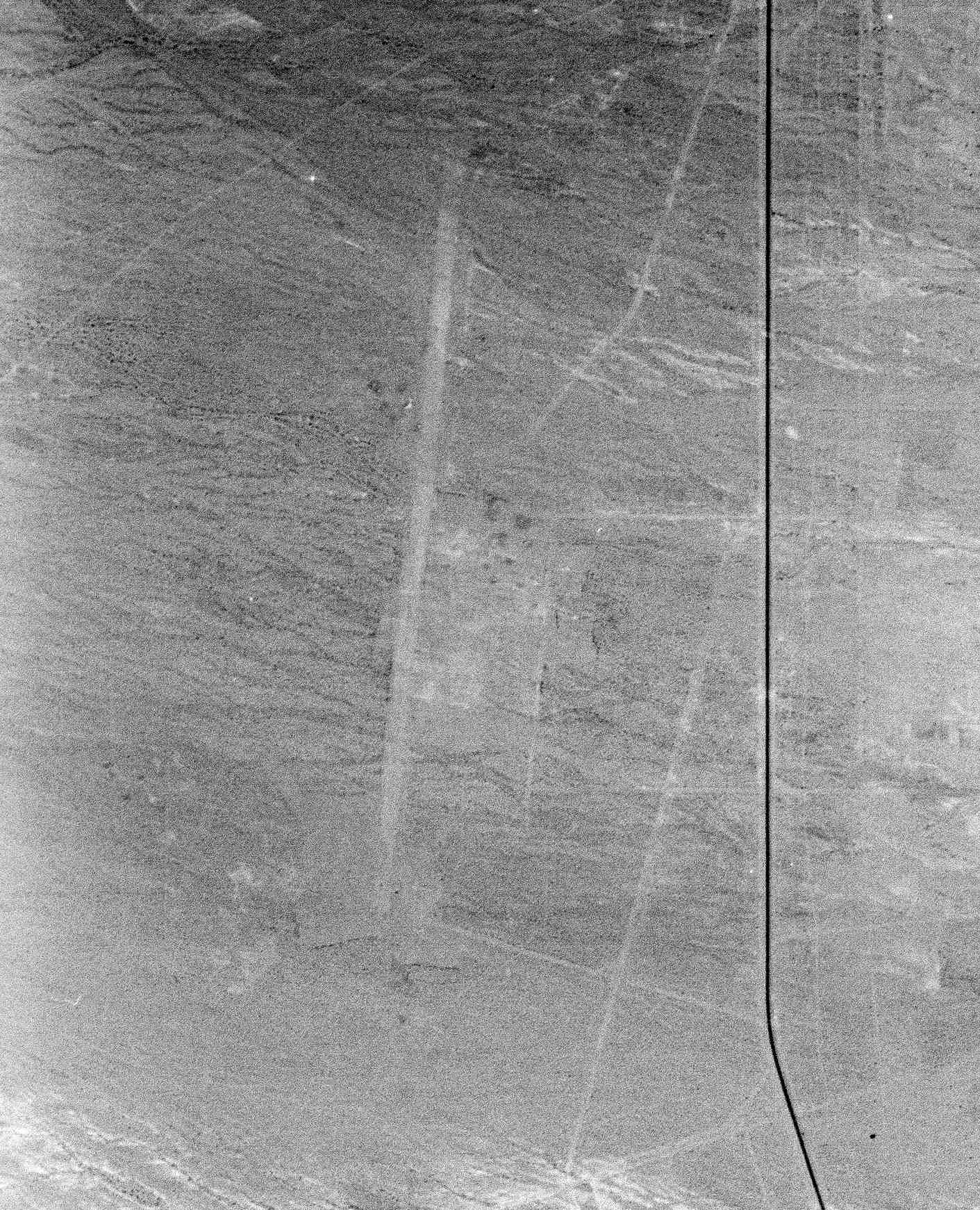
A 2025 aerial view looking northwest showed the Camp Ibis runway remained barely recognizable.
The Camp Ibis Airfield site is located along the west side of Route 95, 2 miles north of Arrowhead Junction.
See also: "The Desert Training Center/CA-AZ Maneuver Area, 1942-44" by Matt Bischoff
____________________________________________________
35.07, -115.64 (Southwest of Las Vegas, NV)
A 6/16/78 USGS aerial view of the Kelso Airfield.
The specific name of this airfield is unknown.
According to Francis Blake, this airfield was one of 4 landing fields which “were constructed by Army and/or Air Force units for the 1964 'Desert Strike' war games.
The 'games' pitted troops & Air Force in AZ against same in CA, and lasted only a couple months.
The other 3 [airfields] are in Ivanpah Valley to the NE.”
There is no indication that the 4 Desert Strike airfields were ever reused after the 1964 exercise.
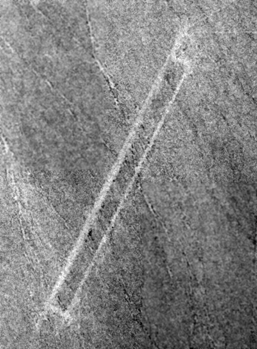
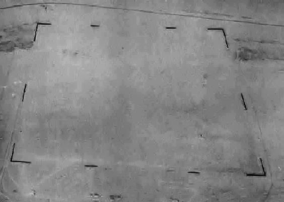
The earliest depiction which has been located of the Kelso Airfield was a 6/16/78 USGS aerial view.
It depicted a single unpaved northwest/southeast runway, with no indication of any buildings or other improvements.
the 1985 USGS topo map depicted a single northeast/southwest runway at Kelso, labeled simply as “Landing Strip”.
Francis Blake reported in 2014, “I visited 2 of the [Desert Strike] fields several years ago to make sure they were 1964 vintage & yes, I found enough artifacts to prove that.
The runways were made with a crude mix of local desert gravel & asphalt.”
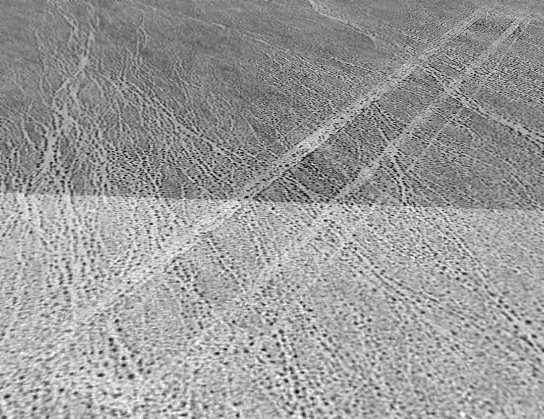
A 10/1/95 USGS aerial view looking north showed the Kelso runway outline remained recognizable.
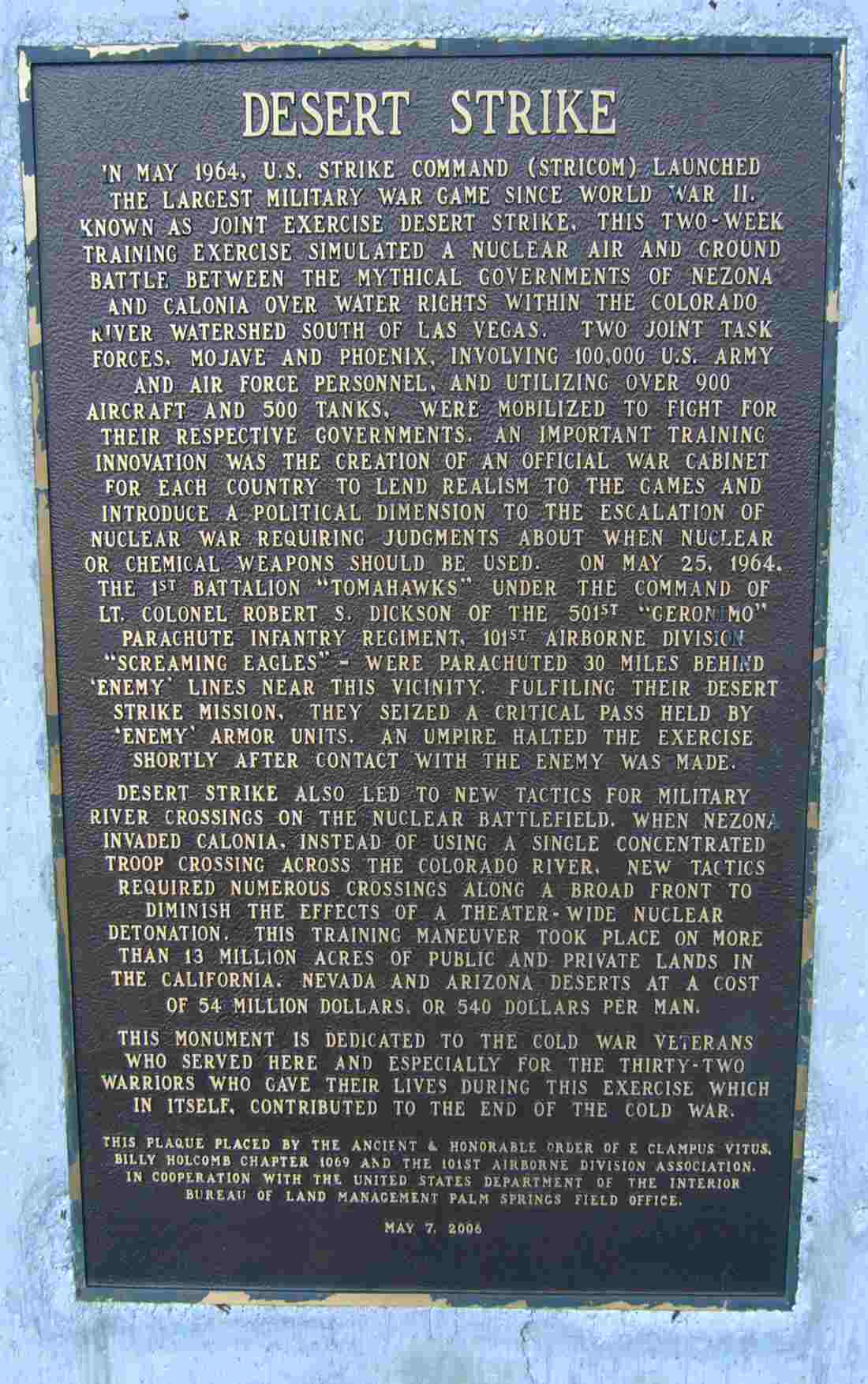
A 2011 photo of a 5/7/06 historical plaque commemorating Joint Exercise Desert Strike.
A 2023 aerial view looking northwest showed the Kelso runway outline remained recognizable.
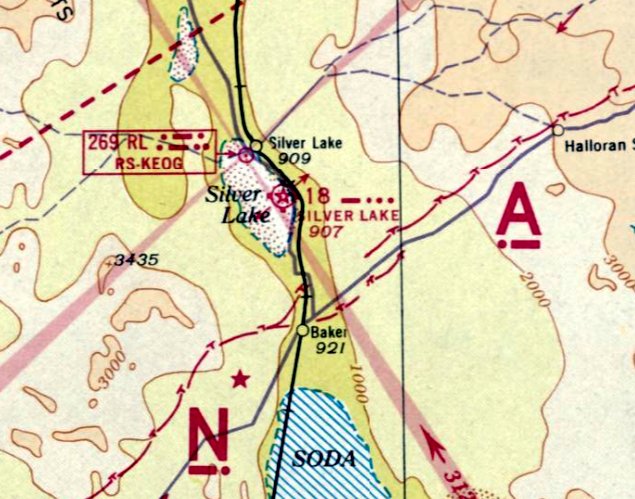
The Kelso Airfield is located north of the intersection of Kelbaker Road & Kelso Cima Road.
Thanks to Francis Blake for pointing out this airfield.
____________________________________________________
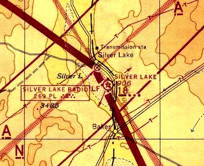
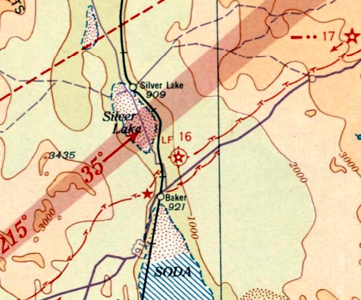
Silver Lake Intermediate Field, Silver Lake, CA
35.35, -116.09 (Southwest of Las Vegas, NV)
Silver Lake Intermediate Field, as depicted on the November 1939 LA Sectional Chart.
The earliest dated indication of construction at the eventual site of Silver Lake Intermediate Field appears to be the footers of a tower at the site,
which as of a 2005 visit by Keith Wood appear to still bear the date of “3-23-36”.
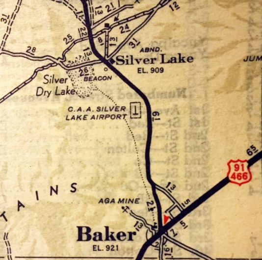
The Silver Lake Intermediate Field was apparently established to replace the Baker Intermediate Field (less than a mile to the southeast).
The date of construction of the Silver Lake Intermediate Field has not been determined,
but it appears to have been established at some point between 1938-39,
nor listed among active airfields in the 1934 Department of Commerce Airfield Directory (courtesy of Chris Kennedy)
nor depicted on the December 1938 LA Sectional Chart.
The earliest depiction which has been located of Silver Lake Intermediate Field was on the November 1939 LA Sectional Chart,
which depicted it as a commercial/municipal airport, with Commerce Department Airway Beacon #18.
Lee Nelson recalled, “Silver Lake... It was a very lively place in 1942.
Silver Lake was an intermediate emergency field between major airports on the national airways system
in the 1930s & 1940s which was marked by hundreds of Low Frequency Ranges.
It had no runway but was a 4,000' square marked out on the dry lakebed by edge lights on all 4 sides.
The road from Baker came up the east side & at the northeast corner at the entrance along the north side
was the CAA Operations building seen now as a swimming pool that was strictly for CAA personnel who manned it 24/7.
On top it had the usual rotating white aircraft beacon & also red lights flashing RL in code identifying it as Silver Lake.
They had radio & teletype & took radiosonde observations & sent hourly weather reports.
Transports checked in as they passed ovehead & I could file flight plans by stopping in or by radio. There was no control tower.
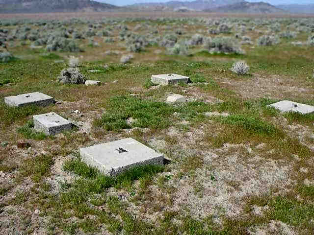
[The] concrete blocks not far from the field [were] the footings for the 5 steel radio antenna towers of the Adcock Low Frequency Range.
It broadcast the code 'A' & 'N' audio signals that marked the airway & also a code RL for Silver Lake.”
Lee continued, “When flying was shut down on the coast [Silver Lake] was the closest airport to the busy LA area
and the FBOs who had contracts for the government's college Civilian Pilot Training program had to scramble
so many formed a flight line along the west side of the field & staked out their planes there & used large trailers as offices.
Nick Lentini brought his Cubs from El Monte, one operators had several Meyers metal biplanes, and Pancho Barnes moved in,
but the largest & only one who built a hangar was United Flying Schools from Vail Field
who brought Pipers & Porterfields & other small planes, Waco UPF-7s & other biplanes, and a Stinson Reliant that was the largest plane on the field.”
Lee continued, “I worked for Hank Coffin at Vail & had a contract to graduate a CPT class
in cross country navigation, range orientation, airways flying, and night flying in the Stinson so moved out to Baker in January 1942.
I had all the ratings so also taught aerobatics in the Wacos, instructed private students who came out to continue their lessons,
ran flight checks on pilots who applied to join the Canadian Air Forces & whatever else came along.
The earliest depiction of the Silver Lake Airfield which has been located
was a 1942 photo (by Lee Nelson) of 2 Cubs & a Stinson Reliant on the Silver Lake lakebed airfield.
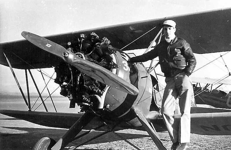
A 1942 photo of Lee Nelson in front of a Waco at Silver Lake.
Lee Nelson recalled, “I left [Silver Lake] in September to join Pan Am
for whom I flew everything from the China Clipper M-130 flying boat to Boeing 747s all over the world for 35 years.”
According to Lane Leonard, “Right after Pearl Harbor when aviation was cut off from the west coast
a flight training school existed at Baker & probably moved up to Silver Lake.
My father who was working at Lockheed needed to travel there every weekend to get his Instrument Rating.
Many of the Cal Aero Instructors went there to acquire their instrument training.”
“CAA Silver Lake Airport”, as depicted on a 1943 map (courtesy of Kevin Walsh).
A 7/25/43 aerial view looking east from the 1945 AAF Airfield Directory (courtesy of Scott Murdock, enhanced by Bill Grasha)
depicted Silver Lake Intermediate Field as a square unpaved area.
According to the "Guide to 50 Interesting & Mysterious Sites in the Mojave, Volume 2" by William Mann (via Francis Blake),
Silver Lake was used during WW2 as a training airfield for the Civil Air Patrol.
Due to security restrictions during the war,
private aircraft could not be flown within 100 miles of the coast,
so aircraft of the CAP came to Silver Lake to conduct training flights.
The dry lake was used as an airfield,
and the aircraft would taxi to the buildings along the road after each training session.
The book mentions an episode in 1943 or 1944 when a radio message came in to the Silver Lake CAP unit
to clear the field, as an Army basic training squadron were coming in for an emergency landing.
Ten or twelve planes made hasty landings, after which their pilots ran for the latrine.
Apparently the "emergency" was that they had all had something for breakfast that was causing them distress.
The 1944 LA Sectional Chart (courtesy of John Voss) depicted Silver Lake as Intermediate Field 18.
The 1944 US Army/Navy Directory of Airfields (courtesy of Ken Mercer)
described Silver Lake as being "Site 18" along the LA - Salt Lake City Airway, and it listed the runway as being 4,000'.
According to Keith Wood, “Silver Lake was about as close as civil planes could fly to the coast
during much of the war without having a sortie number.
That meant that most training which would have been done closer to LA had to be done there.
The nearest neighbors were in Baker, 5 miles away, so a pool was about all the diversion they could manage.”
The 1945 AAF Airfield Directory (courtesy of Scott Murdock) described Silver Lake Intermediate Field
as a 367 acre square property within which was a 4,000' square sand landing area.
The field was said to have 6 wooden hangars, the largest being a 125' x 30' structure.
Silver Lake described as being owned by the U.S. Government & operated by the Civil Aeronautics Administration.
After WW2 some of the Civil Air Patrol buildings were relocated to Baker, where they reportedly still stand.
According to John Hazlet, the 1946 Los Angeles Sectional Chart depicted Silver Lake Airport
as a CAA Intermediate Field with Airway Beacon 17 at the airport, on the east edge of Silver Lake dry lake.
The 1949 Los Angeles Sectional Chart (according to Chris Kennedy)
depicted "Silver Lake (CAA)" as having a 4,000' unpaved runway.
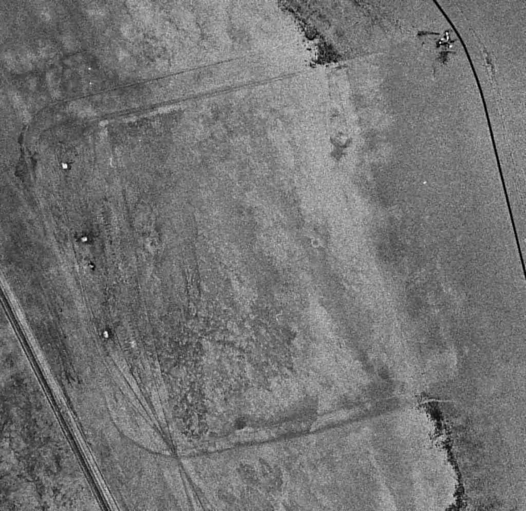
A 7/2/53 USGS aerial photo (enhanced by Bill Grasha) showed the square landing area of Silver Lake Airport still remained recognizable.
What might have been several small buildings were depicted at the northeast corner of the airfield area, along the west side of the road.
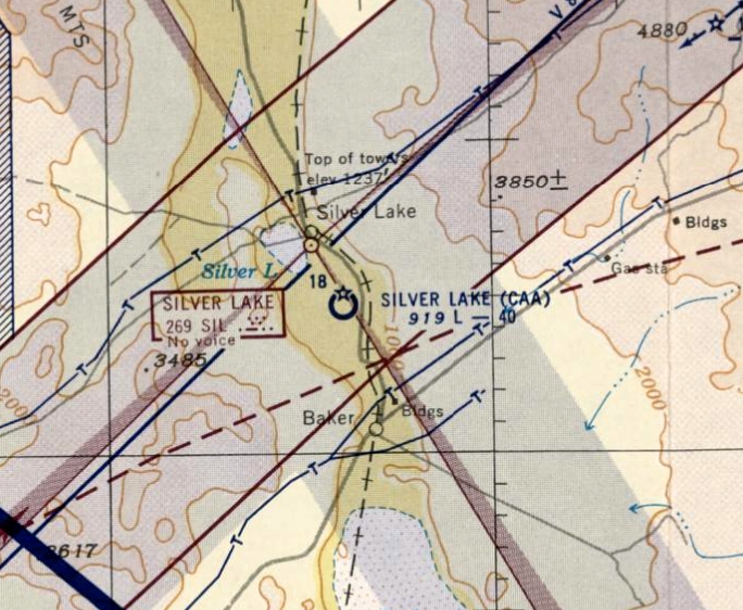
The last aeronautical chart depiction which has been located of the Silver Lake Airfield was on the September 1953 LA Sectional Chart.
It depicted “Silver Lake (CAA)” as having a 4,000' unpaved runway.
According to Francis Blake, “The 1930s office/homes of the managers of Silver Lake Airfield were moved to Baker in the 1950s.”
Silver Lake was apparently abandoned at some point between 1953-54,
as it was not depicted at all on the March 1954 LA Sectional Chart.
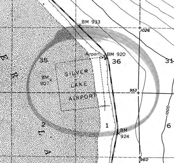
The 1956 USGS topo map (courtesy of Francis Blake) depicted "Silver Lake Airport" as being a square area, measuring 3,800' per side.
What might have been several small buildings were depicted at the northeast corner of the airfield area,
along the west side of the road.
In the 5/22/94 USGS aerial photo, there was no recognizable trace of a former airfield.
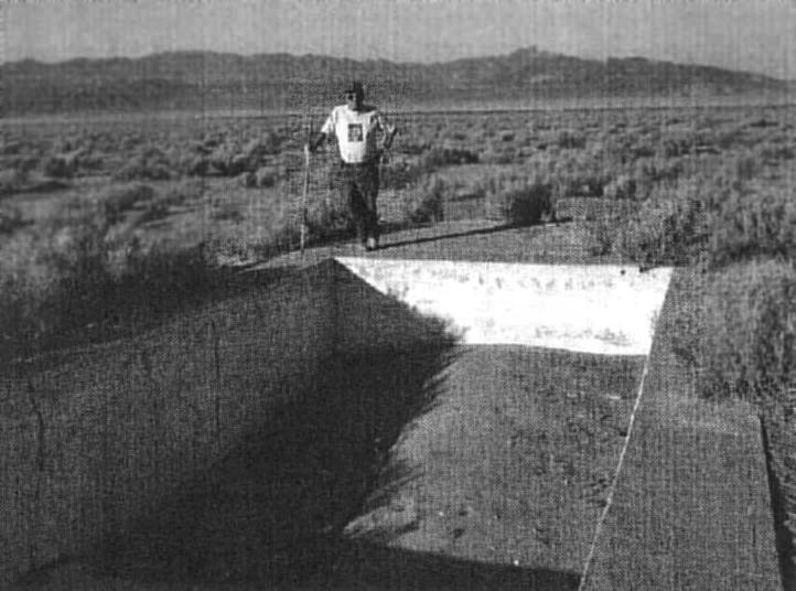
A recent (undated) photo by Ron McKinley (courtesy of Francis Blake, enhanced by Bill Grasha) of Bill Man in front of the remains of the swimming pool at Silver Lake.
How nice that this remote little flight training base was equipped with a swimming pool!
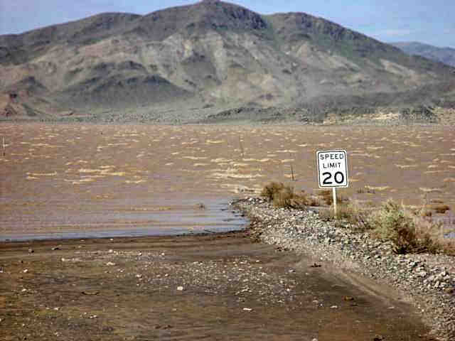
A March 2005 photo by Keith Wood (enhanced by Bill Grasha) of Silver Lake,
which “will give you a pretty good idea why it was abandoned and not much remains.
Notice the whitecaps (browncaps?) in the lake.
This was shot about a mile or so north of the CAP field.”
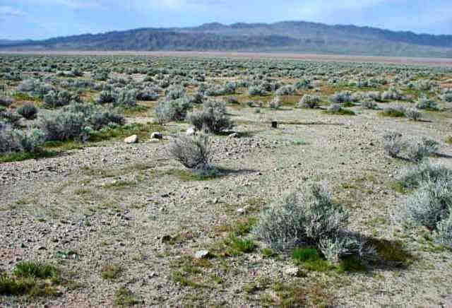
A March 2005 photo by Keith Wood (enhanced by Bill Grasha) of the Silver Lake hangar site.
Keith reported, “No visible remains of the hangar, but the ground shows the wear patterns that go with a hangar, and some of the electrical fuses were found here.”
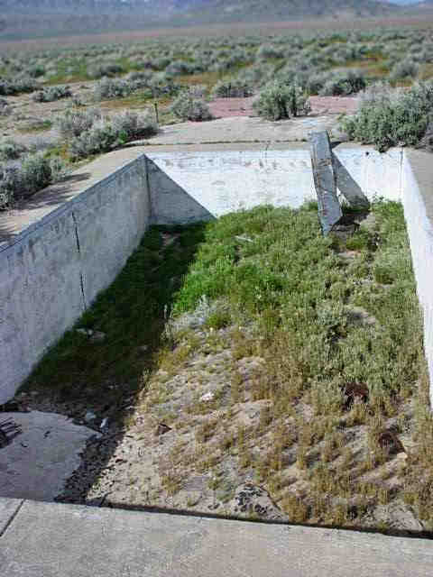
A March 2005 photo by Keith Wood (enhanced by Bill Grasha) of the Silver Lake site, which “shows that the pool is still there. There was a bath house as large as the pool.”
A March 2005 photo by Keith Wood (enhanced by Bill Grasha) of the footings of a tower at Silver Lake.
There was a single electrical conduit (visible in the nearest footing, inside of the angle-iron) which had a single 12ga wire still visible.
Notice the damaged geo marker pylon between the nearest and farthest footings.”
According to Silver Lake pilot Lee Nelson, the concrete blocks were “the footings for the 5 steel radio antenna towers of the Adcock Low Frequency Range.”
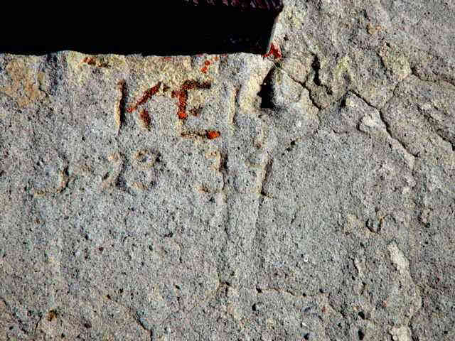
A March 2005 photo by Keith Wood (enhanced by Bill Grasha) at Silver Lake “of a tower footing. The date looks like 3-23-36!
If so, then the field was built before the war, and just adopted later.”
Keith Wood observed in 2005, “The original trash pit is partially uncovered,
and the wind has blown cans & other sheet-metal waste hundreds of yards from the pit in a huge debris field,
while the lack of rain has allowed such thin items as condensed milk cans to survive and be identifiable 60 years later!
It would be interesting to excavate and see what's there.”
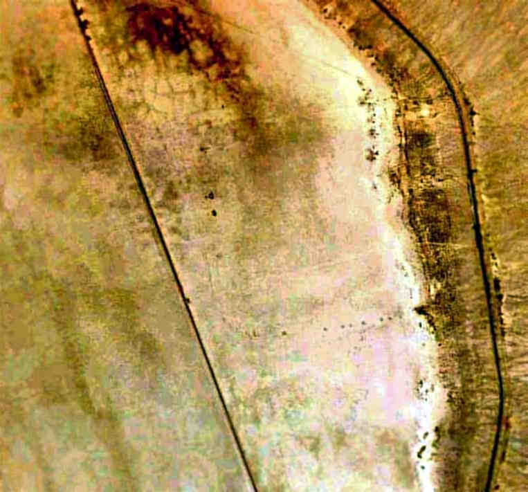
In a 5/24/09 aerial photo (enhanced by Bill Grasha) there was no recognizable trace of Silver Lake Airfield.
____________________________________________________
Baker Intermediate Field, Baker, CA
35.28, -116.06 (Southwest of Las Vegas, NV)
The Baker Intermediate Field, as depicted on the 1929 "Rand McNally Standard Map of CA With Air Trails" (courtesy of Chris Kennedy).
Photo of the airfield while open has not been located.
Baker Intermediate Field was one of the network of airfields
which were established in the 1920s by the Department of Commerce at intermediate points along major airways,
to serve as emergency landing fields for commercial aircraft flying between major cities.
The date of construction of the Baker Intermediate Field has not been determined.
The earliest reference to the field which has been located was in the 1929 Standard Oil Airfield Directory (courtesy of Chris Kennedy).
It described the Baker Intermediate Field as being located 1/2 mile east of the town of Baker,
with a railroad on the west side, and a highway on the south side of the field.
The airfield was said to be owned by the U.S. Department of Commerce.
The airfield was said to consist of a 2,600' x 2,600' sandy surface, with no runways.
The earliest aeronautical chart depiction which has been located of Baker Intermediate Field 16 was on the June 1932 LA Sectional Chart.
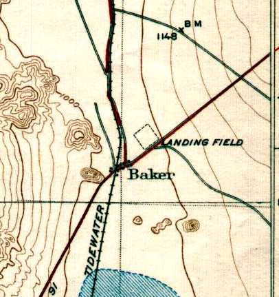
The 1933 USGS topo map (courtesy of Gerald McMillen) depicted the Baker Intermediate Field as a 3,000' square “Landing Field” on the northeast side of the town of Baker.
The Baker Intermediate Field was described in the 1934 Department of Commerce Airfield Directory (courtesy of Chris Kennedy)
as being Site 16 along the Los Angeles - Salt Lake City Airway.
It was said to be located 1 mile northeast of the "city" (a very generous description!) of Baker.
The airfield was said to consist of a 2,640' x 2,640' sand surface.
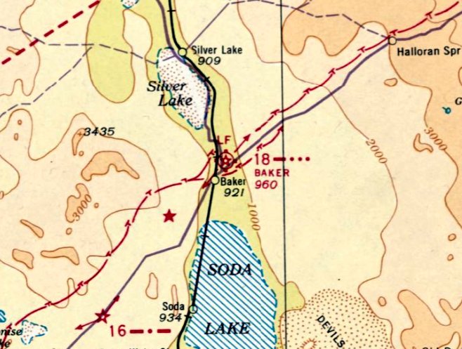
The last aeronautical chart depiction which has been located of Baker Intermediate Field was on the December 1938 LA Sectional Chart, which depicted Baker as Site 18.
Baker Intermediate Field was apparently replaced (for reasons unknown) at some point between 1938-39 by the Silver Lake Intermediate Field (less than a mile to the northwest),
as only the Silver Lake Intermediate Field was depicted on the November 1939 LA Sectional Chart.
Tom Rancadore recalled, “Baker Field in the 1940s... My dad (Sal Rancadore) said he was there training women to fly for cargo runs. He flew a Stearman.”
Baker Intermediate Field was no longer depicted on the 1943 USGS topo map.
A 7/2/53 USGS aerial view of the site of the Baker Intermediate Field (enhanced by Bill Grasha) showed the faintest trace of the diagonal outline of the airfield.
According to Francis Blake, “The 1930s office/homes of the managers of Silver Lake Airfield were moved to Baker in the 1950s.”
A March 5, 2005 aerial view of the site of the Baker Intermediate Field showed no remaining recognizable trace of the Baker airfield,
which had been covered by an expansion of the town of Baker between 1953-2005.
According to Francis Blake, “The 1930s office/homes of the managers of Silver Lake Airfield [moved to Baker]... Up until late 2012, a very old lady lived in the Silver Lake house.
[It] became rundown. If I had had the money, I would bought & moved it, then restored it.
Impossible now because the old lady was placed in a 'home' for her own benefit, and the house was demolished in early 2013 for a big rig parking lot.”
____________________________________________________
____________________________________________________
This site covers airfields in all 50 states.