
Abandoned & Little-Known Airfields:
California, Southwestern Sacramento area
© 2002, © 2025 by Paul Freeman. Revised 6/10/25.
This site covers airfields in all 50 states: Click here for the site's main menu.
____________________________________________________
Please consider a financial contribution to support the continued growth & operation of this site.
For a 9th year, the CA pages of this website are sponsored by the California Pilots Association:

Antioch Airport (revised 8/12/17) - Brennan Airpark / Fairfield Suisun Air Park (revised 9/10/23) - Davis Airport / State Forestry Airport (revised 12/24/18)
El Macero Airfield (revised 11/4/24) - Jensen Airport (revised 6/10/25) - (Original) Rio Vista Airport (revised 6/10/25)
Travis Aero Club Airport (revised 12/26/23) - Vaca-Dixon Airport (revised 10/25/23) - Vacaville Airport / Vacaville Gliderport (revised 12/15/23)
____________________________________________________
Brennan Airpark / Fairfield Suisun Air Park, Fairfield, CA
38.25, -122.03 (Southwest of Sacramento, CA)
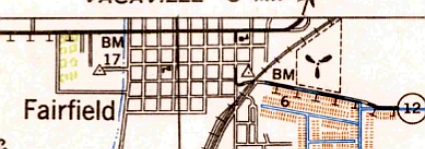
The 1942 USGS topo map depicted the Brennan Airpark as an irregularly-shaped outline with an unlabeled propeller symbol on the east side of Fairfield.
The date of construction of this small general aviation airport has not been determined.
Brennan Airpark was not yet depicted on the September 1942 Sacramento Sectional Chart (courtesy of Ron Plante).
The earliest depiction which has been located of Brennan Airpark was on the 1942 USGS topo map.
It depicted an irregularly-shaped outline with an unlabeled propeller symbol on the east side of Fairfield.
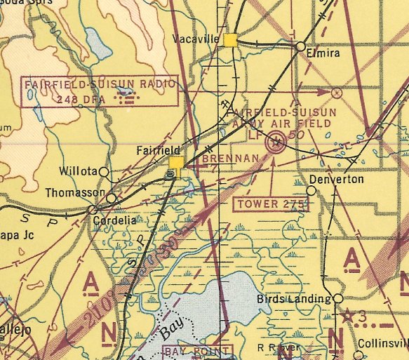
The earliest aeronautical chart depiction which has been located of Brennan Airpark was on the March 1944 Sacramento Sectional Chart (courtesy of Ron Plante).
It Brennan as an auxiliary airfield located adjacent to the east side of the town of Fairfield.
Brennan Airpark was depicted in an unchanged fashion on the December 1944 Sacramento Sectional Chart (courtesy of Ron Plante).
According to the book "Two Hours By Crow" by Howard & Judith Campbell (courtesy of Wings of History),
“In 1945, the Army released civilians to fly again & they stormed into this piece of ground to teach & learn.
The field changed from 'private' to "commercial', the name changed to the 'Airpark', and the two sod runways were cleared off, although the entire field could be used if necessary.”
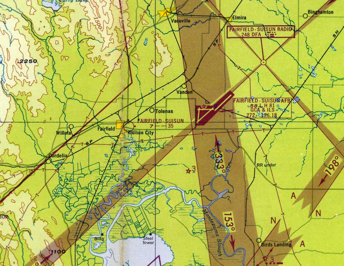
Brennan Airpark was evidently renamed Fairfield Suisun Air Park at some point between 1944-48,
as that is how it was depicted on the February 1948 San Francisco Local Aeronautical Chart (courtesy of Tim Zukas).
It depicted Fairfield-Suisun as having a 3,500' unpaved runway.
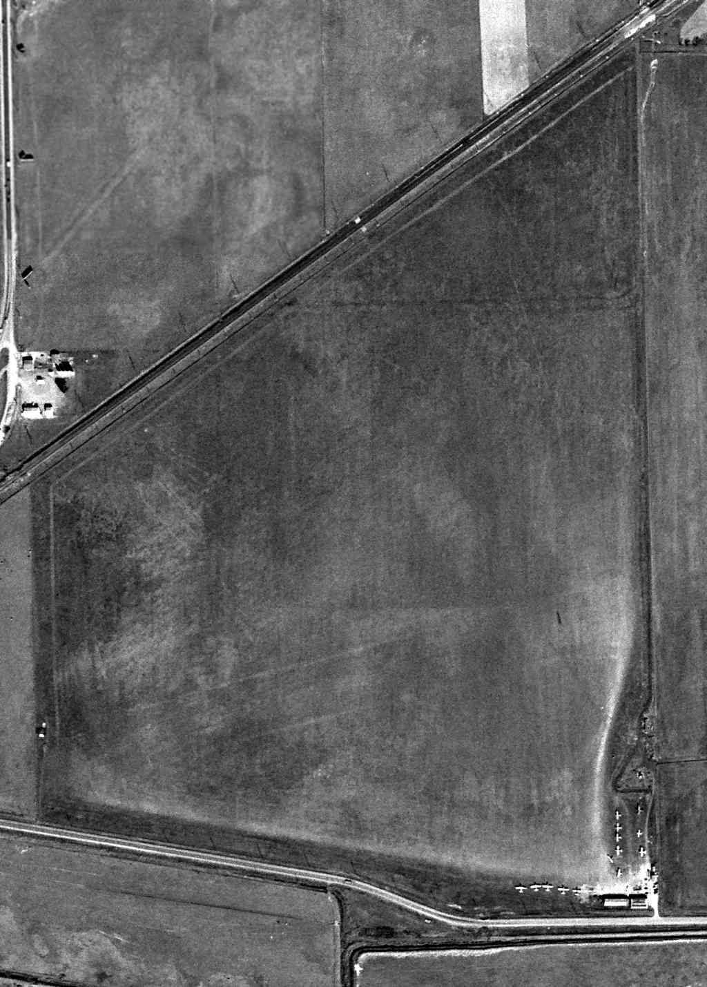
The earliest photo which has been located of the Fairfield Suisun Air Park was a 3/8/48 USGS aerial view.
It depicted Fairfield Suisun as being an irregularly-shaped grass field, with a few small buildings & 14 single-engine aircraft on the southeast corner.
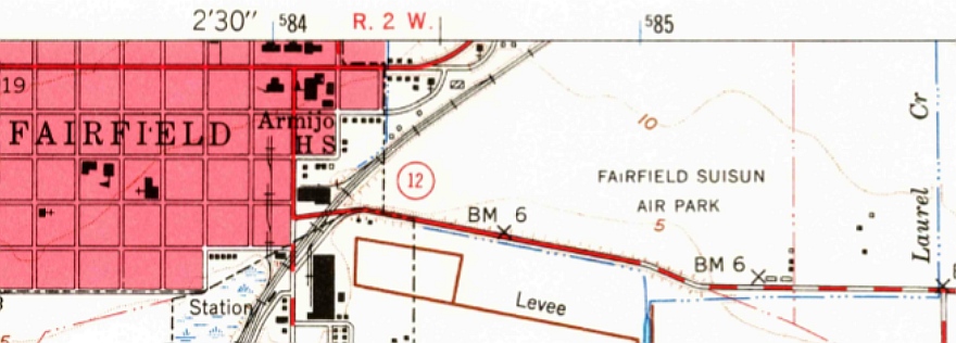
The 1949 USGS topo map depicted Fairfield Suisun Air Park as having a few small buildings on the southeast corner.
According to the book "Two Hours By Crow" by Howard & Judith Campbell (courtesy of Wings of History),
“By 1949 the longest grass strip was 3,500' & a hangar had been built, complete with a shop & an Aircraft & Engine mechanic.
At the same time, 80 & 91 octane fuels were available for regulars as well as transients.
The
field was lighted with the illumination coming on when a pilot
requested by triggering his microphone 5 times.”
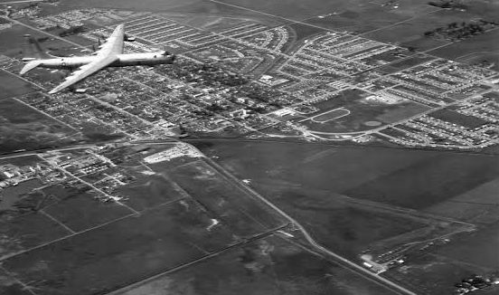
A circa 1950s aerial view by Capt. Donald Stout looking northwest (courtesy of Christopher Latham) showed a massive Air Force RB-36D over Fairfield Suisun at the bottom-right.
Kirby Stevens recalled, “Fairfield Air Park... In the mid-1950s, the airpark was run by A.D. 'Bert' Waite.
He would buy surplus AT-6 & BT-13 airplanes, remove the engines & install them in Stearman biplanes & make them into cropdusters.
I got the front half of BT-13 & had it in my garage. Bert was an A&P inspector for the FAA as well as a pilot.
He had several interesting planes on the field besides the AT-6s & BT-13s.
I remember getting rides in his Cessna T-50, Howard, Ryan PT-19 as well as Taylorcraft & Ercoupes.
The fuselage & wings of the ATs & BTs were just stacked up on the back of the field.”
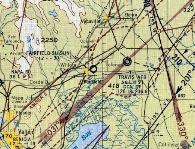
The last aeronautical chart depiction which has been located of Fairfield Suisun Air Park was on the October 1956 Sacramento Sectional Chart,
which depicted it as having a 3,000' unpaved runway.
The last photo which has been located showing aircraft at the Fairfield Suisun Air Park was a 1957 aerial view.
The number of aircraft had dwindled to only two.
Fairfield Suisun Air Park was evidently closed (for reasons unknown) at some point between 1956-57,
as it was no longer depicted on the April 1957 Sacramento Sectional Chart.
According to the book "Two Hours By Crow" by Howard & Judith Campbell (courtesy of Wings of History),
“The Church of God used the hangar for services in 1961.
State Highway 12 was being upgraded to the south, a housing tract & shopping center was building up to the east, and the town was pushing down on the railroad tracks from the north.
By 1965 the field closed & homes swept over the runways. The planes that had been based there had moved on & only memories remain.”
A 1968 aerial view showed the Fairfield Suisun Air Park hangars remained, but residential streets had been constructed over the northwest part of the site.
The 1969 USGS topo map still depicted the Fairfield Suisun Air Park in an unchanged fashion.
The 1980 USGS topo map depicted streets having been constructed over the site of Fairfield Suisun Air Park.
A 1982 aerial photo showed no trace remaining of Fairfield Suisun Air Park, with houses covering the property.
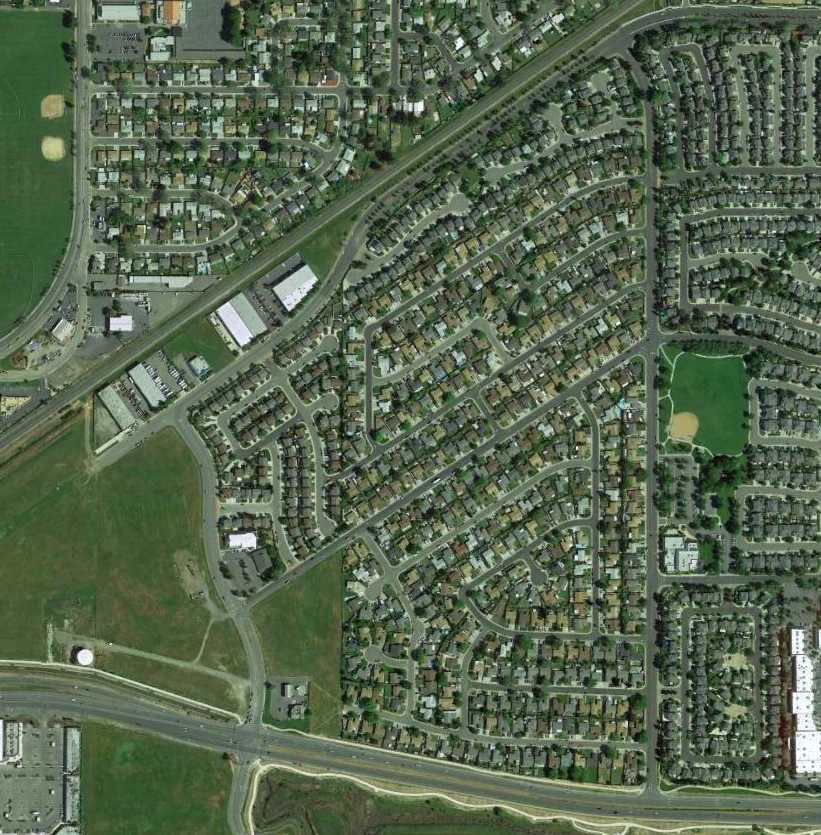
A 4/16/13 aerial photo showed no remaining recognizable trace of Fairfield Suisun Air Park.
The site of Fairfield Suisun Air Park is located northwest of the intersection of Highway 12 & Village Drive.
____________________________________________________
Travis Skypark / Travis Aero Club Airport (8Q0), Fairfield, CA
38.27, -121.972 (Southwest of Sacramento, CA)
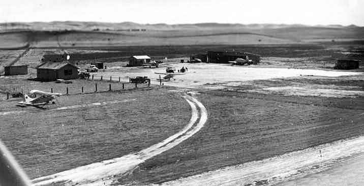
A circa 1955-56 aerial view of the Travis Aero Club Airport.
This little airfield was located on the property of Travis Air Force Base,
yet it was a completely separate & distinct airfield from the primary airfield on the base.
It was created purely for the purposes of the base Flying Club.
The Travis Aero Club Airport was evidently established at some point between 1953-54,
as it was not yet depicted on the 1953 USGS topo map.
According to Christopher Latham (2006 office manager of the Travis Aero Club), “The club opened in December of 1954.”
Wayne Bomar recalled, “My father, Maj. William Bomar, was a C-124 pilot at Travis from 1955-59.
At age 15 I joined the Aero Club while it was still operating out of the Vaca-Dixon airport. Soon after, it moved to Travis.”
The earliest depiction which has been located of the Travis Aero Club Airport was a circa 1955-56 aerial view,
which depicted several light civilian aircraft parked among a few small buildings.
The Travis Aero Club Airport was not yet depicted on the September 1957 Sacramento Sectional Chart.
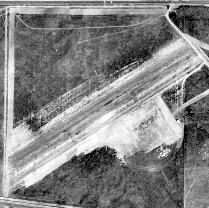
A 1957 aerial view from the Alexandria Digital Library @ UC Santa Barbara (courtesy of Jonathan Westerling) depicted the Travis Aero Club Airfield
as having a northeast/southwest & parallel taxiway, and a ramp with a small building on the south side.
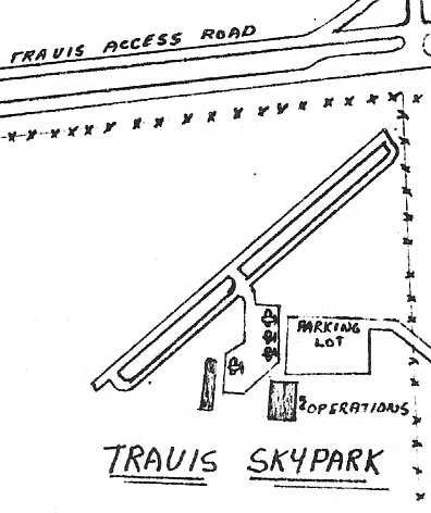
The layout of the Travis Skypark, from a 1957 brochure for the Travis Flying Club (courtesy of Wayne Bomar via Christopher Latham).
It depicted the field as having a single northeast/southwest runway, parallel taxiway, and a ramp & 2 buildings on the southeast side.
The Club was described as having 8 aircraft, including T-34 Mentors on loan from the Air Force.
Wayne Bomar recalled, “I soloed [at the Travis Skypark] in 1957.”
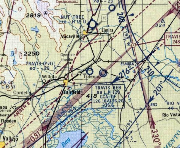
The earliest aeronautical chart depiction of the Travis Aero Club Airport which has been located was on the April 1958 Sacramento Sectional Chart.
It depicted “Travis” as a private airfield having a 2,000' unpaved runway.
Wayne Bomar recalled, “The club acquired a 1928 Consolidated Fleet in 1958.
I soloed & flew it several times - as a student pilot! I got my private license there in 1959.”
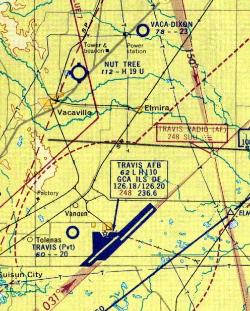
The April 1959 San Francisco Local Aeronautical Chart (courtesy of Paul Columbus) depicted “Travis” as a private airfield having a 2,000' unpaved runway.
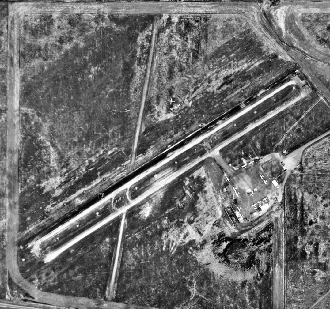
A 1965 aerial view from the Alexandria Digital Library @ UC Santa Barbara (courtesy of Jonathan Westerling)
depicted the Travis Aero Club Airfield as having a paved runway & parallel taxiway, and a crosswind runway had been added at some point between 1957-65.
A ramp on the south side had a dozen light single-engine aircraft & a small building.
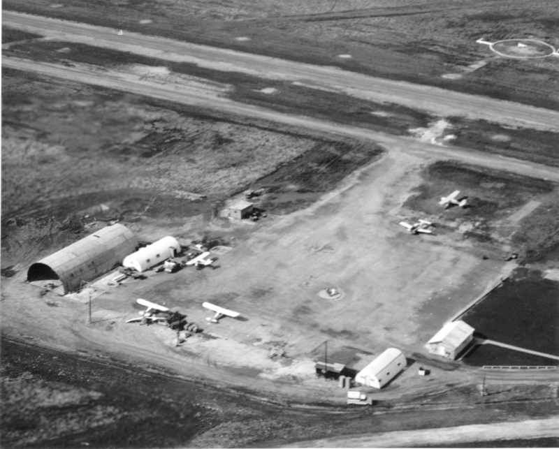
According to Christopher Latham, as of the early 1960s the Travis Aero Club runway was an oil-topped surface.
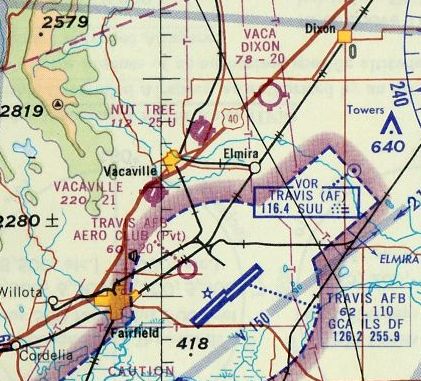
The June 1965 Sacramento Sectional Chart (courtesy of Ron Kunse)
depicted the Travis Aero Club Airport as having a 2,000' unpaved runway.
The Aerodromes table on the 1967 Sacramento Sectional Chart
described the Travis Aero Club Airport as having a single 2,000' turf runway.
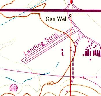
The 1968 USGS topo map depicted the Travis Aero Club Airport as having a single paved northeast/southwest runway with a parallel taxiway,
and a cluster of small buildings on the southeast side.
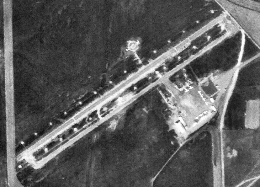
A 4/22/68 USGS aerial view depicted the Travis Aero Club Airfield as having a paved runway, parallel taxiway, and a ramp with 10 light aircraft.
The crosswind runway seen only 3 years before in the 1965 aerial photo appeared to already have been abandoned.
A 1970 aerial view (from the Alexandria Digital Library @ UC Santa Barbara, courtesy of Jonathan Westerling)
showed the field to consist of a single northeast/southwest runway, with a ramp along the south side of the field.
The Travis Aero Club Airport apparently gained a paved runway at some point between 1967-80,
as the 1980 USGS topo map depicted the field as having a single paved northeast/southwest paved runway.
According to Christopher Latham (office manager of the Travis Aero Club), “Our runway was widened in 1995-96 from 35' to 50'.”
Christopher continued, “The club's condition around 2005-2006 was not good.
All the planes were 'tired', engines were timing out, and 60th Services Squadron hardly had any money to fix the airfield, the aircraft, and the clubhouse.
We would have been closed within a year or two if we stayed. We recently paid off the debt on our old runway.”
In its last year of operation (2006), the FAA Airport/Facility Directory data for the Travis Aero Club Airport
described the field as having a 2,000' asphalt Runway 4/22 & a 1,600' turf Runway 16/34.
The field was said to have a total of 21 based aircraft, including 1 multi-engine aircraft, and the manager was listed as Mike Caudell.
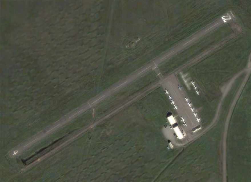
A 2005 aerial view depicted the Travis Aero Club Airport as having a total of 15 light aircraft visible on the field.
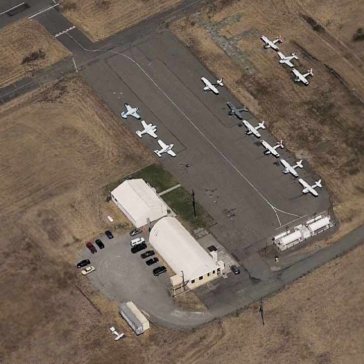
A circa 2001-2006 aerial view looking north at the Travis Aero Club ramp.
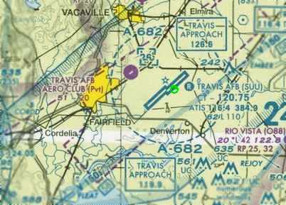
The 2006 Sacramento Sectional Chart depicted the Travis Aero Club Airport as a private field having a single 2,000' paved runway.
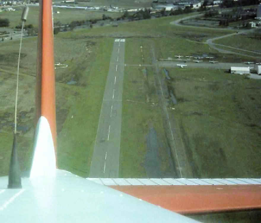
A 2006 aerial view by Christopher Latham, looking northeast after departing the Travis Aero Club Airfield's Runway 22 in a Cessna.
Unfortunately, a September 2006 article described how a decision had been made to “relocate” the aero club “off base”,
thus closing the last airport operated exclusively by an Air Force Aero Club.
The reasons given for closing the Aero Club Airport were “environmental & safety issues”,
particularly the fact that “the aero club resides in the middle of an environmental preserve
which essentially prohibits us from performing maintenance on the runway.”
Funny how a Wal-Mart is never forced to close & be removed from the landscape
because it sits in the middle of land which has been determined to be important for “environmental” reasons.
Yet that kind of logic is perfectly fine to justify closing an operating airport.
Christopher Latham (office manager of the Travis Aero Club) reported in 2006,
“At the time of our closing, Runway 22/4 was 2,000' x 50'. Runway 16/34 was closed. The manager was Joseph Hefferon.”
Christopher continued, “The club itself has relocated to the new Rio Vista Municipal Airport because there was no room at the main base to relocate the aero club.
A former Group commander said he didn't want small general aviation aircraft
flying around between C-5s, KC-10s & the new C-17s that are arriving at Travis.
Out of 26 USAF Aero Clubs, 25 are located on the main runways & we are the only one that cannot relocate (to the main base at Travis).
Travis had no room for us on the ramp. They still don't because today they just turned away a pilot who has a civil landing permit to land on military bases
and told him there was no room for him to park.”
Christopher continued, “Environmental was not the only reason. There was a piece of property on the departure end of [Runway] 22.
An easement was placed on the deed when the property was sold,
that the city of Fairfield put in place, which prohibited any development on that property as long as the Travis Aero Club was still in operation.
In 2003 Forecast Homes (who bought the property) approached us, and asked us, 'What would it take you guys to leave the Aero Club?'
We asked for a certain amount of money, 4 brand new airplanes, hangars
and a club house either at Nut Tree Airport in Vacaville or on the main base at Travis.
Well the Nut Tree Airport manager said he could take us, but we have to share a facility with the local flight school, Blue Ridge Aeronautics
(which we didn't want to because it would have caused a conflict of interest).
Also the Nut Tree Airport manager said he really wants more corporate business to come in, plus there was no room at all on Nut Tree to build.
So we took our business elsewhere.”
Christopher continued, “So Rio Vista took us in with open arms.
They had room in the terminal for our club house, there was room on the ramp for our planes, and there was room for us to build our hangars.
We shut down operations at the Travis Aero Club field on April 15, 2006. I was the last flight out of there that day.
We have been down here at Rio Vista for the last 6 months; we are currently waiting on a lease from the city so we can start building our hangars.
I have a brand new 2006 Piper Archer III & a Cherokee 6XT with air conditioning & the Avidyne Entegra panels.
I have 2 more Archers arriving late this year.
And on top of that, THERE ARE HOUSES ENCROACHING ON THE NEW RIO VISTA AIRPORT!
That's pretty much the last chapter in the Travis Aero Club field.
Travis AFB is currently using the old airfield as a heliport for the hospital across the street.”
A 4/8/07 aerial view still showed the Travis Aero Club Airport runway marked as an active runway, and showed 5 light single-engine aircraft parked on the ramp.
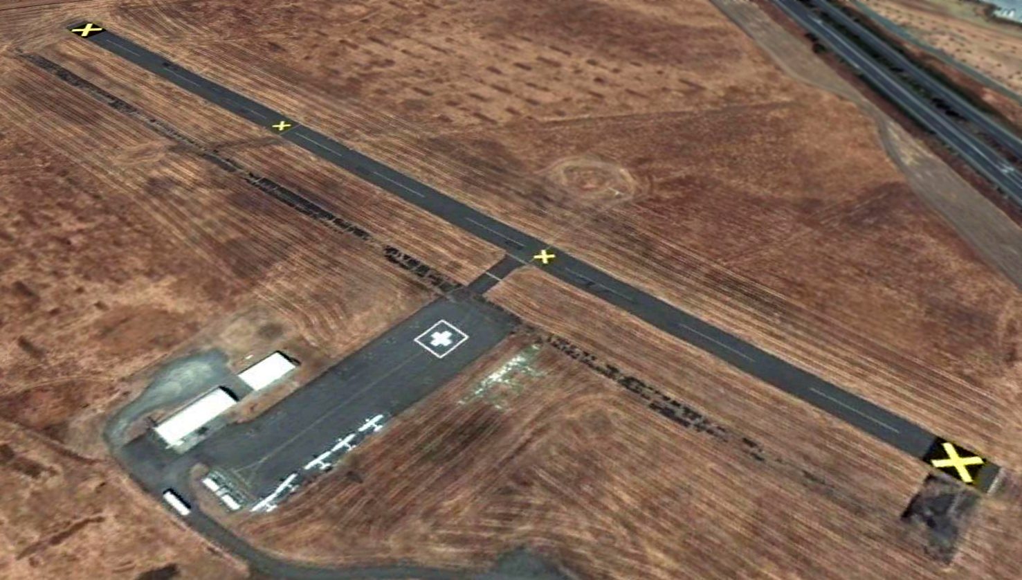
A 6/24/07 aerial view still showed showed 5 light single-engine aircraft parked on the Travis Aero Club Airport ramp,
although closed-runway 'X' symbols had been pained on the runway within the previous 2 months.

An August 2013 photo by Ron Plante looking southwest at the Travis Aero Club Airport.
Ron reported, “All the buildings are gone, only 2 above-ground aviation gasoline tanks remain.
A sign says hospital helipad, authorized personnel only, etc., so I stayed off the ramp & runway.”
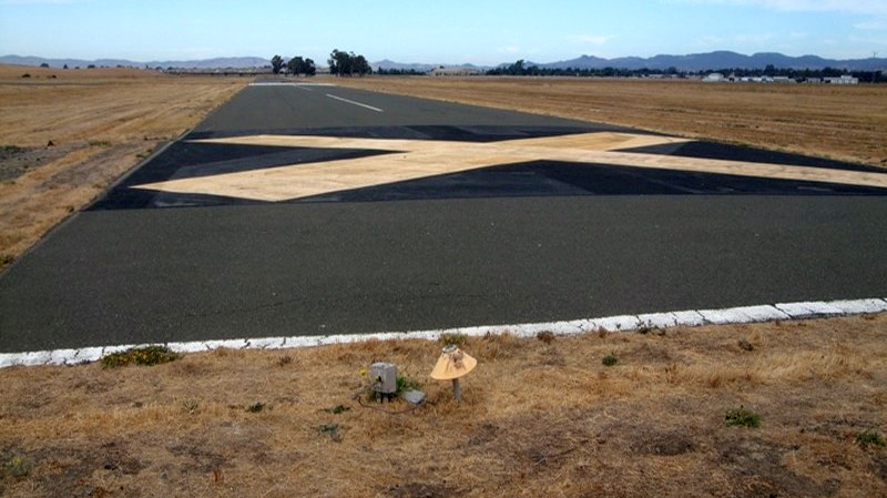
An August 2013 photo by Ron Plante of the Travis Aero Club runway.
Ron reported, “The surrounding grass was recently mowed, and the runway is in excellent condition.”
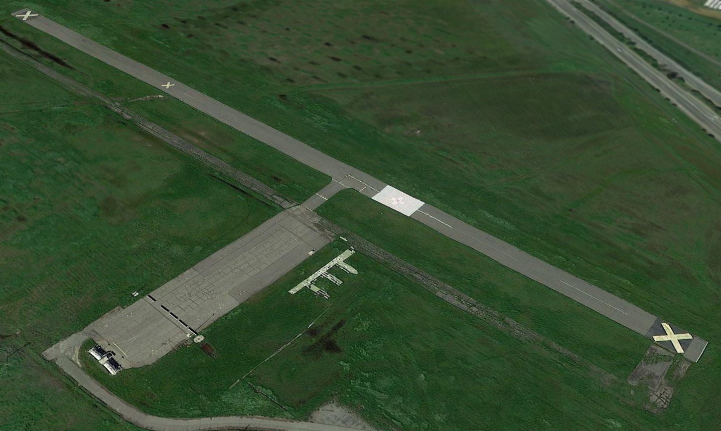
A 2016 aerial view looking west showed the the Travis Aero Club Airport runway remained intact.

A 2023 photo looking south at the Travis Aero Club Airport runway & ramp.
The Travis Aero Club Airport is located northwest of the intersection of Hickam Avenue & Hospital Drive.
Thanks to Vanessa Grigsby for pointing out the closure of this airfield.
____________________________________________________
Davis Airport / State Forestry Airport, Davis, CA
38.56, -121.68 (Southwest of Sacramento, CA)
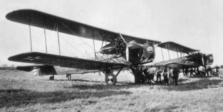
A circa post-1930 photo of 2 Army Keystone B-3 bombers at the Davis Nursery,
when they were used to transport seedlings from the facility to other parts of California.
Photo is courtesy of Dan Lang of the CDF, via Dann Shively.
The date of the photo is unknown, but the Keystone B-3 did not enter service until late 1930.
It is not known if by that point the Davis facility had a formal airfield, or if the bombers just operated from an open grass area.
According to Dann Shively, “The California State Nursery near Davis was established in the early 1920s.
It was used to grow trees, do research & store equipment.”
The earliest depiction of aircraft at the Davis Nursery which has been located
was a 1927 photo (courtesy of Dan Lang of the CDF, via Dann Shively)
of 2 Army DeHaviland bombers which were used to transport seedlings from the facility to other parts of California.
However a 3/28/37 USGS aerial view depicted no trace of an airfield at the Davis Nursery.
The airfield at the State Nursery may not have yet been formally established by 1938,
as it was not depicted on the April 1937 Sacramento Sectional Chart or a 8/27/37 USGS aerial photo,
nor listed among active airfields in The Airport Directory Company's 1938 Airport Directory (according to Chris Kennedy).
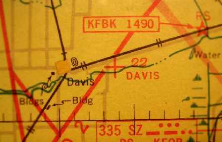
The earliest aeronautical chart depiction of the Davis airfield which has been located
was on the 1939 Sacramento Sectional Chart (courtesy of Dann Shively).
It depicted “Davis” as an auxiliary airfield.
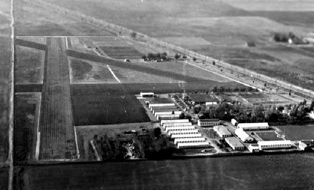
A 1940 aerial photo looking west at the 3 unpaved runways on the south & west side of the Davis Nursery
(courtesy of Dan Lang of the CDF, via Dann Shively).
At some point between 1939-41 the airfield was evidently renamed the State Forestry Airfield,
as that is how it was listed in The Airport Directory Company's 1941 Airport Directory (courtesy of Chris Kennedy).
It was described as an auxiliary airfield, consisting of a triangular sandy loam field having 3 oiled runways,
with the longest being the 2,608' east/west strip.
A hangar was said to be marked with “State Forestry Airport”.
However, the 1943 & 1944 Sacramento Sectional Charts (according to Chris Kennedy) depicted the field as “Davis”.
It was not listed among active airfields in the 1945 AAF Airfield Directory (courtesy of Scott Murdock).
According to the book "Two Hours By Crow" by Howard & Judith Campbell (courtesy of Wings of History),
the State Forestry Airfield had “a number of Grumman TBF Avenger torpedo planes surplused from the U. S. Navy stored on the field behind the buildings.”
The 1946 Sacramento Sectional Chart (courtesy of Dann Shively) depicted “State Forestry” as an auxiliary airfield.
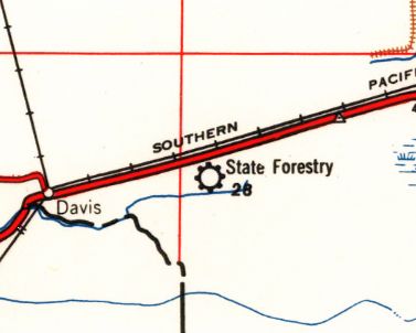
The State Forestry Airport, as depicted on the 1947 USGS topo map.
The 1948 Sacramento Sectional Chart (courtesy of Jonathan Westerling) depicted “State Forestry” as having a 2,600' unpaved runway.
The 1952 USGS topo map did not depict the airfield at all.
The 1954 Sacramento Sectional Chart (courtesy of Dann Shively) depicted the State Forestry Airport as having a 2,300' unpaved runway.
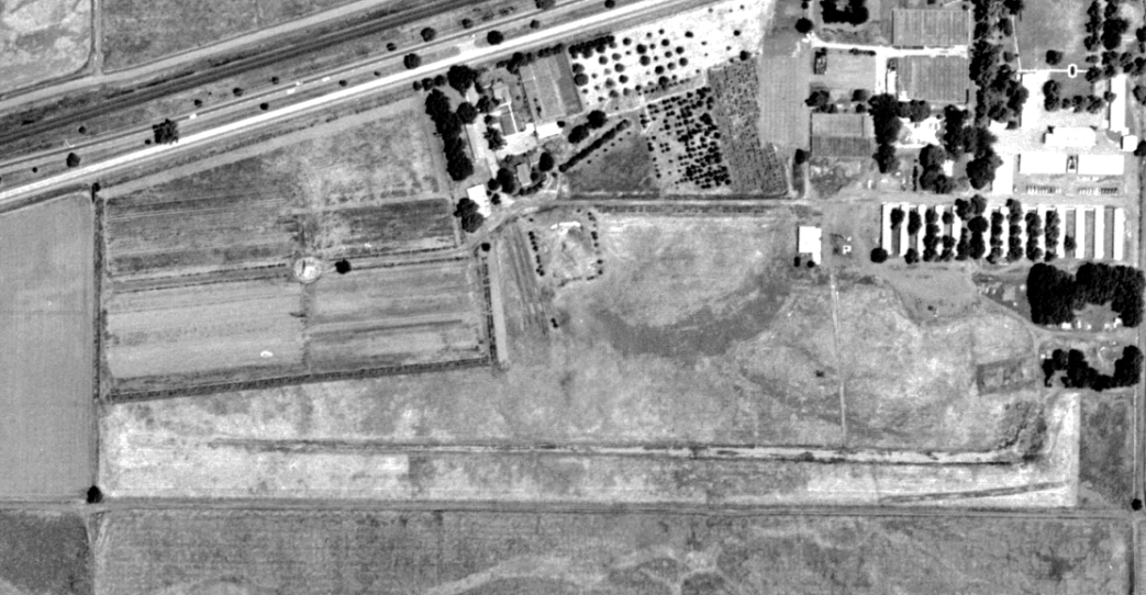
The last photo which has been located of the Davis State Forestry Airport was an 8/21/57 USGS aerial view.
It depicted the State Forestry Airport as having a single east/west unpaved runway.
The 1961 Sacramento Sectional Chart (courtesy of Dann Shively)
depicted the State Forestry Airport as having a 2,300' unpaved runway.
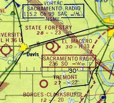
The last aeronautical chart depiction which has been located of the State Forestry Airport
was on the September 1962 Sacramento Sectional Chart (courtesy of Chris Kennedy).
It depicted the State Forestry Airport as having a 2,300' unpaved runway.
Note that it also depicted the new El Macero Field in very close proximity.
According to the book "Two Hours By Crow" by Howard & Judith Campbell (courtesy of Wings of History),
“Some crop dusters used the strip until the early 1960s when it too closed.”
The State Forestry Airfield was evidently abandoned (for reasons unknown) at some point between 1962-65,
as it was no longer depicted on the June 1965 Sacramento Sectional Chart.
A 1966 aerial view showed the area of the former runway remained clear, but the runway itself was no longer distinct, just an empty field.
The State Forestry Airfield was no longer depicted on the 1970 USGS topo map.
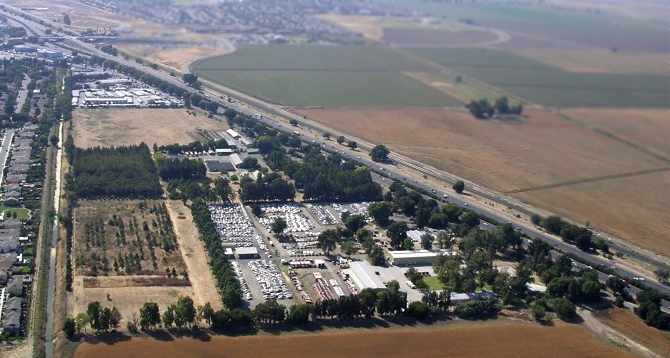
A 2006 aerial photo by Dann Shively looking west at the site of the former State Forestry Airfield,
taken from the same perspective as the 1940 aerial photo.
The site of the State Forestry Airfield is located south of the intersection of Interstate 80 & County Road 105.
Thanks to Dann Shively for pointing out this airfield.
____________________________________________________
38.54, -121.68 (Southwest of Sacramento, CA)

El Macero Airfield, as depicted on the September 1962 Sacramento Sectional Chart (courtesy of Chris Kennedy).
No airfield was depicted at this location on the 1952 USGS topo map, a 1957 aerial photo, or the September 1960 Sacramento Sectional Chart.
According to the book "Two Hours By Crow" by Howard & Judith Campbell (courtesy of Wings of History),
“Bruce Mace, a well-known landowner in the Sacramento Valley near the town of Davis, developed his property on the east side of Mace Boulevard.
In 1961 he put in an 18-hole golf course & a few homes around the fairways.
The clubhouse & restaurant were centrally located on Club House Drive & the entire tract was called El Macero.
The property limits were confined within the north border by North El Macero Drive & the south boundary was later set off by South El Macero Drive.
Without showing any imagination, the eastern border was called East El Macero Drive & it was added when the runway was removed.
In the early days of the development before the south & east drives were put in, access to the field was from the north end only & the sod tiedown area 'bulged' at the middle of this grass field.
The idea was to have golfers & their friends fly into the course & spend the day as both an athletic effort & a social one.
Of course, if you liked your visit, you would probably buy a lot & built a home close to your recreation.”
The earliest depiction which has been located of the El Macero Airfield
was on the September 1962 Sacramento Sectional Chart (courtesy of Chris Kennedy).
It depicted El Macero as a public-use field having a 3,300' hard-surface runway.
Note that it also depicted the California State Forestry Airport in very close proximity.
The earliest photo which has been located of the El Macero Airfield was a 1966 aerial view.
It depicted an unpaved north/south runway.
The status of the El Macero Airfield evidently changed to that of a private field at some point between 1962-67,
and the described runway surface was also downgraded from paved to unpaved,
as the 1967 Sacramento Sectional Chart (courtesy of John Voss)
depicted El Macero as a private field with a 3,100' unpaved runway.
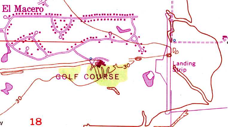
The 1968 USGS topo map depicted El Macero as a single north/south runway on the east edge of the golf course, labeled “Landing Strip”.
Chris Rogers recalled, “El Macero... my father flew his Cessna 210 in & out of there regularly during the late 1960s & early 1970s
when my grandparents lived in the golf-oriented country club development.”
Dann Shively recalled, “Although private, many pilots would use it for practice. There were no facilities there except for a windsock.
I used to practice soft-field landings there in the early 1970s & used it when I checked out in taildraggers.”
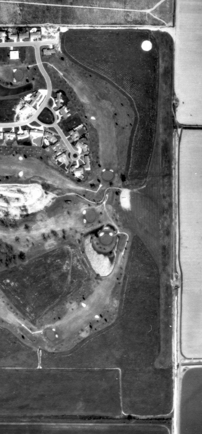
The only photo which has been located of the El Macero Airfield was a 3/21/70 USGS aerial view.
It depicted El Macero as having a single north/south unpaved runway on the east edge of the golf course,
and 1 light single-engine plane was visible parked along the west side of the midpoint of the runway.
"Two Hours By Crow" continued, “The runway was abandoned in 1971 & the strip of land was divided into more lots, all of which have homes on them today.
Most airports are forced out of existence by noise complaints from the residents but in this case the lack of aviation use & the press of economics accomplished the same result.”
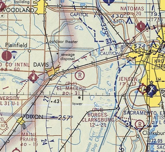
The last aeronautical chart depiction which has been located of the El Macero Airfield
was on the November 1971 San Francisco Sectional Chart (courtesy of Ron Plante).
It depicted El Macero as a private field having a 3,100' unpaved runway.
The last reference to the El Macero Airfield which has been located
was in the 1980 AOPA Airport Directory (according to Chris Kennedy).
It described the “El Macero Country Club” Airfield as having a single 3,100' turf Runway 16/34.
El Macero Airfield was no longer depicted on the April 1980 San Francisco Sectional Chart or the 1992 USGS topo map.
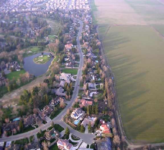
A 2006 aerial photo by Dann Shively looking north at the site of the former El Macero Airfield.
Dann observed, “There is no evidence an airstrip existed. East El Macero Drive & the houses on the street now cover what was the strip.”
Thanks to Dann Shively for pointing out this airfield.
____________________________________________________
Jensen Airport, Sacramento, CA
38.51, -121.5 (West of Sacramento Executive Airport, CA)
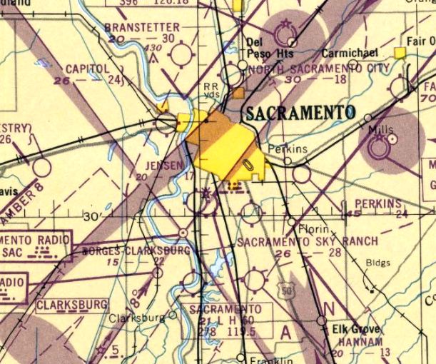
Jensen Airport, as depicted on the September 1949 Sacramento Sectional Chart.
According to a display at Sacramento Executive Airport which honors Charlie Jensen (courtesy of Dann Shively),
this small airport was built by agricultural aviation pioneer Charlie "Red" Jensen.
Jensen began taking flying lessons at age 16, and at 18, he became the first licensed airplane mechanic in California.
Red’s life was dedicated to agricultural aviation,
although he also worked as an aerial advertiser, ran a charter service, operated a flying school & flew as a fire fighter.
He declined to be recognized as heroic,
yet several times he used his flying skills to rescue injured fire fighters & miners & carry flood victims to safety.
In 1930 he founded his own agricultural aviation firm, Jensen Dusting & Planting Company,
at what is now Sacramento Executive Airport.
When a growing number of legal restrictions began to hinder his business, he bought land across the street from the airport & opened Jensen Field.
City officials tried, but couldn’t stop the move.
The date of establishment of Jensen Airport has not been determined.
The earliest depiction which has been located of Jensen Airport was a 1947 aerial photo (courtesy of Dann Shively).
Dann Shively observed, “It clearly shows the airstrip & hangar with nothing around it but just a half block away from Sacramento Municipal Airport.
It was mainly a crop duster field, but others kept their small planes there as well.
Charlie operated from Executive Airport for years.
He was kicked off because the cropdusting operation didn't mesh well with the airport (or so the city thought).
They probably didn't like bull Stearmans taking off at 5:30am.
So Charlie just bought up a bunch of land across the street & built his own airport. Kind of an 'in your face' move.
It was a fun place to hang out. And the landings & takeoffs were always interesting.
Some of the planes had no radios so you couldn't talk to the tower just down the street.
It had a definite pattern that was smaller & lower than Executive Airport's.
If you did contact the tower, it was for advisories only.
The controllers couldn't clear you to takeoff or land; just let you know what was around you."
Jensen Airport was not yet depicted on the August 1948 Sacramento Sectional Chart.
The earliest aeronautical chart depiction which has been located of Jensen Airport was on the September 1949 Sacramento Sectional Chart,
which depicted Jensen as having a mere 1,700' unpaved runway.
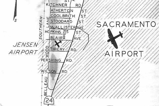
Jensen Airport, as depicted on a circa 1949-50 Sacramento city map (courtesy of Curtis Carroll, via Dann Shively).
Red Jensen flew his own Travelaire in Howard Hughes’ World War 1 movie "Hells Angels", for which he provided planes.
At one point he had 53 planes in his fleet & he could fly them all.
His membership in the Confederate Air Force was his pride & joy.
"Mr. Ag Aviation" was the title given Jensen by the California Agricultural Aircraft Association, which he founded.
He held the California Department of Agriculture Aerial Applicator License Number 1.
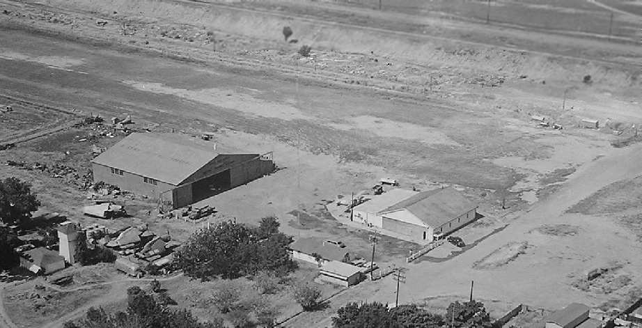
A circa 1950s aerial view looking southwest at Jensen Airport (used by permission of the Jensen family, courtesy of Dann Shively).
Note the 3 TBM Avengers, with their wings folded, below the main hangar.
In 1955 Red Jensen was one of the first commercial helicopter operators to receive the Lawrence D. Bell Helicopter Pioneer Award.
Red saw helicopters as the future of agricultural aviation. He was planning a helicopter school. He had a dream, more than many men.
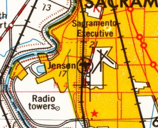
Jensen Airport, as depicted on the 1957 USGS topo map.
A 1957 aerial view depicted Jensen Field as consisting of a short unpaved north/south runway,
with 2 hangars on the northeast end, around which were parked a few aircraft.
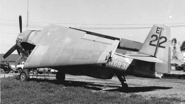
A 4/27/63 photo (courtesy of Bob Fish) of a TBM Avenger at Jensen Field.
According to the plane's logbooks, it had been converted by Red Jensen into a waterbomber in 1962.
This same plane is on display (as of 2004) on the USS Hornet museum in Alameda, CA.
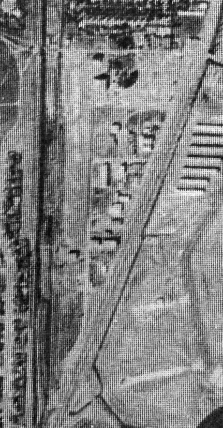
A 10/30/64 State of CA aerial view (courtesy of Kevin Walsh) depicted Jensen Field in the same physical configuration as the 1957 photo,
but the number of aircraft parked on the field had increased to a dozen.
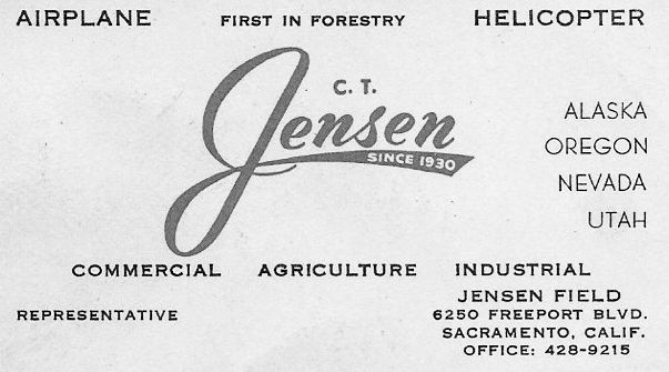
A circa 1960s business card for C.T. Jensen, (courtesy of Dann Shively).
Dan Shively reported that his son “had bought an old coffee table at a garage sale & stuck in a drawer was this card.”
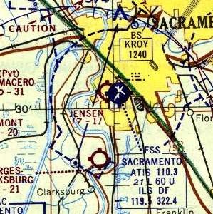
The 1967 Sacramento Sectional Chart (courtesy of John Voss) depicted Jensen Airport as having a 1,700' unpaved runway.

Jensen Field was depicted as a runway & a hangar in the book "Two Hours By Crow" by Howard & Judith Campbell (courtesy of Wings of History).
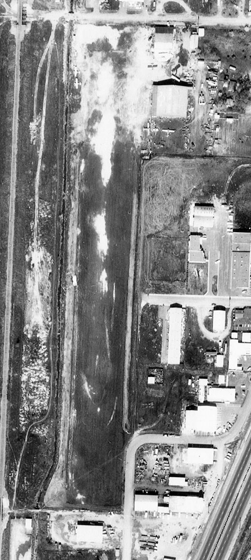
A 2/27/68 aerial view (from the UCSB Library) showed 4 aircraft parked on the northeast side of Jensen Field.
Airbearfed recalled, “ I landed here once in 1970-71 to pick up a part for a TBM.
It was the first time landing at an a uncontrolled airport, but having to call the SAC tower to tell them what I was doing.”
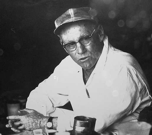
A 1974 photo of Charlie Jensen (used by permission of the Jensen family, courtesy of Dann Shively).
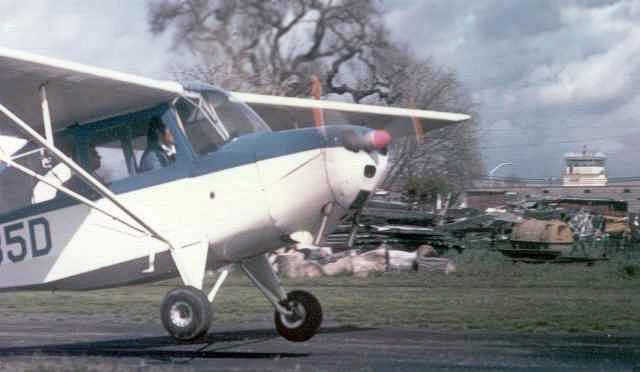
A 1975 photo looking east at Dann Shively landing his Aeronca Champ at Jensen Field (courtesy of Dann Shively).
Dann recalled, “In the background is Charlie's junk pile; tanks, steel, containers etc.
In the background the control tower from Sacramento Executive Airport can be seen.
Jensen's was just a half a block away from the bigger airport.”
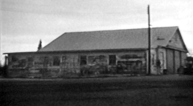
A still from a circa 1975 16mm film shot by Phil Schroeder at Jensen Airport (courtesy of Dann Shively), showing the machine shop & workshop.
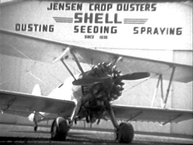
A still from a circa 1975 16mm film shot by Phil Schroeder at Jensen Airport (courtesy of Dann Shively),
showing “one of Charlie’s cropdusters just after returning from a flight. It’s sitting in front of the main hangar.”
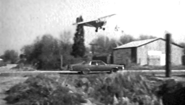
A still from a circa 1975 16mm film shot by Phil Schroeder at Jensen Airport (courtesy of Dann Shively),
of “a Piper Cub landing. You can see that we scared a lot of motorists on the approach.
You had to descend over a railroad right-of-way just on the west side of the airport, and then scoot over at the last minute to hit the runway. Much fun!”
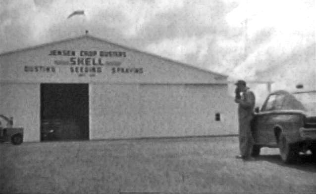
A still from a circa 1975 16mm film shot by Phil Schroeder at Jensen Airport (courtesy of Dann Shively),
“of Charlie eating lunch in front of the main hangar.
It was fun to see the film but sad that everyone in is dead now & the airport’s disappeared. It was a fun time.”
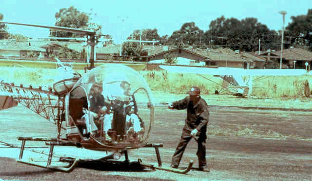
A 1976 photo looking west at Dann Shively in his Bell 47 at Jensen Field, on the day he got his helicopter license (courtesy of Dann Shively).
Dann recalled, “I took my future wife for a ride & landed over at Jensen to show Charlie, himself a helicopter pioneer.
Between the old runway & the houses shown in the photo now sit more houses built in the last 2 years [2004-06].”
Kevin Page recalled, “I grew up flying out of Jensen Field. C.T. 'Red' Jensen was my crop-dusting mentor.”
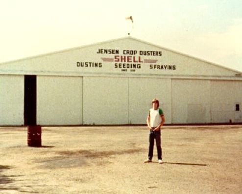
A 1978 photo of Kevin Page in front of the Jensen Crop Dusters hangar. Kevin recalled, “Red was still alive & life was good.”
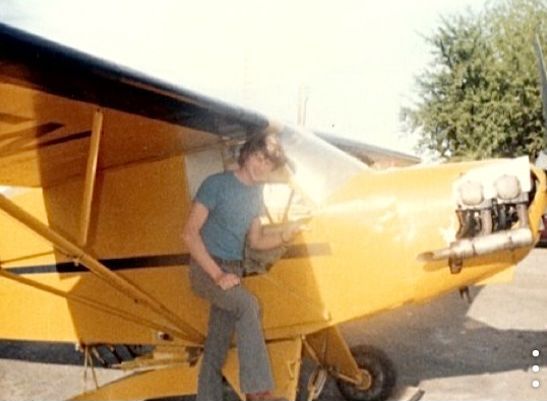
A 1978 photo of Kevin Page in front of the Red Jensen's Piper PA-11 Cub at Jensen Field.
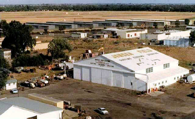
A 1980 aerial view by Dann Shively looking southeast at Jensen Field.
Dann observed, “It shows Charlie’s big hangar with Executive Airport hangars in the background a block away.
Just to the left of the hangar you can see one of his TBM bombers.
The other 2 had been sold at this point. On the lower left was his shop building & just above that the little building that held the bathrooms.
Just to the left of the bathroom (out of view) was his office & the entrance to the field.”
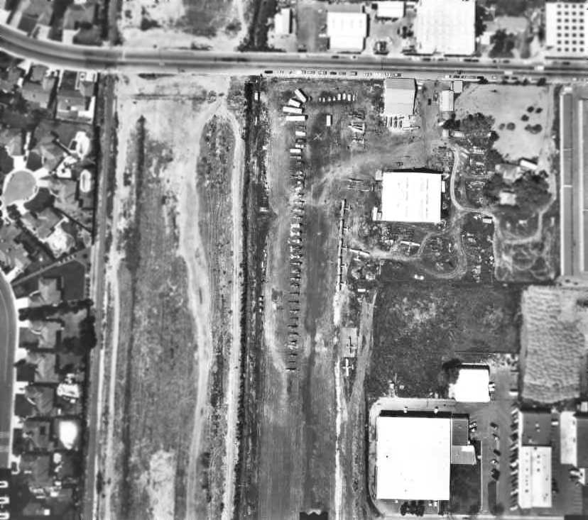
A 1980 aerial photo of the north end of Jensen Airport (courtesy of Dann Shively),
taken on the day of the auction of the aircraft & supplies of the late Charlie (Red) Jensen.
"You can see the runway, shops & main hangar. You can see many of the aircraft & parts that were up for sale.
There were mostly Stearmans, some Pipers & a couple of BT-13s. His 3 TBMs had already been sold."
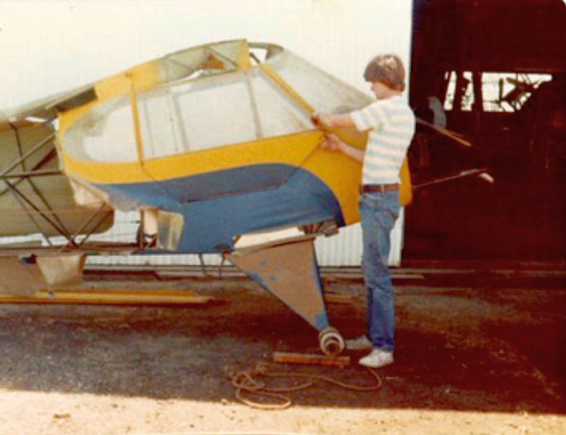
A 1980 photo of Kevin Page preparing Red Jensen's Piper PA-11 Cub for auction at Jensen Field.
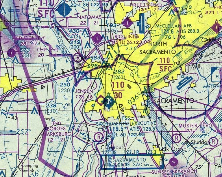
The last depiction which has been located of Jensen Airport was on the April 1980 Sacramento Sectional Chart.
It depicted Jensen Airport as as having a mere 1,600' unpaved runway.
Kevin Page recalled, “I flew the last load for Red just before he passed.
I had my aircraft at his airport with Dann Shively's News Copter 3 & we were the last two people to operate out of Jensen Field.”
According to Dan Shively, Jensen Airport "closed after the owner's death in 1980.
At the time of his death the field was home to about a dozen small planes & our own news helicopter. He was an amazing guy."
According to the book "Two Hours By Crow" by Howard & Judith Campbell (courtesy of Wings of History),
“This 1,700' long dirt strip was alongside the railroad tracks & existed until 1986, six years after 'Red' had died.”
Jensen Airport was no longer depicted on the October 1993 Sacramento Sectional Chart (courtesy of Ron Plante).
By 1993, aerial photos showed that the site had been redeveloped,
with warehouses & a new street covering the site of the former airport.
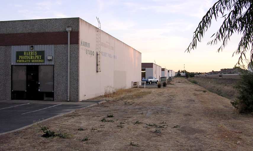
A 2003 photo by Dann Shively of the warehouse buildings that now sit on the location of the former runway of Jensen Airport.
Dann reported, “"On the property now lies commercial buildings. There is no evidence an airport ever existed."
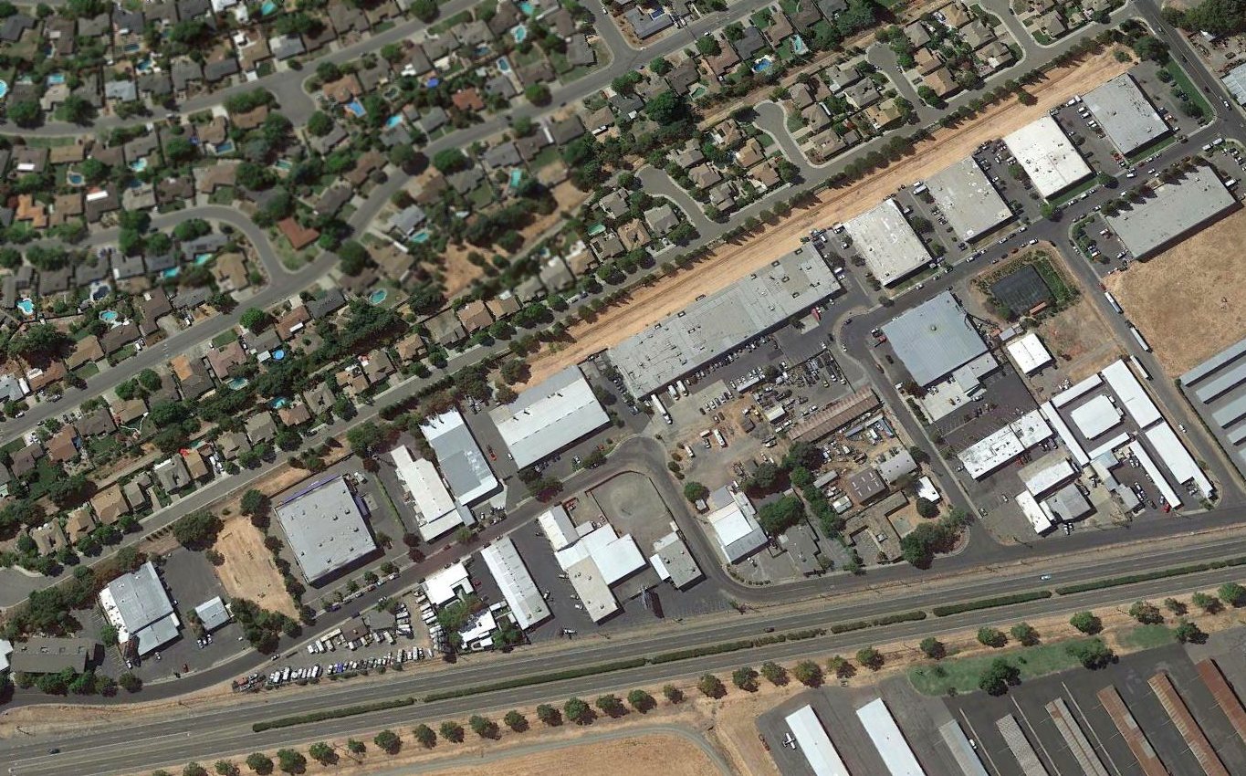
A 2018 aerial view looking northwest at the row of warehouses which cover the site of Jensen Airport.
The site of Jensen Airport is located southwest of the intersection of Blair Avenue & Belleau Wood Lane,
adjacent to the west side of Sacramento Executive Airport.
____________________________________________________
Vaca-Dixon Airport, Vacaville, CA
38.4, -121.91 (Northeast of San Francisco, CA)
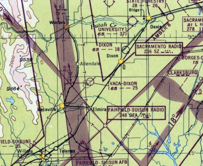
Vaca Dixon Airport, as depicted on the February 1948 Sacramento Sectional Chart (courtesy of Jonathan Westerling).
This general aviation airport was not yet listed among active airfields in the 1945 AAF Airfield Directory (courtesy of Scott Murdock)
nor depicted on the August 1947 Sacramento Sectional Chart.
According to the book "Two Hours By Crow" by Howard & Judith Campbell (courtesy of Wings of History),
“Opening in 194 7, when the Army relaxed the civilian flying restrictions, the runways started out as dirt strips & a private field.”
The earliest depiction of the Vaca-Dixon Airport which has been located
was on the February 1948 Sacramento Sectional Chart (courtesy of Jonathan Westerling).
It depicted Vaca-Dixon as having a 2,500' unpaved runway.
The 1949 Sacramento Sectional Chart (according to Chris Kennedy)
also described Vaca-Dixon Airport as having a 2,500' unpaved runway.
According to the book "Two Hours By Crow" by Howard & Judith Campbell (courtesy of Wings of History),
“By 1949 the runways had been paved & the status was changed to 'commercial'.
While it was new, the dirt runways were about 2,500' long give or take how well the grader stopped each time it scraped the surface.
With the change in class, the longer paving was 2,400' long and the shorter extended for 1,935'.
Just about this time, a private owner put in a banked oval auto racing track in hopes of attracting the open-wheeled Indianapolis type cars.
In its heyday, the airport offered fuel, hangars, aircraft sales, aircraft rentals, and a restaurant.”
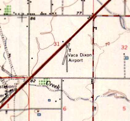
The 1953 USGS topo map depicted Vaca-Dixon Airport as having 2 runways, oriented north/south & northeast/southwest.
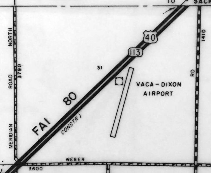
A 1955 CA Highways Map (courtesy of Kevin Walsh) depicted Vaca-Dixon Airport as having only a single runway.
According to Wayne Bomar, the Travis AFB Aero Club operated from the Vaca-Dixon Airport circa 1955-56,
until their own airport was constructed.

The April 1959 San Francisco Local Aeronautical Chart (courtesy of Paul Columbus)
depicted Vaca-Dixon as having a 2,300' unpaved runway.
The 1962 AOPA Airport Directory described Vaca-Dixon Airport as having a single oiled 2,300' Runway 18/36.
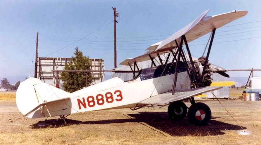
The earliest photo which has been located of Vaca-Dixon Airport was an August 1964 photo by Bill Larkins of a Travel Air 4000 sprayer.
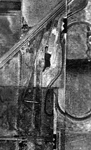
A 1965 aerial view from the Alexandria Digital Library @ UC Santa Barbara (courtesy of Jonathan Westerling)
depicted Vaca-Dixon Airport as having 2 unpaved runways.

The June 1965 Sacramento Sectional Chart (courtesy of Ron Kunse) depicted Vaca Dixon Airport as having a 2,000' unpaved runway.
Vaca-Dixon was depicted on the 1967 Sacramento Sectional Chart (courtesy of John Voss) with a single 2,060' "treated dirt" runway.
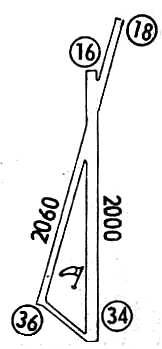
Vaca-Dixon Airport, as depicted in the 1968 Flight Guide (courtesy of Chris Kennedy).
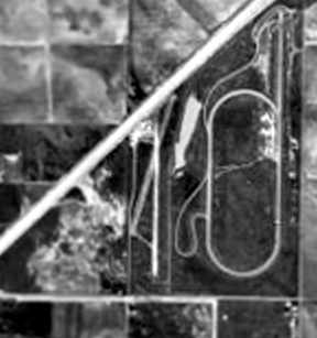
A 1970 aerial view of the site of Vaca-Dixon Airport (from the Alexandria Digital Library @ UC Santa Barbara, courtesy of Jonathan Westerling)
showed the field to have 2 runways & several buildings on the north side of the field.
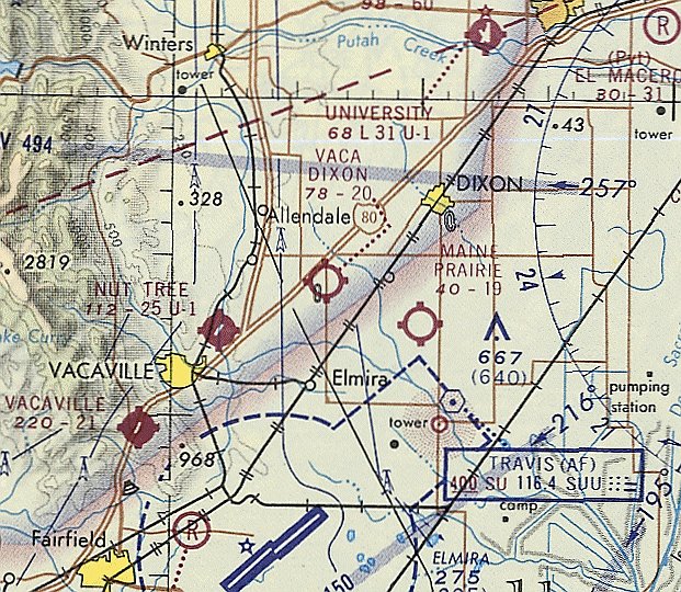
The last aeronautical chart depiction which has been located of Vaca Dixon Airport was on the November 1971 San Francisco Sectional Chart (courtesy of Ron Plante).
It depicted Vaca Dixon Airport as having a 2,000' unpaved runway.
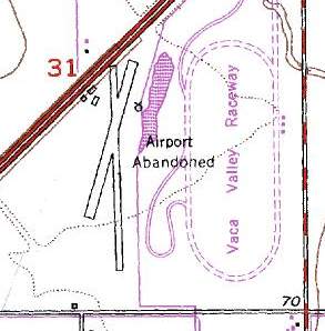
Vaca-Dixon Airport may have gone through a period of abandonment, as the 1973 USGS topo map labeled it as "Airport Abandoned".
In addition to Runway 18/36, the 1973 USGS topo map also depicted a 1,900' runway, oriented approximately 3/21.
Three small buildings (hangars?) were also was depicted west of the northern runway end.
According to the book "Two Hours By Crow" by Howard & Judith Campbell (courtesy of Wings of History),
“Dunng the last years an ultralight airplane dealer tried to be successful & failed, then a glider operation became the sole business.”
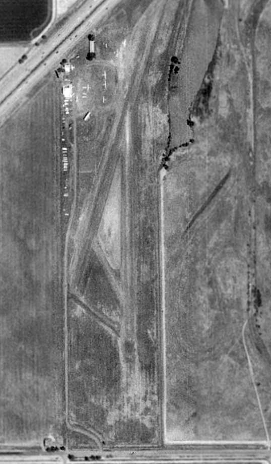
A 1993 aerial view showed the Vaca-Dixon Airport still in use, with a total of 6 light aircraft visible at the north end of the field.
Vaca-Dixon was no longer depicted on the October 1993 San Francisco Sectional Chart (courtesy of Ron Plante).
According to the book "Two Hours By Crow" by Howard & Judith Campbell (courtesy of Wings of History),
“When the gliders moved out on 12/1/93, the airport certificate was pulled.”
Other sources reported Vaca-Dixon Airport closed in 1995.
In a 2000 aerial photo, the Vaca-Dixon Airport runways & hangar still existed, just devoid of any aircraft.
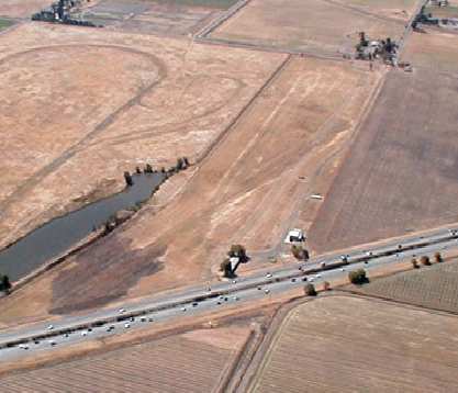
A 2003 aerial view by Jonathan Westerling, looking southeast at the remains of the Vaca-Dixon Airport.
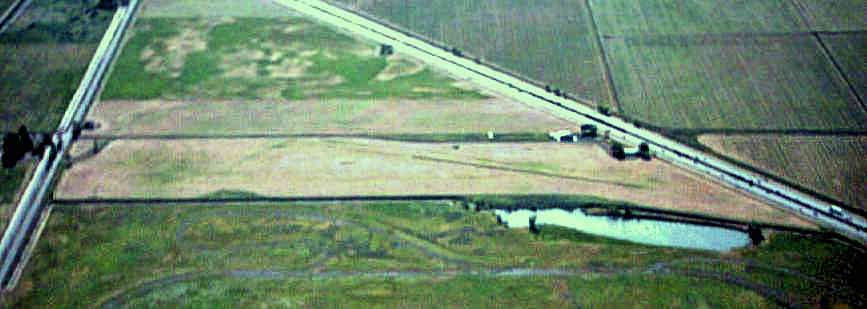
A 2003 aerial view looking west at the former Vaca-Dixon Airport, by Dann Shively.
Dann reported, “It's hard to even see the runways from the ground as they're pretty much overgrown.
I did manage a shot from the south looking north. It shows the buildings shown in John Westerling's aerial shot.
There's a large white container box on the left.
Next is the hangar with an Airstream trailer parked next to it & on the north end another building that may have been the office."”
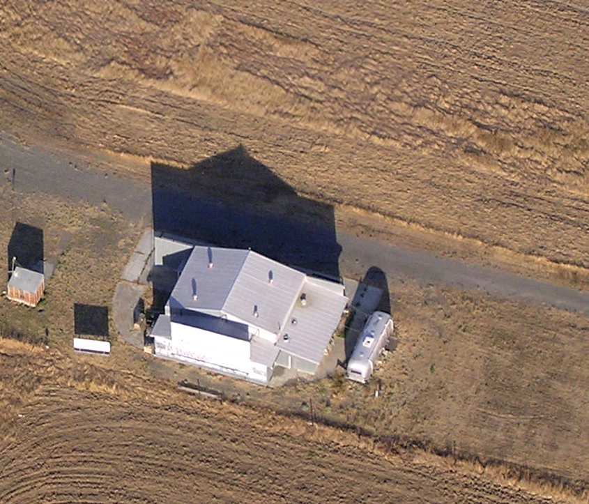
A 2003 aerial photo by Dann Shively, looking southeast at the hangar which remains at the former Vaca-Dixon Airport.
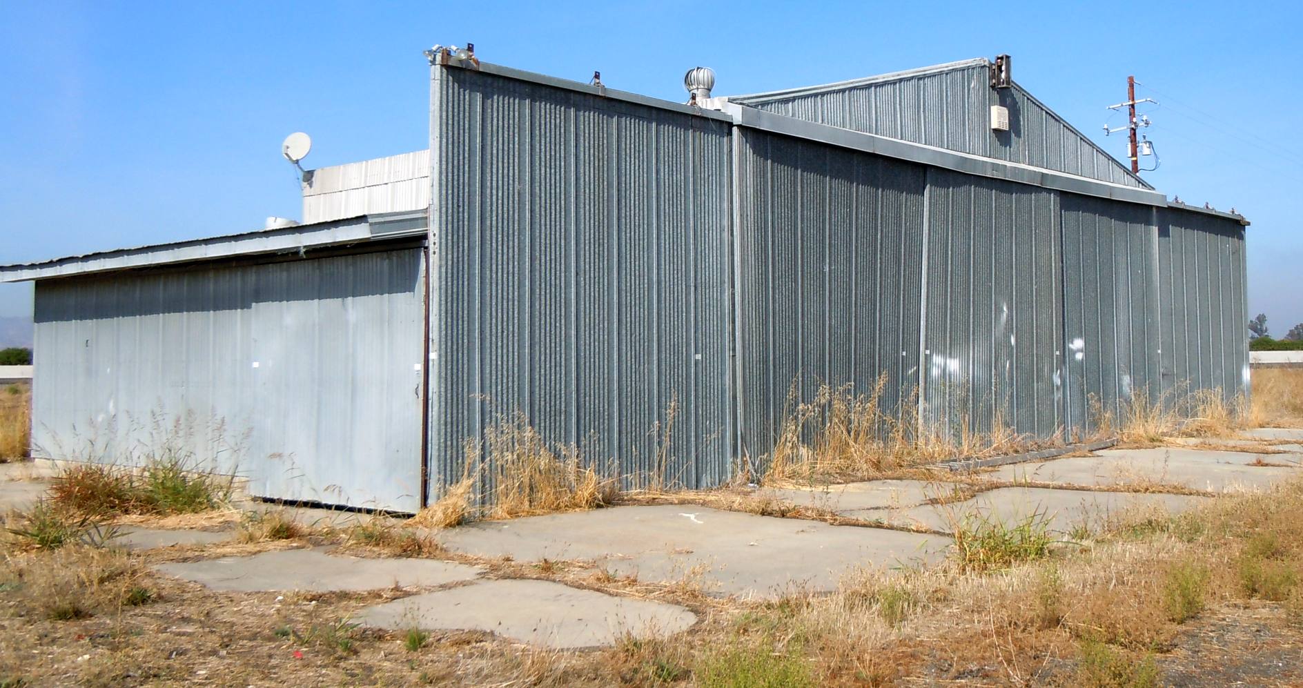
A 10/24/23 photo by Pen Parks of a hangar which remains at the former Vaca-Dixon Airport.

A 10/24/23 photo by Pen Parks of a hangar which remains at the former Vaca-Dixon Airport.
Pen Parks reported in 2024, “I went by Vaca-Dixon Airport & the hangar with the For Lease sign on it [which he photographed in above 2023 photo) is gone.”
Pen Parks reported in 2025, “Vaca-Dixon... the hangars are gone.”
The Vaca-Dixon Airport site is adjacent to the southeast side of Interstate 80, north of Weber Road.
The Vaca Valley Raceway is adjacent to the airport site to the east.
____________________________________________________
Shady Grove Airport / Vacaville Airport / Vacaville Gliderport (VCV), Vacaville, CA
38.33, -122.02 (Northeast of San Francisco, CA)
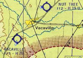
Vacaville Gliderport, as depicted on the 1957 Sacramento Sectional Chart (courtesy of Chris Kennedy).
According to Cindy Baker, this airfield was originally a private field known as the Shady Grove Airport.
The date of construction of Shady Grove Airport has not been determined.
No airfield at this location was yet depicted on the 1951 USGS topo map or the October 1956 Sacramento Sectional Chart.
By 1957, the field had been renamed Vacaville Airport, as that is how it was labeled on the 1957 Sacramento Sectional Chart (according to Chris Kennedy).
It was described as having an unpaved 2,000' runway.
The runway at Vacaville had been paved within the next 5 years, as the 1962 AOPA Airport Directory described the field as having a single paved 2,000' Runway 2/20,
and listed the operator as George Kotsotas.

The June 1965 Sacramento Sectional Chart (courtesy of Ron Kunse)
depicted Vacaville Airport as having a 2,100' paved northeast/southwest runway.
Vacaville Airport was depicted on the 1967 Sacramento Sectional Chart (courtesy of John Voss) with a single 2,100' asphalt runway.
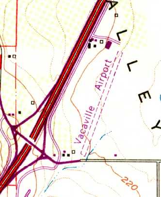
The 1968 USGS topo map depicted the Vacaville Airport as having a single northeast/southwest unpaved runway with several buildings on the northwest side.
According to the book "Two Hours By Crow" by Howard & Judith Campbell (courtesy of Wings of History),
“Vaca-Valley
Aviation, Inc. started a soaring rental & instruction business in
1969.”
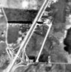
The earliest photo which has been obtained of the Vacaville Airport was a 1970 (from the Alexandria Digital Library @ UC Santa Barbara, courtesy of Jonathan Westerling).
It showed the field to have a single northeast/southwest runway with a hangar on the north side of the field.
According to Cindy Baker, in 1971 David Williams began using the site for gliders under the name of Vacaville Soaring.
Rex Mayes reported, “Dave Williams opened Vacaville Soaring in 1972.”
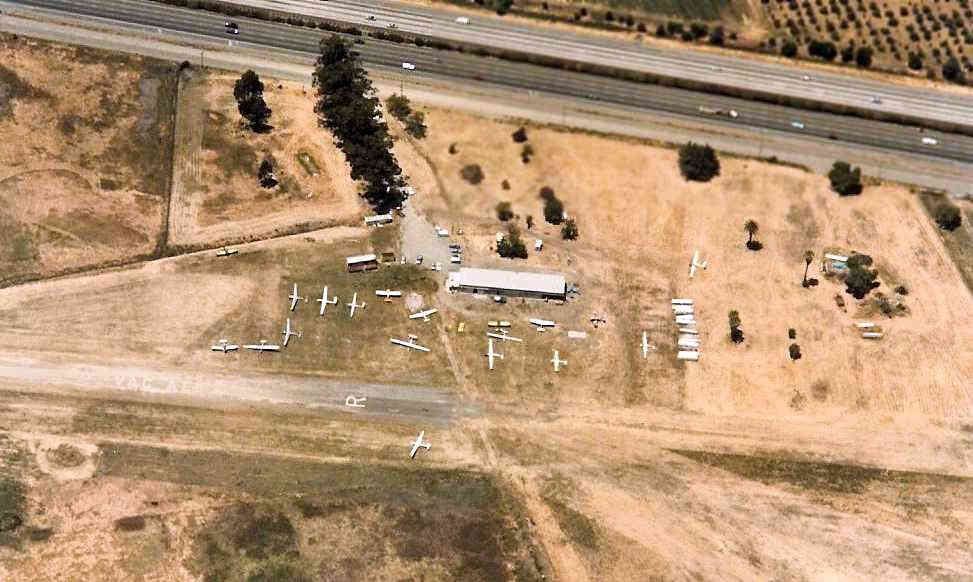
A 1973 aerial view looking west at Vacaville Gliderport
showed a total of at least 19 aircraft (mostly gliders) around a small building on the northwest side of the field.
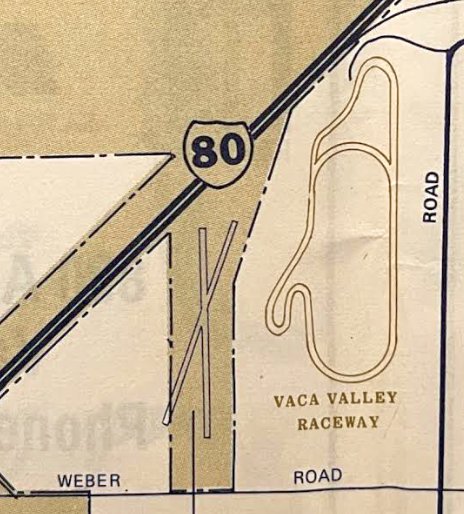
A 1977 road map (courtesy of Kevin Walsh) depicted Vacaville Airport as having 2 runways.
By 1980, the Vacaville runway had apparently been lengthened to 2,700', as that is how it is depicted on the 1980 USGS topo map.
One small hangar also was depicted west of the northern runway end.
Rex Mayes reported, “By 1980-81 the operation soured a bit & Jay Hawk made a play to revitalize the business.
This ended Dave’s tenure in a bit of a hostile takeover & in July 1982 Vacaville Aero Services Inc. was formed & the gliderport was renamed Vacaro (cowboy in Spanish).
Jay Hawk did indeed bring the spirit back to life & got things moving but found it to be tough to turn a profit by running a gliderport while flying as an airline pilot.
In the meantime, Doc Mayes & sons, me & brother Rusty got involved by helping with gounds maintenance & helping Jay secure funding for a couple of fleet aircraft but this relationship was not easy.”
According to the book "Two Hours By Crow" by Howard & Judith Campbell (courtesy of Wings of History),
“Vacaville Aero Services was there in 1981 & they became Vac-Aero in 1982.
The logo for this operation was a fat cowboy with a sombrero riding a cute glider, being a play on the Spanish word vaquero for 'cattlehand'.”
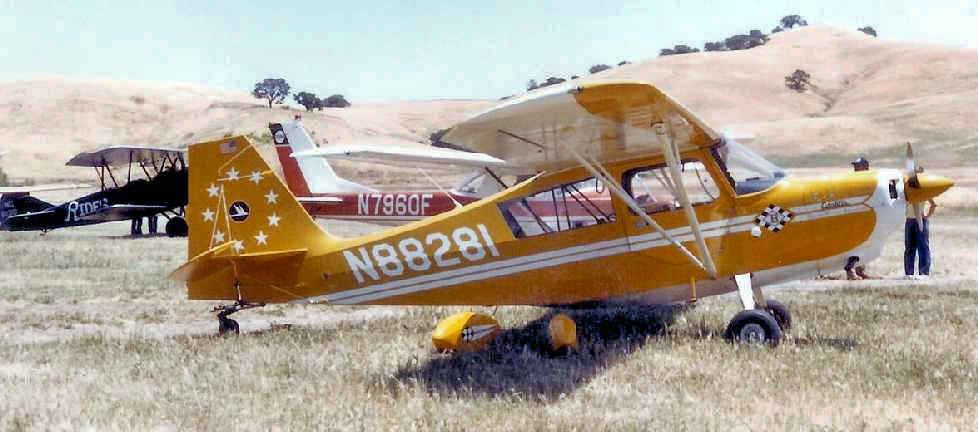
An early 1980s photo by Patrick Burke of N88281, a 1974 Bellanca 7KCAB at Vacaville Gliderport, with a Travelaire biplane & Cessna 150/152 in the background.
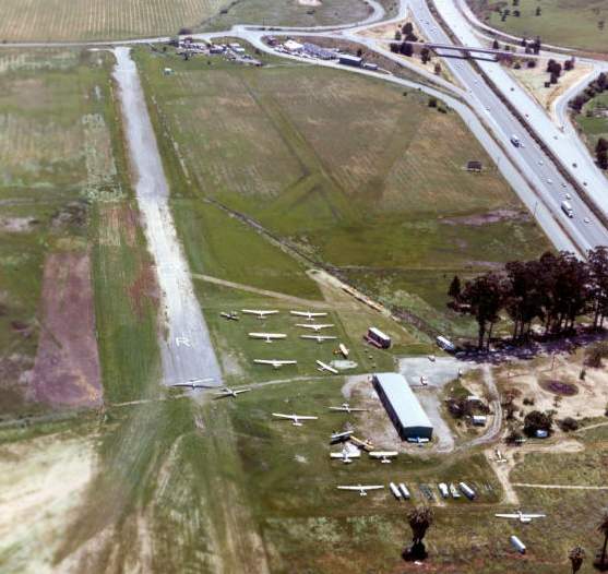
A 1983 aerial photo looking south (copyright by John Hockenbury, used by permission) showed Vacaville Gliderport was apparently well used, as a total of at least 19 gliders & single-engine aircraft are visible on the field.
In 1984, the field was taken over by Dr. Mayes & Lagoon Valley Soaring.
The popularity of gliding at the site reached its height in the 1980s,
with 11,000 glider tows per year being conducted from the site.
Rex Mayes reported, “By July 1984 Jay had had enough & was moving to sell which would have put Doc’s interest & investment at risk. This forced Doc’s hand to take over the business.
In doing so, he was a bit saddled with the glider operation which he renamed Lagoon Valley Soaring & did his best to manage.
Rusty & I were in college & not much help but on weekends. By happenstance I suspended my college ambitions & took over as a 22 year old manager on 10/15/84.
I had no idea what I was getting into & was assured by Doc, 'This will only be temporary as we are going to sell this turd.'
We lost Doc 4 years later & ran Lagoon Valley Soaring for 4 more years until the property was sold to developers.
I never would have thought we would keep this thing running for 30 years & would not have but for all of you & your kind support.”
According to the book "Two Hours By Crow" by Howard & Judith Campbell (courtesy of Wings of History),
“By about 1985, this had become the Lagoon Valley Soaring Center.
Jay Hauk owned the Soaring Center & a 1927 Travel Air while he offered instruction in a Schweizer 2-33, a Blanik & a Schleicher ASK-21. These were towed into the air with a Piper PA-25 Pawnee 235.
A sport parachute service lasted a short while here.”
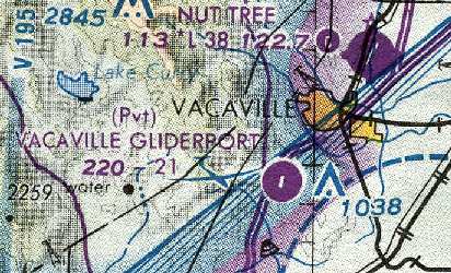
The 1990 San Francisco Sectional Chart (courtesy of Dann Shively) depicted Vacaville Gliderport as a private airfield,
with a single 2,100' paved runway.
In 1991, Rex Mayes moved the operation to Williams, where it operated under the name Valley Soaring Association.
According to the book "Two Hours By Crow" by Howard & Judith Campbell (courtesy of Wings of History),
“The field was closed on 9/25/91; the soaring business & its flying stock had moved to the Vaca-Dixon Airport.”
Vacaville Gliderport was no longer depicted on the October 1993 San Francisco Sectional Chart (courtesy of Ron Plante).
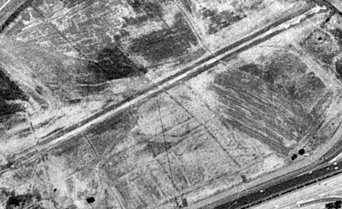
A 1993 aerial view looking southeast showed the Vacaville Gliderport as abandoned, with the runway deteriorated, and the buildings having been removed.
Vacaville Gliderport was no longer depicted at all (even as an abandoned airfield) on 2002 aeronautical charts.
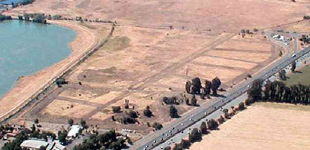
A 2003 aerial view by Jonathan Westerling, looking southeast at the remains of the Vacaville Gliderport runway.
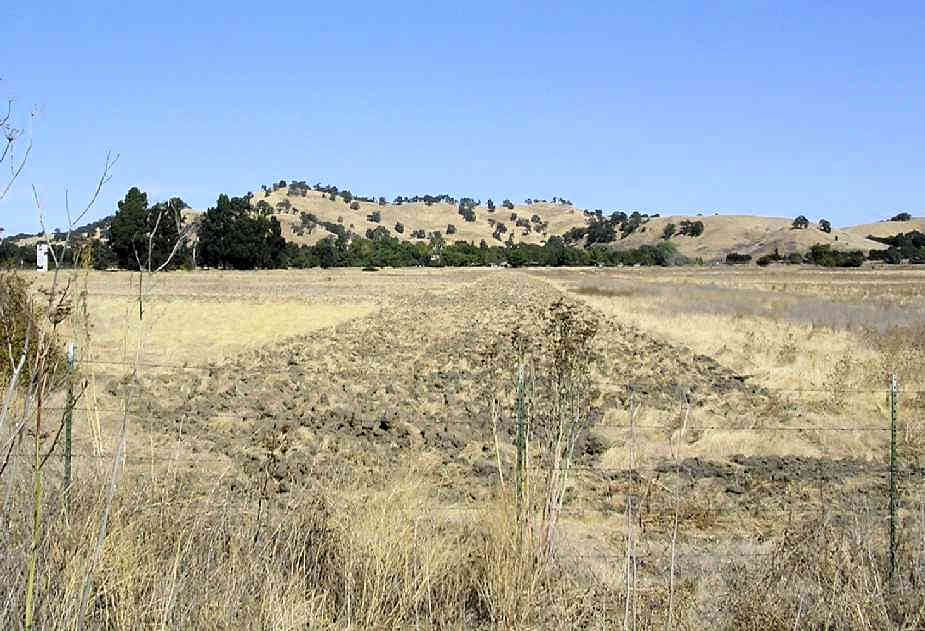
A 2003 photo by Dann Shively, looking east at the remains of the Vacaville Gliderport runway.
Dann reported, “As you you can see the runway still shows signs of being plowed years ago. Nothing is left of the airport.
The office & hangars were near the big trees on the left of the photo. This area is a pristine part of nature between Fairfield & Vacaville in a little valley.
There were huge plans to develop the area commercially in the early 1990s.
Despite an outcry from the community, plans progressed but were eventually shelved because of a downturn in the economy.
Now, it appears those plans are on the move again. So presumably at some time all traces will be erased."
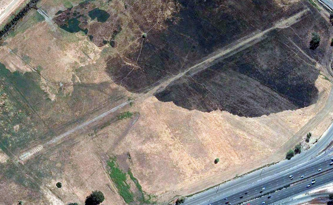
A 2020 aerial view looking southeast showed the remains of the Vacaville Gliderport runway were still recognizable.
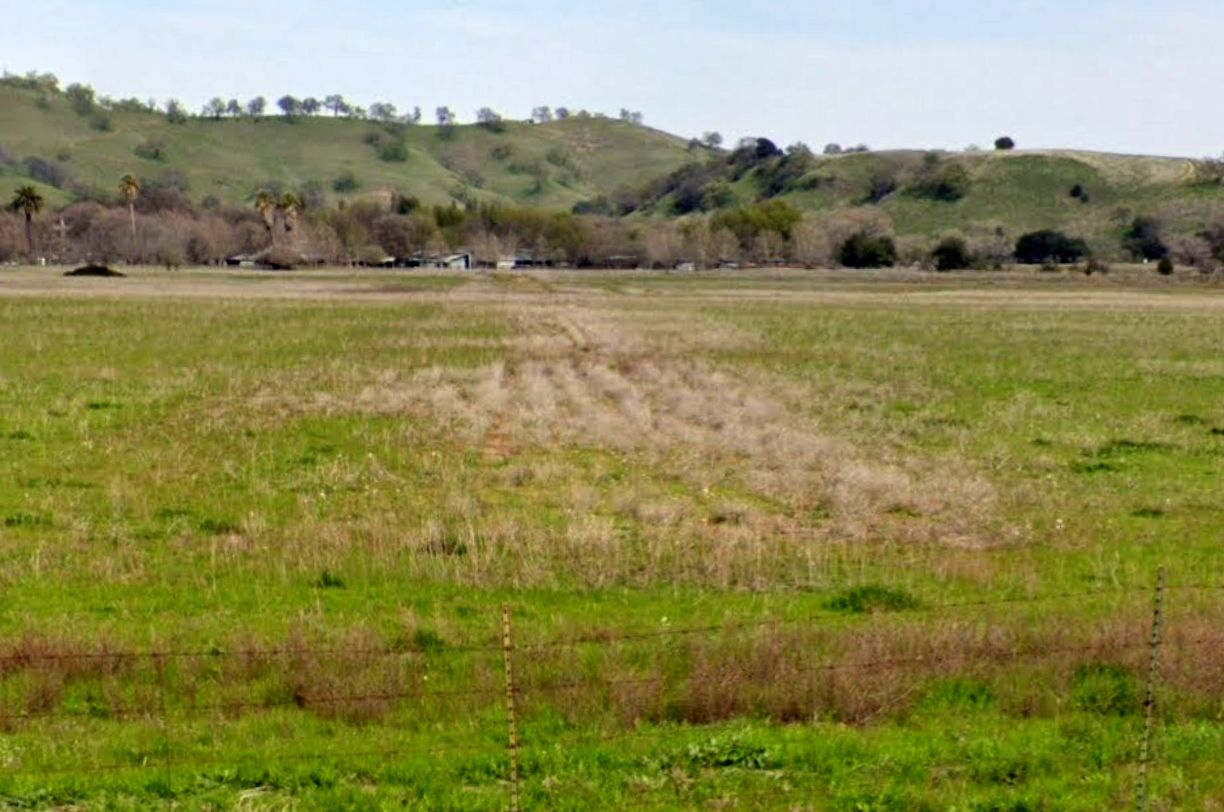
A 2021 photo looking northeast along the remains of the Vacaville Gliderport paved runway.
The Vacaville Gliderport site is adjacent to the east side of Interstate 80, north of Lagoon Valley Road.
____________________________________________________
Antioch Airport (O12), Antioch, CA
37.97, -121.8 (East of San Francisco, CA)
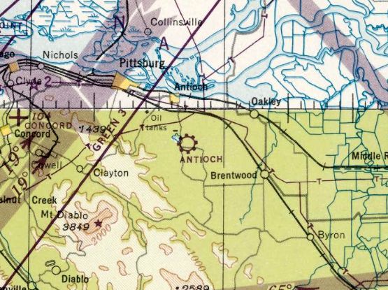
Antioch Airport, as depicted on the February 1947 San Francisco Sectional Chart.
This general aviation airport was not yet depicted on a 1939 aerial photo nor on the August 1946 San Francisco Sectional Chart (courtesy of Dann Shively).
According to the book "Two Hours By Crow" by Howard & Judith Campbell (courtesy of Wings of History),
“On these low foothills Orville Prevost opened an airport in 1946.
He had moved this far out in the country to be able to fly without disturbing the citizens down in town. What a dreamer!”
The earliest depiction which has been located of Antioch Airport was on the February 1947 San Francisco Sectional Chart.
It depicted Antioch as a commercial/municipal airport.
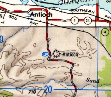
The earliest topo map depiction which has been located of the Antioch Airport was on the 1947 USGS topo map.
According to K.O. Eckland, in 1948 Antioch Airport consisted of a 2,100' dirt runway.
The earliest photo which has been located of Antioch Airport was a 1949 aerial photo.
It depicted Antioch as having 2 unpaved runways, oriented east/west & northwest/southeast.
A hangar & a single light aircraft were visible on the north side of the field.
According to the book "Two Hours By Crow" by Howard & Judith Campbell (courtesy of Wings of History),
“In 1949 the gravel runway was only 2,200' long but that year it was paved out to 2,480'. It was only 33' wide & some pilots preferred to avoid the field.
There were fairly wide gravel shoulders, but the southern side had been cut into the hill & any off-runway excursion would increase the chance of dinging a prop with picked-up gravel or dinging a wing tip.
The northern side had both open shed-type hangars & closed metal hangars running about half its length.
More closed hangars were placed in a 2nd row further north at the western end. A rotating beacon was on the site along with runway lights & a fuel stand selling 80 octane gasoline.
By 1949, they had added a parachute jump school & the Mt. Diablo Soaring Center for those who liked to glide.
In those days Lone Tree Way cut across immediately north of the runway & the jump landing zone was where the homes & streets are now on the River side.”
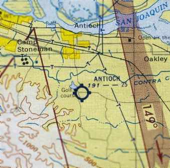
The 1954 San Francisco Sectional Chart (courtesy of Dann Shively) depicted Antioch as having a 2,500' unpaved runway.
The Aerodromes table on the 1955 San Francisco Sectional Chart (according to Chris Kennedy)
described Antioch Airport as having 2 runways, with the longest being a 2,500' oiled strip.
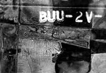
A 1958 aerial view from the Alexandria Digital Library @ UC Santa Barbara (courtesy of Jonathan Westerling)
depicted Antioch Airport as having 2 runways: one oriented east/west & another oriented northwest/southeast.
Another 1958 aerial photo of Antioch Airport showed that several other small hangars had been added at some point between 1949-58,
and the number of aircraft parked outside had increased to 6.
According to the book "Two Hours By Crow" by Howard & Judith Campbell (courtesy of Wings of History),
“Bud & Adrian Todd owned the field between 1958-61. Adrian was a National Aerobatic Champion in her Stevens Aero, a mid-wing monoplane named 'Pitts Eater'.”
Donna Demarest reported that her father, Dave Demarest, started “'Little David's Sky Circus” at Antioch.
According to Donna, “He actually jumped & trained students out at the Antioch Airport from about 1960-66.”
Terry Graham recalled, “My father, Gerald (Jerry) Graham, along with his new wife Martha, purchased the airport for $60K in 1961,
at which time only the Eastern half of the runway was paved.
There was an older man named Bass McKinney, who had a J-3 Cub on the airport when my father bought the place.
He had been involved with the airport at its founding, which I think was centered around a flying club.
He was a quiet fisherman who loved to fly.”
The 1962 AOPA Airport Directory described Antioch as having a single 2,500' asphalt runway, and noted "Skydiving N of the runway."
Terry Graham recalled, “When I moved from my mother’s home in Texas to the Airport on 1/1/64, the runway was paved full length.
There was a pilot’s lounge & office between the red-roofed building & the runway about midfield.
The red roof building was the original shop & we lived in a small mobile home just to the north of it.
The tarmac extended westward as can be seen in your photo, with the fuel pumps on the west edge of the tarmac.
All activity & all the buildings were west of the red-roofed shop building,
and there were only 2 rows of aircraft tie-downs behind to the East of the red roofed building.
The entire East end of the airport was undeveloped at that time, except for the gravel taxiway & the paved runway.”
Terry continued, “The Diablo Skydivers' club met at the airport then,
My father developed the skydiving business until it became the premier West Coast operation, famous all over the World.
Dave Demarest, indeed, was involved & led the club for years; while we ran the operations. We also towed banners & sailplanes.”
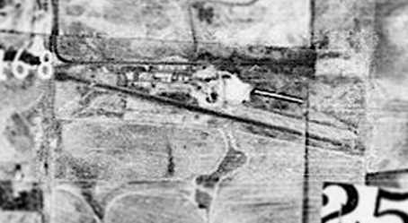
A 1965 aerial view from the Alexandria Digital Library @ UC Santa Barbara (courtesy of Jonathan Westerling)
showed Antioch Airport's former east/west runway was no longer apparent, with the northwest/southeast runway being the only one then evident.
According to the book "Two Hours By Crow" by Howard & Judith Campbell (courtesy of Wings of History),
“By 1968 the management was taken up by Gerald Graham.”
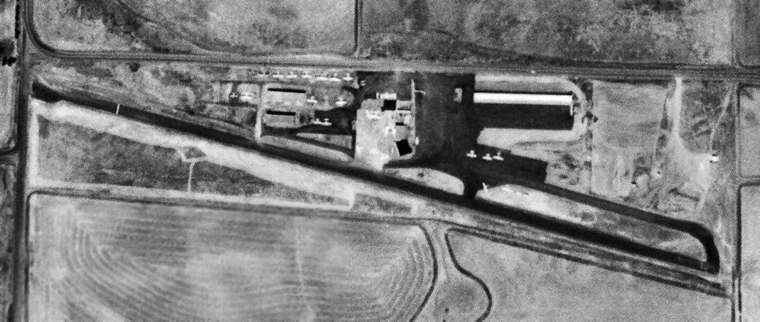
A 5/26/69 USGS aerial view showed that the number of aircraft parked outside at Antioch had increased to over 20.
Terry Graham recalled, “After many blow-ups between Dave & my father, Dave left to start a new skydiving center farther North,
and my father took over & expanded the Antioch Center into the East end of the new long hangar building on the East end of the runway in about 1971.”
According to local pilot Don Rodrigues, Antioch Airport was home of a bustling parachuting operation in the late 1970s.
The target area was in a field across the road.
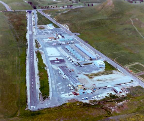
In this 1982 aerial photo looking west at Antioch Airport copyright by John Hockenbury (used by permission),
the field was apparently well used, as a total of at least 30 aircraft were visible on the field.
According to Terry Graham, “Jerry [Graham, airport owner] was a bigger than life personality who you either loved or hated.
There are many stories & intrigues surrounding my father’s life; and all are true to some extent.
He sold the airport sometime in the early 1980s to a retired football player/ investor, Gordon Gravelle.
The fixed base operation was the Graham Flying Service until the airport was sold.”
According to Terry Graham, Tedco was Antioch's Fixed Base Operator after the airport was sold by Jerry Graham.
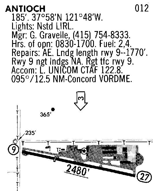
A 1988 airport diagram showed Antioch Airport had a single 2,480' paved Runway 9/27, a parallel taxiway, ramp, and several hangars.
According to the book "Two Hours By Crow" by Howard & Judith Campbell (courtesy of Wings of History), “The field closed in 1989.”
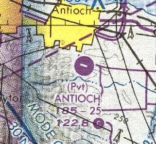
The last aeronautical chart depiction which has been located of the Antioch Airport was on the 1990 San Francisco Sectional Chart (courtesy of Dann Shively).
It depicted Antioch as a private airfield with a single 2,500' paved runway.
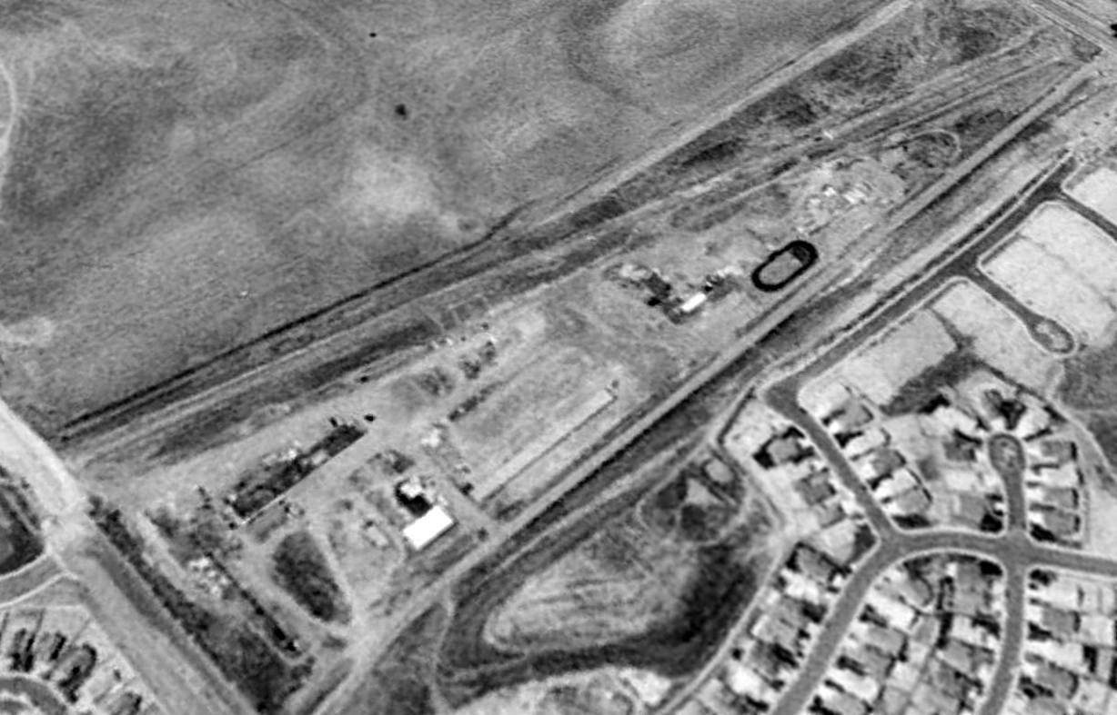
A 1993 USGS aerial view looking southwest showed that Antioch Airport remained largely untouched 4 years after its closure.
The closed Antioch runway was used in 1993 by a radio-controlled model aircraft club.
Terry Graham recalled, “In the mid-1990s, I visited the airport when only part of the runway was left & the buildings had been converted to construction offices for all the developments;
and there sat Bass McKinney’s airplane & the same pickup truck he always had in a stall in the north face of the long hangar building along the runway on the East end of the airport.
Bass was not there for me to say hello.”
A 2001 aerial photo showed that the Antioch Airport site had been completely redeveloped with a housing development.
A 2003 photo by Jonathan Westerling looking west along what used to be the orientation of the Antioch runway, now a high school & housing development.
Jonathan reported, “I wanted to quickly check out the site of the Antioch airport,
since according to the recent aerial photographs, it was being actively redeveloped.
I was hoping that I could get there while the east half of the property still retained some of the historic airport structures.
Unfortunately all remains of the airport have been obliterated.
The west half of the property is part of a massive housing development called "Black Diamond Canyon".
The eastern half is now a just-completed high school."
Terry Graham reported in 2009, “Today, all the surrounding hills have been bulldozed & used as fill for new residential developments.
The last time I visited the area, I had to guess at where the airport had been, as the ground elevations & the roads have all been changed.”
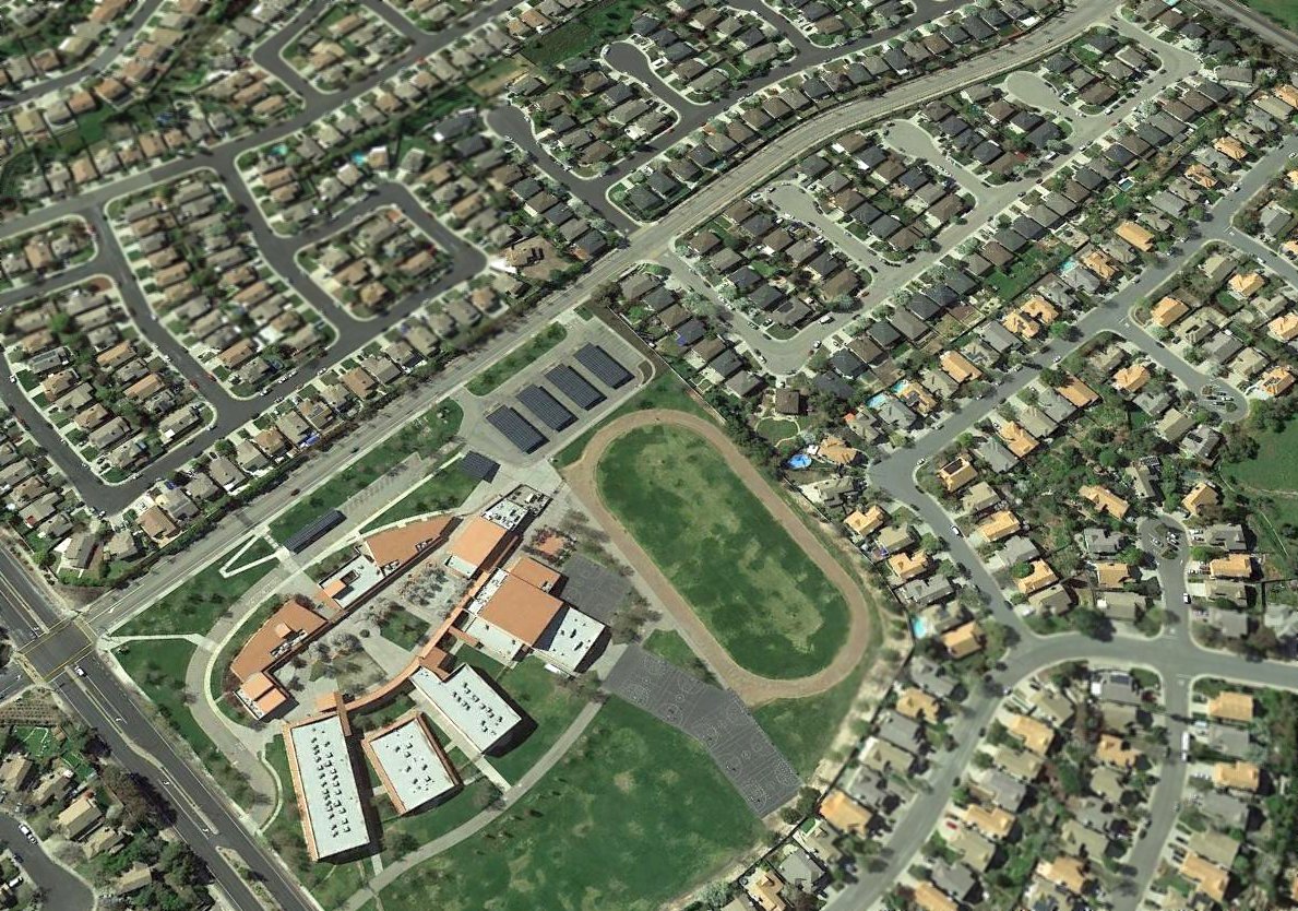
A 2017 aerial view looking southwest shows no trace remaining of Antioch Airport.
Antioch Airport was located southeast of the present-day intersection of Mount Hamilton Drive & Golf Course Road.
____________________________________________________
Original Rio Vista Airport, Rio Vista, CA
38.171, -121.689 (Northeast of Oakland, CA)

Rio Vista Airport, as depicted on the August 1948 Sacramento Sectional Chart.
This general aviation airport was not yet depicted on the August 1947 Sacramento Sectional Chart.
The earliest depiction of Rio Vista Airport which has been located was on the August 1948 Sacramento Sectional Chart.
It depicted Rio Vista as having a 2,500' unpaved runway.
According to the book "Two Hours By Crow" by Howard & Judith Campbell (courtesy of Wings of History),
“In 1949 crop duster Ira 'Skip' Seiden cut a single runway into the dirt just to the north of Rio Vista.
There were no services on the strip. During 'Skip's' days he flew Naval Factory N3N Yellow Perils in his dusting operations, and it is said 'There are many N3Ns buried in & around the airport.'”
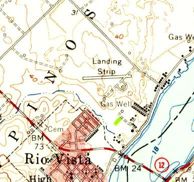
The earliest topo map depiction of Rio Vista Airport which has been located was on the 1952 USGS topo map.
It depicted a single paved east/west runway, labeled simply as “Landing Strip”.
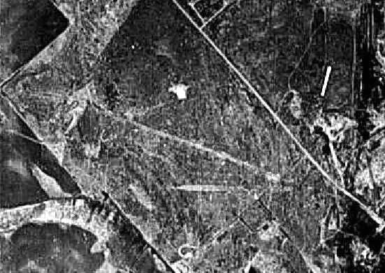
The earliest photo of Rio Vista Airport which has been located was a 10/15/52 USDA aerial photo (courtesy of Dallam Oliver-Lee).
It depicted the field as having 2 runways (oriented east/west & northwest/southeast).
According to a May 1988 Solano County “Airport Land Use Compatibility Plan” (courtesy of Dallam Oliver-Lee),
“The Rio Vista Municipal Airport was established in 1953 to serve the aviation needs of the local community & the surrounding agricultural lands.”
An 8/23/57 USDA aerial photo (courtesy of Dallam Oliver-Lee) depicted Rio Vista as having 2 paved runways (oriented east/west & northwest/southeast).
Two small buildings & 3 light aircraft were visible on the southeast side of the field.
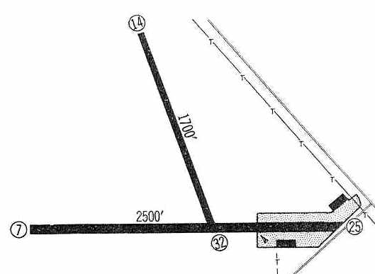
The 1960 Jeppesen Airway Manual (courtesy of Chris Kennedy)
depicted Rio Vista Airport as having 2 paved runways (2,500' Runway 7/25 & 1,700' Runway 14/32),
along with a ramp on the southeast side with 2 buildings.
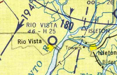
The 1961 Sectional Chart (courtesy of Dann Shively) depicted Rio Vista as having a 2,500' hard-surface runway.
The 1962 AOPA Airport Directory described Rio Vista Airport as having 2 runways.
The 1966 USGS topo map continued to depict a single paved runway, labeled simply as “Landing Strip”.
Rio Vista was depicted on the 1967 Sacramento Sectional Chart (courtesy of John Voss) with a single 2,180' asphalt runway.
According to a May 1988 Solano County “Airport Land Use Compatibility Plan” (courtesy of Dallam Oliver-Lee),
“Major improvements, including construction of a longer & wider primary runway, were completed in 1968.”
According to the book "Two Hours By Crow" by Howard & Judith Campbell (courtesy of Wings of History),
“Every once in a while the wind would make this a crosswind field & in 1968 the second runway was added. It was paved also, but very narrow, with soft sand on both sides.”
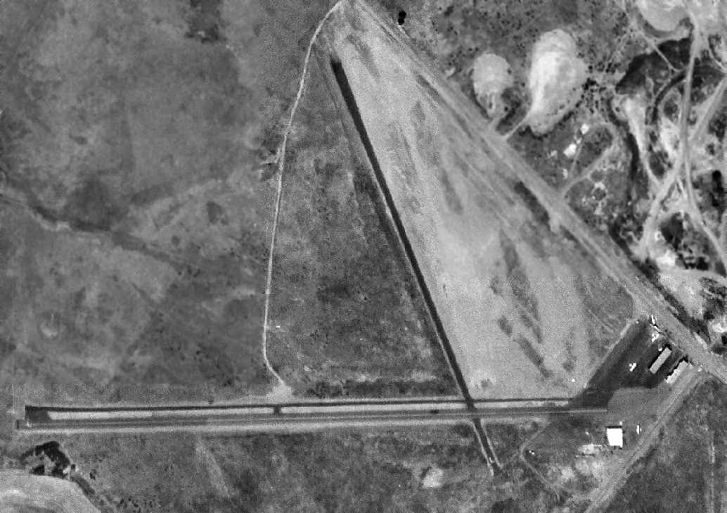
A 5/2/68 USDA aerial photo (courtesy of Dallam Oliver-Lee) depicted Rio Vista's lengthened primary runway,
and showed 3 single-engine aircraft parked outside.
The 1969 USGS topo map depicted 2 paved runways, but still labeled simply as “Landing Strip”.
A 1971 aerial view (from the Alexandria Digital Library @ UC Santa Barbara, courtesy of Jonathan Westerling)
depicted the field as having 2 paved runways.
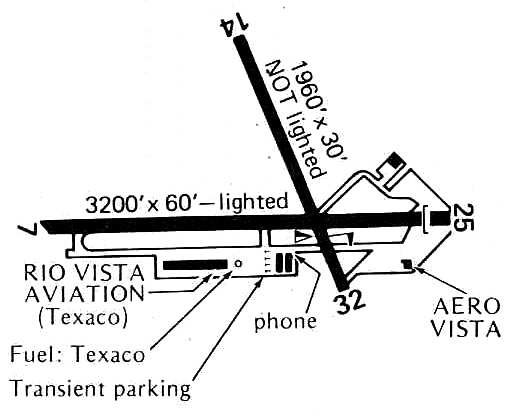
Rio Vista Airport, as depicted on the 1976 Pilot's Guide to CA Airports (courtesy of Chris Kennedy).
The Rio Vista Airport was described in the 1978 Pilot's Guide to CA Airports (according to Chris Kennedy)
as having 2 paved runways: the 3,200' Runway 7/25 & 1,960' Runway 14/32.
A 1978 aerial view depicted 6 light aircraft on the field.
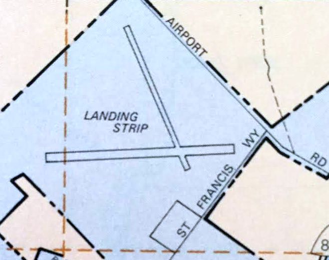
A 1982 street atlas (courtesy of Kevin Walsh) depicted the original Rio Vista Airport as 2 runways labeled simply as “Landing Strip”.
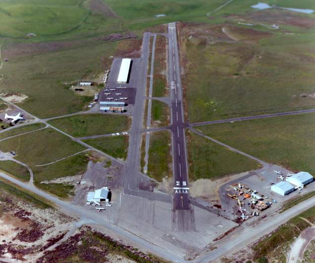
Aerial view of the original Rio Vista Airport in 1982, looking west, copyright by John Hockenbury (used by permission).
According to the book "Two Hours By Crow" by Howard & Judith Campbell (courtesy of Wings of History),
“An unsuccessful venture that drew many pilots but few of the public to the field was called the 'Flying Down to Rio' Restaurant.
A Douglas C-54 Skymaster was barged to Rio Vista & opened as a bistro & bar in late 1987.”
According to a May 1988 Solano County “Airport Land Use Compatibility Plan” (courtesy of Dallam Oliver-Lee),
“It occupies an approximately 0.5-mile square tract of land situated on the northern edge of the city.
The airport's present configuration consists of 2 runways - the east/west oriented primary runway, 3,060' long,
and a shorter, narrower crosswind runway, aligned NNW/SSE.
Some 52 aircraft are based at the airport as of early 1987 & nearly 45,000 annual operations are conducted.”
According to the book "Two Hours By Crow" by Howard & Judith Campbell (courtesy of Wings of History),
“The 'Flying Down to Rio' Restaurant closed in 1990 & the airframe was dismantled & trucked to the Travis AFB Museum.”
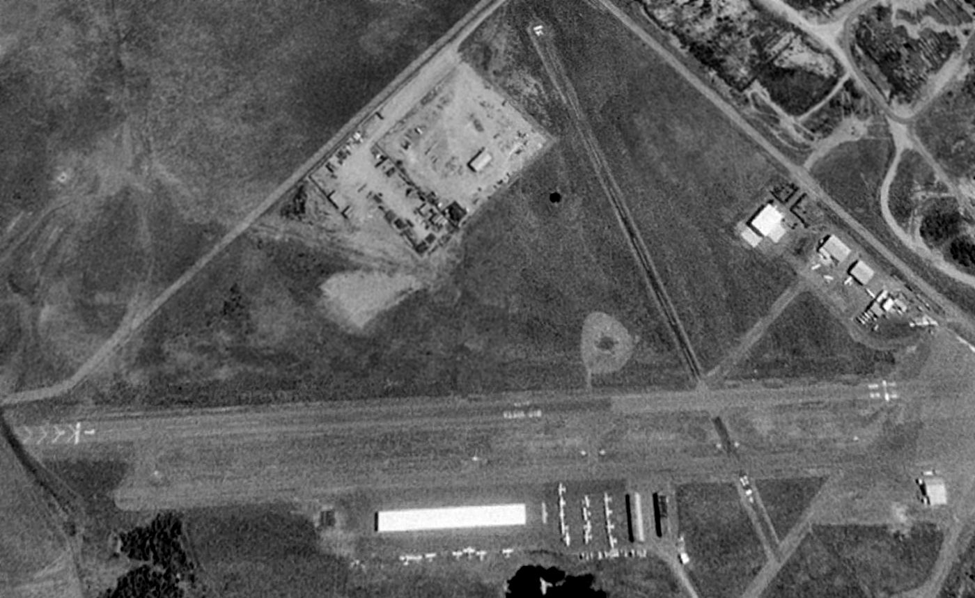
A 1993 USGS aerial view looking north showed the original Rio Vista Airport to be well used, as a total of at over 20 aircraft were visible on the field.
Ramps along the south & east sides of the field had several hangars.
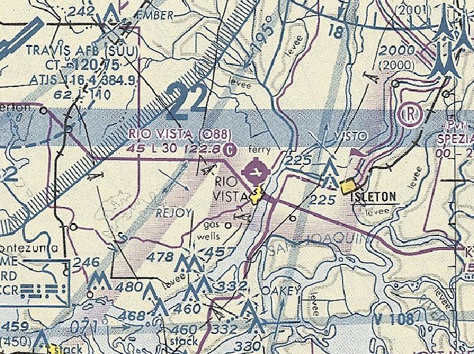
The last aeronautical chart depiction of Rio Vista Airport which has been located was on the October 1993 San Francisco Sectional Chart.
It depicted Rio Vista as having 2 paved runways, with the longest being 3,000'.
According to the book "Two Hours By Crow" by Howard & Judith Campbell (courtesy of Wings of History),
“Elton & Anna Eddy were the field managers until its last days in 1994 & were retired out of the business when the city moved operations to the new field.
They ran the hangar rentals, fuel & pilot supply sales & maintained a very well-stocked aviation book store from their office near the runway intersection.”
The original Rio Vista Airport was closed in 1995, when it was replaced by the new Rio Vista Municipal Airport, 2 miles to the northwest.
The original field was still depicted as an abandoned airfield on 1998 aeronautical charts.
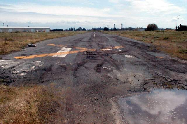
A 2003 photo by Jonathan Westerling, "Looking up the old Runway 14 at the original Rio Vista Airport.
This was the smaller (1,900') cross runway of which only the northern 1,000' remain intact."
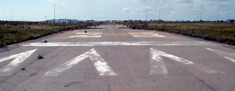
A 2003 photo by Jonathan Westerling, "Looking up the 500 remaining feet at the eastern end of what was
the primary runway at the original Rio Vista airport."
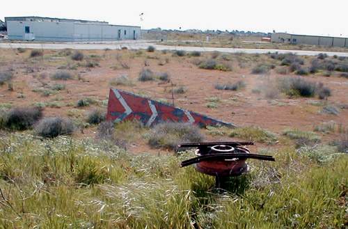
A 2003 photo by Jonathan Westerling. "The old tetrahedron at the original Rio Vista airport has been removed from its pivot (foreground),
but still indicates landing Runway 25."
Jonathan Westerling visited the site of the original Rio Vista Airport (as well as the new Rio Vista Airport) in 2003.
He reports, "If there is ever a good reason to close a general aviation airfield,
it is because the city has built a brand new airport to take its place.
Such is the case in Rio Vista, where in 1995,
a new airfield was constructed just 2 miles north of the old one.
The original Rio Vista airfield was close to town,
but aging & restricted geographically from further growth.
After about 40 years of operation,
the decision was made to invest in a new field rather than upgrade the old one.
The runways at the original airport are still very much in evidence, though 2 new roads,
and a new police station have been built on the property.
The easiest place to view the old runways is from the intersection of Airport Rd. & St. Francis Way."
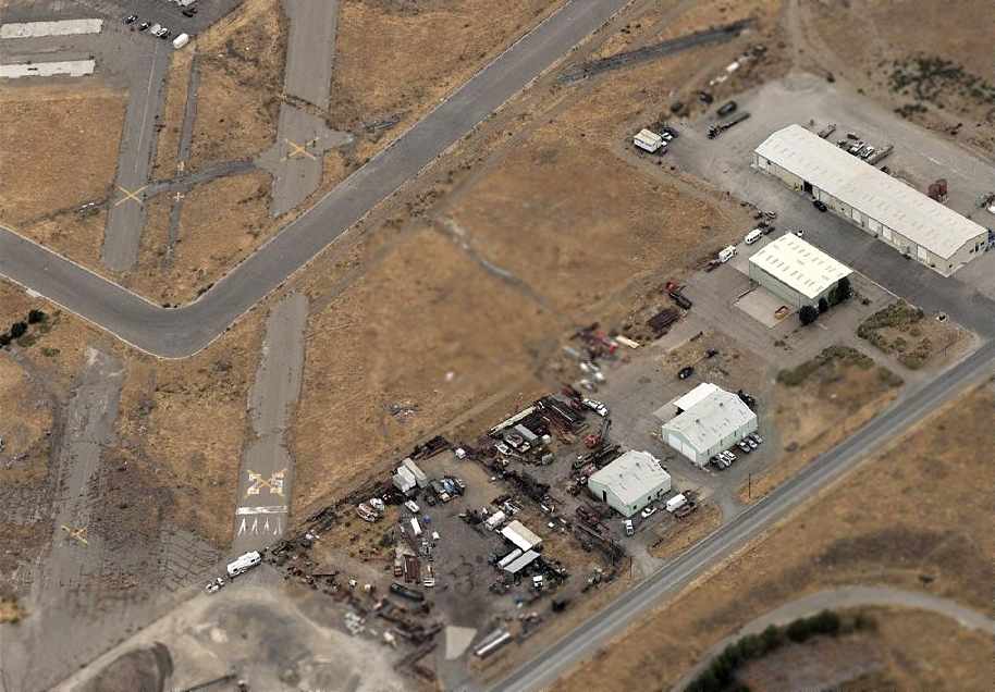
A circa 2006 aerial view looking west at the remains of Rio Vista's Runway 25 (with markings still visible) & several hangars.
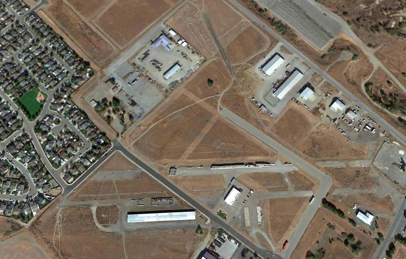
A 2015 aerial view looking north showed portions of several runways & several hangars remaining at the site of the original Rio Vista Airport.
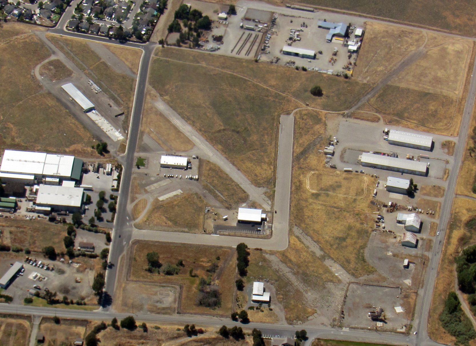
A 6/2/18 aerial view by Gonzalo Curiel looking northwest at the remains of the original Rio Vista Airport. showing portions of several runways, taxiways, ramps, and several hangars which remain.
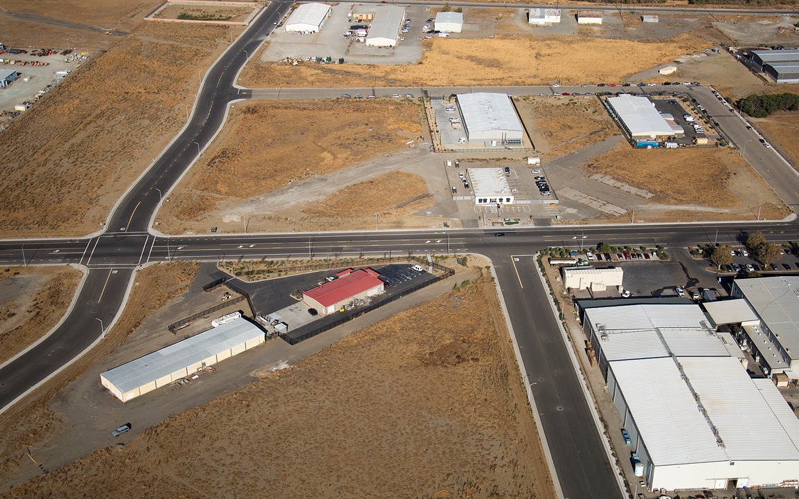
A November 2020 aerial view of the site of the original Rio Vista Airport, showing remnants of runways, taxiways, and ramps around more modern buildings.

A 2023 photo looking west at a row of former hangars which remains on the northeast side of the original Rio Vista Airport site.
____________________________________________________
This site covers airfields in all 50 states.