
Abandoned & Little-Known Airfields:
California: Southeastern Orange County
© 2002, © 2026 by Paul Freeman. Revised 4/2/26.
This site covers airfields in all 50 states: Click here for the site's main menu.
For a 10th year, the CA pages of this website are sponsored by the California Pilots Association:
____________________________________________________
Please consider a financial contribution to support the continued growth & operation of this site.
Capistrano Airport (1st location) (revised 11/20/19) - Capistrano Airport (2nd location) (revised 10/24/20) - El Toro MCAS (revised 5/3/23)
Santa Ana NAS / Hangar City Airport / MCAS Santa Ana / Tustin MCAS (revised 4/2/26)
____________________________________________________
Capistrano Airport (1st location), San Juan Capistrano, CA
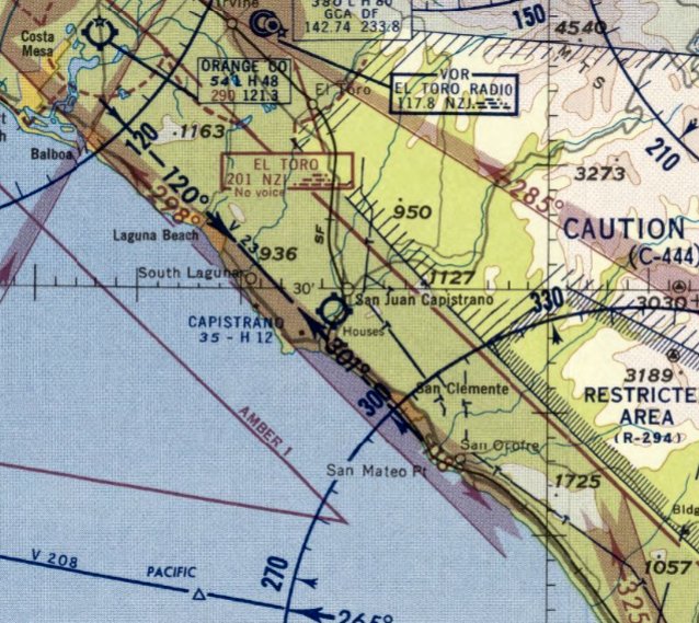
33.485, -117.676 (South of El Toro MCAS, CA)
A 1946 aerial view depicted the Capistrano Airport in its original location (on the northwest side of the San Juan Creek).
According to Carlos Olvera's article “It’s History: What Airport?” in the 8/4/13 Dana Point Times (courtesy of Mike Brown),
“In S.H. Woodruff’s plan to transform Dana Point into a Mediterranean-style destination, getting here was the problem.
Besides improving highways & roads to the coastal community, the community developer wanted to create an aviation option for travelers & residents.
In August 1929, advertising manager for Woodruff, L.J. Burrud, announced the erection of a 25' high sign on a large building
designating 'DANA POINT' for motorist & fliers alike to see.
Woodruff’s vision was that people would 'commute back & forth from their estates at Dana Point to businesses in Los Angeles.'
By September 1931, he began leveling 60 acres near the mouth of San Juan Creek, just south of Mission San Juan Capistrano.
The goal was to build a convergence of air, water, rail & roadways where planes could stop off between San Diego & Los Angeles.
Apparently, that airfield never made it past a dirt strip.”
The original incarnation of Capistrano Airport evidently closed at some point between 1931-38,
as it was not depicted on a 1938 aerial photo or the February 1934 San Diego Sectional Chart.
According to Carlos Olvera's article “It’s History: What Airport?” in the 8/4/13 Dana Point Times (courtesy of Mike Brown),
“After World War II, a second attempt was made.
Located at the end of what we now call Camino Del Avion,
the revived aviation effort had a 1,300' dirt runway & a handful of small buildings associated with it.”
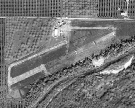
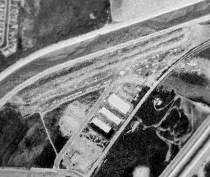
The earliest depiction of Capistrano Airport which has been located was a 1946 aerial view,
which depicted a single northeast/southwest runway & parallel taxiway on the northwest side of the San Juan Creek.
A hangar & a few small buildings were on the north side of the field, around which were parked 3 light aircraft.
Capistrano Airport still was not yet depicted on the August 1946 San Diego Sectional Chart.
The earliest aeronautical chart depiction of Capistrano Airport which has been located was on the 1947 LA Local Aeronautical Chart (courtesy of Tim Zukas).
It depicted Capistrano Airport as having an 1,800' unpaved runway.
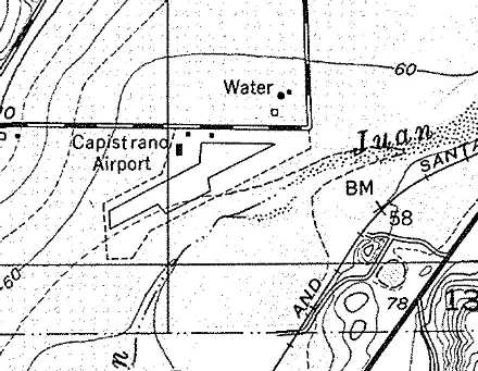
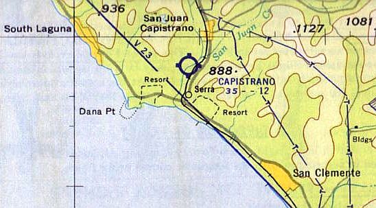
The 1948 USGS topo map (courtesy of Scott O'Donnell) depicted Capistrano Airport as having a single 1,300' northeast/southwest runway,
with 3 small buildings along the north side of the field.
The last depiction which has been located of the original location of Capistrano Airport was on the September 1949 San Diego Sectional Chart.
It depicted Capistrano Airport as having a mere 1,800' unpaved runway.
According to Carlos Olvera's article “It’s History: What Airport?” in the 8/4/13 Dana Point Times (courtesy of Mike Brown),
“Ultimately, this endeavor failed & the airstrip was returned to farming fields in the early 1950s.”
Capistrano Airport was closed by 1950, as it was no longer depicted on the March 1950 San Diego Sectional Chart.
A 1952 aerial photo showed that the original location of the Capistrano Airport had been removed, and replaced with farming fields.
Note that at some point between 1957-58 a 2nd location of the Capistrano Airport was opened on the opposite (south) side of the San Juan Creek.
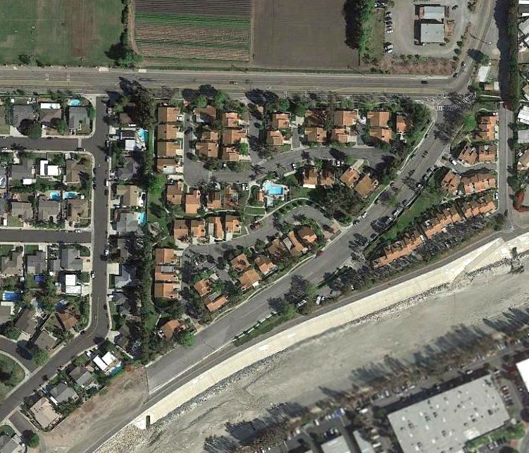
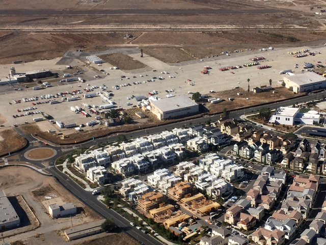
A 2015 aerial view showed no trace remaining of the original Capistrano Airport, with the site covered by houses.
The site of the original location of Capistrano Airport is located southwest of the intersection of Alipaz Street & Camino Del Avion (appropriately enough).
____________________________________________________
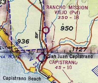
Capistrano Airport (2nd location) (L38), San Juan Capistrano, CA
33.484, -117.673 (South of El Toro MCAS, CA)
The 2nd location of Capistrano Airport (on the south side of the San Juan Creek), as depicted on the March 1958 San Diego Sectional Chart.
No airfield was yet depicted at this location on a 1952 aerial view or the September 1957 San Diego Sectional Chart.
The Capistrano Airport on the south side of the San Juan Creek replaced an earlier incarnation of the airport on the opposite side of the creek.
According to Carlos Olvera's article “It’s History: What Airport?” in the 8/4/13 Dana Point Times (courtesy of Mike Brown),
“A group of individuals decided to improve on the [former] airstrip by constructing a 1,400' landing [strip] on leased property.”
The earliest depiction which has been located of the 2nd location of Capistrano Airport (on the south side of the creek) was on the March 1958 San Diego Sectional Chart.
It depicted Capistrano Airport as having a mere 1,200' paved runway.
The 1960 San Diego Local Aeronautical Chart depicted Capistrano Airport as having a 1,200' paved runway.
The 1962 AOPA Airport Directory described the Capistrano Airport as having a single 1,200' paved Runway 4/22.
The 1966 San Diego Sectional Chart (courtesy of Chris Kennedy) described Capistrano as having an even shorter runway - a mere 1,000 feet!
According to Carlos Olvera's article “It’s History: What Airport?” in the 8/4/13 Dana Point Times (courtesy of Mike Brown),
“As development in the 1960s took off in San Clemente, the airstrip was referred to as the 'San Clemente - San Juan Capistrano Airport'.
The land was purchased in 1964 by Bruce Winton & consisted of 10 acres,
with the leasing of additional adjoining land in 1966 that was declared surplus from the flood district.
The California Public Utilities Commission even got involved in the land’s use
when the governing body requested the county take over control of the dirt road leading to the airport, since it crossed the railroad tracks.
So, in 1966 the city of San Juan Capistrano annexed the 32-acre site.
Air transportation was in full bloom, which prompted the operators of the small field to request a lease extension from 3 years to 25.
But that request was met with opposition from the Flood Control District who held a lease for a 5-acre portion, in the middle of the 2,000' runway.
The dispute threatened an airport shutdown, which would have affected the 62 private planes based there.”
As this squabble continued between the county, the city, the owner & the flood district, time was running out.
At risk was the county losing tax dollars, on its now 85 planes, to either Oceanside or Palomar Airports,
since Orange County Airport, Fullerton, and Meadowlark, were full.”
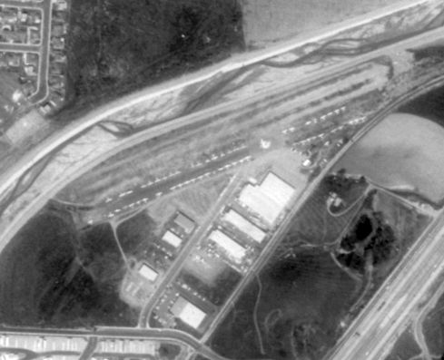
A 1967 aerial photo depicted the Capistrano Airport as having a short northeast/southwest unpaved runway on the south side of the creek,
with a total of 10 light aircraft parked on the south side.
A 1969 aerial view of Capistrano Airport, with at least 39 aircraft visible parked on the ramp.
Photo is from "From Jennies to Jets: The Aviation History of Orange County" (courtesy of Scott O'Donnell).
The airport is depicted on the southeast side of the creek, which at that point had become a flood control channel.
According to Carlos Olvera's article “It’s History: What Airport?” in the 8/4/13 Dana Point Times (courtesy of Mike Brown),
“Capistrano Airport & Industrial Park bought the land in question from the county in a no-bid sale in 1969.
Then the city of San Juan Capistrano leased a portion of the site, removing it from the tax rolls, saving the owners $4,000/year.
When land managers were ready to further develop the area, the leased land would revert to the owners with no back taxes required.
The argument was the airport was a recreational airport performing a public service. To quell the discontent the owners deeded the land to the city.”
A 1/2/70 aerial view of Capistrano Airport (from the UCSB Library), showing a very popular little airport filled with light planes.
Capistrano Airport, as depicted on the 8/14/75 LA Helicopter Aeronautical Chart.
The last aeronautical chart depiction which has been located of Capistrano Airport was on the January 1976 LA Sectional Chart.
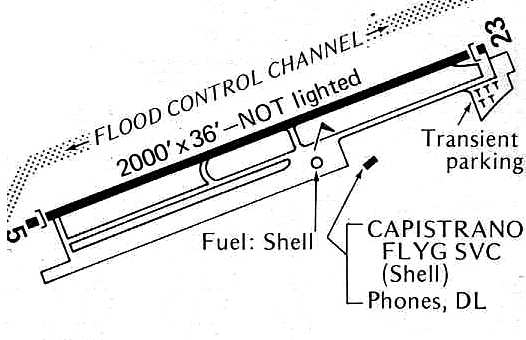
The 1976 Pilot's Guide to CA Airports (courtesy of Chris Kennedy) depicted Capistrano Airport as having a 2,000' paved Runway 5/23, with a parallel taxiway & ramp along the south side.
The operator was listed as Capistrano Flying Service.
According to Carlos Olvera's article “It’s History: What Airport?” in the 8/4/13 Dana Point Times (courtesy of Mike Brown),
“By 1976, complaints were starting to come from new developed homeowners, and a shutdown of the airport was considered.
Then the unthinkable happened: on 5/28/77, a 5-year-old girl was killed when she was struck by the propeller of a crashed plane.
The plane was towing a banner & crashed shortly after takeoff. The young girl was riding a bicycle along a path bordering San Juan Creek.”
Bob Cannon (who ran a banner towing business at nearby Meadowlark Airport) recalled the details of the accident:
"I had just gotten my SkyAd business going when I was introduced to a 'competitor' from the east coast.
I hated the thought of having a new competitor but met the guy one day when he dropped in to L16.
His name was Albert Sibi Jr., and I hired him to do a job.
Back then if a guy told me that he had a waiver I was naive enough to believe it without asking to see the credentials.
On 5/28/77 Al was making a banner pickup.
He was not using the recommended procedure of having a 3' piece of plastic tubing over the tow cable at the aircraft release end.
That tubing prevents the tow cable from getting tangled into the tail wheel & rudder levers.
More ever, it turned out that Al did not have a banner tow waiver nor even a commercial license.
He disappeared after the accident & to my knowledge was never again seen.
At least there was never any newspaper reporting of him nor any scuttlebutt."
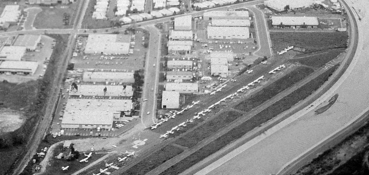
The last photo which has been located of Capistrano Airport was a March 1978 aerial view looking west (courtesy of the Orange County Archives, via Mike Brown).
It depicted a popular little airport, with no less than 51 single-engine aircraft visible on the field.
Jim Bermingham recalled, “Capistrano Airport... was closed on 6/1/78. I flew the last aircraft off of it that day.
The airport owners (property developers) were using the towplane accident as an excuse to close their airport,
so they could develop it for more lucrative uses (as commercial property).
The owners had earlier donated the airport to the city,
but the deed had a clause that the city must use it as an airport, or the owners could re-posses it.”
Strangely enough, even though the Capistrano Airport has been closed for over 20 years,
the San Juan Capistrano Municipal Code still has a section dealing specifically with regulating the Capistrano Airport.
It generally limited operations at the airport to non-commercial purposes, other than those of Capistrano Flying Service.
The January 1979 LA Sectional Chart (courtesy of Mitchell Hymowitz) still depicted Capistrano Airport, but also labeled it as “Closed”.
A 1980 aerial photo showed that commercial buildings built along most of the former Capistrano Airport property, but a short section of runway appeared to remain intact.
The 1994 USGS aerial photo showed that the last remaining Capistrano Airport runway section had been built-over at some point between 1980-94.
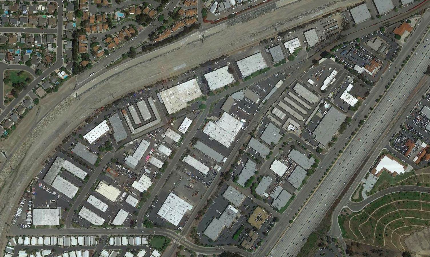
A 2018 aerial view showed no trace remaining of Capistrano Airport.
The site of Capistrano Airport is located north of the intersection of Camino Capistrano & Avenida Aeropuerto (appropriately enough).
Thanks to Scott O'Donnell for pointing out this airfield.
____________________________________________________
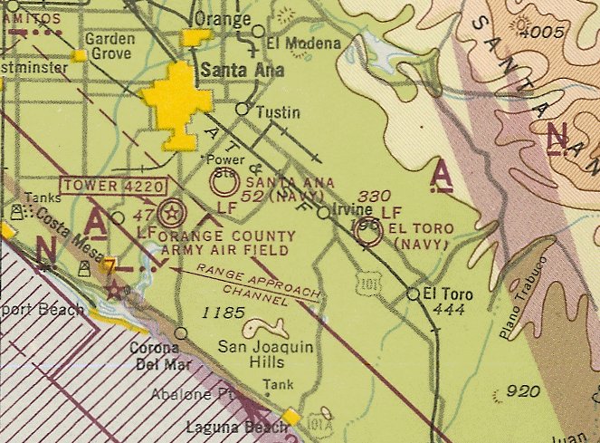
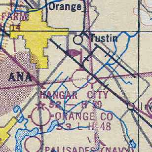
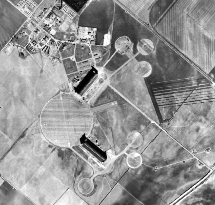
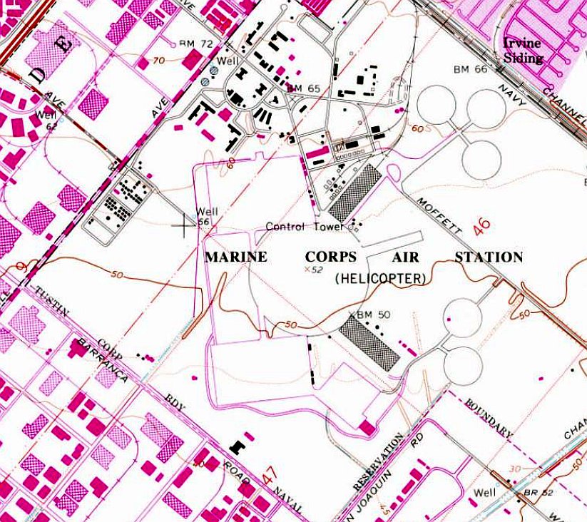
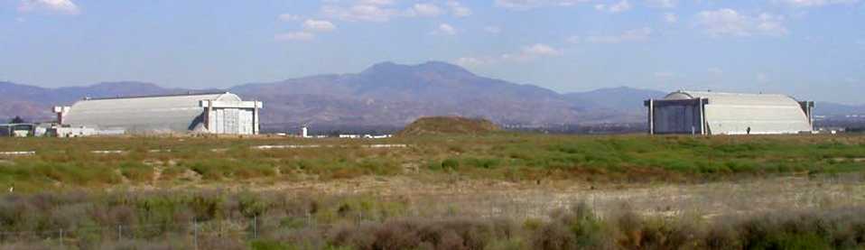
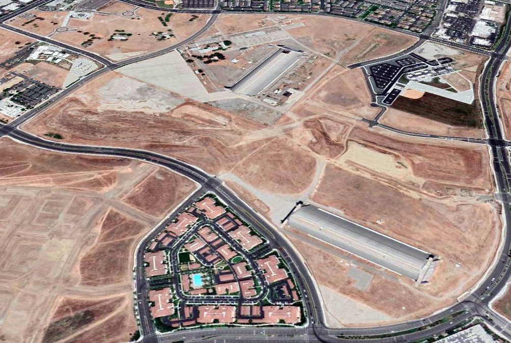
Santa Ana NAS / Hangar City Airport / MCAS Santa Ana / Tustin MCAS (NTK), Tustin, CA
33.704, -117.83 (Northeast of John Wayne Orange County Airport)
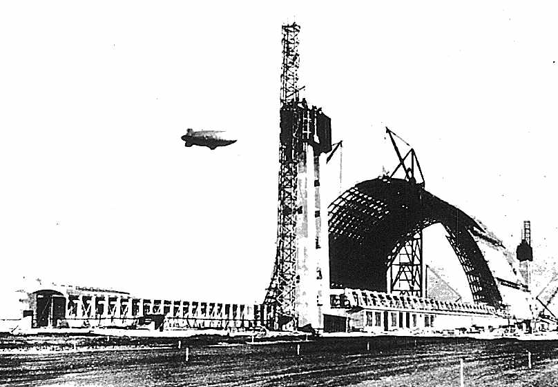
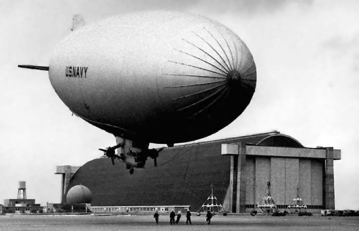
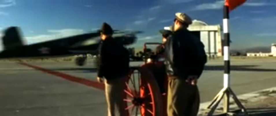
A 1942 U.S. Navy photo of Tustin's Hangar 1 under construction, with a blimp flying overhead.
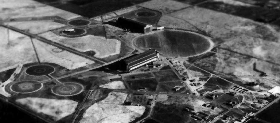
Naval Air Station Santa Ana was built in 1942 as a Navy blimp base.
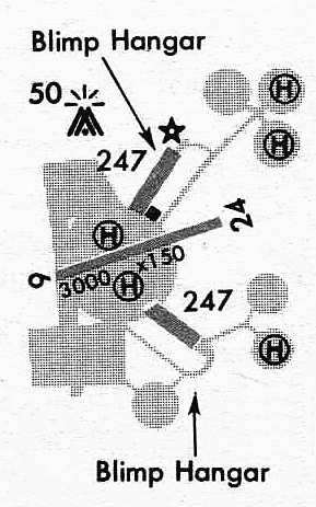
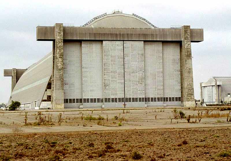
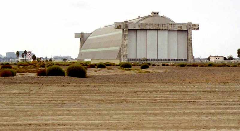
The predominant characteristic of this field was the image of its 2 huge blimp hangars, which were the largest wooden structures in the world.
The hangars were each more than 1,000' long & 300' wide, and were designed to hold 6 blimps simultaneously.
In between the 2 hangars was a huge concrete circular blimp mooring pad.
Extending outward from the central pad were concrete taxiways leading to numerous smaller concrete circular blimp mooring pads.
The earliest aeronautical chart depiction which has been located of NAS Santa Ana was on the August 1943 San Diego Sectional Chart.
A 1943 aerial view looking south at NAS Santa Ana (National Archives photo).
Note the blimp to the right of the upper hangar, and another moored to the left of the hangar.
A 1943 photo of a Navy blimp (specific type unidentified) in front of one of Tustin's massive blimp hangars.
The front gate & the 2 blimp hangars in the 1940s.
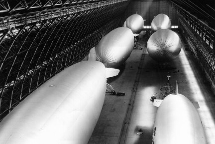
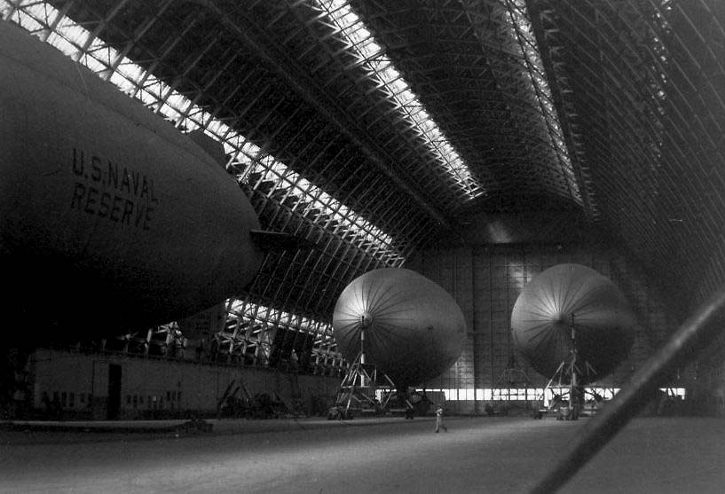
A May 1945 view of 6 blimps fitting inside Tustin's Hangar 1 simultaneously.
Mark Lutz recalled, “My Father was a Navy Blimp Command Pilot at NAS Santa Ana in 1945.”
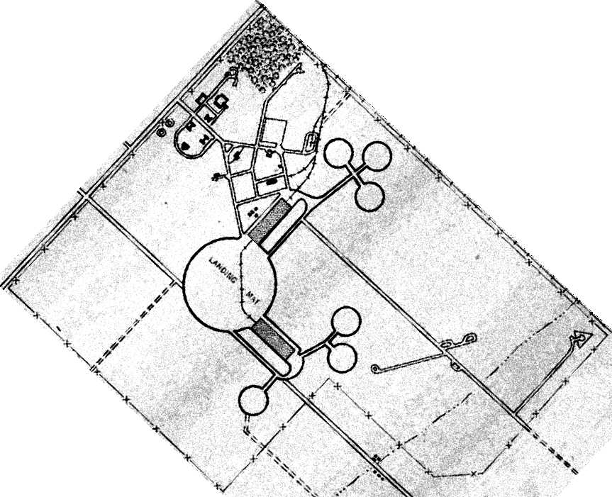
The 1945 AAF Airfield Directory (courtesy of Scott Murdock) described the “Santa Ana Naval Air Station”
as a 1,606 acre irregularly-shaped field within which was a circular 2,000' diameter asphaltic concrete landing mat.
Two 1,058' x 297' wooden hangars were depicted on the southeast & northeast sides of the landing mat,
and a total of 6 smaller blimp mooring circles were located on the far sides of the hangars.
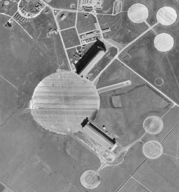
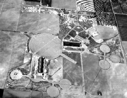
A 1946 aerial view depicted Santa Ana as having the 2 blimp hangars, the huge circular blimp mooring circle,
and 6 smaller blimp mooring circles.
At some point between 1943-46 a fixed-wing Runway 6/24 had been added,
extending northeast from the large mooring circle, in between the 2 blimp hangars.
A crosswind Runway 16/34 was also laid out over the mooring circle.
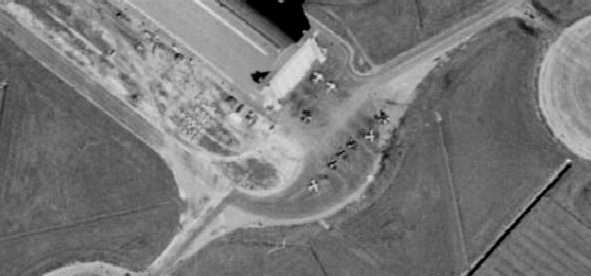
A closeup from the 1946 aerial view showing 9 single-engine fixed-wing aircraft southeast of Santa Ana's south hangar.
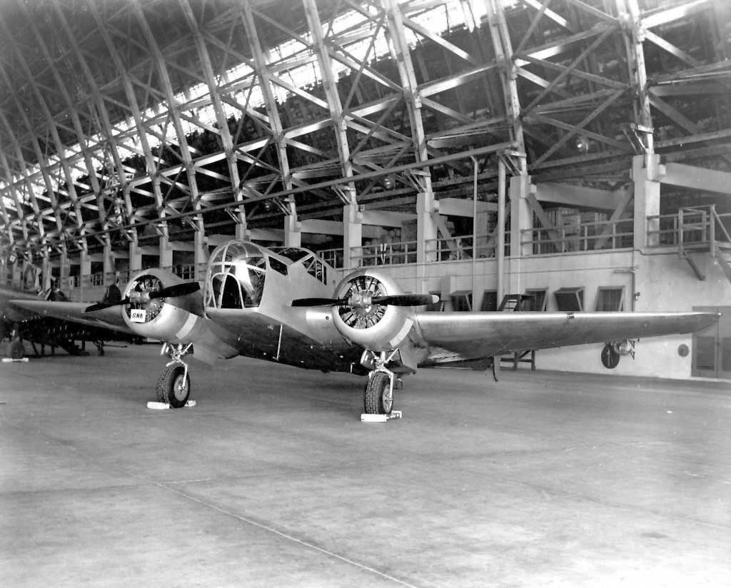
A Beech SNB inside a Santa Ana hangar during the base's 1946 Open House.
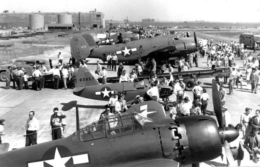
A scene from the 1946 NAS Santa Ana open house, including a captured A6M Zero in American markings, a Culver PQ-14 Cadet target drone, and another drone mounted on its launch track.
Curiously, the 1947 USGS topo map depicted a military airfield symbol (double circle) at the location of Tustin, but without any label.
The 1947 LA Local Aeronautical Chart depicted NAS Santa Ana as having a 2,000' paved runway & a blimp mooring mast.
John Voss reported, “Victor Smith was assigned to the base in 1947.
He commented that VU-7(a) was based at NAS Santa Ana for the continuation of pilotless aircraft evaluation.
VU-7(a) utilized Culver TD2C / Grumman F6F Hellcats as drone aircraft
with Beech SNB Expeditors as the drone controllers.
He commented that only one of the blimp hangers was active during his time there.
OLF Palisades was used for the flight operations (launch & recovery).”
Bill Coons recalled, “We used only one of the blimp hangars
but the other one was active with blimps & they were training for something.”
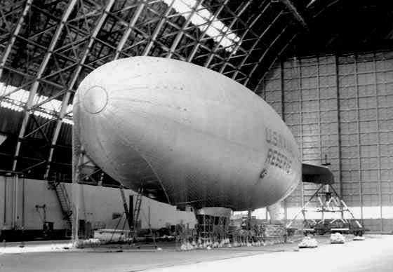
A circa 1940s photo of a blimp marked “U.S. Naval Reserve” inside a Tustin hangar (courtesy of Rex Ricks).
A circa 1940s photo of a Navy blimp control cab at Tustin (courtesy of Rex Ricks).
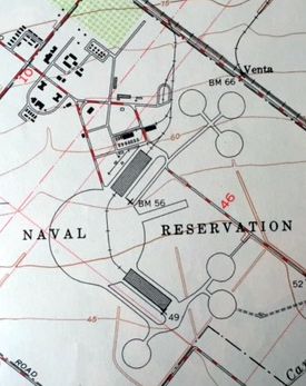
The 1948 USGS topo map (courtesy of Kevin Walsh) described the “Naval Reservation” (curiously without any other name)
as having 2 blimp hangars, the circular 2,000' diameter landing mat, a short runway extending toward the northeast,
and 6 smaller blimp mooring circles to the northeast & southeast.
On 12/20/48 VU-7a was decommissioned & VU-3 was commissioned, according to Victor Smith, via John Voss.
This took place in the blimp hangar at NAS Santa Ana. The squadron was relocated to MCAS El Toro in 1948.
Santa Ana NAS was decommissioned by the Navy in 1949.
For less than 2 years, the huge former Navy blimp airfield was evidently reused as a civilian airport.
The March 1951 USAF San Diego Sectional Chart (courtesy of Chris Kennedy) depicted "Hangar City" as a civilian airport (having a blimp mooring mast).
What an appropriate name for an airport with 2 huge blimp hangars.
The Aerodromes table on the chart described Hangar City as a commercial airport having 3 runways, with the longest being a 3,000' hard surface runway.
The civilian use of the airfield ended in 1951, when the property was transferred to the Marine Corps,
which renamed it as the Marine Corps Air Facility Santa Ana.
According to The California State Military Museum, the station reopened during the Korean War.
Blimp operations staged a brief resurrection when the Navy established a 2-blimp Naval Air Reserve Training Unit (NARTU) on 4/1/51.
The Marines arrived the next month establishing a helicopter air facility.
Bill Griffith recalled, “My 1st exposure to the helicopter station was in the early 1950s
when our Cub Scout pack made a field trip to the base & I distinctly remember seeing blimps in Hangar 1 & helicopters in Hangar 2.
That would probably coincide with its return to military operations in 1951 but prior to 1955.
In those days, the base was known by its civilian nickname, 'LTA' which stood for 'Lighter Than Air'.”
Chuck Hines recalled, “As a USMC Pfc I was assigned duty at MCGCIS-4 squadron (Ground Control Intercept) at the Tustin Lighter Than Air facility in April 1952 during the Korean War.
The squadron HQ offices were located in the blimp hangar.
GCI training & daily radar operations were conducted within an external Jamesway hut located about 200 meters distant from the hangar.
Inside the hangar huge piles of cubed rubber, a national supply, were stored which Marines guarded at night.
The rubber stored in the blimp hangar was a component of the National Defense Stockpile act.
A combat essential since neither Canada nor the U.S. had a capability to produce natural rubber.
That huge volume of rubber was still being stored on the hangar deck when I departed the LTA in May 1953.”
A 1952 aerial photo of Tustin (from Orange County GIS) showed a mere 2 fixed-wing aircraft & 2 helicopters as the only aircraft visible on the massive airfield.
The March 1952 San Diego Sectional Chart depicted Santa Ana MCAF as having a 3,000' paved runway & a blimp mooring mast.
Glenn English recalled, “I joined ZP-951 at the Santa Ana Base later that year until I went active in 1955 to Flight School.
I helped assemble 2 or 3 of the K Ships, probably in 1952-3.
We had an old pre-war G Ship when I joined that had an accident in the hangar, hurt some people in the air ballonet who fell to the concrete below.”
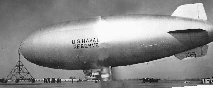
A photo of airship K-59 of the Naval Air Reserve Training Unit, Lighter Than Air,
from the 1952 MCAF Santa Ana Annual (courtesy of Craig Thorson).
Craig recalled, “My Dad flew the Sikorsky HRS helicopters there from 1951-53.
The Beechcraft behind & below the blimp is likely SNB-5, Bureau # 23841
which was based there for fixed-wing currency & instrument training.”
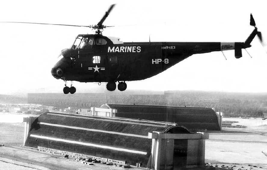
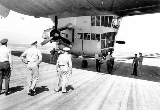
A circa 1953 aerial view (courtesy of Craig Thorson) looking northwest at a Sikorsky HRS-3 Chickasaw (BuNo 130237)
of Marine Squadron HMR-163 flying over the 2 MCAF Santa Ana blimp hangars.
Craig noted, “Those leafy things in the background are orange trees - once quite abundant in Orange County.”
A circa 1950s aerial view of 3 Sikorsky Marine helicopters in front of one of Tustin's massive blimp hangars.
A circa 1950s photo taken from the roof of one of Tustin's massive blimp hangars.
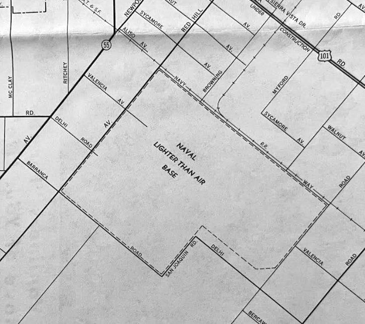
A 1954 street map (courtesy of Kevin Walsh) depicted the property outline of the Santa Ana “Naval Lighter Than Air Base”.
The last photo which has been located of a Navy blimp at MCAF Santa Ana
was an August 1955 photo of 3 Navy blimps & several Navy fixed-wing aircraft (including at least one F4U Corsair) inside one of the blimp hangars.
"MCAF Santa Ana" was depicted on the September 1955 San Diego Sectional Chart (courtesy of Chris Kennedy)
as having a 3,000' hard surface runway.
A small 3,000' runway had been built in between the "V" formed by the 2 blimp hangars
(which must have made for interesting turbulence during crosswinds),
along with a control tower nestled in between.
A 1956 aerial view looking west at MCAF Santa Ana.
According to The California State Military Museum, west coast blimp operations ended for good in June 1956,
when the Navy disestablished the NARTU.
MCAF Santa Ana eventually became the Marine Corps' primary west coast helicopter base,
operating Medium & Heavy Transport & Attack Helicopter squadrons.
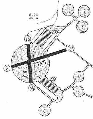
The 1960 Jeppesen Airway Manual (courtesy of Chris Kennedy) depicted the curious runway layout of "Santa Ana MCAF":
the 2,000' diameter primary blimp mooring pad, along with 6 smaller blimp mooring pads,
as well as 2 paved runways (3,000' Runway 6/24 & 2,000' Runway 16/34) which had been constructed over the primary blimp mooring pad.
The only hangars depicted were the 2 massive former blimp hangars.
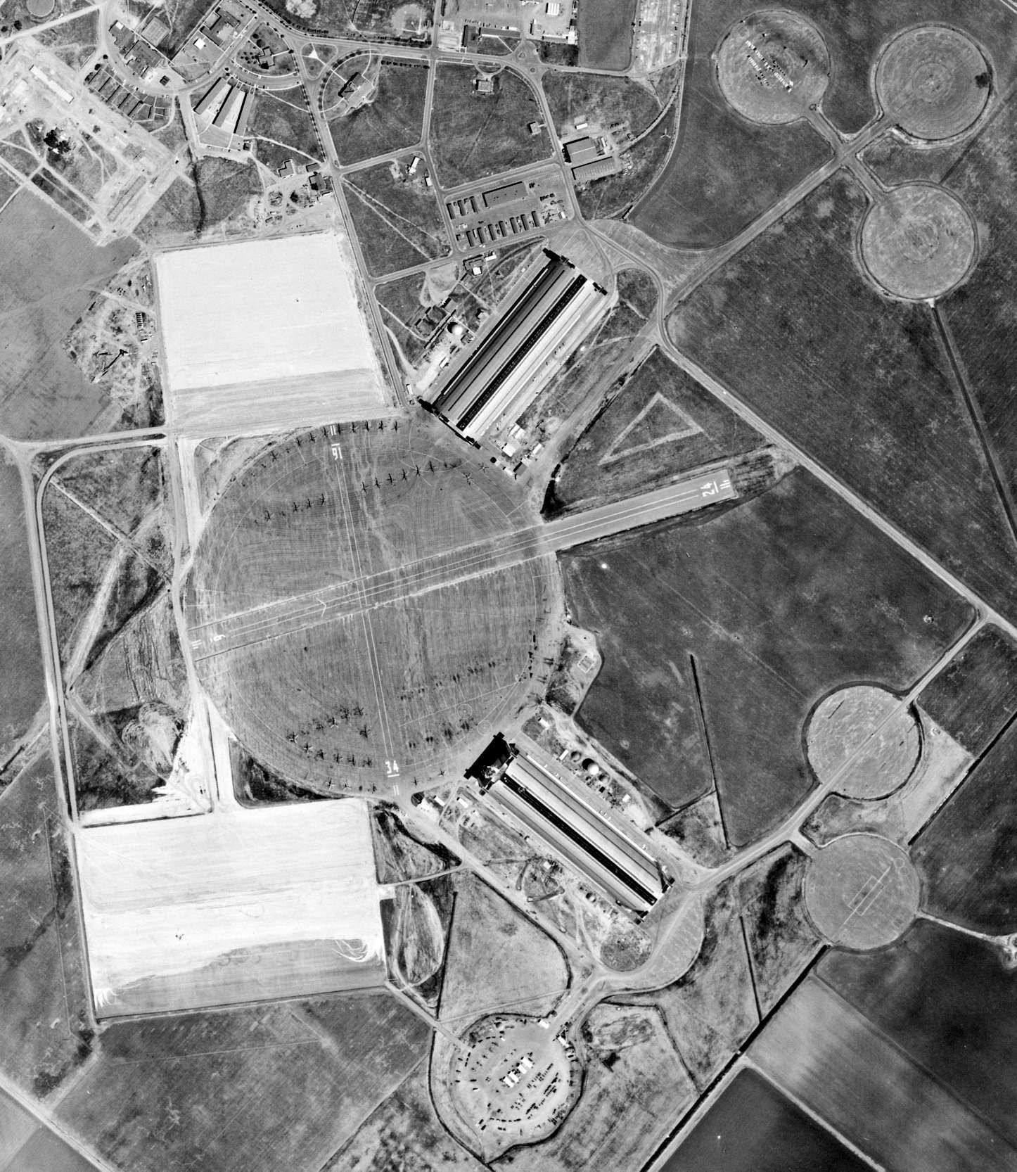
A 5/7/60 USGS aerial view (from the UCSB Library) depicted Santa Ana MCAF as having 2 paved runways extending out from the primary blimp mooring pad, along with 6 smaller blimp mooring pads.
A large number of USMC helicopters were parked on the circular blimp mooring pad,
and 2 large paved rectangular ramps were in the process of being constructed.
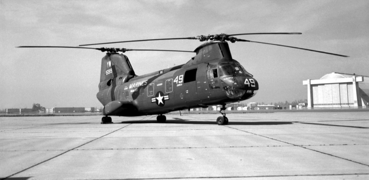
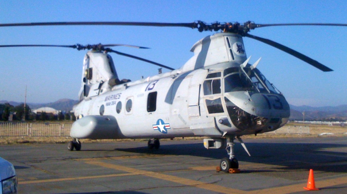
A 3/18/66 photo by J. Costello of USMC HMM-165 Boeing Vertol CH-46A Sea Knight 151919 C/n 2069, with one of Tustin's massive blimp hangars in the background.
"MCAF Santa Ana" was depicted on the 1966 San Diego Sectional Chart (courtesy of Chris Kennedy)
as having a single 3,000' paved runway.
The remarks said, "Primarily a helicopter facility."

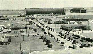
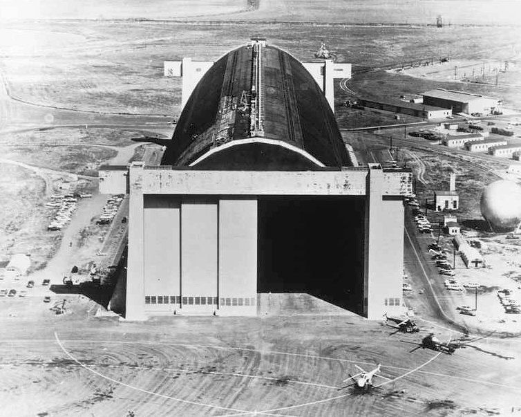
A spring 1968 photo by Joseph Jacobs looking northeast at the Santa Ana hangar & control tower.
On 9/1/69 the base was renamed "Marine Corps Air Station (Helicopter) Santa Ana".
The unique facilities at Santa Ana were very well suited to large-scale helicopter operations,
as the blimp hangars were capable of providing indoor storage for huge numbers
of helicopters, & the blimp mooring pad provided acres of ramp space for parking.
Two modern hangars were eventually added on the edge of the blimp mooring pad for helicopter maintenance.
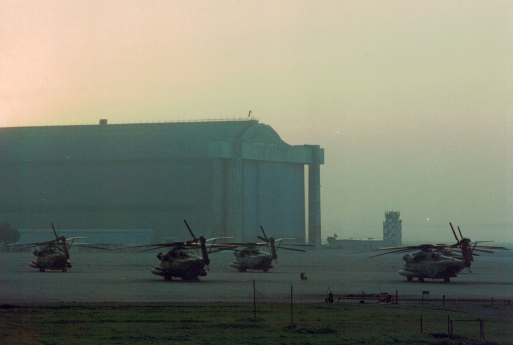
At its peak, Santa Ana housed over 100 helicopters.
According to The California State Military Museum, the facility was renamed to MCAS Tustin in 1970.
Tustin's location also was very suitable for USMC helicopter operations,
as the surrounding mountain ranges included a total of 13 Confined Area Landing Sites,
at elevations ranging from 1,000 to 5,000 feet above sea level.
MCAS Santa Ana, as depicted on the 1971 DoD Instrument Approach Procedures (courtesy of Chris Kennedy).
It showed that between 1960-71, two very large rectangular paved ramps had been added for helicopter parking,
on the north & south sides of the blimp mooring circle.
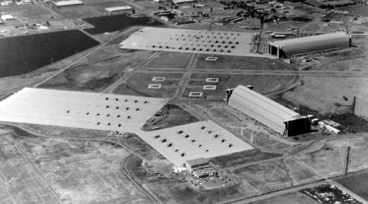
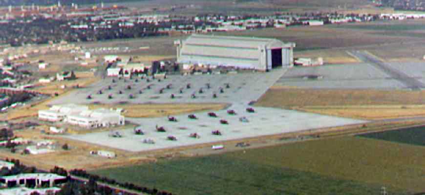
A circa 1970s aerial view looking northeast depicted large numbers of helicopters parked on MCAS Santa Ana's rectangular ramps.
Rodney Yoakam recalled, “I was stationed there in 1972 with HMA-773.
The name then was Marine Corps Air Station, El Toro, Lighter Than Air Facility, Santa Ana.”
Bill Griffith recalled, “I was living in base housing at the helicopter base from 1975-87
and flew El Toro Aero Club aircraft into the helicopter station several times
for open houses where Aero Club aircraft would be on static display.”
According to The California State Military Museum, in 1975 Malcolm Forbes used a Tustin hangar for his attempted balloon flight to Europe.
The same year, Universal Pictures used the station for the filming of “The Hindenburg”.
On 4/23/76, the base was annexed within the city limits of Tustin
and on 6/1/78, the name was again changed to "Marine Corps Air Station (Helicopter) Tustin".
Glen Turner recalled of Tustin, “I was stationed there from 1978-81 & again from 1987-89. It was a beautiful base.
So was MCAS El Toro. My memories of being stationed there are some of the most wonderful of my Marine Corps experience.
In late 1979 or early 1980 I was 'FAPped' (Fleet Assistance Program) from the Marine Air Traffic Control Squadron (MATCS-38)
to the Electronic Maintenance Division, which fell within the domain of Headquarters & Headquarters Squadron (H&HS, EMD).
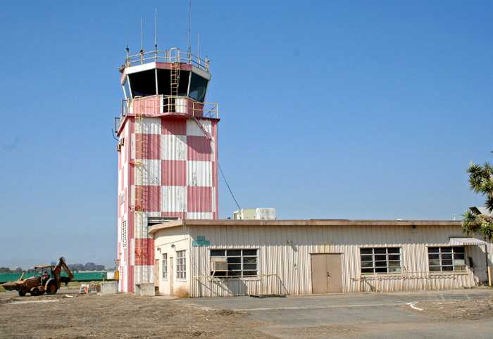
EMD was located in the yellow building at the foot of the red & white checkered control tower.
A red & gold sign above the double doors read, 'Headquarters & Headquarters Squadron, Electronic Maintenance Division.'
The officer-in-charge of EMD at the time was CWO2 Gibbs, a former Gunnery Sergeant from MATCS-38.
There was also Mr. Chadwick, a civilian of GS-11 rank, and 2 other civilians working there as well. I was one of 8 or 9 Marines with the rank of sergeant or below.”
Glen continued, “I was sent to EMD because I was a Navigational Aids Repairman (MOS 5955)
who, in addition to my primary MOS training, had attended the U.S. Navy's 6-week GRN-9 & SRN-6 TACAN course at Great Lakes, IL.
The 'powers-that-be' had decided that a AN/GRN-9B TACAN Set was to be installed on the north side of Hangar 1
(the hangar closest to the 'main drag') for use by the helicopter squadrons in their training.
My purpose was to assist NAVALEX & its contractors in the installation, then stay on as the TACAN technician afterwards.
Now this TACAN was a huge vacuum tube beast. The original antenna for this equipment was a rotating, electromechanical type.
Our antenna, on the other hand, was all solid-state & known as the OE-253.
The 15 Hz & 135 Hz modulation of the cardioid-shaped, electromagnetic pattern was achieved by controlling the reverse-biasing of PIN diodes.
So, what we had was a system comprised of vacuum-tube technology from the 1950s driving & 'latest & greatest' in solid state technology from the late 1970s.”
Glen continued, “The OE-253 antenna was mounted on the roof of a small room located at the very top of Hangar 1’s north side.
This room, according to word-of-mouth, was an old control tower from back in the US Navy’s blimp days.
Some of the windows were gone & pigeons had made it their home. Pigeon dung was everywhere! Rotted cardboard too!
There was a very dangerous trap door on one side of the room that we stayed well clear of.
To fall through the trap to the concrete floor below would have certainly resulted in death.
Just looking through it to the Goodyear blimp (temporarily stored there at the time) almost made me dizzy!
Nevertheless, I assisted in the installation of antenna & the routing of its power & heliax cables from the TACAN down below.”
Glen continued, “After the TACAN’s installation & successful flight check it was part of my routine to climb the old ladders & walkways on top of Hangar 1,
and perform preventative maintenance on the OE-253 TACAN antenna, its cables, the various VHF antennas used to communicate with aircraft & other entities,
and on the ground cables strung from one end of the hangar to the other.
The view of the mountains & Mt. Baldy was great!
I very much wish I had had the foresight to bring up a camera with me, but a 22 year-old buck sergeant thinks he has all the time in the world.”
Greg continued, “At the bottom of the red & white checkered control tower was a room filled with recording equipment.
The recorders provided aeronautical information to local aircraft (ATIS) & tape-recorded communications between the air traffic controllers & pilots.
These conversations were periodically wiped clean for re-use, but I don’t remember how often.
What I do remember is the less-than-pleasant task of 'securing' the tapes early one morning in December of 1980 following the crash of a CH-46 into a CH-53.
The 53 was practicing heavy lifts with a 500lb weight slung from beneath. The 46 came in right on top of it.
I don’t know if it was or was not pilot error. What I do know is 6 or 7 Marines were killed.
I believe one Marine was (miraculously) able to walk away, but required hospitalization.
The accident occurred a few days after I stood the night watch as LTA’s Staff Duty Officer (yes, buck sergeants stood this watch).
Although relieved I wasn’t the SDO on duty that night, I remember thinking about the pilot & crewmembers’ families and what a [messed] up Christmas they were going to have.”
Greg continued, In an air-conditioned room at the southern-most end of Hanger 1, closest to the control tower mentioned previously, was the transceiver room.
We called it 'The 22 Room' at the time. Inside were AN/GRT-22 transmitters. These AM transmitters communicated ATIS & controller information to pilots.
Each was comprised of an Exciter & Linear Power Amplifier, and was capable of operating in the low power (10 watt, Exciter-only) & high power (50 watt, Exciter + LPA) modes.
I believe the operational carrier frequency band was 200-400 Khz. We adjusted the circuitry for 90% modulation.
They were great little AM transmitters back in the day, for they came with extremely stable, easily adjusted frequency synthesizers.
I loved tuning & repairing this equipment.
Marine Corps ATC units also incorporated AN/GRT-22 transmitters in their AN/TRN-33 non-directional homing beacons which transmitted the 3-letter station identity code.”
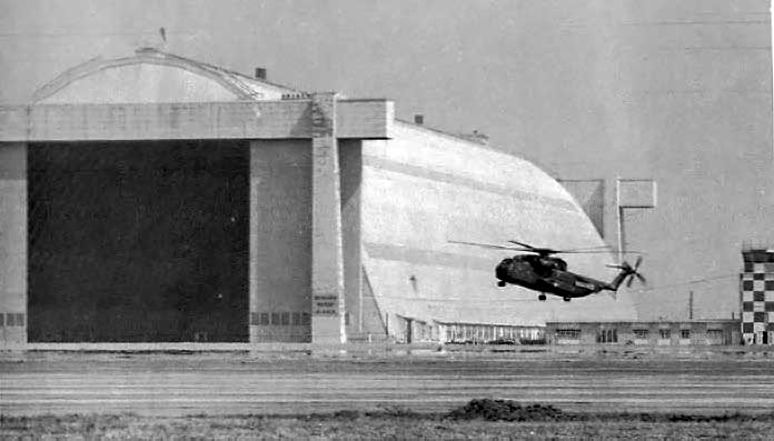
A circa 1970s photo of a Marine CH-53 Sea Stallion making an approach in front of a massive Tustin blimp hangar.
The 1980 LA Terminal Chart (courtesy of Jim Hackman) depicted “MCAS (H) Tustin” as having a 3,000' paved runway.
The 1981 USGS topo map depicted the “Marine Corps Air Station (Helicopter)” (curiously without any other name)
as having 2 blimp hangars, a control tower, the circular 2,000' diameter landing mat, a short runway extending toward the northeast,
and 5 smaller blimp mooring circles to the northeast & southeast.
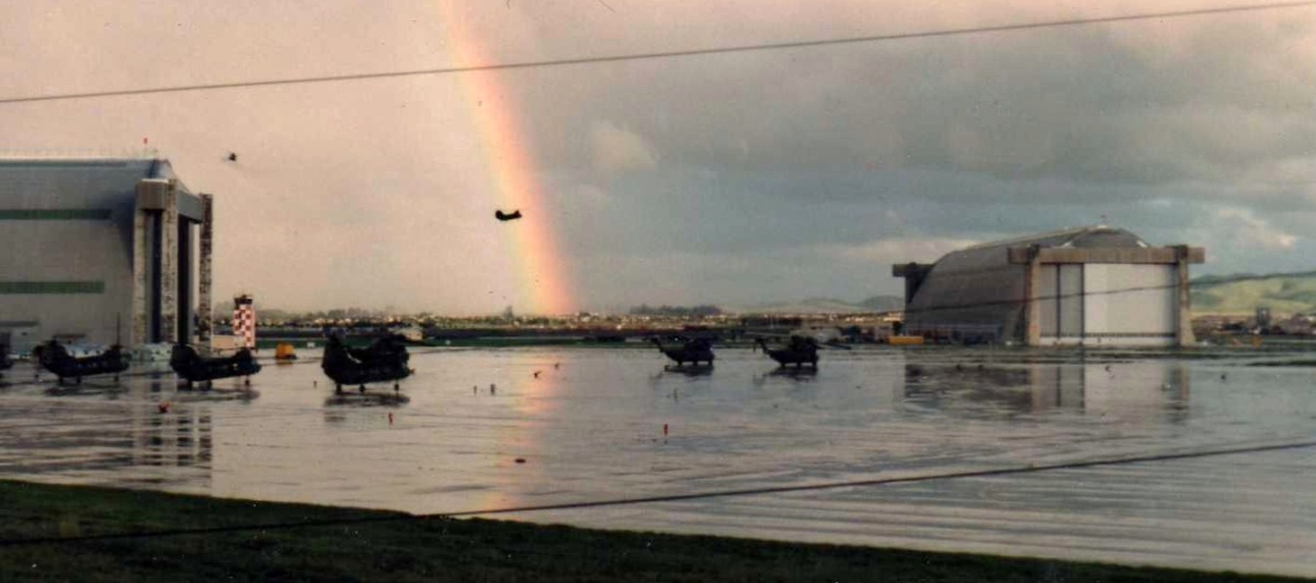
An early 1980s photo of Marine CH-53 & CH-46 helicopters flying under a rainbow at Tustin.
Armin Webster recalled, “I was stationed at MCAS Tustin from 1984-87.
In the Southwestern corner of the base were housed H&MS-16 (MALS-16),
Aviation Supply, GSE, and the Engine Test Cells
along with HMT-301 Training Squadron, which flew the CH-46, CH-53D, and the CH-53E aircraft.”
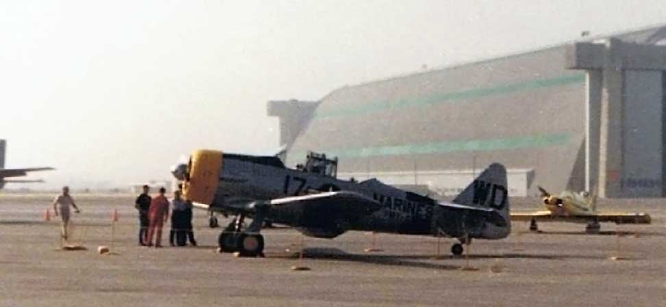
A 1986 photo by Chuck Wilson of a North American SNJ in Marine markings,
along with several other aircraft at Tustin for an airshow.
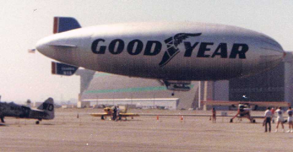
A 1986 photo by Chuck Wilson of a Goodyear blimp flying at Tustin for an airshow.
According to Jose Martinez (stationed at Tustin with HMT-302),
the blue-trimmed hangar was constructed for HMT-302 “in 1988 after the squadron split from HMT-301”.
A 1992 aerial photo by Clark Cook looking east at Tustin MCAS(H), taken when on approach to Runway 19L at SNA.
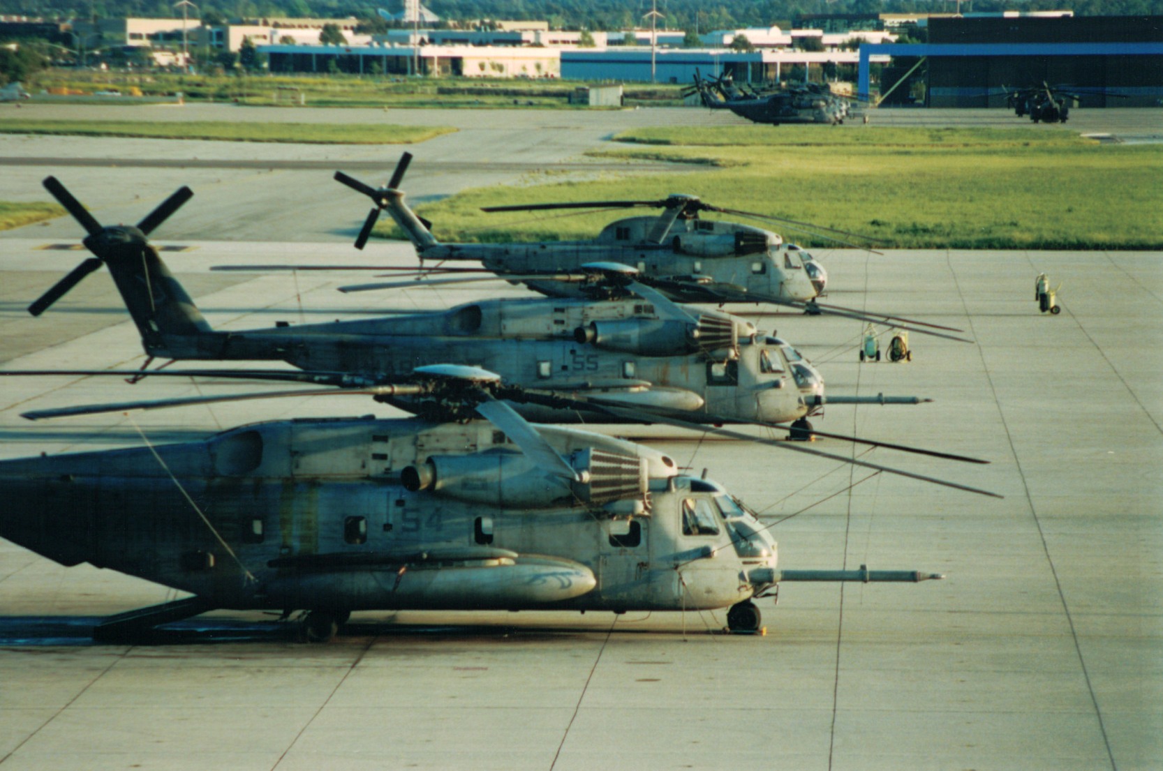
Tustin was still a very active airfield at this point – note the dozens of CH-53s & CH-46s parked on the ramp.
Jon Edwards recalled, “I was stationed at Tustin from 1992-96.
I was assigned to HMH-462 (Screw Crew) from May 1992 - September of 1995.
When I arrived the squadron still had CH-53A/D models which we transitioned out of over the next year (1993).
After we transitioned to the CH-53E, HMT-302 & HMH-363 (Lucky Red Lions) still had CH-53Ds.
With HMT-302 being mainly a training squadron for helicopter mechanics they had both CH-53 D & E models.
I was attached to HMH-363 from September of 1995 - April of 1996 & we were the last active squadron on MCAS Tustin with CH-53Ds as HMT-302 had been moved to the East coast.
When I got to HMH-462 they still had 2 CH-53As which were from Vietnam era. They still had bullet holes from then that were patched & only visible from inside the aircraft.
When I got to Tustin I was in Hangar 2 with HMT-302 for 4 months
and after graduating CH-53 hydraulics training I was sent to HMH-462 which was based in Hangar 1 at the end closest to the tower & also the flight line.
After we came back from Okinawa in April of 1994 we were in the hangar next to the NCO Club that faced Redhill.
When I was transferred to HMH-363 in September 1995 I was in Hangar 1 at the opposite end.”

A 9/11/93 photo of a USMC Boeing Vertol CH-46E Sea Knight flying in front of a Tustin blimp hangar.
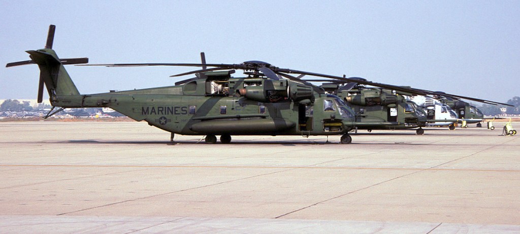
A 11/8/93 photo of a row of Marine CH-53E Sea Stallions on the Tustin ramp.
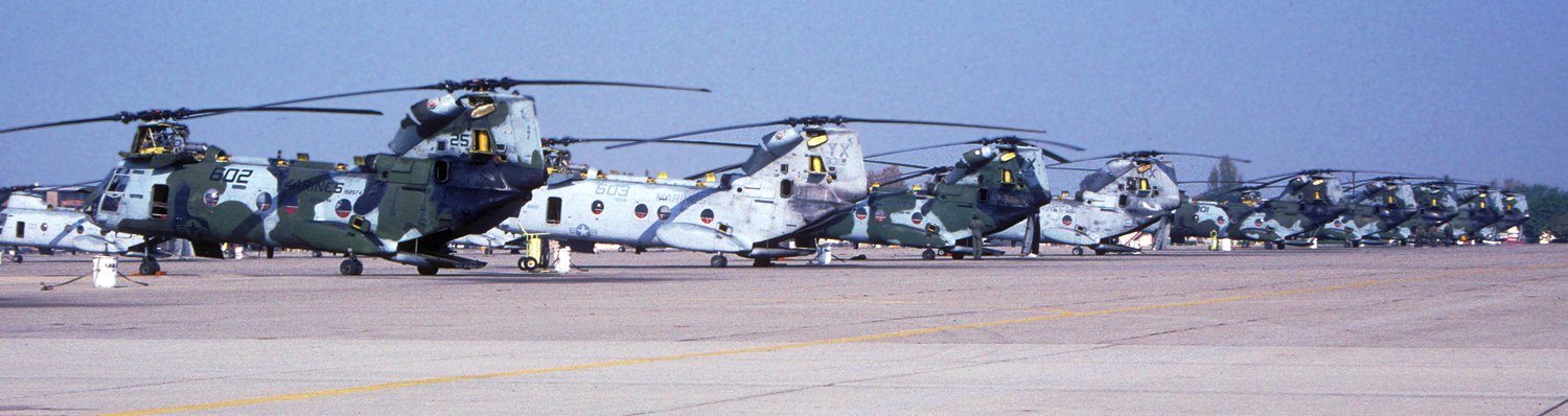
A November 1993 photo by David Ilott of rows of USMC Boeing Vertol CH-46E Sea Knights on the Tustin ramp.
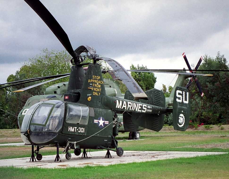
An October 1993 photo by Michael Baldock of a rare Kaman HOK-1/UH-43D Husky, painted in its Tustin colors.
It was one of 4 helicopters on display at the time along Tustin's west gate (note the CH-53 in the background).
The 1994 LA Terminal Chart depicted MCAS Tustin as having a 3,000' paved runway.
A 1994 aerial view showing a large number of Marine Corps helicopters on the MCAS Tustin ramps.
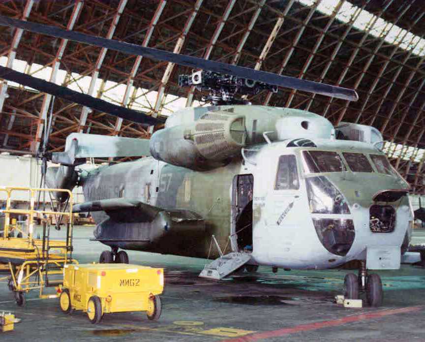
A 1994 photo by Chris Lampe of a Marine Sikorsky CH-53D Sea Stallion of HMT-302 undergoing maintenance inside one of Tustin's giant blimp hangars.
According to Chris, “Any CH-53D models [at Tustin] would belong to HMT-302, as the only CH-53Ds on the air station belonged to the training squadron.”
A 1994 photo by Chris Lampe of Marine Sikorsky CH-53E Sea Stallions dwarfed within Tustin's giant blimp hangar.

A 1994 photo by Chris Lampe of Marine Sikorsky CH-53 Sea Stallions & Boeing CH-46 Sea Knights inside one of Tustin's giant blimp hangars.
A 1994 photo by Chris Lampe of 2 Marine Sikorsky CH-53E Sea Stallions & a CH-53D on the Tustin ramp.
A 1994 photo by Chris Lampe of Tustin's Hangar 1, dwarfing the adjacent control tower.
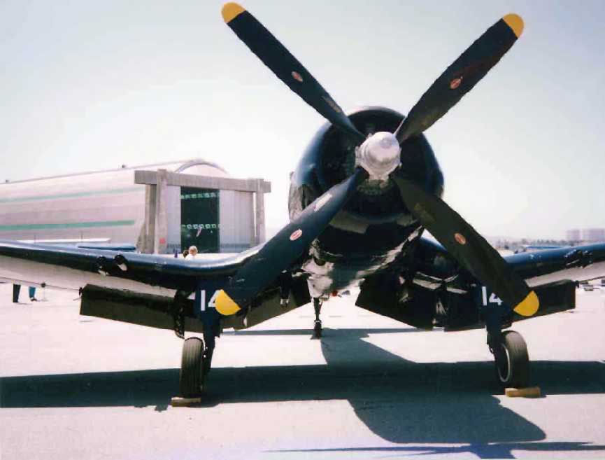
A circa 1990s photo of a F4U Corsair fighter, which was presumably flown into the base for an airshow.
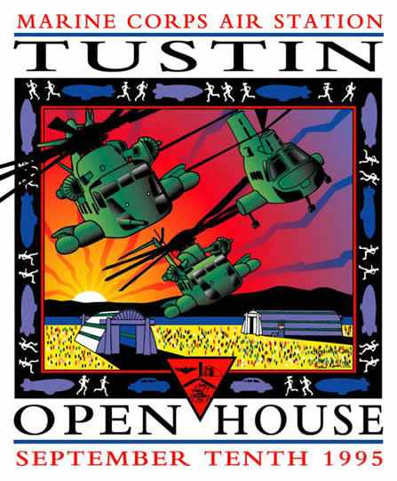
A poster by Paul & Kimberleigh Gavin of Gavin Arts for the 9/10/95 MCAS Tustin Open House.
A 1996 photo by Chris Lampe of Marine Sikorsky CH-53E Sea Stallions in front of one of Tustin's giant blimp hangars & its control tower.
Paul Freeman worked at Tustin MCAS in 1996, as an engineer for Hughes Aircraft,
completing the upgrade of the Weapons Tactics Trainers (full-dome motion-base flight simulators) for the CH-53E & CH-46E helicopters.
The simulators were installed in a building just north of Hangar 1.
The last aeronautical chart depiction which has been located showing MCAS Tustin still operational was on the January 1998 LA Sectional Chart (courtesy of Ron Plante),
which depicted Tustin as having a 3,000' paved runway.
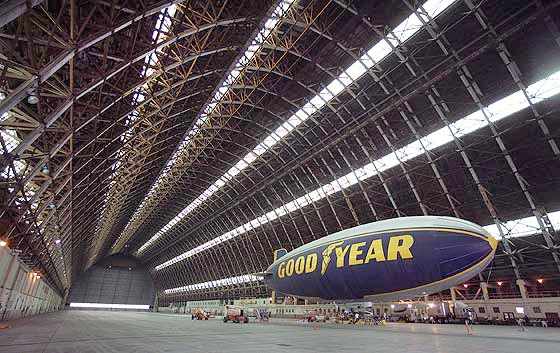
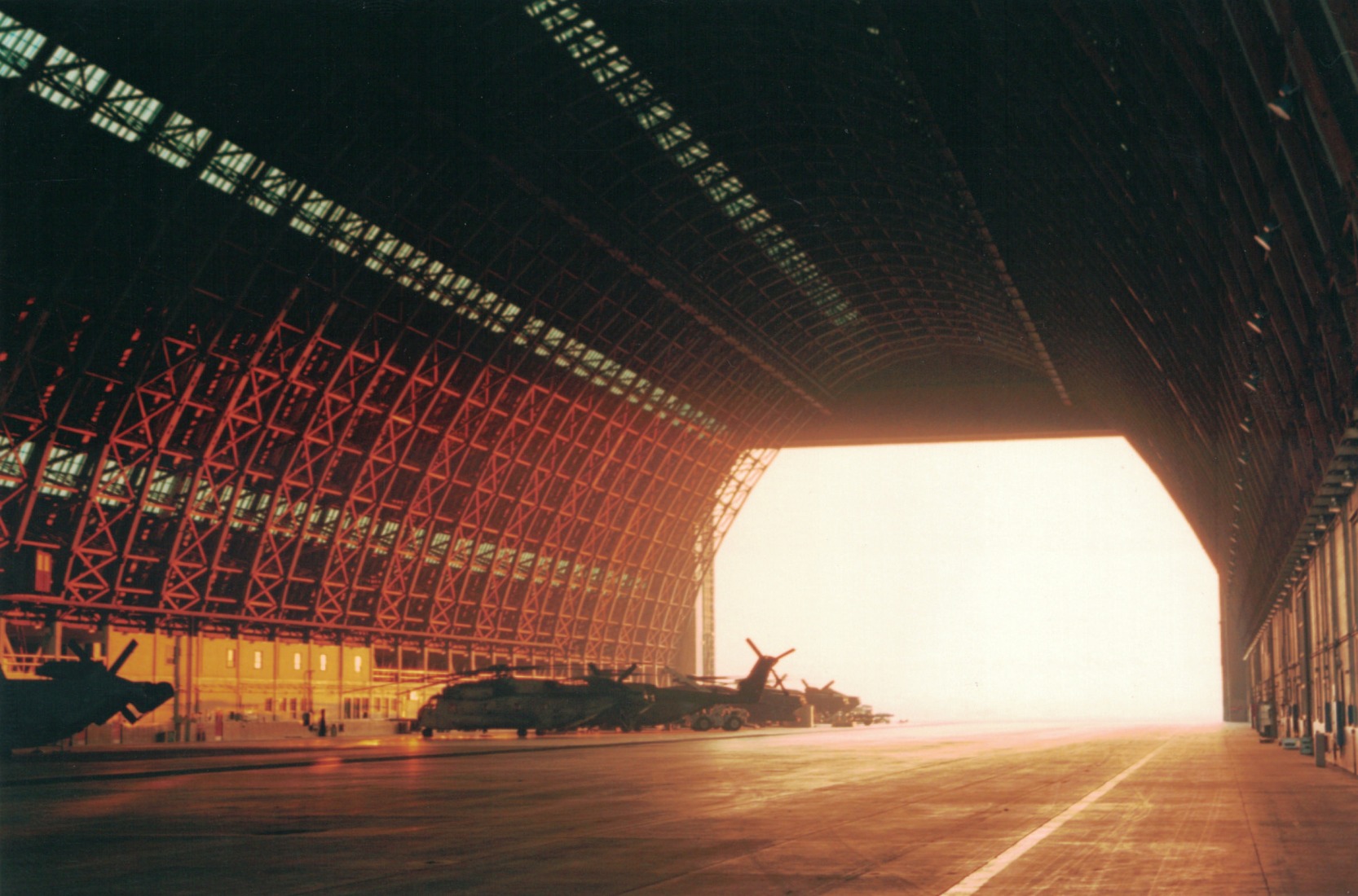
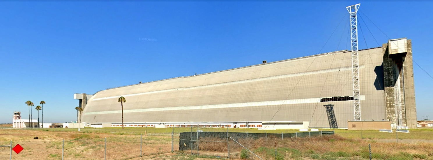
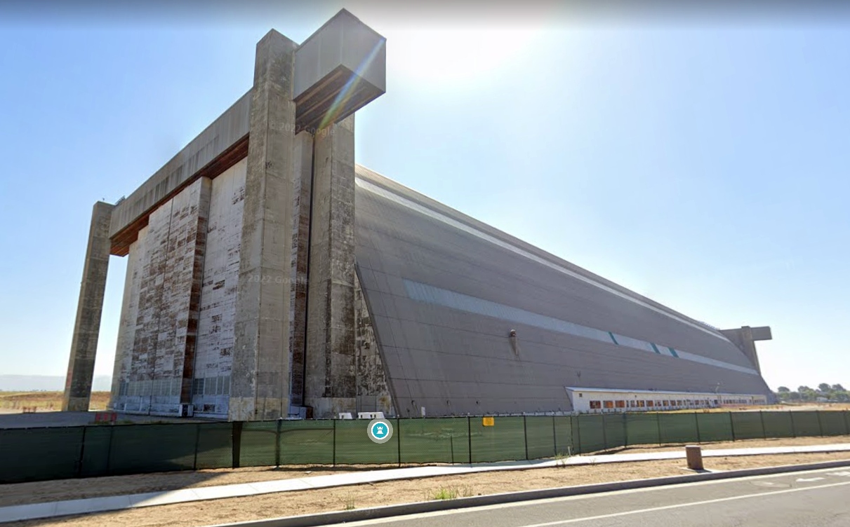
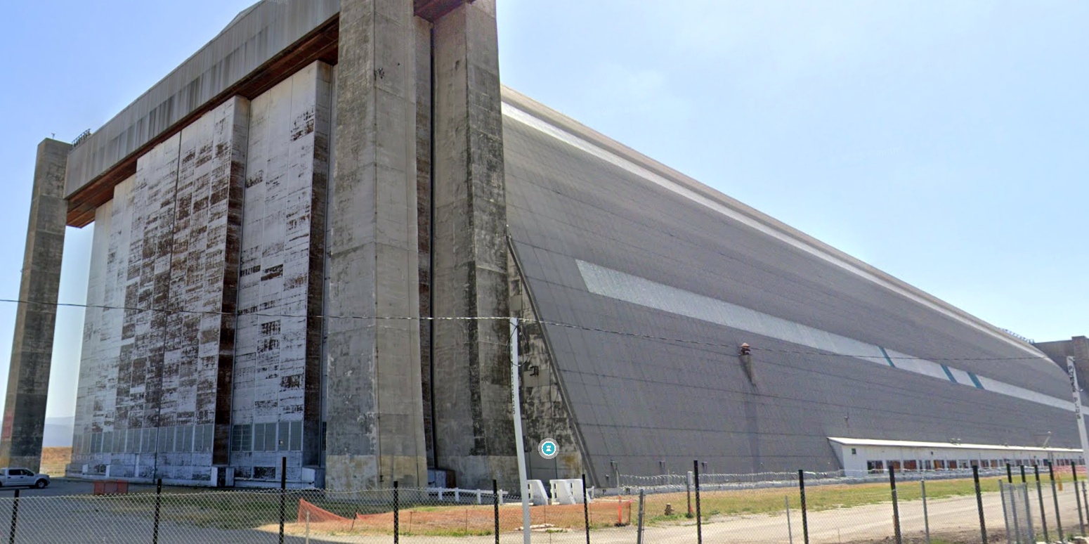
An appreciation for the massive size of the Tustin blimp hangars
may be gained via this undated photo of a Goodyear blimp inside a Tustin hangar (courtesy of Rex Ricks).
Due to Tustin's proximity to Hollywood & the unique imagery of the blimp hangars,
it has been used for location shooting for numerous movies & TV programs, including JAG, The X-Files, etc.
As part of the Base Realignment & Closure process, Tustin was closed by the Marine Corps in 1999.
Most active-duty Tustin units were relocated to MCAS Miramar, while others went to MCB Camp Pendleton.
The Reserve CH-53 & CH-46 squadrons were relocated to Edwards AFB.
Lazlo Arato recalled, “In early 2000, I noticed a large twin-engine plane making several low passes over Tustin MCAS.
I recognized it a year later as part of the movie "Pearl Harbor", where Major Doolittle is training his squad for short take-off.
It's a fine honor to this airfield & the blimp hangars.”
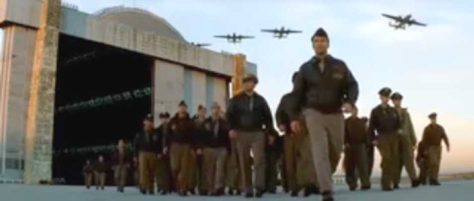
An image from the 2001 movie “Pearl Harbor”, showing a formation of B-25s overflying a Tustin hangar.
An image from the 2001 movie “Pearl Harbor”, showing a B-25 Mitchel taking off from a Tustin runway,
with a Tustin hangar & the control tower in the background.
This may be the last time that aircraft operated from Tustin.
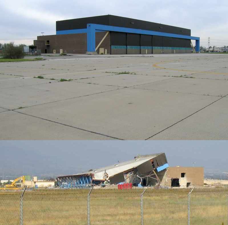
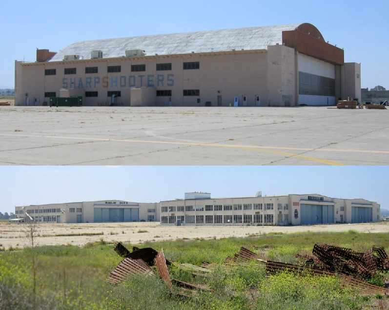
A 2002 photo by Michael Baldock of www.ghostbase.org of one of Tustin's massive hangars.
A 2002 photo by Michael Baldock of www.ghostbase.org of one of Tustin's hangars, which dwarfs the adjacent control tower (to the left of the hangar).
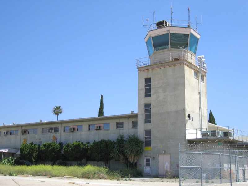
A 2002 photo by Michael Baldock of www.ghostbase.org of Tustin's abandoned control tower.
Note the Cessna flying overhead.
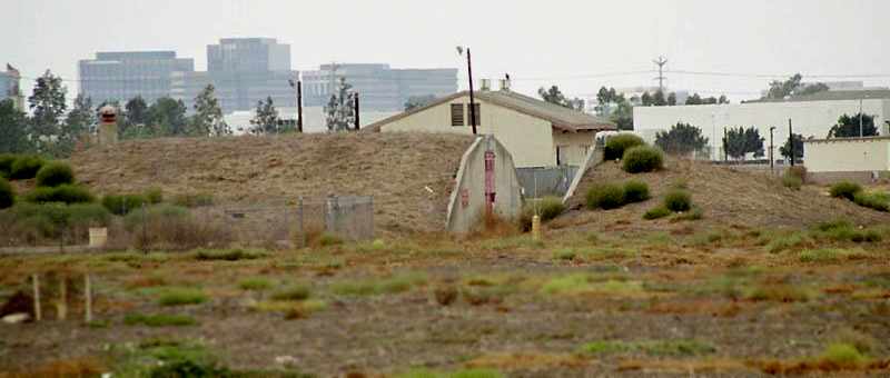
A 2002 photo by Michael Baldock of www.ghostbase.org of a former ammunition bunker at Tustin.
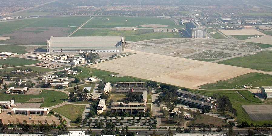
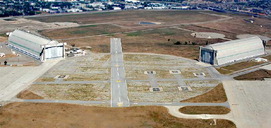
A 2003 aerial view by AirNikon looking east at Tustin (used by permission).
Following Tustin's closure by the Marine Corps, one of the blimp hangars has been designated a national historic landmark,
and is to be preserved (the 2nd one presumably will be torn down).
Overall, plans were approved by the local government to reuse the property for a mixture of purposes, including parkland & commercial development.

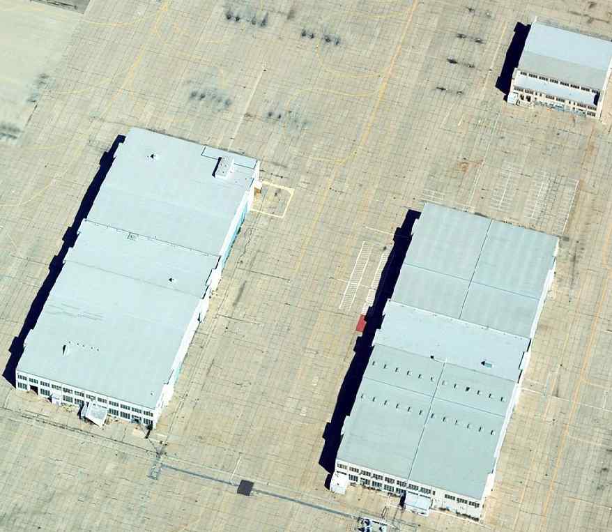
The last photo which has been located showing the Tustin airfield facilities remaining intact was a 2004 aerial view looking north.
All the hangars, ramp, and blimp mooring pads remained intact, at least for the time being.
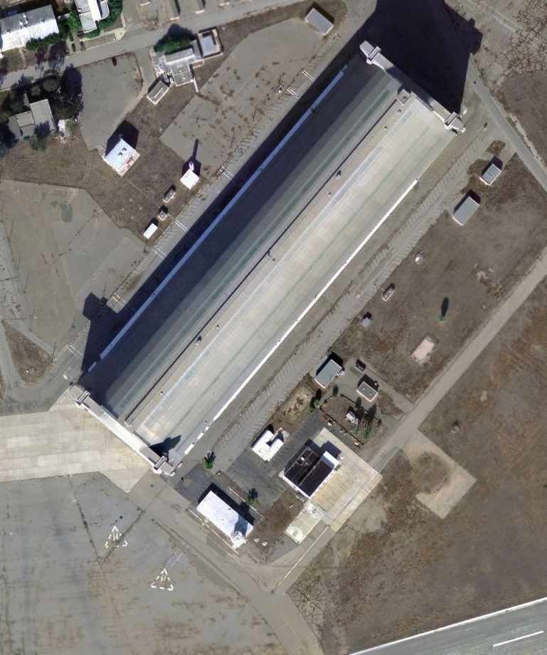
A close-up of Tustin's Hangar 1 from the March 2004 USGS aerial photo.
A November 2004 aerial photo by Jonathan Westerling looking north at the abandoned Tustin Airfield
showed that the entire airfield still remains intact (for now), including both hangars.
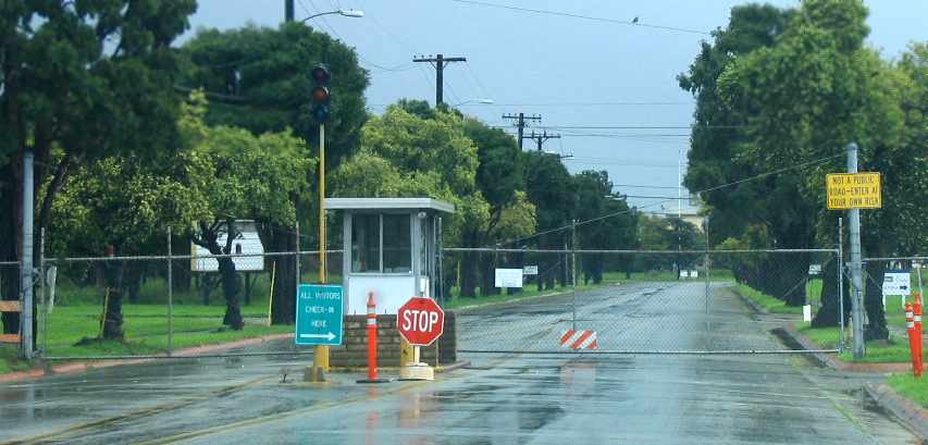
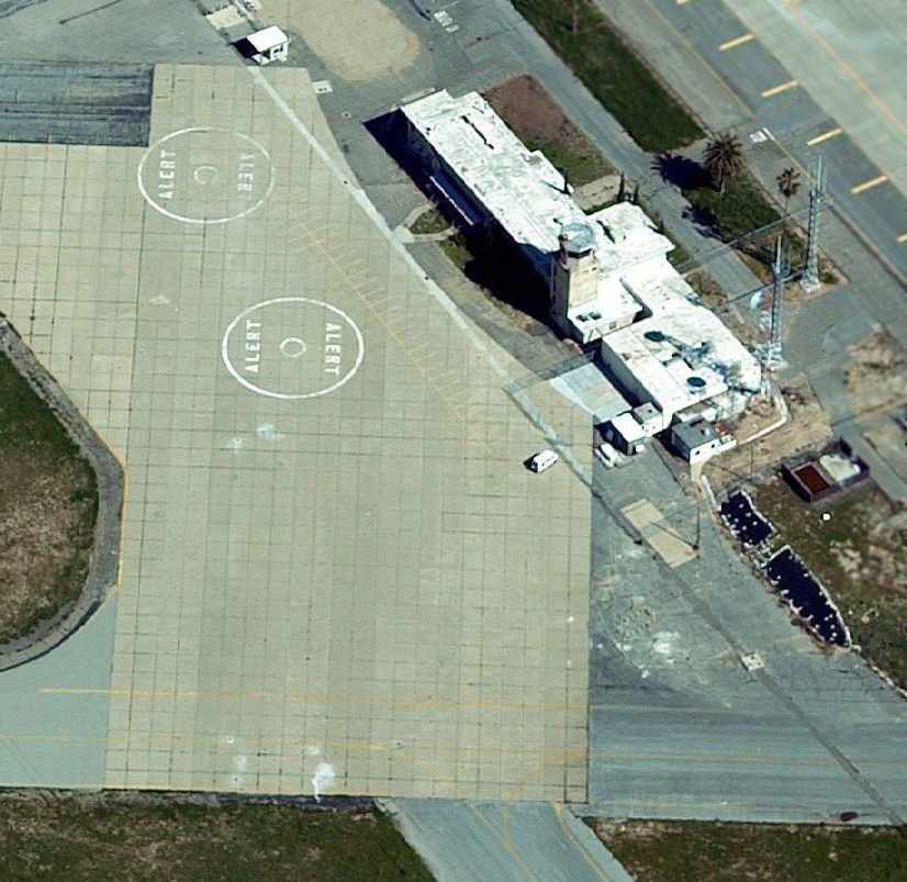
A February 2005 photo by Paul Freeman of the guard shack at Tustin's main entrance.
Paul Freeman visited Tustin in February 2005, to find the base entrance locked up tight.
From what could be seen from the perimeter of the base,
the airfield facilities still appeared to remain intact, with all runways & hangars still remaining.
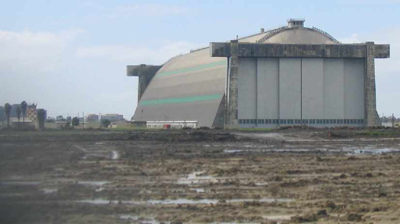
A February 2005 photo by Paul Freeman looking west at Tustin's Hangar 1, with the control tower on the left.
A February 2005 photo by Paul Freeman looking along the profile of one of Tustin's massive blimp hangars.
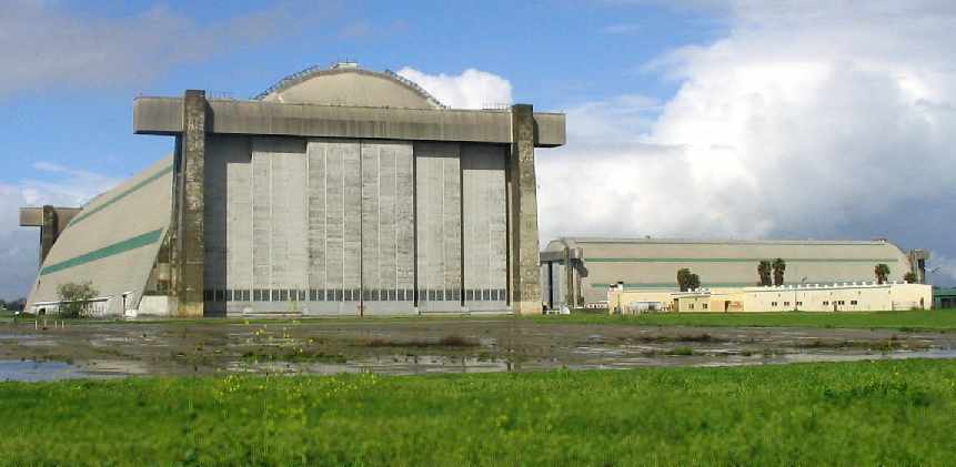
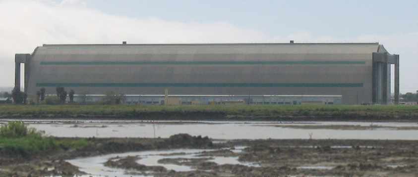
A February 2005 photo by Paul Freeman looking north at Tustin's Hangars 2 & 1.
Two 2005 photos by Brian Smole, taken before & after Tustin's HMT-302 helicopter hangars was demolished.
Note that this hangar was of relatively recent construction – post-1988 – less than 17 years old. What a waste.
A 9/4/05 aerial view looking northeast along Tustin's Runway 6 (copyright Brian Bartlett, used with permission).
Six helipads are visible among the former blimp mooring pad.
Brian Smolke reported in 2005, “In the past few months I've watched as redevelopment has started in force.
There have been large piles of concrete rubble in the western part of the base,
and I imagine that much of the tarmac has been demolished.
The small (compared to the blimp hangars) brown hangar on the south side of the base has also been demolished,
along with support structures to the east.
The main gate from Redhill Avenue has also been removed to make way for a new, wider road.
Current plans indicate the northern blimp hangar will be preserved,
while the southern blimp hangar will be demolished to make way for a road interchange.
This hangar might be one of the last things to go, though.
It seems like time is up for this base.”
Armin Webster reported in 2005, “From what was published in the Orange County Register
is that the Southwestern corner of MCAS Tustin is to be used to build a large shopping mall.”
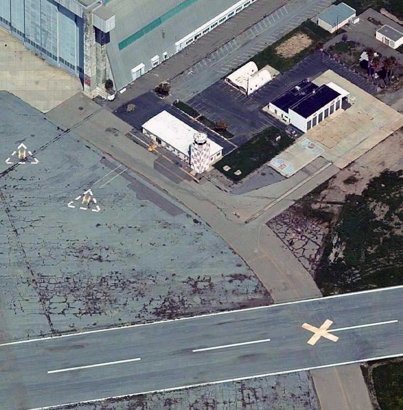
A circa 2005 aerial photo looking north at Tustin's former control tower, in between Hangar 1 & the runway.
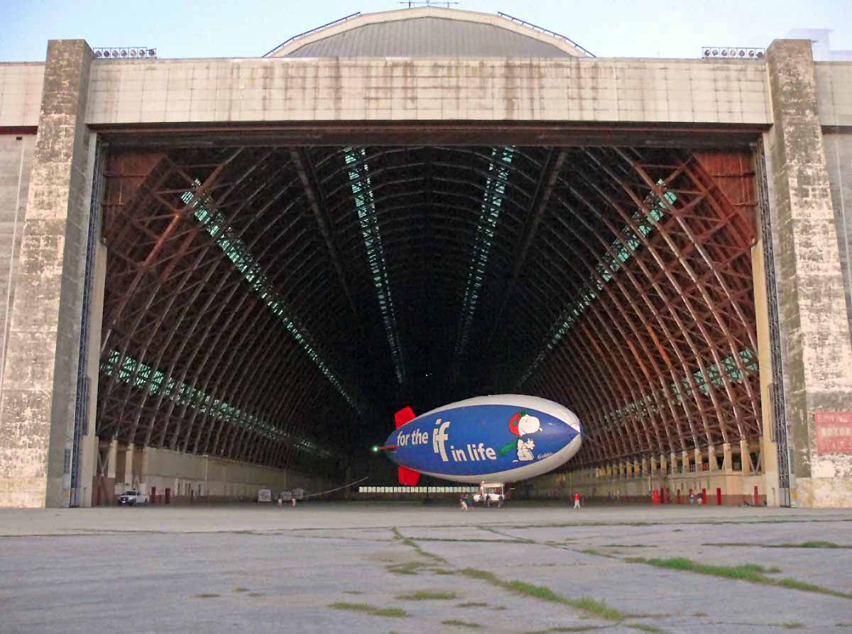
A 2/27/08 photo of the MetLife Snoopy blimp inside a Tustin hangar.
MCAS Tustin was depicted as an abandoned airfield on the 2009 LA Terminal Chart.

A redevelopment plan posted as of 2010 on the City of Tustin website.
Of the approximate 1600 acres, approximately 1294 acres have been conveyed to the City of Tustin, private developers and public institutions
for a combination of residential, commercial, educational, and public recreational & open-space uses.
The remaining 308 acres will be conveyed to other federal agencies, the City of Tustin and public institutions for the same uses.
One hangar (slated to be transferred to Orange County control) is depicted in the tan area labeled "Orange County Urban Regional Park"
and the other hangar (to be turned over to Tustin, and to be torn down & the property used for commercial buildings & parking) is depicted in the blue area labeled "GO".
An undated photo (posted as of 2010 on the City of Tustin website) of the Tustin control tower, presumably soon to be torn down.
A September 2010 photo of Mark Lutz in front of Tustin's Hangar 1.
Mark reported, “The Navy's closed base caretaker's office kindly granted me access to the hangars themselves.
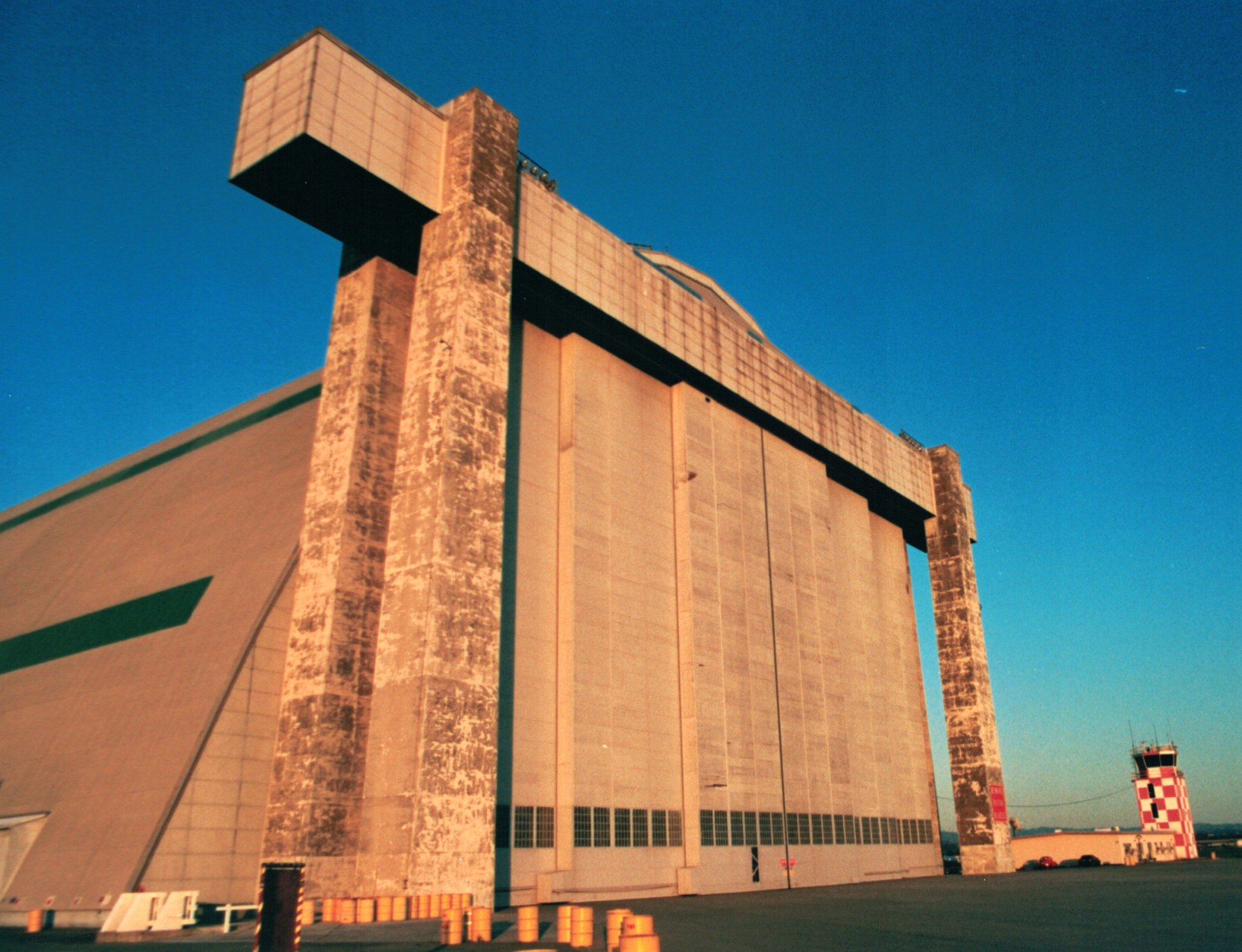
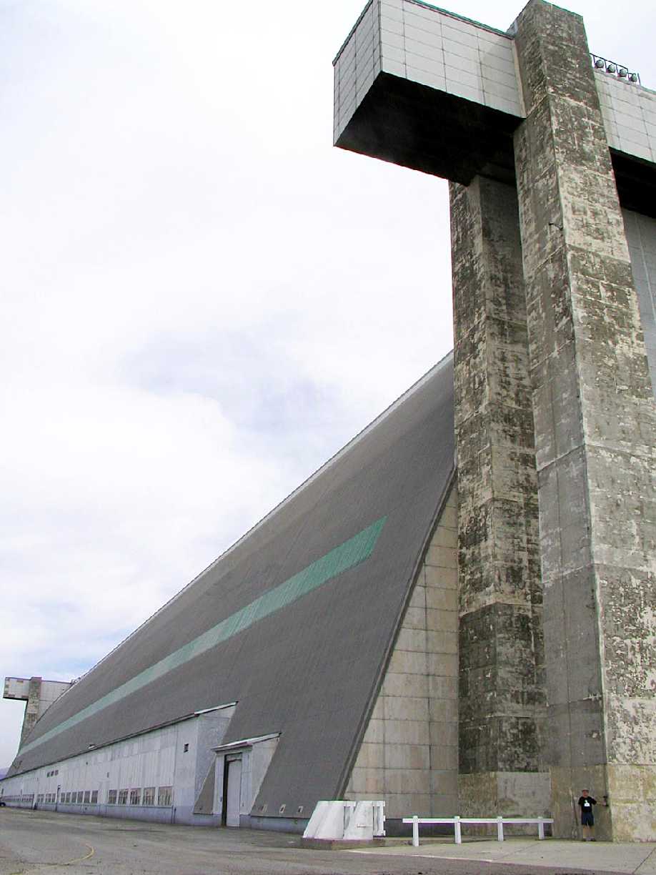
My photos show the immense size of the hangars better than any photos I've ever seen before. The WW2 blimp hangar is 1/5 mile long x 18 stories high.”
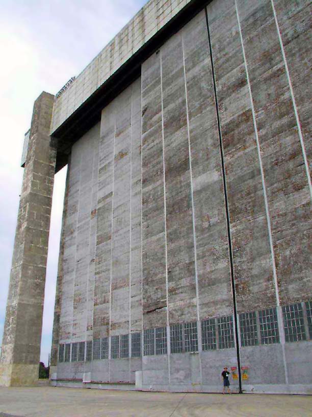
A September 2010 photo of Mark Lutz in front of Tustin's Hangar 1 airship door.
Mark reported, “There are 6 leaves - you can see 4 of them in this photo.
Each leaf is 120' tall, 37.5' wide, 3' thick, weighs 30 tons, and rolls on a rail.
It's like a giant's sliding closet door. The motorized door opening system takes about 2 minutes to fully open.
Each end of the hangar has one of these doors. This one is on the landing pad (West) end.
Each door pillar sits on a concrete footing 30' x 60', 8' thick, which in turn sits on over 100 pillars.
The doorways are structurally separate from the timber truss-work hangars because the wind load is more than the wood truss-work can handle.
Both of this hangar's doors are still fully operational.”
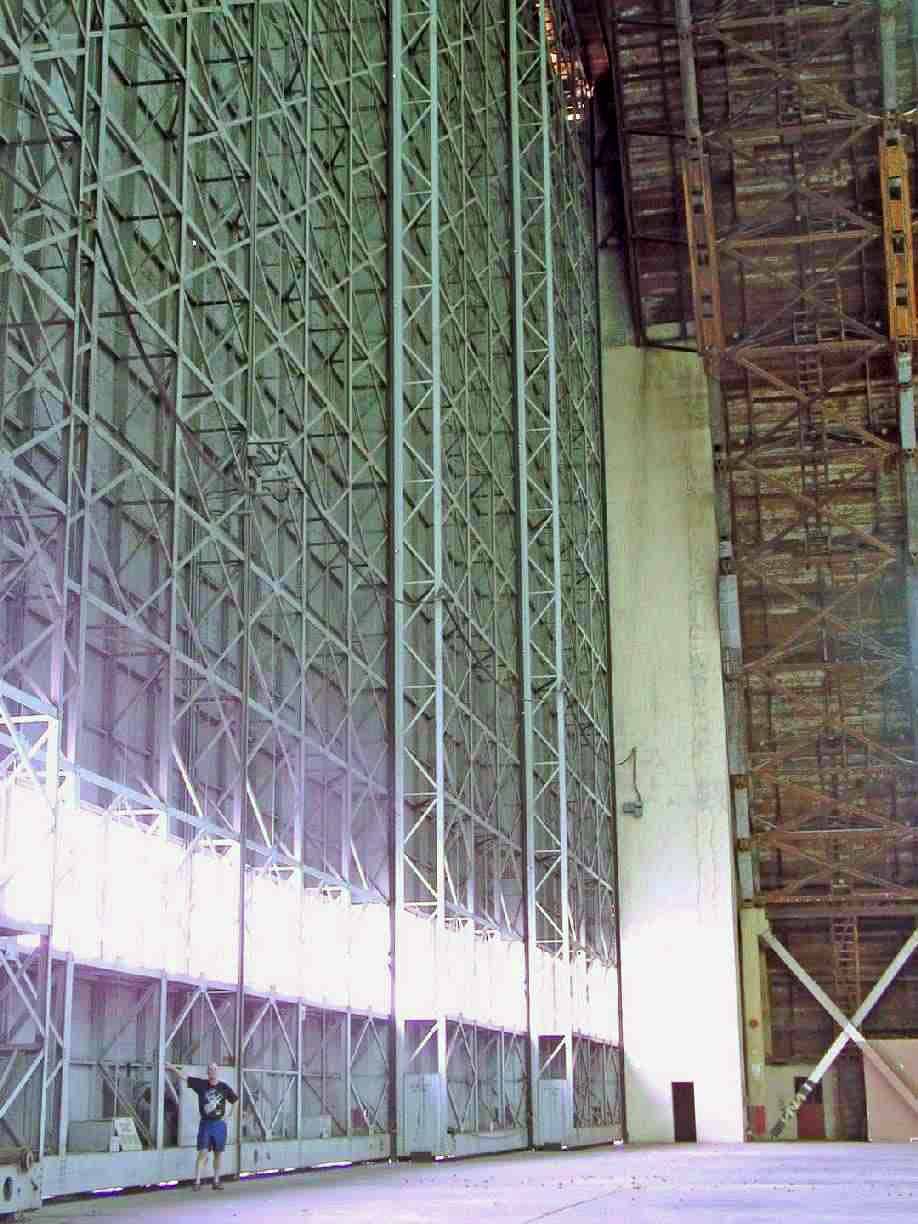
A September 2010 photo of Mark Lutz inside Tustin's Hangar 1. Mark reported, “On the right, in the timber truss-work, note the ladders.
These were used by airship riggers to gain access to the catwalk about 150' above the floor. Those timbers are 4x12 inches in cross section.”
A September 2010 photo by Mark Lutz looking east at Tustin's 2 hangars. Mark reported, “The landing mat is being used to store fill.
The recent housing market collapse caused the developer to stop 'development' of the base.
The hangar on your right is threatened with tear-down when development resumes. The hangar on your left is the one in my photos above.”
Mark Lutz reported in 2012, “The more Northern hangar is used quite a bit for television automobile advertisements -
if you know what it looks like inside, it is unmistakable every time it is used.
About the 2nd Tustin hangar: It is considered a little less earthquake robust than the Northern one.
I've looked at its construction history, and it sounds very robust to me.
Both hangars trusses sit on more than 1,000 concrete filled steel pipes sunk 40-60 feet down.
One was dug up to check its condition - it is very good.
The wood is heavily treated with borate salts which protect against fire and insects and rot, and which are, even today, considered reasonably safe for humans.
The timbers making up the trusses are substantial - the biggest ones are maybe 8x18 inch cross section,
many are 4x12 inch cross-section, and they're all bolted together with big 'ring' washers to spread the stress - good design.”
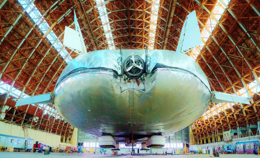
A 2013 photo of the experimental Aeroscraft rigid airship inside a Tustin hangar.
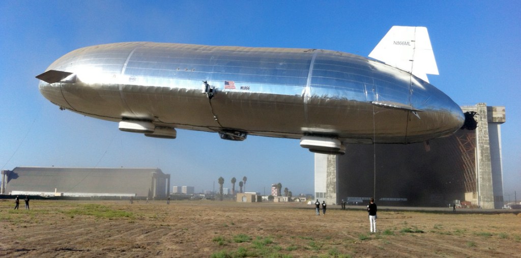
An amazing 2013 photo showing an experimental Aeroscraft ML866 rigid airship taking flight outside the Tustin hangars.
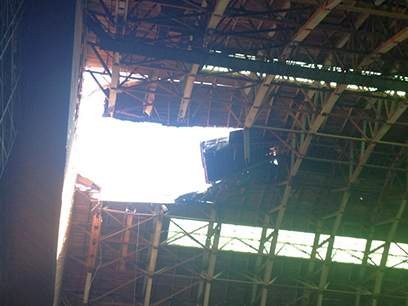
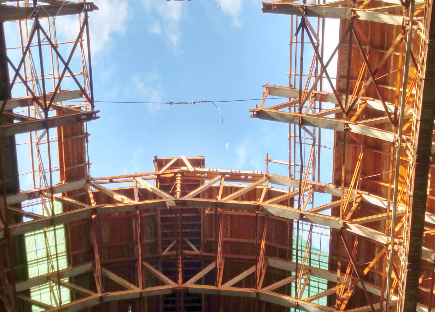
An undated photo showing the 625 square foot hole in the Tustin hangar roof after it collapsed on 10/7/13, damaging the Aeroscraft airship housed inside.
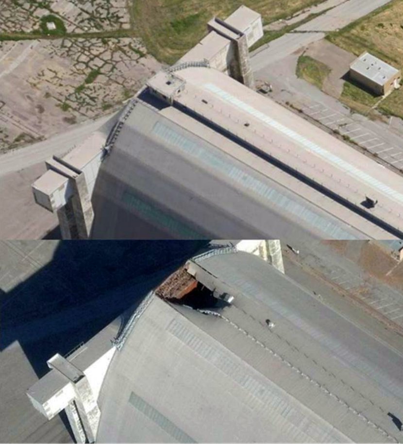
A set of “before & after” photos (courtesy of Mark Lutz) showing the damage to the Tustin blimp hangar from the 10/7/13 roof collapse.
What was the purpose of the small windowed room at the top of the hangar which was lost in the collapse?
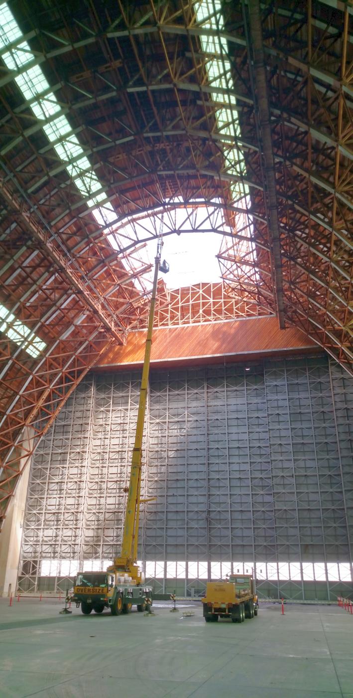
A 2015 photo by Jeremy Bruce of Beebusters of cranes used to repair the hole in the Tustin blimp hangar roof which suffered a partial roof collapse.
Jeremy reported, “I recently did some work in one of the hangars. After the roof caved in, a bunch of bees moved in.
We were contracted by a crane company that was working with the property caretaker to remove the bees.”
A 2015 photo by Jeremy Bruce of Beebusters of the hole in the Tustin blimp hangar roof, showing the intricate all-wood structure of these 73 year old buildings.
A 2018 3-D aerial view looking north at Tustin's former control tower & Hangar 1.

A 2018 photo looking southeast at the interior of Tustin's Hangar 2.
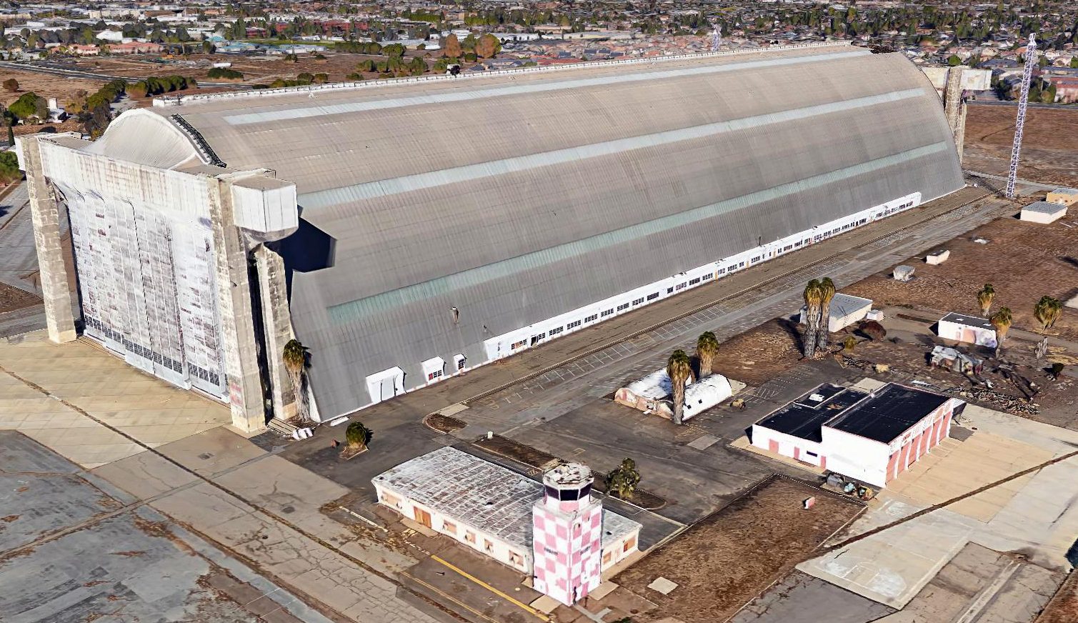
A 2021 aerial view looking north shows Tustin's 2 massive blimp hangars are the only remaining element of the once-extensive airfield infrastructure,
with all the other hangars, ramps, and blimp mooring pads having been removed & replaced by housing.
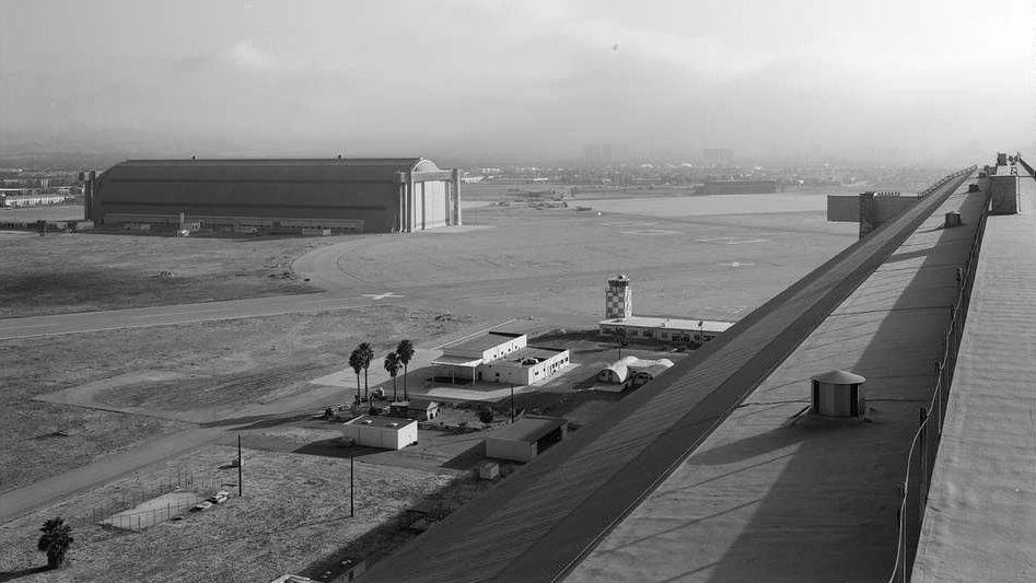
A June 2022 photo looking west at Tustin's massive Hangar 1 & the comparatively tiny control tower.
A June 2022 photo looking east at Tustin's massive Hangar 2.

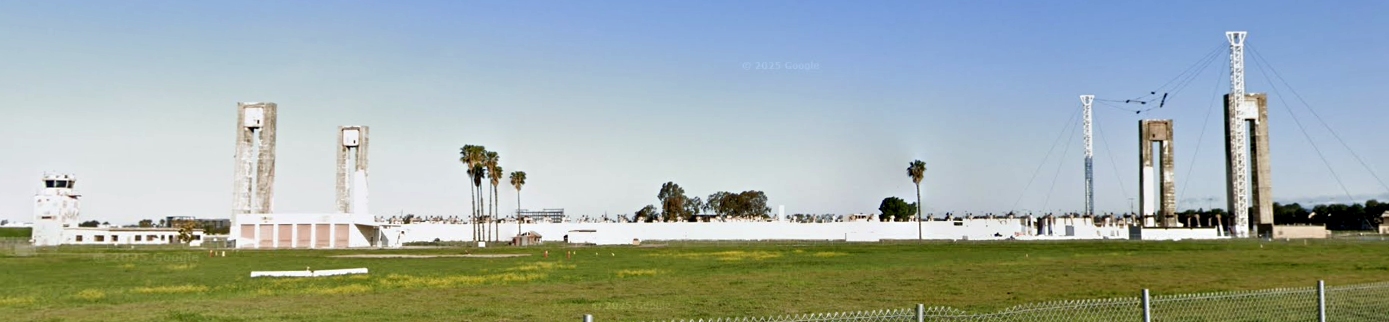
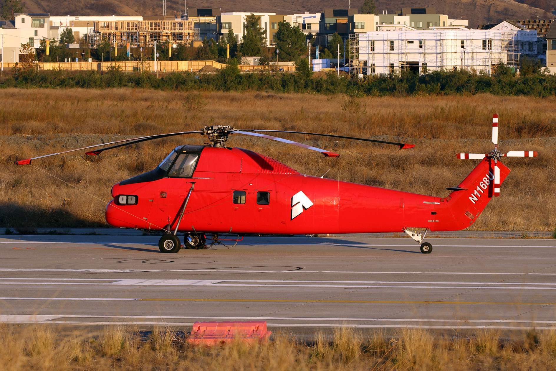
A sad January 2024 photo by Rob Scholle “of the north hangar, cleaned up from the fire with only the hangar door frames standing guard over what little remains.”

A sad January 2024 photo by Rob Scholle “of the north hangar, cleaned up from the fire with only the hangar door frames standing guard over what little remains.”

A sad January 2024 photo by Rob Scholle at Tustin. Rob remarked, “I realized that I had parked on a piece of an old parking apron denoted by the padeyes embedded in the concrete.”
A 2025 photo looking east at the Tustin's Hangar 2.
A sad April 2025 photo looking northwest at Tustin's former control tower & the remains of Hangar 1.
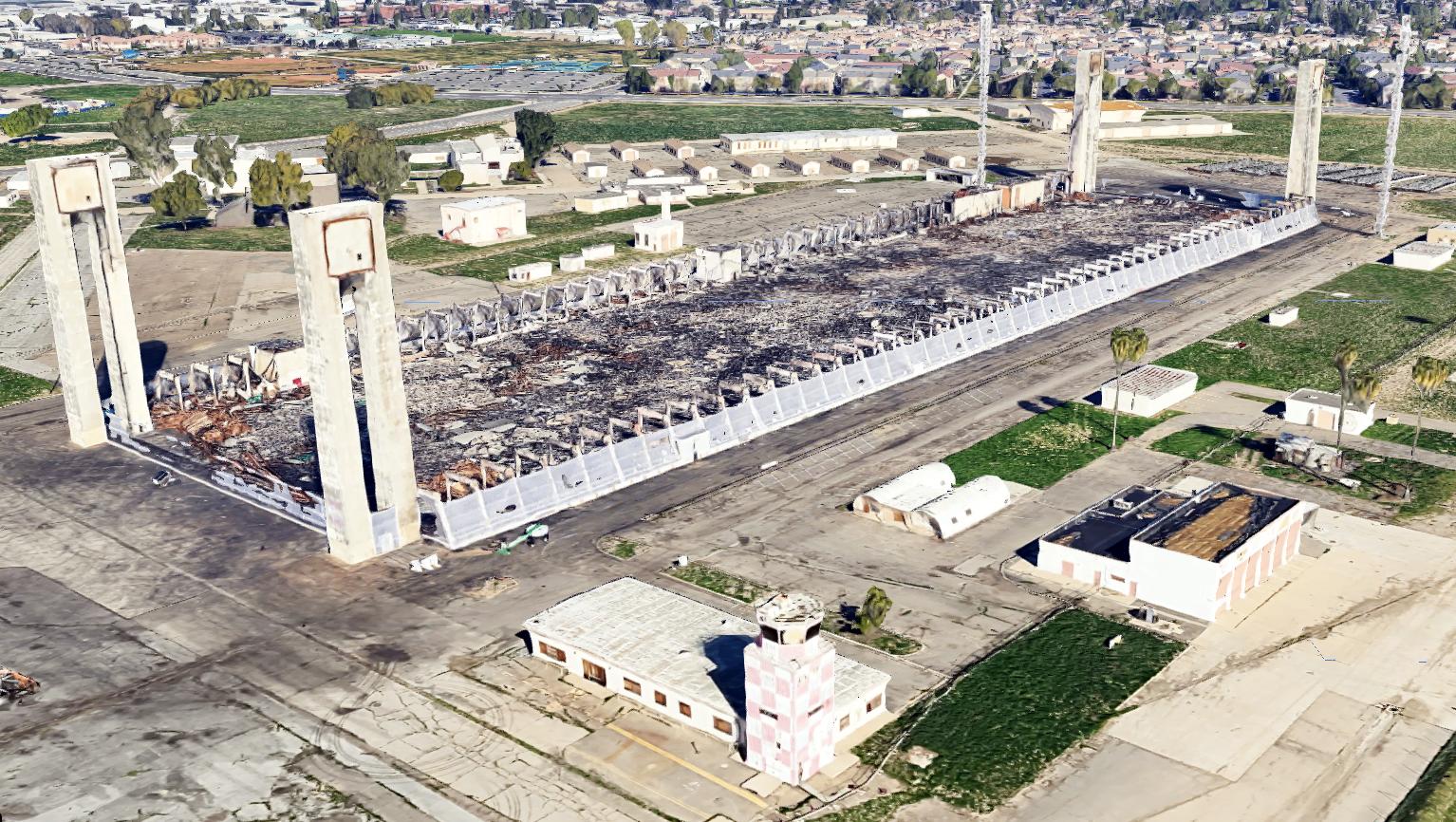
A 2026 3-D aerial image looking north at Tustin's former control tower & the remains of Hangar 1.
See also: http://members.aol.com/NARTUSA/BLIMPSPg3.html
____________________________________________________
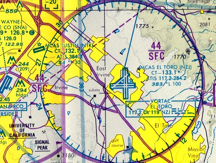
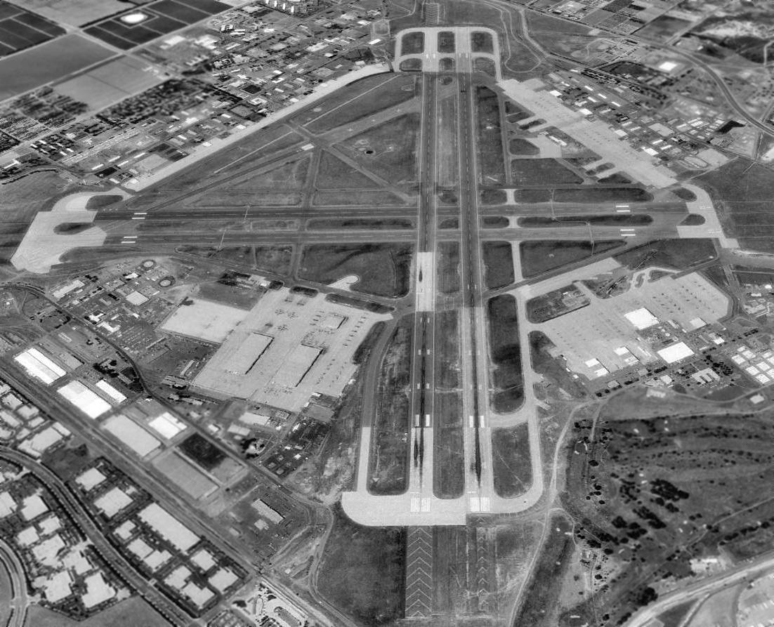
El Toro MCAS (NZJ), El Toro, CA
33.67, -117.73 (Southeast of John Wayne Orange County Airport)
“El Toro (Navy)”, as depicted on the August 1943 San Diego Sectional Chart.
On 5/5/42 Lt. Col. William Fox was designated the Navy Representative to the site selection committee
to make immediate surveys of Southern California to determine the best available sites for Marine Corps air bases.
He was told that 1st consideration should be given to a site
that would relocate the 5 Marine Carrier Groups serving at Naval Air Station, San Diego.
Marine Corps officials favored 5 sites: Santa Barbara, El Centro, Mojave, Miramar, and the bean fields at El Toro.
On Admiral Moffet's advice, Lt. Col. Fox came to Southern California to see the bean fields.
James Irvine offered Lt. Col. Fox other sites on his ranch for $1 a year,
including the Orange County Airport site, attempting to preserve the bean field crop.
The Marines decided they wanted the bean fields for their airfield.
In early 1942, the Marines paid James Irvine $100,000 for 4,000 acres,
including 1,600 acres designated for a lighter-than-air (blimp) base.
The bean field that became MCAS El Toro appeared to be perfect for Marine Corps requirements.
The field sat in a quiet valley at the base of the Saddleback Mountains.
Only a few miles from the Pacific Ocean, it was fog free most of the year,
and the main Santa Fe Railroad line ran adjacent to the site's west border.
The bean field also perched just north of Camp Pendleton,
which served as the Marines Infantry Training Base & bombing range.
El Toro was also close to San Clemente Island, approximately 60 miles off the coast, which also served as a bombing range.
The seaport of Long Beach just north of El Toro was used extensively during World War II.
Government officials & businessmen in Orange County, unlike James Irvine, were extremely happy the Marines had landed.
The new air base would bring thousands of civilians & military people into the area, as well as jobs & money.
These politicians knew the military base had given birth to what would become one of the wealthiest counties in the nation.
On 9/23/42 Col. Theodore Millard arrived in Southern California to take charge of base construction.
While pondering the enormous task before him,
he received a message that the 1st 80 Marines to be assigned to MCAS El Toro had arrived at the nearby train depot.
No military transportation existed at the time,
and no barracks had been built to house the Marines.
For the next several hours, Colonel Millard drove his private vehicle back & forth to retrieve the Marines for duty.
Construction on the air station began on 8/3/42, eight months after the bombing at Pearl Harbor.
The 1st landing at El Toro was conducted by Major Carmichael,
who made an emergency landing while the field was still under construction.
Within 4 months, construction crews finished the runways, taxiways, and run-up areas.
A month later, in January 1943, the 1st hangars, barracks, and bachelor officer quarters were completed,
and the finishing touches turned a bean field into an air station.
Five asphalt runways & over 27 miles of paved highways were laid in 5 months.
The effort, although incredibly successful, did not proceed without problems.
In the very early days, the few wooden buildings all had very leaky roofs.
At one point, heavy rains turned the buildings into wash tubs
and the freshly turned dirt into a giant mud bowl; there were no laundry facilities to clean muddy uniforms.
One of the major disappointments occurred at the new commissary building.
While the roofers were hot-tarring the roof, the building caught fire & burned to the ground.
However, by December 1942, planes were taking off & landing.
When the skies were clear, Marines & construction workers alike watched the mock dog fights overhead
as pilots trained for combat in the Pacific.
Marine Base Defense Group 41 (MBDAG-41) was organized at El Toro on 1/1/43.
Originally, the group was created to administer & supervise training activities of aircraft squadrons for combat duty in the Pacific.
Consisting of only a Headquarters Squadron, a Service & Maintenance Squadron and one Fighter Squadron,
MBDAG-41 eventually trained 20 fighter, dive-bomber, and torpedo squadrons for combat duty by the end of the war.
Headquarters Squadro0n 41 was probably the largest headquarters squadron in the Marine Corps' history,
at a peak strength of approximately 2,000 personnel.
During the same month, flight operations at El Toro accelerated into a high tempo.
The 1st squadron assigned to El Toro was VMF-113, flying SNJ trainers and F4F Wildcats.
Combat-tested flying squadrons FMF-212, VMF-223, VMF-224, and VMSB-232 arrived from the Pacific to retrofit & reorganize.
Squadrons flying F4U Corsairs, Douglas SBDs and Curtis SB2C Dive-bombers arrived from NAS North Island,
MCAD (Marine Corps Air Depot) Miramar, and from combat duty in the Pacific.
In addition, B-24 Bombers from the consolidated plant in San Diego
lumbered down the runways en-route to San Clemente Island for bombing practice.
On 1/10/43, these squadrons fell under the command of the newly created Marine Aircraft Group 23.
During WWII, El Toro was used primarily as a training base for pilots, aircrews, and ground personnel,
but was also a major debarkation station for personnel being transferred to overseas duty.
The earliest depiction of El Toro which has been located was on the August 1943 San Diego Sectional Chart.
It labeled the airfield as “El Toro (Navy)”.
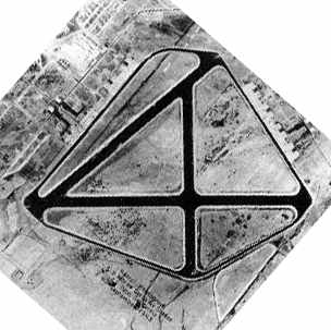
A September 1943 aerial view showing the original configuration of MCAS El Toro, with 3 paved runways.
An early 1940s aerial view looking at El Toro's main entrance, with the control tower visible in the background (courtesy of Rex Ricks).
A September 1944 aerial view looking southwest at MCAS El Toro,
showing the 4th & 5th runways which had been added at some point between 1943-44, parallel to the original runways.
The 1945 AAF Airfield Directory (courtesy of Scott Murdock) described the El Toro MCAS
as a 2,319 acre rectangular property within which were 3 asphaltic concrete runways, with the longest being the 7,200' east/west strip.
The field was said to have a total of 10 wooden hangars, measuring 122' x 80',
and to be owned by the U.S. Government & operated by the Marine Corps.
El Toro was described as having 2 auxiliary fields:
Cal-Aero Outlying Field, 22 miles NNE, and Camp J.H. Pendleton Outlying Field, 33 miles southeast.
The August 1945 San Diego Sectional Chart (courtesy of Chris Kennedy) labeled the field as "El Toro (Navy)".
At the end of WWII, El Toro found itself on a short list of bases to be closed.
However, in 1946, Headquarters Marine Corps placed El Toro on its list of 7 installations to be maintained in active status.
Shortly thereafter, the commander of Marine Air Base West Coast, Major General Louis Woods,
moved his headquarters El Toro from MCAD Miramar, and the last remnants of the Marine presence at Miramar followed.
A 12/29/46 UGSS aerial view of MCAS El Toro (from the UCSB Library) showed an incredible number of aircraft on the field.
The 1947 USGS topo map labeled the field as “El Toro”.
The 1947 LA Local Aeronautical Chart depicted MCAS El Toro as having 5 paved runways, with the longest being 7,200'.
A 1949 photo of F4U Corsairs at MCAS El Toro.
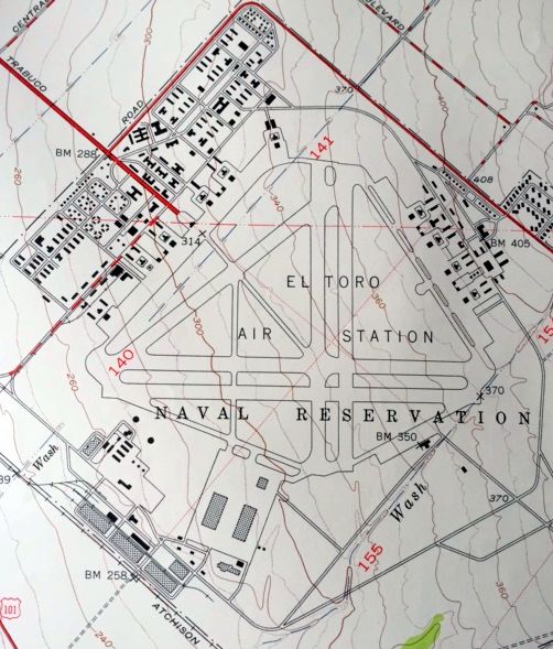
The 1949 USGS topo map (courtesy of Kevin Walsh) described the “El Toro Air Station Naval Reservation”
as having 5 paved runways, and an extensive number of taxiways, ramps, hangars, and other buildings.
Fifteen thousand visitors attended the 1st El Toro air show on the Nation's 1st Armed Forces Day in 1950.
In 1950, North Korean troops stormed across the 38th parallel into South Korea.
This 2nd conflict in the Pacific in less than a decade
confirmed the Marine Corps' need for a permanent West Coast air base
to ensure combat-ready pilots were available & as a debarkation point for marines going overseas.
In 1950, MCAS El Toro was selected as a permanent Master Jet Station
and center of support for the operation & combat readiness of Fleet Marine Forces, Pacific.
To support those new roles, the aviation infrastructure at El Toro was expanded significantly.
At its height the airbase encompassed a total of 4,700 acres.
For most of the ensuing years, El Toro served as the primary base
for Marine Corps west coast fighter squadrons.
The 1st Marine jet squadron to fly in combat (VMF-311) in Korea came from El Toro,
departing in November 1950 with F9F-2B Panthers.
On 1/15/51, HMM-161 was activated at MCAS El Toro.
HMM-161 was the 1st tactical helicopter squadron in the Marine Corps.
In September 1951, HMM-161 arrived in Korea to become the 1st helicopter squadron to prove itself in combat.
In 1955, the 3rd Marine Aircraft Wing arrived at El Toro from Opa Locka Florida.
El Toro's early 3rd MAW consisted of fighter, attack, photograph reconnaissance, observation, refueling, and bomber jet aircraft,
as well as, attack, utility, and transport helicopters, and transport planes.
In addition, training schools and courses included aircraft instrument school, maintenance schools,
survival, ejection seat, low pressure and water survival schools, and aircraft simulator training,
Nuclear, Biological, and Chemical Warfare School, jet transition squadron schools,
special weapons and tactical atomic weapons school, and the Staff Non-commissioned Officers School among others.
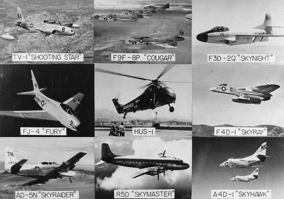
A 1950s USMC picture of several types of aircraft operated from MCAS El Toro (courtesy of John Voss).
The September 1955 San Diego Sectional Chart (courtesy of Chris Kennedy)
depicted "MCAS El Toro" as having an 8,000' hard surface runway.
El Toro's longest runway was somewhat lengthened at some point within the next 4 years,
as the September 1959 San Diego Sectional Chart (courtesy of Chris Kennedy)
depicted "MCAS El Toro" as having a 10,000' hard surface runway.
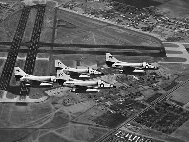
A June 1961 aerial view looking west at a formation of 4 VMA-121 A-4C Skyhawks over El Toro.
A 1962 aerial view looking north at El Toro.
In 1963, El Toro celebrated its 20th anniversary; 75,000 people attended the annual El Toro Air Show that year.
A 1964 photo of former astronaut John Glenn flying a Grumman TF-9J Cougar at El Toro.
Note the Cougar's unusual arrangement of a interior windscreen for the backseat pilot.
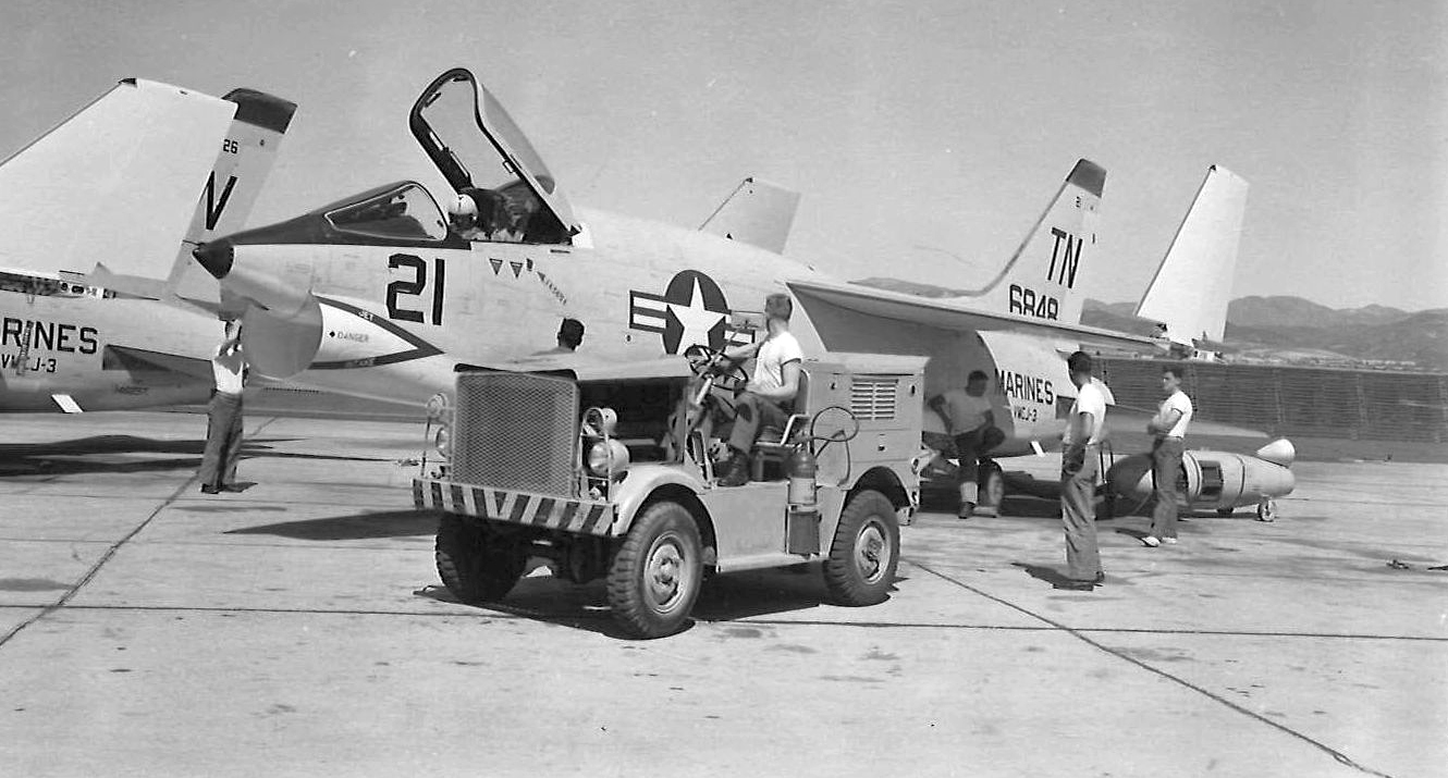
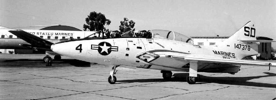
A circa 1960s photo of a Chance-Vought F8U-1P Crusader of VMCJ-3 at MCAS El Toro.
The Vietnam War incrementally turned into a full-scale conflict during the 1960s,
and the nation discovered for the 3rd time in 20 years that it was ill-prepared to go to war.
El Toro once again became a debarkation point for servicemen and women embroiled in the toils of war.
President Lyndon Johnson & later Richard Nixon landed at El Toro frequently to talk to the Marines, as well as conduct national business.
During the next 10 years of war, personnel & squadrons rotated to & from El Toro & Vietnam
in support of the 1st Marine Aircraft Wing in the Western Pacific.
The 1966 San Diego Sectional Chart (courtesy of Chris Kennedy)
depicted "MCAS El Toro" as having 5 paved runways, with the longest being 10,000'.
El Toro MCAS, as depicted on the 1971 DoD Instrument Approach Procedures (courtesy of Chris Kennedy).
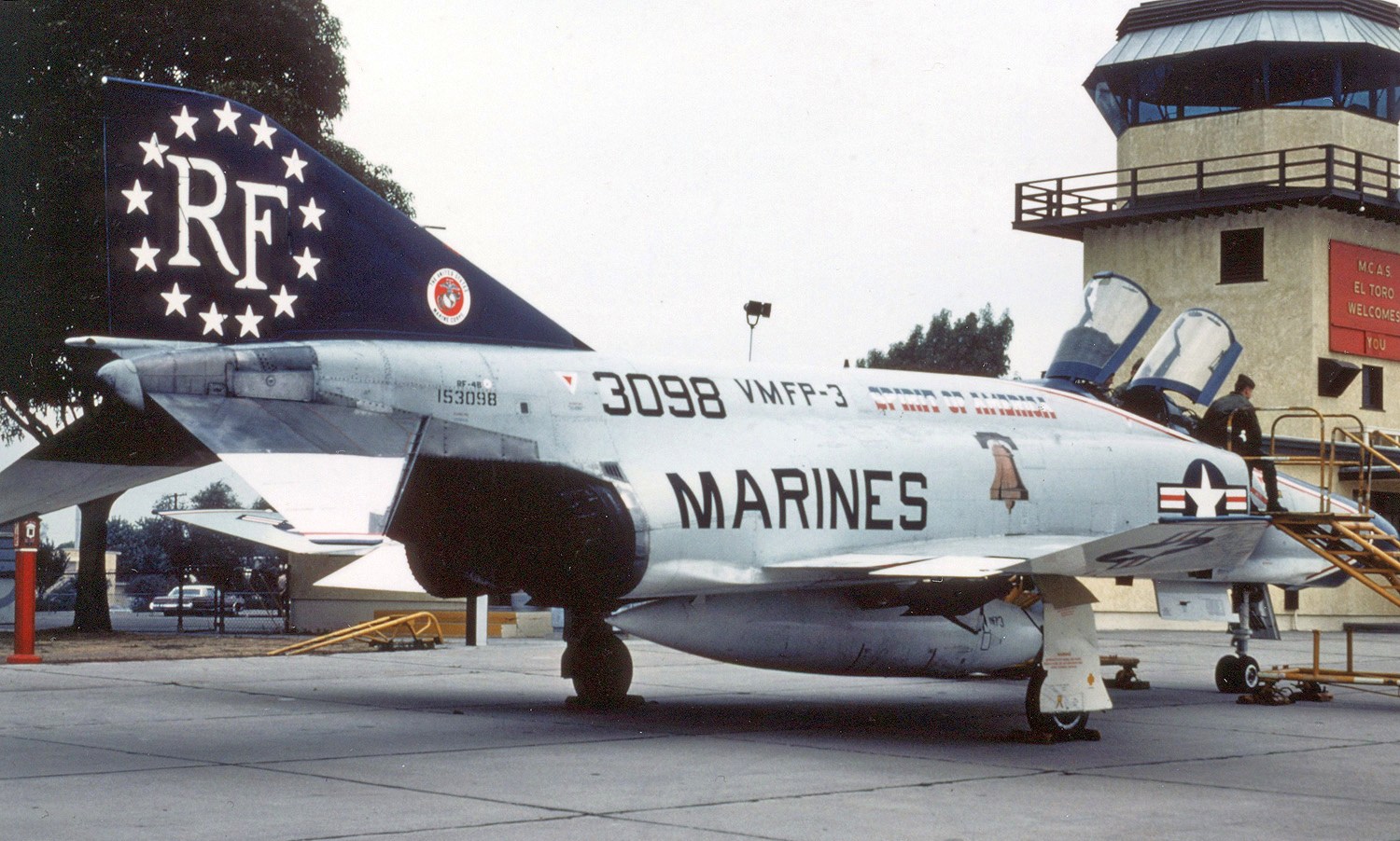
A 1975 photo of USMC VMFP-3 McDonnell Douglas RF-4B Phantom II in front of the El Toro control tower.
At the end of the Vietnam War & the fall of Saigon,
thousands of Vietnamese refugees relocated to the U.S. with little more than the clothes on their backs.
During May of 1976, flights delivering Vietnamese & their families, who were loyal allies during the war,
arrived at El Toro at the rate of one per hour.
Over 50,000 people arrived as part of Operation New Arrival & then departed for procession locations across the U.S.
With the cessation of the Vietnam War, defense budges were slashed once again & parts of the armed forces languished.
El Toro and Tustin lead the Marine Corps in the introduction & perfection of aerial weapons deployment and training,
as well as the perfection of helicopter assault tactics & strategy.
The 3rd MAW developed the Weapons & Tactics School located in Yuma, Arizona, to teach advanced aerial war fighting skills.
A 3/14/77 UGSS aerial view of MCAS El Toro (from the UCSB Library) showed a large number of USMC aircraft on the field.
The July 1980 LA Terminal Chart (courtesy of Jim Hackman) depicted “MCAS El Toro” as having 5 paved runways, with the longest being 10,000'.
A 10/27/81 photo of a Douglas A-4M Skyhawk in front of a MCAS El Toro hangar.
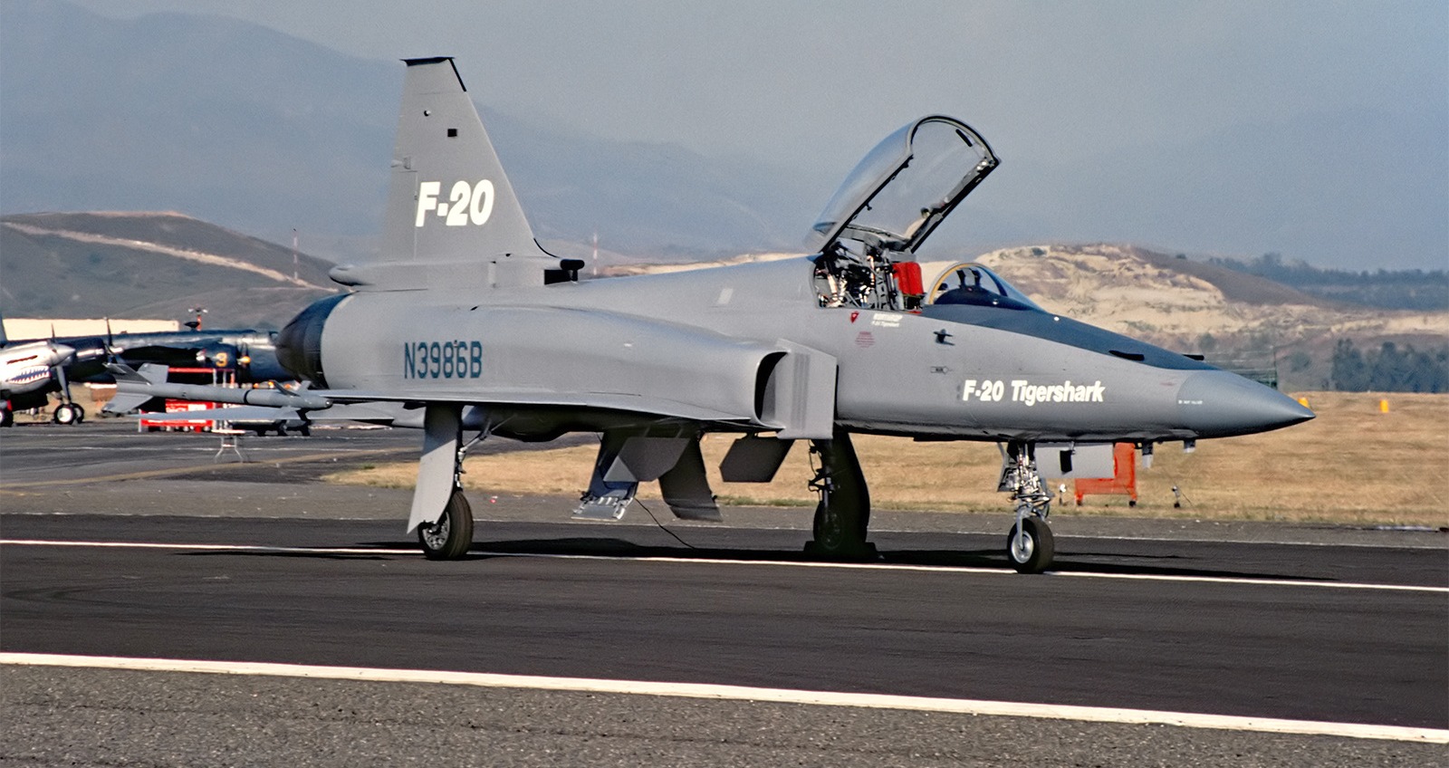
A 5/6/84 photo by Dan Stijovich of the 2nd prototype Northrop F-20A Tigershark, N3986B C/n GI1001, getting prepped to leave the 1984 El Toro show.
The mid-1980s saw the early remnants of the Marine Corps' only Aviation Museum assemble at El Toro.
The museum had a total of 41 airframes ranging from WWII to a modern-day F/A-18 Hornet.
A circa-1980s aerial view of F/A-18s on the El Toro ramp.
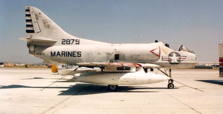
A sad photo of BuNo 142879, a Douglas A-4B Skyhawk, serial #11941 awaiting restoration at the MCAS El Toro museum.
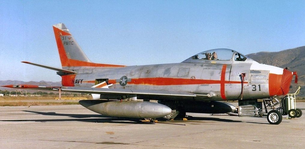
A 3/16/91 photo of a North American QF-86F Sabre (target drone conversion) in Navy markings at MCAS El Toro.
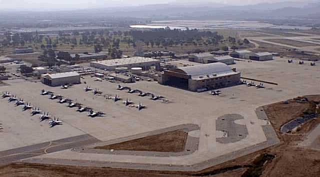
A 1993 DOD aerial view looking northeast at the large numbers of Marine aircraft parked on El Toro's southwest & southeast ramps.
In 1993, as part of the Base Realignment & Closure process,
El Toro became one of more than 20 California military bases slated for closure.
At the time its closure was determined,
El Toro was home to all of the Marine Corps' west coast F/A-18, C-130 & CH-46 units.
The last aeronautical chart depiction which has been located of El Toro was on the 1994 LA Terminal Chart,
which depicted “MCAS El Toro” as having 5 paved runways, with the longest being 10,000'.
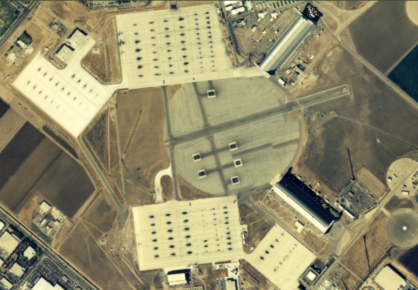
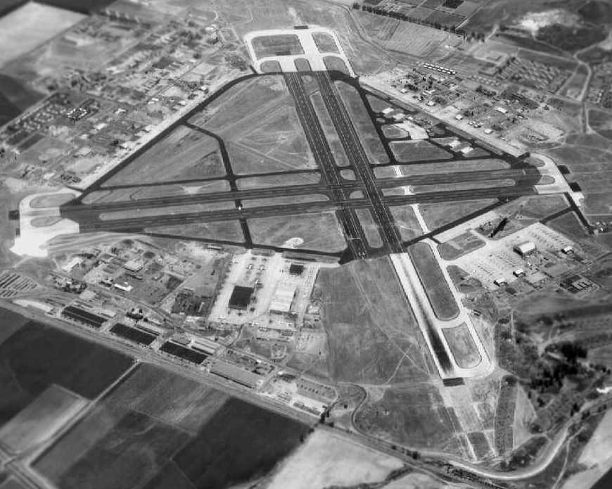
A 1994 USGS aerial view looking north at the massive El Toro airfield.
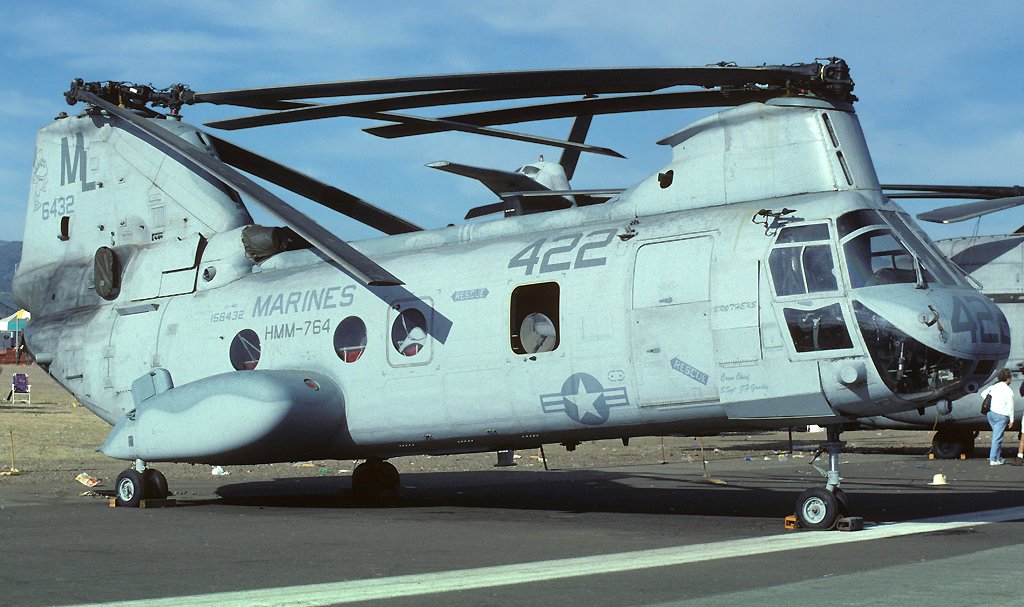
A 4/27/97 photo by Alex Christie of USMC HMM-764 Boeing Vertol CH-46E Sea Knight 156432 C/n 2502 on the El Toro ramp.
The last El Toro air show was attended by 2 million visitors in 1997.
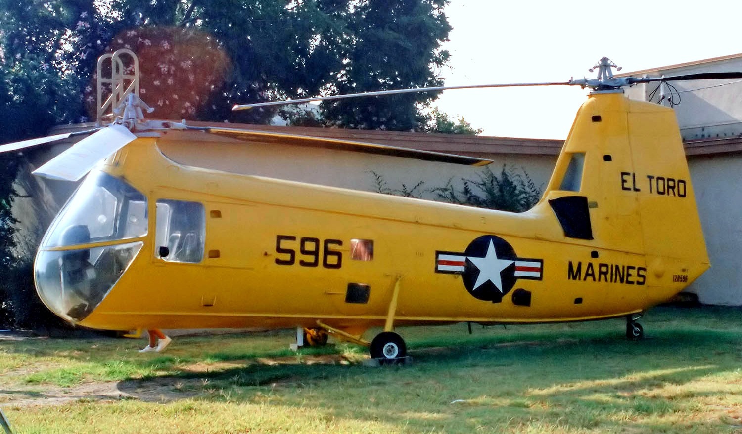
A 10/12/98 photo of a Piasecki HUP-2/UH-25B Retriever of the Flying Leatherneck Museum at El Toro.
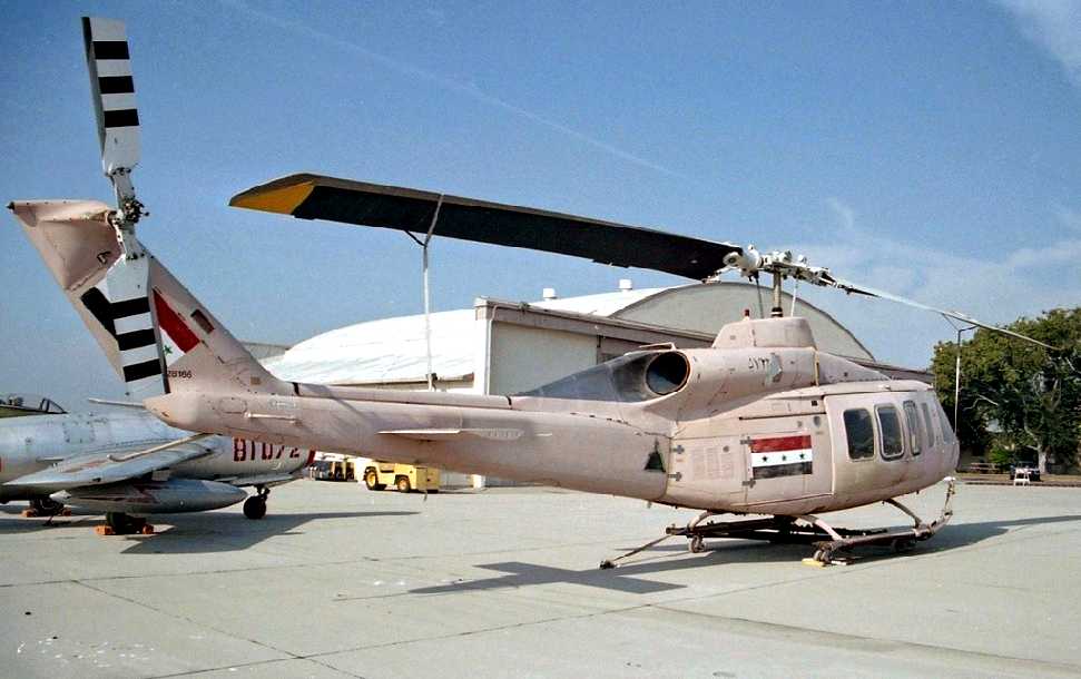
A 10/12/98 photo by George Trussell of a captured Iraqi Bell 214ST of the Flying Leatherneck Museum at El Toro.
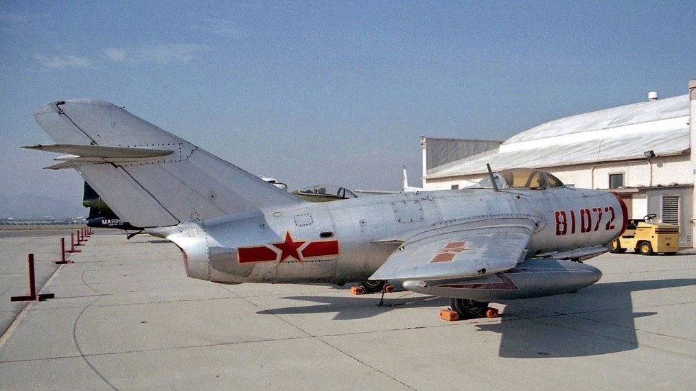
A 10/12/98 photo by George Trussell of a Mikoyan-Gurevich MiG-15bis of the Flying Leatherneck Museum in front of an MCAS El Toro hangar.
To prepare for El Toro's impending closure, all of the base's resident aviation units were relocated to Miramar Naval Air Station,
which had been vacated by the Navy & taken over by the Marine Corps.
El Toro was then closed by the Marines in 1999.
The extensive collection of aircraft of the Flying Leatherneck Aviation Museum
was also relocated from El Toro to Miramar (according to Chris Kennedy).
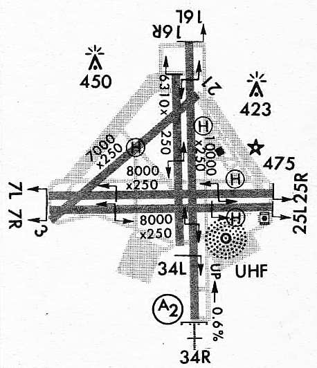
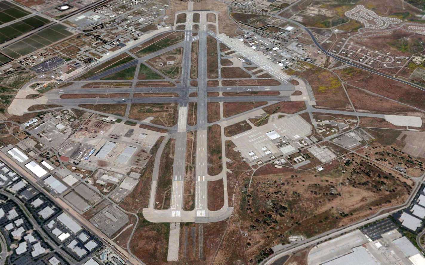
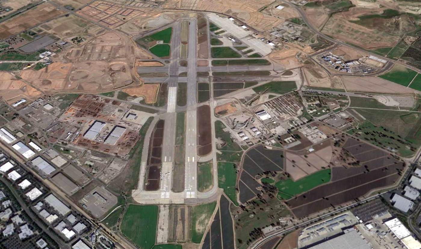
At the time of the base's closure, the El Toro airfield consisted of 5 runways
(the longest, the parallel 16L/34R & 16R/34L were 10,000') and a huge amount of ramp & hangar space.
The possibilities of reusing El Toro as a commercial airport for the booming Orange County area have aroused extreme political controversy,
ranging from the typical "not in my backyard" sentiments, to environmental activists.
In spite of all of these opponents, the population of the Los Angeles metropolis hasn't stopped increasing,
and perhaps the environmentalists would prefer that another airport eventually be built from virgin undeveloped land elsewhere?
It would seem pointless to waste the billions of federal tax dollars that were poured into the aviation facilities at El Toro,
when they are sorely needed to serve the expanding air travel needs for this area.
However, in spite of that logic, the Navy announced in 2002 that they were bowing to political pressure exerted by some local interest groups,
and were not going to allow El Toro to be redeveloped as a civil airport,
but rather would only permit the property to be used for non-aviation purposes.
The massive airfield facilities at El Toro (5 paved runways up to 10,000' long, numerous hangars, acres of concrete ramps)
are actually more extensive than those found at many commercial airports across the country.
Billions of dollars worth of aviation infrastructure, to be wasted. What a good idea.
An organization called The New Millennium Group still hoped to convince officials to reuse El Toro as a passenger airport.
As of 2004, the project name for the non-aviation redevelopment of this valuable aviation resource was called Heritage Fields.
An article in the 2/3/05 issue of the Wall Street Journal
reported that General Motors had set up 4 automobile test courses on the El Toro runways,
giving more than 10,000 invited potential customers the chance to drive practically every car in GM's lineup.
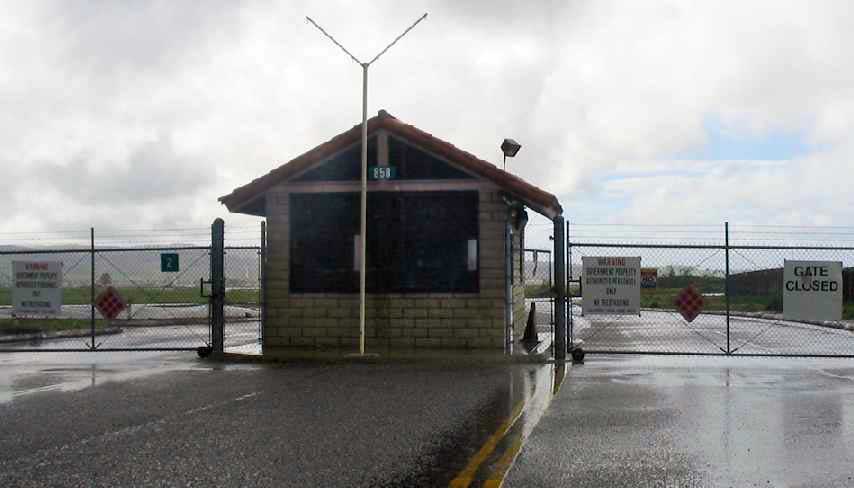
A February 2005 photo by Paul Freeman of the guard shack at El Toro's Gate 2, on the north side of the field.
Paul Freeman visited El Toro in February 2005.
Views of the airfield area could only be obtained from the perimeter,
as the main gate of the former base indicated that it was currently being used by the California prison system.
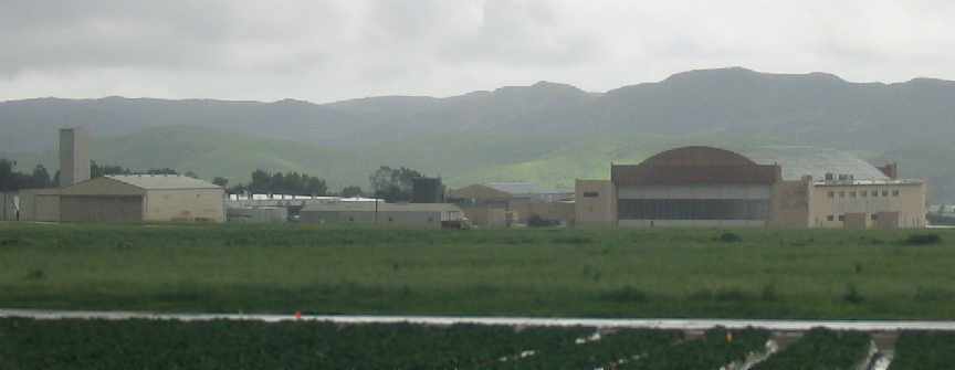
From what could be seen from the perimeter of the base,
the airfield facilities still appeared to remain intact, with all runways & hangars still remaining.
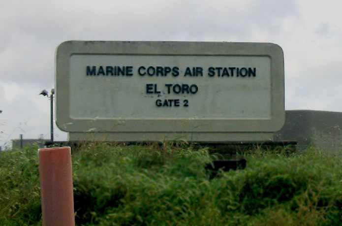
A February 2005 photo by Paul Freeman of the original sign at El Toro's Gate 2.

A February 2005 photo by Paul Freeman of the sign at El Toro's Gate 2 describing redevelopment plans.
A February 2005 photo by Paul Freeman looking south at some of El Toro's hangars.
A May 2005 photo by Brian Smolke of El Toro's control tower, taken during the 'Final Salute' open house of MCAS El Toro,
“before the demolishing was to begin in earnest.”
A May 2005 photo by Brian Smolke of El Toro's former MAG-11 & MAG-46 hangars.
A circa 2005 aerial photo looking north at El Toro's former control tower.
A circa 2005 aerial photo looking north at hangars on El Toro's southwest ramp.
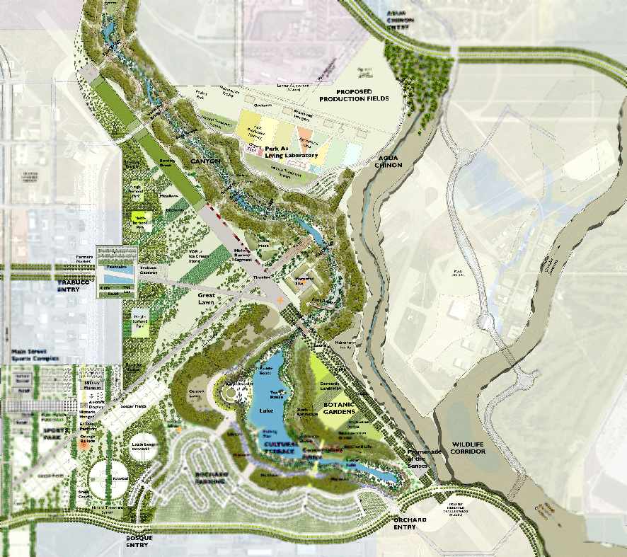
A circa 2006 plan for the non-aviation reuse of the El Toro property (courtesy of Chris Kennedy).
Note the “Historic Runway Segment” in the center, the “VOR Ice Cream Stand” just to the west,
and the “Preserved Hangars” on the north side.
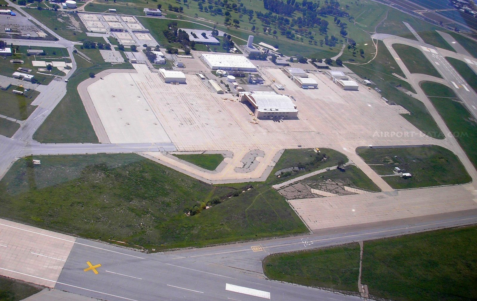
A 4/20/06 aerial view of the El Toro ramps & hangars.

A 4/20/06 aerial view looking west at the massive El Toro airfield.
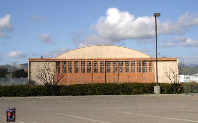
An April 2006 photo by Rex Ricks of “a WW II era hangar which is near the CSU Fullerton El Toro Campus.”
Rex reported that the hangar was “still standing” as of 2007.
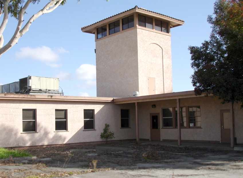
An April 2006 photo by Rex Ricks of a control tower on the northwest side of the base (near the Trabuco Road entrance).
Rex Ricks reported in 2007, “Unfortunately, the control tower in the center was recently demolished. Thanks a lot Lennar!
Like Irvine needs to make way for even more beige cooker cutter housing.
There are some pockets where you can now enter including the main entrance on Trabuco.”
The last plane to land & take off from El Toro was a Cessna 152 from a local flight school, Sunrise Aviation.
In 2007, a flight instructor made an emergency landing on El Toro's closed runway.
At first the local government was going to force the operator to disassemble the Cessna & truck it out,
before consenting to it being flown out.
Michael Church had the honor of making the very last departure from El Toro.
Ironically there is still an “aircraft” operating from El Toro:
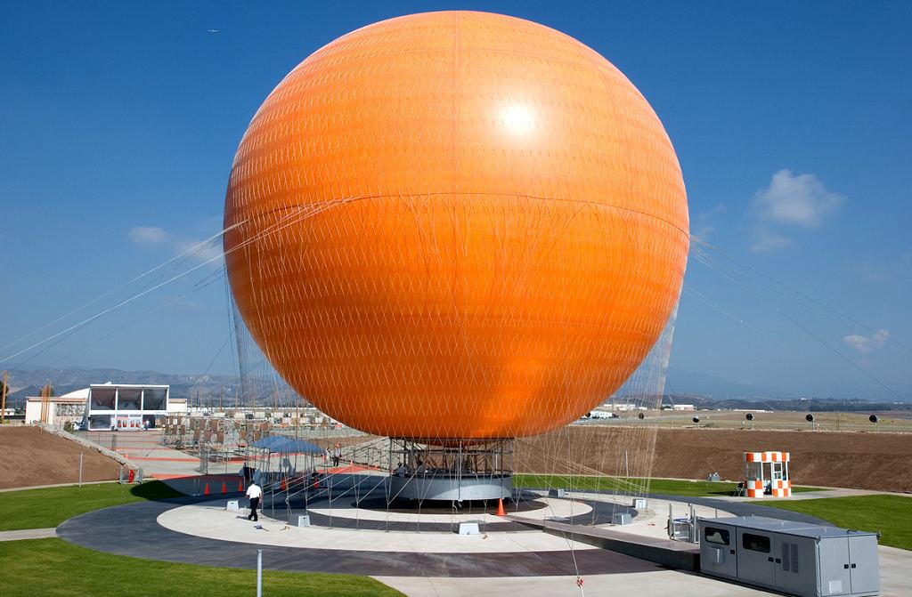
a 10/14/07 photo of an Aerophile 5500 balloon which conducts tethered sightseeing rides from a newly-constructed pad adjacent to the former Runway 7L.
The last photo which has been located still showing the El Toro airfield relatively intact was a 2010 aerial view looking north.
According to Wikipedia, the American Top Gear TV series was filmed at the former MCAS El Toro from 2010-2016.

A July 2011 photo by Stephen Partida of a Bell UH-1Y at El Toro.
Stephen recalled, “I snuck on base that evening cause I had heard the buzzing of aircraft overhead all afternoon & just knew they must be doing something special on base.
Sure enough, I found a ramp full of aircraft staged & ready for the weekend's airshow. Toned down compared to years passed but an airshow none the less. I believe it was the 2011 Great Park Airshow.”
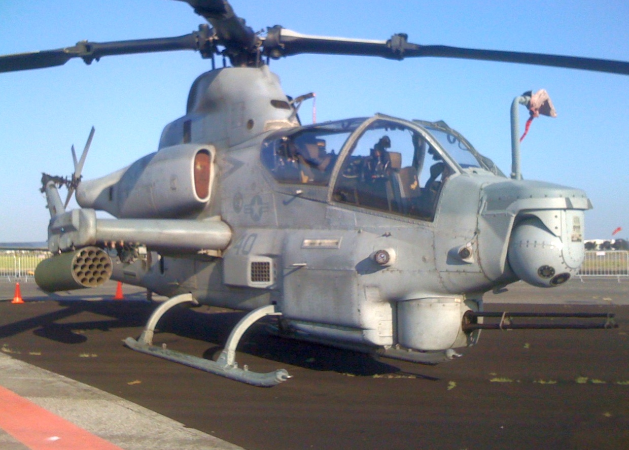
A July 2011 photo by Stephen Partida of a Bell AH-1Z at El Toro.
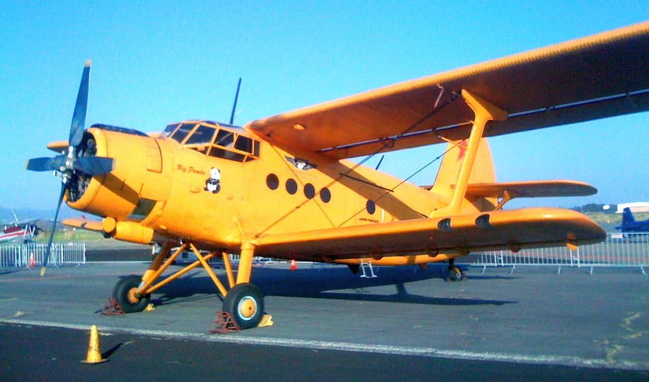
A July 2011 photo by Stephen Partida of Shijiazhuang Y-5B (a Chinese variant of the Antonov An-2) “Big Panda”at El Toro.
A July 2011 photo by Stephen Partida of a Boeing Vertol CH-46 (with red/white/blue high-contrast markings unusual for that era) at El Toro.
A July 2011 photo by Stephen Partida of a Ryan PT-22 Recruit at El Toro.
A sickening view for anyone who cares about the billions of dollars of aviation infrastructure at El Toro MCAS:
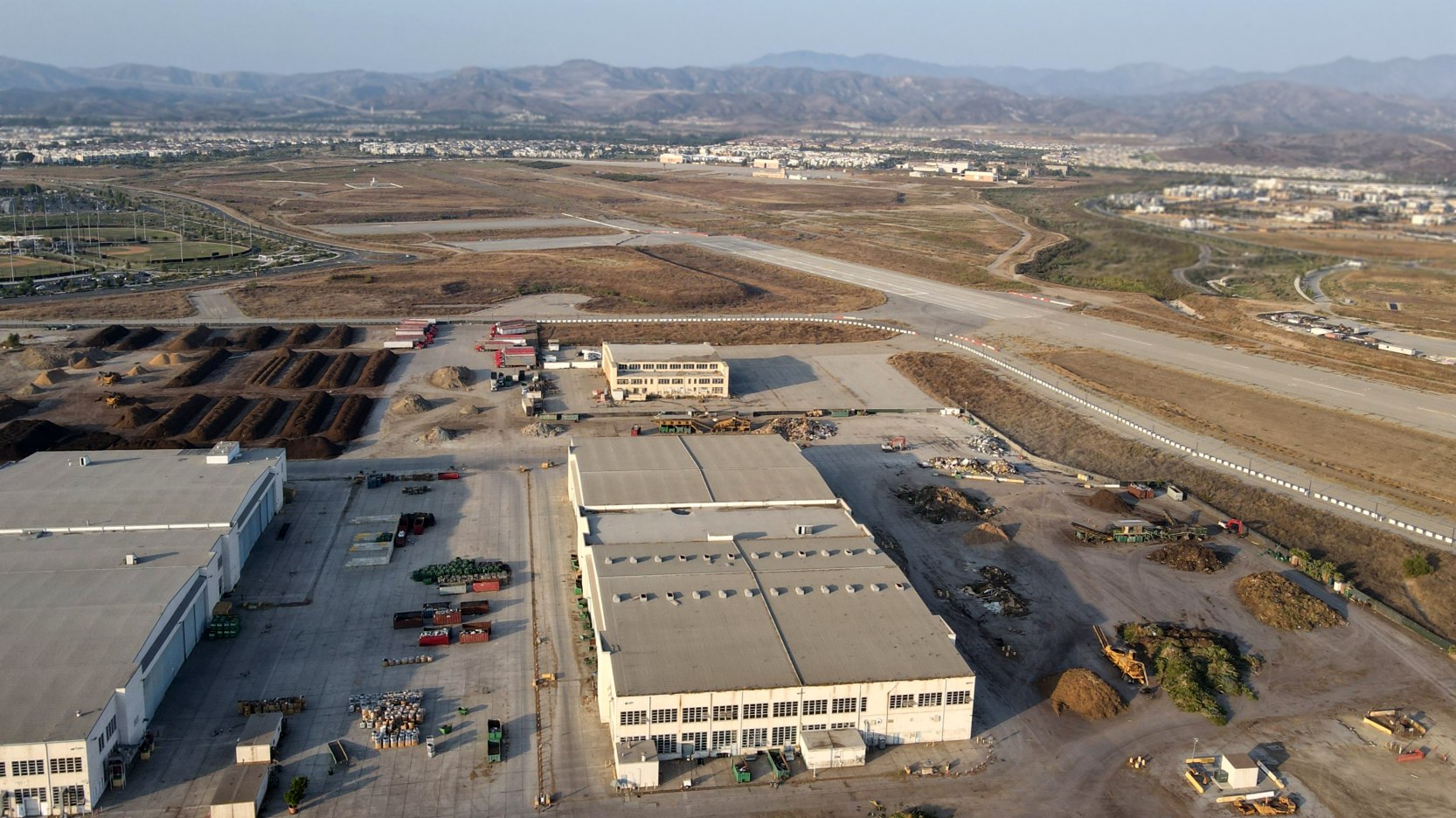
a 2016 aerial view looking north, showing that the massive airfield facilities are being progressively removed.
A 5/18/17 drone aerial picture by Andy Schwarz, looking along the El Toro runways, all that aviation infrastructure being ripped up. Andy observed, “Pretty sad whats happening.”
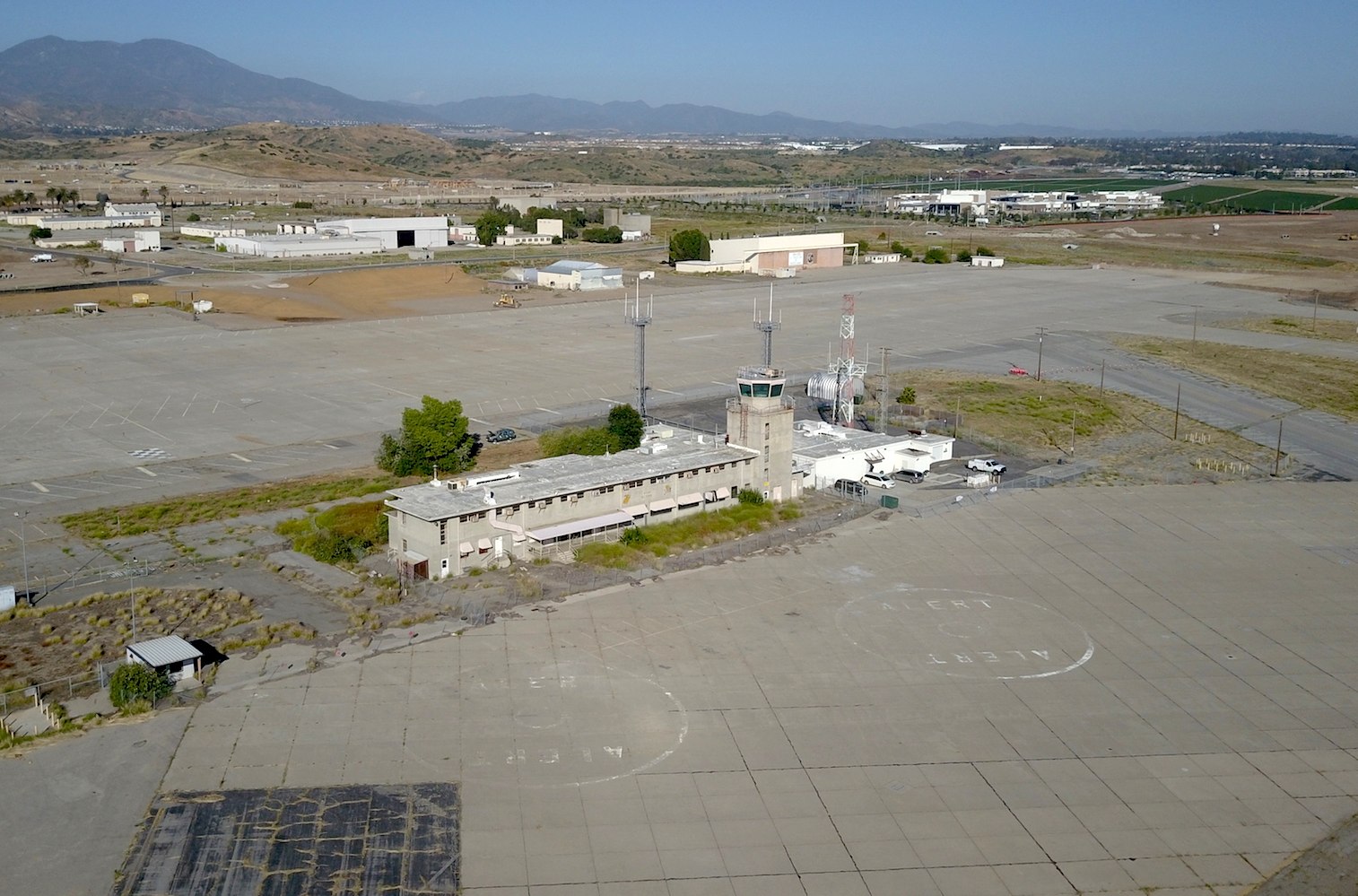
A 5/18/17 drone aerial picture by Andy Schwarz, looking at the former El Toro control tower & 2 hangars.
Steve Maurice reported, “The 2 circles in the foreground were for Angel 1 & Angel 2, the Search & Rescue Hueys [Bell UH-1s].
The crew office & quarters were on the bottom-left of the building & we had a cafeteria in the middle.”
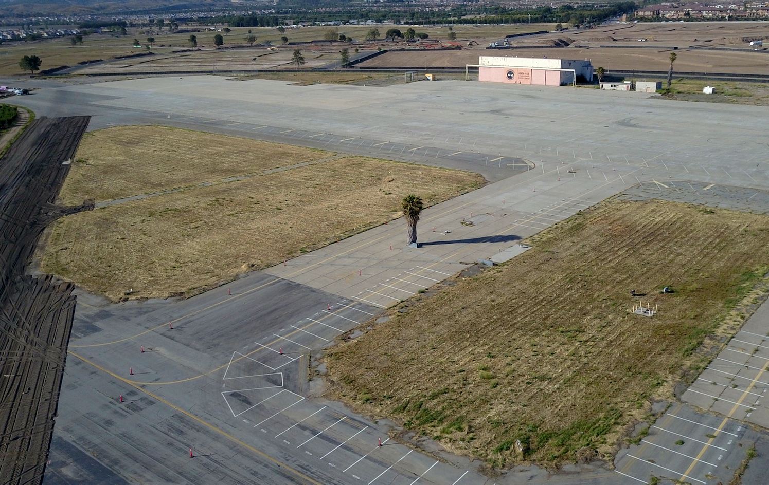
A 5/18/17 drone aerial picture by Andy Schwarz, looking at the former El Toro ramp, with the former HMM-153 hangar in the background.
In the center is a implausible sight of a palm tree “growing” right in the center of a taxiway – presumably placed there for some reason?
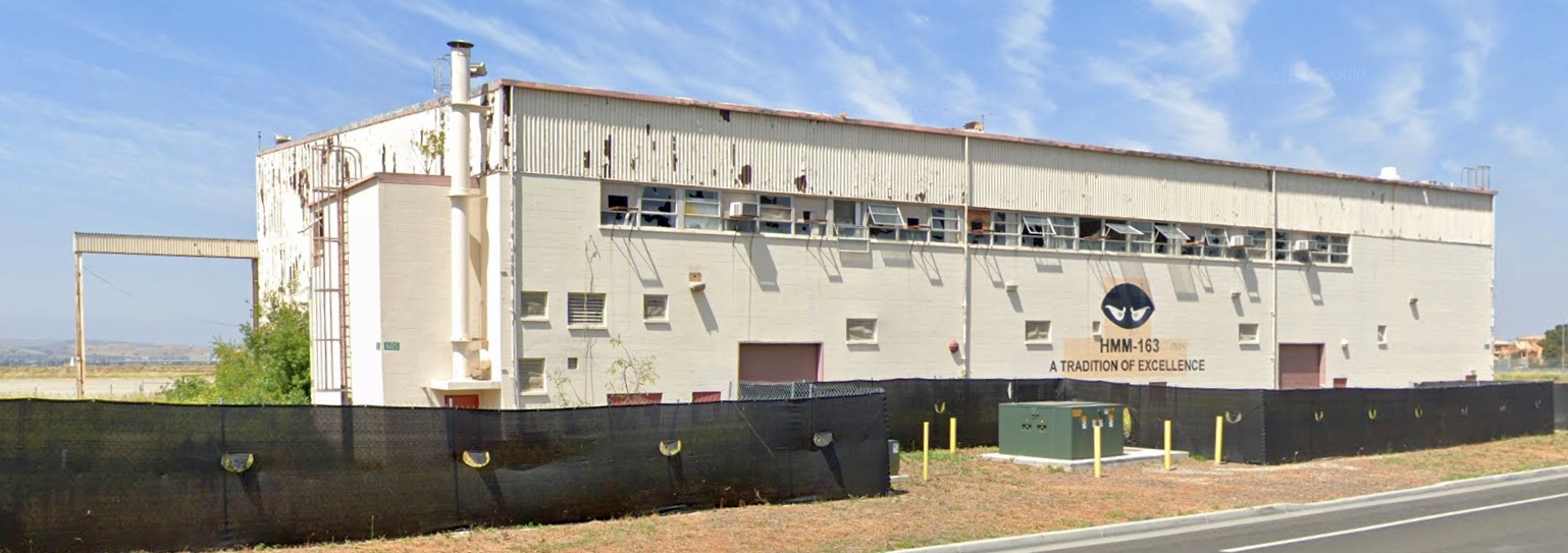
A May 2019 photo looking west at the El Toro hangar which still bears the “HMM-163, A tradition of excellence” logo.
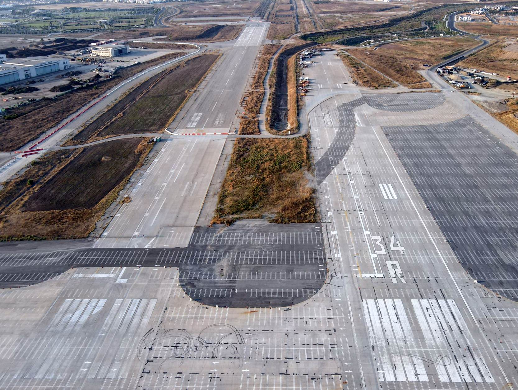
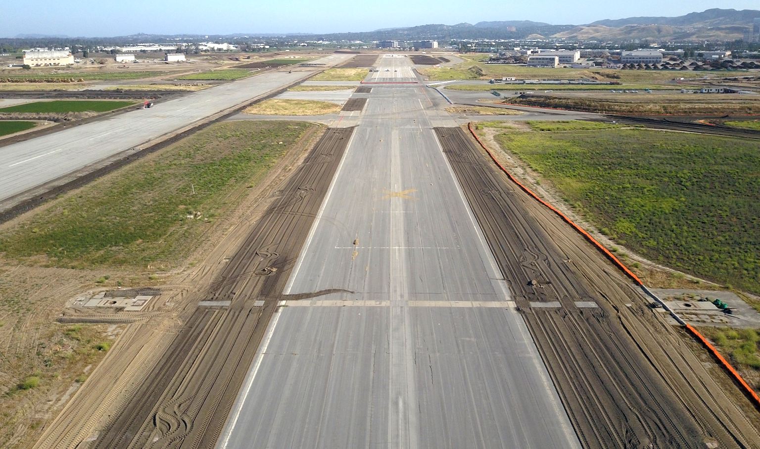
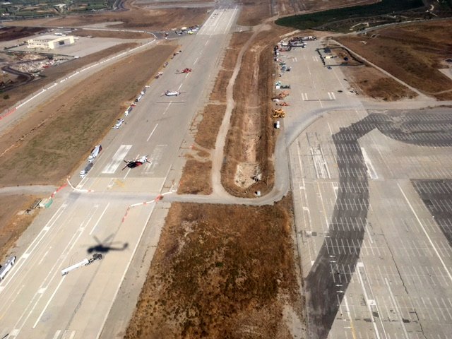
A 9/27/20 drone aerial picture by Andy Gulley, looking north along the remains of El Toro Runways 34L & 34R, showing the excavation which has been done.
A 9/27/20 drone aerial picture by Andy Gulley, looking northwest at the former El Toro hangars.
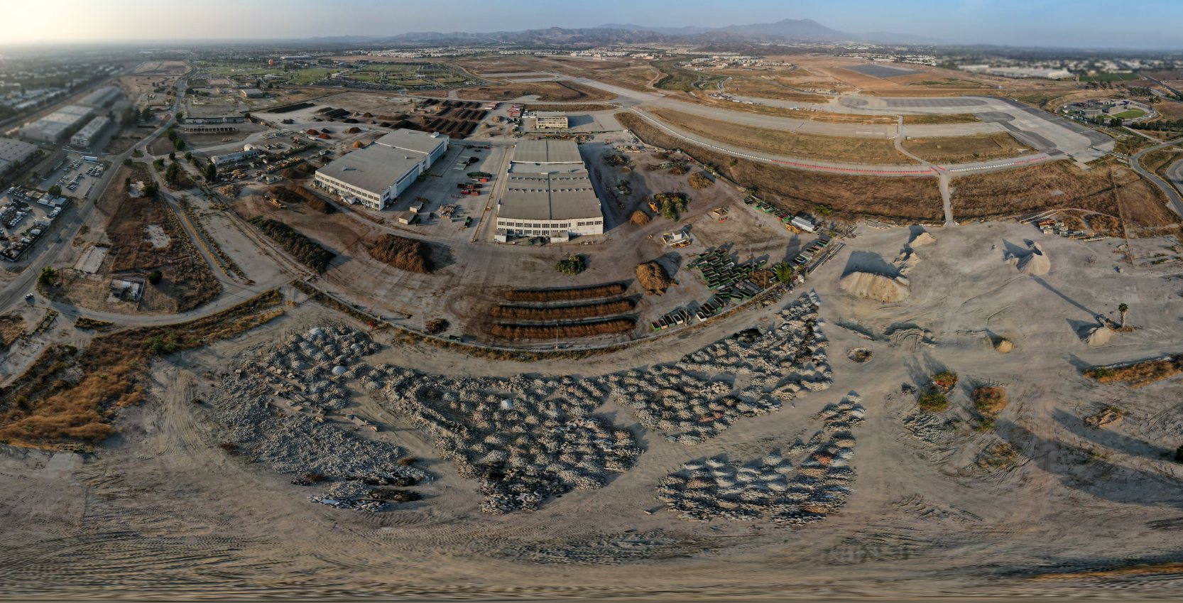
A 9/27/20 panoramic drone aerial picture by Andy Gulley, looking east at the remains of the El Toro hangars, ramps, and runways.
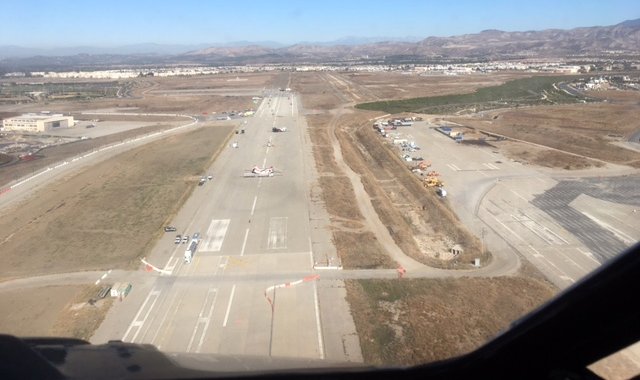
An October 2020 aerial view by Bob Altemus looking north at the south end of El Toro Runways 34L/34R, with 2 Boeing Chinooks & a Sikorsky Skycrane visible on Runway 34L.
Bob reported the photo was taken “while flying as a co-pilot on a Sikorsky CH-54B Skycrane helping to assist in the firefighting efforts during the Orange County fires.
As can be seen, they established the Helibase on the first few thousand feet of Runway 34L.
Type I (heavy helicopters) basically on the threshold, while the Type II & IIIs (medium & smaller helicopters) further down the runway.
Of interest, you can still see the ‘carrier deck’ painted areas for those Marine squadrons that deployed to the carriers as part of the Carrier Air Wing.
Since I formerly flew out of MCAS Tustin as a CH-53E pilot in the 1980s & flew multiple ILS & Ground Controlled Radar approaches into Runway 34L, it was certainly sad to see its current condition.”
The aviation infrastructure that (hasn't yet) been removed at El Toro is still seeing some use that is critically beneficial to the community:
Stephen Heffler reported, “MCAS El Toro is being used as a staging area for helicopters fighting the Santiago Fire on 10/26/20.
What's left of the runway on the south side of the base is in use. Three Chinooks & 4 other helicopters are being used.”
A December 2020 aerial view by Bob Altemus looking north at the south end of El Toro Runways 34L/34R during the Orange County firefighting efforts, with 2 Boeing Chinooks visible on Runway 34L.
A December 2020 aerial view by Bob Altemus at El Toro of “the former VMFA ramps (MAG-11), utilized to establish the Command Base Camp for the ongoing firefighting operations.”
A 12/4/20 photo by Bob Price of a Sikorsky S-58T on a former El Toro runway.
Bob reported, “2020 was a bad wildfire year (on top of everything else!) and for a little while,
there was a temporary firefighting helicopter base set up on some surviving pavement of El Toro's former north/south runway.
Development of the area has continued since so I can't say whether this section of runway is still intact or if it has been used in subsequent fire seasons.”
____________________________________________________
____________________________________________________
This site covers airfields in all 50 states.