Abandoned & Little-Known Airfields:
Arizona - Southwestern Tucson area
© 2002, © 2022 by Paul Freeman. Revised 1/8/22.
____________________________________________________
Please consider a financial contribution to support the continued growth & operation of this site.
Continental Airfield (added 1/8/22) - Ryan Aux AAF A-1 / Haarman Field (revised 11/15/20) - Ryan Auxiliary AAF A-2 / Neff Field (revised 11/15/20)
____________________________________________________
Continental Airfield, Continental, AZ
31.844, -110.977 (South of Tucson, AZ)

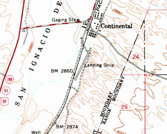
Continental Airfield, as depicted on the 1958 USGS topo map.
The date of establishment of this private airfield has not been determined.
The earliest depiction which has been located of Continental Airfield was on the 1958 USGS topo map,
which depicted a single paved northeast/southwest runway, generically labeled as “Landing Strip”.
The earliest photo which has been located of Continental Airfield was a 1958 aerial view.
It depicted a single unpaved northeast/southwest runway, of which the northeast third was paved in asphalt, with a single small hangar on the northeast side.
Continental Airfield was not yet depicted on Phoenix Sectional Charts from 1958-71, which typically did not depict private airfields at that time.
The earliest photo to have been located showing aircraft at Continental Airfield was a 1975 aerial view.
It showed 2 light single-engine aircraft parked on the north end of the runway, across from a cluster of 3 small hangars.
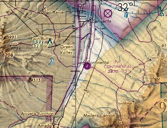
The earliest aeronautical chart depiction which has been located of Continental Airfield was on the 1977 Phoenix Sectional Chart.
It depicted Continental as a private airfield having a single 1,300' paved northeast/southwest runway.
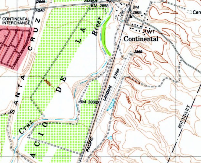
The 1981 USGS topo map depicted Continental Airfield as a single unpaved northeast/southwest runway, generically labeled as “Landing Strip”.
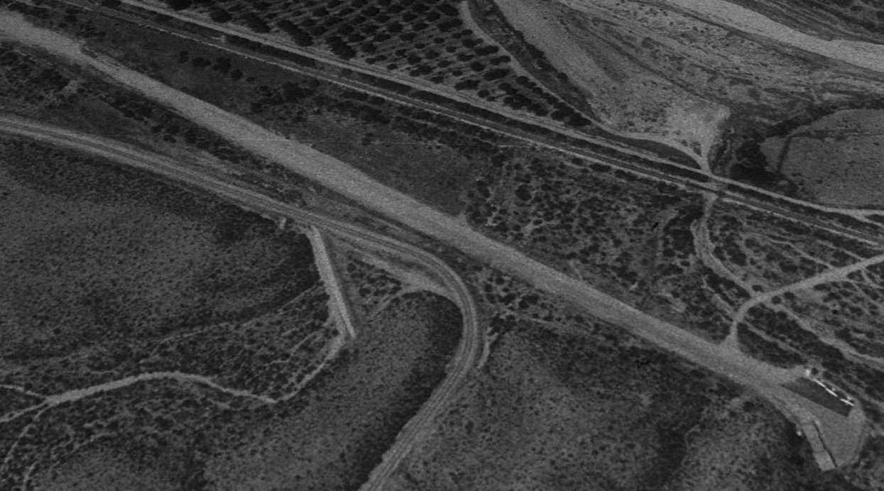
The last photo to have been located showing aircraft at Continental Airfield was a 1992 aerial view looking west.
It showed 3 light single-engine aircraft parked on the north end of the runway, across from a cluster of 3 small hangars.
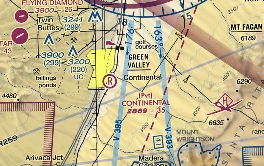
The last aeronautical chart depiction which has been located of Continental Airfield was on the April 2017 Phoenix Sectional Chart.
It depicted Continental as a private airfield having a 3,500' unpaved runway.
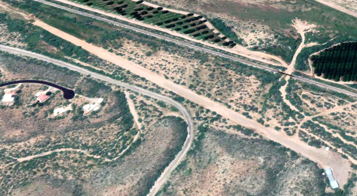
A 2018 aerial view looking west showed Continental Airfield to have an unpaved southwest/northeast runway, with a cluster of 3 small hangars on the northeast side (bottom-right).
Bill Foraker reported, “It was a private field for a bit, then was bought by FICO, the large pecan company that is now the largest pecan grove in the US.
I think FICO has since closed the strip.”
Continental Airfield was evidently closed (for reasons unknown) at some point between 2017-2021,
as it was no longer depicted on the 2021 Phoenix Sectional Chart.
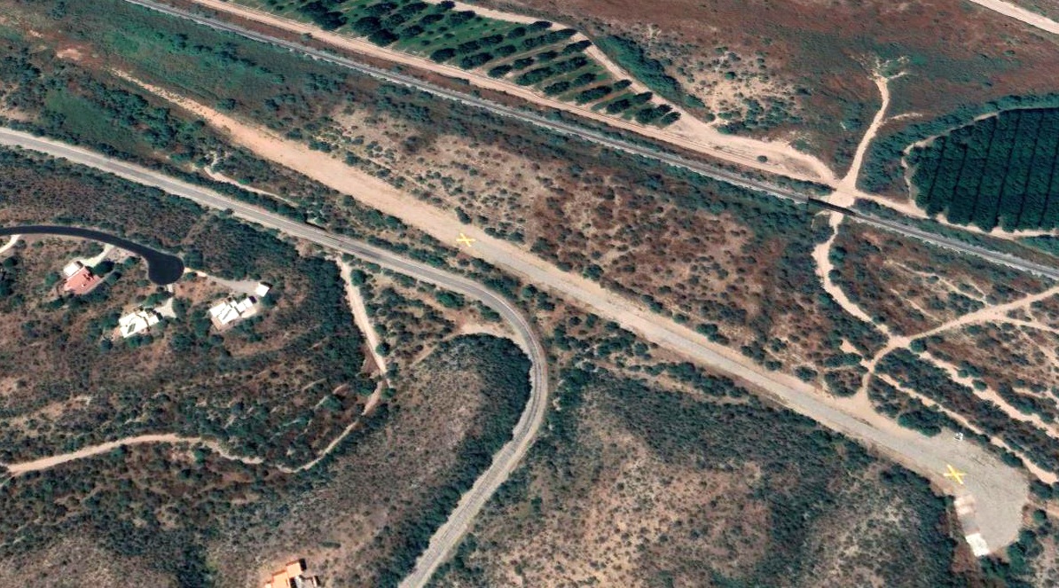
A 2021 aerial view looking west showed Continental Airfield's runway to have been marked with 2 yellow closed-runway “X” symbols, and the hangars had been removed at some point between 2018-2021.
Thanks to Bill Foraker for pointing out this airfield.
____________________________________________________
Ryan Auxiliary AAF A-1 / Haarman Field, Tucson, AZ
32.108, -111.1 (Southwest of Tucson International Airport, AZ)
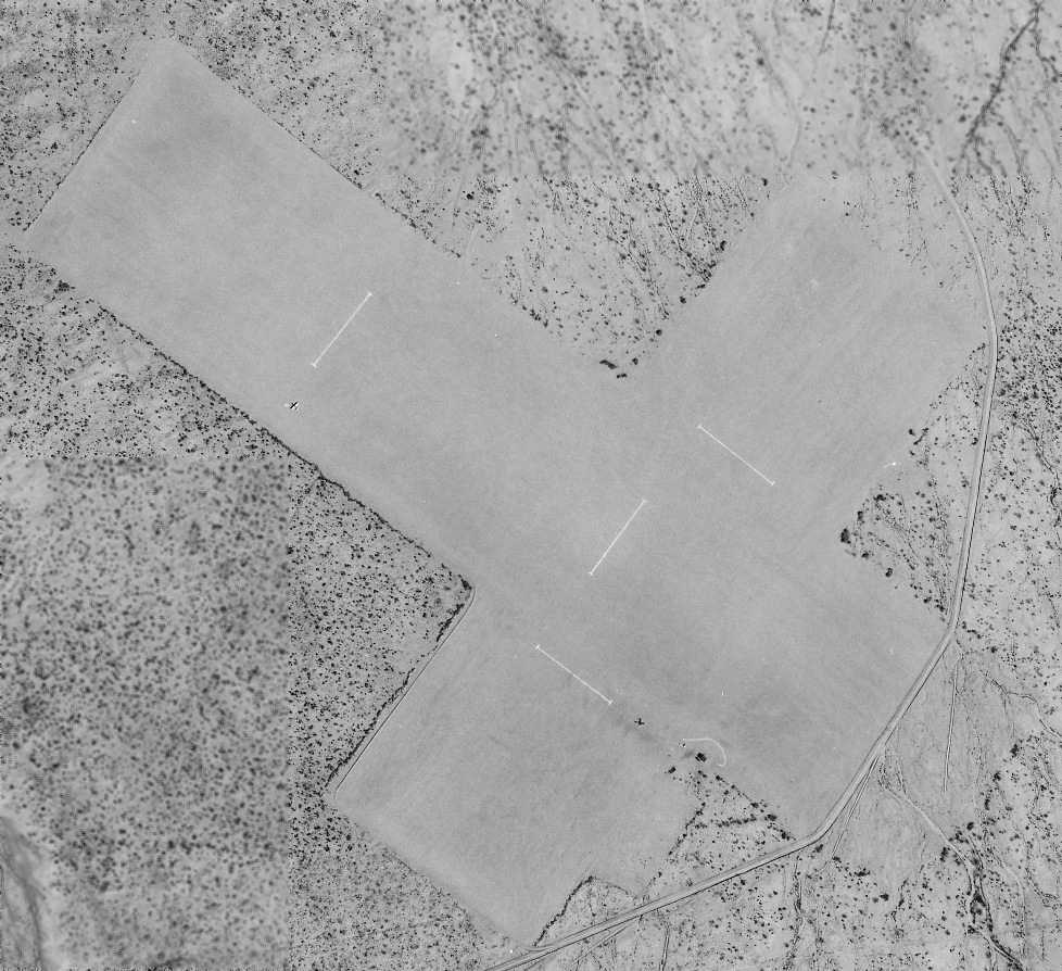
A 3/2/43 USAAF aerial view of Ryan Auxiliary A-1 (courtesy of Brian Rehwinkel).
A-1 Haarman Field was one of 4 satellite airfields which were constructed during WW2
for the use of the Tucson Primary Flying School,
which was operated under contract for the USAAF by the Ryan School of Aeronautics at Ryan Field (3.5 miles northwest).
The date of construction of Haarman Field has not been determined.
The Ryan School of Aeronautics began operations in 1942.
But Haarman Auxiliary #1 was not depicted at all on the 1943 Phoenix Sectional Chart (according to Chris Kennedy), or subsequent Phoenix Sectional Charts from 1944 or 1945.
The earliest depiction of Haarman Field which has been located was a 3/2/43 USAAF aerial view (courtesy of Brian Rehwinkel).
It depicted Haarman A-1 as having 2 perpendicular graded runways, with 2 planes visible on the field.
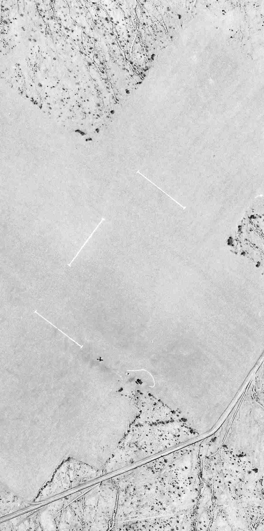
A closeup from the 3/2/43 USAAF aerial view (courtesy of Brian Rehwinkel)
showing one of the aircraft at Haarman A-1, along with a small building (or tent) & possibly a wind indicator at the runway intersection.
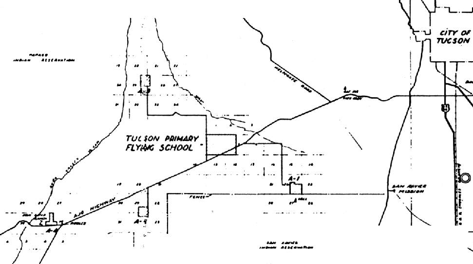
The earliest map depiction of which has been located of Haarman Field
was on a 1944 USAAF map of (courtesy of John Voss) of Ryan Field (labeled "Tuscon Primary Flying School") & its satellite airfields (courtesy of John Voss).
Ryan's other WW2-era auxiliary airfields were:
A-2 Neff Field (to the southwest), A-3 Bane Field (to the west, of which no remains have been identified),
and A-4 Kerlinger Field (to the west-southwest, of which no remains have been identified).
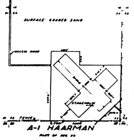
As depicted on the 1944 AAF airfield layout diagram (courtesy of John Voss),
the airfield at Haarman consisted of 2 graded sand runways, 2,900' & 2,300' long, along with a "stagehouse".
The date of closure of Haarman Field has not been determined.
The Ryan School of Aeronautics ceased operations in 1944, at which point its auxiliary fields undoubtedly were abandoned.
Haarman Auxiliary #1 was not depicted at all on the 1945 Phoenix Sectional Chart (courtesy of John Voss).
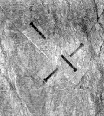
A 2/19/56 USGS aerial view depicted Haarman Field as having 2 perpendicular runways, oriented northwest/southeast & northeast/southwest.
All 4 runway ends had a circular turn-around pad.
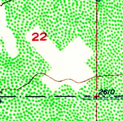
The 1957 USGS topo map depicted the cross shape of the airfield as a clearing, but did not label it.
A 1967 aerial view depicted 2 perpendicular runways, oriented northwest/southeast & northeast/southwest.
All 4 runway ends had a circular turn-around pad.
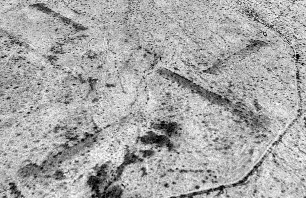
A 1992 USGS aerial view looking north depicted the remains of Haarman Field, showing the 2 perpendicular runways still recognizable.
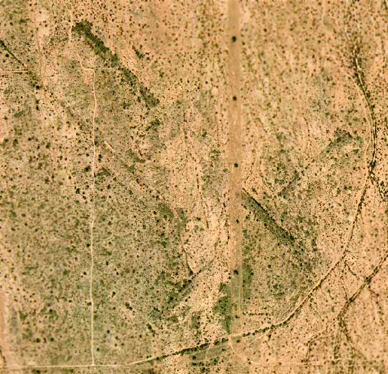
A 2003 aerial view of the remains of Haarman Field (courtesy of John Sparks).
The outline of the 2 runways were plainly apparent. There did not appear to be any remains of any structures.
John Sparks reported in 2003, "The area is currently under development by Joe Ceaser, a local land developer.
The majority of the airstrip is on land known as Starr Valley Block 9.
This would be the leg of the northwest/southeast runway.
In the [above 2003 aerial] photo you can see a bladed portion of land just west of the runway junction.
This is the new water retention drainway for the Starr Valley master planned community.
The portion east of the new drainage way (from the runway junction east) is still government land."
The new housing development is located adjacent to the northwest side of the former airfield,
along with various retention/drainage areas & new roads.
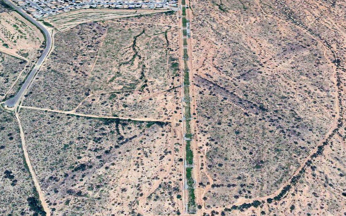
A 2018 aerial view looking north at the site of Haarman Field showed the traces of the 2 runways were still recognizable.
Haarman Field is located 1.5 miles south of the intersection of West Valencia Road & South Viviana Road.
____________________________________________________
Ryan Auxiliary AAF A-2 / Neff Field, Tucson, AZ
32.09, -111.24 (West of Tucson International Airport, AZ)
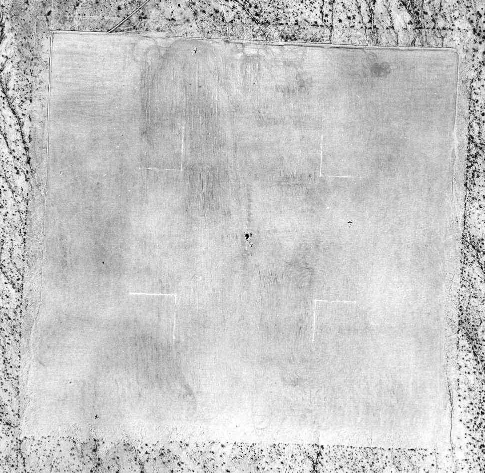
A 3/2/43 USAAF aerial view of Ryan Auxiliary A-2 (courtesy of Brian Rehwinkel).
A-2 Neff Field was one of 4 satellite airfields which were constructed during WW2 for the use of the Tucson Primary Flying School,
which was operated under contract for the USAAF by the Ryan School of Aeronautics at Ryan Field (4 miles to the northeast).
The date of construction of Neff Field has not been determined. The Ryan School of Aeronautics began operations in 1942.
But Neff A-2 was not depicted at all on the 1943 Phoenix Sectional Chart (according to Chris Kennedy), or subsequent Phoenix Sectional Charts from 1944 or 1945.
The earliest depiction of Neff Field which has been located was a 3/2/43 USAAF aerial view (courtesy of Brian Rehwinkel).
It depicted Neff A-2 as consisting of a graded square field, with 3 planes visible on the field.
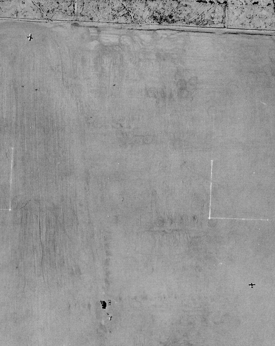
A closeup from the 3/2/43 USAAF aerial view of Ryan Auxiliary A-2 (courtesy of Brian Rehwinkel)
showing 2 of the aircraft along with a small building (or tent or truck) - and a wind direction indicator.
Brian observed, “This layout for an Army Air Forces seems to be a common layout (even for AAF contractor fields).
The Army placed small operations shacks in the middle of the auxiliary training fields & the aircraft landed everywhere except the middle of the field.”

The earliest map depiction of which has been located of Neff Field
was on a 1944 USAAF map of (courtesy of John Voss) of Ryan Field (labeled "Tuscon Primary Flying School") & its satellite airfields (courtesy of John Voss).
A-1 Haarman Field (to the southeast), A-3 Bane Field (to the northwest, of which no remains have been identified),
and A-4 Kerlinger Field (to the west-southwest, of which no remains have been identified).
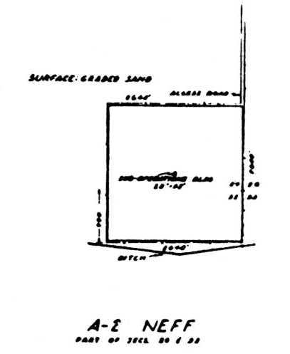
As depicted on the 1944 AAF airfield layout diagram (courtesy of John Voss) the airfield at Neff consisted of a square landing area.
No buildings were depicted at the airfield.
The date of closure of Neff Field has not been determined.
The Ryan School of Aeronautics ceased operations in 1944, at which point its auxiliary fields undoubtedly were abandoned.
Neff A-2 was not depicted at all on the 1945 Phoenix Sectional Chart (courtesy of John Voss).
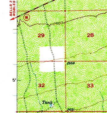
The square landing area of the former Neff Field still depicted on the 1957 USGS topo map, but unlabeled.
A 1958 aerial photo showed the remains of what appeared to be 4 runways laid out in a square.
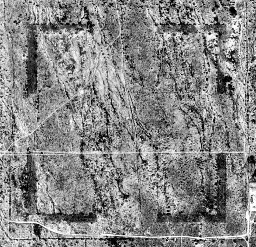
The 1992 USGS aerial photo of the site of Neff Field showed the remains of what appeared to be 4 runways laid out in a square.
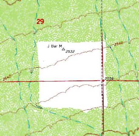
The square landing area of the former Neff Field still depicted on the 1995 USGS topo map (but unlabeled),
with a surveying marker named “J Bar M” at the north end.
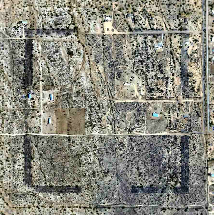
A 2005 aerial view of the site of Neff Field showed the remains of the 4 runways remained fairly unchanged,
but houses had sprouted up over the site at some point between 1992-2005.
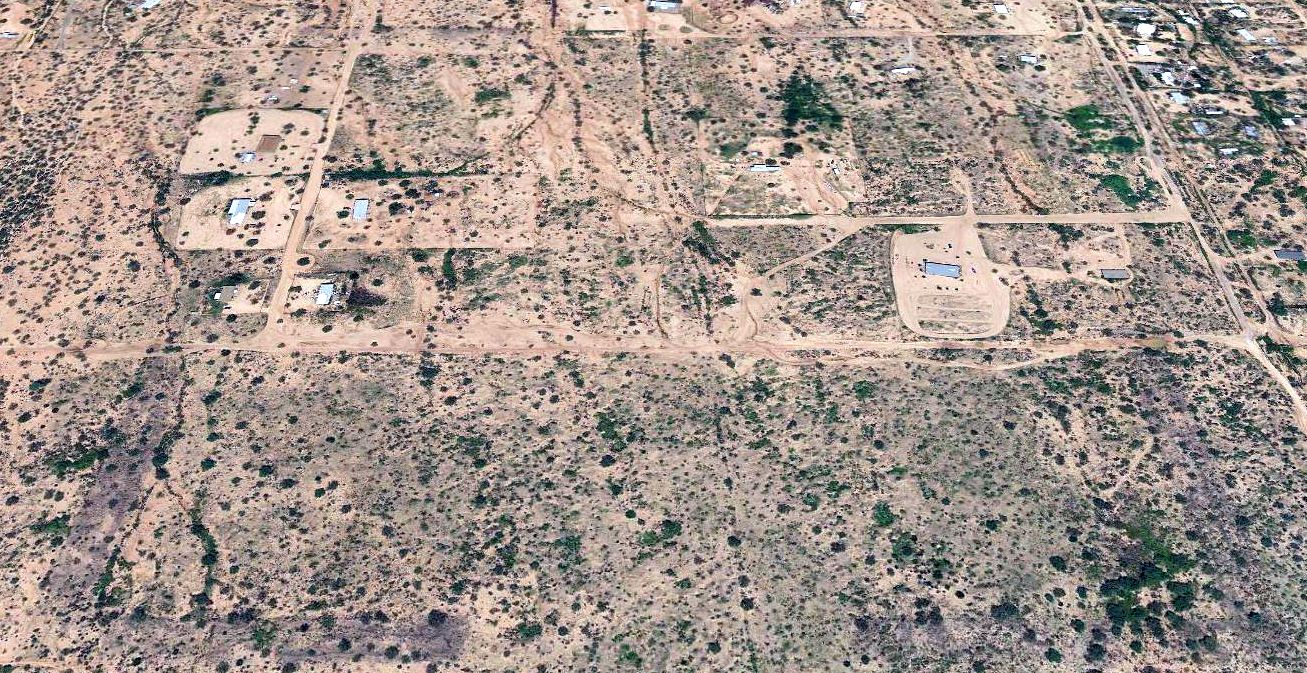
A 2018 aerial view looking north at the site of Neff Field showed the traces of the 4 runways had become less recognizable compared to the 2005 photo.
Neff Field is located southwest of the intersection of Dales Drive & South Marstellar Road.
Thanks to Chris Kennedy, David Brooks, and Joel Svoboda for determining the location of this airfield.
____________________________________________________
____________________________________________________
This site covers airfields in all 50 states.