Abandoned & Little-Known Airfields:
Southeastern Arkansas
© 2002, © 2024 by Paul Freeman. Revised 3/3/24.
This site covers airfields in all 50 states: Click here for the site's main menu.
____________________________________________________
Please consider a financial contribution to support the continued growth & operation of this site.
Eberts Field (revised 12/6/20) - Lonoke Emergency Field / Lonoke Municipal Airport (revised 12/10/20) - Toney Field (added 3/3/24) - Worth James Airport (revised 6/3/18)
____________________________________________________
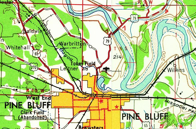
34.254, -92.012 (Southwest of Memphis, TN)
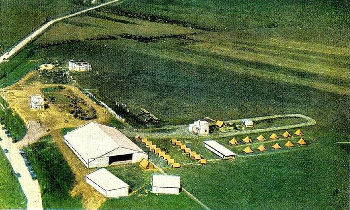
A colorized version of an undated aerial view looking northeast at Toney Field (courtesy of Joe Melton) from a 1928 booklet, showing a hangar & a few other buildings on the west side of a grass airfield.
Several rows of tents would seem to indicate a military encampment.
Joe Melton reported, “I have seen mention of Toney Field as far back as 1924 in the Commerce Department Aeronautical Bulletins.
It was Pine Bluffs' municipal airport.”
According to a 2/20/20 NW AR Democrat Gazette article, “Built in the early days of aviation, Toney Field was the Jefferson County seat's first airport.”
The earliest photos which has been located of Toney Field were a set of undated aerial views from a 1928 booklet.
This one showed Toney Field looking northwest.
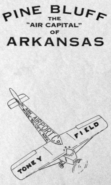
The cover of a 1928 booklet described Toney Field as the “Air Capital of Arkansas”.
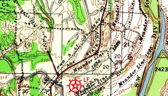
The earliest topo map depiction which has been located of Toney Field was on the 1932 USGS topo map.
It depicted the red “LF” symbol, but with no name.
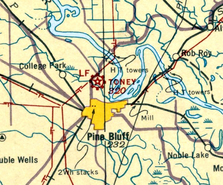
The earliest aeronautical chart depiction which has been located of Toney Field was on the November 1935 Little Rock Sectional Chart.
It depicted Toney as a commercial/municipal airport.
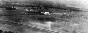
A 1949 USGS aerial view depicted Toney Field as an irregularly-shaped grass airfield with some buildings on the west side.
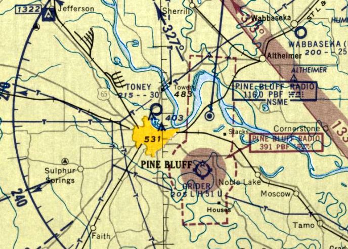
The last aeronautical chart depiction which has been located of Toney Field was on the 1961 Little Rock Sectional Chart.
It depicted Toney Field as having a 3,000' unpaved runway.
Toney Field was evidently closed (for reasons unknown) at some point between 1961-65,
as it was no longer depicted on the 1965 Little Rock Sectional Chart.
A 1961 USGS aerial view depicted Toney Field's hangar as remaining intact, but there were no aircraft visible.
The last topo map depiction which has been located of Toney Field was on the 1964 USGS topo map.
Toney Field was no longer depicted on the 1972 USGS topo map.
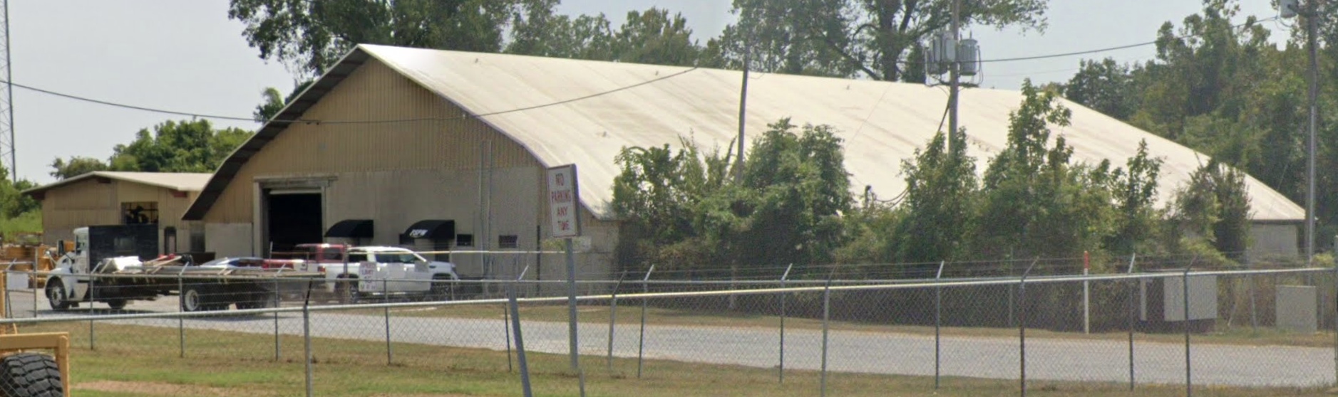
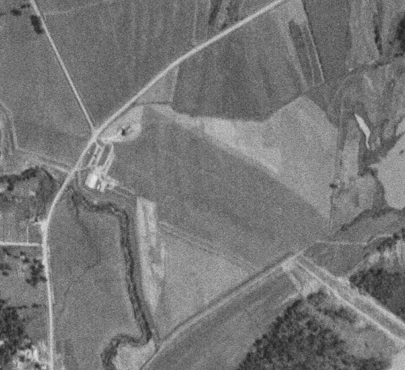
A 2023 photo looking southeast shows the former Toney Field hangar remains intact, reused by a business.
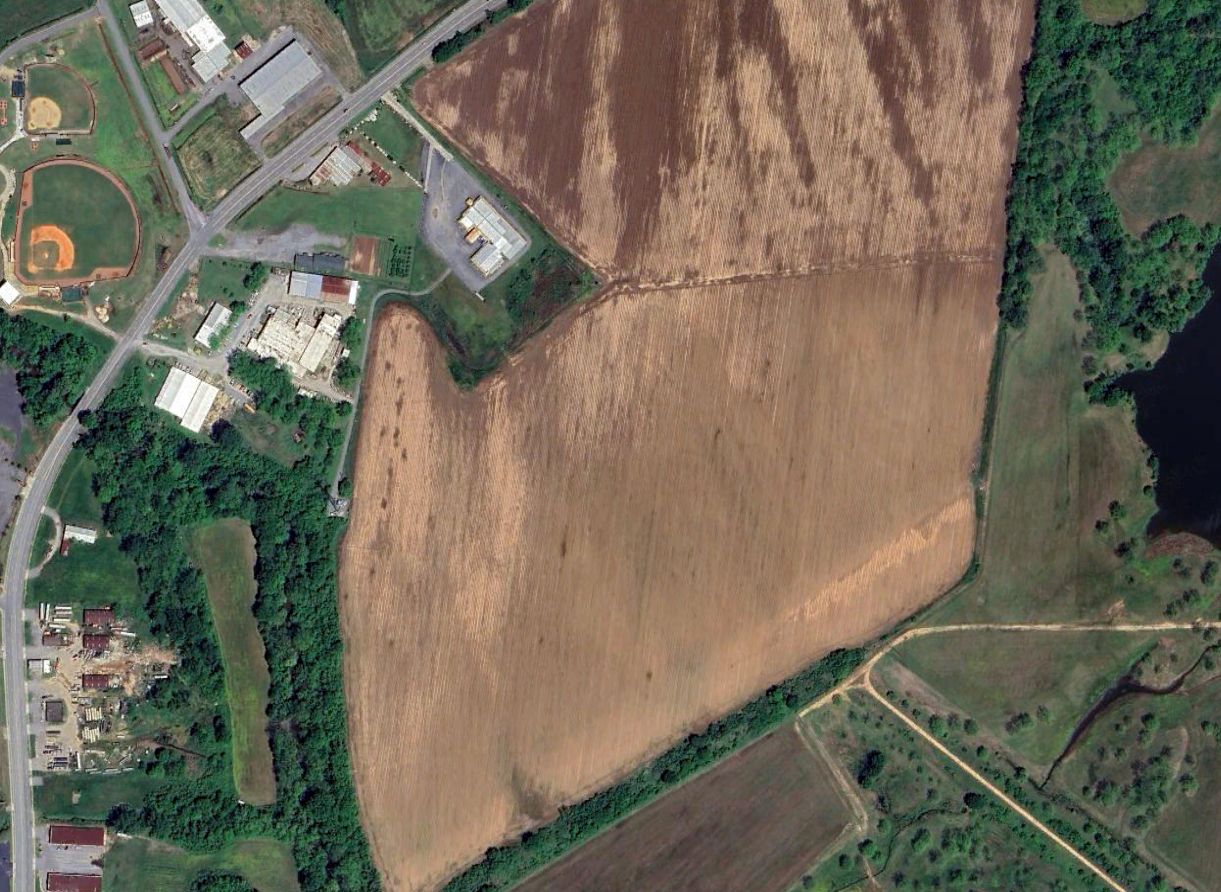
A 2023 aerial view shows the former Toney Field hangar remains intact along the west side. The majority of the former airfield remains clear, being used for farming.
Thanks to Joe Melton for pointing out this airfield.
___________________________________________________
34.8, -91.92 (East of Little Rock, AR)
According to the Arkansas History Commission, the 640-acre Eberts Field
was named for native Arkansan, West Point graduate, and Signal Corps Captain Melchior Eberts.
Eberts died in May 1917 while making airplane exhibition flight at Columbus, NM.
Construction of Eberts Field began 12/11/1917.
The Primary Flying Course was an 8-week course with a student capacity of 300.
Eberts Field also housed a Temporary Storage Depot.
The earliest depiction of Eberts Field which has been located
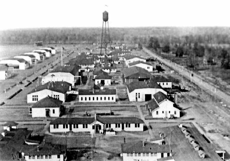
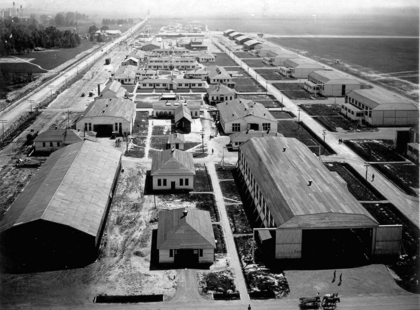
was a a circa 1918 aerial view looking north at the field (courtesy of the Lonoke County Historical Society & Shirley McGraw).
It depicted the field as having a long row of hangars running north/south along the east side of the field,
with the airfield area to the west.
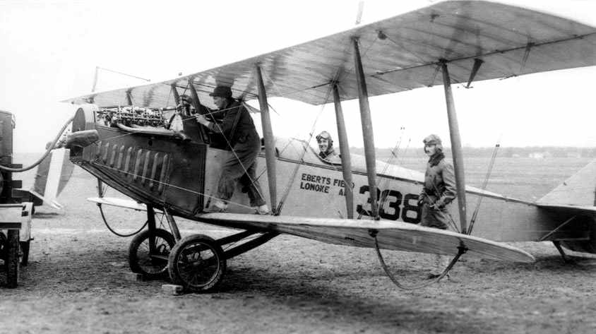
A circa 1918 photo of a JN-4 being refueled at Eberts Field (courtesy of Johnnie Bransford).
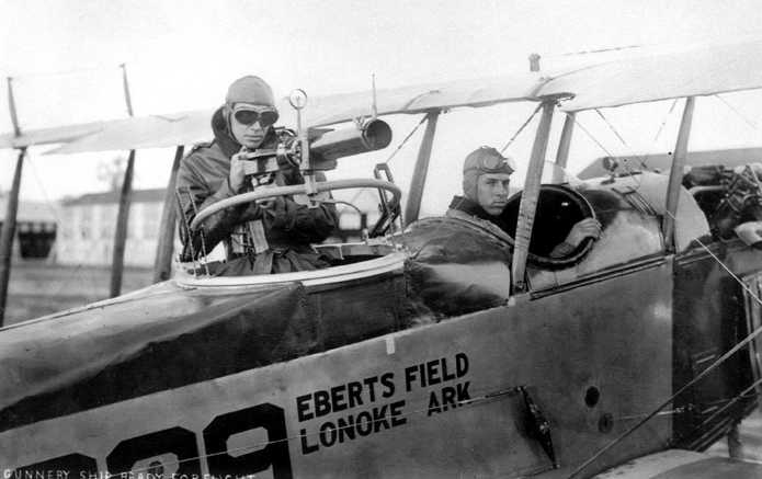
An undated photo of an Eberts Field JN-4 Jenny modified for gunnery instruction.
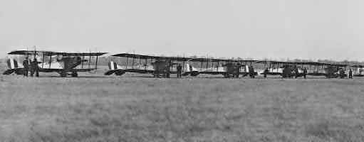
An undated photo of Eberts Field (courtesy of Colin Christie, enhanced by Bill Grasha).
According to Colin, the original panoramic photo depicted “the planes lined up... wing tip to wing tip... containing more than 100 planes.
Each plane has 2 soldiers at attention in front of their Jennys.
My Grandfather, George Christie, was a flight instructor at Eberts Field.”
A 1918 Eberts Field postmark (courtesy of Dana Donahue) on a letter sent by Dana's Great-Uncle, (Frederick Dehmer).
Dana observed that Dehmer “as a young man apparently died of Pneumonia while stationed at Eberts Field in 1918.
As far as I know he made it to the rank of Corporal, although one of his letters makes it sound as if he was due for promotion to Sergeant soon and hoped to become a pilot.”
According to a historic marker at the site of Eberts Field, approximately 2,500 enlisted men & officers were stationed there from 1918-19.
Although a large number of planes were reportedly operated from Eberts Field, not a single fatal accident occurred there.
A 1918 Army Signal Corps aerial view looking south along the row of hangars at Eberts Field.
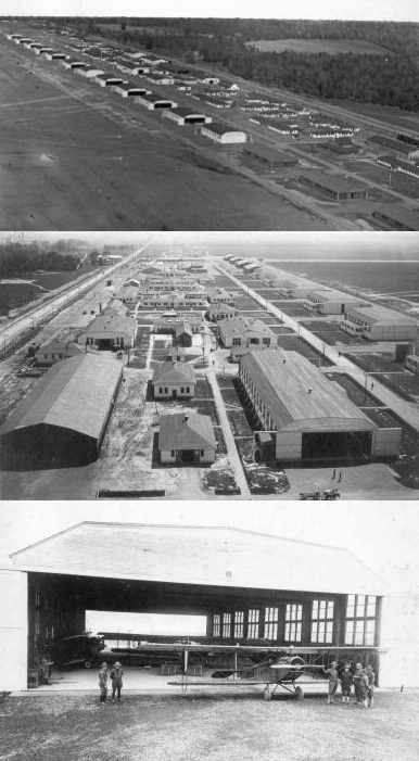
Several WW1-era photos of hangars & biplanes at Eberts Field (courtesy of Robert Horton).
The First World War ended (11/11/18) before Eberts Field's first class graduated.
Construction at Eberts Field ended in January 1919, at a total cost of $1,829,560.
Eberts Field was no longer depicted on the November 1935 Little Rock Sectional Chart.
A 12/19/75 USGS aerial photo showed that the row of at least a dozen concrete hangar foundations was still visible along the east side of the site of Eberts Field.
Some of the foundations had more recent sheds built upon them.

A single north/south “Landing Strip” was depicted along the eastern edge of the site of Eberts Field on the 1984 USGS topo map.
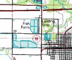
A single north/south “Landing Strip” was depicted along the eastern edge of the site of Eberts Field on the 1990 USGS topo map.
However, the majority of the airfield area of the former Eberts Field had been flooded & turned into a fish farm.
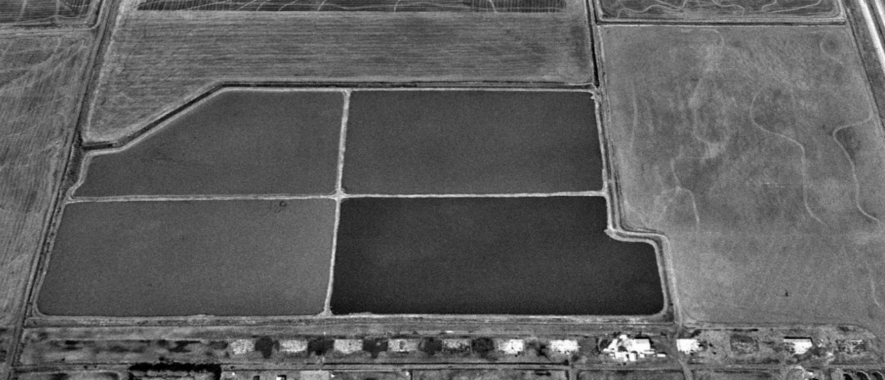
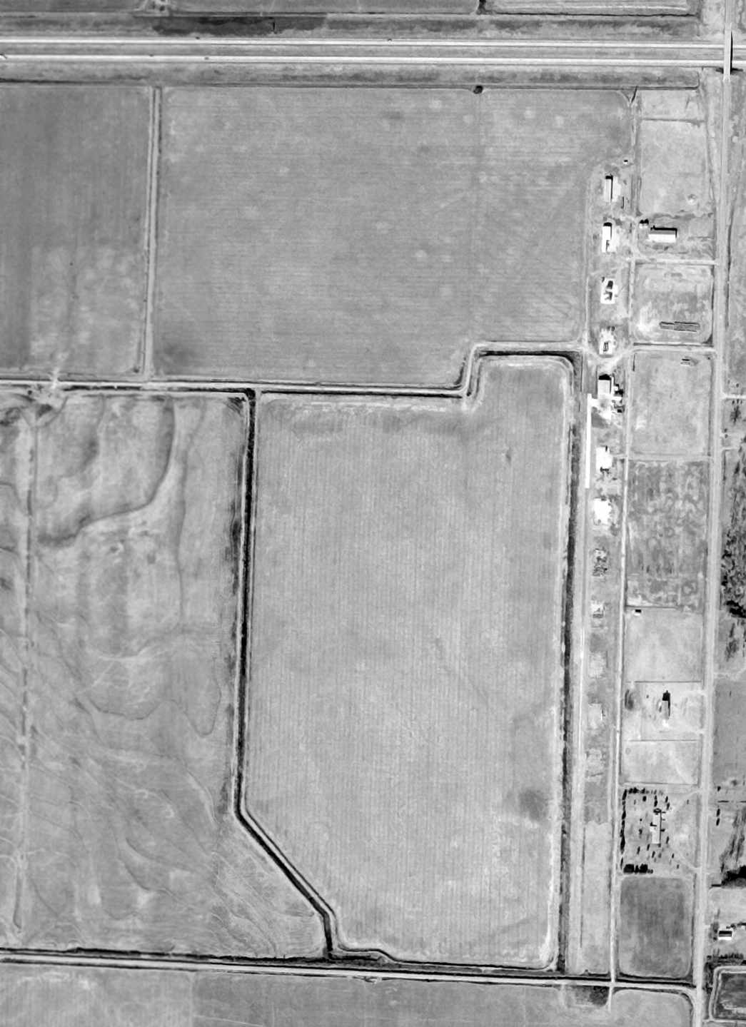
A 1994 USGS aerial view looking west showed the row of at least a dozen concrete hangar foundations was still visible along the east side of the site of Eberts Field.
It appears as if some of the foundations have had more recent sheds built upon them. The majority of the former airfield area was filled in with fish ponds.
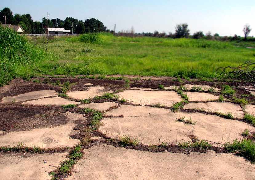
A 2005 photo by Scott Murdock of the remains of a concrete hangar foundation at the site of Eberts Field.
Scott observed, ““The line of hangars for this W.W.I airfield runs north-south, at the east edge of the former flying field.
I had access to the hangar foundations - about a dozen of them - via a paved road running north-south just to their west.
A historical marker describes the field & its wartime contribution.
Much of the area of the flying field itself is now bermed-up & used as a fish farm.”
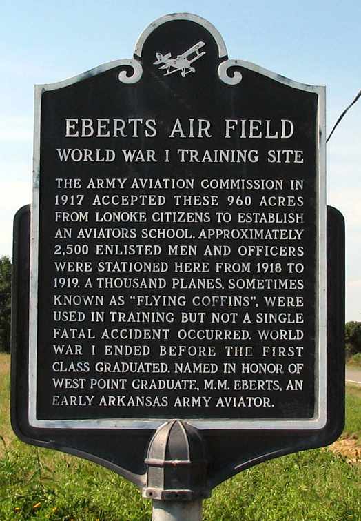
A 2005 photo by Scott Murdock of a historical sign at the site of Eberts Field.
[The assertion that “a thousand planes” were used here is particularly suspect.]
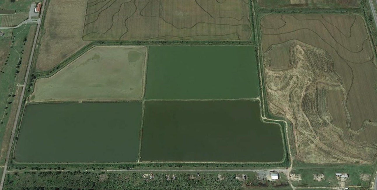
A 2018 aerial view looking west showed the row of at least a dozen concrete hangar foundations was still visible along the east side of the site of Eberts Field.
The site of Eberts Field is located southwest of the intersection of Interstate 40 & Route 89.
____________________________________________________
Lonoke Emergency Field / Lonoke Municipal Airport, Lonoke, AR
34.788, -91.92 (East of Little Rock, AR)
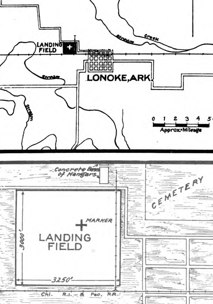
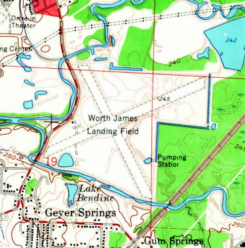
Lonoke “Emergency Field”, as depicted on a 4/15/24 Commerce Department Airway Bulletin (courtesy of Joe Melton).
The date of establishment of Lonoke Municipal Airport has not been determined.
The earliest depiction which has been located of Lonoke Municipal Airport was on a 4/15/24 Commerce Department Airway Bulletin (courtesy of Joe Melton).
It depicted Lonoke “Emergency Field” as a rectangular plot measuring 3,250' east/west by 3,000' north/south, with a cross marker in the northeast portion.
Railroads were depicted adjacent to the airfield's southern & eastern edges,
and the “concrete bases of hangars” of Eberts Field were depicted adjacent to the north side.
Why was Lonoke Airport established here, if Eberts Field had already been built (and was no longer being used) adjacent to it?
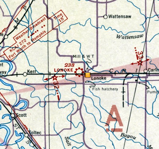
The earliest aeronautical chart depiction which has been located of Lonoke Municipal Airport was on the November 1935 Little Rock Sectional Chart.
The Airport Directory Company's 1937 Airport Directory (courtesy of Bob Rambo)
described Lonoke Municipal Airport as being located 1.5 miles west of the town of Lonoke.
It was said to consist of a 320-acre rectangular field, measuring 5,200' x 2,460'.
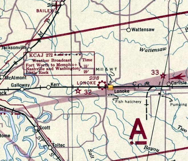
The last aeronautical chart depiction which has been located of Lonoke Municipal Airport was on the February 1939 Little Rock Sectional Chart.
Lonoke Municipal Airport may have been closed at some point between 1939-40,
as it was not depicted on the 1940 USGS topo map.
According to Scott Murdock, “I believe that this was also the site of a WW2 contract glider school,
operated by Kenneth Starnes Flying Service for the AAF.”
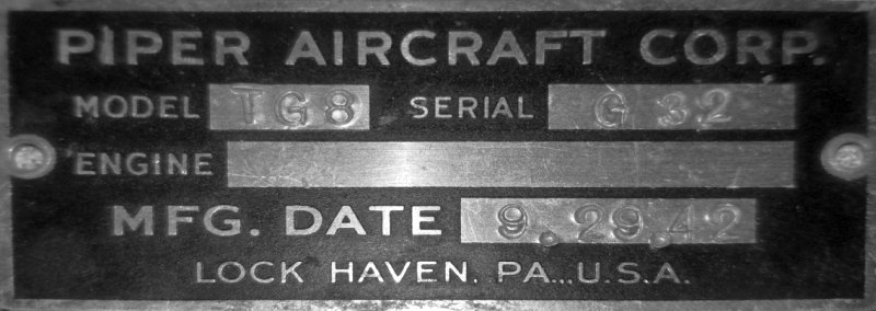
A 2020 photo by Joe Melton of the dataplate from a Piper TG-8 glider from the Lonoke glider training facility.
Joe Melton reported, “I was told that the glider training field was a one square mile section of land that was leased from a farm somewhere to the north.
They used Piper TG-8 gliders & the program was short-lived due to wrecks. I have the data plate from one of the gliders, s/n G-32.
I found the plate in Dennis Cantrell's old hangar at Conway. Kenneth Starnes originally had that hangar.”
However, no airfield in Lonoke was nor depicted on Little Rock Sectional Charts from 1942/44/45,
nor listed in the April 1944 US Army/Navy Directory of Airfields (courtesy of Ken Mercer).
Nothing recognizable as a former airfield was depicted at the site of Lonoke Municipal Airport on a 1955 aerial photo, just an open field.
A 2018 aerial view looking north showed no trace remaining recognizable of Lonoke Municipal Airport.
____________________________________________________
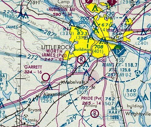
Worth James Airport, Little Rock, AR
34.707, -92.328 (Northwest of Memphis, TN)
Worth James Airport, as depicted on the February 1960 Little Rock Sectional Chart.
This small airfield was located on the west side of Little Rock.
Worth James Airport was evidently established at some point between 1957-60,
as it was not yet depicted on the August 1954 Little Rock Sectional Chart, nor on the 1957 USGS topo map.
The earliest depiction which has been located of Worth James Airport
was on the February 1960 Little Rock Sectional Chart.
It depicted Worth James as a private airfield having a 4,600' unpaved runway.

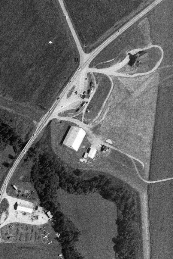
The earliest photo which has been located of Worth James Airport was a 4/3/60 USGS aerial photo.
It depicted the airport as having 2 perpendicular unpaved runways, with 2 hangars on the west side.
There were no aircraft visible on the field.
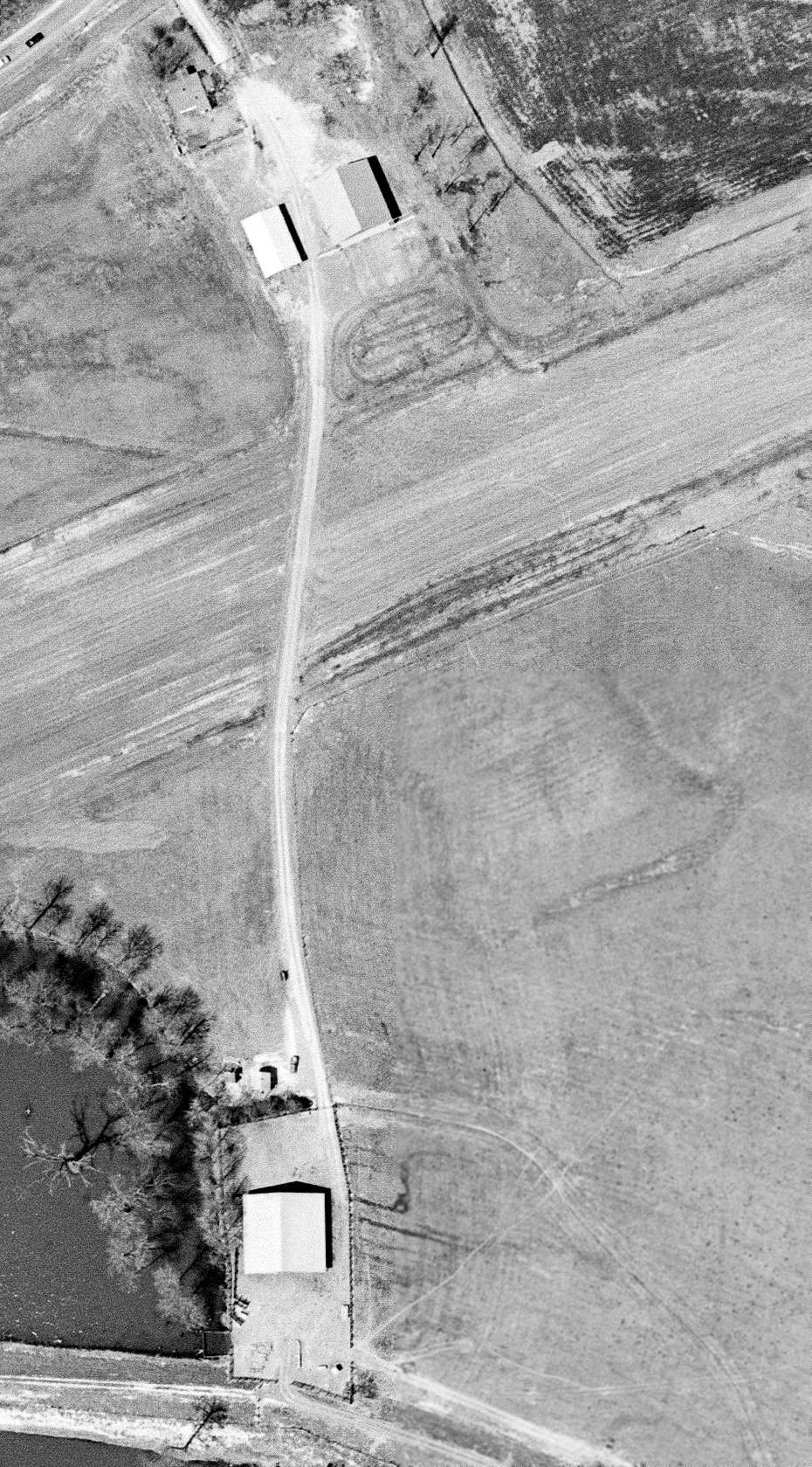
A closeup from the 4/3/60 USGS aerial view of the hangars on the west side of Worth James Airport.
The 1961 USGS topo map depicted “Worth James Landing Field” as having 2 perpendicular unpaved runways,
with 2 hangars on the west side.
A 1970 aerial photo depicted Worth James Airport in the same fashion as the 1960 aerial view.
The last aeronautical chart depiction which has been located of Worth James Airport
was on the November 1974 Memphis Sectional Chart (courtesy of Ron Plante).
It depicted Worth James as a private airfield having a 4,500' unpaved runway.
The last labeled map depiction which has been located of Worth James Airport was on the 1986 USGS topo map,
which depicted it in the same fashion as the 1961 USGS topo map.
Worth James Airport was evidently closed (for reasons unknown) at some point between 1986-93,
as it was no longer depicted on the April 1993 Memphis Sectional Chart.
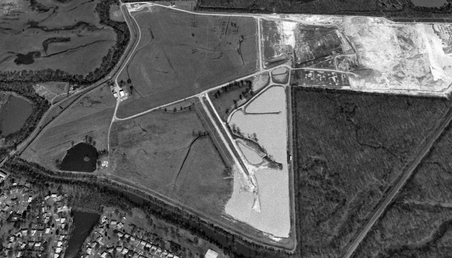
A 1994 USGS aerial view looking north showed the western portions of Worth James Airport's former 2 grass runways were still intact, along with 2 hangars to the northwest of the runway intersection.
But the eastern portion of the airfield had been removed.
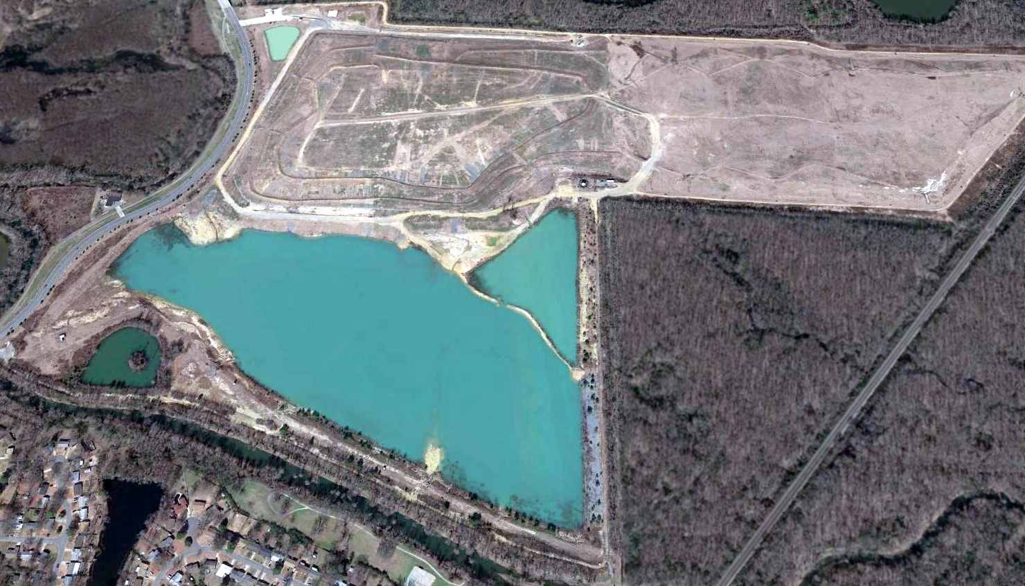
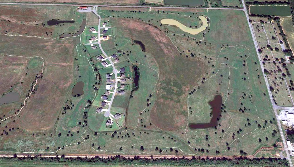
A 2014 aerial view looking north showed the site of Worth James Airport had been covered with a surface mining operation, with no trace remaining of the little airport.
The site of Worth James Airport is located southeast of the intersection of Mabelvale Pike & Asher Avenue.
Thanks to M.L. Anthony for pointing out this airfield.
____________________________________________________
____________________________________________________
This site covers airfields in all 50 states.