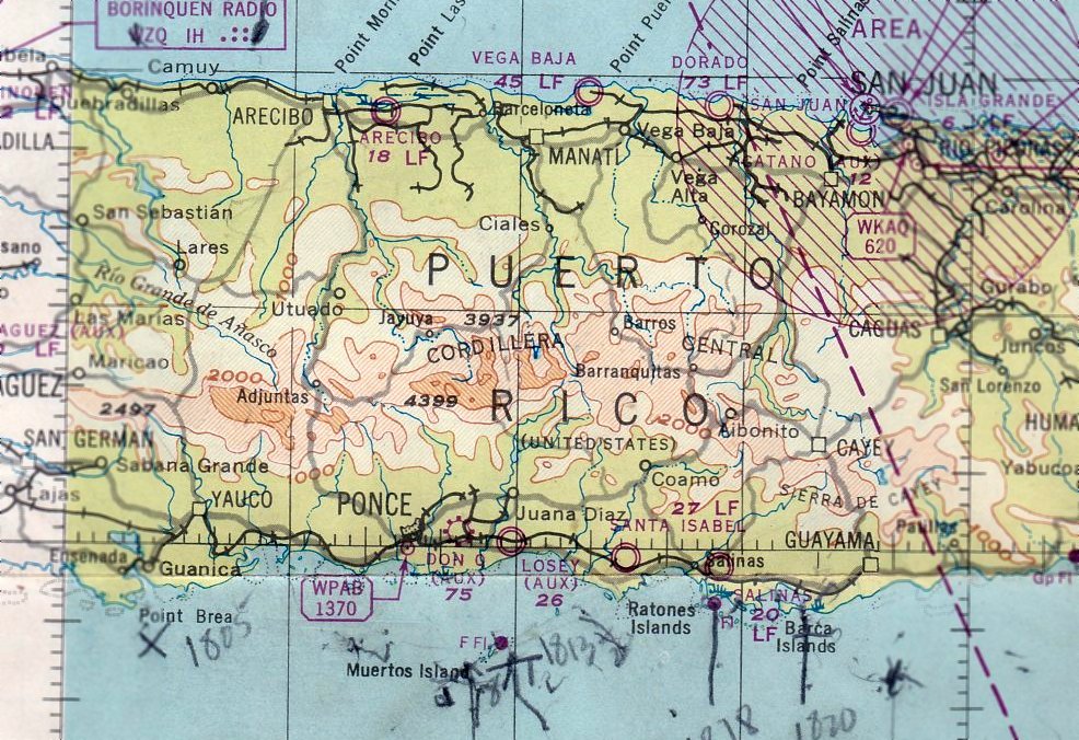
Abandoned & Little-Known Airfields:
Eastern Puerto Rico
© 2002, © 2022 by Paul Freeman. Revised 11/8/22.
This site covers airfields in all 50 states: Click here for the site's main menu.
____________________________________________________
Please consider a financial contribution to support the continued growth & operation of this site.
Camp Garcia Vieques (revised 6/21/14) - Catano NAAF (added 7/26/20) - Diego Jimenez Torres Airport (added 12/22/20) - Dorado Beach Airport / Dorado AAF / Dorado Airport (revised 11/8/22)
Patillas Airport (revised 1/1/17) - Salinas Aux Airdrome (revised 11/8/22) - Santa Isabel Aux Airdrome (revised 11/8/22)
____________________________________________________
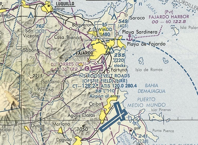
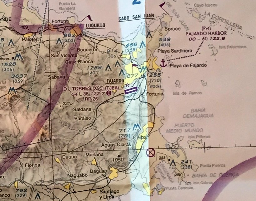
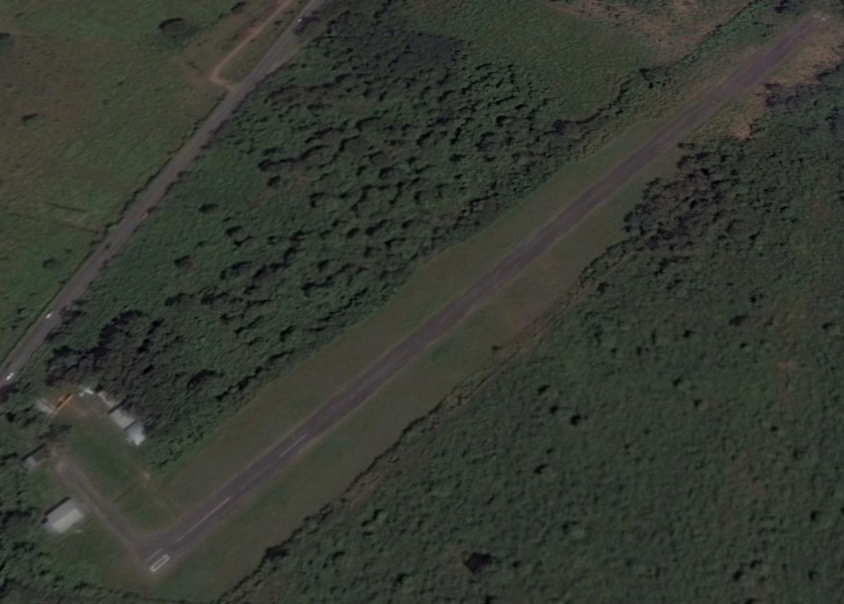
Diego Jimenez Torres Airport (TJFA / X95), Fajardo, PR
18.309, -65.664 (Southeast of San Juan, PR)
DJ Torres Airport, as depicted on the November 1993 San Juan Terminal Aeronautical Chart (courtesy of Ron Plante).
This small general aviation airport on the northeast side of Puerto Rico was evidently established at some point between 1965-93,
as it was not yet depicted on a 3/11/62 USGS aerial photo or a 1965 Aeronautical Chart (courtesy of Kevin Walsh).
The earliest depiction which has been located of DJ Torres Airport was on the November 1993 San Juan Terminal Aeronautical Chart (courtesy of Ron Plante).
It depicted DJ Torres Airport as having a single paved 3,600' northeast/southwest runway.
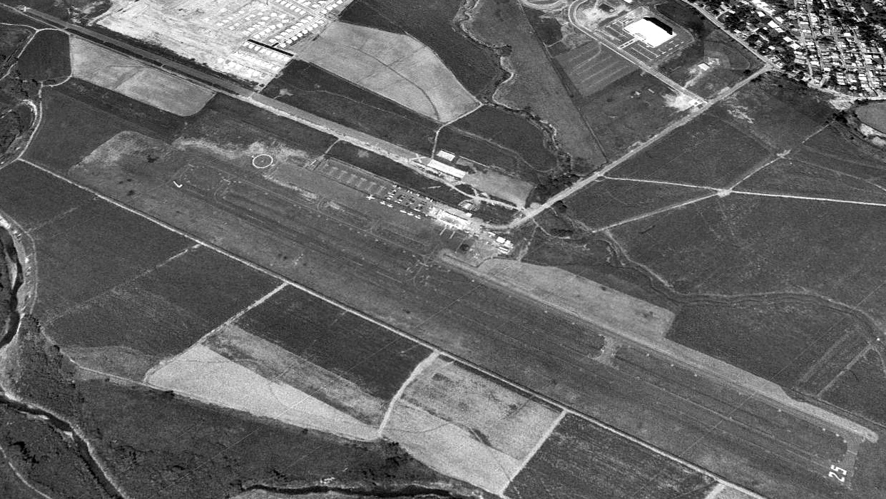
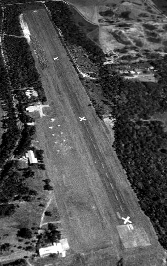
The earliest photo which has been located of Diego Jimenez Torres Airport was a 1994 USGS aerial view looking northwest.
It depicted Torres Airport as having a single paved Runway 7/25, along with an abandoned parallel paved runway to the north, marked with closed-runway “X” symbols.
What was the purpose of the abandoned parallel runway?
A paved ramp in between the runways had some small buildings (but apparently not any hangars), and 7 light single-engine aircraft.
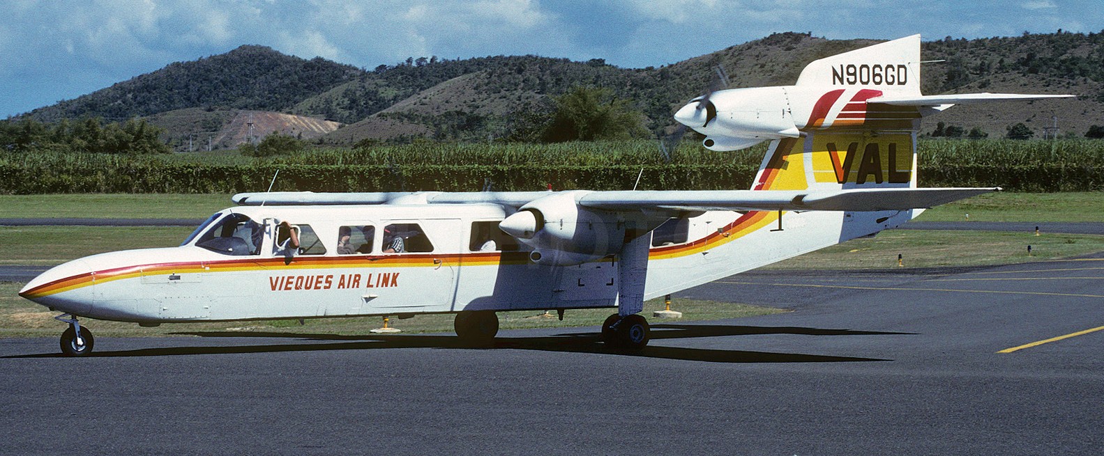
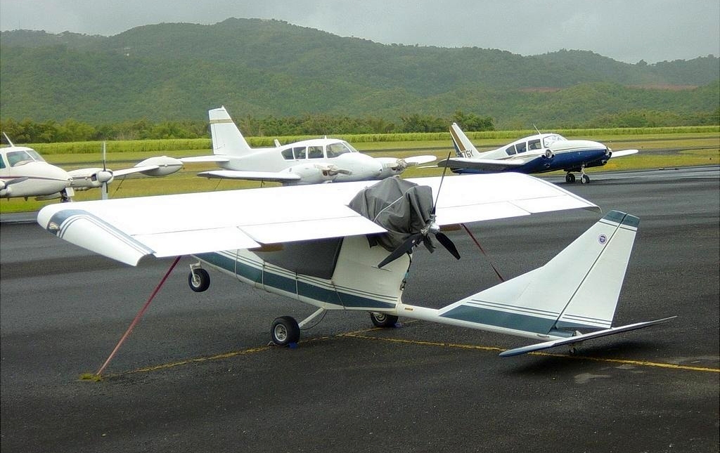
A 4/26/95 photo by Peter Smithson of N906GD, a Britten-Norman BN-2A Mk.III-2 Trislander serial # 1060 of Vieques Air Link taxiing at Fajardo Diego Jimenez Torres Airport.
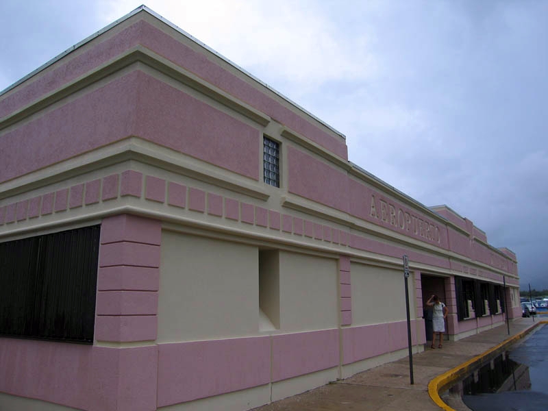
An 8/18/07 photo of the Diego Jimenez Torres Airport terminal building.
The last aeronautical chart depiction which has been located of DJ Torres Airport was on the October 2008 San Juan Terminal Aeronautical Chart (courtesy of Ron Plante).
It depicted DJ Torres Airport as having a single paved 3,600' northeast/southwest runway.
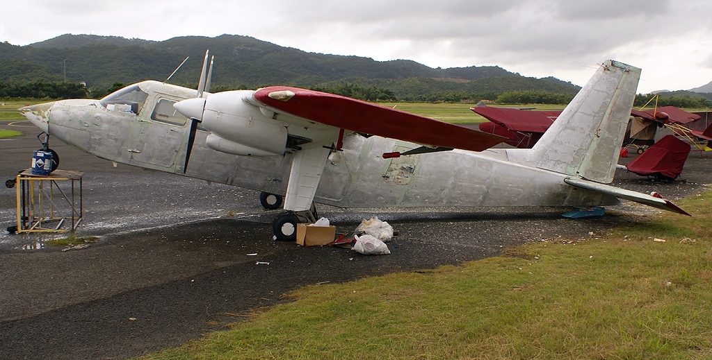
A sad 11/23/08 photo by Hector Rivera of N555DM, a Britten-Norman BN-2A-26 Islander serial # 129, at Fajardo Diego Jimenez Torres Airport.
A 7/13/03 photo by Jordan of N216CV, an experimental Titan Tornado II at Fajardo Diego Jimenez Torres Airport.
According to Wikipedia, José Aponte de la Torre Airport opened in 2008 a few miles to the southeast,
using the much larger runways of the former Roosevelt Roads Navy airfield.
This presumably spelled the end of any need for Diego Jimenez Torres Airport.
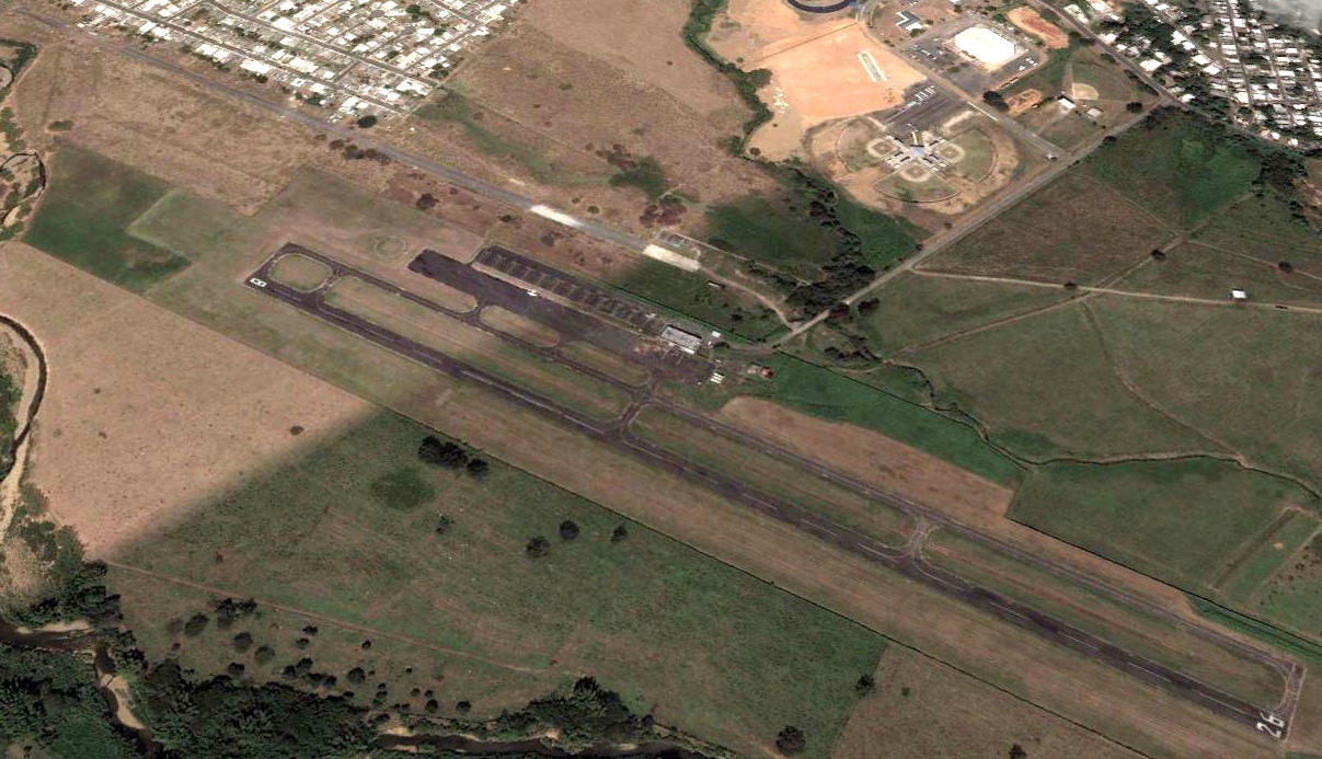
The last photo which has been located showing aircraft at DJ Torres Airport was a 2011 aerial view looking northwest.
In contrast to previous years, only 2 aircraft were visible on the Torres ramp.
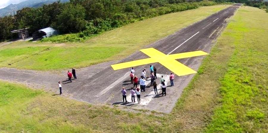
A 2/24/15 FAA notice (courtesy of Ramon Giusti) said, “On 1/21/15, PRPA, sponsor of Diego Jimenez Torres Airport (X95), informed the FAA that the Airport will close permanently on 4/30/15.
X95 is a small 94-acre non-towered, general aviation airport. The useful life of the federally funded improvements expired in 2013.
FAA recognizes that PRPA is no longer contractually obligated to continue operating this airport.”
A 2020 aerial view looking northwest showed DJ Torres Airport after its closure, with yellow closed-runway “X” symbols visible on the most-recently used Runway 7/25.
The airport otherwise remained intact.
Thanks to Ramon Giusti for pointing out this airfield.
____________________________________________________
Catano Naval Auxiliary Airfield, San Juan, PR
18.436, -66.129 (West of Downtown San Juan, PR)
Catanao Naval Auxiliary Airfield, as depicted on a 3/13/41 US Military aerial photo (courtesy of Gino Villarini).
This small military airfield was believed to have been established in the pre-WW2 buildup as a support/auxiliary field for NAS San Juan, located only 2 NM to the northeast.
The date of establishment of Catano Naval Auxiliary Airfield has not been determined.
The earliest depiction which has been located of Catano Naval Auxiliary Airfield was a 3/13/41 US Military aerial photo (courtesy of Gino Villarini).
It depicted “Naval Landing Field Catano” as a single paved northeast/southwest runway,
with possibly some aircraft parking revetments on the north side.
No airfield at this location was depicted on USGS topo maps from 1941/47/50/57.
The only aeronautical chart depiction which has been located of Catanao Naval Auxiliary Airfield was on the April 1944 Virgin Islands AAF Aeronautical Chart (courtesy of Leon Cleaver).
Catano Naval Auxiliary Airfield was presumably closed at some point between 1944-65,
as it was no longer depicted on a 1965 Aeronautical Chart (courtesy of Kevin Walsh) or a 1979 street atlas (courtesy of Kevin Walsh).
A 1994 aerial photo showed the site of Catano Naval Auxiliary Airfield had been covered with buildings & streets,
but one street (Cll Las Mercedes) appeared to have been built directly over the alignment of the former runway, possibly reusing the runway pavement.
A 2016 aerial view showed no overt trace of Catano Naval Auxiliary Airfield,
but one street (Cll Las Mercedes) appeared to have been built directly over the alignment of the former runway, possibly reusing the runway pavement.
Thanks to Gino Villarini for pointing out this airfield.
____________________________________________________
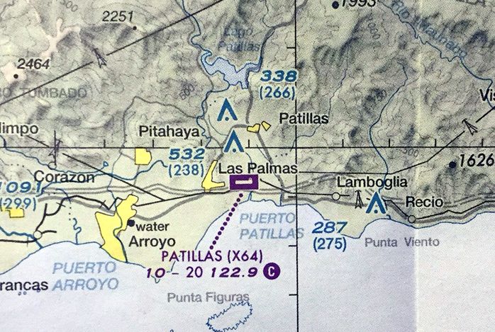
Patillas Airport (X64), Patillas, PR
17.982, -66.02 (South of San Juan, PR)
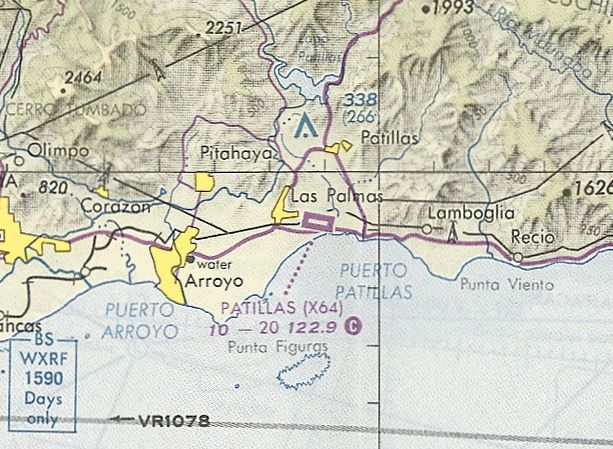
Patillas Airport, as depicted on the November 1993 Puerto Rico Sectional Chart (courtesy of Ron Plante).
This small general aviation airport on the south coast of Puerto Rico was evidently established at some point between 1965-93,
as it was not yet depicted on a 1965 Aeronautical Chart (courtesy of Kevin Walsh).
The earliest depiction which has been located of Patillas Airport was on the November 1993 Puerto Rico Sectional Chart (courtesy of Ron Plante).
It depicted Patillas Airport as having a single paved 2,000' northwest/southeast runway.
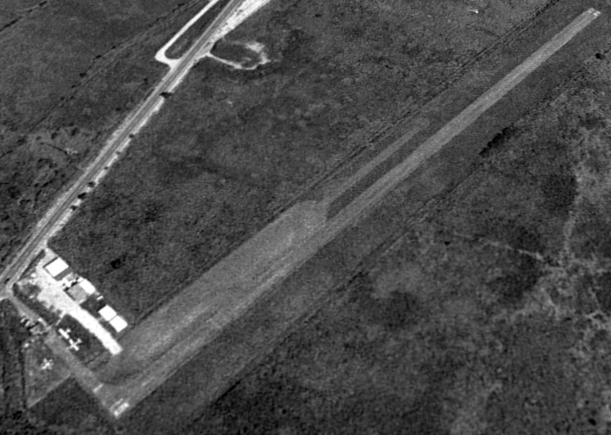
The earliest photo which has been located of Patillas Airport was a 1994 USGS aerial view looking northeast,
which showed Patillas Airport to have a single paved east/west runway, with 3 or 4 light aircraft parked on the northwest side.
According to its FAA Airport/Facility Directory data, for 12-month period ending 7/15/95, Patillas Airport conducted an average of 6 takeoffs or landings per day.
There were 10 aircraft based at the airport: 7 single-engine & 3 ultralights.
The October 2008 Puerto Rico Terminal Aeronautical Chart depicted Patillas Airport as having a single paved east/west 2,000' runway.
According to its FAA Airport/Facility Directory data, Patillas Airport consisted of 16 acres,
within which was a single 2,000' asphalt Runway 10/28, described as of 8/16/11 as in fair condition.
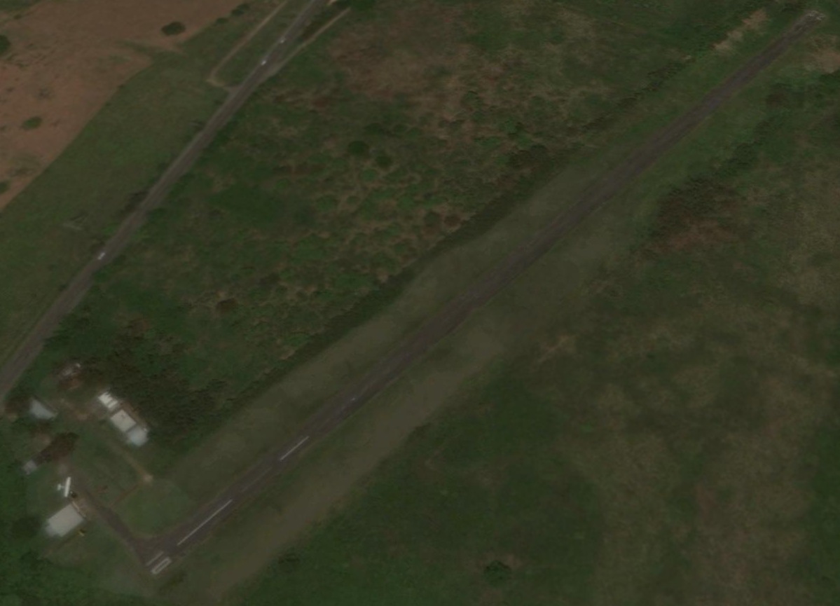
The last photo which has been located showed aircraft at Patillas Airport was a 2013 aerial view looking northeast,
which showed one single-engine light aircraft parked on the northwest side.
A 2014 aerial view looking northeast still showed Patillas Airport's runway marked as an active runway.
A circa 2015 aerial view looking northeast showed Patillas Airport's runway newly marked with a closed-runway “X” symbol.
Tony Richardson reported in 2015, “Patillas [Airport], which had been on Sectionals for years, disappeared off the map,
and Don Omar plans to develop it into the 'Patillas Raceworld'.”
The site of Patillas Airport is located east of the intersection of Route 53 & Route 3.
Thanks to Tony Richardson for pointing out this airfield.
____________________________________________________
Salinas Auxiliary Airdrome, Salinas, PR
17.971, -66.267 (Southwest of San Juan, PR)
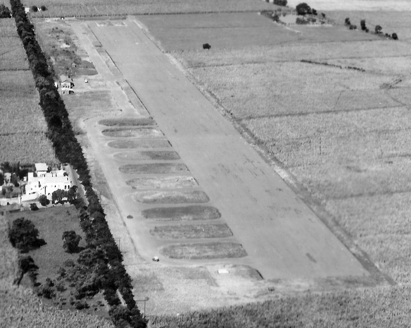
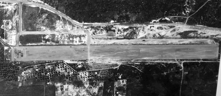
A 11/13/42 U.S. Government aerial view looking west at Salinas Airfield (courtesy of Garred Giles).
This field on the southern coast of Puerto Rico was built during WW2 as an Army Air Force auxiliary airfield at a cost of approximately $10 million.
The earliest photo which has been located of the Salinas Airfield was a 11/13/42 U.S. Government aerial view looking west (courtesy of Garred Giles).
It depicted the field as having a single paved northwest/southeast runway,
with a light-colored square patch on the western end of the runway – a feature common to the nearby Santa Isabel Airfield – what purpose did this serve?
A paved parallel taxiway was located on the south side, along with 11 paved connecting taxiways on the southeast side.
There were 2 small buildings on the south side of the runway, but no aircraft visible on the field.
The earliest aeronautical chart depiction which has been located of Salinas Field was on the April 1944 Virgin Islands AAF Aeronautical Chart (courtesy of Leon Cleaver).
It depicted Salinas as a military airfield.
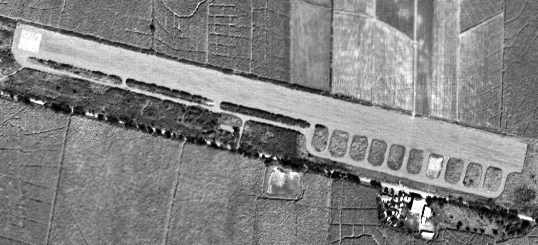
A 12/21/58 USGS aerial view showed Salinas Airfield to remain intact, but without any sign of recent aviation usage.
The May 1964 USAF Operational Navigation Chart (courtesy of Chris Kennedy) depicted Salinas as a civilian airport with a single east/west runway.
The only photo which has been located showing aircraft at the Salinas Airport was an 11/24/67 USGS aerial view.
It depicted a total of 7 single-engine aircraft parked adjacent to the southwest side of the runway.
The Salinas Airport was evidently closed at some point between 1967-71,
as it was no longer depicted at all (even as an abandoned airfield)
on the December 1971 San Juan Local Aeronautical Chart (courtesy of Robert Brown).
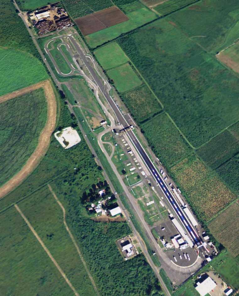
According to the website of the Salinas Speedway, starting in 1975 the Salinas runway was reused
as a quarter-mile dragstrip certified by the National Hot Rod Association.
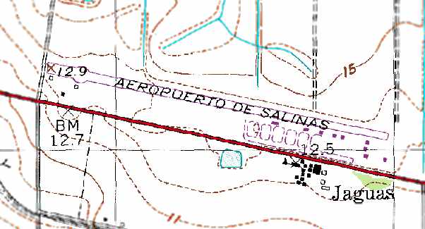
The 1977 USGS topo map depicted the “Aeropuerto De Salinas” as having a single paved 3,500' northeast/southwest runway,
with several taxiways & small buildings (hangars?) on the southeast side.
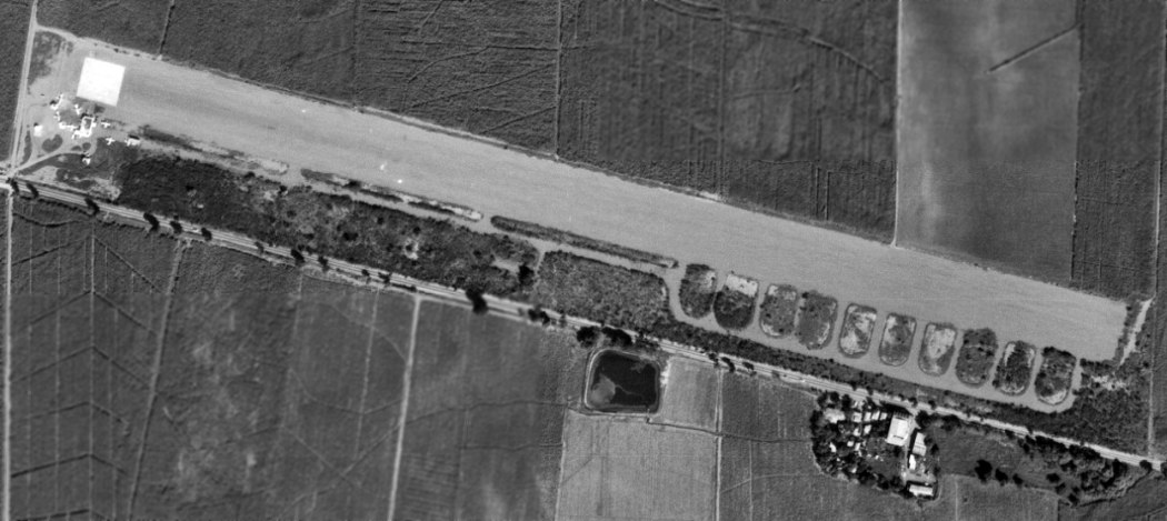
A 3/15/77 USGS aerial photo showed the Salinas runway modified to accommodate drag racing.
Salinas Airport, as depicted on a 1979 road map (courtesy of Kevin Walsh).
According to the website of the Salinas Speedway, until 1982 the dragstrip at the Salinas runway rented to different promoters.
It then was closed from 1982-84, at which point it was acquired by the Lopez family, who continued to operate the dragstrip.
At some point between 1964-94, the Salinas Airport was apparently closed & the runway was reused as a racetrack,
as seen in the 1994 USGS aerial photo.
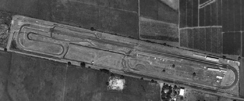
A 2004 aerial view looking northwest along the former runway at Salinas, reused as a racetrack.
As of 2013 the Salinas Speedway continues to operate a dragstrip & 1.7 mile road course laid out over the former runway.
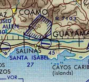
The site of Salinas Airfield is located on the north side of Route 3, two miles east of Salinas.
Thanks to Scott Murdock for pointing out this airfield.
____________________________________________________
Santa Isabel Auxiliary Airdrome / Santa Isabel Airport (PR27), Santa Isabel, PR
17.965, -66.39 (South of San Juan, PR)
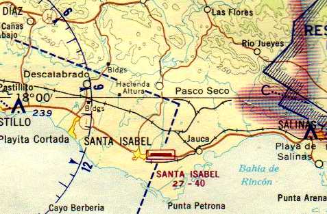
Santa Isabel Airfield, as depicted on the April 1944 Virgin Islands AAF Aeronautical Chart (courtesy of Leon Cleaver).
Photo of the airfield while in use has not been located.
A total of 129 acres along the southern coast of Puerto Rico was acquired in 1940-42 for an Army Air Force auxiliary airfield,
Santa Isabel Auxiliary Airdrome.
The Army's Caribbean Air Command utilized the site as an auxiliary airfield for Losey Field.
The construction at the site consisted of 3 buildings, runways, taxiways, roads, utilities,
fuel storage & dispensing system, and a railway siding.
The earliest depiction which has been located of Santa Isabel Field was on the April 1944 Virgin Islands AAF Aeronautical Chart (courtesy of Leon Cleaver).
It depicted Santa Isabel as a military airfield.
The Santa Isabel Airdrome remained active until 1946 when its functions were no longer required.
The Santa Isabel property was transferred to the US Department of Interior in 1947.
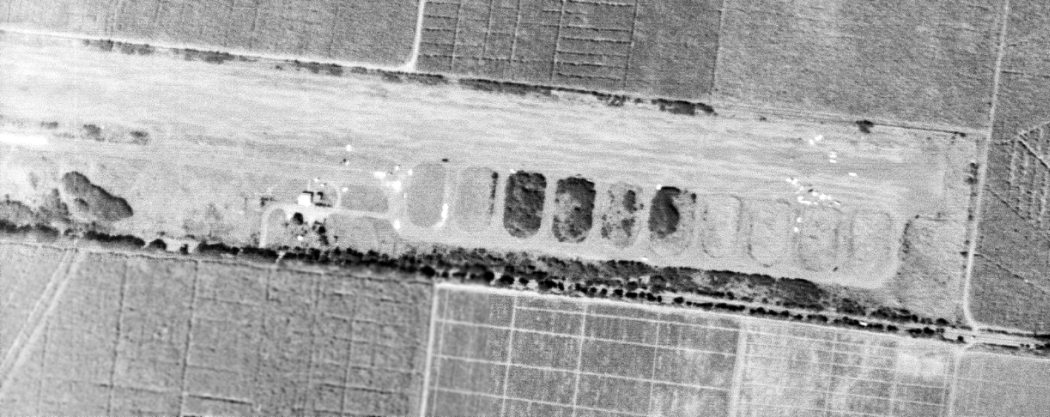
The earliest photo which has been located of the Santa Isabel Airfield was a 12/21/58 USGS aerial view.
It depicted the field as having a single paved northwest/southeast runway,
with a paved parallel taxiway on the southwest side & a number of paved taxiways on the southwest side.
There were a few small buildings on the south side of the runway,
but there were no aircraft or any other sign of recent aviation usage.
The May 1964 USAF Operational Navigation Chart (courtesy of Chris Kennedy) depicted Santa Isabel as a civilian airport with a single east/west runway.
A 11/24/67 USGS aerial view showed the Santa Isabel airfield remained intact,
but it appeared abandoned, with no sign of recent aviation usage.
The December 1971 San Juan Local Aeronautical Chart (courtesy of Robert Brown)
depicted Santa Isabel as having a single east/west 4,000' paved runway.
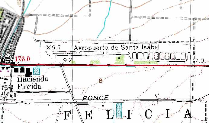
The 1977 USGS topo map depicted the “Aeropuerto de Santa Isabel” as having a single paved east/west runway,
with a parallel taxiway on the south side of the runway, and several taxiways on the southeast side.
Santa Isabel Airport, as depicted on a 1979 road map (courtesy of Kevin Walsh).
A 1992 Army Corps of Engineers report stated that the site was "undeveloped".
Although the Corps of Engineers report used the plural term "runways" to describe the airfield configuration,
all of the depictions which have been located of the airfield showed a single runway.
In the late 1990s the FAA Airport Facility Directory listed Santa Isabel as a current private airfield (PR27),
owned by the Israel PR Agricultural Company.
The field was described as having a single 4,000' paved Runway 9/27,
and 1 single-engine aircraft based at the field.
The 1995 USGS aerial photo depicted a single paved east/west runway.
A set of buildings was located southeast of the runway, built over the former aircraft parking/dispersal area.
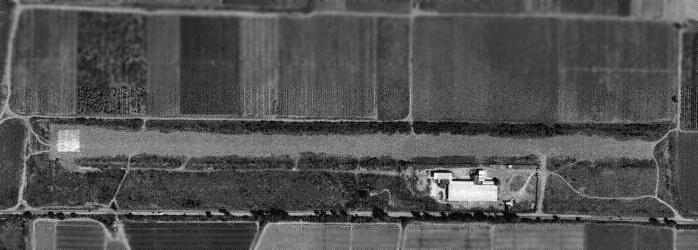
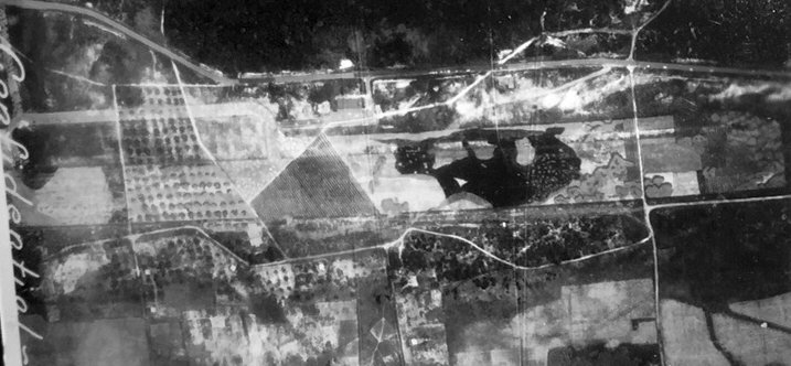
A circa 2005 aerial view looking northeast along Santa Isabel's runway.
A number of cars were parked adjacent to the light-colored pavement square on the west end of the runway.
Is this area used for model aircraft operations, or something else?
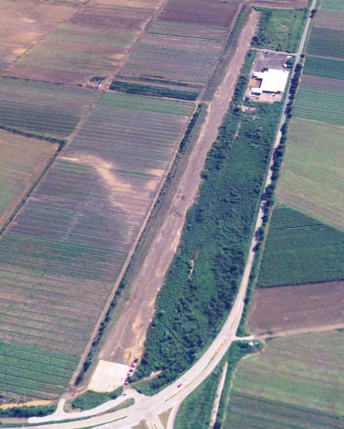
The October 2008 Puerto Rico Terminal Aeronautical Chart depicted Santa Isabel as an abandoned airfield.
____________________________________________________
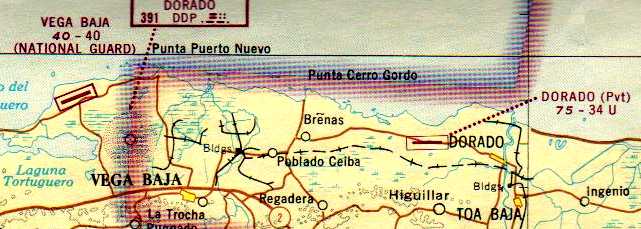
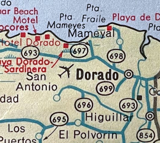
Dorado Beach Airport / Dorado Army Airfield / Dorado Airport (DDP), Dorado, PR
18.46, -66.3 (West of San Juan, PR)
An 11/22/42 USAAC aerial view of Dorado Army Airfield (courtesy of Jeff Hilsmeier).
This field on the northern coast of Puerto Rico was originally established for the private use of pioneer aviator Clara Livingston,
“who used to own hundreds of acres that surround the area”, according to Ricarco Medina.
“The farm was a grapefruit plantation owned & operated by Clara Livingston's father; she took over management at age 22.
Clara Livingston is listed as being the 11th woman aviator in the world & she lived most her life on the Island.”
The original date of construction of the airfield has not been determined.
According to Ricardo Medina, “Amelia Earhart was a friend of Clara & this strip was used by her
when she made a stopover with Fred Noonan & stayed overnight at Clara's ranch during her last flight in 1937.”
The Dorado Airfield was reused by the military during WW2 as an Army Air Force auxiliary airfield,
and the military evidently paved the runway during that period.
The earliest depiction which has been located of Dorado Airfield was an 11/22/42 USAAC aerial view (courtesy of Jeff Hilsmeier).
It depicted Dorado as having an east/west paved runway, with 2 buildings (hangars?) on the north side.
Ricardo Medina reported, “I have spoken with people of the area & none of them recall seeing military installations there,
only the airstrip of the 'Americanos' as they refer to mainland Americans.”
A 6/1/43 USAAF aerial view of Dorado Army Airfield (courtesy of Jeff Hilsmeier) showed how the runway had been effectively camoflauged by painting natural patterns on the runway pavement.
The photo was from an Army Department Engineer report, “Camoflauge Bulletin #1, Toning Down of Runways.”
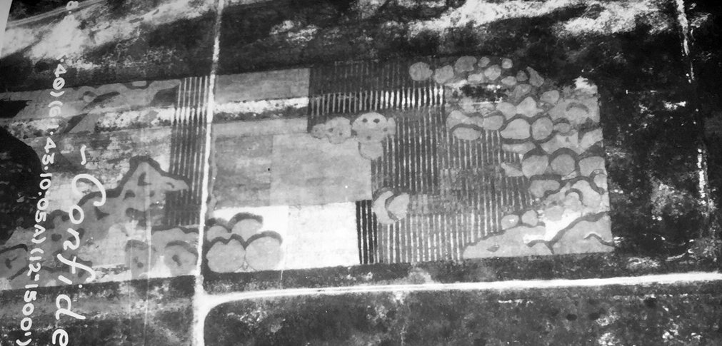
A closeup of the east end of the Dorado runway from a 6/1/43 USAAF aerial view (courtesy of Jeff Hilsmeier) showed the natural patterns painted on the runway pavement.
The earliest aeronautical chart depiction which has been located of Dorado Field was on the April 1944 Virgin Islands AAF Aeronautical Chart (courtesy of Leon Cleaver).
It depicted Dorado as a military airfield.
David Perkins recalled, “I took flight lessons at Dorado while I was stationed with the Navy there from 1947-1949.
My main instructor was a Puerto Rican by the name of I. Ferrer.
Miss Livingston occasionally gave check rides to determine how well her students were doing (and if her instructors were teaching!).
Her main fleet at the time was Aeronca 3AC, a couple of Seabees, and she purchased a Navion as soon as they became available.
This aircraft was used for training commercial pilots. I believe she had a couple of Piper Cubs, too, but I never flew one of those.”
According to Ricardo Medina, “The property was sold in 1959 to Lawrence Rockefeller to establish a hotel resort.”
The airfield was reopened as a commercial airport, the Dorado Airport, at the same time as the Dorado Beach hotel in the early 1960s.
The hotel had strong ties to Eastern Airlines.
Dorado was listed as an active airfield in the 1962 AOPA Airport Directory with a 3,500' paved runway,
the operators listed as West Indies Airmotive & the Dorado Beach Hotel, and airline service provided by Caribair.
Dorado was the home to Dorado Wings airlines for over 20 years, according to former Dorado Wings employee Michael Miller.
They operated flights from San Juan to St. Thomas, St Croix, Tortola, and Virgin Gorda, with about 80 flights a day.
The Quonset hangar at Dorado was used for maintenance of their aircraft.
The May 1964 USAF Operational Navigation Chart (courtesy of Chris Kennedy) depicted "Dorado Beach" as a civilian airport with an east/west runway.
An 11/22/67 USGS aerial view depicted Dorado Beach Airfield to have a single east/west paved runway.
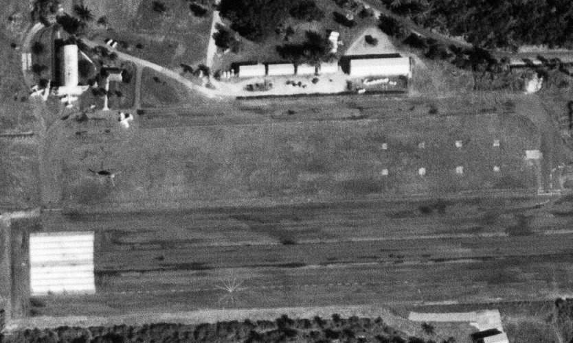
A closeup from the 11/22/67 USGS aerial view of Dorado Beach Airport, showing 3 light aircraft parked around some small buildings on the northwest side.
What were the cluster of 8 markings to the north of the runway?
The December 1971 San Juan Local Aeronautical Chart (courtesy of Robert Brown)
depicted Dorado as a private airfield with a single east/west 3,400' paved runway.
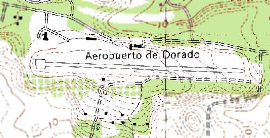
The 1977 USGS topo map depicted the “Aeropuerto de Dorado” as having a single paved east/west runway,
with several small buildings (hangars?) on the north side of the strip.
Dorado Airport, as depicted on a 1979 road map (courtesy of Kevin Walsh).
According to Ricardo Medina, “The concrete runway was laid out many years later on top of the existing compacted macadam material
by a commercial aircraft company that operated at that place in the 1970s & 1980s.”
In 1981 the Dorado Wings airline had a fleet of 8 Britten-Norman Islanders, 3 Jetstreams, a Piper Navaho,
and a Cessna 182 used for pilot transfer to San Juan.
The remains of N116DW, a Britten-Norman Islander, are most likely still next to the hangar.
It crashed on take-off in San Juan on the night of 7/20/81.
The airline was sold in 1981 & became Crownair, and moved its operations to San Juan.
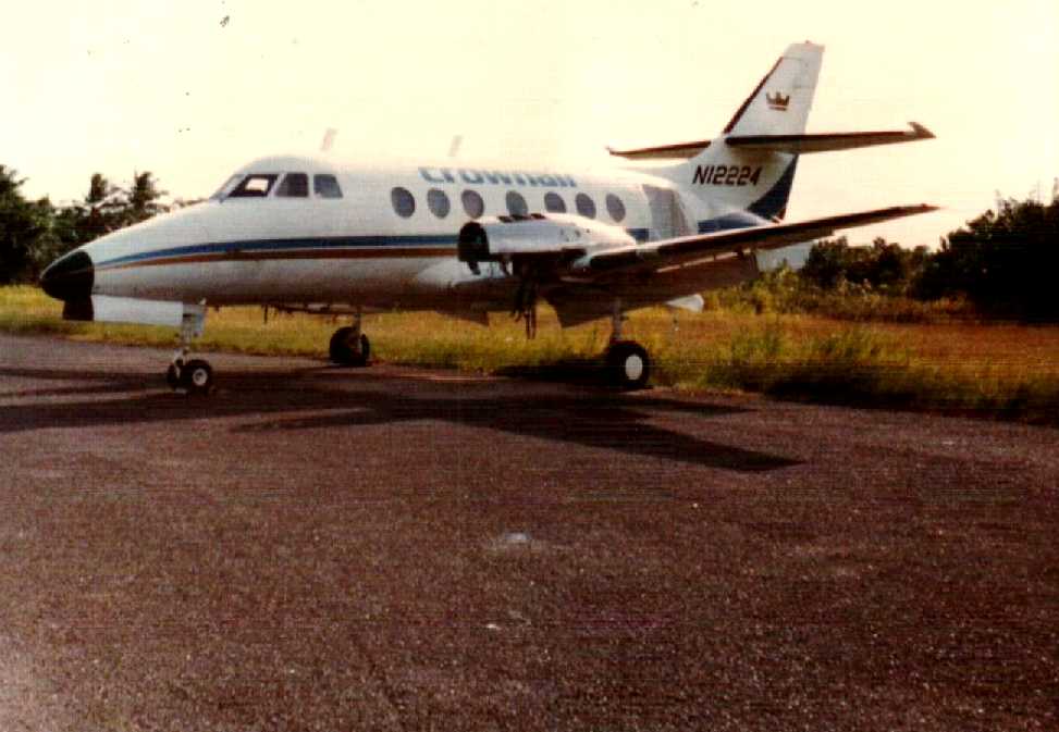
A 1982 photo by Michael Miller of N12224, a Crownair Jetstream (sans engines) at Dorado Beach Airport.
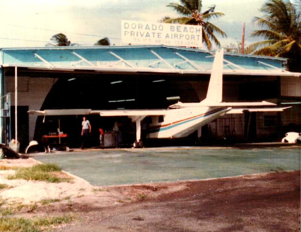
A 1982 photo by Michael Miller of a Britten-Norman Islander inside a Dorado Beach hangar.
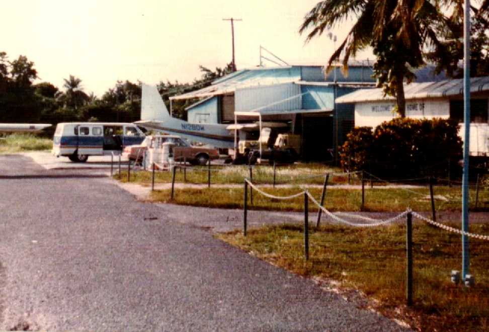
A 1982 photo by Michael Miller of N1280W, a Britten-Norman Islander inside a Dorado Beach hangar.
By the time of the 1982 AOPA Airport Directory (courtesy of Ed Drury)
Dorado Airport was listed as a private airfield, with a 3,420' asphalt Runway 10/28.
Dorado Airport was closed sometime shortly after 1982.
In an unusual twist, Dorado Airport was used to shoot the 1991 HBO movie “Doublecrossed”,
starring Dennis Hopper as drug smuggler pilot Barry Seal.
The hangar was used as a set, and a Beech 18 was crashed for the movie.
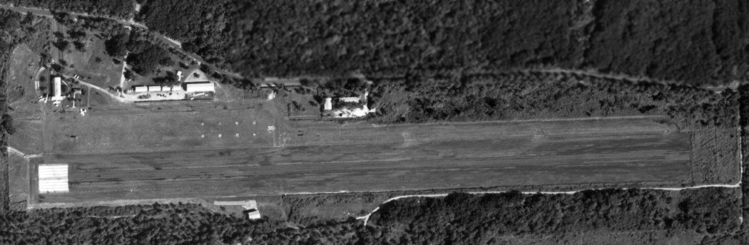
A 11/24/94 USGS aerial view looking southeast showed Dorado Airport to consist of a single 3,500' paved Runway 10/28, a small ramp & a single small hangar.
Closed-runway "X" markings were visible along the runway, but it remained in very good condition,
and 2 light aircraft were still parked on the ramp north of the runway.
Dorado was depicted on the 1998 World Aeronautical Chart as an abandoned airfield.
Unfortunately, according to Ricardo Declet
(whose uncle had worked at Dorado Airport as an Eastern Airlines mechanic),
the portion of the airport visible from the road was redeveloped for housing construction in 2001.
A 2002 aerial photo showed that at some point between 1994-2002,
all of the runway was removed & replaced by housing.
Oddly, a newly-constructed 400' miniature runway segment was constructed over the midpoint of the former runway,
but with a more northwest/southeast orientation, and painted with “10/28” runway numbers.
A 2003 photo by Ricardo Medina looking west along the newly-constructed miniature runway segment located at the site of Dorado Airport,
along with a small recently-constructed Quonset-hut on the right,
which houses a museum which houses memorabilia of airfield founder Clara Livingston.
A 6/7/09 aerial view looking southeast shows the dense housing covering most of the site of Dorado Airport,
with the newly-built commemorative runway segment in the center.
Thanks to Scott Murdock for information about Dorado.
____________________________________________________
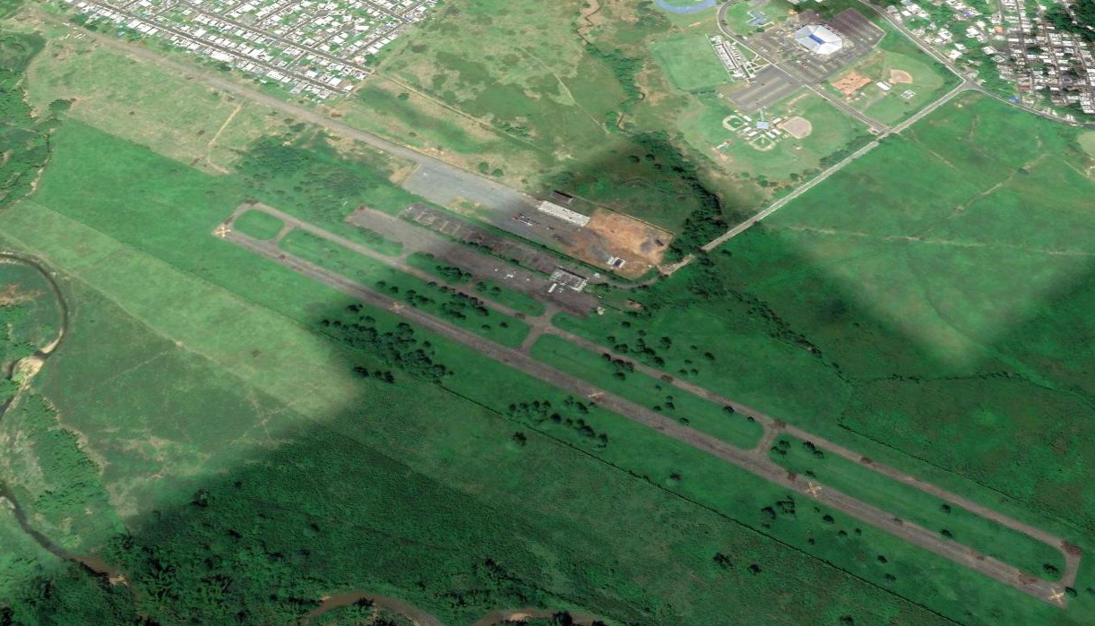
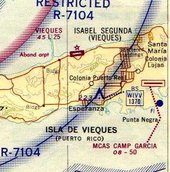
Camp Garcia Vieques Airfield (PR18), Vieques Island, PR
18.116, -65.42 (Southeast of San Juan, PR)
Vieques Airfield, as depicted on the May 1964 USAF Operational Navigation Chart (courtesy of Chris Kennedy).
The Navy purchased 27,000 acres of land on Vieques Island in 1939,
which was used for a target range & for amphibious exercises by the Marines.
The airfield on Vieques was built in 1960 by a Marine engineering company.
The airfield served as the base's primary logistical lifeline:
transports flew in supplies & training units, and flew out departing units.
The earliest depiction which has been located of the Vieques Airfield
was on the May 1964 USAF Operational Navigation Chart (courtesy of Chris Kennedy).
It depicted Vieques as having a single 4,000' runway.
The December 1971 San Juan Local Aeronautical Chart (courtesy of Robert Brown)
depicted MCAS Camp Garcia as having a single 5,000' paved east/west runway.
Norman Massey recalled, "I landed on this strip in 1975 on a Navy C-1 from Roosevelt Roads.
That was the worst scare of my life. Coming for landing it just above tree top, all I could see what looked jungle out the missing cargo door.
I just knew the plane was going down into it & all of us were going to die.
The plane circled out over open water & on around then landed. There 10 or so head of cattle on the runway."
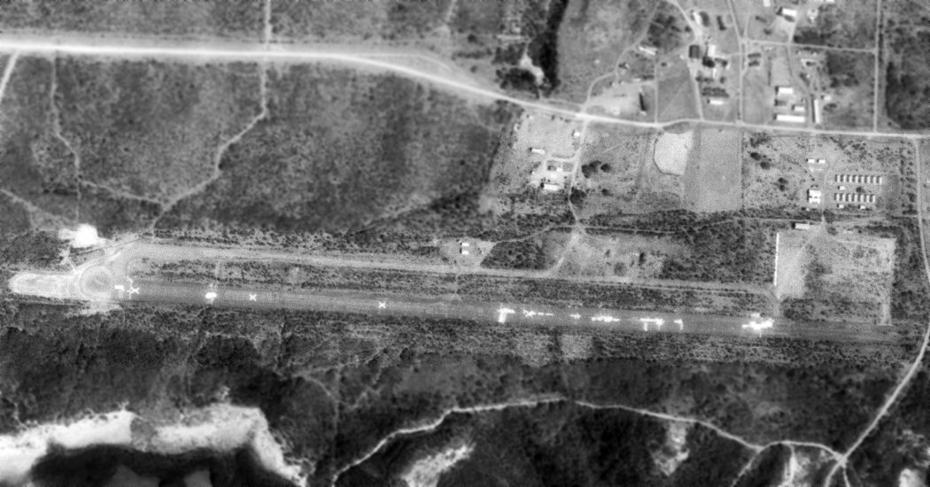
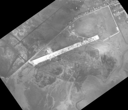
The earliest photo which has been located of the Camp Garcia Airfield was a 3/24/77 USGS aerial view.
The field has a single east/west paved runway, which was marked with several closed-runway “X” symbols & several other unknown markings.
Starting in the 1970s, various groups in Puerto Rico started an escalating series
of protests & incursions against the military use of the Vieques facilities.
As a result, the Marine Corps deactivated Camp Garcia in 1978
(although the Navy has attempted to continue to use Vieques for target practice).
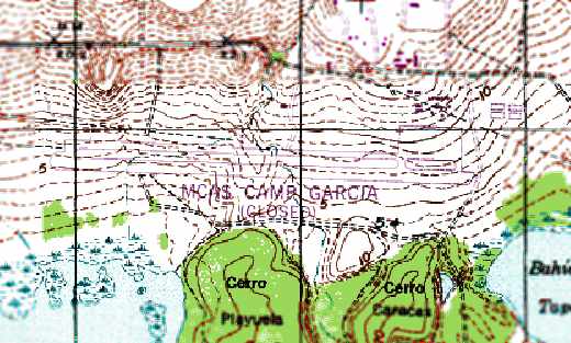
The 1982 USGS topo map depicted “MCAS Camp Garcia (Closed)” as having a single east/west runway,
with a parallel taxiway on the north side & a ramp on the northeast side.
A few small buildings were depicted on the northeast side of the airfield.
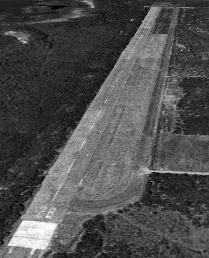
A 11/24/94 USGS aerial view looking west along Camp Garcia's Runway 28.
According to Randy Nickum, NAS Roosevelt Roads “was officially closed in 2004,
and with it, the bombing range & airfield at Camp Garcia.”
As of 2003, the Vieques Airfield was still listed in the FAA Airport/Facility Directory,
although with the remark, "Airport closed permanently".
It was described as having a single paved 5,000 Runway 10/28.
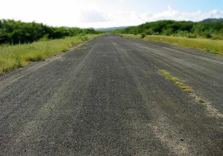
A 2004 photo by Paul Houston looking along the former Camp Garcia runway.
Paul observed, “I vacation each year on the island of Vieques.”
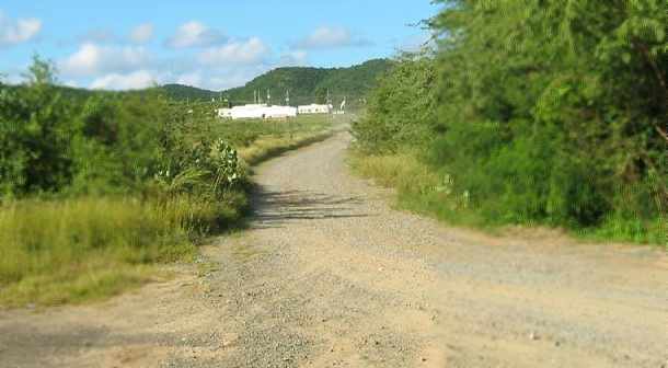
A 2004 photo by Paul Houston of the road leading to the Camp Garcia buildings.
Randy Nickum reported in 2006, “The former bombing range will be allowed to return to a natural state as something of a natural ecological area.
The unintended consequence of the protests against the bombing ranges is that there is now considerable unemployment in Vieques.”
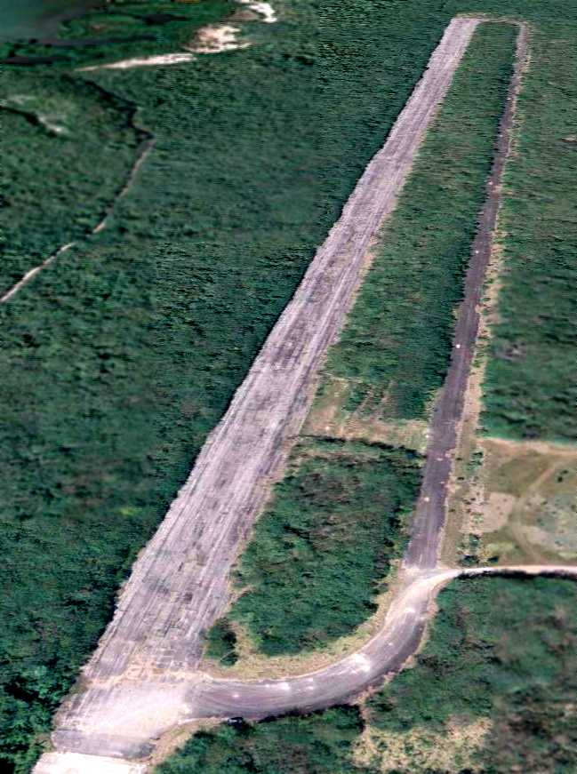
A 9/22/09 aerial view looking west along the abandoned Camp Garcia runway.
____________________________________________________
Since this site was first put on the web in 1999, its popularity has grown tremendously.
If the total quantity of material on this site is to continue to grow,
it will require ever-increasing funding to pay its expenses.
Therefore, I request financial contributions from site visitors,
to help defray the increasing costs of the site
and ensure that it continues to be available & to grow.
What would you pay for a good aviation magazine, or a good aviation book?
Please consider a donation of an equivalent amount, at the least.
This site is not supported by commercial advertising –
it is purely supported by donations.
If you enjoy the site, and would like to make a financial contribution,
you
may use a credit card via
![]() :
:
Please consider checking the box to make a monthly donatation.
For a mailing address to send a check, please contact me at: paulandterryfreeman@gmail.com
If you enjoy this web site, please support it with a financial contribution.
please contact me at: paulandterryfreeman@gmail.com
If you enjoy this web site, please support it with a financial contribution.
____________________________________________________
This site covers airfields in all 50 states.