Abandoned & Little-Known Airfields:
Central Nevada
© 2002, © 2024 by Paul Freeman. Revised 7/6/24.
This site covers airfields in all 50 states: Click here for the site's main menu.
____________________________________________________
Please consider a financial contribution to support the continued growth & operation of this site.
Tonopah Airfield / Cavanaugh Airfield / Lambertucci Airfield (revised 3/8/24)
Tonopah Aux #1 AAF (revised 7/6/24) - Tonopah Aux #2 AAF (revised 3/8/24) - Tonopah Aux #3 AAF (revised 8/20/17)
Tonopah Aux #4 AAF (revised 3/8/24) - Tonopah Aux AAF #5 / Mellan Airstrip (revised 11/18/20)
____________________________________________________
Tonopah Aux AAF #1, Mellan, NV
37.82, -116.06 (Southeast of Tonopah Test Range, NV)
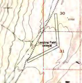
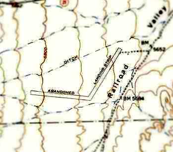
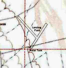
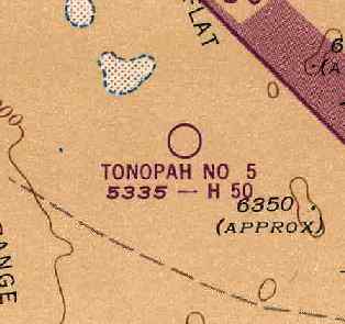
The 1952 USGS topo map (courtesy of Chris Kennedy) depicted the 2 runways of Tonopah Aux #1, labeled as “Landing Field (Abandoned)”.
Tonopah #1 Auxiliary Army Airfield was one of 5 satellite airfields
which supported flight training operations at Tonopah Army Airfield.
The date of construction of Tonopah Aux #1 has not been determined.
Tonopah AAF Auxiliary #1 was not depicted on Mt Whitney Sectional Charts from 1943/44/45/46.
The earliest reference which has been located to Tonopah Aux #1
was its listing in the 1945 AAF Airfield Directory (courtesy of Scott Murdock).
It described Tonopah AAF Auxiliary #1 as a 640 acre L-shaped property
having 2 bare 5,000' runways, oriented northeast/southwest & northwest/southeast.
The field was not said to have any hangars, to be owned by the U.S. Government, and operated by the Army Air Forces.
Tonopah Aux #1 was evidently abandoned after WW2 & never reused.
The earliest depiction which has been located of Tonopah Aux #1 was on the 1952 USGS topo map (courtesy of Chris Kennedy).
It depicted the field as having 2 runways, labeled simply as “Landing Field (Abandoned)”.
The earliest photo which has been located of Tonopah Aux #1 Army Airfield was an 11/9/52 USGS aerial view.
It showed the field to have 2 runways, with no other improvements.
The 1984 USGS topo map continued to depict the Tonopah Aux #1 airfield in the same fashion as the 1952 map.
Nothing at all was depicted at the location of the Tonopah Aux #1 airfield on the 1988 USGS topo map.
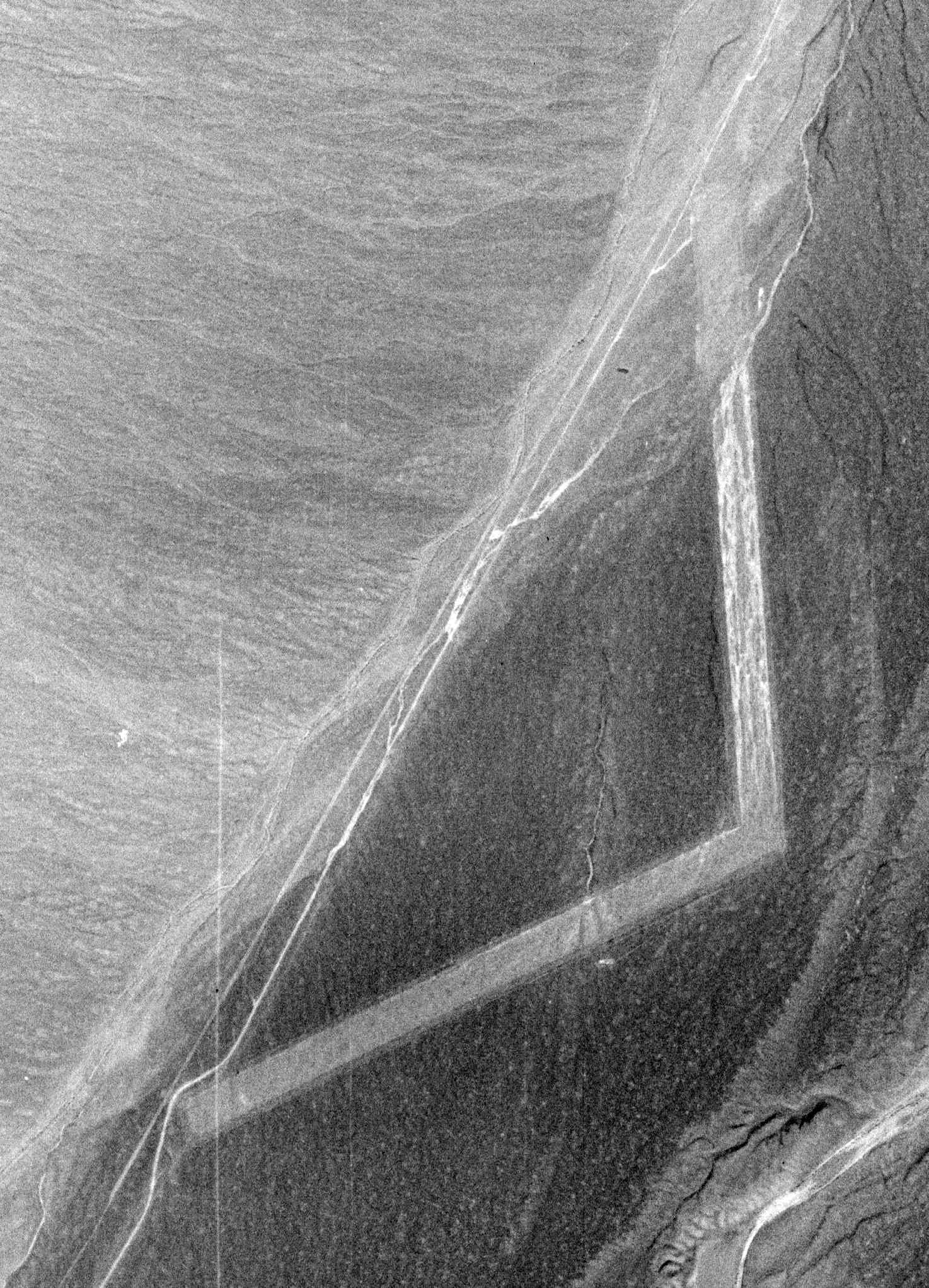
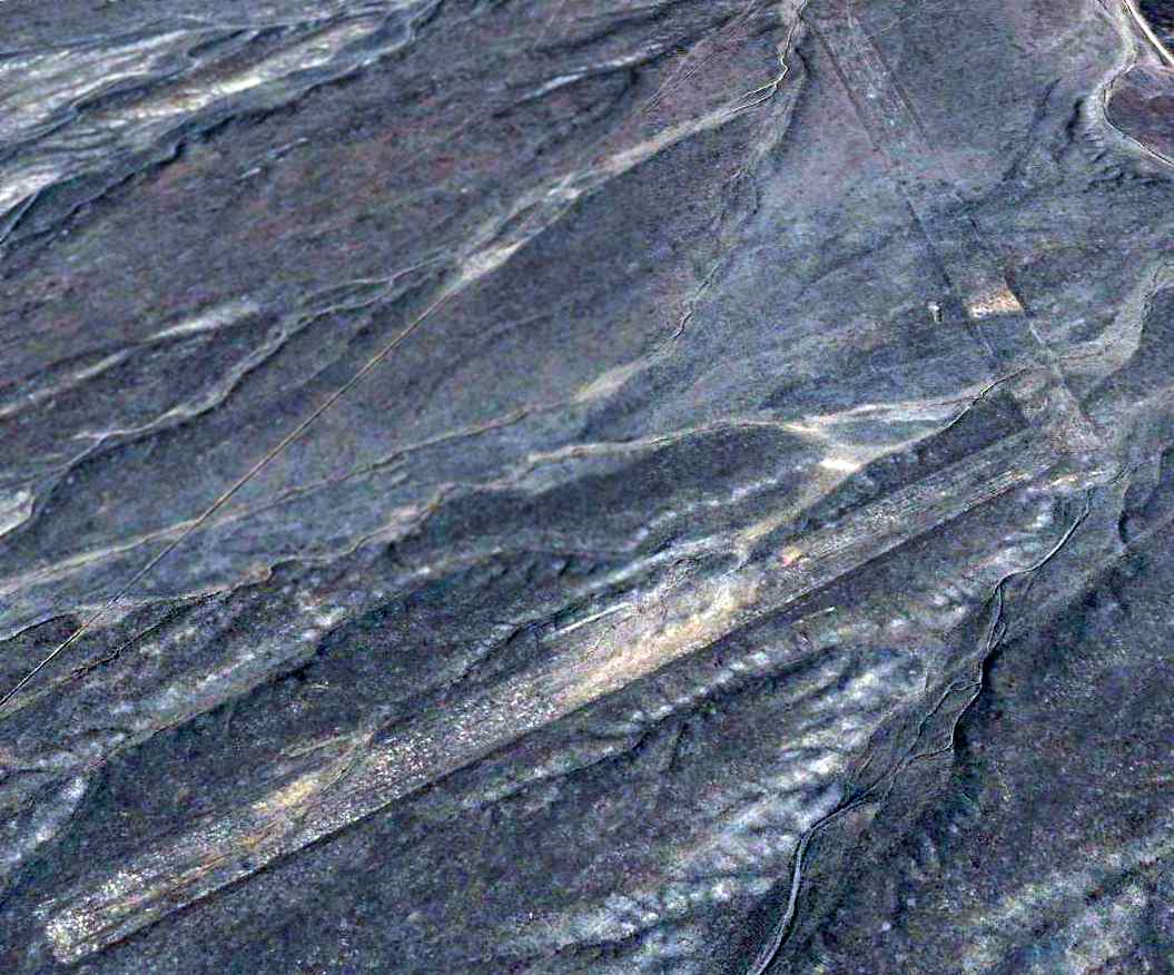
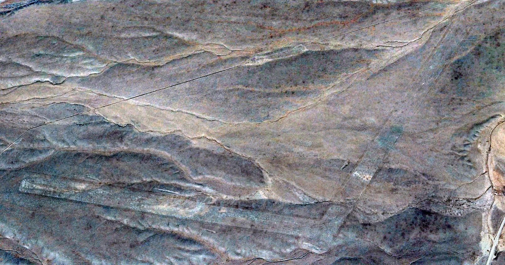
A 9/3/99 USGS aerial view looking northeast depicted Tonopah Aux #1 AAF as having 2 runways.
There was no sign of remains of buildings or any other improvements, nor any sign of recent usage.
A 2023 aerial view looking northwest at Tonopah Aux #1 showed the remains of the airfield to remain unchanged.
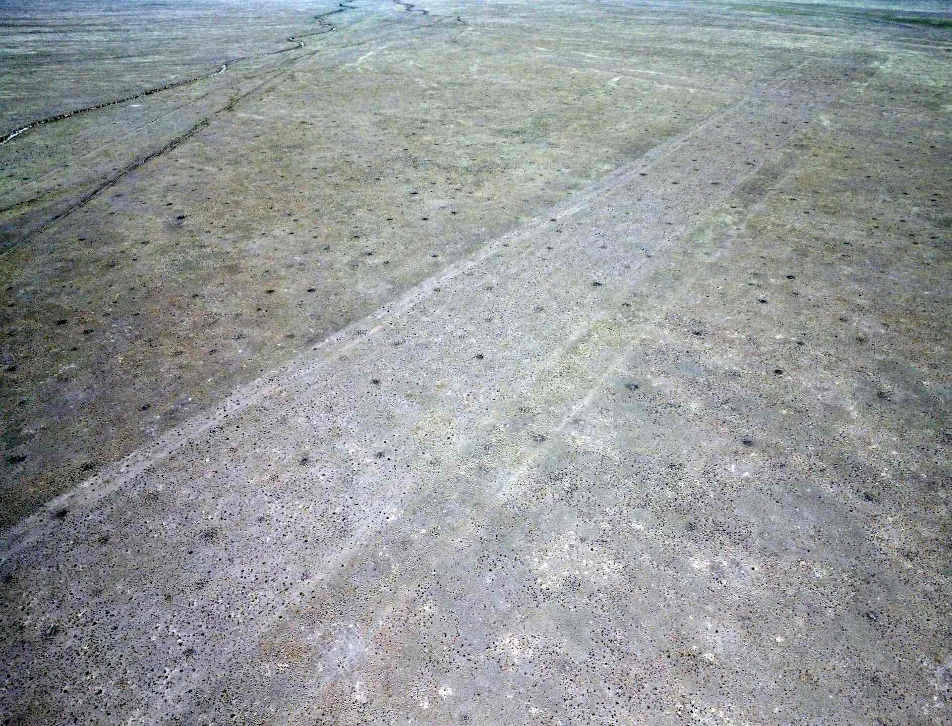
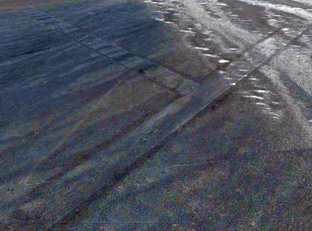
A 5/22/24 drone aerial view by Rob Roberts looking west at the southern runway at Tonopah Aux AAF #1.
Rob reported, “I was able to (legally) fly my drone. Since the airstrip is not easily recognized from the ground & the only aerial photos I've ever seen are from satellites & airplanes, I think these drone photos at 400' give a unique perspective.”
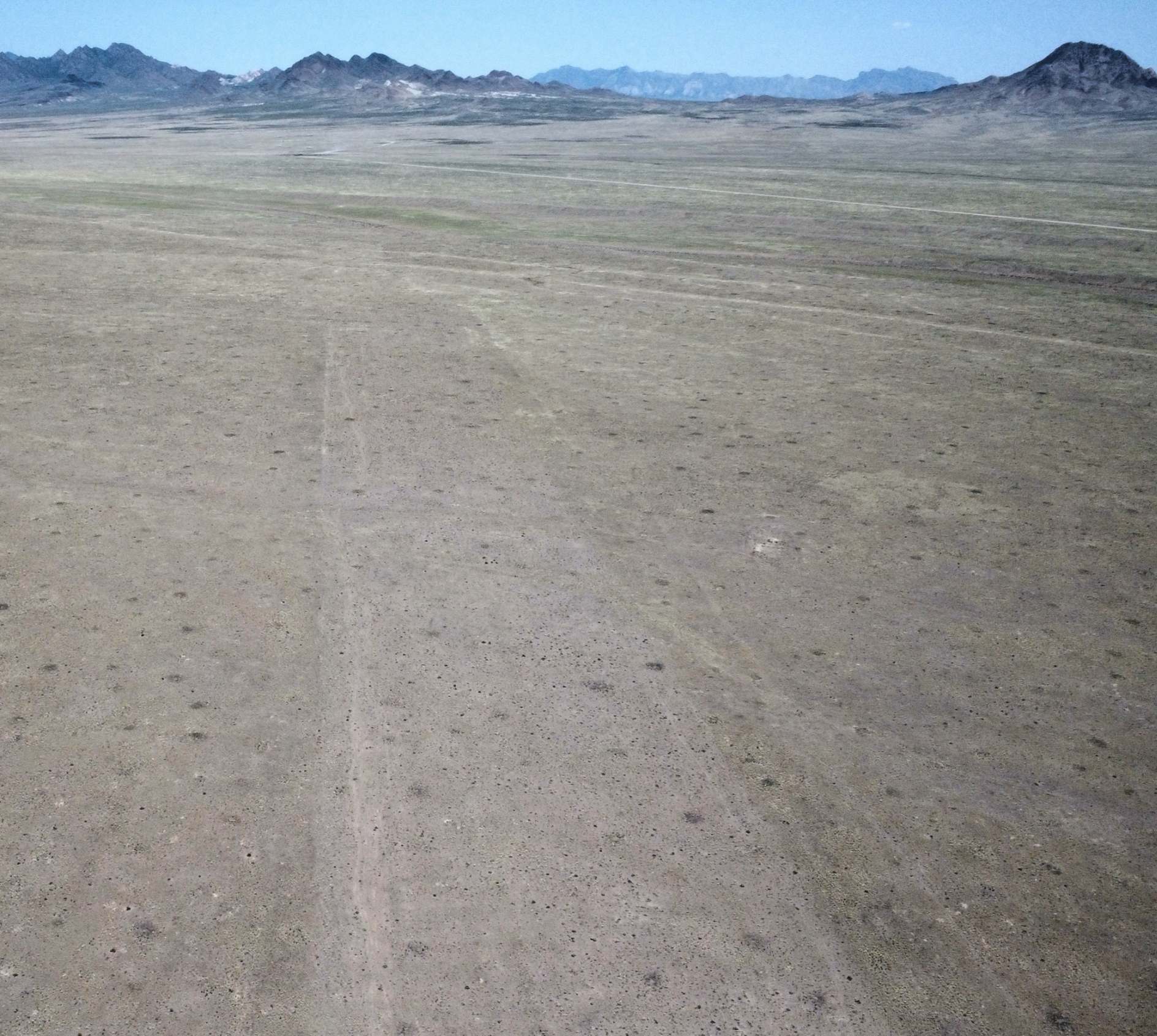
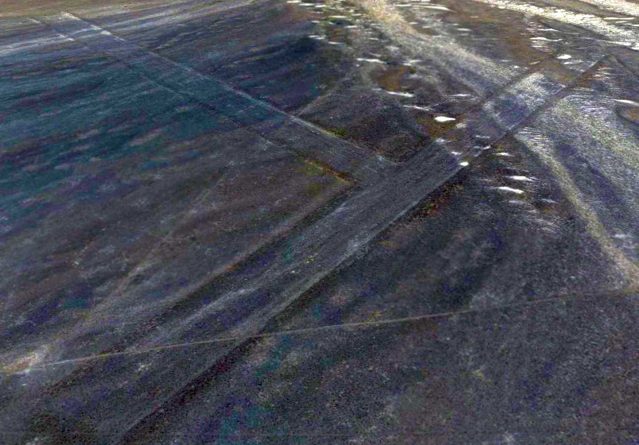
A 5/22/24 drone aerial view by Rob Roberts looking southwest at the southern runway at Tonopah Aux AAF #1.
____________________________________________________
Tonopah Aux AAF #2, Mellan, NV
37.72, -116.16 (Southeast of Tonopah Test Range, NV)
The 1952 USGS topo map (courtesy of Chris Kennedy) depicted the 2 runways of Tonopah Aux #2 as an “Abandoned Landing Strip”.
Photo of the airfield while in use has not been located.
Tonopah #3 Auxiliary Army Airfield was one of 5 satellite airfields
which supported flight training operations at Tonopah Army Airfield.
The date of construction of Tonopah Aux #2 has not been determined.
Tonopah AAF Auxiliary #2 was not depicted on Mt Whitney Sectional Charts from 1943/44/45/46.
The earliest reference which has been located to Tonopah Aux #2
The earliest reference which has been located to Tonopah Aux #2
was its listing in the 1945 AAF Airfield Directory (courtesy of Scott Murdock).
It described Tonopah AAF Auxiliary #2 as a 640 acre L-shaped property
having 2 bare 5,000' runways, oriented north/south & east/west.
The field was not said to have any hangars, to be owned by the U.S. Government, and operated by the Army Air Forces.
Tonopah Aux #2 was evidently abandoned after WW2 & never reused.
The earliest depiction which has been located of Tonopah Aux #2 was on the 1952 USGS topo map (courtesy of Chris Kennedy).
It depicted the field as having 2 runways, labeled “Abandoned Landing Strip”.
The 1977 USGS topo map continued to depict the airfield in the same fashion as the 1952 map.
Nothing at all was depicted at this location on the 1988 USGS topo map.
The earliest photo which has been located of Tonopah Aux #2 was a 3/3/03 aerial view looking northeast.
It depicted Tonopah Aux #2 AAF as having 2 runways.
There was no sign of remains of buildings or any other improvements, nor any sign of recent usage.
A 2023 aerial view looking north at Tonopah Aux #2 showed the remains of the airfield to remain unchanged.
____________________________________________________
Tonopah Aux AAF #3, Mellan, NV
37.63, -116.66 (Southeast of Tonopah Test Range, NV)
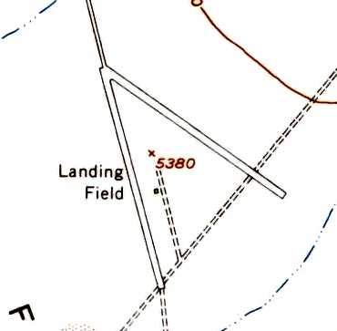
The 1952 USGS topo map (courtesy of Chris Kennedy) depicted the 2 runways of Tonopah Aux #3, labeled simply as “Landing Field”.
Photo of the airfield while in use has not been located.
Tonopah #3 Auxiliary Army Airfield was one of 5 satellite airfields
which supported flight training operations at Tonopah Army Airfield.
The date of construction of Tonopah Aux #3 has not been determined.
No airfield was yet depicted at this location on the 1942 USGS topo map.
Tonopah AAF Auxiliary #3 was not depicted on Mt Whitney Sectional Charts from 1943/44/45/46.
The earliest reference which has been located to Tonopah Aux #3
The earliest reference which has been located to Tonopah Aux #3
was its listing in the 1945 AAF Airfield Directory (courtesy of Scott Murdock).
It described Tonopah AAF Auxiliary #3 as a 640 acre T-shaped property
having 2 bare 5,000' runways, oriented east/west & northwest/southeast.
The field was not said to have any hangars, to be owned by the U.S. Government, and operated by the Army Air Forces.
Tonopah Aux #3 was evidently abandoned after WW2 & never reused.
The earliest depiction which has been located of Tonopah Aux #3 was on the 1952 USGS topo map (courtesy of Chris Kennedy).
It depicted the field as having 2 runways, labeled simply as “Landing Field”.
The 1983 USGS topo map continued to depict the airfield in the same fashion as the 1952 map.
Nothing at all was depicted at this location on the 1988 USGS topo map.
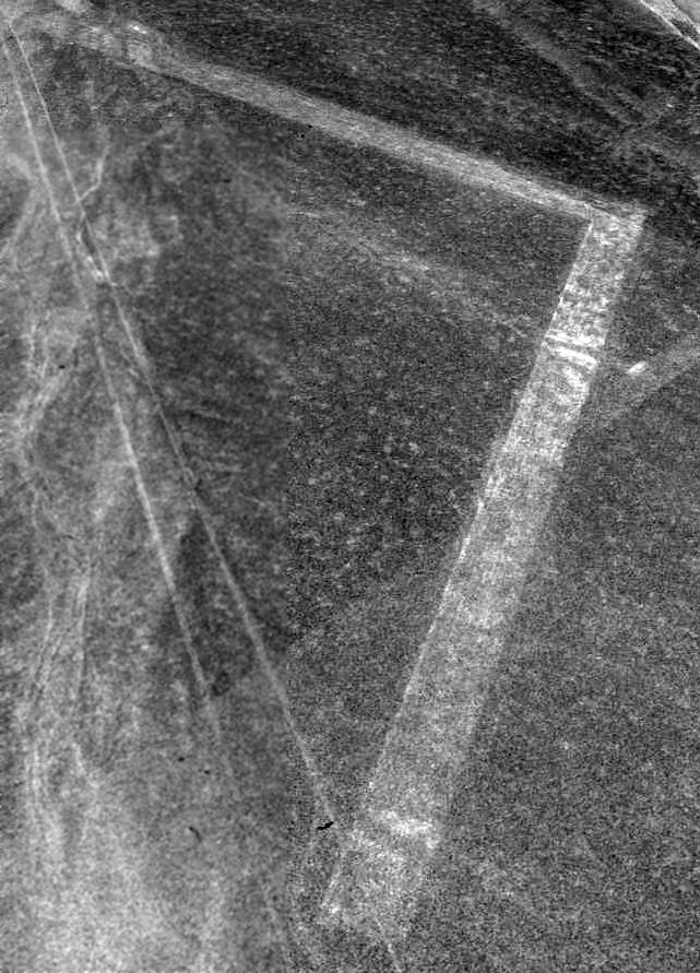
The earliest photo which has been located of Tonopah Aux #3 was a 2006 aerial view looking north.
It depicted Tonopah Aux #3 AAF as having 2 runways.
There was no sign of remains of buildings or any other improvements, nor any sign of recent usage.
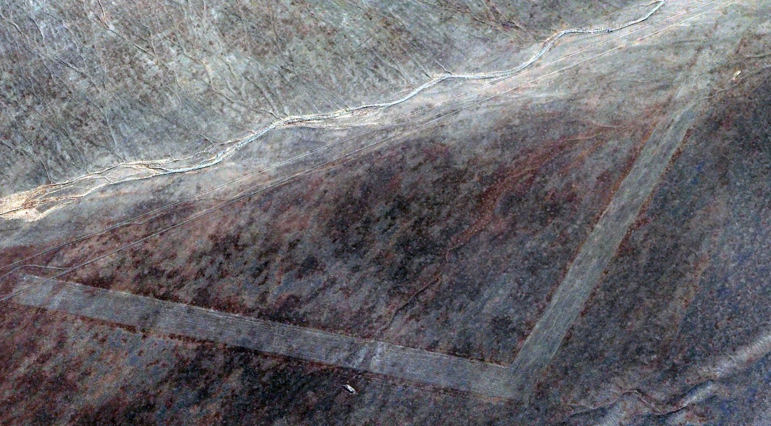
A 2016 aerial view looking north at the site of Tonopah Aux #3 depicted the 2 runways as remaining recognizable.
____________________________________________________
Tonopah Aux AAF #4, Mellan, NV
37.76, -116.65 (Southeast of Tonopah Test Range, NV)
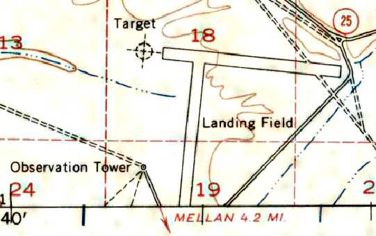
Tonopah Aux AAF #4 was labeled simply as "Landing Field" on the 1952 USGS topo map.
Tonopah #4 Auxiliary Army Airfield was one of 5 satellite airfields
which supported flight training operations at Tonopah Army Airfield.
Tonopah AAF Auxiliary #4 was not depicted on the 1942 USGS topo map,
or Mt Whitney Sectional Charts from 1943/44/45/46/59/70/72.
The earliest reference which has been located to Tonopah Aux #4
was its listing in the 1945 AAF Airfield Directory (courtesy of Scott Murdock).
It described Tonopah AAF Auxiliary #4 as a T-shaped property
having 2 bare 5,000' runways, oriented northeast/southwest & northwest/southeast.
The field was not said to have any hangars, to be owned by the U.S. Government, and operated by the Army Air Forces.
Tonopah Aux #4 was evidently abandoned after WW2 & never reused.
The earliest depiction of this field which has been located was on the 1952 USGS topo map.
It depicted the airfield as consisting of two paved runways, labeled "Landing Field".
A circular bombing target was depicted immediately off the west end of the east/west runway,
along with an observation tower along the west side of the north/south runway.
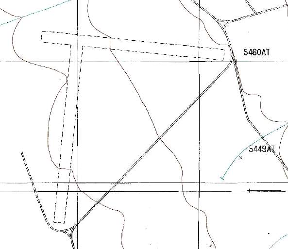
The 1987 USGS topo map depicted two 5,200' runways, but did not label the facility at all.

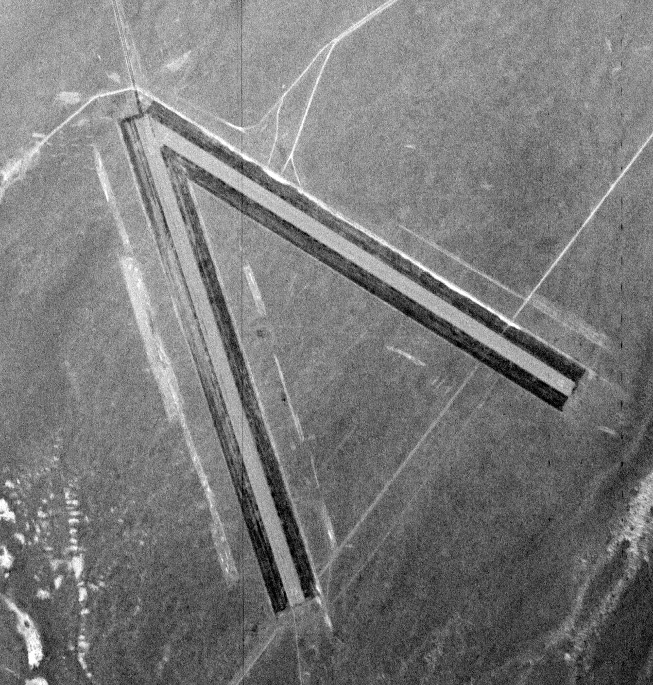
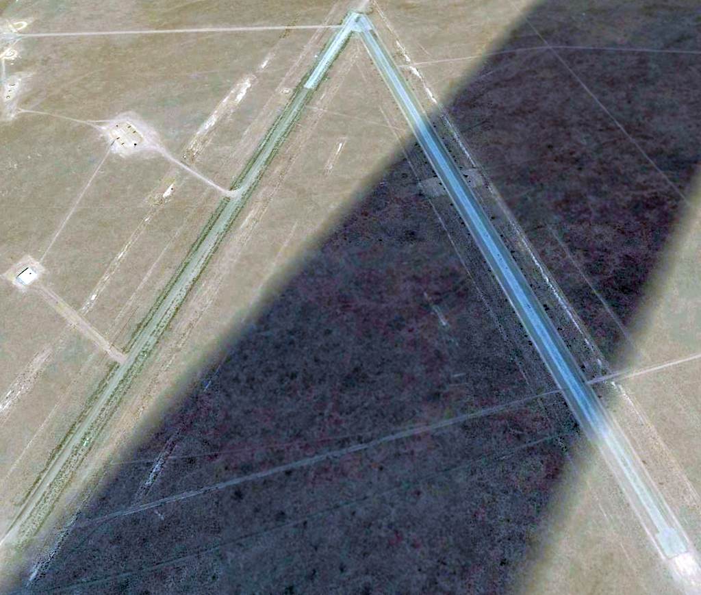
The earliest photo which has been located of Tonopah Aux #4 was a 5/30/07 aerial view looking northwest.
It depicted the field as having 2 unpaved runways, but without any sign of recent use or improvements.
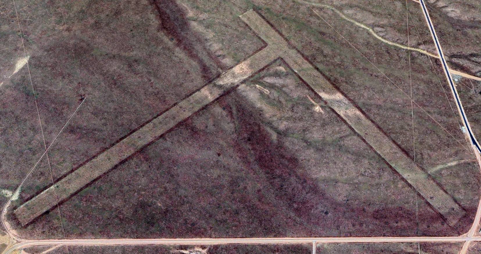
The latest photo which has been located of Tonopah Aux #4 was a 2023 aerial view looking northwest, which showed both runways remained distinct.
Tonopah Aux #4 is located within the Restricted Areas of the Nellis AFB Range, only a few miles southeast of the Tonopah Test Range Airfield,
and just north of Tonopah Aux #5 / Mellan Airfield.
____________________________________________________
Tonopah Aux AAF #5 / Mellan Airstrip, Mellan, NV
37.68, -116.63 (Southeast of Tonopah Test Range, NV)
Tonopah “#5" Auxiliary Army Airfield, as depicted on the February 1944 Mt. Whitney Sectional Chart.
This auxiliary airfield which supported operations at Tonopah Army Airfield was evidently built at some point between 1943-44,
as it was not yet depicted on the 1942 USGS topo map nor on the August 1943 Mt. Whitney Sectional Chart (according to Chris Kennedy).
The earliest depiction which has been located of this airfield was on the February 1944 Mt. Whitney Sectional Chart.
It depicted Tonopah “#5" as an auxiliary airfield.
The April 1944 US Army/Navy Directory of Airfields (courtesy of Ken Mercer)
described the "Tonopah Bombing & Gunnery Range Auxiliary AAF #5" as having a 5,000' hard-surfaced runway.
The 1945 AAF Airfield Directory (courtesy of Scott Murdock) described Tonopah AAF Auxiliary #5 as a 640 acre V-shaped property having 2 asphalt 5,000' runways,
oriented east/west & northeast/southwest (Aux #5 was evidently the only one of the 5 Tonopah Auxiliaries to have paved runways).
The field was not said to have any hangars, to be owned by the U.S. Government, and operated by the Army Air Forces.
The February 1949 Mt. Whitney Sectional Chart (courtesy of Chris Kennedy) labeled the airfield simply as "Tonopah #5",
and depicted it as having a 5,000' hard-surface runway.
It was labeled simply as "Landing Field" on the 1952 USGS topo map,
which depicted the airfield as having 2 paved runways & a small building in between the two strips.
The earliest photo which has been located of Tonopah Aux #5 Army Airfield was an 11/9/52 USGS aerial view.
It showed the field to have 2 paved runways, with a small structure (or foundation) in between the 2 strips.

It was depicted as the "Las Vegas Bombing & Gunnery Range" airfield
on the May 1957 Mt. Whitney Sectional Chart (courtesy of Chris Kennedy).
This airfield was apparently abandoned (at least officially) within the next 2 years,
as it was no longer depicted at all on the March 1959 Mt. Whitney Sectional Chart (according to Chris Kennedy).
However, this airfield apparently got a new lease on life in the 1980s,
when the Nevada restricted areas began to be used for tests of classified aircraft.
It thus became the only one of the 5 WW2-era Tonopah auxiliary airfields to see any reuse.
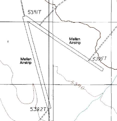
It was labeled as "Mellan Airstrip" on the 1987 USGS topo map,
which depicted the airfield as consisting of 2 paved 5,300' runways.
It was not depicted at all on the 1990 NV Airports & Landing Strips Map (courtesy of Jim Mallery).
According to a Department of Energy Environmental Impact Statement,
"Mellan airstrip is located on the southern portion of the Tonopah Test Range.
This airstrip supports DOE & USAF training programs & is used sporadically.
There are no support facilities associated with this airstrip."
According to a USAF environmental assessment, Mellan Airfield is currently used by the Air Force to conduct combat landing training for airlift forces.
The type of aircraft used are described as including "C/MC/AC-130, C-17, C-160, C-235, & C-222".
In spite of its active use by the USAF, the Mellan Airstrip was not depicted at all (even as an abandoned airfield) on 2002 aeronautical charts,
and was not listed in the 2002 published FAA data as an airfield of any kind.
As of 2002, the Air Force was attempting to replace Mellan Airfield with a proposed airfield,
Cedar Pass (to be built 60 miles east of Tonopah),
due to its desire to conduct airlift training on a dirt runway, instead of the paved runways at Mellan.
A 5/30/07 aerial view looking northwest showed the Tonopah Aux #5 / Mellan airfield to have 2 paved runways, with the eastern runway appearing to have been paved at a more recent date than the western strip.
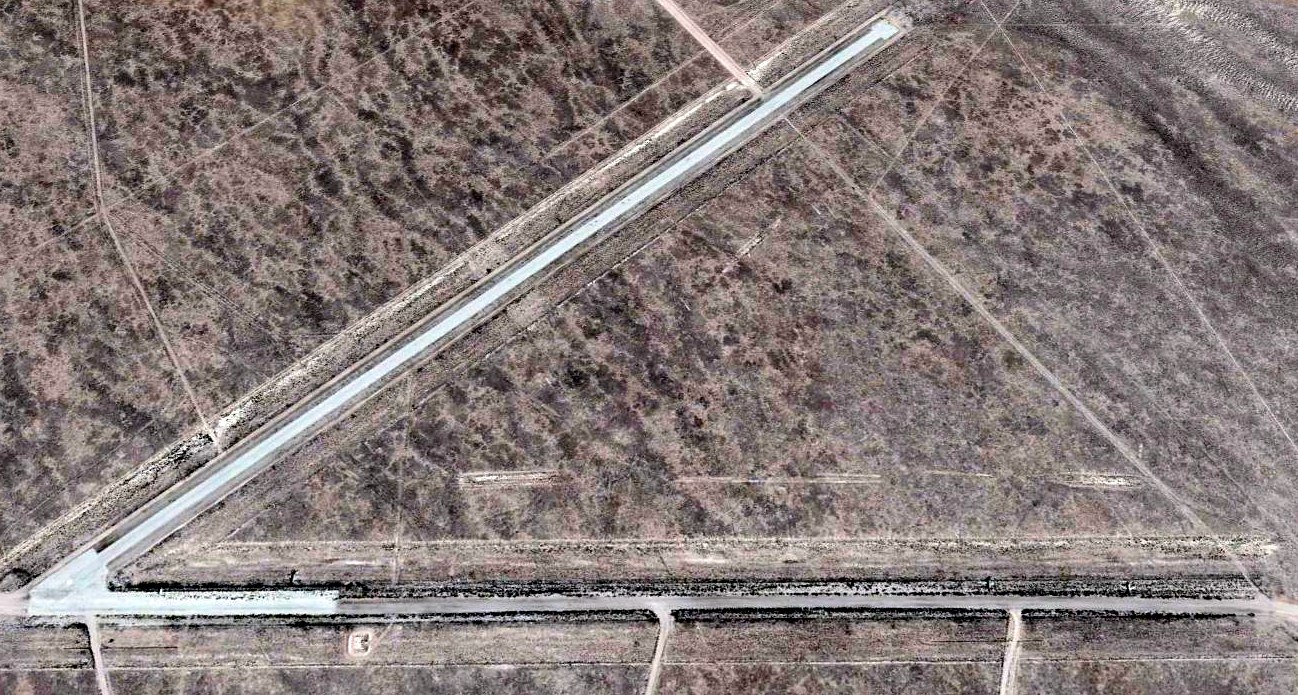
A 2017 aerial view looking northeast at the Tonopah Aux #5 Airfield showed the 2 paved runways to remain intact.
The Mellan airstrip is located within the Restricted Areas of the Nellis AFB Range,
only a few miles southeast of the Tonopah Test Range Airfield, and one mile east of Antelope Dry Lake.
____________________________________________________
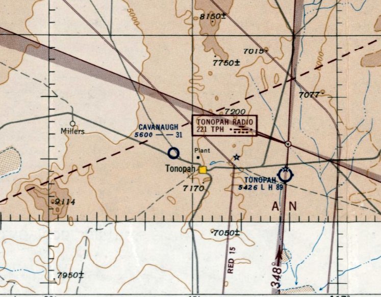
Tonopah Airfield / Cavanaugh Airport / Lambertucci Airfield, Tonopah, NV
38.09, -117.28 (Southeast of Tonopah Test Range, NV)

Tonopah Airfield (to the northwest of the town of Tonopah), as depicted on the August 1945 Mt. Whitney World Aeronautical Chart (courtesy of Chris Kennedy).
Photo of the airfield while in use has not been located.
This auxiliary airfield was located northwest of the town of Tonopah.
The Tonopah Airport to the northwest of the town was evidently established at some point between 1944-45,
as it was not yet depicted at all on the October 1944 Mt. Whitney Sectional Chart (according to Chris Kennedy).
The earliest depiction of this airfield which has been located
was on the August 1945 Mt. Whitney World Aeronautical Chart (courtesy of Chris Kennedy).
It depicted “Tonopah” as an auxiliary airfield to the northwest of the town of Tonopah.
The February 1949 Mt. Whitney Sectional Chart (courtesy of Chris Kennedy)
continued to depict “Tonopah” as an auxiliary airfield to the northwest of the town of Tonopah.
At some point between 1949-52, this airfield was evidently renamed “Cavanaugh” Airport,
as that is how it was labeled on the September 1952 Reno Sectional Chart (courtesy of Chris Kennedy).
This was after the much larger Tonopah AAF (to the east of the town)
had been relinquished by the military & reused as the new Tonppah Airport.
Cavanaugh Airport was depicted as having a 3,100' unpaved runway.
The last depiction which has been located of Cavanaugh Airport was on the March 1953 Reno Sectional Chart.
It depicted Cavanaugh as a public-use airport having a 3,100' unpaved runway.
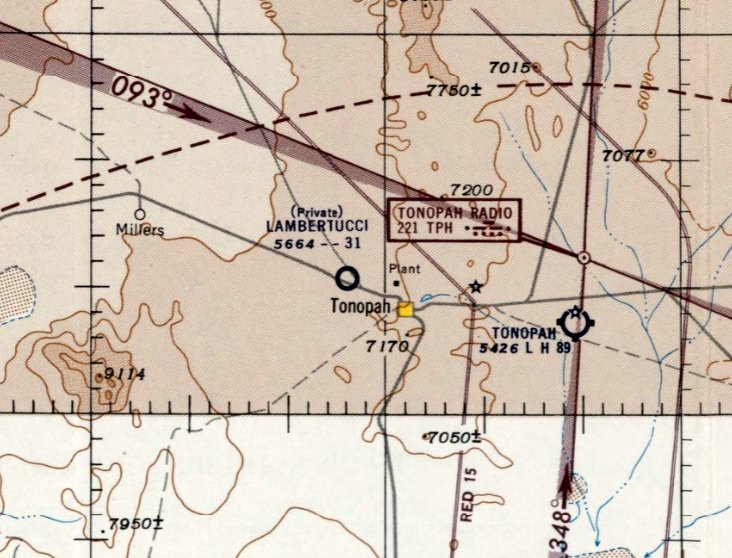
The status of the field was changed to a private field & it was renamed “Lambertucci” Airfield at some point between 1953-54,
as that is how it was labeled on the October 1954 Reno Sectional Chart (courtesy of Chris Kennedy).
Lambertucci was depicted as having a 3,100' unpaved runway.
The last depiction which has been located of Lambertucci Airfield was on the October 1955 Reno Sectional Chart.
It depicted Lambertucci as a private airfield having a 3,100' unpaved runway.
The Lambertucci Airfield was evidently closed (for reasons unknown) at some point between 1955-56,
as it was no longer depicted on the October 1956 Reno Sectional Chart.
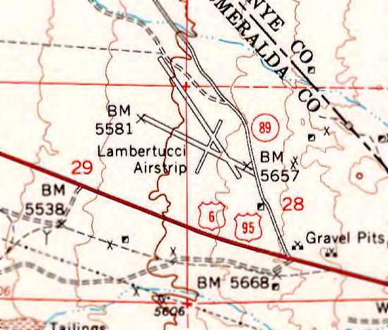
The “Lambertucci Airstrip” was still depicted on the 1961 USGS topo map, with 3 runways.
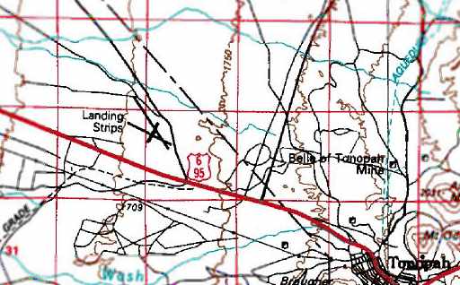
The 1987 USGS topo map depicted 3 runways at the site of the former airport, labeled simply as “Landing Strips”.

The former Tonopah/Cavanaugh/ Lambertucci airfield was still remarkably intact as seen in a 1994 USGS aerial view looking northwest,
with 3 unpaved runways still well-preserved by the desert environment.
A cluster of what could be a few small buildings (or remains) was on the east side of the field.
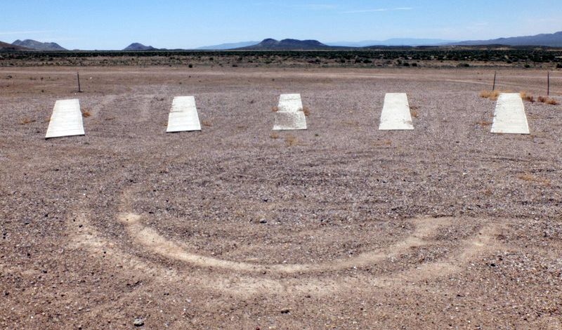
A 4/22/16 photo by Mike Legeros looking south at a skeet shooting range on the northeast end of the site of Tonopah/Cavanaugh/ Lambertucci Airport.
According to Keith Wood, “The 5 concrete objects are a skeet shooting range.
Clay pigeons were launched from the low building that they are pointing at. Shooters stood at various stations on the concrete pads to take their shots.
Note the black remains of countless clay pigeons past the launcher.”
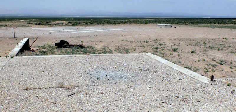
A 4/22/16 photo by Mike Legeros looking northwest at a foundation at the site of Tonopah/Cavanaugh/ Lambertucci Airport.
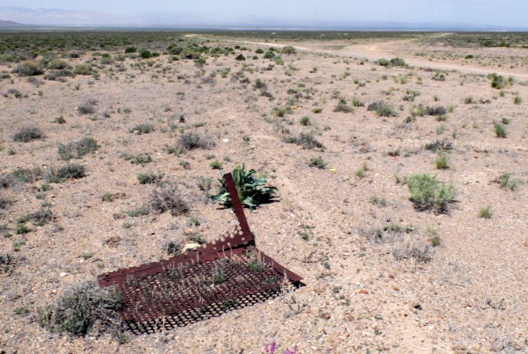
A 4/22/16 photo by Mike Legeros of an unidentified metal object at the site of Tonopah/Cavanaugh/ Lambertucci Airport.
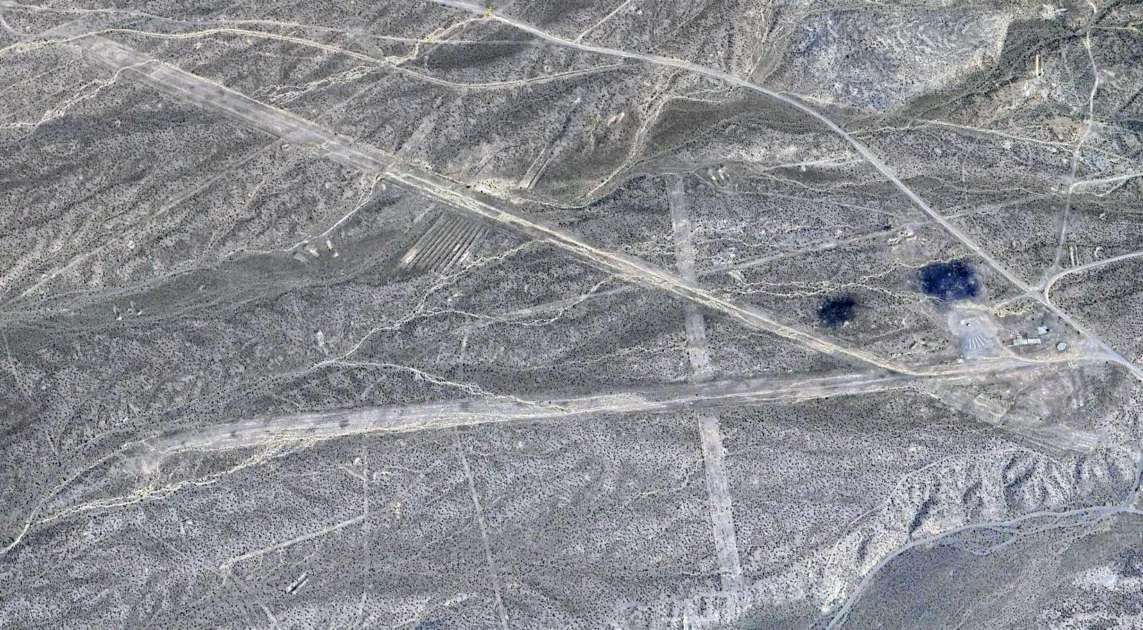
A 2022 aerial view looking northeast at the former Tonopah/Cavanaugh/ Lambertucci Airport shows the field to remain in the same condition.
The site of the original Tonpah Airport is located northwest of the intersection of Route 95 & Route 89.
____________________________________________________
Since this site was first put on the web in 1999, its popularity has grown tremendously.
If the total quantity of material on this site is to continue to grow,
it will require ever-increasing funding to pay its expenses.
Therefore, I request financial contributions from site visitors,
to help defray the increasing costs of the site
and ensure that it continues to be available & to grow.
What would you pay for a good aviation magazine, or a good aviation book?
Please consider a donation of an equivalent amount, at the least.
This site is not supported by commercial advertising –
it is purely supported by donations.
If you enjoy the site, and would like to make a financial contribution,
you
may use a credit card via
![]() :
:
Please consider checking the box to make a monthly donatation.
For a mailing address to send a check, please contact me at: paulandterryfreeman@gmail.com
If you enjoy this web site, please support it with a financial contribution.
please contact me at: paulandterryfreeman@gmail.com
If you enjoy this web site, please support it with a financial contribution.
____________________________________________________
This site covers airfields in all 50 states.