
Abandoned & Little-Known Airfields:
Colorado: Northwestern Denver area
© 2002, © 2018 by Paul Freeman. Revised 5/11/18.
This site covers airfields in all 50 states: Click here for the site's main menu.
For a 7th year, the CO pages of this website are sponsored by the Colorado Pilots Association:
____________________________________________________
Please consider a financial contribution to support the continued growth & operation of this site.
____________________________________________________
Ruston Field / Federal Heights Airport, Federal Heights, CO
39.88, -105.02 (Northwest of Denver, CO)
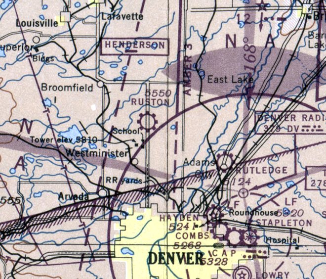
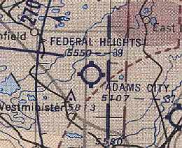
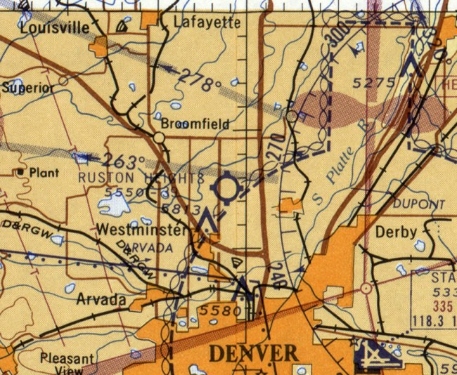
Ruston Field, as depicted on the March 1946 Denver Sectional Chart.
The Federal Heights Airport, also known as Ruston Airport was formed in 1944 by Harry Ruston.
Harry Ruston's idea for the airport was that some of the World War II pilots would like to keep flying.
Ruston Airport was one of the first private airports in Colorado.
It was located southeast of the intersection of 100th Avenue & Federal Boulevard.
The airport property consisted of 320 acres.
It had a single hangar (100' x 97') used for major engine repairs.
A second building (70' x 31') contained 2 classrooms,
one with aircraft simulators, and one which became a cafe, the "Pilots Perch."
However, no airfield at this location was yet depicted on the February 1945 Denver Sectional Chart (courtesy of Richard Doehring).
The earliest depiction which has been located of Ruston Field was on the March 1946 Denver Sectional Chart.
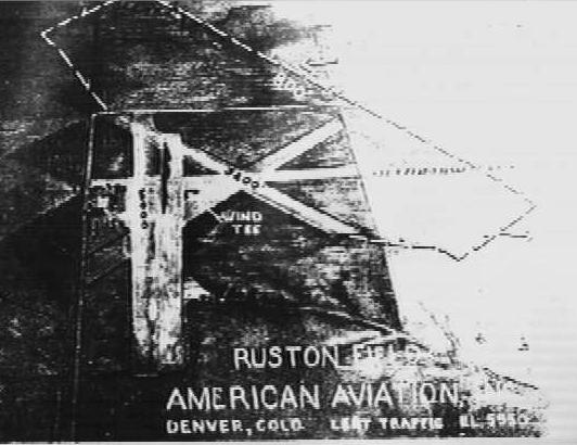
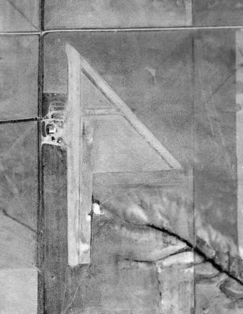
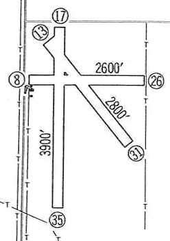
An undated view (courtesy of Patrick Griffith) of the layout of Ruston's 4 unpaved runways
(N/S: 3,900', N/W: 2,600', and N/W & S/E: 2,800'),
as well as the 8,000' grass landing area (the diagonal outline).
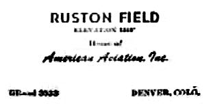
An undated business card of Ruston Field's operator, American Aviation, Inc. (courtesy of Patrick Griffith).
Bill Lemaster recalled that he flew into Ruston Field several times in the late 1940s.
The airport served as a training center for Regis College & Denver University.
Ruston Field was depicted on the February 1949 Denver Sectional Chart (courtesy of Chris Kennedy)
as having a 3,500' unpaved runway.
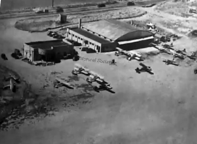
An undated aerial view looking northwest at the hangar, terminal building,
and several planes on the ramp of Ruston Field (courtesy of Jim LaRue via Cheryl York).
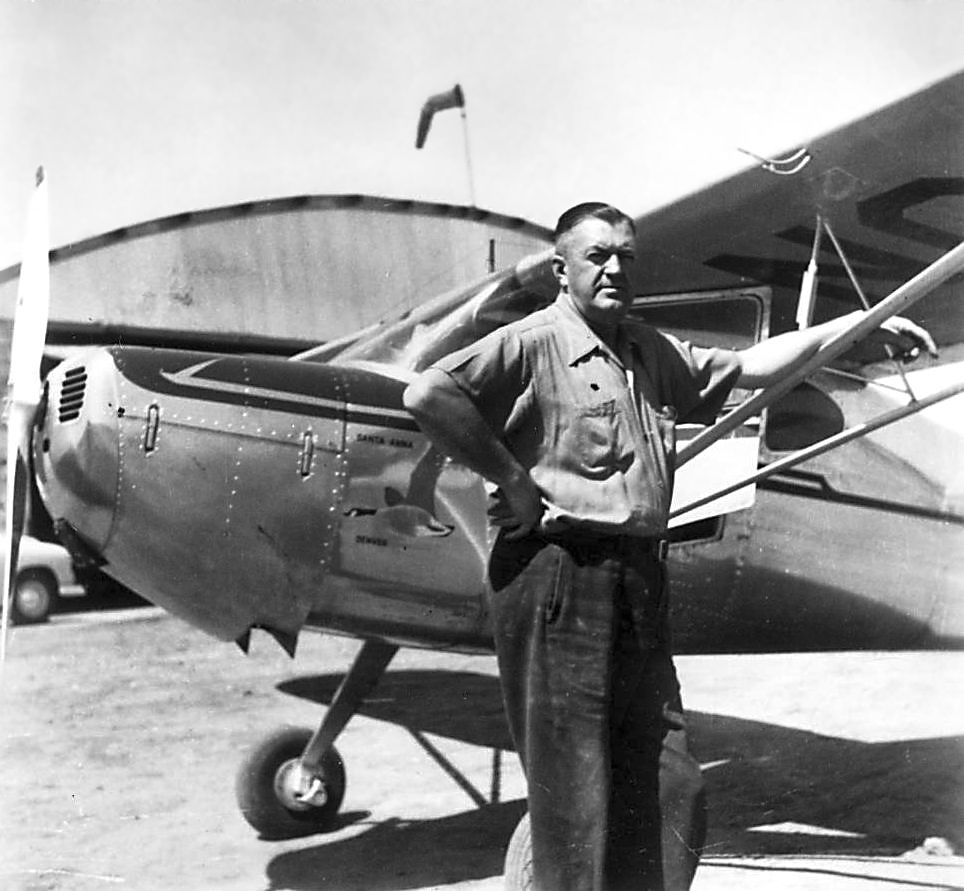
An undated (circa 1945-50s?) photo of Louis "Gus" Quinn, pilot & educator, in front of a Cessna at Ruston Field.
A 9/10/53 aerial view depicted Ruston Field as having 2 runways, with a hangar & a few smaller buildings on the west side.
At some point between 1949-54, the field was apparently renamed Federal Heights Airport,
as that is how it was labeled on the May 1954 Denver Sectional Chart (courtesy of Chris Kennedy).
It was depicted as having a 3,900' unpaved runway.
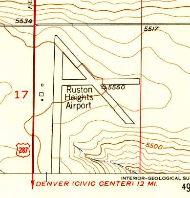
The 1956 USGS topo map depicted the "Ruston Heights Airport” as having 3 runways, and 3 small buildings along the west side of the field.
A 1956 aerial photo showed Ruston Heights Airport perhaps at its zenith of popularity, with 21 light aircraft on its west side.
According to Cheryl York, “Between 1957-1960, the Jefferson County Airport took all the business from Ruston Airport.
Ruston also came under increasing pressure from surrounding housing developments."
The 1960 Jeppesen Airway Manual (courtesy of Chris Kennedy)
depicted the "Ruston Heights" Airport as having 3 runways, with the longest being the 3,900' Runway 17/35.
Two small buildings were depicted along the west side of the field.
The last depiction which has been located of Ruston Airport was on the June 1960 Denver Sectional Chart.
It depicted Ruston Heights Airport as having a 3,900' unpaved runway.
According to Cheryl York, "Mr. Ruston finally closed his airport in 1961. It took him 3 years to get out of debt.”
Ruston Field was no longer depicted at all on the June 1963 Denver Sectional Chart (courtesy of Chris Kennedy).
Aerial photos in 1963 & 64 showed Ruston Heights after its closure, with the runways & hangars remaining intact, but the field was devoid of aircraft.
Aerial photos in 1971 & 78 showed the runways had been plowed away, but the hangars remained.
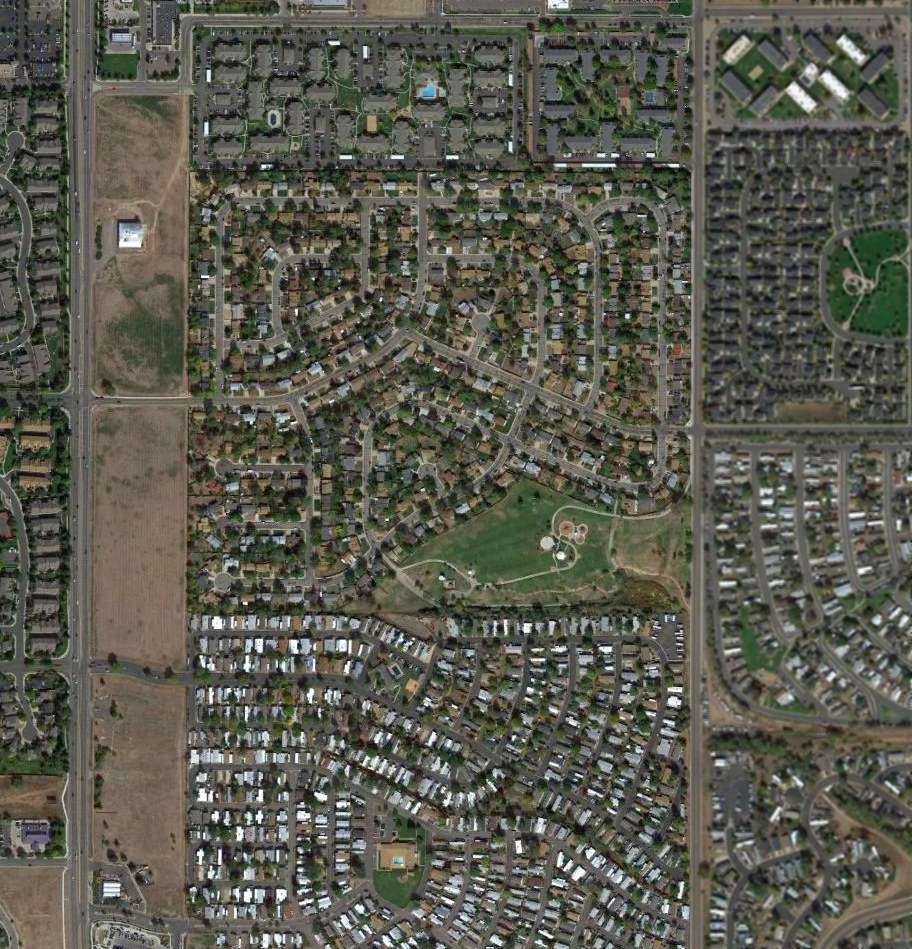
A 1983 aerial photo showed houses had been built over the majority of the Ruston Airport site, but the hangar remained on the west side.
A 1991 aerial photo showed no trace remained of Ruston Field, with the majority of the airport site being covered by houses.
However the hangar & airport office building remained standing on the west side of the property.
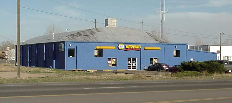
A 2002 photo by Patrick Griffith of an original hangar from Ruston Field, which remained in use as an auto parts store.
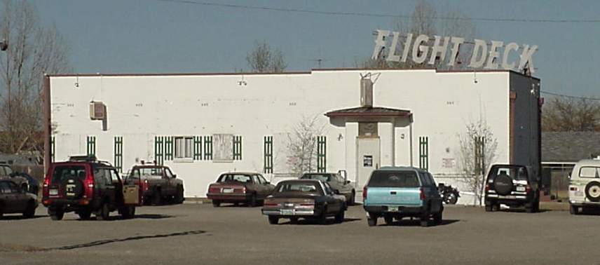
A 2002 photo by Patrick Griffith of Ruston Field's airport office building, which remained in use as the “Flight Deck” bar.
Cheryl York reported on an interesting part of Ruston Airport's configuration:
“When I got a tour from a man who was like a piece of history there,
he showed me an arched doorway downstairs that had been bricked up.
It used to be the entrance of a tunnel where the Ladies Of The Eve went from airport [office building[ to hangar.”
Bob Resling reported in 2005 that “The Flight Deck Bar is still standing & is located on the East side of Federal Boulevard.”
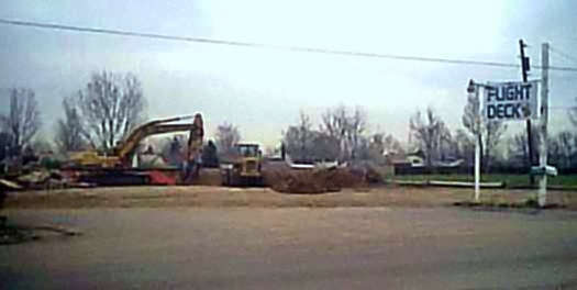
A 2005 photo by Cheryl York showing the demolision of the former Ruston Airport office building, last reused as the Flight Deck Bar.
Cheryl York reported, “As of 4/13/05 the Flight Deck Bar [the former Ruston Airport office building] is gone.
I found out from Mayor Sparks of Federal Heights that it was the owner, Shelly Ruston Munn, that had the Flight Deck leveled.”
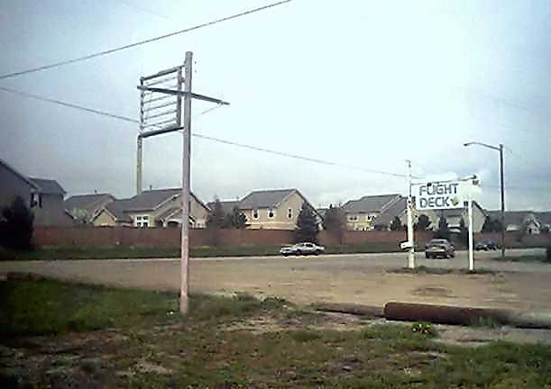
A 2005 photo by Cheryl York showing the reason for the redevelopment of the former Ruston Airport – the ever-present new homes.
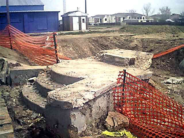
A 2005 photo by Cheryl York showing the remains of the steps which led into the Ruston Airport office building.
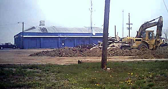
A 2005 photo by Cheryl York showing the former Ruston Airport hangar, which remains standing (for the time being).
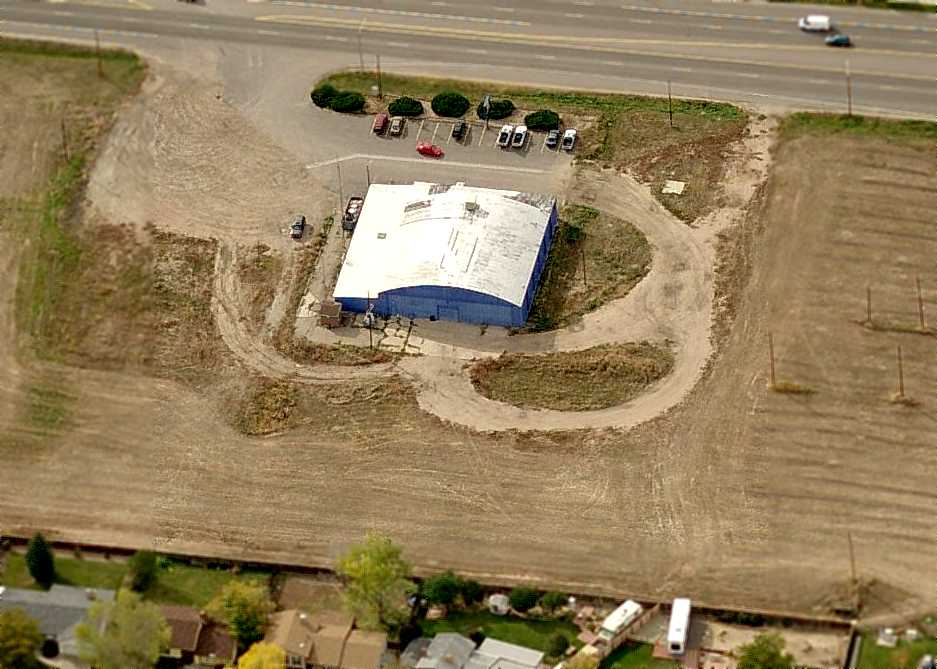
A circa 2008 aerial view looking west at the last remaining element of Ruston Airport:
a single hangar which remains standing on the east side of Federal Boulevard.
A 2015 aerial view shows one remaining element of Ruston Airport remains on its northwestern side: a single hangar.
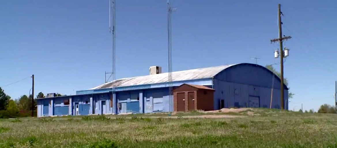
A 2017 photo looking northwest at the last remaining trace of Ruston Field, a former hangar, taken just before its demolition.
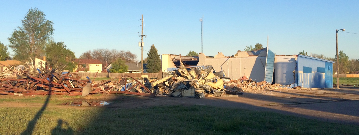
A 5/11/17 photo by David Tomecek of the demolition of the last remaining trace of Ruston Field, a former hangar.
David reported, “Demolition started 5/11/17 on the original hangar building, depicted in [previous] photos as the blue NAPA auto parts store.
Given their progress today, it's likely to be completely down by 5/12 & the debris hauled off fairly quickly.”
Thanks to Patrick Griffith for pointing out this field.
See also: http://www.rootsweb.com/~coadams/forgottenpast_1/airport.html
____________________________________________________
Since this site was first put on the web in 1999, its popularity has grown tremendously.
If the total quantity of material on this site is to continue to grow,
it will require ever-increasing funding to pay its expenses.
Therefore, I request financial contributions from site visitors,
to help defray the increasing costs of the site
and ensure that it continues to be available & to grow.
What would you pay for a good aviation magazine, or a good aviation book?
Please consider a donation of an equivalent amount, at the least.
This site is not supported by commercial advertising –
it is purely supported by donations.
If you enjoy the site, and would like to make a financial contribution,
you
may use a credit card via
![]() :
:
Please consider checking the box to make a monthly donatation.
For a mailing address to send a check, please contact me at: paulandterryfreeman@gmail.com
If you enjoy this web site, please support it with a financial contribution.
please contact me at: paulandterryfreeman@gmail.com
If you enjoy this web site, please support it with a financial contribution.
Or if you prefer to contact me directly concerning a contribution (for a mailing address to send a check),
please contact me at: paulandterryfreeman@gmail.com
If you enjoy this web site, please support it with a financial contribution.
____________________________________________________
This site covers airfields in all 50 states.