
Abandoned & Little-Known Airfields:
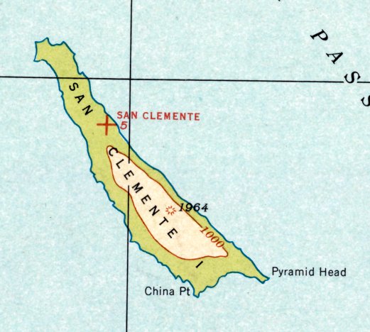
California: Pacific Islands
© 2002, © 2022 by Paul Freeman. Revised 10/15/22.
This site covers airfields in all 50 states: Click here for the site's main menu.
For the 6th year, the CA pages of this website are sponsored by the California Pilots Association:
____________________________________________________
Please consider a financial contribution to support the continued growth & operation of this site.
Hamilton Cove Seaplane Base (revised 10/15/22) - San Clemente Naval Auxiliary Air Station (revised 6/25/22)
____________________________________________________
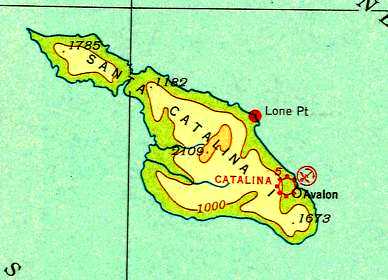
Hamilton Cove Seaplane Base, Catalina Island, CA
33.35, -118.33 (West of Los Angeles, CA)
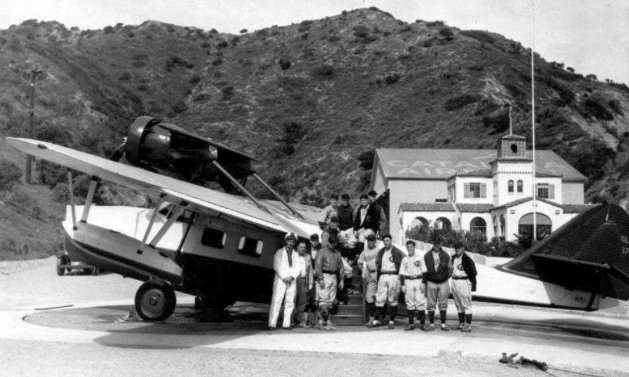
A 1931 photo of Phillip Wrigley's Chicago Cubs in front of a Douglas Dolphin twin-engine seaplane at Hamilton Cove (courtesy of Kevin Walsh).
Jonathan Westerling reported, “The first formal seaplane base on Santa Catalina Island was reported in 1923 (according to the 1925 California Aeronautical Bulletins)
at a cove just south the only city on the island, Avalon.
Pacific Marine Airways used this seaplane base to transport Los Angeles vacationers to the island for the sum of $15 round trip (according to aerofiles.com).
Though pricey, the service proved quite popular, with Pacific Marine Airways logging a reported 3,500 passengers in the summer 1927.
This success (and revenue) led to the establishment of a more substantial seaplane base on the Island in 1931.”
According to February 2010 “South Bay History” article by Sam Gnerre, in 1931 the island's owner, Phillip Wrigley, began Wilmington-Catalina Airline, Ltd.
The planes used for this airline were the Douglas Dolphin, a twin-engined seaplane passenger airliner.
Its interior was well-appointed & it could comfortably seat 10 passengers.
The earliest photo which has been located of Hamilton Cove was a 1931 photo
of Phillip Wrigley's Chicago Cubs in front of a Douglas Dolphin twin-engine seaplane (courtesy of Kevin Walsh).
The Wrigley family owned the airline, the Chicago Cubs, and most of the island, and Philip Wrigley was a close friend of Donald Douglas.
According to Chris Bell (who maintains the website www.catalinagoose.com which is replete with pictures of seemingly every seaplane that ever landed at this airport),
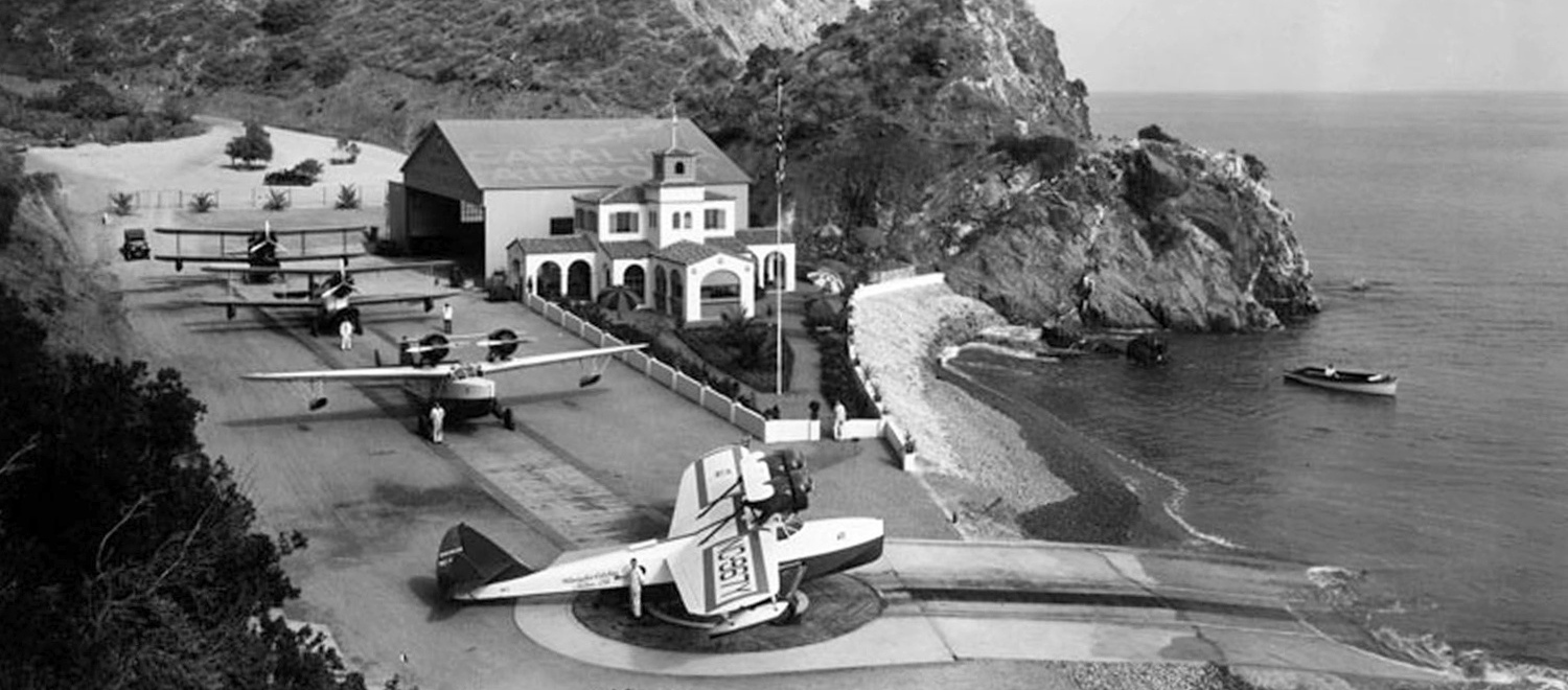
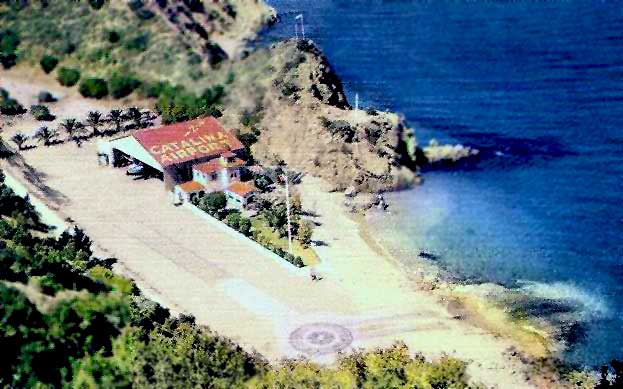
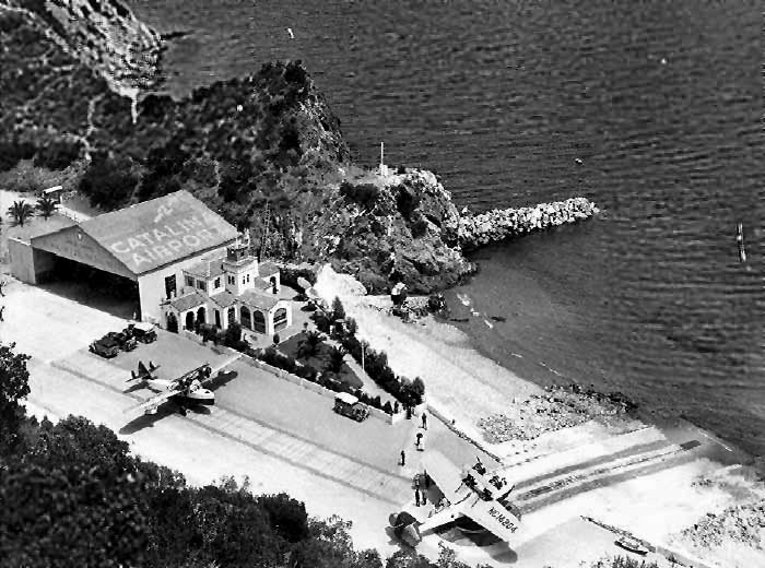
“In 1931, Philip Wrigley helped design a unique airport at Hamilton Cove, the 2nd cove north of Avalon,
to accommodate the Douglas Dolphin 'Amphibion' planes of the Wilmington-Catalina Air Line, Ltd., a Wrigley-operated firm.
The twin-engine Dolphins landed just offshore & would taxi up a ramp to a large turntable mechanism.
The airplane would then be rotated until it was facing the water & ready for a trip back to the mainland.
A small Spanish-style terminal building welcomed residents, business people & tourists to Catalina.”
There was also a large hangar behind the terminal building.
Note: According to Tim Kalina, “'Amphibion' is the correct spelling... it's an antiquated spelling that was peculiar to a few aircraft companies.
Sikorsky was the first to use this spelling for their amphibious planes.”
A 1931-33 photo 4 planes on the Hamilton Cove Seaplane Base ramp.
Jonathan Westerling noted, “Several Loening C2H amphibians are on the ramp, and a Douglas Dolphin is on the turntable.”
The first official depiction of the new Hamilton Cove Seaplane Base is in the 1932 Airway Bulletin #2 (according to Jonathan Westerling).
It lists the base as being “On 1,000' wide by 150' deep cove. Sand & gravel beach.
Buoys 1,000' offshore & 1,000' apart marked ‘Seaplane Channel Keep Off’.
Concrete ramp 125' long by 40' wide in center of beach.
Hangar marked ‘CATALINA AIRPORT’ with north arrow & “AVALON CAL.”
Gas house at head of ramp, pump & hose for ships in water or on ramp.
Mooring buoy for seaplanes 200' offshore. Service day & night.”
The earliest aeronautical chart depiction which has been located of the Hamilton Cove Seaplane Base
was on the 1934 San Diego Sectional Chart (courtesy of Jonathan Westerling).
Jonathan noted, “Curiously, and certainly mistakenly, the chart lists a landplane base at the same location.”
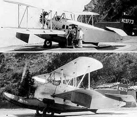
Two circa 1931-41 photos of a rare Loening C2H amphibian of Wilmington-Catalina Airline at the Hamilton Cove Seaplane Base.
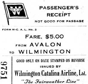
A circa 1931-41 passenger's receipt from the Wilmington-Catalina Airline,
showing the extravagant fare of $5 for a flight from Avalon to Wilmington.
According to Jeannine Pedersen, author of “Catalina By Air”, the terminal building also served as a home for the airport caretaker.
The terminal can be seen in scenes from the 1935 movie “Murder On A Honeymoon” which was filmed on the island.
Jonathan Westerling reported, “According to Jeannine Pedersen, the turntable was wooden & had to be turned by hand.
Jeannine said that the 'legend' behind the unique turntable design involved wither Phillip or William Wrigley – of bubblegum fame.
Their family was from Chicago & owned Santa Catalina Island.
When creating the seaplane base they got the idea of the rotating turntable from similar designs used in the rail yards back in Illinois.”
Jonathan Westerling reported, “The chief pilot for Wilmington-Catalina Air Lines was Walter Leroy 'Si' Seiler.”
The following is excerpted from 'The Umpteenth Voyage', TWA Capt. Gene Gerow’s 1977 memoir of his 42-year aviation career
which included a stint with Wilmington-Catalina Air Lines:
“After the 2nd Dolphin went back into service I began flying occasionally with other 1st pilots…
the most interesting of all those I flew with was the Chief Pilot, ‘Si’ Seiler...
He was a genuine character... There was no door between the cockpit & the passenger cabin
and quite often someone would stroll forward during the channel crossing & talk with the crew.
One day Joan Crawford was standing there asking questions & I was valiantly trying to give her the best answers
but being a newcomer in the areas, some of them stumped me & I turned to Si for the correct answers.
Finally Joan asked a question that even Si couldn’t answer but instead of admitting this,
he pulled his cap down over his eyes & said to me out of the corner of his mouth, ‘Don’t talk to her…she’s drunk.'”
A colorized undated aerial view looking north (from the Pomona Public Library's Frasher Foto Collection, via Jonathan Westerling)
depicted a single seaplane inside the Hamilton Cove Seaplane Base's hangar.
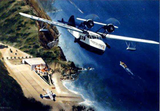
“Days of the Dolphin”, an undated painting by Frank Loudin of a Douglas Dolphin over the Hamilton Cove Seaplane Base (courtesy of David Johnston via Jonathan Westerling).
According to David, “Frank & his wife lived on Catalina and had an art gallery in Avalon for a number of years.”
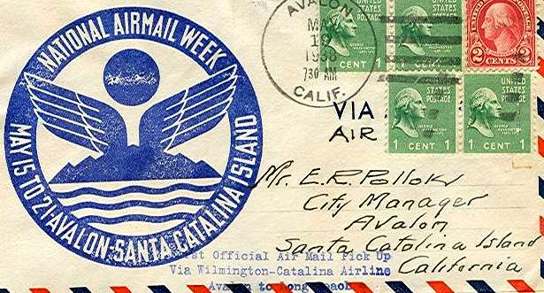
A 1938 envelope commemorating the first airmail to travel through the Hamilton Cove Seaplane Base (courtesy of Jonathan Westerling).
A circa 1930s brochure for Santa Catalina (courtesy of Kevin Walsh) depicted a twin-engine flying boat on the ramp at the “Airport”.
The 1938 Bulletin #2 (courtesy of David Brooks) added that the grade of the concrete ramp was “12%, then 6% to level at turntable.”
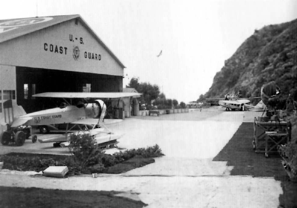
A circa 1930s photo of the Hamilton Cove Seaplane Base showing the hangar painted with “U.S. Coast Guard”,
and a Coast Guard biplane floatplane & twin-engine monoplane flying boat (types unidentified) on the ramp.
Wilmington-Catalina Airline's only accident occurred in 1938, but did not involve passengers,
occurring during testing to determine whether landings & takeoffs were possible in the morning fog.
The last photo which has been located showing the Hamilton Cove Seaplane Base in civilian operation
was a 1940 aerial view looking north (courtesy of Jennine Pedersen / Catalina Island Museum, via Jonathan Westerling).
Jonathan observed, “Note the windsock on the top of the hill.“
According www.catalinagoose.com, Wilmington-Catalina Air Line was noted
in the March 1941 issue of Flying & Popular Aviation as "the shortest airline in the world."
The article points out that not only was Wilmington-Catalina Air Line, serving 2 towns less than 30 miles apart,
the shortest but also the safest airline, having flown the channel 38,000 times carrying over 200,000 passengers with no accidents or injuries between 1931-41.
The 1941 Aircraft Directory Company Directory (according to Jonathan Westerling).described the seaplane base
with the notation “To be discontinued & replaced by a landplane base in the spring of 1941.”
Following the entry of the U.S. Into WW2, civilian air traffic to Catalina Island was shut down by September 1942,
and the Coast Guard took over the Hamilton Cove Seaplane Base.
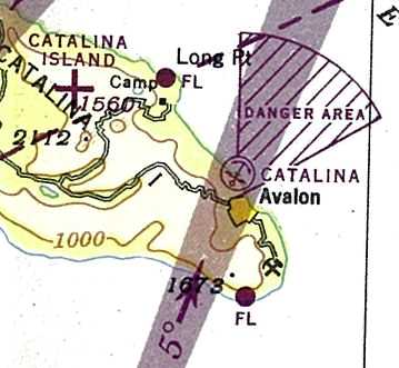
The 1945 San Diego Sectional Chart (courtesy of Jonathan Westerling) depicted both the Hamilton Cove Seaplane Base & the new Catalina Island landplane airport.
According to Keith Wood, the “Danger Area” depicted as fanning out to the northeast from the Seaplane Base
“was used by the Coast Guard seaplanes, which might need to take off at any time, with no warning.”
Jonathan Westerling reported, “After World War II, the Hamilton Cove Seaplane Base reopened for a brief time,
though it did not see any regularly-scheduled seaplane service.”
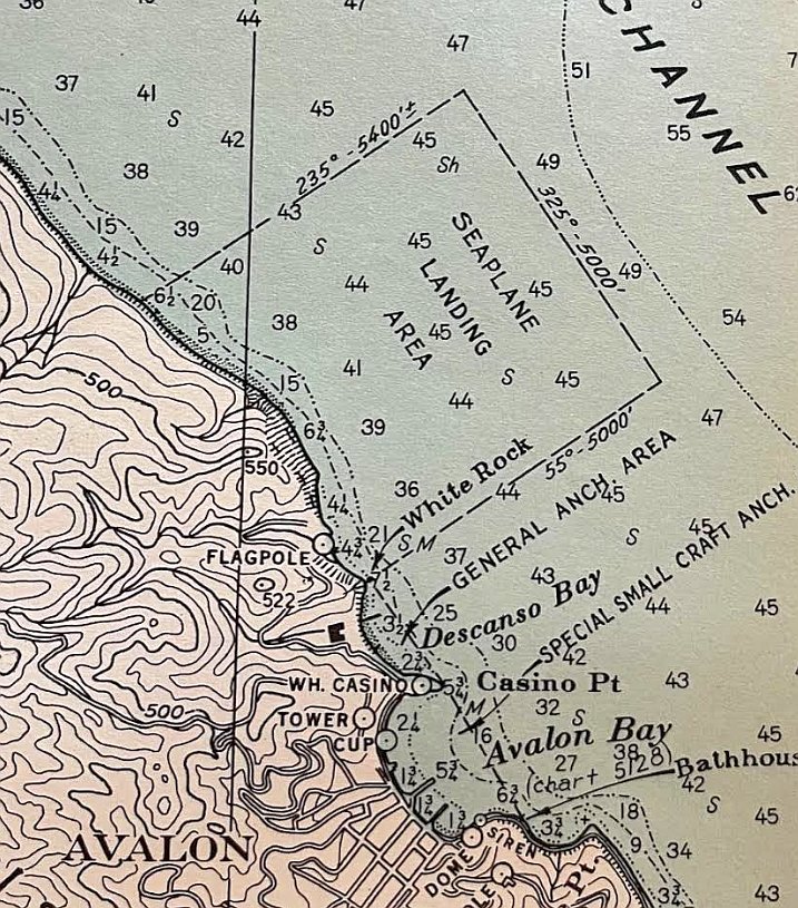
A circa 1940s Coast & Geodetic Survey chart of the Hamilton Cove “Seaplane Landing Area” (courtesy of Kevin Walsh).
According to Chris Bell there wasn't any seaplane service to Catalina again until 1947,
however this postwar passenger service used a floating dock in Descanso Bay south of Avalon instead of the Hamilton Cove Seaplane Base.
Jonathan Westerling reported, “The Hamilton Cove facility was not listed in the 1947 Directory of Airfields,
The last depiction which has been located of the Hamilton Cove Seaplane Base was on the August 1947 San Diego Sectional Chart.
Strangely, it depicted Hamilton Cove Seaplane Base with half of an anchor symbol: erroneous or intentional?
Hamilton Cove Seaplane Base was no longer depicted on the March 1948 San Diego Sectional Chart.
Jonathan Westerling reported, “It was curiously & perhaps incorrectly depicted as 'Hamilton Beach' on the 1949 California Aeronautical Chart” (courtesy of Bob Barton).
According to David Johnston, author of “Knights of Avalon: Seaplanes of Catalina”,
the Hamilton Cove Airport was owned by Santa Catalina Island Company which did not grant permission for the new companies to use their facility.
According to Chris Bell, “The seaplane base terminal building remained there until the late 1960s.
There was actually a family that lived in the building for several years.
The hangar building was moved up to the Airport in the Sky to be used as a hangar facility there.
That hangar is still being used today [2011].
Any other remnant of the terminal at Hamilton Cove was demolished when grading began for the condominium complex that at the location now.
The grading for the complex began in the early 1970s.”
According to Jeannine Pedersen, the cupola from the terminal bldg was saved
and was placed at the apartment complex which was built at the site of the former airport.
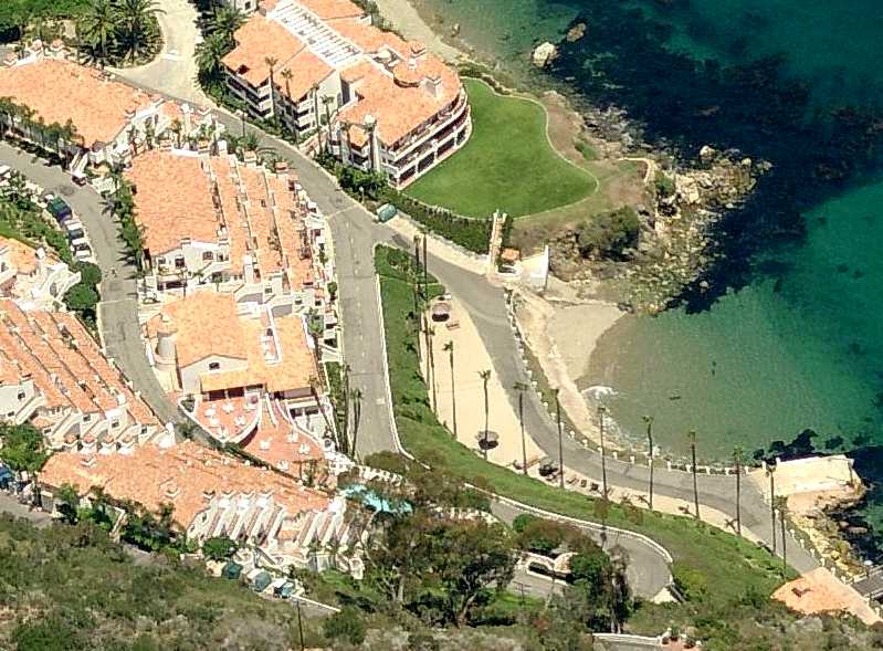
A circa 2008-2011 aerial view looking north at the site of Hamilton Cover Seaplane Base, showing a condominium complex covering the site,
with nothing remaining of the former aviation facilities.
The hill along the coast shown in several vintage postcards to have located a windsock has been somewhat flattened.
____________________________________________________
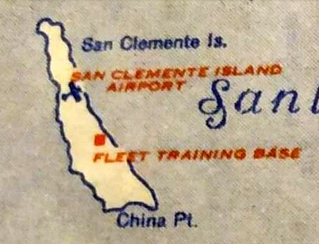
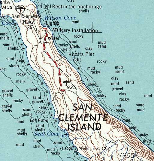
San Clemente Airfield / San Clemente Naval Auxiliary Air Station, San Clemente Island, CA
32.95, -118.53 (South of Catalina Island, CA)
San Clemente Airfield, as depicted on the February 1934 San Diego Sectional Chart.
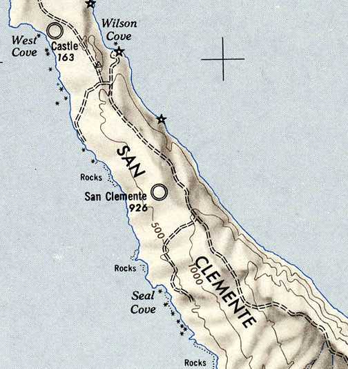
The first airstrip on San Clemente Island was located in the center of the island.
Its date of construction is unknown.
The earliest depiction which has been located of San Clemente Airfield was on the February 1934 San Diego Sectional Chart.
It depicted San Clemente as an auxiliary airfield.
The Airport Directory Company's 1937 Airports Directory (courtesy of Bob Rambo)
described "San Clemente Island Aux" as having two 1,600' "sandy loam" runways.
The April 1938 San Diego Sectional Chart depicted San Clemente as a military airfield.
A program to improve the San Clemente Airfield was begun in 1938.
The Works Progress Administration & a contractor built two runways (3,000' & 2,000') and a hangar.
The construction was completed by 1941.
However, the December 1941 San Diego Sectional Chart did not depict any airfield on San Clemente Island.
With the outbreak of WW2, a Marine scouting squadron began operating from the San Clemente Airfield in 1942
with 19 Vought SB2U Vindicators & a single Grumman J2F Duck.
That same year another construction project commenced to extend the runways,
and an Army detachment activated two radar stations on the island.
The airfield was commissioned as Naval Auxiliary Air Facility San Clemente Island in 1943.
The station was evaluated for blimp operations but was deemed unsuitable due to the island's strong & unpredictable winds.
It was used for bomb testing, radar training, fighter gunnery training, and electronic countermeasures.

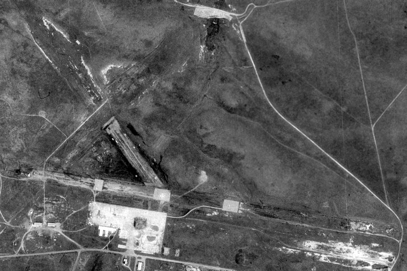
The earliest photo which has been located of San Clemente NAAS was a 5/12/43 aerial view (from the UCSB Library).
It depicted the field as having 2 asphalt runways, with a clearing for a 3rd runway,
and a ramp with a hangar & several buildings on the south side.
A 1944 aerial view of San Clemente NAAS (National Archives photo)
depicted the field as having 2 asphalt runways, with a clearing for a 3rd runway,
and a ramp with a hangar & several buildings on the south side.
In 1945, in spite of the previous negative evaluation for blimp suitability,
blimps from Santa Ana & Del Mar began averaging 3 landings at San Clemente per week.
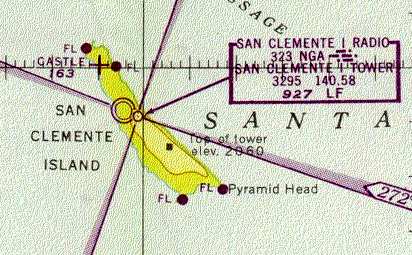
The 1945 Mojave AAF Chart (courtesy of Chris Kennedy) depicted San Clemente as having a control tower.
The 1946 USGS topo map still depicted the original San Clemente airfield.
A 1946 road map (courtesy of Kevin Walsh) depicted “San Clemente Island Airport” as a civilian facility, but presumably erroneously.
The March 1951 San Diego USAF Sectional Chart (courtesy of Chris Kennedy)
described "NAAS San Clemente Island" as being "closed".
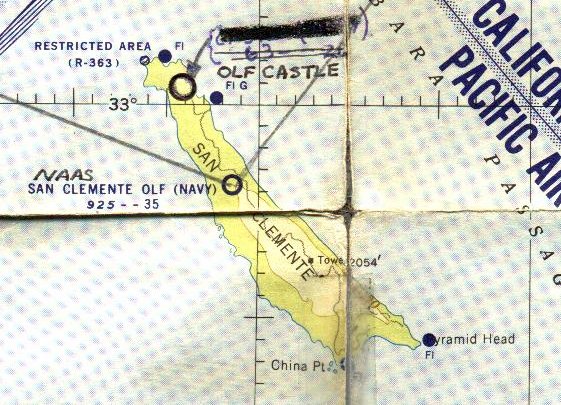
"San Clemente OLF (Navy)" was depicted on the 1953 San Diego-San Francisco Flight Chart (courtesy of Scott O'Donnell),
which described the field as having a 5,000' hard-surfaced runway.
A 2/19/54 USGS aerial view (from the UCSB Library) depicted the original San Clemente NAAS as remaining intact but deteriorated.
"San Clemente OLF" was listed among active airfields in the "Aerodromes" table
on the 1955 San Diego Sectional Aeronautical Chart (courtesy of John Voss).
It described the field as having three "oil seal treated" runways (the longest being 5,000').
Strangely, although this airfield was included in the table of active airfields, the remarks say simply, "Closed".
The last aeronautical chart depiction which has been located of the original San Clemente Airfield was on the 1955 San Diego Sectional Chart (courtesy of John Voss).
It depicted “San Clemente OLF (Navy)” as having a 3,500' unpaved runway.
Charles Geeslin recalled, “I was stationed at San Clemente from 1958 to October 1960.
The North Field (Castle) was already open. I was a radar operator in the Air Force & had free run of the island.
We worked on 21 days & off the island 7 days for retreat in Long Beach.
I was also in civilian flight training at Long Beach where I received my license in 1960.
During that time I flew a tricycle-geared Champ out to the North runway several times & to the old runway once,
communicating with the radar site on 121.5 as the Champ had no UHF.
Before the Seabees & Peter Kiewit completed the Castle runway
we were often airlifted out of the old runway to Long Beach in civilian Grumman Gooses or in DC-3s.
Eventually almost all the Gooses flipped on landing at Catalina
so we then switched to the North Castle runway and got out on DC-3s.
The radar site at San Clemente was responsible for all the Southern & seaward airspace in the 11th Naval District
even though we were Air Force.
We used to scramble units all the way from George AFB to March & El Toro, Miramar and NAS North Island.
We often controlled Navy P5Ms out of San Diego for surface intercepts of suspicious targets or unusual weather.”
In 1961 the original airfield in the middle of the island was evidently closed,
after being replaced by the much larger San Clemente Naval Auxiliary Landing Field on the northern end of the island.
A preliminary study was carried out in the same year by the Naval Ordnance Test Station,
China Lake, for a major renovation of the old landing field.
This study included renovation and/or enlargement of a number of the berthing,
messing, administrative, utility, and aircraft support facilities.
Apparently this was never done, and the old airfield remained inactive.
The last depiction which has been located of the original San Clemente airfield
was with an unlabeled airfield symbol on the 1963 USGS topo map.
The 1970 USGS topo map no longer depicted the original San Clemente airfield.
In 1971, a civilian group headed by Congressman Anderson and the Marine Parks and Harbor Association
attempted to obtain civilian yachting access to Pyramid Cove.
This group suggested that the Navy could move their bombardment range to San Nicolas Island.
It also recommended that the old airfield could be renovated for civilian aircraft use, while possibly including a restaurant at the terminal.
This attempt was unsuccessful.
Fleet Composite Squadron 3 inaugurated their new island operations and support facilities in 1971.
VC-3 launched jet target drones for surface ship target practice from the old deactivated airfield.
VC-3 has since been deactivated, and it is not known if the old airfield has been used since for any drone operations, or anything else.
Chuck Ross recalled flying in to San Clemente.
"The best trip though was in about 1977 when we took some civilian contractors out there.
The Navy was offering a contract to clean up the site of the old airfield up on top of the island.
We pilots went with them to survey the job.
There were acres of scrap around the old ramps, including deck guns & the wreckage of several Navy airplanes.
Fascinating browsing in that stuff."
Only a single runway (the east/west runway) was depicted on the 1977 USGS topo map, labeled "Landing Strip".
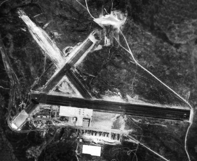
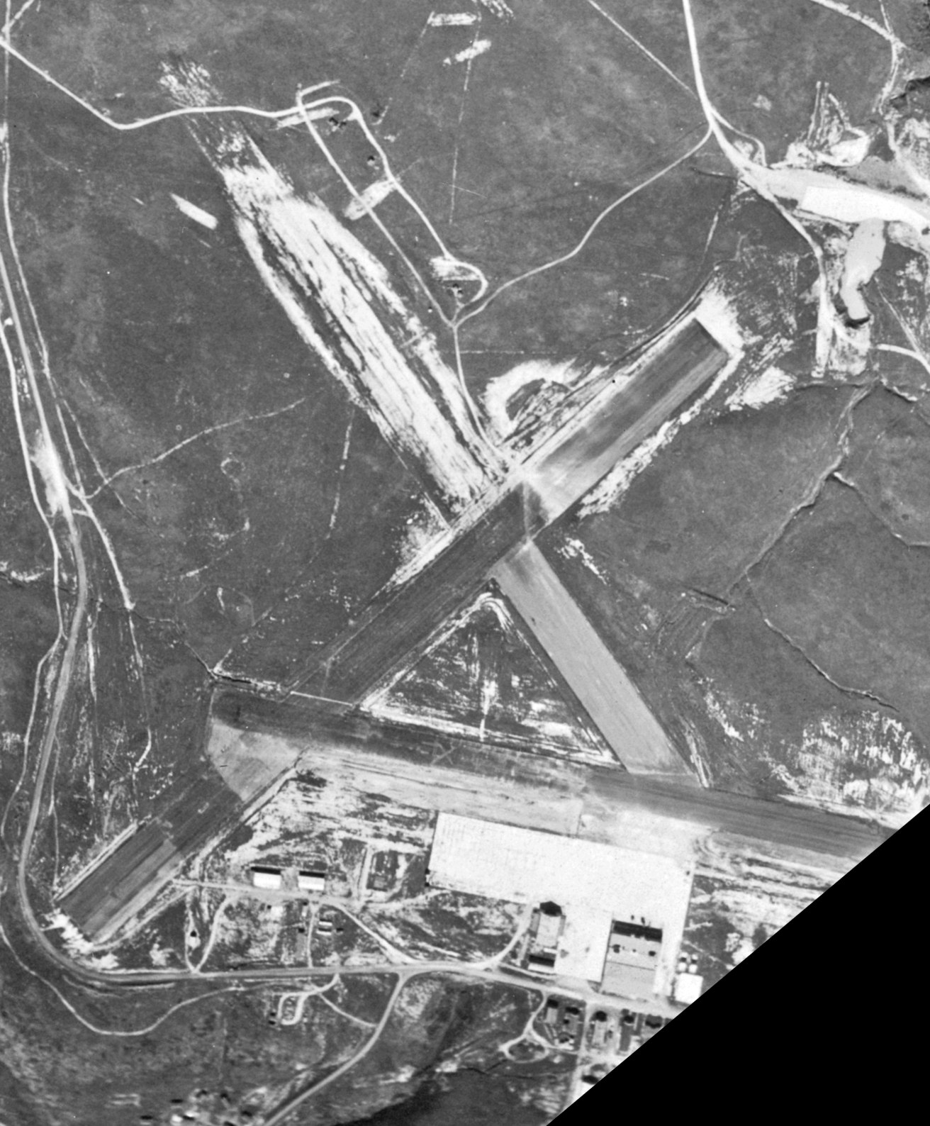
As seen in the 1994 USGS aerial photo, the remains of the original San Clemente NAAS consisted of 3 paved runways (the longest is 5,200'), and a concrete ramp south of the runways.
The primary runway was in better shape than the smaller runways, which were barely perceptible.
The foundations of former buildings were apparent on & around the ramp, along with some small buildings which remained standing.
The airfield was not depicted at all (even as an abandoned airfield) on 2002 aeronautical charts.
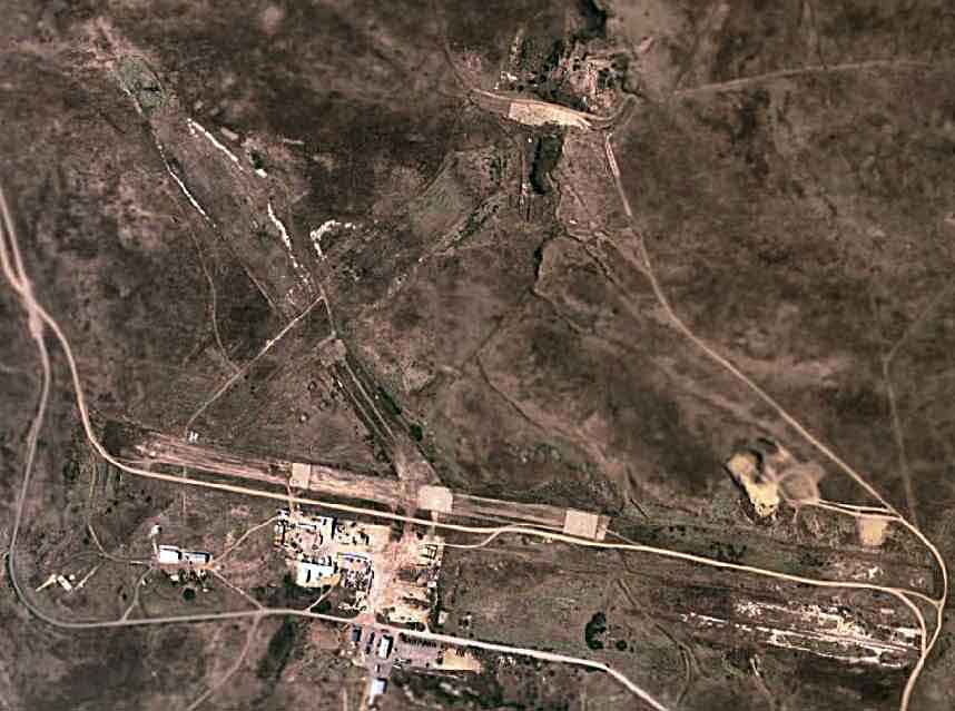
A 2006 aerial photo showed that the remains of all 3 runways still were recognizable.
The ramp area appeared to be used for the storage of unidentified items.
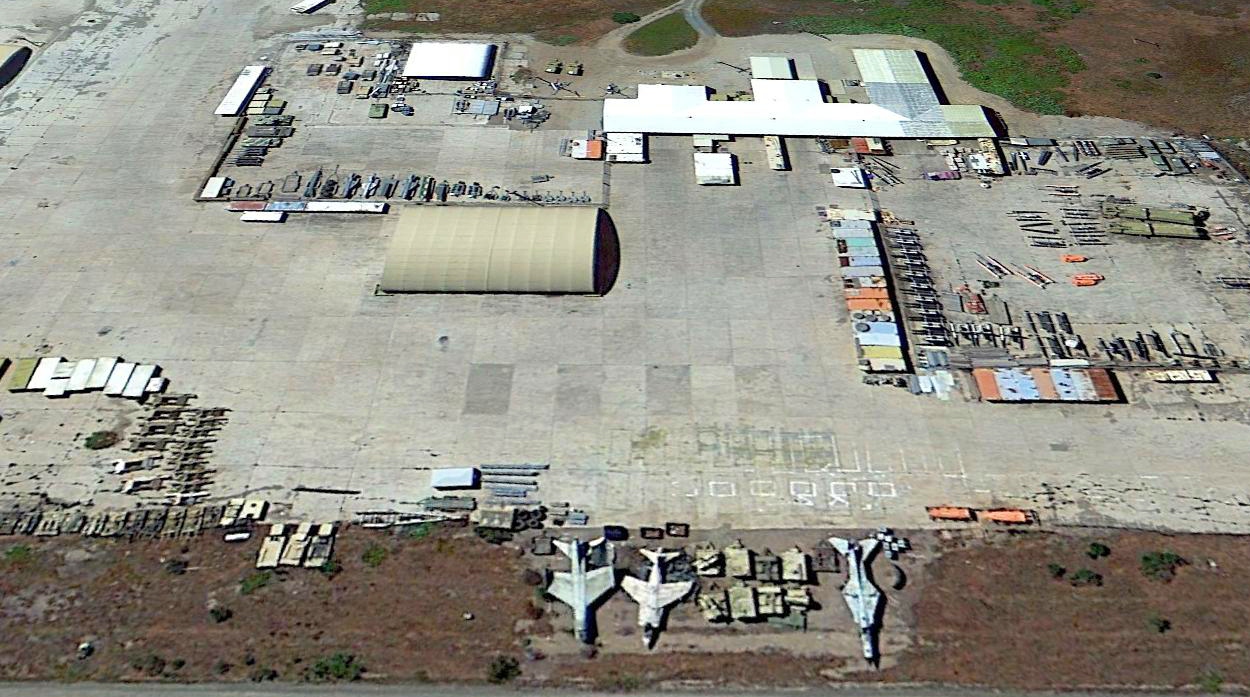
A 2013 aerial view looking south at the original San Clemente NAAS ramp showed an interesting assortment of junked aircraft, including a Vought A-7 Corsair, BAE / McDonnell Douglas AV-8 Harrier, and a MiG-23.
The fenced compound at the top-left contains several junked missiles or targets, including what appear to be several P-15 Termit / SS-N-2 Styx / SSS-C-2 Silkworm anti-ship missiles.
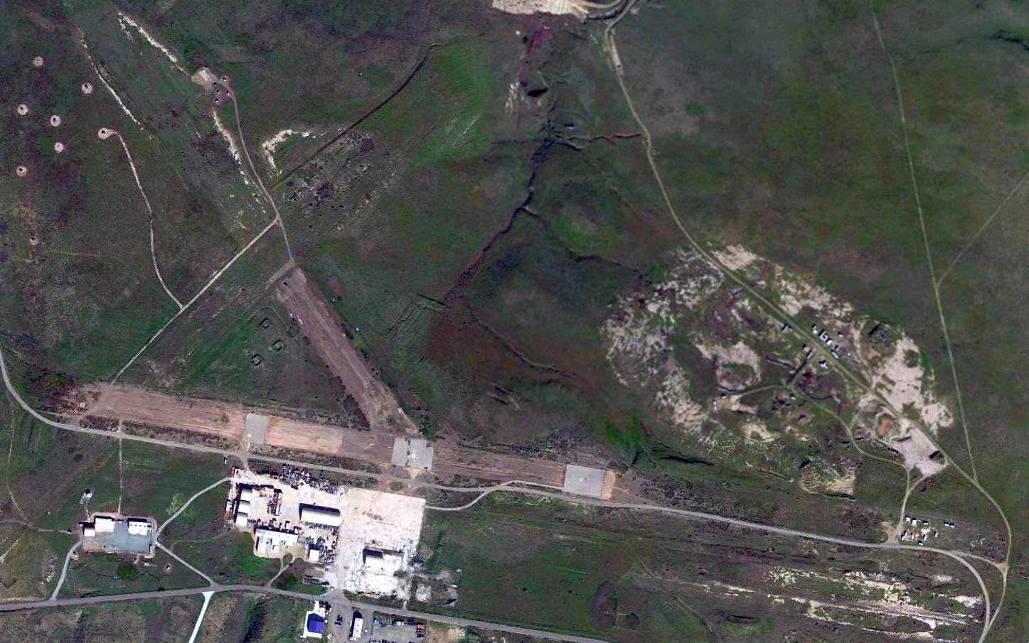
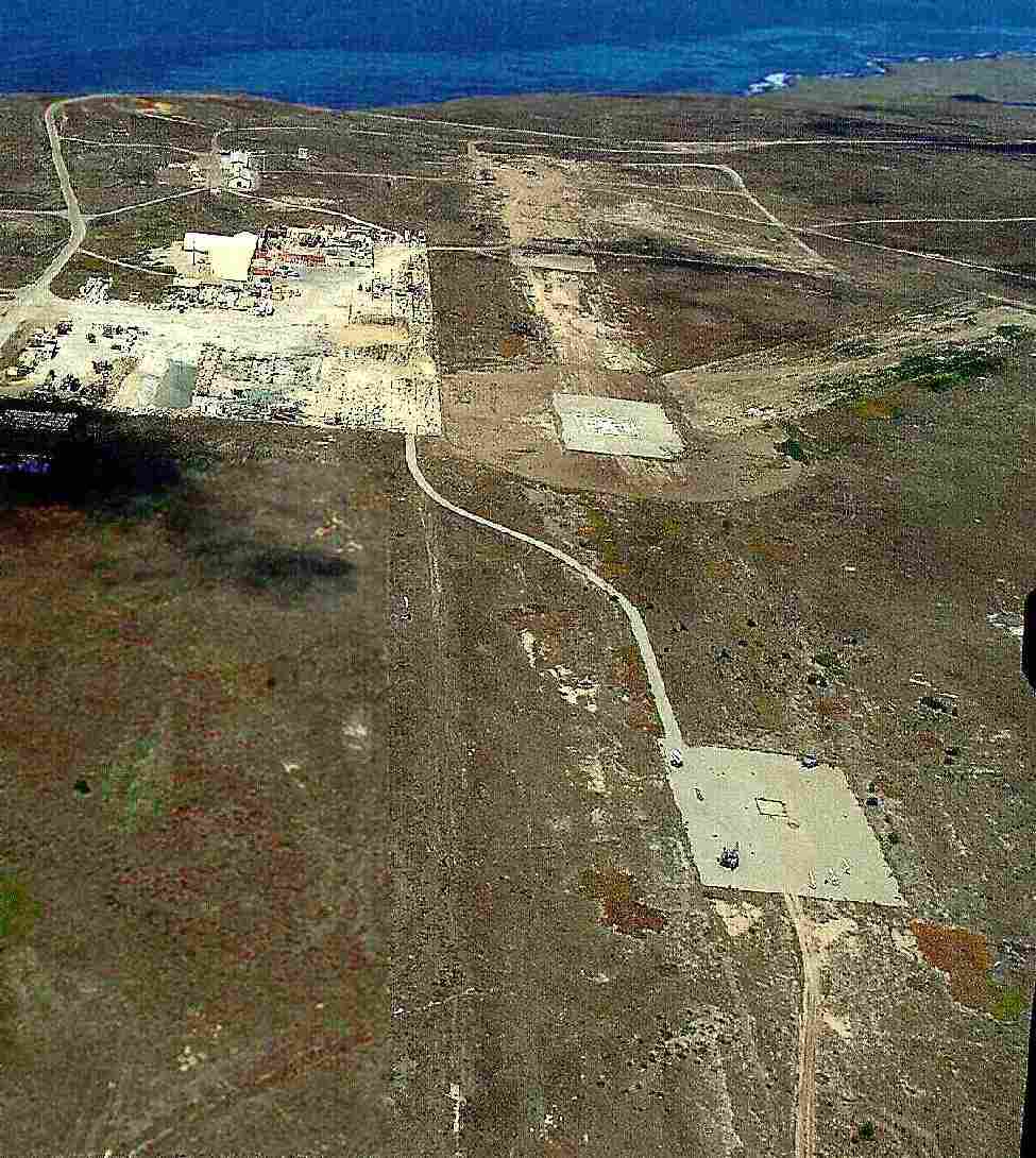
A 2015 aerial view of the original San Clemente NAAS showed it to remain intact but deteriorated.
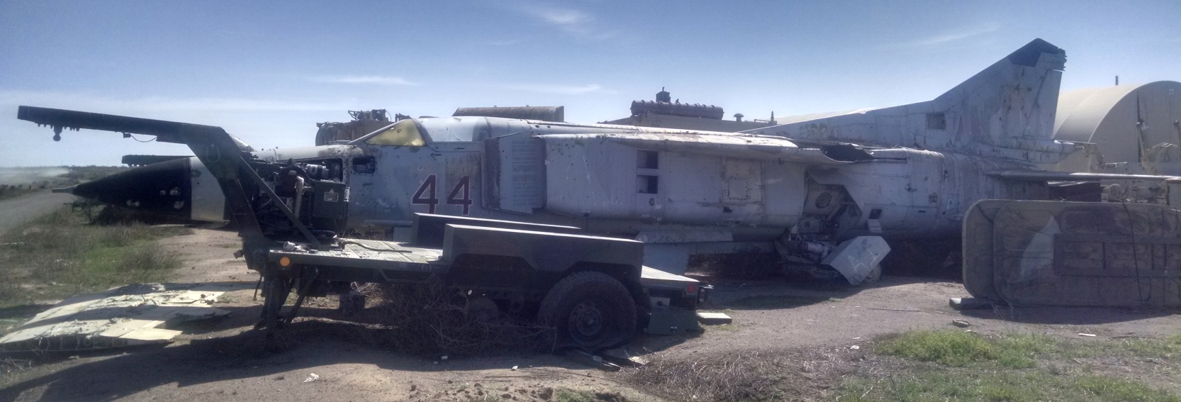
A pre-2019 photo of a MiG-23 (reportedly used in the Constant Peg test program) which ended up at the original San Clemente NAAS ramp.
____________________________________________________
Since this site was first put on the web in 1999, its popularity has grown tremendously.
If the total quantity of material on this site is to continue to grow,
it will require ever-increasing funding to pay its expenses.
Therefore, I request financial contributions from site visitors,
to help defray the increasing costs of the site
and ensure that it continues to be available & to grow.
What would you pay for a good aviation magazine, or a good aviation book?
Please consider a donation of an equivalent amount, at the least.
This site is not supported by commercial advertising –
it is purely supported by donations.
If you enjoy the site, and would like to make a financial contribution,
you
may use a credit card via
![]() :
:
Please consider checking the box to make a monthly donatation.
For a mailing address to send a check, please contact me at: paulandterryfreeman@gmail.com
If you enjoy this web site, please support it with a financial contribution.
This site covers airfields in all 50 states.
%20Overhead.jpg)